
















![[협상/분석-214] 이란의 고민-내부/외부 동시 압박. 트럼프의 선택 (휴전 중) 해상봉쇄/기뢰제거. [정광용TV, 레지스탕스TV]](https://i.ytimg.com/vi/wuvEwY4H16M/maxresdefault.jpg)






Global supply chains depend on narrow maritime passages, artificial canals, and critical ports that concentrate trade flow, making them vulnerable to disruption; these chokepoints—such as the Strait of Malacca, Suez Canal, Panama Canal, Strait of Hormuz, Bab-el-Mandeb, English Channel, Bosphorus, Strait of Gibraltar, Lombok Strait, Turkish Straits, Cape of Good Hope, Port of Santos, and the South China Sea—control the movement of food, fuel, and manufactured goods, and any blockage or congestion can ripple across the entire world economy.
Global Supply Chain Chokepoints: 15 Critical Trade Route Vulnerabilities
Added:Basic maritime geography, including the locations of major oceans, seas, and primary shipping lanes.
Fundamental concepts of supply chain logistics, such as transit times, shipping containerization, and the 'just-in-time' inventory model.
The core principles of global economics and international trade, particularly import/export interdependencies between manufacturing hubs and consumer markets.
An introductory understanding of international maritime law, such as the United Nations Convention on the Law of the Sea (UNCLOS) regarding passage through international straits.
Supply chain resilience strategies, including nearshoring, dual-sourcing, and transitioning from 'just-in-time' to 'just-in-case' inventory management.
Advanced geopolitical risk analysis, focusing on how sovereign nations project naval power to secure or threaten maritime bottlenecks.
Economic modeling of trade disruptions, analyzing how shipping delays translate to global inflation, cargo insurance rate spikes, and commodity price fluctuations.
Emerging alternative trade corridors, such as the Arctic's Northern Sea Route, land-based trans-continental rail networks, and new canal proposals.
4.9K views145likes32:10Original Release: 2026-02-26
Global trade. It looks smooth on the surface, but behind that flow are narrow passages and single canals, crowded straits, and critical export hubs where the entire system tightens up. So today's video is on 15 global supply chain choke points.
Starting with number 15, the Strait of Mala.
Stretching about 800 km between the Malay Peninsula and the Indonesian island of Somatra. It connects the Indian Ocean with the South China Sea and by extension the Pacific Ocean. For vessels traveling between Europe, the Middle East, Africa, and East Asia, it is the shortest sea route available.
Each year, tens of thousands of ships pass through this narrow corridor, and it carries a substantial portion of global trade. Energy analysts consistently rank it among the most important oil transit choke points. And a large share of crude oil shipments from the Persian Gulf to China, Japan, and South Korea move through these waters. At its narrowest point near Singapore, the strait's only about 2.7 km wide, and heavy traffic, shallow sections, and sandbanks make the navigation pretty rough. Larger tankers and container ships have to follow designated traffic separation schemes to reduce the risk of any collision. And despite those measures, the density of the shipping here makes the straight vulnerable. The straight has experienced maritime accidents, piracy concerns, and periodic congestion. In the early 2000s, piracy incidents in the region raised international alarm, prompting coordinated patrols by Malaysia, Indonesia, and Singapore. And since then, the joint maritime security efforts have really reduced piracy rates. But the risk is still a factor in global shipping. The Port of Singapore at the southern entrance is consistently ranked among the busiest container ports in the world. Its operations here depend heavily on uninterrupted traffic. Any blockage or major incident would affect not just transit traffic but also port throughput.
Governments and international organizations recognize the straight of Mala as a critical choke point. Simply not a regional passage. It's a structural link between the Indian and Pacific economic systems. A relatively small stretch of water carries a disproportionate amount of energy supplies and manufactured goods. Its continued operation depends on security, safe navigation, and political stability. When ships move through the Straight of Malika, they're passing through one of the most vital arteries of the global supply chain. The world's factories, refineries, and distribution centers rely on this narrow maritime corridor.
Number 14, the Suez Canal.
The Suez Canal is a 193 km artificial waterway connecting the Mediterranean Sea to the Red Sea. It was completed in 1869 and it eliminated the need for ships traveling between Europe and Asia to sail around the southern tip of Africa. Today, it is one of the most important trade routes in the world.
Roughly 10 to 15% of global maritime trade passes through the canal each year. Now that's really important for shipping and oil transport. Crude and refined petroleum products move from the Middle East to Europe, frequently transiting through the Suez. This canal operates as a single lane passage in many sections with some passing zones.
Ships have to travel in a scheduled convoy to manage the traffic. And although expansions have increased its capacity, it remains a narrow corridor.
That vulnerability was highlighted in March of 2021 when the container ship Ever Given ran a ground during high wind and blocked the canal for 6 days. During that period, hundreds of vessels were delayed. Some ships were rerouted around the Cape of Good Hope. And that incident showed how a single obstruction in this canal can disrupt global trade. Because the canal has no lock system and it operates at sea level, the water flow between the Mediterranean and Red Sea isn't the primary constraint. Instead, vessel size, traffic density, and precision of navigation determine the throughput. Large container ships, sometimes over 400 meters long, have to move carefully through this narrow channel. The government of Egypt has invested in expansions and dredging projects to increase its capacity and reduce the waiting time. However, its position means that it remains inherently a choke point. It's just a single fixed corridor through which a substantial share of global trade has to pass. Alternative routes do exist, but they're significantly longer. For time-sensitive cargo and just in time supply chains, that delay can have a major economic consequence. When operating smoothly, though, the Sewish Canal shortens distances and it lowers costs for international trade. When obstructed, even briefly, the effects are felt across worldwide industry. From oil tankers to container ships loaded with consumer goods, the steady flow through the Suez Canal is the defining feature of the modern global economy.
It's not simply a waterway carved through the desert. It's a central link in the supply chain.
Number 13, the Panama Canal.
One of the most strategically important engineered passages in global trade is the Panama Canal. It opened in 1914 and it connects the Atlantic Ocean to the Pacific through a system of locks that lift ships above sea level to cross the ismas of Panama. And for vessels traveling between the east coast of the Americas and Asia, it reduces travel distance compared to routing around South America's Cape Horn. Unlike the Suez Canal, which operates at sea level, the Panama Canal relies on a series of lock chambers that raise and lower the ships using fresh water from Gaton Lake.
Now, it's this reliance on fresh water that introduces a unique supply chain vulnerability, water availability.
Periods of drought in Panama have led to restrictions on daily vessel transits and draft limits, which directly affect their shipping capacity. In 2023 and four, lower than average rainfall reduced the water levels in the lake, prompting canal authorities to limit the number of ships that could pass through.
The canal did undergo a major expansion completed in 2016, adding a new set of locks that were capable of handling the larger Neo Panamax vessels. And that expansion increased the overall capacity and allowed larger container ships and liqufied natural gas carriers to transit. However, even with that expanded capacity, the canal is a fixed and limited corridor. Shipping companies have to plan their routes months in advance. Any congestion, maintenance closure, or weather related disruption can cascade through the supply chain.
Container shipping operates on tight schedules, and when vessels are delayed at the canal, ports, and rail networks on both sides of the Americas, it can experience bottlenecks because it is a man-made system with mechanical gates, pumps, and control infrastructure. Maintenance is critical here. The Panama Canal Authority manages transit scheduling, lock operations, and water conservation to maintain all their throughput. The Panama Canal shows how global trade can hinge not just on the geography, but on engineered infrastructure.
A narrow strip of land combined with a freshwater lake and lock system determines the flow of billions of dollars of goods each year. When water levels fall or traffic increases beyond capacity, that impact is felt across the global shipping network.
Number 12, the Straight of Hormuz.
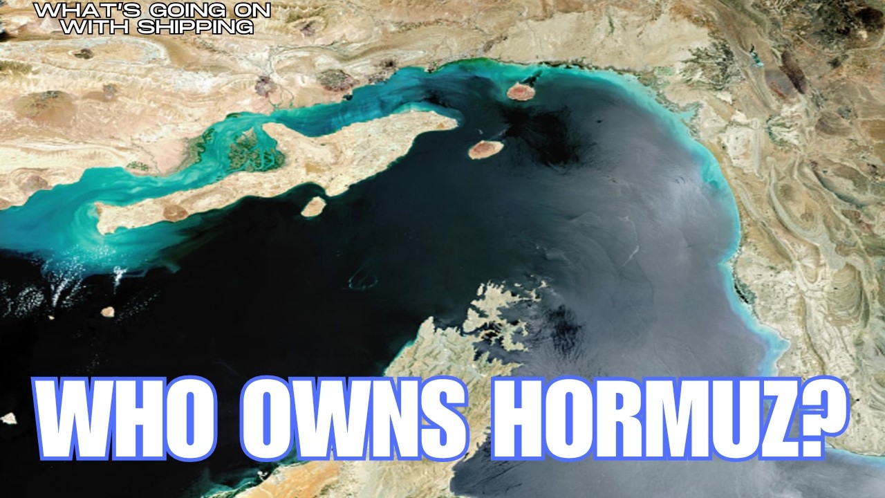
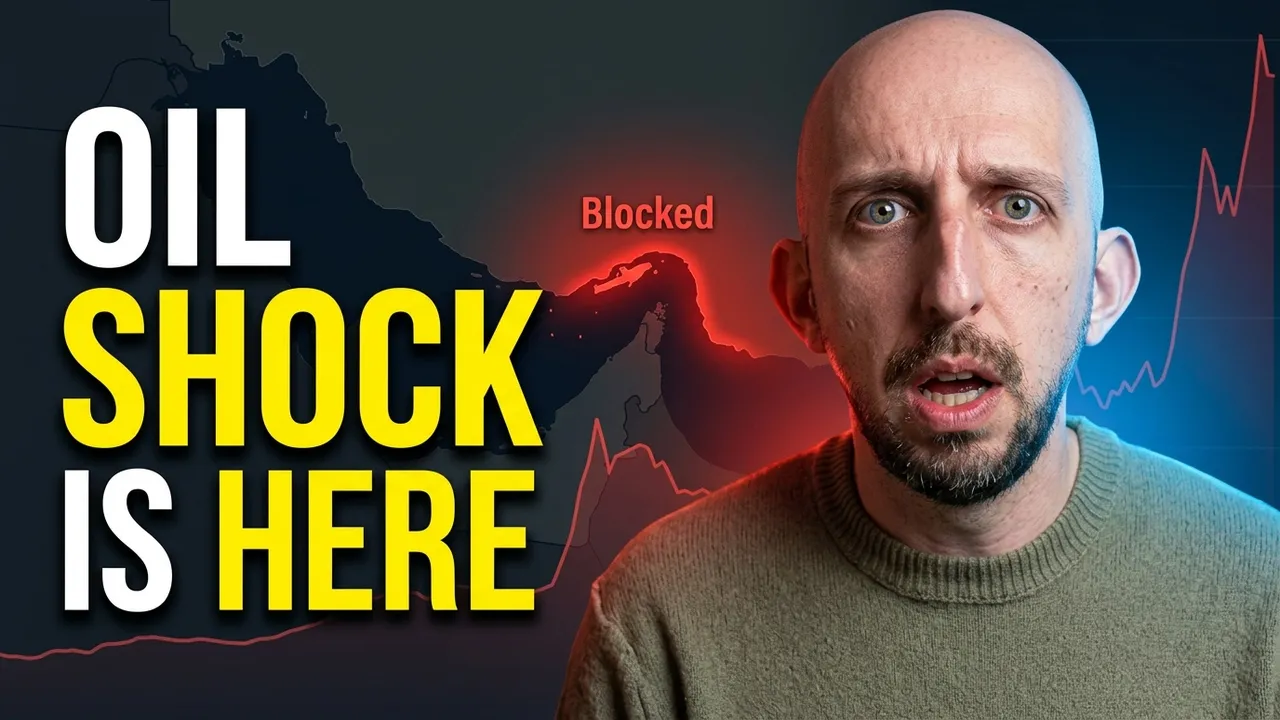
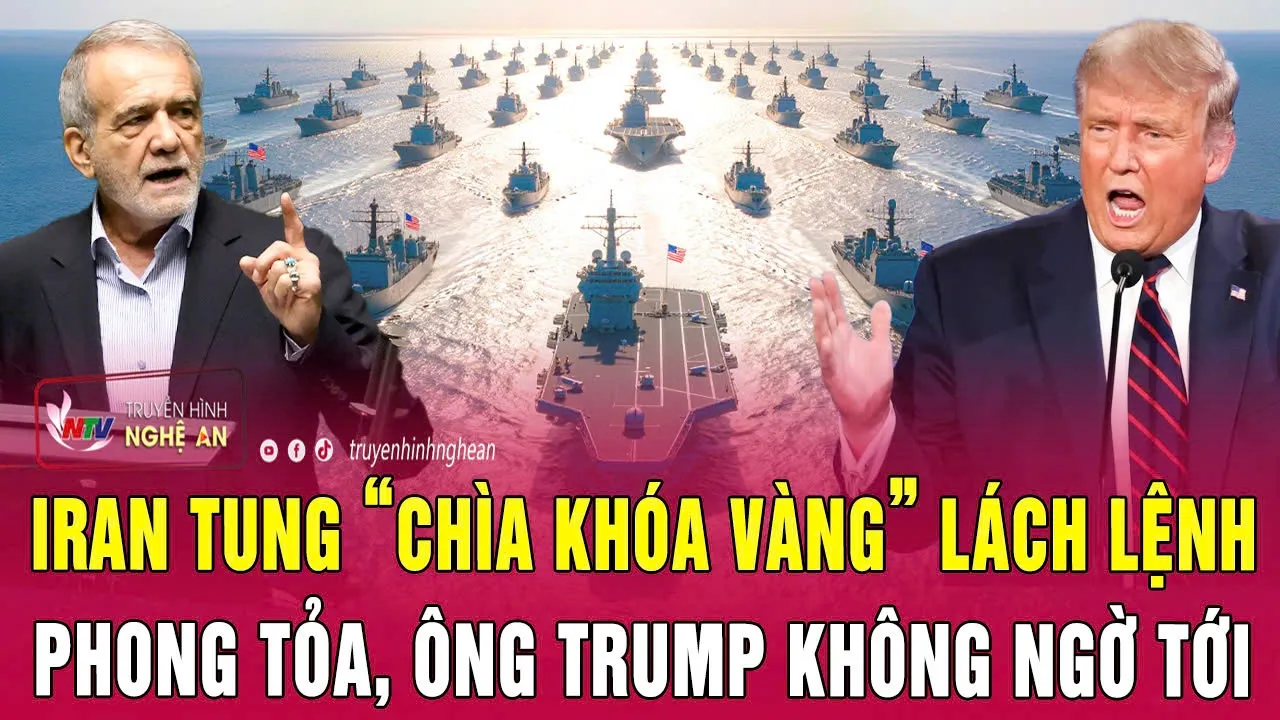
Located between Iran and Oman, it connects the Persian Gulf to the Gulf of Oman and the Arabian Sea. At its narrowest navigable point, shipping lanes are only a few kilometers wide in each direction. Major oil producing countries in the Persian Gulf, including Saudi Arabia, Iraq, and the United Arab Emirates, Kuwait, and Qatar, rely on the Strait of Hormuz to transport crude oil and liqufied natural gas to the global markets. Energy agencies here consistently identify the strait as one of the highest volume choke points.
Daily flows account for a significant share of global petroleum. Disruption in this corridor will influence global oil prices within hours. Although the overall waterway is wide, the designated traffic separation lanes are narrow to ensure safe navigation. The large tankers have to follow precise routes to avoid collision and grounding. There have been some political tensions in the region that have periodically raised concerns about disruptions. Incidents involving vessel seizures, military activity, or threats to shipping have showed the strategic importance of keeping open this transit. Unlike the canals, the straight of Hormuz is a natural passage, but its functioning global trade is no less important. Ships moving through it are part of a carefully coordinated supply chain that connect Middle Eastern production with refineries in Asia, Europe, and beyond.
Some of the Gulf countries have developed limited alternative export routes like pipelines that bypass the strait. However, those alternatives don't fully replace the volume that can be moved by sea through the Hormuz.
Beyond crude oil, refined petroleum products and liqufied natural gas shipments also transit through the corridor. Energy importing nations like in East Asia are highly dependent on uninterrupted flow through the straight.
It shows that maritime passages can influence global markets and its importance lies not only in its physical dimensions but in the concentration of energy supply that moves through it.
When tankers pass between the Persian Gulf and open ocean, they're moving through one of the most important choke points in the global supply chain.
Number 11, the Babel Mandeb.
The Babel Mandeb Strait is a narrow passage that links the Red Sea to the Gulf of Aiden and beyond that the Arabian Sea in the Indian Ocean. It's positioned between Yemen on the Arabian Peninsula and Djibouti and Eratraa in the Horn of Africa. It serves as the southern gateway to the Suez Canal. Its name roughly translates to gate of tears, which is a reference to the difficulty and danger of navigating the waters. Today its importance is in the volume of global trade that moves through it. Any vessel traveling between the Suez Canal and the Indian Ocean has to pass through Babel Mandeb. And that means oil shipments moving from the Persian Gulf to Europe, container ships carrying Asian exports to Mediterranean ports, and bulk carriers transporting commodities all depend on the corridor.
It's also a major oil transit choke point. Millions of barrels of crude oil and refined products pass through it daily. If the straight were blocked or disrupted, tankers heading to or from the Suez Canal would have to reroute around the Cape of Good Hope at the southern tip of Africa. The straight itself though is divided into two channels by Pam Island. This eastern channel known as the Bob Eskender is narrower and shallower. The western channel called the Dak El Mayon is wider and used by most large vessels, but even so, shipping lanes are confined and heavily regulated to prevent any collisions. There have been security concerns that have periodically affected transit through the region. Piracy in the Gulf of Aiden peaked in the late 2000s, leading to multinational naval patrols. More recently, regional conflicts and maritime attacks have raised some renewed concerns about safety of shipping. And these kinds of events have shown geopolitical instability will intersect with supply chain vulnerability.
Babel Mandeb shows that choke points are often interconnected. It doesn't operate in isolation. Its importance is tied directly to the Suez Canal to the north and the broader Indian Ocean trade routes to the east. A disruption in one amplifies the impact on the other. It's geographically narrow, strategically positioned and heavily traffked, the Babel Mandeb Strait remains one of the most critical passages in the global supply chain.
Number 10, the Taiwan Strait.
Lying between mainland China and the island of Taiwan is the Taiwan Strait.
And while it is wider than many traditional choke points, it functions as a corridor for some of the world's most valuable trade. A huge portion of global container shipping passes through the waters surrounding Taiwan. East Asia is a center of manufacturing and the strait sits along a major sea lane which connects Chinese, Japanese, and South Korean ports with Southeast Asia, Europe, and North America. Taiwan is home to some of the world's most advanced semiconductor fabrication facilities, including operations run by Taiwan Semiconductor Manufacturing Company. These facilities produce a large share of the world's advanced logic chips used in smartphones, data centers, and automotive systems.
Finished products and related components are then transported by air and sea. But the maritime shipping remains essential for moving the raw materials and large volumes of finished goods. Liqufied natural gas shipments to East Asian markets transit nearby waters too.
Container ships carrying electronics, machinery, textiles, and consumer goods all routinely pass through this region.
And unlike canals or narrow straits like Hormuz or Malaka, the Taiwin Strait is not physically constrained to the same degree. However, it does have some geopolitical factors and the concentration of industrial capacity in the region has given it some importance.
Though some periods of heightened military activity in the straight have prompted shipping companies to monitor risk. While commercial traffic has continued to flow, the potential for any disruption shows how supply chains can be vulnerable to not just geography but to politics. These kinds of corridors can be defined by the concentration of trade, industrial production, and even the strategic positioning along a major shipping lane. When container vessels pass through the waters there, they're moving goods that power the global economy. The steady flow through the Taiwan Strait reflects the deep integration of East Asia into global supply networks.
Number nine, the English Channel and the Straight of Dover.
At its narrowest point, known as the Straight of Dover, the United Kingdom and France are separated by just over 30 km of water. The English Channel is one of the busiest maritime corridors in the world. This narrow stretch funnels a massive volume of global trade between the North Sea and the Atlantic Ocean.
Every year, tens of thousands of vessels transit the channel. It's a primary route for container ships, oil tankers, bulk carriers, feries, roll-on rolloff vessels transporting vehicles and freight between continental Europe and the United Kingdom. The port of Rotterdom and the Netherlands, one of the largest ports in Europe, depend on uninterrupted access through the channel for goods and entering and leaving Northern Europe. Likewise, ports in Antworp and Hamburg are directly connected to this corridor. The channel operates under one of the world's most structured traffic separation schemes.
Ships follow designated lanes to reduce any collision risk. Despite these controls, though, congestion is a persistent challenge. Weather conditions add another layer of vulnerability. The strong wind, fog, and heavy seas here can slow traffic or increase the risk of accidents. The Straight of Dover is also critical for cross-ch ferry service and freight transport between the UK and mainland Europe. Delays in maritime crossings will quickly translate into supply chain bottlenecks, particularly for perishable goods and just in time manufacturing.
Beyond the maritime shipping though, the channel is home to the Channel Tunnel, which is a rail link that carries both the passenger and freight trains beneath the sea. And while the tunnel offers an alternative to sea transport, it doesn't really replace the capacity of oceangoing vessels. The channel's role became visible during periods of customs disruption and border congestion following the United Kingdom's exit from the European Union. Even short delays at ports like Dover have shown how sensitive regional supply chains are to these kinds of interruptions. The English Channel shows that choke points aren't limited to distant straits. Even in highly developed and heavily regulated regions, narrow maritime passages can concentrate enormous volumes of trade into a very confined space.
Number eight, the Bosphorus.
Running through the heart of Istanbul, the Bosphorus Strait connects the Black Sea to the Sea of Marmara and ultimately the Mediterranean. It's one of the world's most constrained maritime corridors with sharp turns and narrow sections. This straight serves as the primary outlet for the Black Sea nations, including Russia, Ukraine, Romania, and Bulgaria. grain exports, oil, refined petroleum products, and other bulk commodities pass through.
Under the Montro Convention of 1936, Turkey maintains control over the transit through the straight while guaranteeing freedom of passage for commercial vessels during peace time.
Physically, the Bosphorus is only about 700 m wide at its narrowest point. It also features a strong current and multiple sharp bends. Traffic density is high. Thousands of vessels transit annually, moving cargo between the Black Sea and the Med. Tankers carrying oil from ports in Russia and Kazakhstan rely heavily on the route. Agricultural exports too from Ukraine and surrounding regions also depend on uninterrupted access. Because the strait runs directly through Istanbul, any maritime accident carries immediate safety and environmental implications. Past incidents involving tanker collisions have heightened the awareness and risks of the associated heavy traffic in these confined waters. And unlike artificial canals, the Bosphorus can't be widened easily. The natural geography here and urban surroundings limit any expansion.
Turkey has explored some alternative projects like proposals for a parallel canal, but the Bosphorus is the primary passage. The Bosphorus shows you that choke points are not only defined by size, but the concentration of economic activity that they serve. A single winding channel through a major city connects agricultural producers, energy exporters, and global consumers. When ships pass beneath Istanbul's bridges and move between the continents, they're traveling through one of the most strategically important corridors in global trade.
Moving on to number seven, the Straight of Gibralar.
The Straight of Gibralar is the only natural maritime connection between the Atlantic Ocean and the Mediterranean Sea. At its narrowest point, it measures about 14 km across, separating southern Spain from northern Morocco. And despite its relatively modest width, it carries an immense share of global traffic. the container ships moving goods between Asia and the Americas through the Suez Canal, oil tankers transporting crude from North Africa, and bulk carriers carrying agricultural and industrial commodities. The strait is important because it connects multiple major trade corridors. Traffic entering from the Mediterranean may have originated in the Black Sea through the Bosphorus or from the Red Sea through the Suez Canal. In this way, Jibralar functions as the western exit point for several choke points. Oil shipments from Algeria and Libya frequently move through Gibralar on route to global markets. LG cargo and refined petroleum products also transit the strait. It operates under an established traffic separation scheme to reduce any collision risk. Even so, the volume of ships moving in both directions make this one of the most closely monitored maritime corridors.
And of course, geopolitically, the straight lies between European and African territories. Today, ports in Spain and Morocco depend heavily on uninterrupted traffic through the strait. Tangier Med, in particular, has grown into one of the largest container ports in Africa.
There are no practical alternative sea routes connecting the Mediterranean to the Atlantic. Any blockage would effectively isolate Mediterranean shipping from the wider oceans. The straight shows how global trade is structured around geography. It's not simply a narrow gap between the continents. It's a mandatory transit point for vessels that link Europe, North Africa, the Middle East, and beyond.
Number six, the Lombok Strait.
Between the Indonesian islands of Bali and Lombok is the Lombok Strait. It connects the Java Sea to the Indian Ocean. And while the straight of Malaa handles the majority of maritime traffic between the Indian and Pacific oceans, the Lombok Strait by contrast is much deeper and capable of accommodating larger vessels. For this reason, very large crude carriers and other deep draft ships often choose the Lumbok Strait. This makes it important in global energy transport, particularly for shipments bound for East Asia. The straight will carry oil tankers, bulk carriers, and container vessels that are unable or unwilling to pass through the shallower Mala route. In the event of a disruption in the straight of Mala, a significant portion of traffic would likely divert to Lombok or other Indonesian straits like Sunda. The potential redirection does show its role as a secondary choke point. Indonesia's geographic position at the intersection of major oceans means that several of its straits function as global corridors. Lumbok is among the most important because of its depth and its capacity for large vessels. And while not heavily as trafficked as Mala, the Lumbok Strait remains essential to maintaining global shipping networks. In global supply chain terms, it represents redundancy. It shows you that while certain choke points will dominate the headlines, the secondary corridors often carry strategic weight when the primary routes face disruption.
Number five, the Turkish Straits. The dinels and Bosphorus system.
The Turkish straight system consists of two narrow waterways, the dinels and the Bosphorus connected by the sea of Marmara. Together they form the only maritime outlet from the Black Sea to the Mediterranean. And while the Bosphorus passes directly through Istanbul, the dinels links the Aian Sea to the Sea of Marmara, completing the corridor.
For countries bordering the Black Sea, the system's essential. Russia, Ukraine, Romania, Bulgaria, and Georgia all rely on the straits to move their exports.
Oil from Russia and Kazakhstan, grain from Ukraine, and a range of bulk commodities transit this corridor. The Dardell's is about 61 km long, and it narrows in several sections. And like the Bosphorus, it's characterized by strong currents and winding navigation.
Under the Montro Convention of 1936, Turkey guarantees freedom of passage for civilian shipping during peace time.
However, the convention also gives Turkey regulatory authority over transit conditions, which gives them geopolitical importance of the straits.
Crude oil located at Black Sea ports depend heavily on this route. Although pipeline alternatives exist for some volume, maritime export through the straits remain central to the regional energy flow. Grain exports are another major component. Ukraine and Russia, they're among the world's largest grain exporters. And during periods when Black Sea shipping has been disrupted, the global food market has reacted quickly.
The system is though physically constrained. The surrounding urban development will limit expansion. Heavy traffic through these narrow waters combined with strong surface and subsurface currents requires amazing coordination.
Because vessels exiting the Black Sea must pass sequentially through the Bosphorus, the Sea of Marmara and the Dinardells. The entire system functions like a unified checkpoint. A disruption in one effectively restricts the entire thing. This is just a series of narrow waterways through a single country that links agricultural producers, energy exporters, and global consumers. The uninterrupted function of this system is critical not only to regional economies but to the broader international supply chains.
Number four, the straight of Sunda.
The Sunda Strait. It lies between the Indonesian islands of Java and Sumatra.
It connects the Java Sea to the Indian Ocean and serves as another key maritime passage within the Indonesian archipelago. Although not as deep as the Lombok Strait, Sunda provides an alternative route to the straight of Malaa for vessels traveling between the Indian and Pacific. The strait is narrower and shallower in sections limiting the size of ships that can transit it. And the region is geologically active. The volcanic island of Crakatoa lies within the straight.
The 1883 eruption of Crakatoa had some global climatic effects and it reshaped parts of the surrounding coastline. From a supply chain perspective, shipping companies factor multiple Indonesian passages into their planning to maintain flexibility. This is a redundancy that reduces dependence on any single narrow waterway.
Energy shipments of oil bound for East Asia may transit through Sunda when the conditions are favorable. Bulk commodities and manufactured goods also pass through it as part of a broader Asia Europe trade flow. And like other checkpoints, Sunda's importance is magnified by its geography. It's not a wide open sea lane, but a defined passage between the islands. The straight shows you how global trade networks are relying on a web of interconnected passages. And while some choke points dominate in volume, secondary routes provide essential resilience. Narrower waterways, whether defined by treaties or island chains, concentrate global trade into corridors where disruption would have consequences far beyond their immediate surroundings.
Together, the Turkish straight system and the Strait of Sunda show how checkpoints can be shaped by political agreements and natural geography.
Number three, the Cape of Good Hope.
The Cape of Good Hope is located at the very southern tip of Africa. It's not a narrow straight or an artificial canal.
It's just an open ocean route. Yet, it functions as one of the most important fallback choke points in global trade.
When the Suez Canal is operating normally, vessels traveling between Europe and Asia pass through the Mediterranean and the Red Sea. But when the canal is blocked, restricted, or deemed unsafe, the ships have to reroute around southern Africa, rounding the Cape of Good Hope. A voyage between Northern Europe and East Asia can increase by about 6 to 10,000 km depending on origin and destination.
That translates into an additional fuel consumption, higher freight cost, and longer transit times. The Cape route became globally visible during the 2021 blockage of the Suez Canal. Hundreds of vessels were delayed. Some shipping company lines chose to wait while others diverted around Africa. This sudden increase in traffic along the Cape route demonstrated how dependent global trade is on a small number of corridors. The Cape itself is not physically narrow, of course, but it represents a pivot point.
It's where the Atlantic and Indian oceans meet and ships rounding the Cape must navigate powerful currents and challenging conditions. Ports along the South African coast like Durban and Cape Town serve as logistical support hubs for vessels. And if there's increased rrooting traffic, it can place pressure on regional port infrastructure and shipping schedules here. When vessels round the Cape, they're responding to disruption elsewhere in the network.
This makes the Cape sort of like a relief valve in the global supply chain system. It doesn't constrain traffic by narrow width, but by sheer distance and the increased cost. In that sense, the Cape of Good Hope shows you how choke points aren't always defined by geography. They can be defined by dependency, too. The global economy relies on Suez for efficiency. And when that's compromised, the Cape becomes the necessary, though more expensive path.
Number two, the Santos port.
The port of Santos is the largest port in Brazil and it's one of the most important export hubs in the southern hemisphere. It's located in the state of Sa Paulo. It handles a substantial share of Brazil's agriculture, mineral, and industrial exports. Unlike narrow straits or canals, this one's a different type of choke point. It's a concentrated export gateway. Brazil is one of the world's largest exporters of soybeans, corn, sugar, coffee, and iron ore. And a portion of these commodities move through Santos. During peak seasons, congestion in the port has historically caused delays in vessel loading. Trucks transporting grain from inland farms queue along the highways leading to the port. Rail and road infrastructure feeding at Santos becomes critical. The global food supply chain is closely linked to Brazilian agricultural output. When shipments from Santos are delayed, international commodity markets will respond.
Importing countries that depend on Brazilian soybeans and corn monitor the port closely. Infrastructure investments here have expanded capacity over time, including improvements to rail connections and the terminals. Even so, though, high seasonal volumes will test the limits of their networks. Because Brazil's agricultural production is distant from its coastal export terminals, inland transport networks form part of that choke point dynamic, efficient movement from farm to port is essential. And any constraint along that path will affect global trade. When bulk carriers load soybeans or iron ore at Santos, they're not just moving Brazilian goods, they're linking South American production to the global demand. This port's operation is a key component in maintaining stability in the international commodity markets.
Number one, the South China Sea.
The South China Sea is not a narrow straight nor a man-made canal. It's just a big body of water covering about 3 12 million km. Yet, despite its size, it does function as a critical choke point in the global supply chain. A very large portion of the world's maritime trade passes through these waters each year.
Major routes connecting East Asia with Europe, the Middle East, Africa, and North America converge here. Container ships leaving ports in Taiwan, China, and South Korea typically transit the South China Sea before heading towards the Straight of Mala or north toward the Pacific. Vessels departing from East Asian manufacturing centers pass through the South China Sea before entering the Straight of Mala on route to the Indian Ocean or Suez Canal. Oil shipments traveling from the Persian Gulf to Northeast Asia move in the opposite direction, crossing the South China Sea after transiting the Straight of Mala.
This kind of concentration of traffic makes the region important. It's estimated that trillions of dollars worth of goods transit the waters annually. that includes containerized consumer products, industrial components, agricultural commodities, and energy supply. Unlike narrow choke points like Hormuz or Malaa, the South China Sea's vulnerability stems less from physical constriction and more from concentration and geopolitics.
Multiple nations border the sea, including China, Vietnam, Philippines, Malaysia, and Brunai. Overlapping territorial claims have led to some long-standing disputes over islands and maritime boundaries. Despite the disputes though, shipping continues to operate along established sea lanes.
International maritime law recognizes freedom of navigation in the international waters and global shipping companies plan their routes accordingly.
The South China Sea is also home to several of the world's busiest ports.
Shanghai, Shenzen, Hong Kong, and Kawong are major container hubs connected directly to trade flow acrossing the sea. These ports handle millions of containers annually, feeding goods into the world. Manufacturing zones from the Pearl River Delta, the Yangze River Delta, and Taiwan depend on the exports coming out of here. Finished goods like electronics to machinery and textiles move through the South China Sea.
Because global supply chains are increasingly integrated, delays in one segment quickly propagate through the others. If shipping schedules are disrupted in the South China Sea, downstream ports in Europe, the Middle East, and North America will experience congestion. And this is also a region where naval presence and maritime security is visible. Various nations conduct patrols and exercises here.
Commercial shipping companies monitor the advisories and adjust their routes when necessary to ensure safe transit.
The South China Sea therefore functions as a wide but essential corridor connects production centers, energy routes, and consumer markets. Whether container vessels depart from East Asian ports and head westward, they enter one of the most heavily trafficked maritime zones on Earth. When oil tankers travel east from the Middle East, they cross the same waters. The South China Sea's openness, navigability, and stability underpin supply chains that stretch from factory floors in Asia to store shelves and industrial facilities around the world. In the architecture of global commerce, it's less a narrow gate and more a giant crossroad. Yet the concentration of trade within it makes it one of the most consequential choke points in existence.
Up Next

45:48
China vs West: The Trade War and the Future of Made in China
@CNAInsider
2.6M views•2024-01-18
5:07
Impact of Yuan in Indo-Russian Trade Amid Sanctions
@WION
261.9K views•2022-07-01

10:33
Behavioral Economics Explained: Rationality, Nudges, and Risk
@crashcourse
1.1M views•2016-03-12

113:18
The Age of Easy Money: Fed & Inflation | Full Documentary
@frontline
21.2M views•2023-03-15
Related Study Plans & Knowledge Roadmaps
Structured learning paths in Economics
economics
Sovereign Debt: Defaults, IMF & Restructuring
01Introduction to Sovereign Debt & Government Bonds
02Debt Sustainability & Credit Ratings
03Anatomy and History of Debt Crises
+ 2 more learning modules
12h5 modules
Explore Roadmap
economics
Market Design: Matching Theory & Gale-Shapley
01Introduction to Market Design and Price-Free Markets
02Two-Sided Matching & The Gale-Shapley Algorithm
03School Choice Systems and Mechanism Design
+ 2 more learning modules
10h5 modules
Explore Roadmap
economics
Impossible Trinity: Forex, Capital & Policy
01Introduction to Monetary Policy and Central Banking
02Exchange Rates and International Capital Flows
03The Mundell-Fleming Model
+ 2 more learning modules
8h5 modules
Explore Roadmap
economics
Healthcare Economics: Market Failures & Systems
01Introduction to Healthcare Markets and Market Failure
02Asymmetric Information and Adverse Selection
03Moral Hazard and Insurance Design
+ 2 more learning modules
12h5 modules
Explore Roadmap