


















Satellite archaeology uses advanced technologies like multispectral imaging, LIDAR, and radar to detect buried ancient cities without ground excavation, revealing entire civilizations that were previously hidden beneath jungles, deserts, and oceans. This non-invasive approach allows researchers to map urban layouts, water management systems, and trade networks across vast regions, fundamentally rewriting our understanding of human history by showing that ancient civilizations were more interconnected and sophisticated than previously believed.
20 Buried Cities Found by Satellite Archaeology: A New View of Lost Metropolises
Added:Basic principles of remote sensing, including how satellites collect and process data from the Earth's surface.
Fundamentals of the electromagnetic spectrum, particularly how different wavelengths (like infrared, LiDAR, and radar) penetrate vegetation and soil.
Traditional archaeological survey methods and the physical limitations of ground-based exploration in dense or remote environments.
An introductory understanding of Geographic Information Systems (GIS) and how spatial data is mapped and analyzed.
The methodology of 'ground-truthing,' which involves physically verifying and excavating satellite-detected anomalies on-site.
The application of machine learning and artificial intelligence to automatically identify archaeological patterns in massive satellite datasets.
Using satellite surveillance for cultural heritage preservation, specifically tracking looting, warfare damage, and environmental threats to ancient sites.
Advanced studies in ancient urbanism, exploring how these newly discovered metropolises challenge existing historical models of population density and societal collapse.
231 views1likes50:38@echoesoftheunknown348Original Release: 2025-11-12
Beneath your feet right now could lie the ruins of a forgotten empire.
Satellite archaeology is using [music] space age technology to uncover entire cities that vanished from memory, revealing [music] them from orbit.
By the end of this journey, you will have explored 20 of these resurrected metropolites. From a jungle swallowed Kre capital to a desert [music] consumed Arabian trade hub.
How did a prosperous Roman port simply disappear beneath the waves? And what catastrophic event left a Middle Eastern city [music] fused into glass? What lost civilization do you hope is waiting to be found? A single researcher studying a routine aerial photograph of an English field noticed [music] something strange.
The crops were not growing uniformly. In certain [music] areas, they were taller and greener, tracing out faint geometric lines beneath the soil. These were crop marks, and they pointed directly to the buried foundation walls of a massive Roman villa complex, completely hidden from view on the ground.
This was the quiet beginning of a revolution in how we find the past. This is the essence of satellite archaeology, a field formerly known as remote sensing.
It is the science of analyzing data collected from satellites and aircraft to identify what lies beneath the earth's surface without ever breaking ground.
Pioneers in this field [music] like Dr. Sarah Parkak often describe it as using the equivalent of a giant X-ray machine from space. [music] The technology peers down seeing through the veil of time and soil.
How does it achieve this seeming magic?
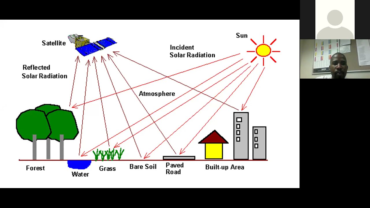
One [music] of its key techniques is multisspectral imaging. This process captures light and other forms of energy that are invisible to our own eyes.
It [music] can detect incredibly subtle differences in the health and composition of soil and plants. A buried stone wall, for instance, [music] will affect how much water the soil above it can hold.
Plants growing directly over that wall will be stunted and less healthy compared to those rooted in the deep, moist soil of an ancient ditch. From hundreds of miles in orbit, the satellite sees this struggle for life and maps it, revealing the ghostly blueprint of a city.
This approach is transformative. It allows archaeologists to survey enormous, inaccessible regions from dense jungles to vast deserts [music] with astonishing speed and complete non-invasion.
Fragile sites remain [music] perfectly preserved, their secret safe until the moment is right for a careful, targeted excavation. [music] This revolutionary eye in the sky has truly opened a new chapter in exploration, making the invisible brilliantly visible.
Now, let's see what it has found. Think of the legendary city of Troy not as a single ruin, but as a stack of civilizations. [music] Each time a city fell, a new one was built directly upon its bones. Each layer buried deeper by the slow accumulation of centuries.
This is the true nature of a buried city. [music] It is not merely a collection of crumbling walls. It is a substantial human settlement, a place that once [music] thrmed with life as a hub of trade, culture, and power, which was then [music] abandoned and subsequently intombed.
This burial was not an act of violence, but a patient process of nature. Silt from a flooding river might gently cloak its streets. Relentless desert sands could drift over its buildings.
Or a cataclysm like a volcanic eruption might seal it instantly under a blanket of ash. This crucial process of covering is what separates a buried city [music] from a simple ruin.
A ruin is exposed, weathered by wind and rain, and often picked over by generations of people. But a city protected by earth or sand is placed in a kind of deep freeze.
The very layers that hide it also act as a perfect preservative, shielding it from the elements [music] and from later human interference. The result is an unparalleled time capsule.
When archaeologists finally reach it, they do not [music] find just the foundations of palaces. They find a frozen moment. They might discover an ordinary meal left on a table, the footprints of a child in a courtyard, or the vivid paint on a merchant's shop wall.
This perfect preservation offers a snapshot [music] of ancient life in all its vibrant everyday detail.
Understanding this definition transforms these sites from mere historical footnotes into sealed windows to the past, setting the stage for the incredible discoveries we are about to uncover.
From hundreds of miles above, the flat expanse of the Nile Delta appears as a patchwork of green and brown, a landscape that seems to hold no secret.
But to a satellite's penetrating eye, this sameness is an illusion. Etched into the earth are the faint geometric outlines [music] of a massive complex, a ghostly blueprint of a city that once rivaled thieves itself. [music] This is Tannis, the lost capital of ancient Egypt. For decades, Tannis was known to archaeologists primarily from the silver screen. immortalized in the film raiders of the lost ark as the final resting place [music] of the Ark of the Covenant.
In reality, its true story is even more compelling. [music] This was the powerful northern capital during the 21st and 22nd dynasties, a period of great division in Egyptian history.
While early excavations [music] in the 1930s made a stunning discovery, the undisturbed royal tombs of pharaohs like Susen's I, [music] those digs only scratched the surface of a much larger urban center.
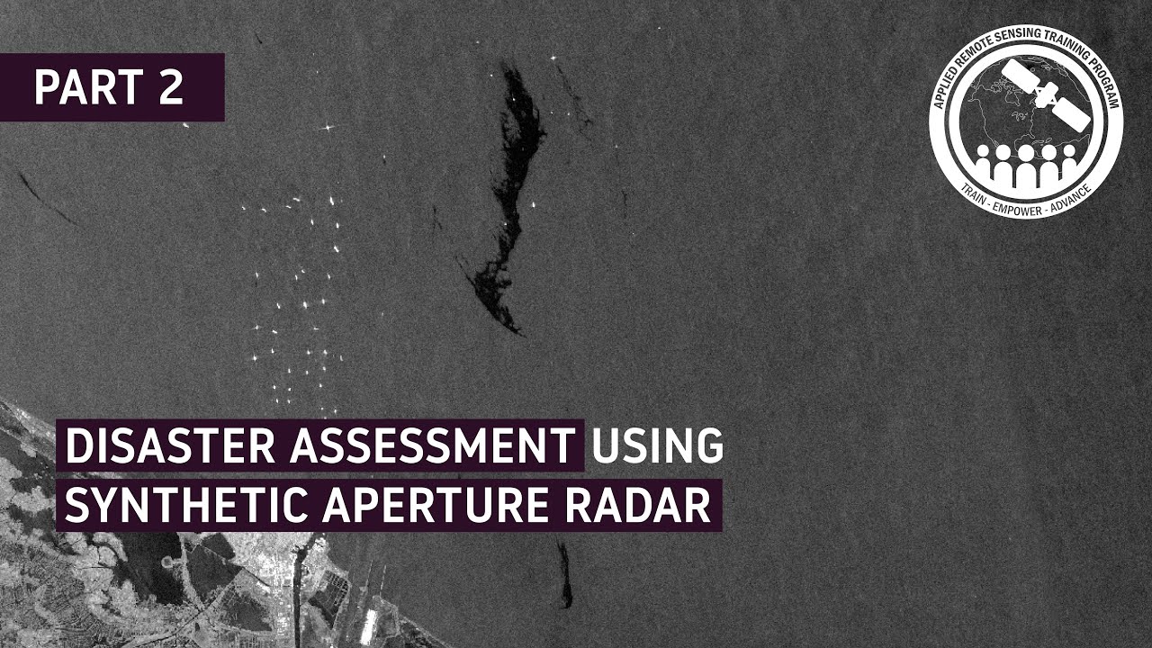
The city's full scope remained a mystery, swallowed by the dry, shifting sands. Then came the satellites equipped with radar. This technology is not fooled by surface appearances.
Its signals pierced the dry sand, mapping the hidden contours of the ground below. The resulting images revealed the complete urban plan of Tannis in astonishing detail.
Archaeologists could now see the sprawling layout of its grand temples dedicated to the god Ammon, its intricate network of canals and harbors that connected [music] it to the Mediterranean trade routes and the vast residential quarters where its citizens lived and worked.
This was not just a royal necropolis. It was a living, breathing metropolis.
[music] The satellite data confirmed that Tannis was a major political and [music] economic hub, a city designed to project power and wealth.
It allowed researchers to move beyond the treasure filled tombs and understand [music] the city as a whole, targeting their ground excavations with unprecedented precision [music] to uncover the markets, workshops, and administrative centers that formed the heartbeat of this ancient capital.
Tannis [music] stands as a powerful testament to how modern technology can illuminate even the most famous of [music] lost cities, revealing the full story written just beneath the sand.
From the sun bleached deserts of Egypt, our journey now pushes into the oppressive heat and tangled greenery of the Cambodian jungle. The dense Cambodian jungle seemed an impenetrable fortress, guarding its secrets for over a thousand years.
Then with a click of a mouse, the forest simply vanished. Researchers [music] analyzing LAR data over the Pnomulan Plateau watched as the digital canopy was stripped away, revealing the ghostly grid of a massive city sprawled across the mountain.
This was Mahandra Parvata, the legendary first capital of the Kmir Empire. Lost for [music] centuries before the grand temples of Anker Watt were even a thought. This mountain city was the heart of a rising [music] civilization.
The LAR technology works like a form of high techch echolocation from [music] the sky. Aircraft fly over a region firing millions of laser pulses every [music] second towards the ground.
These pulses bounce back [music] and by measuring their return time, a supremely detailed three-dimensional map of the true ground [music] surface is created, effectively seeing through the trees.
What it revealed on that plateau was staggering. The landscape [music] was not wild, but meticulously engineered.
The data showed a vast planned urban network of temples, roadways, canals, and massive earthworks, all laid out with clear intention.
This was not a small, primitive settlement that slowly grew. It was a sprawling, organized city from its very beginning, a revelation that completely rewrote the early history of [music] the Kmir Empire.
Perhaps the most crucial discovery [music] was the evidence of a sophisticated water management system.
The empire that would later build the vast reservoirs and moes of Anchor was already mastering hydraology here on a mountaintop.
They were carving channels and [music] creating reservoirs to capture monsoon rains, redistributing water to sustain a large urban population through the dry season.
This technological prowess hidden under the jungle [music] explains how such a powerful civilization could flourish in this challenging environment. Finding Mahandra Parvata did more than just add an older city to the map. It gave the Kirre Empire a profound and complex origin story.
From the humid jungles of Southeast [music] Asia, our search for lost cities now carries us to the opposite extreme.
To a vast sea of sand where an entire civilization was consumed by the desert, a simple mound rising from the Iraqi plains can hide an entire world. This is a tell, a man-made hill created by the slow accumulation of mudbrick ruins over centuries, and it is the most obvious sign of a buried city from the air.
One such mound marks the site of Casa Shemach, which was far more than a simple village. [music] It served as a key provincial capital for the mighty Neoasyrian Empire, an ancient superpower whose reach [music] extended across the Near East.
To understand its secrets, archaeologists turned to an unexpected source. Declassified photographs from Cold War spy satellites. These Corona program images taken decades [music] ago provide a priceless historical record of the landscape before modern development and widespread looting scarred the [music] region.
By comparing these older images with modern satellite photos, researchers [music] can see exactly what has been lost and more importantly what features remain intact beneath the surface.
This comparison allowed them to map the city's defensive walls and locate the footprint of its central palace with remarkable accuracy. This aerial intelligence gave [music] context to the discoveries made by brave teams on the ground who unearthed kifform tablets, the written records of the empire.
These clay documents inscribed with wedge-shaped writing detailed the daily administration of the province from tax collections to military dispatches.
Cassmach thus becomes a window into the meticulous bureaucratic machine [music] that held the Assyrian Empire together.
A remote outpost ensuring the flow of power and wealth back to the imperial heartland.
>> [music] >> This story of a desert administrative center now finds a startling parallel an ocean away [music] deep in the rainforests of the Americas. The sprawling Maya city of Caracall was thought to be a modest ceremonial center, a pocket of civilization in the vast Belisian rainforest.
That assumption was shattered by a single lidar survey. From the air, the laser pulses cut through [music] the dense green canopy, and when the digital forest was peeled back, [music] the true metropolis was revealed.
The known ruins were merely the city's crowded downtown. The data showed that Caracall extended for over 200 km, a vast urban landscape supporting a population that likely exceeded 100,000 people at its height.
What emerged was a picture of incredible organization and connectivity. The LAR maps exposed a sprawling web of wide raised causeways like ancient highways linking the city center to distant suburbs, farms, and satellite communities.
These roads were not simple paths. They were sophisticated infrastructure that bound the city together, allowing for the movement of people, goods, and armies across the challenging terrain.
The imagery also revealed tens of thousands of previously unknown structures hidden under the jungle growth. There were not just pyramids and palaces, but vast residential districts [music] with countless homes, proving the city was densely populated.
Perhaps most telling were the discoveries of advanced [music] agricultural terraces carved into the hillsides and a complex network of reservoirs and canals.
This intricate water management system showed how the meer of Caracall engineered their environment to be sustainable, capturing [music] rainfall to support their massive population through dry seasons.
This single technological survey fundamentally rewrote the story of the Mayer. It disproved the long-held idea that their cities were isolated, empty ceremonial centers visited only by priests and [music] elites.
Caracall was a thriving, interconnected, and brilliantly adapted urban society. A revelation that came not from a decadesl long excavation, but from a few flights over the jungle.
From the new world's lush greenery, we returned to the old to a city swallowed by the desert. For centuries, [music] the desert whispered a legend of Yubar, a city of unparalleled wealth built on the trade of frankincense, a treasure so precious it was worth its [music] weight in gold.
The stories told of towering palaces [music] and unimaginable riches, all lost in a single divine cataclysm that [music] sent the entire metropolis crashing into a sinkhole.
Many wrote it off as pure fantasy, a desert mirage of a story. The search for this Atlantis [music] of the sands consumed generations of explorers, all of whom returned from the empty quarter with little more than sand and shattered hopes.
The turning point arrived not with a camel [music] caravan, but with a satellite in orbit. Researchers analyzing radar images noticed something astonishing. Beneath the featureless dunes, the radar could detect the bedrock. And etched into that ancient stone were the faint converging lines of caravan routes like ancient [music] highways.
These were the paths of countless camels carrying precious incense, and they all led to one specific unassuming location.
A ground team was dispatched to this spot, known today as Shiser.
What they found was not a sprawling metropolis of legend, but something perhaps more historically significant.
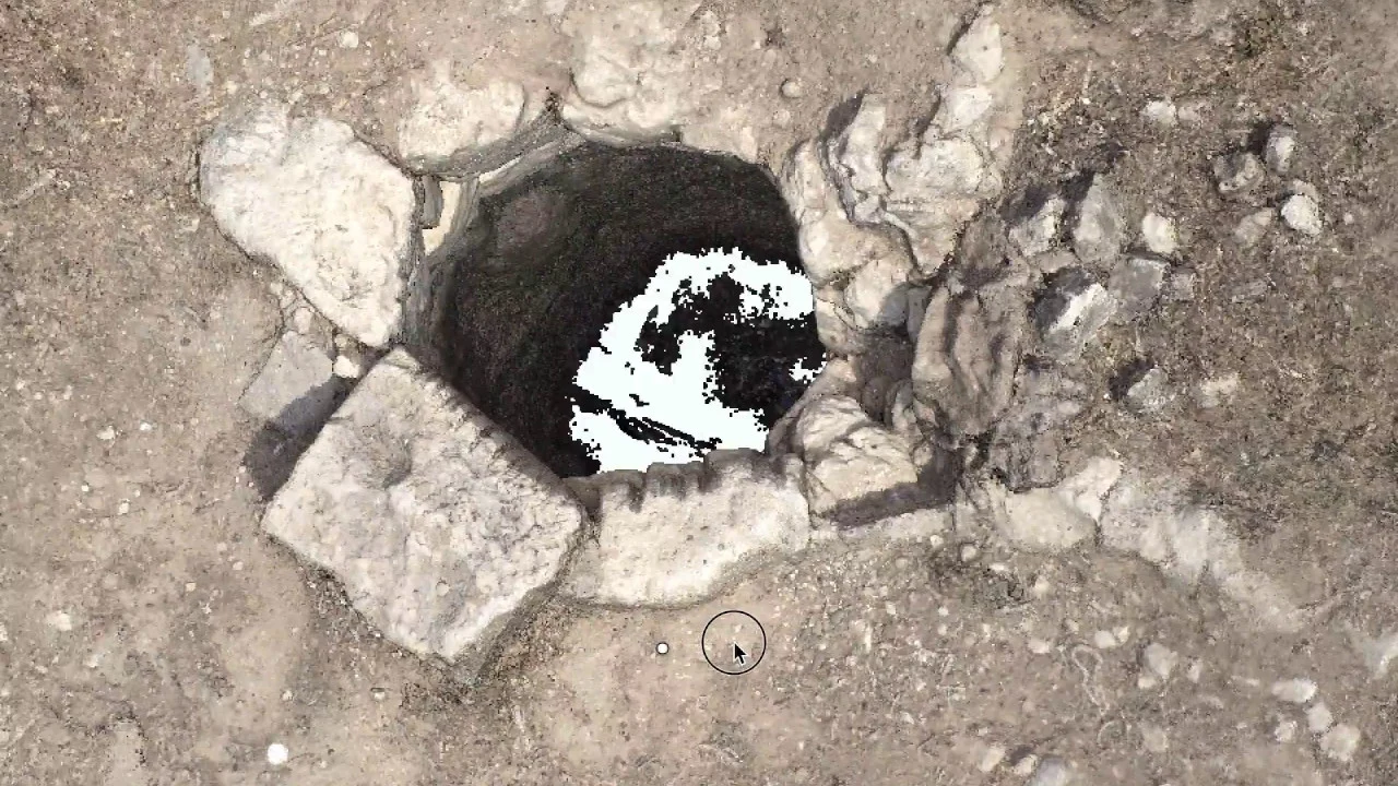
They uncovered the remains of a formidable fortress guarding a massive ancient well.
This was no myth. It was a vital caravansai, [music] a crucial desert port where traders would have gathered to water their animals and rest before the perilous journey ahead.
The discovery proved [music] that the legend of Yubar was rooted in a powerful truth. It was not a single vast city, but a critical hub whose dramatic [music] collapse into a limestone cavern was remembered and magnified over a thousand years of storytelling.
>> [music] >> A city vanishing into the earth is one thing, but some were obliterated in [music] an instant. The legend spoke of a city built by the hands of Trojan [music] prisoners, a settlement founded by the very people defeated in the war, made famous by Homer.
For generations, the city of Tenya existed only in these ancient texts, a phantom from Greek mythology [music] whose physical reality was doubted by many. Its location was a complete mystery until a satellite scanning the sunbaked earth of the pelpineese region detected the whispers of walls deep beneath the olive groves.
The imagery revealed clear anomalies in the soil and the health of the plants tracing [music] out the straight lines and right angles that nature simply does not [music] create.
This was the first solid clue that tenure was more than a story. Ground penetrating radar then mapped the ghostly outlines of an entire urban plan, confirming the presence of a substantial settlement.
When archaeologists began [music] to dig, they uncovered a city that was not merely surviving but thriving. They found rich tombs filled with gold and jewelry, the remains of elaborate buildings, [music] and a sophisticated network of pipes and channels that supplied fresh water to its inhabitants.
The artifacts told a story of immense prosperity with coins and pottery from across the Mediterranean proving that Tena was a well-connected hub of trade.
Its wealth flowing in from [music] Greece, Rome, and beyond.
The discovery was monumental. It provided tangible archaeological proof for a place that had lived only in legend, transforming myth into documented history.
From a city born from the echoes of the Trojan War, we journey next to a place whose wealth was built on a very different kind of treasure. A city that mastered the art of commerce in the ancient world.
While Petra captured the world's imagination with its ornate facades, another city watched from the neighboring mountains. [music] Cellar, a fortress of rose red stone, stood as a powerful stronghold long before Petra reached [music] its peak.
Highresolution satellite imagery has now pulled this overshadowed [music] giant back into the light, revealing a sprawling complex of temples, tombs, [music] and dwellings carved directly into the cliff faces.
This was no minor outpost. The city's strategic position, visible from orbit, placed it at a crucial crossroads of ancient [music] trade routes, controlling the flow of incense, spices, and wealth through the region.
Its [music] extensive and sophisticated water collection system with channels and systems mapped by satellites proves it could sustain a large population in the Arab environment, a signature of Nabotian engineering genius.
This new aerial perspective is helping archaeologists unravel a complex relationship [music] rather than simply being eclipsed by Petra. Cellar appears to have been a major regional power in its own right, part of a broader network of Nabotian control that dominated the desert trade.
The rediscovery of Cellar forces us to look beyond the single famous jewel of Petra and see an entire kingdom of rock cut cities, each playing a vital role in a desert empire.
This interconnected world of trade and power stretched far beyond the Middle East, reaching across continents to a [music] city that reveals a truly global network of ancient exchange.
The sheer scale of the Roman logistical machine becomes [music] visible from orbit at Porters. What appears from the ground as scattered ruins and a large lake reveals itself from space as a breathtakingly complex artificial harbor. a colossal hexagon of water dug by hand, [music] connected by canals stretching like arteries towards Rome.
This was the empire's main maritime gateway, a hub of such immense activity that [music] its true scope remained hidden until recently. While the central basin [music] was always known, satellite imagery combined with ground penetrating radar has now exposed the port's full anatomy.
The data maps out a sprawling landscape [music] of immense warehouses for storing grain from Egypt, administrative centers bustling with clerks managing the flow of goods, and a labyrinth of canals that allowed barges to ferry their cargo directly up the Tyber River to the heart of the capital.
This was more than a dock. It was a perfectly engineered transshipment point, a machine for feeding a city of over a million people and fueling [music] an empire's economy.
Every shipment of North African grain, every block of prized Greek marble, every amphora of Spanish olive oil passed through this meticulously organized complex.
To [music] see its complete layout is to understand the Roman genius for infrastructure. A system designed to move immense volumes of goods with relentless efficiency.
Poris stands as a monumental testament to the power of trade and the ambition of an empire that saw the entire Mediterranean as its own. This story of a city built on commerce and connection finds a stark contrast [music] in our next discovery. A city that flourished not in the shadow of an empire, but in the shadow of a volcano.
A wealthy civilization can vanish so completely that it becomes little more than a rumor. For centuries, Tartesos was exactly that, a land of legendary riches mentioned in ancient Greek texts, famed for its seemingly endless supplies of silver and gold.
Historians knew it existed somewhere in southern Spain, but its heartland, its great cities, remained elusive, fading from history so utterly that many wondered if it was more myth than reality.
The quest to find it became an archaeological obsession. The breakthrough [music] came not from a shovel, but from the sky. High above the marshlands of the Guadalquia River Basin, [music] advanced sensors peered through the damp earth.
What they revealed were startling geometric shapes hidden [music] deep underground massive circular and rectangular structures that formed the clear outline of a sophisticated [music] urban plan.
These were not random features. They pointed to the presence of a major settlement, a complex hub of activity perfectly positioned to control the trade of precious metals from the nearby mountains.
This is what archaeologists [music] had searched for, the potential capital of the Tartesian culture. Finding this city would do more than just mark a spot on a map.
It would transform Tartesos from a semi- mythical name into a tangible [music] powerful civilization, forcing a complete rewrite of the history of pre- Roman Iberia.
It proves that some of the greatest stories from antiquity were not just stories after all. From the mysterious marshes of Spain, our search for lost cities now carries us to the windswept plains of Turkey.
High on a windswept Turkish hilltop, the stones of Zerivan Castle have witnessed centuries [music] of history. But for a long time, the full story of this remote outpost remained buried.
Satellite imagery peeled back the layers of this rugged landscape, revealing [music] that this was no simple castle.
It was Samachi, a massive self-sufficient Roman military base guarding the empire's volatile eastern frontier.
The aerial views expose the complete blueprint of a sprawling garrison town, [music] complete with extensive residential quarters for soldiers and their families, vast granaries to withstand long sieges, [music] and intricate networks of rock cut tombs.
But the most startling discovery lay hidden entirely underground. The satellites detected subtle clues pointing to a secret sanctuary, [music] a temple dedicated to the god Mithras.
This was the center of a mysterious soldier cult that swept through the Roman legions, a faith practiced in hidden [music] caveike chambers far from prying eyes.
Finding this myth confirmed that Zeravan was a profound cultural crossroads.
Roman legionaries, Persian traders, and local peoples all intersected here, creating a unique melting pot at the edge of the empire.
This fortress was more than just walls and watchtowers. It was a [music] microcosm of the Roman world, a community of thousands living under the constant threat of invasion.
The discovery of Zeravan Castle provides an incredibly intimate look [music] into the harsh, disciplined, and spiritually complex life on the Roman frontier. A stark reminder that the glory of empires was forged in such remote and lonely places.
From a fortress standing guard against the desert, we now dive [music] beneath the waves to a city that lost its battle with the sea. A colossal stone pharaoh emerges from the murky depths. His crown [music] breaking the surface for the first time in over a thousand years.
This was the moment the sunken [music] gateway to Egypt was found. Thus Heraclean was not merely a port. It was the official mandatory entry point for all ships sailing from [music] Greece and the wider Mediterranean into Egypt.
For centuries, every trader, every [music] diplomat, every traveler had to pass through this city, paying their taxes and having their goods inspected before being allowed to sail further up the Nile.
This immense economic and political power made it one of the most important cities in the ancient world, long before Alexander the Great founded his famous city of Alexandria, just a few miles away.
So, how does a place of such monumental significance simply vanish [music] beneath the waves? The city was built on the unstable clay of the Nile Delta, a foundation that was always vulnerable.
Over time, a combination of rising sea levels and a series of earthquakes caused the waterlogged soil to liquefy, [music] essentially turning to quicksand. The heavy stone temples and colossal statues simply sank into the morass and the Mediterranean Sea [music] rushed in to claim them. While marine archaeologists performed the heroic task of diving and [music] recovering these treasures, their work was guided by eyes in the sky. Satellite surveys mapped the ancient submerged coastline, identifying promising [music] areas where the silt and clay had preserved the city's remains.
From these watery ruins, an [music] entire world has been resurrected.
Divers have brought up gold coins and delicate jewelry, the wrecks of 70 ancient ships still in the harbor, and towering statues of gods and pharaohs that once lined the city's grand canals.
Thonis Heraclean offers a perfectly preserved snapshot of a bustling multicultural hub at the peak of its power, a crucial chapter of Egyptian history rescued from the sea.
This story of a city lost to water finds a fascinating parallel in a city built to thrive in one of the driest [music] places on Earth. The sprawling modern metropolis of Cairo is a city of millions, [music] a dense tapestry of life and history.
Yet beneath [music] its bustling streets and modern buildings lies a ghost, the faint but distinct footprint of the city that started it all. Satellite radar has peered through the layers of time and concrete [music] to reveal the outlines of Al Fastat, the first Islamic capital of Egypt.
Founded in the year 641 by the [music] Arab commander Amma Iban Al. As this settlement began as a simple military garrison, it was a city of tents [music] that rapidly evolved into a permanent and thriving metropolis, a melting pot of Arab, Egyptian, and other cultures.
For centuries, [music] Al Fastat was the administrative and economic heart of Egypt, a center of power that predated Cairo by over 400 years. Its decline was slow and practical.
As new dynasties rose, they built their own capitals nearby, and Alustat was gradually abandoned. Its buildings were systematically quarried for their valuable stone and bricks, which were used to construct the new city of Cairo.
literally building the future from [music] the stones of the past.
The old capital was left to be buried by centuries of debris, [music] forgotten beneath modern neighborhoods and even vast refused dumps. Now satellite imagery and ground penetrating radar are mapping its extensive ruins without disturbing the [music] city above.
This noninvasive technology is revealing the complete urban plan of early Islamic civilization. Researchers can trace the layout of its grand mosque, one of the very first in Africa, the winding alleys of its markets, and [music] the distinct industrial quarters where artisans practiced their craft.
Rediscovering Al Fastat [music] is like finding the original root system of a great ancient tree. It shows us the deep origins of one of the world's greatest continuous [music] urban centers, a foundational layer that has supported everything that came after.
From this foundational capital, we now travel to another African center of immense influence. A city that was a beacon of learning and spiritual power.
The famous walled city of Shibam with its towering mudbrick skyscrapers was never an isolated marvel. The deserts of the Hadramot Valley hold secrets much older, and from orbit, [music] their traces are now coming to light.
Satellite imagery has mapped the faint ghostly outlines of Shibam's ancient predecessors, [music] entire cities buried in the surrounding landscape.
These are not mere ruins, but substantial settlements visible as large mounds and distinct subsurface structures, proving that urban life in this region [music] flourished for thousands of years before the iconic skyline we know today.
The most revealing data shows the intricate networks of [music] ancient irrigation canals and field patterns etched into the earth. These systems were the lifeblood of the region, [music] capturing precious seasonal floodwaters to sustain agriculture and support a large population in one of the world's most arid environments.
This discovery fundamentally changes our understanding of Shibam's architecture.
Those incredible centuries old high-rise buildings are not a sudden innovation.
They are the brilliant culmination of a long and sophisticated architectural tradition. A legacy of urban living and construction knowledge passed down through generations.
By uncovering these deeper roots, we see that South Arabian civilization was not a fleeting phenomenon, but a culture with profound and ancient [music] foundations, masters of survival in a challenging land.
This pattern of deep hidden roots is a recurring theme [music] and it finds a powerful echo in a city that thrived not on water management but on its [music] position at the crossroads of the world.
The sprawling ruins of MV in Turkmanistan [music] represent a different kind of hub, a legendary nexus of silk road trade. The ruins of MV stretch across the desert like a set of giant discarded [music] nesting boxes.
From orbit, you can clearly see the distinct walled outlines of at least five different cities [music] built right beside one another. Each a new layer of civilization constructed over the bones of the last.
This was not merely a city. It was a continuous urban heart beating for over 2,000 years. [music] A place so renowned that it was once called the queen of the world.
Located at a crucial crossroads of the Silk Road, MV became one of the most populous cities on Earth. A dazzlingly cosmopolitan hub where Zorostrian priests, Buddhist monks, Netorian Christians, and Muslim scholars exchanged ideas as freely as merchants traded Chinese silks for Roman glass.
This was a center of immense learning with legendary libraries and observatories that advanced the science of astronomy. The sheer scale of the [music] site is almost incomprehensible from the ground, but satellite imagery provides the God's eye view necessary to document its full sprawling extent and [music] attract the ongoing threats it faces from modern farming and relentless desert winds.
This aerial surveillance is vital for preservation, allowing experts [music] to see where ancient walls are crumbling and to prioritize protective measures.
The imagery also helps archaeologists [music] decode the city's long evolution, mapping how it transformed under a succession of empires [music] from the Achanid Persians to the Seljuk Turks, whose magnificent Sultan collar citadel still dominates the skyline.
[music] Among the most intriguing features visible are the ancient ice [music] houses or yakuals. Ingenious conicle structures designed to store ice collected in the winter, providing cool refreshment during the blistering [music] summer months.
The story of MV is a powerful testament to the resilience and ingenuity of urban life. Yet, it is also a sobering lesson in impermanence. Even the queen of the world can fade, her grand slowly reclaimed by the sands.
This cycle of rise and fall echoes across the globe, and our search now takes us to a different kind of empire, [music] one that mastered the dense rainforests of Africa.
The great Dufa rises from the Sudin desert, a colossal temple of sunbaked mudbrick that has stood for over 3,000 years. For a long time, this imposing structure seemed like a lonely monument, a solitary sentinel in a vast, empty [music] landscape.
But satellite surveys have now revealed its true [music] context. The land surrounding the Dufa is not empty at all. It is a sprawling [music] ghost city. The imagery maps out an extensive urban area, a capital of immense scale and sophistication.
This was Kerma, the heart of a kingdom that for nearly a thousand [music] years stood as a formidable rival to its northern neighbor, ancient Egypt. The satellites did not just [music] find scattered ruins. They revealed a complete city plan.
The data shows a complex network of major temples, [music] elaborate palaces, and dense residential quarters, all encircled by massive defensive fortifications.
These were the walls of a capital that commanded respect and projected power.
For centuries, the narrative of the Nile Valley was overwhelmingly Egyptoentric, portraying the regions to the south as mere tributaries or conquered territories.
The rediscovery of Kerma completely shatters that view. Here was a sophisticated, independent, and powerful civilization that flourished simultaneously with the Egyptian middle and new kingdoms appear and often an adversary.
How did this kingdom accumulate such wealth and power so far south? The answer lies in its strategic [music] position. Kerma controlled the vital trade routes that funneled the riches of central Africa northward towards Egypt.
Gold, ivory, ebony, [music] and exotic animal skins all passed through its markets with Kerman merchants acting as the crucial middlemen. This control over commerce funded the construction of their monumental city [music] and sustained a society complex enough to challenge the pharaohs.
The story of Kerma forces a dramatic rewrite of ancient history, proving that the light of civilization burned brightly in more than one place along the Nile.
This African powerhouse now compels us to look east to another river valley where an entire script and a way of life remain an enigma. The silence of the Kalistan Desert is a blanket over a forgotten giant.
Here in the Arab plains of Pakistan, a massive unexavated mound rises from the dust known as Ganuri Wallala. [music] For decades, the story of the Indust Valley civilization has been told through its two famous cities, Mohenjo Darrow and Harrapa.
But satellite surveys have now confirmed a third metropolis, a titan of equal [music] stature that has slept beneath the sands for 4,000 years. While its famous sisters [music] have been partially excavated, Ganariala remains almost entirely untouched, a sealed time capsule [music] waiting to be opened.
Topographic analysis from space reveals an urban sprawl covering hundreds of hectares. A city that would have been a teeming hub of activity and [music] home to tens of thousands of people.
Its strategic position in the southern Indust region was no accident. This city was perfectly placed to control the flow of trade and resources, likely managing the valuable Carnelian and Agate [music] mines to the south and overseeing trade routes that stretch to the coast and beyond.
What makes Ganuri Wala so tantalizing is its pristine condition. The answers to the Indust Valley's most profound mysteries are likely locked within its soil.
Why did this vast sophisticated civilization which spanned an area larger than ancient [music] Egypt and Mesopotamia combined suddenly collapse around 1900 B.CE.?
How was a society of such immense scale with its standardized bricks, elaborate drainage systems, [music] and enigmatic script actually governed? Was it a unified empire, a league of city states, [music] or something else entirely?
The discovery of this third giant forces [music] us to reconsider the entire map of the ancient world. The potential knowledge buried at Gamarriwala could finally allow us to read the [music] story of the Indas, a narrative written not in grand monuments to kings, but in the quiet, organized streets of its cities.
This buried metropolis represents one of the last great untapped sources of understanding about the ancient world.
Our final [music] city discovery takes us to a land of biblical legends.
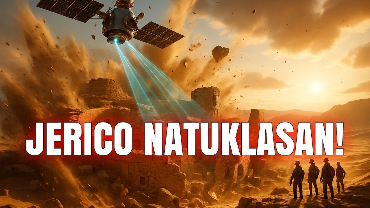
A layer of destruction at Tall El Ham tells a story of instantaneous annihilation. Across the entire city, archaeologists found a thin, dark line of ash and debris, and within it pottery shards that had been melted into glass.
Mud brick walls built to withstand sieges were vitrified, their surfaces transformed into a brittle, glassy coating by a heat so intense it can only be described [music] as infernal.
This was not the work of a conquering army with torches. [music] The evidence points to a sudden apocalyptic event that flattened the city in a single searing moment around [music] 1650 before the common era.
For many, this scientific evidence echoes one [music] of the most famous stories of divine judgment ever told, the obliteration of the biblical cities of Sodom and Gomorrah.
The location of tall El Ham [music] in the Jordan Valley, its immense size revealed by satellite surveys [music] and the nature of its fiery end have led some researchers to propose it as the historical sodom.
This connection remains one of the most heated debates in archaeology. A fascinating collision of scripture and science. The prevailing scientific theory is that [music] the city was destroyed by a cosmic air burst similar to the Tongaska event in Siberia in 1908 where a meteor or comet exploded in the atmosphere with the force of a nuclear bomb.
The thermal pulse would have instantly incinerated everything and everyone followed by a shock wave that leveled every structure. This explanation provides a plausible physical mechanism for a cataclysm so devastating it was remembered for [music] centuries and woven into foundational text.
Whether one sees tall Elam as Sodom or simply as a prosperous city that suffered [music] a freak astronomical disaster, its rediscovery demonstrates how ancient tales of world ending fire might be rooted in real witnessed events.
The line between myth and history becomes wonderfully blurred, inviting us to reconsider [music] other legendary catastrophes. After journeying through these 20 resurrected cities, a final [music] question remains.
How exactly does a satellite hundreds of miles in space accomplish such detective work? A satellite does not see a city.
It sees [music] data. The true magic happens when a trained human eye learns to read that digital landscape.
Take the simple principle of chlorophyll stress. A stone wall buried a few feet below the surface holds very little water. The plants growing directly above its struggle, becoming [music] stunted and less green.
Our eyes might miss this subtle variation, but a multisspectral sensor detects the precise light signature of that stressed vegetation, painting a ghostly negative image of the structures hidden below. It is as if the very life of the plants is betraying the secrets of the dead. On the other hand, lidar technology actively paints the [music] ground with laser light.
It fires millions of invisible pulses every second. [music] Each one bouncing back from the first solid object it hits, whether that is a leaf, a branch, or the bare earth.
By stripping away the first returns from the vegetation, analysts are left with a breathtakingly precise [music] map of the ground itself, a digital terrain model that reveals every ancient [music] road, every forgotten foundation, and every subtle earthwork with centimeter level accuracy.
This is not a photograph. It is a resurrection of [music] the landscape as it was meant to be seen. The data itself comes from a surprising [music] mix of sources. We owe a great debt to history's spies.
The declassified Corona satellite imagery [music] from the Cold War provides a priceless time capsule showing the Middle East and other [music] regions before modern agriculture and rampant looting erased countless archaeological features.
Comparing these 60-year-old photographs with modern Maxar satellite imagery, which offers stunning highresolution detail allows researchers to see exactly what has been lost and what fragile remains might still survive.
Yet, this [music] process is far from automatic. An analyst must become a digital detective learning to distinguish the straight line of a Roman aqueduct from a modern irrigation ditch or the circular depression of a Bronze Age hut from a natural sinkhole.
This technology has also become a crucial [music] shield. By regularly monitoring at risk sites from orbit, archaeologists and governments can spot the fresh scars of lutter pits almost as soon as they appear, or track the [music] encroachment of urban sprawl onto priceless heritage.
This marriage of space age innovation and [music] ancient history is not just a convenience, it is a revolution. It has ushered [music] in a true golden age for archaeology, transforming a science of slow, careful excavation into one of vast panoramic [music] discovery.
So, what does this grand view of 20 lost cities truly mean for our story? It rewrites our past not in ink, [music] but in the very layout of streets and walls.
We now understand that the Kmir Empire was a master of hydraology from its very beginning. that the Maya built vast interconnected urban networks and that a civilization as powerful as Egypt's once thrived further south along the Nile.
These are not isolated facts. They are threads being woven into a richer, more complex, and truly [music] global human tapestry. We are learning that our ancestors were not isolated.
They were traders, engineers, and citybuilders on a scale we are only now beginning to appreciate. [music] Every ghost city mapped from space is a reminder that our history is deeper, more connected, and far more incredible than we ever knew.
From the sunken peers of Thonus Heraclean to the Liidar revealed grids of Mahandra Parvat, these 20 [music] cities form a breathtaking mosaic of human ambition.
They stand as powerful monuments to our shared drive to build, to connect, and to endure [music] against the relentless forces of nature and time. This is the true legacy of satellite archaeology, a field that has fundamentally rewritten the job description of an explorer.
We no longer need to hack through jungles or cross empty deserts to find a lost world. Today, the greatest discoveries often begin with a quiet click in a laboratory, a moment of pattern recognition that pulls an entire metropolis back from the void.
This non-invasive gaze from space allows us to rediscover lost chapters of our collective story without ever disturbing the soil, preserving these fragile sites for future generations while still learning their secrets.
These findings collectively [music] tell a profound truth about our past.
They reveal a history far richer and more deeply interconnected than any single [music] textbook could contain.
Great cities and powerful civilizations rose and fell [music] in complex cycles, not in isolation. The trade routes of the Nabotans connected [music] with the empires of the Mediterranean, while the fortunes of a Roman port were directly tied [music] to grain shipments from Egypt.
Each discovery challenges our longheld assumptions, confirming the kernels of truth within our oldest legends while simultaneously [music] filling the vast blank spaces on our historical maps.
The story of humanity is an epic still being written with [music] new paragraphs being uncovered every year.
With these technological eyes in the sky constantly scanning our planet, we are guaranteed to uncover even more wonders, more lost capitals, and more forgotten chapters.
What lost city do you hope will be discovered next? Share your thoughts in the comments below and subscribe to join us on our next historical adventure.
Up Next
17:23
Introduction to Postcolonial Theory: Key Thinkers and Cultural Analysis
@Tom_Nicholas
325.8K views•2018-10-24
38:41
Astrobiology Through an Anthropological Lens: Field Insights
@georgiatechastrobiology
128 views•2021-04-14
4:45
Proxemics Explained: The Study of Personal Space
@Vox
536K views•2016-07-05
10:38
Psychology of Internet Trolling and Pranks Explained
@AzzyLand
10.7M views•2017-12-20
Related Study Plans & Knowledge Roadmaps
Structured learning paths in Anthropology
anthropology
Space Anthropology: Analogs, Culture & Habitats
01Foundations of Space Anthropology & Cosmic Imaginaries
02Extreme Isolation & Micro-Societies in Orbit
03Space Analog Habitats & Earth-Based Simulations
+ 2 more learning modules
15h5 modules
Explore Roadmap
anthropology
Legal Anthropology: Customary Law & Pluralism
01Foundations of Legal Anthropology and Social Justice
02Legal Pluralism: Coexisting Legal Systems
03Customary Law and Indigenous Dispute Resolution
+ 2 more learning modules
15h5 modules
Explore Roadmap
anthropology
Global Tourism: Gaze, Authenticity & Heritage
01Introduction to the Sociology of Tourism
02The 'Tourist Gaze' (John Urry)
03Staged Authenticity in Tourism
+ 3 more learning modules
14h6 modules
Explore Roadmap
anthropology
Modern Kinship (ART, Adoption & Chosen Family)
01Foundations of Kinship and Family
02Assisted Reproductive Technologies (ART) & Relatedness
03Transnational Adoption and Global Kinship
+ 2 more learning modules
12h5 modules
Explore Roadmap