






![DARASA ONLINE: S02 EPISODE 38 [FORM IV] GEOGRAPHY - EROSION AND DEPOSITION BY RUNNING WATER](https://i.ytimg.com/vi/TpM3tvjXrZ0/sddefault.jpg)


![[에듀피디] 산림산업기사 사방공학 1강](https://i.ytimg.com/vi_webp/gC-fyt0ReJo/maxresdefault.webp)
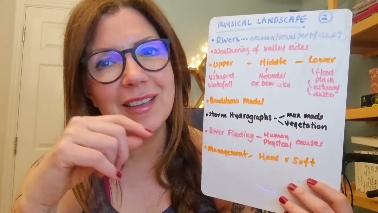










This video provides a comprehensive overview of hydrology and fluvial geomorphology for AS/A Level Geography students, covering key topics including water stores (interception, surface water, temporary/permanent stores, groundwater, channel storage, soil moisture), flow types (throughfall, stem flow, overland flow, channel flow, infiltration, percolation, through flow, base flow), aquifers and springs, hydrographs (annual and storm hydrographs with components like approach segment, rising limb, bankfull discharge, peak discharge, receding limb, and lag time), the Bradshaw model of river characteristics changing downstream (upper, middle, lower courses), river processes (abrasion, attrition, hydraulic action, corrosion, traction, saltation, suspension, solution), flow types (laminar, turbulent, helicoidal), river landforms (meanders, river cliffs, point bars, oxbow lakes, pools, riffles, waterfalls, gorges, rapids, floodplains), and human impacts on river systems including flood prevention strategies.
Hydrology & Fluvial Geomorphology: A Level Geography
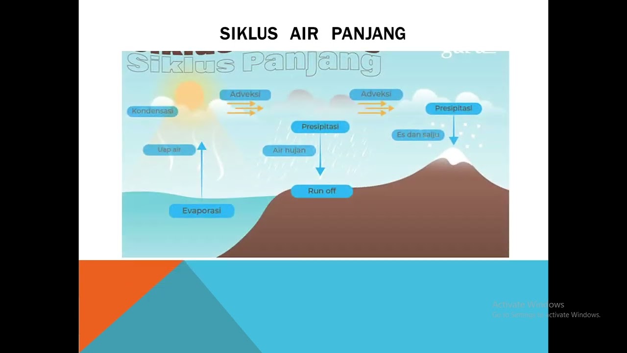
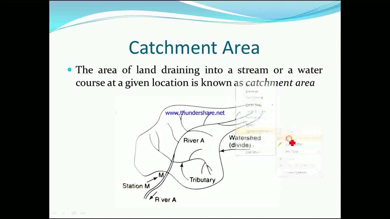
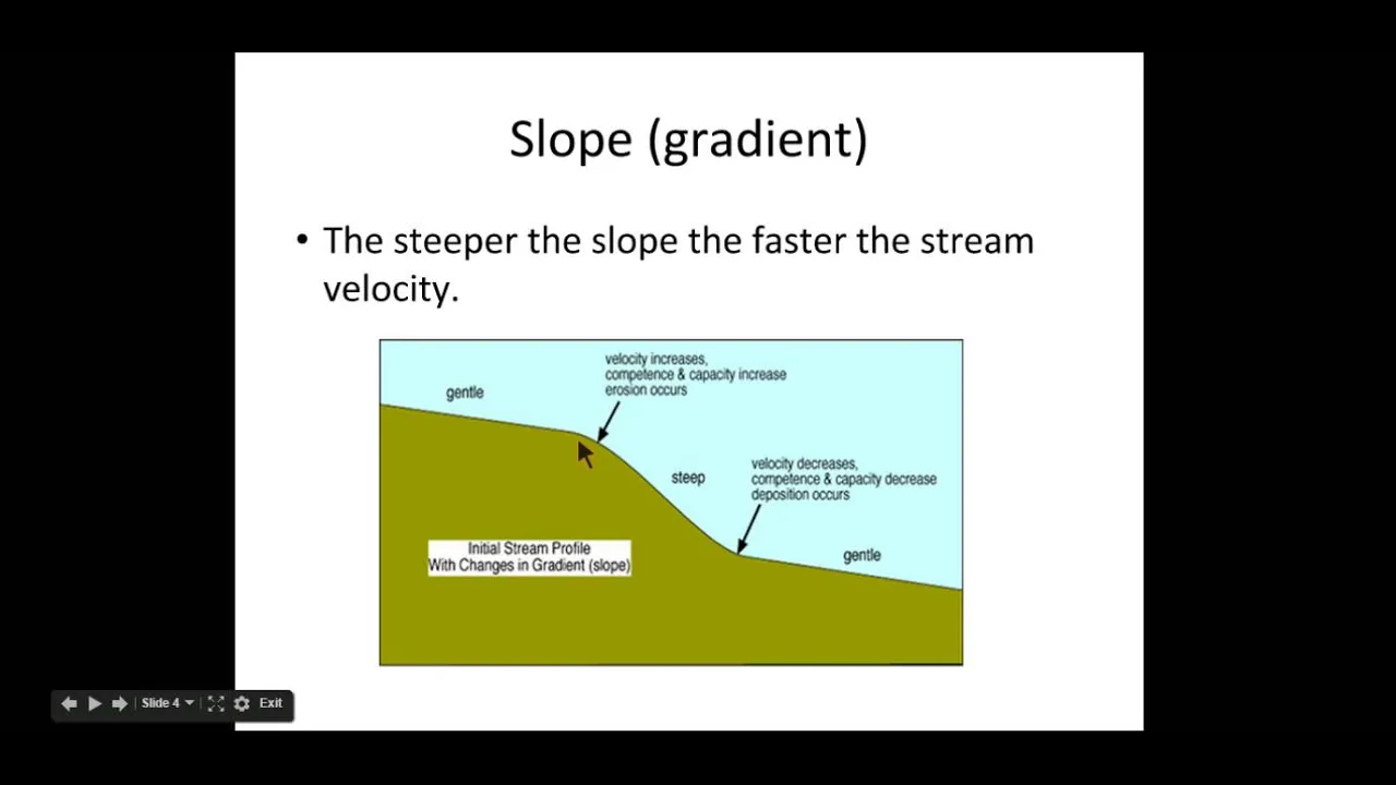
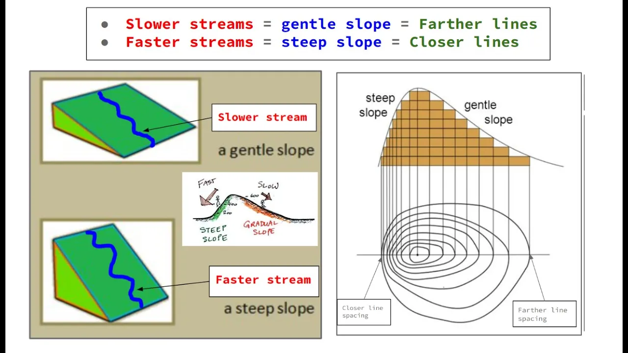
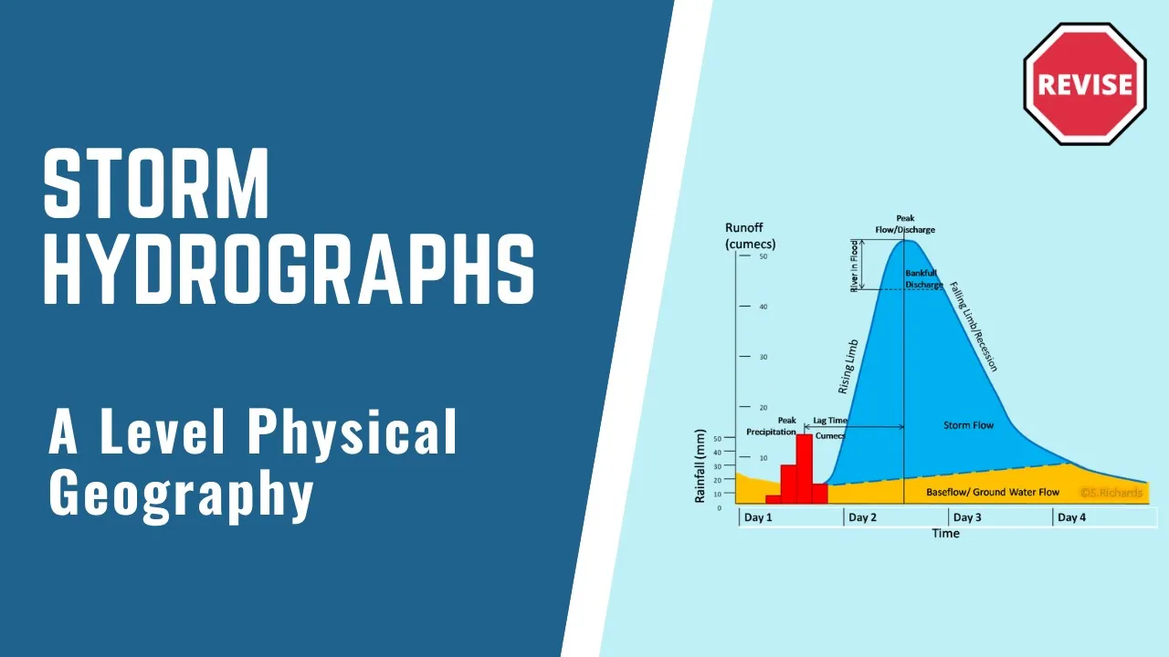
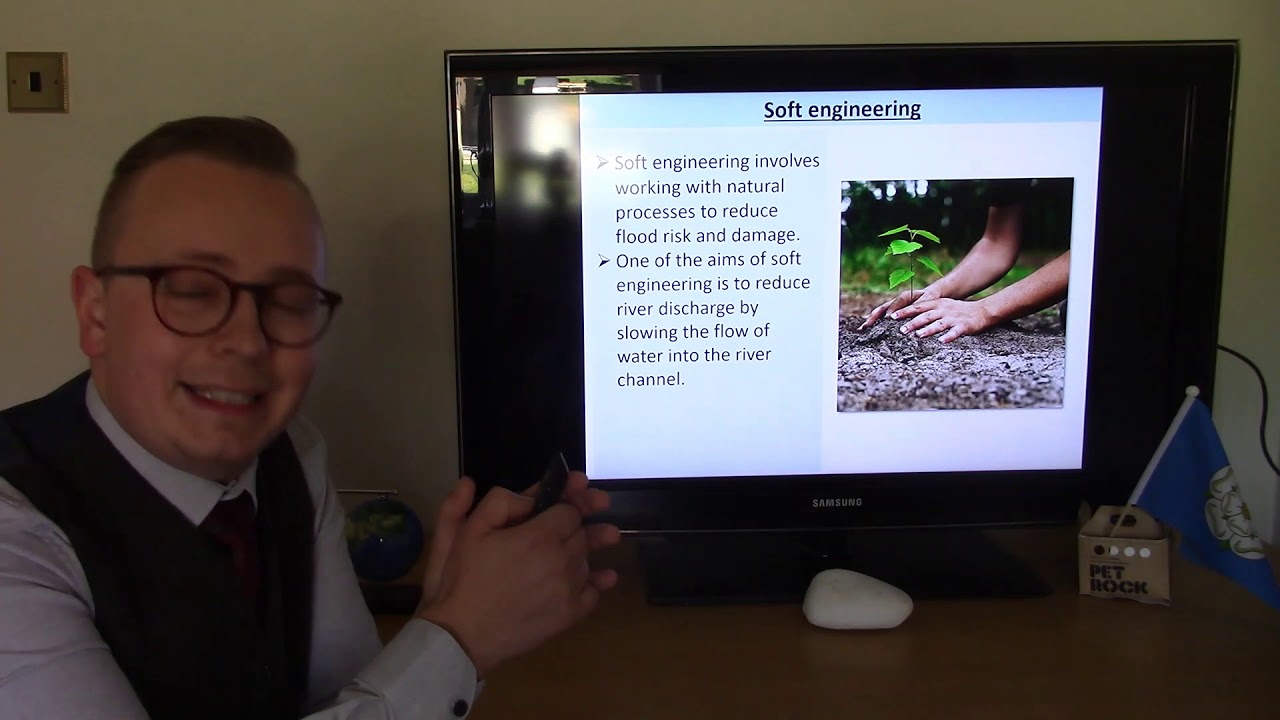
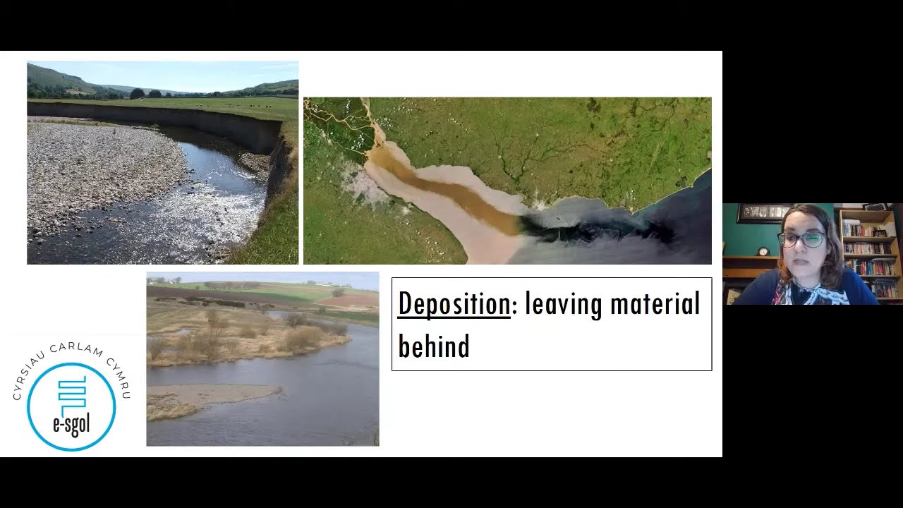
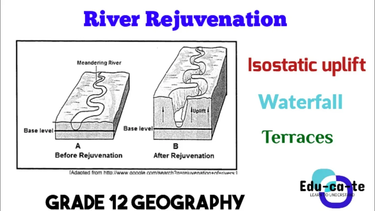
Added:okay so I'm going to be studying hydrology and flal geomorphology it's quite late right now so I might mess up a few words just bear with me if you want to follow along here is the not schedule but here are the topics I'm going to be going through so I'm going to start the stores then flow types underground water you can read the rest you can pause the video and read the rest if you want to I'm just making a video about this because I don't want to sound like a mad man talking to myself at almost 2: in the morning so yeah time to study I'm also going to be just drawing in paint just to help myself understand topics and if you also want to understand the topic you can just pay attention Okay so hydrology and flal dermology I'm going to start with stores okay so there are a few different types of stores let's start with interception so we can think of interception as let's say there is a tree wrong color let's say there's a tree or a bush overground so the definition of interception is precipitation CT and stored by vegetation before it reaches the ground so let's say it rains this rainfall or the moisture with water from this rainfall gets caught by this bush or tree and it doesn't reach the ground so that is interception moving on we have surface water surface water occurs when infiltration capacity is exceeded this causes water build up on the surface okay I'm just going to use the same diagram so let's say it rains again the soil is saturated which means it can no longer which means that water can no longer infiltrate into the soil this causes water build up on the surface and this buildup of water is called surface water okay now let's move on to Temporary stores so a temporary store is something like a puddle so the temporary store is something like a puddle so you can think of temporary stores are just puddles on the ground they won't be there forever they will disappear eventually that is why they're temporary then we have permanent stores so permanent stores or stores such as Wetlands oceans and lakes they are those you could say big puddles that don't dry up okay now we have groundw so groundwater is water that is percolated into the Bedrock so here's the surface here's the Bedrock so groundwater is the water that is infiltrated into the soil gone through all the soil and then get stored in this Bedrock so Bedrock is just the very hard rock that is deep in the ground yeah it's basically it and we can dig Wells and water we can dig Wells into this bedrock and this Bedrock normally sits at the water table so there is always water here along here and US humans can dig Wells below this below Bedrock to access this water which can then be pumped back up to the surface and then we drink that that so that's groundw groundw is just water that is water that has percolated into Bedrock okay now we come to channel storage so let's add little part here so Channel storage is just water that is stored in a river so here's the river it's just the water that gets stored in that River or stream or what whatever man-made drainage channel it's not too difficult to understand and then the Final store that we need to know is soil moisture so there's not any empty space between the Surface soil and Bedrock this is all filled up with this is all filled up with other pieces of soil and rocks and whatever so in between these soil particles there is space and this space can be filled by or these small gaps can be filled by water so when this occurs it increases the soil moisture level and eventually this will cause the soil to become unstable um soil moisture is different in different soil types so for instance sandy soil is similar to what I just drew so sandy soil has large pores this means that there is a lot of space between each sand particle as you can see here a lot of space this means that sand is permeable and there is quick infiltration so when it rains on the sand the water infiltrates quickly however soil types such as clay or hygroscopic it's quite difficult to understand but basically that means that if you have a clay particle you have a clay particle and it in it interacts with water the clay particle will grow in size and consume that water okay that's basically what Hy hygroscopic is and eventually once this clay particle has absorbed this moisture it becomes impermeable and because clay particles are very close together as you see in here once they've expanded and absorbed all their water they become impermeable and water can no longer infiltrate into them and this causes buildup of surface water and this brings us to flows okay so flows I'm going to start with the flows that occur above ground so let's say this is the ground again so first we have throughfall throughfall is just here we have a tree yeah the tree is a bit scum but yeah here we have a tree through fall is water that has fallen onto the tree and then drips off of this tree into the ground so it's the water that interacts with the tree DPS off the leaves and then goes into the ground that is through fall then we get stem flow stem flow is pretty similar however this occurs when the water from the tree goes down the stem or trunk of the tree and into the ground so if you ever get all stem flow in the exam um just think of what a stem is and then just say that the water flows down that stem and you should get your marks okay so now we get to Overland flow so I'm tired now we get to Overland flow so Overland flow occurs when the soil is saturated or when precipitation exceeds the infiltration rate and surface runoff occurs so Overland flow occurs when there is a lot of rain or rain for a long time and the soil below the surface becomes saturated saturated soil is basically just soil that can no longer absorb any moisture so when this happens there is a buildup of surface water so there's a buildup of surface water and once this buildup becomes great enough Overland flow will take place which happens well Overland flow is basically just this water flowing over the ground and then extreme Overland flow is called hortonian flow and this is shallow lamina flow that causes a lot of erosion you can think of hortonian flow as a flash flood for instance so it occurs when there's a lot of surface water there's a lot of surface water and then there is very quick flow rate above above the ground which causes erosion so yeah that's Overland flow and finally we get channel flow which is quite easy so Channel flow is just water that flows in a channel so if you have a river it's the water that flows down that River if you have a stream it's that water that flows down the stream and yeah you also get the man-made channels so it's just that water that flows inside that channel okay now we get below ground so I'm going to start by just drawing the surface so below ground we can start with infiltration so infiltration is when is when precipitation is absorbed into the [Music] soil I really need a B plus yo I'm tired I'm going to get through this it's fine so infiltration is when precipitation is absorbed into the soil so let's say rains this water will um this water will interact with the soil and then it will infiltrate into the soil okay moving on we get percolation so percolation is the slow movement of water downwards through the soil and into Bedrock so let's say this black line here is bedrock so infiltration occurs up here above ground above ground into the ground percolation is from occurs once infiltrations occurred and it is just the water moving downwards into Bedrock through the soil Bedrock is just you can think of Bedrock as very dense soil and and rocks deep below the surface so percolation is just between percolation is just flow between the Surface and Bedrock okay moving on we get to the the horizontal flow types so these two flow types are lateral not lateral I mean vertical so infiltration and percolation are both vertical which means that they both occur in the vertical plane the next few are going to be horizontal let me just quickly draw another quick diagram there's the ground there's Bedrock I'm going to start with through flow so through flow is water that flows through through the soil between the Surface and Bedrock so here's the surface here's Bedrock through flow is the water that flows between bedrock and the surface so it's not above above the ground is Overland flow it is the flow that occurs between bedrock and the surface so it's through flow it flows through the soil okay next we have groundwater which isn't really a flow type but it brings us on to the next flow type so groundw is just water that has infiltrated the ground and has entered the water table so the water table is usually around Bedrock quite deep down and you might get asked what the pratic zone is um the pratic zone is part of an aquafer which is an underground layer of water made up of porous Stone Earth or gravel so the pratic zone is basically this layer here it's just run about the water table so I'm getting SRA here so groundw is water that's infiltrated the ground that has entered the pratic zone or enter the water table so just groundw is just water stored underground it's basically just quite easy to understand it's just water stored deep down underground round about Bedrock okay and now this moves us onto base flow so base flow is when underground water seeps into a riverbed and contributes to the discharge this occurs very slowly and can take months or even years so here's the ground water this groundw will slowly move in the direct in in a certain direction doesn't matter which direction but it usually moves towards more water so it moves and then eventually it will join a river bed so here's a river and then once it has joined this River bed um it will sometimes form an underground river which I'm sure you've heard of before so an underground river is just a river that flows underground so it's a lot slower than an actual River but it's fun it's fundamentals are the same it's just water flowing Downstream together yeah okay so what's next next is the water table so this is no longer what's it called this is no longer flow types this is just underground water so we have the water table the water table makes up the upper level of the pratic Zone it will rise and fall depending on the amount of rainfall percolating downwards and the amount of Base flow from lower rocks so the water table is just this are area here pratic zone is roughly just the PRI zone is just this level like you just think pratic Zone this level if you get a it just say it's similar to water table you might get one mock might get two marcks but just say yeah just say that so water table is collection of groundwater top of pratic Zone that is influenced by influenced by the amount of water coming down from rainfall and the amount of water coming up because of Base flow okay now I'm going to move on to groundwater recharge and groundwater loss so groundwater increase and groundwater decrease so on this side I'm going to have increase this side I'm going to have decrease okay so it increases increases because of infiltration it increases because of seepage so seepage from river banks the beds of rivers puddles and lakes and it increases artificially so ground water recharge occurs because of infiltration seepage and artificially artificially it occurs from irrigation and reservoirs those are the two main ones so there you go there are three reasons why and then groundwater loss occurs because of evapor transpiration so let's say there's a drought this water from deep down will go up to the surface and evaporate and move on to another area natural discharge so groundwater it will will just continue flowing downwards into let's say that underground river as mentioned before that's just discharge leakage or outflow yeah it just goes somewhere else it just moves moves along as said before just joins Another River joins another Basin joins something and then the main reason that groundwater loss occurs is artificially so groundwater is the water underground because humans are greedy we want this water so we dig Wells and reservoirs into this water and we suck this groundwater out of the ground and take it away from the area this causes the water table to drop and it to be less ground water and then we complain about droughts and trees dying and not enough water and rivers and everything yeah okay now let's move on to aquaus so aquafers are perme aquafers are permeable Rock like Sandstone Limestone and chalk that contain significant quantities of water water inside aquafers moves slowly and maintains Stream flow by absorbing or releasing water in wet and dry periods so aquafer is just deep down in the ground let me let me start draing glue I don't even know why I started drawing in Red so aquafer water underground water underground this water is stored in permeable rocks like Sandstone Limestone and torque and aquafers are only classified as aquafers when they contain a lot of water okay um the water in inside aquaus is never stagnant it is always moving even though it is moving very slowly it is always moving and it moves because of wet seasons and dry seasons so let's say there is a lot of rain it will move it will sink further further down into the earth into Bedrock because there is more water um in dry seasons the aquafer will reduce in size because the water is needed elsewhere and it is absorbed by the drier um soil above okay and now we get to Springs so Springs are quite easy to understand here's the ground here's the groundw so a spring is underground water flow that reaches the surface so here's underground water here's the surface a spring is just when this underground water reaches the surface so it is it occurs when this underground water is either very near to the surface or when only just a part of the spring or underground water goes up to the surface that is a spring it occurs where percolating water reaches an impermeable layer or saturated zone so you can think of it as groundwater here is moving along this way and it gets trapped by rocks like this and impermeable remember impermeable and then it gets forced up and it causes a spring okay now let's move to discharge so I'm going to be talking about the hydro so you get two types of hydrographs let me quickly see if I can find a picture of one okay let me let me use this one one looks quite easy copy image it's going to be bad quality but who cares there we go hydrog so we get two types of hydrographs we get get an annual hydrograph and a storm hydrograph um the annual hydrograph is used to study the responses yo I'm tired I can't even speak the annual hydrograph is used to study a river what am I saying the annual hydrograph is used to study the responsiveness of the river to its environment okay so I don't even know why I read that but annual hydrograph is just a graph that shows how the river Rises and Falls throughout the year so let's say you get a lot of rain in summer the river will be higher in summer and let's say you don't get rain in Winter it will be low in winter so an annual hydrograph will show the seasonal characteristics and its biggest influencer is the climate so as said Seasons climate whatever whatever floats your boat hardly ever gets asked in exams you normally get asked the storm hydrograph because the storm hydrograph is interesting the storm hydrograph is used to show variations of river discharge over a short time period this graph includes both discharge and rainfall on the y axis just keep note of that okay so here we have a storm hydrograph so the discharge rate is measured in kumex which is me cubed per second that's the unit of [Music] discharge okay okay okay so if I extend this line here why is on that thing if I extend this line here that is the approach segment so the approach segment is the discharge prior to the storm so it will always be lower than the peak disch charge you can just think of it as lower you can just think of it as how the river normally is when there is no storm okay the rising limb shows how quick what am I saying here's the rising limb right here the rising Lim just shows a quick rise and discharge so I said before before there was a storm discharge rate was low storm started Rising limb become steep it just shows how quickly the River Rose or how quick the discharge rate Rose Rising limb is always before be is always before Peak discharge okay bag full discharge is is a line let me make it here so here's the bankful discharge line so bankful discharge line is a line that indicates the maximum amount of discharge that can occur in that River without a flood occurring so anything above this line will result in a flood so as you can see here if this was the Bank full discharge line then there would have been a flood because the Peak discharge is greater than what the river can hold so the peak discharge is just the maximum River discharge so it is the quickest rate at which water was flowing through the [Music] river okay now we have lag time lag time right here lag time is just the time between the Max rainfall and Max discharge so to calculate lag time you look at the time of the peak rainfall or maximum rainfall and the time of peak discharge this time in between these two things is the lag time a shorter lag time will result in a steeper Rising limb a longer lag time will result in a um shallower Rising limb the receding limb or the falling limb is N I would say 99% of the time less steep than the rising limb this show this receding limb shows the discharge decline after the Pak discharge so Pak discharge occurs the the right um the receding limb or the falling limb is just the discharge after Peak discharge has occurred so it just always downwards it always occurs after Peak discharge and you must just remember falling limb because it's falling off the top here's the peak it's falling falling Li okay now we get to storm flow so storm flow is just the stream discharge after the storm [Music] so here's so storm flow is just what happens afterwards so it's just this part here if you ex see this it's just that and then [Music] yeah so right here this quick jump and lag time is caused by quick flow quick flow is Overland flow that reaches the channel quickly this causes this steep this steep lag time okay okay okay moving on storm processes so rain falls on a drainage basin in large amounts Overland flow occurs because precipitation is greater than the INF filtration rate this causes the rising limb to build to a peak Peak rainfor SL discharge after a few hours Overland flow reduces and stops through flow then contributes to discharge and stops flood waters from going down and stops flood waters from going down as quickly as they Rose later base flow takes over and the river goes back to pre- flood level so what I just explained there was basically how a storm hydrograph occurs so so let's say a drainage basin is just an area that feeds a channel so every drainage basin will have one main channel so here's the main channel in this drainage basin this channel will be fed by a whole lot of tribute trees which are just small streams and rivers flowing from Higher Ground to this channel this channel will always be at the lowest point in this drainage basin so in a storm hydrograph so storm hydrograph occurs when there is rainfall this rainfall is everywhere in large amounts or it occurs for a long time this rainfall will then cause Overland flow because the precipitation rate is greater than the infiltration rate or the soil is already saturated so this causes Overland flow which leads to these inputs becoming greater so Overland flow just causes more water to go into the stream the more Overland flow the higher the peak discharge will become and the quicker not quicker but the more steep the lag time so once this peak discharge is met and it is no longer raining as heavily the peak discharge will decrease as Overland flow reduces and eventually stops through flow will then contribute to discharge and through flow is just the water that's gone through the ground as I explained earlier and that will just continue feeding the river the river won't be as high as when it's being fed the ovland flow however it will still be above normal and then once this through flow goes away then the river will be fed normally through base flow and it's original through flow levels and channel it'll be fed by the channel flow such as the Stream and thgs not thgs what's it called tributes okay pretty easy so drainage basing characteristics so shape and size small drainage basins respond quickly so lag time is reduced River channels in circular basins respond quicker than those in linear ones so let's say the drain patient is a bad example let's say drain Bas is small and in a circle lag time will be very quick or lag time will be very minimal there wouldn't be a lot of lag time because all the water or all the precipitation in the system is fed directly to the channel the main Channel okay now we move on to drainage density low drainage density causes long lag times because water has a few paths to take okay so the quicker the drainage density so quicker the drainage density shorter Life Time longer drainage density longer lifetime drainage density is just the amount of let me actually Google that because I'm not 100% sure [Music] drainage [Music] trity okay so drainage density is just how many rivers there are in an area or how many rivers there are feeding that Channel I would think of it that way so here's the area here's the main Channel High drainage drainage density will mean that there are a lot of tributaries and small streams feeding the channel low drain density would mean that this channel is only fed by a few of these streams and tributaries okay and that's why a low drain drainage density causes long lag times low drain density means less water gets to that main Channel okay next we have soil parity and permeability so impermeable Services result in a greater Peak flow due to more Overland flow so let's say let's say in a city we have cement cement is impermeable this causes a lot of Overland flow Overland flow it's Overland flow goes quickly into the channel and causes the lowest lag times and highest peak discharge um permeable services such as torque and gravel allow for a lot of infiltration percolation this causes less Overland flow and increases the lag time and decreases the peak flow then we get stuff like clay clay is once clay has become um what's the word now once clay has become hygroscopic which I explained earlier it's just when the clay absorbs some water it acts the same way as concrete and will no longer absorb or will no longer be permeable it will become impermeable and cause more Overland flow um this storm the storm hydrograph is also influenced by rock type so impermeable rocks result in quicker response time and lesser lag times and higher Peak discharge permeable rocks like lime Stone remember the remember Limestone if you get asked anything about rocks mention Limestone because it's one of the best examples for a permeable Rock which means it absorbs water okay so permeable rocks like Limestone produce hardly ever produce storm hydrographs this is because they absorb the water and yeah hold it um hydrograph is influenced by slopes a steeper slope will mean more Overland flow and shorter lag time and higher Peak discharge flow so steeper the slope quicker water gets to the channel quicker water get to the channel and higher lag time less not I mean less lifetime higher Peak discharge yeah vegetation type dense vegetation results in more interception results in reduced flood response which results in longer life time which also results in lower P's charge and then one of the main impacts on a drainage basin and the storm hydrograph is land use so urbanization and deforestation increase Overland flow this increases drainage density which means water gets to the river faster which increases Peak flow and life times are reduced okay hopefully hopefully I'm recording this so I'm not going to be pretty upset okay now we get to a bit of an easier topic River Channel processes and landforms let me just find a picture of this graph here let me look for this parad Shore model because it's pretty good in my opinion explain thing quite easily yes time with one hand is rough Brad sh model this isn't the best one a bit better okay here we have the Bradshaw model so the Bradshaw model just shows how a river characteristics change as it goes down stream okay so Brad show model can be split up into three sections these sections are upper course middle course and lower course that's very bad upper course middle course lower course so up that's very very bad so up mid up middle and lower course okay so as you can see Upstream in the river there is not a lot of discharge this is because the channel will merge with more channels Downstream and this increases discharge um the channel channel is not very wide the channel depth is shallow the average velocity is not too great this is because there is a lot of turbulent flow the load quantity is relatively low the load particle size is greatest this is because there is the most um I wouldn't say I wouldn't say that the velocity is low but I would say that this is the quickest part of the river this goes against what I just said about average velocity being lowest but because there is a lot of power in this water and the water is very steep the load particle size is greatest okay just forget what what I just said let me start at the bottom here so Upstream Upstream in a river this is normally in mountains and Hills it's very Rocky and it's very steep so the gradient in the upper course of a river Upstream is very very steep this causes very quick average velocity or it causes a lot of turbin flow the channel bed is very rough this is because it is mainly traveling over rocks and big boulders and these Boulders will take a very long time to be eroded unlike the sand and clay further Downstream and then the load SL load side load particle size is also greatest this is because it's in mountains lots of velocity lots of power in the water yeah middle course is just an average between everything middle course um has medium amount of discharge it's not the widest part of the river it's not the deepest part of the river it velocity is not the greatest it's load quantity is not the greatest but it has a mix of everything so it has large particles has smaller particles it has everything um the channel bed is is a little bit rough as it's progresses from Upstream to Midstream and it Smooths out as it goes along and then the slope is not that not that great it's not the shallowest but it's not that great yeah and then the discharge and then we move down to lower course greatest discharge widest part of the river deepest part of the river the average velocity is highest the load quantity is highest this load quantity will also have the smallest particles like sand clay and gravel this is because it requires the least velocity um in Downstream in the river the bed is very smooth and the slope is shallowest okay moving on to how much do I still have to go through oh my God it's a lot okay moving on to erosion so let's start with abrasion abrasion is when a river bed and Bank are eroded by the river's load so here's the river bed abrasion is a c abrasion is caused when particles within the water hit the bottom of the river and hit the hit the bottom of the river and hit the side of the river um this erosion is caused by mechanical impact of debris rubbing on the river bed and sides this increases with velocity [Music] and yeah the hardness or the density of these of these objects also influences how quickly abrasion kind of Rod a river bed so just think of abrasion as rocks being picked up by the water hitting the hitting the bed and Bank moving on to attrition attrition is when these particles within within the river banging against each other break apart creating smaller particles these small poles Bang into each other creating even smaller particles and this process continues okay hydraulic action is the removal of loose material from the river bed or Banks due to frictional drag of water on the channel so here's the bed water flowing what is that here's the bed water flowing down this way now let me remove that's not very good watch is going this way we have a rock over here this water will keep hitching this rock over and over hydraulic action keep hitching this rock eventually this rock will have too much force acting against it too much frictional force acting against it and it will become dislodged and therefore it is removed from this area and pushed further along the river where abrasion will take place and then attrition will take place okay now we get to corrosion corrosion occurs when the minerals and rocks are dissolved by weak acids in the river and are broken down so corrosion is just just think just think of rust or something just think of rust and then just think of that happening to rocks it's just when when the rock is broken down by like chemicals okay what's else is there yeah that's about that's about it so lateral erosion is erosion on the river banks vertical erosion is erosion on the riverbed rate of erosion depends on the amount of weight of of load velocity gradient hardness of geology pH level and human impacts so the rate of erosion is influenced by many factors such as the weight of the load the velocity of the river the gradient the hardness of these rocks the pH level of the water and human impacts okay moving on to load transport what have I done so far done quite a bit yeah okay low transport so let's start with traction traction is when large particles are rolled along the riverbed by the force of the water particles spend all or most of their time on the river bed so traction here's a river bed here's a rock this rock is is moved along the riverbed not really lifting it's just pushed along rolled along rolled along and this occurs because the water is pushing it yeah that is traction so traction is when a particle is pushed along the riverbed saltation saltation is when gravel and small rocks hop along the river bed as a fast current Picks Them Up and a slower one cruises y a slower one causes them to fall back down so let's just use the same diagram so smaller particles so saltation is smaller particles like this or or pick upop by quick velocity quick pick up and when the velocity drops when the there's less velocity they fall back down to the river bed and bounce off bounce along they just bounce along so saltation is just when small particles bounce along the river bed okay you can think of it as like wind pushing a plastic bottle along a road it won't just roll when there's a gust of wind it will be picked up a little bit and startop bouncing around okay suspect ension suspension is when silt and Clay are held up by the water this gives the river a cloudy appearance especially close to the mouth so lower velocities are able to pick up small particles like clay and salt these particles stay within the water column and Cloud up the cloud up the river which make it look muddy and dirty this can almost always be seen um near to the river mouth where there is a lot of sediment in the water okay solution small minerals dissolve into water and flow with it so solution you can just think of it as like mineral water it's just when salts and stuff are absorbed from these rocks into the water um yeah just absorbed by the water from rocks and stuff that are broken down and are transported Downstream okay now just capacity as the amount of material River can carry and competence is the diameter of the largest possible particle a river can carry for a given velocity okay I'm not going to explain the Hulan Strom curve actually I will I'll explain that cve quickly I won't go to detail but I'll quickly explain it I've done a few pause papers on it so I understand it images let me just quickly okay okay here we go H strong curve okay it looks very confusing if you look at it like this okay but I promise you it isn't so the Hulan Strom curve is a diagram that shows the relationship between the velocity of a river and the size of the particles that are eroded transported and deposited it shows where the sediment will be eroded transported or deposited so deposition occurs when there is a reduction in energy sedimentation occurs when sediment is dropped from from Still Water okay so here it looks quite quite confusing however it isn't let me just let me see if I can zoom in okay there we go po quality however just deal with it so here we go so this white column here in the exam it might not be colored in but you will get these lines here so on the Y AIS we have velocity on the x axis we have the sedma size so just remember that the smaller the Seda size the I mean you can't really say that just remember that clay and silt are exceptions because they require a high velocity for how do I explain this now I know I know how to do it but I just struggled to explain it okay so velocity y- axis sediment xaxis CL silt are exceptions because they are able to be transported as a in a suspension as you can see here wrong thing as you can see here why isn't this as you can see here clay and silt can be transported in a suspension you can say this because deposition does not occur so this whole white area is the range in which a suspend the particles at the top here the particles at the top got transported as a suspension this line here is the critical erosion curve or critical erosion velocity needed to erode these um different types of particles as you can see here's the peak here's the maximum erosion needed and then here's the maximum velocity needed for deposition to occur okay normally they'll ask something like um what is the maximum erosion needed for f well what is the erosion what is the velocity needed for the erosion of fine Sands then you would say here so you would take this line go along to the y- axis and you would look at it as as you can see 0.1 it looks confusing cuz there are so many lines but it isn't each one of these is 0.1 on that oh it's it's addition so how do I yeah so look here's 0.1 0.2 0.3 0.4 0.5 0.6 0.7 0.8 0.9 1 okay and then it's 1 2 3 4 5 6 7 8 9 10 and then it comes in tens so then it's 10 20 30 40 50 60 70 80 90 100 then it's in 100 so 100 200 300 400 500 so it's pretty simple it just counts so you just double this amount each time just or you add this amount onto the next number so it's 0.1 0.2 and then this will be 0.1 plus 0.2 0.3 okay and just carries on it's quite simple so then as I was saying the maximum maximum velocity needed not the not the max I mean the lowest velocity needed to erode a particle will be roughly 10.7 10.8 no I'm wrong I'm wrong here it'll be roughly 18 okay roughly 18 and then remember to include the units in your answer because if you get asked this you will need to include this unit and you will lose all your marks if you don't include it so I was wrong there so if they ask you to find the lowest velocity needed to erode a erode a sediment type not sediment type particle type you go there go down the line find the lowest point go along to Velocity and then you work it out so this will be about 18 cm/ second Nega 1 okay that should explain it okay now we get to flow types so we get a river has three flow types and you need to know these so the river has lamin flow lamina flow is water that flows in sheets parallel to the riverbed common on smooth surfaces so lamina flow is just water flow that is straight lamina straight straight along the river here's the edge of the river goes straight down the river the river looks very smooth from the side there's no white water no turbulence no Rapids the flow is smooth then we get turbulent flow okay turbulent flow is when water closes to the B bed or Banks is slowed by friction and is overtaken by the thw th the th is just the line of forest flow so you can draw it like this just water that gets interrupted turns back on itself flows irregularly does not flow in straight lines flows wherever it wants this will cause Rapids and it will cause the river to look rough okay this is caused because say this is a river bed riverbed is rough like this and this roughness will cause the water that hits it to flow in random directions so the water will start flowing that way some water will start flowing this way and then this slows the flow of the water and creates turbulence within the stream and yeah and then we get to helicoidal flow um I don't know why but they seem to ask helicoidal flow quite a bit I'll draw it up here just to explain so helicoidal flow is the horizontal turbulence produced uh I can't say helicoidal flow is horizontal turbulence that produces a cork screw motion the THV moves both laterally from bank to bank and vertically from surface to bed during one rotation okay so I can just explain it quickly here so let me use a better color here's the river the H coidal flow is flow that looks like this okay that looks very rough right now but I'll explain it here it's easy to explain if you draw like this okay so here's the slip of slope this is the slip of slope it's a bad drawing there it is here is the outer edge of the river outer edge in inner Bank water hel coidal flow is turbulence that is produced both laterally and horizontally in a Corr motion so it looks like this okay so that's helal flow it's acts from in a meander if they ask hel coidal flow or if they ask how a slip of slope is formed or if they ask how undercut is formed or if they ask how a river Cliff is formed draw this diagram I drew it right here you will get at least one or two marks just for drawing this no labeling okay so helicoidal flow is flow that produces a corc motion where the thwi moves both laterally and horizontally both laterally and vertically from bank to bank and from service to bed during one rotation so what happens here is it erods this it cuts this erodes it and then the flow is slowest going back up so this s is deposited here yeah what else do have have to [Music] explain okay so Channel types we get straight channels braided channels and Meandering channels so straight channels are normally artificial they're just straight Rivers like perfectly straight Rivers okay very artificial hardly ever find them braer channels are channels divided by islands and bars they are found when Central when a central sediment bar begins to form in a channel due to reduced Stream flow or increased sediment load okay so Brad river is a river with banks and balls in between so it's sand banks and balls in between the river okay you see so it looks something like this okay these Banks sand banks and bars are caused because the flow rate in the river decreased there was more sediment in the river and this sediment built up and built up and built up and this eventually created the river to shallow and peaks of this um what's it called deposition or sedimentation breach the surface of the water causing these um bars which cause the river to become braided and then Meandering river ah here we go so a Meandering river is just a river that snakes and bends like so it just bends you know the channel looks like a snake with many bends fact is such as Channel slope discharge and helicoidal flow and load combined to create a mandering channel so here I just I drew the cross-section of meander please go and look at it I don't feel like explaining it now but please go look at it if you don't understand why it's formed or how this is formed but yeah that's what it looks like as a river that's what it looks like as a cross-section so imanda is not formed because of an obstacle remember that it is not formed because of an obstacle if you put that in your answer you will get an automatic zero because it means you don't know what you're talking about okay land forms land [Music] forms um what do I need to say for this okay I'll just go through this quickly I won't I'll draw a little bit but I won't really explain too much I'll just read it land forms meanders a pronounced Bend in the course of a river so Meander that's what Meander looks like pulls and riffles cause the th wig to deflect where the th is fastest erosion occurs and the deposition deposition where it is slowest so River Cliffs this here is a river Cliff this here is the point bar Point bar is shallow River Cliff is deep and the river Cliff is often undercut so here's the undercut which undercut means it's just yeah it's undercut and then an Oxo lake is occurs when a meander is cut off so say a meander becomes too steep a flood occurs this meand gets broken so what occurs the river goes like this straight past oxa lake is the remainder of that Meander so that's that's what oxer lake looks like so river river continues going straight the Meander gets broken and then the leftover water here forms an oxb Lake okay so pools are just deep sections of a river Channel with lots of erosion riffles or shallow sections of a Riv bed where sediment is deposited um in another video I explained why you can watch that if you want it's just the video I posted before this okay and then we get to waterfalls um I'm just going to put a picture on the screen because explaining it will take quite a while and I don't feel like explaining it now cuz it's late and I'm getting lazy um please paste the whole thing thing okay perfect there we go waterfalls so waterfalls occur when there's hard rock over softer rock water flows over this harder Rock and the softer Rock gets eroded eventually the soft rock will get eroded so much that a plunge pool will form and over time this soft rock will form an undercut the harder Rock will collapse and a deeper plunge will form with Boulders at the bottom from this harder Rock and as this occurs the waterfall will grow in size the waterfall will become higher okay so that's waterfalls if you get asked an eight more question about waterfalls it should be free marks if you don't know what waterfalls are then tough luck so Gorges are a deep-sided valley caused by waterfall retract so this waterfall will where's the thing over time this waterfall will move backwards waterfalls are never moving forwards they're always moving backwards so once this waterfall has moved back far enough it will create a Gorge so it will look like this the and yeah that's just what gorgeous Rapids are found in the upper course of a river um they occur where the riverbed is Rocky and irregular this causes turbulent flow and white water and it is very dangerous so if there are Rapids in a river it's just dangerous so if you get asked something about Rapids just say dangerous um caused because of Any regular River bed okay flood planes here's the river flood planes are on the on the outer sides of the river so flood plays or flat land made up of a mixture of sand and clay silt and gravel next to the river that gets covered by flood water whenever the river floods so so here's the thing there's normal where water normally is when the river floods this whole area underwater all of the all of the stuff from inside this River gets taken out and put all over here this create this makes this land very fertile [Music] and yeah makes the land very f and this is because sand clay silt and gravel are all moved onto the Outer Banks so a lot of farming is down around rivers and that's why because it floods and then fertile Soul gets moved to the outside yeah so levies are a rais bank formed on a river at the lower coast of the river so to stop floods levies can be built so there's the river Levy is just an extension of the river bank that keeps the water within the river and stops floods and then Deltas or Wetlands that form as a as Deltas or Wetlands that form as a river empties its water and sediment into another body of water such as an ocean lake or other stream you get types of Deltas but we don't really need to like dive into that if you get asked Deltas in your exam don't don't do it um if in those in the last page of your exam if you get asked about deltas rather find another question to do and do the other question because it is very difficult to find eight marks from Deltas or 15 marks from deltas because it's just very repetitive and there's not a lot of information about them unless you know about all of the bird for deltas and others and yeah it's a lot of work okay so now what are we doing here okay so um okay so here we go human impacts so catchment flow modifications so humans cause deforestation deforestation reduces evapor transpiration this increases surface runoff reduces lag time and there is less surface storage this results in higher Peak discharge so deforestation causes more floods so if you have a tree you have a tree why is it blue tree tree people cut these trees down and surprise surprise floods occur okay f forestation is when people pla trees to counter deforestation so that will reduce floods because they just planting the trees that they took away from the areas um urbanization I'm just going to read this whole thing urbanization causes more impermeable surfaces reduces infiltration and increases Overland flow sewage systems and and storm drains get water to the main Channel quicker urbanization causes lag times to be reduced and FL Peak and uh urbanization causes lag times to be reduced causes flood Peaks to be increased this is because there is this is because there are more impermeable surfaces and water gets to the river quicker and then by buling on flood planes the available flood space is reduced so flood levels will rise higher and will will cause more damage to the buildings built on these flood planes this is very this can be or this could be seen commonly in the USA however now with the very strict noblea guides and guidelines it is less common abstraction takes water out of the system artificially over abstracting cause drying up of rivers falling of water tables and saltwater intrusion in coastal areas channelization increases the capacity of a channel so shorter lag times and higher flood Peaks low channelization lowers the risk of flooding because waterers transported away quickly water storage pulling dams yeah it just controls water in an area and then reductions and Industry AC ity so if we start using water from an area less or using less water from an area all Springs can reemerge this can cause flooding and areas become less stable okay so causes of river floods physical causes are such as physical causes are heavy rain or persistent rainfall rapidly melting snow or ice impermeable soil and bedrock Coastal Storm surges lack of vegetation natural discharges or dab failure okay so I'm just going to give some examples So Physical causes heavy or persistent rainfall an example of this is the Western Cape recently in September they received very bad floods as a result of persistent rainfall and heavy rainfall okay rapidly melting ice or snow this can be seen almost every year in India as ice and snow from the Himalayas melts and increases the floods and increases flood rates impermeable soil and Bedrock this can be seen in a place called exmouth where they receiv received a lot of rain in a short period of time which caused the clay in the riverbeds to become impermeable which caused the flooding of the Town exmouth Coastal storm Coastal Storm surges this can be this can be seen in the Mississippi floods in when they had their hurricanes um the storm surges broke the levies which caused flooding lack of vegetation is basically everywhere you can just think of how you can just think of a place where default station has caused problems and then natural disasters or damn failure that can be seen as in Libya recently um probably about a month or two ago in Libya when the dams failed and flooded the town killing a few people okay so human causes urbanization impermeable surfaces storm drains Channel restrictions all of these cause floods building on flood planes yeah of course floods those buildings when a flood occurs and increases the flood level because there's less area for the water to go okay and then farming causes floods because the areas around the river are no longer natural and are manipulated to the forms liking this can cause floods okay impacts of river floods death damage disruption makes a mess in lower income countries there are always more deaths less clean up and there are always more deaths and the cleanup cost is less in higher income countries there are less deaths and a higher cleanup cost okay flood prevention so flood prevention can be done in three ways I say the three PS prediction prevention and post flood plans okay so here's some quick notes about that so reoccurrence interval how often on average a flood of a certain size is likely to occur so that can be predicted so when the time comes for a flood to occur the people can be prepared flood risk flood risk Maps can be created that show where a river is most likely to flood areas with a high risk can be can be calculated from this from these flood risk maps and th these areas with high risk should be prepared for floods like flash floods and these areas or areas below dams areas subject to flash floods and areas close to the shore okay and then forecasting weathering use of weather satellites and then yeah just knowing when a flood is going to happen you can do this based on the weather and then here's some post flood things loss loss sharing so disaster Aid and Assurance so you ensure your stuff against floods this will reduce the impact and then of course you get hard engineering and soft engineering hard engineering is engineering against the natural process soft engineering is engineering that works with the natural processes so hard engineering is building stuff like dams straightening the River Building levies building reservoirs building spillways and making the channel wider they are very common in hi's however they are expensive soft engineering are always cheaper than hard engineering and use the environment to reduce flooding they do this by planting marshin contour plowing removal of sediment dumping rocks and sand into or around the channel and these are most common in low-income countries so and then we get to the land use zoning so the no OAA in America has influenced has not influenced has introduced land use zoning so people are no longer allowed to build on flood planes as they are at risk and will cause damage to the Natural Area because they are building property on a flood plane and then what else is there appropriate appropriate flood plane use so this protects Wetlands animal grazing land is situated near the the river Channel parks are built between rivers and houses critical buildings like hospitals and police stations and fire departments are built far as far as possible from from PL I can't even speak on that TI yeah I think it's time to end it from possible flood prone areas so if there's a if there's a river at the bottom here Mountain the hospitals and police stations will be built on top here this is because they are least likely to get damaged by a flood and they are safe when a flood occurs so flood floods the area down here people have safety and people have help at the top of the mountain at higher ground and will no longer need to worry about flood impacting them okay I think I'm going to end it there if you watch your hopefully you learn something um I learned some stuff for geography and yeah feel good about my exam good luck guys
Up Next
Hydropower Controversy: Dams vs. Wild Rivers in America
@patagonia
1.6M views•2020-04-24

Triumph of Orthodoxy Icon: Byzantine Art & History Explained
@BenCallan
2.1K views•2024-08-06

FastAPI vs Flask vs Django: Choosing the Right Python Web Framework
@TechWithTim
302.5K views•2024-05-26

Game of Thrones Opening Credits: A Cinematic Analysis
@gameofthrones
46.3M views•2011-04-18
Related Study Plans & Knowledge Roadmaps
Structured learning paths in General & Interdisciplinary Studies