LiDAR (Light Detection and Ranging) technology, which uses laser pulses from aircraft to penetrate dense jungle canopies, has revolutionized archaeology by revealing tens of thousands of previously unknown Maya structures, including a massive hidden pyramid near Tikal's center that may contain an intact royal tomb, demonstrating how modern technology can uncover ancient civilizations that were thought to be fully mapped after over a century of study.
LiDAR Reveals Lost Maya Pyramids in Guatemalan Jungle
Added:Deep Dive
The basic principles of LiDAR (Light Detection and Ranging) technology, specifically how laser pulses measure distances to map topography through dense vegetation.
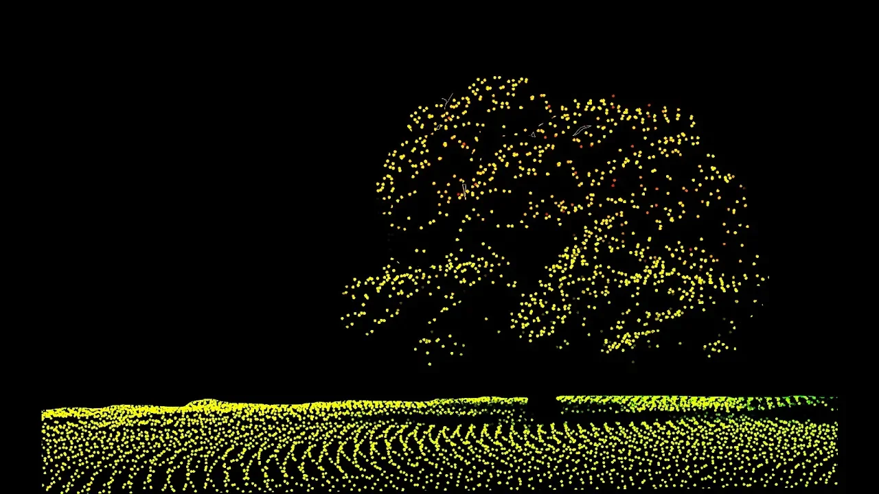
How Does LiDAR Remote Sensing Work? Light Detection and Ranging
995.9K
LiDAR (Light Detection and Ranging) is a remote sensing technology that uses laser pulses to measure distances and create detailed 3D maps of terrain and vegetation; the system works by emitting laser pulses from an aircraft, measuring the time it takes for the light to travel to the ground and return, calculating distance using the speed of light, and then determining elevation by combining this distance with GPS altitude data and accounting for aircraft tilt and pulse angle, which allows scientists to study forest structure including canopy layers and ground features.
Click to watch →
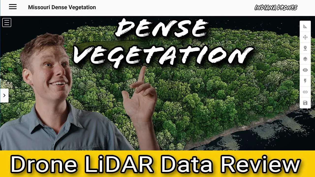
LiDAR drone Data processing and a review: Dense Vegetation
16K
LiDAR (Light Detection and Ranging) technology uses laser pulses to create precise 3D representations of terrain and features. Unlike photogrammetry which relies on visible light imagery, LiDAR can penetrate dense vegetation canopies to capture accurate bare earth measurements. This capability is particularly valuable in forested, swampy, or brush-covered environments where traditional imaging methods fail. The technology works by emitting laser pulses that reflect off surfaces and return to the sensor, with the time-of-flight measured to determine distance. In dense vegetation scenarios, the laser pulses pass through gaps in the canopy and strike the ground, allowing LiDAR to map terrain beneath trees, thick brush, and tall grasses with high accuracy.
Click to watch →
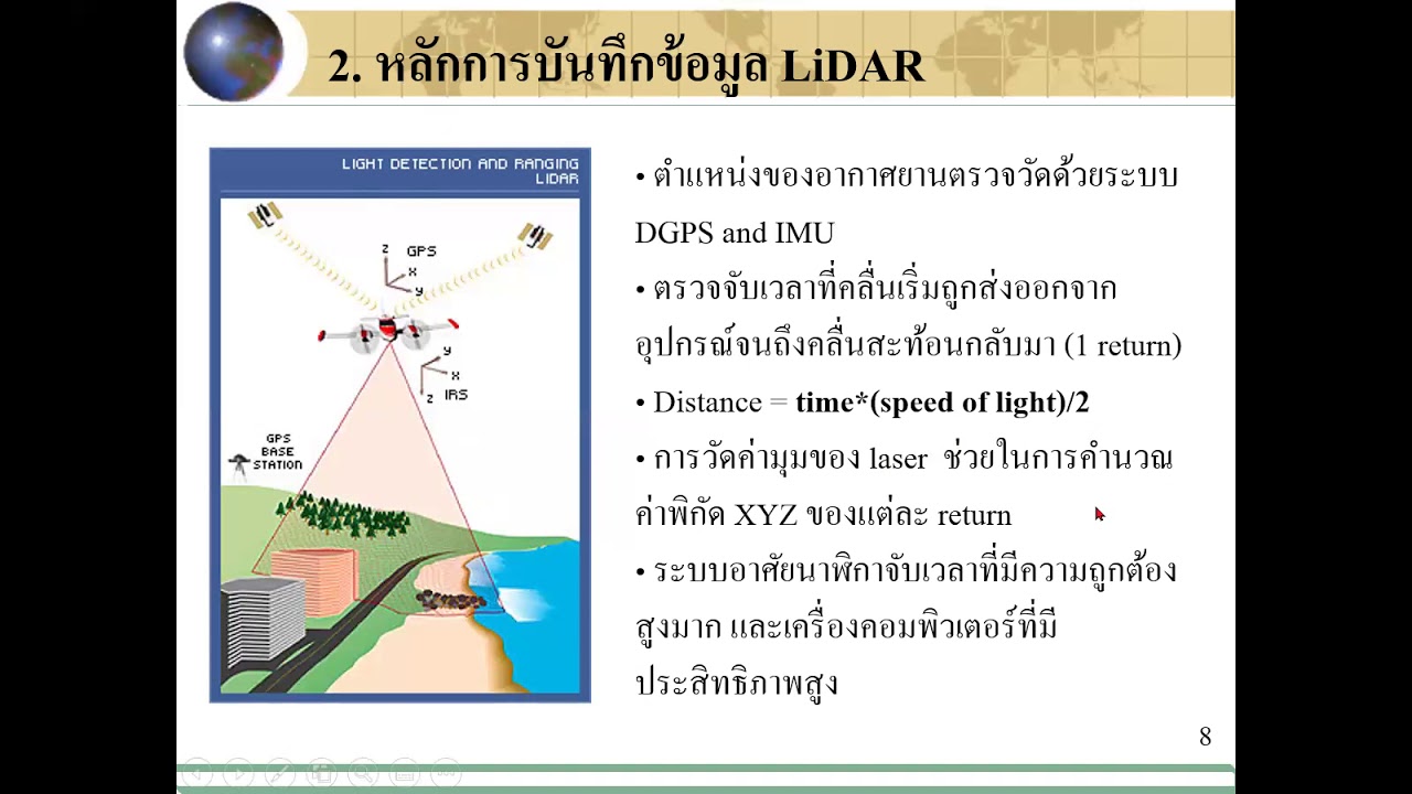
01451254 0902
276
LiDAR (Light Detection and Ranging) systems create 3D terrain and object models by emitting laser pulses and measuring return times. The system uses green and infrared wavelengths (approximately 1,000 meters) with atomic clocks measuring 10 nanoseconds for centimeter-level accuracy. Distance calculation follows: distance = (speed of light × time) / 2. Differential GPS (DGPS) uses two receivers (base station and aircraft) within 40-60 km to correct satellite errors. Scanning patterns include linear, diagonal/zigzag, and circular, with diagonal being most common. First return indicates vegetation tops, last return indicates ground. Combining these returns enables vegetation height extraction for forestry applications including biomass estimation and forest inventory.
Click to watch →
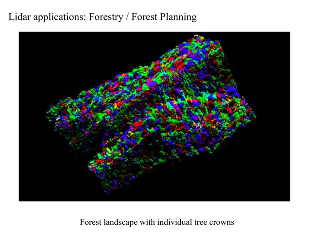
Lecture Online 9 1 Lidar introduction audio
234
LIDAR (Light Detection and Ranging) uses lasers in visible/near-infrared wavelengths to measure distances by timing pulse round-trips. Range is calculated by multiplying speed of light by half the elapsed time. Modern systems require GPS for 3D positioning and IMUs for orientation. Primary applications include topographic mapping, urban building height extraction, landslide detection, and micro-fault identification for seismic hazard assessment. LIDAR pulses have specific characteristics: repetition rates of 25-500 kHz, horizontal pulse widths of 10-150 cm, and vertical durations of 6-12 nanoseconds (corresponding to 1.8-3.6 m depth). Pulse shapes are typically Gaussian or Rayleigh, affecting surface resolution. Beam intensity follows Gaussian distribution with 86.5% energy within defined width. Beam divergence determines footprint size (altitude × divergence in radians). LIDAR can penetrate vegetation canopies to reach ground surfaces, but this depends on canopy density—denser vegetation produces more canopy returns and fewer ground returns. The laser does not pass through materials but finds gaps in the canopy. This penetration capability enables bare earth extraction, essential for creating digital elevation models beneath vegetation. LIDAR returns are captured as waveforms showing energy from all surfaces encountered. Waveform analysis reveals canopy structure, understory vegetation, and ground surfaces. Discrete return systems record specific points (first, last, or multiple returns) rather than full waveforms. First return systems capture canopy tops; first/last systems capture canopy and ground. Multiple return systems can record 3-5 returns per pulse. Increasing pulse width causes ground surfaces to appear at higher elevations due to signal smoothing. This problem is severe in areas with dense understory vegetation.
Click to watch →

What Is LiDAR and how does LiDAR work?
67.5K
LiDAR (Light Detection and Ranging) is an active remote sensing technology that uses laser pulses to rapidly and accurately measure 3D features of the environment; the system calculates distance by measuring the time it takes for emitted laser pulses to reflect off surfaces and return to the sensor, then combines this with GPS positioning and IMU orientation data to create detailed 3D point clouds that can penetrate vegetation to capture ground-level data through multiple returns.
Click to watch →
Deep Dive
An overview of the Maya civilization, including their geographical range in Mesoamerica, their timeline, and architectural characteristics like pyramids, causeways, and royal tombs.
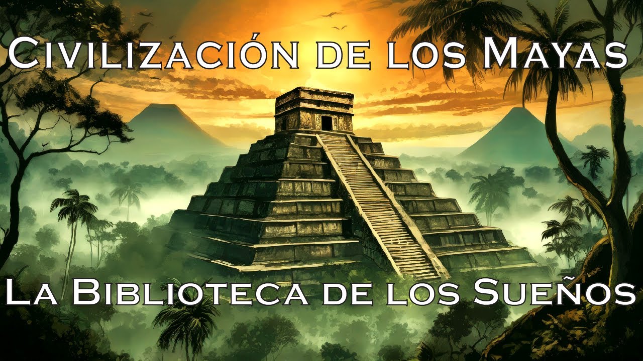
Ciudades Perdidas de los Mayas (Arqueología, Historia para Dormir)
2.2K
The Maya civilization was a pre-Columbian civilization in Central America, distinct from the Aztecs and Incas. Unlike these civilizations which were single empires, the Maya were a civilization that lasted much longer and unified different peoples. When the Spanish arrived, the Maya had already declined centuries earlier, though their descendants remained. The Maya region consists of southern Mexico, all of Guatemala, Belize, and parts of Honduras and El Salvador, with a tropical climate featuring plains, forests, and mountains. A large part is the Yucatán Peninsula, mostly a vast plain with some hills. This area is part of Mesoamerica, meaning 'in the center' or 'in the middle,' primarily an area of culture or civilization used by archaeologists and historians. It is considered a cradle of civilization where advanced civilizations emerged independently. The criteria most scholars agree on for defining a civilization are: the presence of agriculture, the existence of cities, metalurgy, a society with hierarchy where people belong to different classes and have different roles, and the existence of monumental architecture. The Maya region shared specific characteristics with other Mesoamerican civilizations, including advanced astronomical knowledge, the practice of human sacrifice on a scale much larger than any other ancient civilization, and a particular worldview believing the world was divided into three parts: the celestial realm, the earth, and the underworld. The first sparks of civilization appeared about 8000 years ago when the first inhabitants domesticated plants, leading to sedentary societies based on agriculture. They made discoveries similar to those made by societies with which they had no contact, such as pottery, metalurgy, and weaving. However, like other Mesoamerican cultures, the Maya had relatively few domesticated animals and did not use the wheel. When the first Spanish explorers arrived in Mexico in the 16th century, they found societies that had reached a relatively high level of technical knowledge, perhaps similar to the late Roman Empire. Traces found in Belize and Mexico point to around 2000 BC, about 4000 years ago, as the period when settlements where ceramics and figurines were made appeared. One of the first documented Maya cities is Nacbe in Guatemala, where occupation began around 1400 BC. By the 7th century BC, the city had very large buildings including a pyramid and several palaces. A characteristic of Maya cities is that structures were connected by roads and causeways, and cities could be connected to each other. Evidence of murals excavated indicates they had a writing system by the 3rd century BC, more than 2000 years ago. El Mirador is the modern name of a site near Nacbe. The Maya name of the city has been lost. The site was discovered in the depths of the Guatemalan jungle in 1926 but received little attention until it was first mapped in the 1960s and explored in subsequent decades. To the archaeologists' amazement, the site revealed a city that could have had hundreds of thousands of inhabitants at its peak, possibly more populated than Rome during the same period. It was one of the largest cities in the world during the 1st century BC and the period we call antiquity. The site has several thousand structures including monumental architecture up to 72 meters (230 feet) tall. The entire city center covers an area of 10 square miles (26 km²). The city was apparently planned in its entirety before construction began because the buildings are perfectly aligned not only with each other but also with the course of the sun and the cardinal points. Many of the large structures are artificial platforms where the ground has been elevated and leveled, topped with sets of three pyramids. There are 35 of these structures, making 105 pyramids in total, including one of the largest in the world called La Danta. When the city was populated, these structures were covered with cut stones and decorated with stucco, a decorative construction material that can be molded or sculpted when wet and becomes very hard like stone when dry. Ancient stucco was generally a mixture of lime, sand, and water. There is a large amount of causeways and passages, some several meters above the ground, connecting the main buildings. The most remarkable thing about this city is how populated it was, with urban population estimates of 100,000 to 250,000 people. These estimates require an enormous amount of food production, but the region where it is located is not fertile. The soils of tropical forests contain very few nutrients, and the nutrients present are often washed away by rain and carried to other areas. The Maya developed a very productive system for transporting mud from swamps several kilometers away from the city. Thousands of tons of mud were transported and placed on artificial terraces for intensive cultivation. The mixture of nutrient-rich mud and forest soil was very fertile and suitable for crops like corn or beans. When the soil became depleted of nutrients, they simply added another layer of mud to revitalize it. The city of El Mirador apparently prospered for more than 2000 years but was completely abandoned in the 2nd century AD, along with other cities in the same area. It is not clear why this happened. Perhaps there was an external threat like war, as the remains of a large wall surrounding most of the city have been dated to the last decades of occupation, which could have contributed to its decline. Possibly due to soil erosion resulting from deforestation, the Maya were probably important destroyers of forest areas not only to create space for their cities and cultures but also for their architecture, decoration, and art. As their civilization became more refined, they increased the use of plaster and stucco to cover their buildings, including houses, floors, and even ceramics. This coating was easily painted and had decorative qualities, but producing these materials required significant amounts of wood for combustion. Archaeologists have estimated that producing one ton of lime cement required about 5 tons of limestone and 5 tons of wood. Consequently, the deforested area around the city probably became increasingly larger, meaning the food supply was increasingly distant and the vegetation-depleted soil could have been washed away by rains, creating a desert around the city. Plants were cut immediately whenever they tried to regrow. Around the 1st century AD, the city was progressively abandoned. The site was partially reoccupied but this second occupation lasted little and ended around the year 980. Over more than 1000 years, the jungle slowly covered the surroundings and the city itself, making it disappear from memory. What had been one of the largest cities in the world was erased, even the local people did not know the ruins were there or only knew a very small part of them until the 20th century when the site was rediscovered and its importance revealed. The Maya language did not disappear completely in modern times but evolved. Linguists estimate that about 4000 years ago, around 2000 BC, there was a single Maya language called Proto-Maya spoken in a small region of northwestern Guatemala. As the
Click to watch →
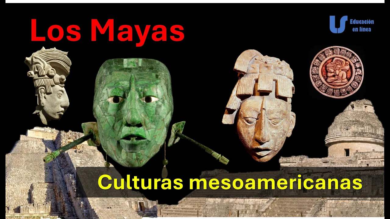
Los Mayas, cultura, arte y su declive - Culturas de Mesoamérica, Historia de México
262
The Maya civilization was one of Mesoamerica's most advanced, recognized for achievements in architecture, astronomy, hieroglyphic writing, mathematics, and calendar systems. The historical period for Mesoamerican civilizations spanned from 200500 BCE to 1521 CE, divided into Preclassic, Classic, and Postclassic periods. The Maya territory covered approximately 325,000 km² across three main regions: Northern Lowlands (Yucatán Peninsula with karstic soil and cenotes), Central Lowlands (tropical rainforest with cities like Tikal and Palenque), and Southern Highlands (mountainous volcanic region with fertile soils). The civilization originated around 2000 BCE with agricultural communities centered on maize cultivation.
Click to watch →
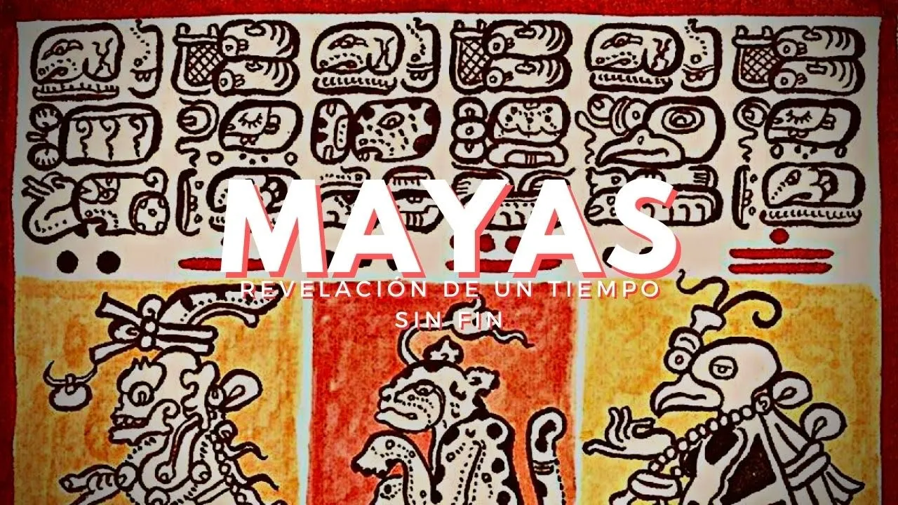
Mayas: Revelación de un tiempo sin fin
25.7K
The Maya were one of the most sophisticated pre-Hispanic cultures of Mesoamerica, flourishing for nearly 2000 years with innovative genius developing a complex sociopolitical and economic structure based on elaborate symbolic and religious conceptions explaining nature, cosmos, and the supernatural. The Maya area spans over 400,000 square kilometers across Mexico, Belize, Guatemala, Honduras, and El Salvador, containing more than 4,000 archaeological sites distributed across three major regions: the Northern Lowlands (Yucatán Peninsula), the Central Lowlands (jungle environment), and the Highlands of Chiapas and Guatemala. Around 4,500 years ago, proto-Maya groups established in Guatemala's highlands, spreading through migration. The Classic Period (250-600 AD) marked their maximum flourishing when dynasties consolidated power, followed by the Maya Collapse (800-900 AD). Around 1200 AD, Chichén Itzá was destroyed by Mayapán, leading to political fragmentation into 16 principalities that the Spanish encountered in the 16th century. The culture was highly heterogeneous with 30 languages and regional variants. Cacao was one of the most venerated plants, serving as both food and currency. The Maya developed an extraordinary calendar system based on findings from their late Olmec neighbors, formulating the Long Count and Calendar Round system around 100 BC, which they adopted and developed remarkably. Around 250 AD, they created new ritual and astronomical cycles, precisely calculating the cycles of Venus, Mars, and possibly Mercury, as well as eclipses, and elaborating lunar tables. All archaeological zones represent the same symbolic concept: places situated in the cosmic space, with a main causeway representing the Milky Way as the only visible way to reach the houses of the sun, moon, and Venus. The city of Toniná exemplifies Maya urbanism with seven platforms and an exterior circuit passing through eight temples, creating the illusion of traveling through the sky. Every 20 years, a new deity entered the Maya calendar among 13 essential deities, each dominating 20 days and 20 years in a cyclical pattern. The Red Queen is a royal tomb discovered in mid-1994 during excavations of Temple 13 at Palenque, with a rich offering of jadeite beads, obsidian blades, and other objects covered by a layer of cinnabar.
Click to watch →

CIVILIZACIÓN MAYA (Los Constructores del Maíz) - Documentales
1.9M
The Maya civilization was one of the most impressive ancient civilizations in the world, flourishing in the improbable environment of a tropical jungle. They created remarkable achievements without metal, wheels, or animal traction. The civilization prospered in Central America for over 1000 years from approximately the 1st century AD until the Spanish conquest in the 16th century. Unlike other pre-Columbian civilizations such as the Aztec and Inca, the Maya never had a unified empire but rather a group of independent city-states that were often at war with each other across an area spanning approximately 1000 kilometers north to south and 600 kilometers east to west. Palenque, located in southern Mexico, was one of the oldest and most significant Maya cities, reaching its maximum splendor during the 7th century AD when nearly all the great buildings we preserve today were constructed during the reign of King Pakal the Great (615-683 AD). The palace excavated in Palenque during the 1890s served as a kind of parliament where the ruler would meet with all palace members to make decisions about the city and kingdom. The walls featured stucco sculptures of powerful Maya rulers wearing attire appropriate for the gods, representing them as earthly representatives of divine beings. Despite being exposed to the elements for over 1300 years, traces of original colors remain visible. Most public buildings were painted red with hematite powder, an iron oxide extracted from limestone. The Temple of the Inscriptions, begun in 675 AD when Pakal was 70 years old, was initially believed to be merely a temple dedicated to gods. However, in the early 1950s, Mexican archaeologist Alberto Ruz discovered a staircase inside and found Pakal's tomb, which had been hidden by 300 tons of rubble to prevent grave robbers. The tomb of King Pakal was the first royal tomb found intact in a Maya temple, containing the most rich and well-preserved burial discovered in the Americas. Under an enormous sarcophagus carefully carved, lay the body of the king adorned with jewels of incalculable value, including a fabulous jade death mask that covered his face. Since then, many other tombs of Maya rulers have been found, especially at Tikal in Guatemala and Copán in Honduras. Copán, located in present-day Honduras, was a medium-sized border city on the southern frontier of the Maya region, surrounded by peoples of different civilizations. With an estimated population of 20,000 inhabitants, Copán reached its maximum splendor at the beginning of the 8th century AD during the reign of King Rabbit 18. Most of the great buildings of Copán were constructed during his reign, but it was recently discovered that two temples built by Rabbit 18 contained tombs of previous kings, including the tomb of the first known king, Yax K'uk' Mo', who founded the city in the 5th century AD. The Hieroglyphic Stairway, the most famous monument of Copán, contains the longest known Maya hieroglyphic text with up to 2,000 glyphs, recently deciphered. This piece of propaganda tells the history of the kings of Copán from its founder Yax K'uk' Mo' to its 15th king, who completed the stairway. The 12th king of Copán is buried beneath it, suggesting he may not have been accepted by all in Copán, possibly because he was not a pure Maya. King Rabbit 18, without doubt the greatest of all Copán kings, had to deal with many problems. During his 40-year reign, Copán prospered more than ever before. However, at the end of his mandate, a conflict with neighboring Maya cities became increasingly deep, preluding the imminent fall of Copán. He was arrested by his king and sacrificed there. His death in 738 AD marked the beginning of the end of Copán. Not long after the death of Rabbit 18, around 800 AD, the great city-state of Copán fell. The collapse of the Classic Maya civilization remains one of the great mysteries in debate. There are as many theories as Maya archaeologists. Some people may have remained there for decades after our last record of royal presence, so while their history will be interrupted, the Maya have always endured.
Click to watch →
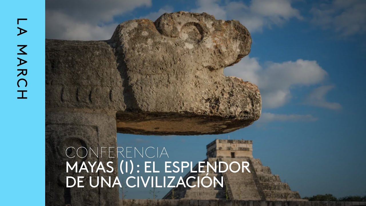
Mayas (I): el esplendor de una civilización · La March
44.8K
The Maya civilization belongs to the Mesoamerican cultural area, one of two pristine civilizations in the Americas. The Maya territory occupies approximately one-third of Mesoamerica (330,000 km²) in the southeastern portion, entirely below the Tropic of Cancer. This region consists of two distinct geographic areas: southern highlands with metamorphic and neovolcanic mountain chains, and northern lowlands below 800-900 meters covered by tropical rainforest. These complementary regions provided different mineral resources including obsidian, basalt, and jade (the most precious material, equivalent to gold). Maya civilization began approximately 1100 BCE, though human presence dates back 13,500 years. Early Maya groups practiced incipient agriculture while relying primarily on hunting and gathering. By around 700 BCE, Maya groups had developed temples oriented to solstices and equinoxes, demonstrating mastery of solar tracking and agricultural cycles. Maya royal institutions were well-established by 100-150 BCE, as evidenced by the first known hieroglyphic texts at San Bartolo. Maya cities were organized around domestic groups consisting of related families living together in shared spaces. These groups included parents, children, and married children who established separate households until space became limited. Maya cities were characterized as 'garden cities' or 'low-density urbanizations' with dispersed populations. Each domestic group lived adjacent to the main temple, creating interwoven residential, ceremonial, and agricultural spaces. Maya cities were politically independent states, similar to ancient Greek city-states, with each city having its own ruler. A conquering king could impose tribute but could never become king of the conquered city.
Click to watch →
Deep Dive
The challenges of traditional jungle archaeology, such as dense canopy cover, physical accessibility issues, and the limitations of foot-survey mapping.

Archeologové právě otevřeli nedotčenou mayskou hrobku a to, co je uvnitř, je pro odborníky záhadou
1.6K
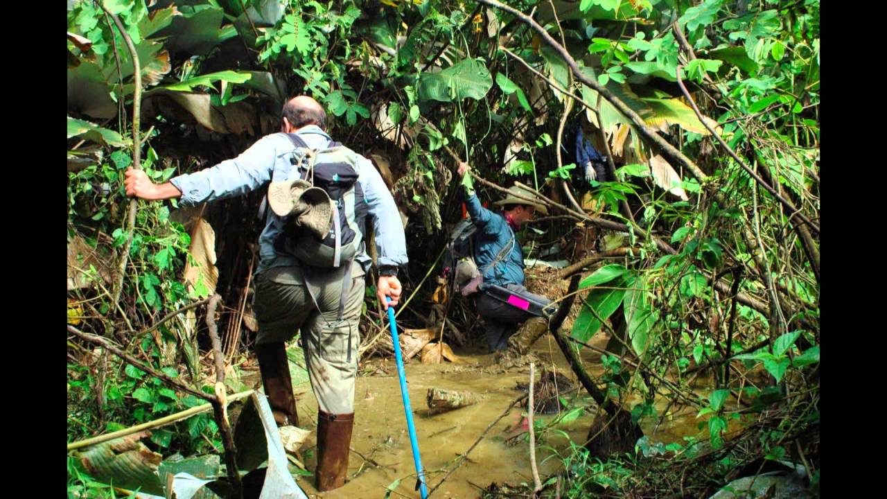
Dense jungle, Maya cities, and overgrown vegetation made traditional excavation nearly impossible. Walking through dense trees and tangled roots revealed almost nothing. Traditional excavation was impossible—hand clearing jungle to find a tomb would take years, and even then it would be nearly impossible to know where to dig. Every wrong step risked destroying fragile evidence, and the terrain made mistakes deadly dangerous.
Click to watch →
Speaker Documentary Filmmaker Steve Elkins
66.3K
The Mosquita Jungle presents extreme exploration challenges: a 50-meter tall multi-level canopy blocking visibility beyond 20-30 feet, mud holes that suddenly deepen to dangerous depths, and rivers that can rapidly flood. Traditional expeditions move only about one mile daily. The area was historically called 'Gates of Hell.' Previous explorers often failed or disappeared. These obstacles made systematic search impossible until LiDAR technology provided a solution.
Click to watch →

ЛИДАР НАШЁЛ ПОД ДЖУНГЛЯМИ ТО, ЧТО НЕ ДОЛЖНО БЫЛО СУЩЕСТВОВАТЬ
806
Tropical jungles present fundamental methodological challenges for archaeology. Unlike temperate regions where dry air preserves structures and aerial photography reveals earthworks, dense tropical vegetation grows so rapidly and thickly that it completely conceals man-made structures. A 15-meter pyramid can be hidden within 5 meters of its base, making traditional ground-based exploration extremely slow, expensive, and incomplete.
Click to watch →

ДРОН С Лидаром Обнаружил Под Джунглями Майя Мегаполис На 10 Миллионов Жителей!
4K
Dense tropical jungles present extreme challenges for archaeological investigation. Trees can reach heights of 50 meters with such density that sunlight barely reaches the ground. Vines as thick as human arms can completely cover ancient structures, while fig tree roots can break apart stone masonry built centuries ago. In such conditions, archaeologists walking within meters of massive pyramids may not even notice them, seeing only overgrown hills indistinguishable from natural terrain. This explains why for centuries, archaeologists only discovered Maya cities that had been partially cleared or were located in more open areas.
Click to watch →

2+ Hours Of South America's Greatest Archeological Mysteries
29.2K
Exploring dense jungle environments presents significant physical and logistical challenges. Stevens and Catherwood faced treacherous mountain passes, biting insects, tropical fevers, and threats from rebel forces. Their journey through Moo Mountain took five hours of continuous struggle through mud holes and gullies. Upon reaching Copan, they encountered ruins so overgrown that they could barely see ten yards ahead. The initial discovery created profound impressions—Stevens described entering a 'new world' when he first saw stone walls rising from the jungle. This demonstrates why many archaeological sites remained undiscovered for centuries and why successful exploration requires both determination and careful preparation.
Click to watch →
Deep Dive
The difference between non-invasive remote sensing techniques and active ground excavation in archaeological methodologies.
Towards a narrative-based analysis of landscape development
152
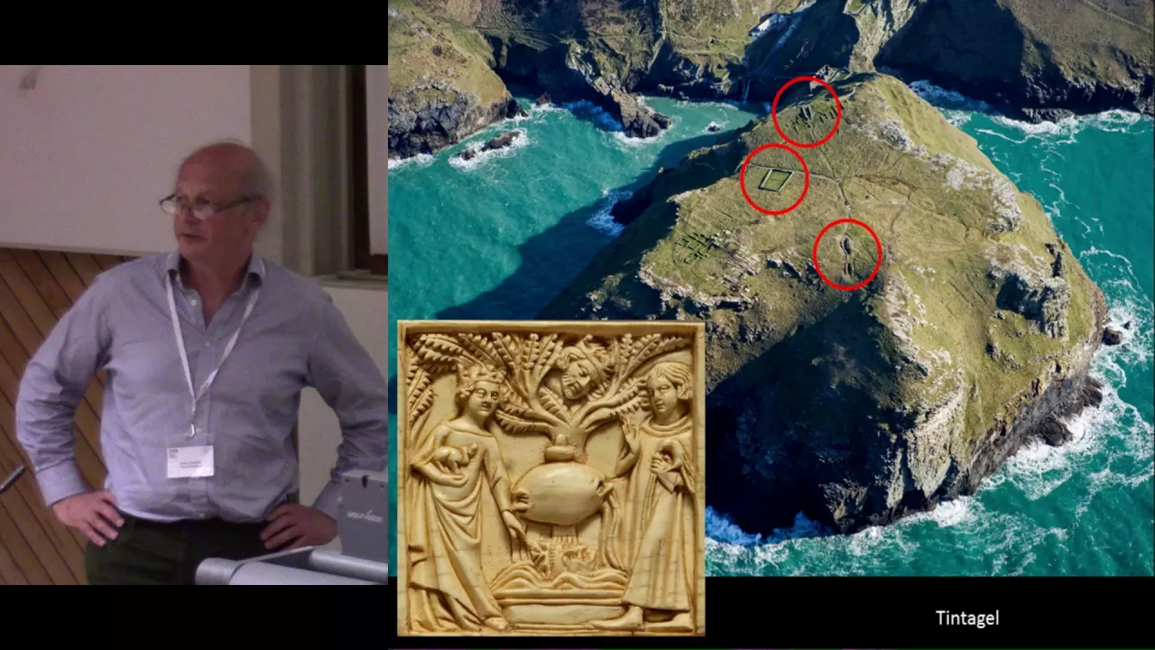
Excavation results are sometimes unfairly privileged over non-invasive methods characterized merely as prospection. When aerial photography or geophysical surveys show features that are then excavated and nothing is found, the assumption that non-invasive techniques are wrong is incorrect. Excavators can dig through features without seeing them, and excavators can invent features that don't exist. What is seen in a hole in the ground is not necessarily more true than what appears on geophysical plots, aerial photographs, or physical features on the ground surface. Excavators should stand on the side of their trenches and look out into the landscape before beginning work.
Click to watch →
Moderne Prospektionsmethoden in der Archäologie - Dr. Posluschny, Forschungszentrum am Glauberg
1.2K
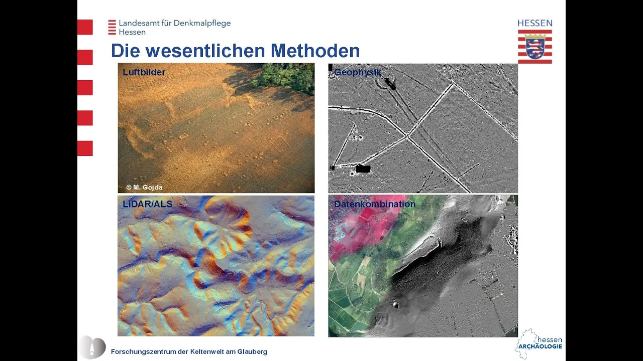
Archaeologists use remote sensing methods to extend knowledge without direct excavation. These methods are based on natural sciences and allow discovery of new sites and gathering of additional information that would not be financially feasible through traditional excavation. Unlike excavation, which destroys what it reveals, remote sensing is non-invasive and can cover large landscape areas quickly. These methods use physical, chemical, or biological approaches to detect changes in soil caused by human activities such as digging or building. Aerial archaeology represents the beginning of these methods, with early attempts using balloons and even pigeons to capture images, though these were not very successful.
Click to watch →

Василий Новиков. Археология в цифровом мире: неинвазивные методы
14.2K
Archaeological research is divided into two main approaches: non-invasive methods (разведочные мероприятия) using remote sensing and geophysical techniques without disturbing sites, and invasive methods (экскавация) involving physical excavation with tools like trowels. Large kurgans may require heavy machinery for careful removal, while smaller sites are typically excavated manually.
Click to watch →
Лекция «От разведки до 3D модели: Современная археология и реставрация» 21.01.2024
4.1K
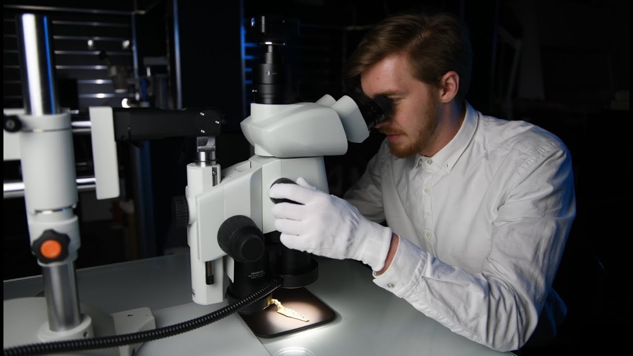
Modern archaeology divides into three main parts: non-invasive research, earthwork excavation, and laboratory processing. Non-invasive methods emerged from World War I and II, including aerial photography (aэрофотосъёмка) which reveals features invisible on the ground. LIDAR technology, originating in Mesoamerica, uses laser pulses from aircraft to penetrate vegetation and reveal buried features. Geophysical surveys use methods like striking metal rails to detect soil stratigraphy. Excavation (земляные работы) is the central part, typically lasting one to two months per year. Archaeologists dig systematic trenches to examine soil stratigraphy and determine if a site is worth excavating. Sites are divided into squares for systematic documentation, working by layers or depth intervals.
Click to watch →

Finding Hidden Temples and Lost Nazca Lines with Satellites
1.8M
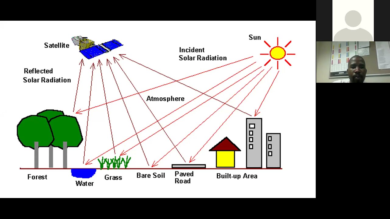
Remote sensing technologies are categorized as active or passive based on how they collect data. Passive systems receive light that naturally reflects off surfaces, such as most satellite imagery that uses different parts of the light spectrum (near, middle, far infrared) to detect vegetation differences, soil variations, and water patterns. Active systems like LiDAR and radar emit energy and measure its return. This distinction affects which technologies are appropriate for different archaeological contexts and burial depths.
Click to watch →
Prerequisite Knowledge
- Concept 01The basic principles of LiDAR (Light Detection and Ranging) technology, specifically how laser pulses measure distances to map topography through dense vegetation.
- Concept 02An overview of the Maya civilization, including their geographical range in Mesoamerica, their timeline, and architectural characteristics like pyramids, causeways, and royal tombs.
- Concept 03The challenges of traditional jungle archaeology, such as dense canopy cover, physical accessibility issues, and the limitations of foot-survey mapping.
- Concept 04The difference between non-invasive remote sensing techniques and active ground excavation in archaeological methodologies.
Subsequent Learning
- Step 01How GIS (Geographic Information Systems) software is used to filter out vegetation and process raw LiDAR point clouds into bare-earth digital elevation models.
- Step 02The concept of 'ground-truthing'—the crucial field methodology archaeologists use to physically verify and excavate anomalies detected by aerial scans.
- Step 03How landscape-scale LiDAR data has revolutionized our understanding of Maya population density, agricultural intensification (such as terracing), and interconnected urban networks.
- Step 04Advanced applications of LiDAR in other disciplines, such as forestry management, flood risk modeling, and the navigation systems of autonomous vehicles.
Laser Map
Tikal Secrets
Tomb Clues
Laser Map
0:00Playing Section
- 1
LiDAR reveals massive hidden structures beneath jungle canopy.
- 2
Technology transforms understanding of ancient Maya civilization.
- 3
Pyramids and alignments uncovered across vast unexplored region.
The Limitations of Remote Sensing and the Critical Need for Ground-Truthing
While LiDAR technology has revolutionized Mesoamerican archaeology by revealing massive structures beneath the jungle canopy, critics and traditional archaeologists caution against over-reliance on remote sensing. They argue that aerial scans can lead to a form of technological determinism, where spectacular digital images overshadow the essential, meticulous work of physical excavation and 'ground-truthing.' LiDAR cannot identify artifact functions, stratigraphic timelines, or cultural nuances, and it often misses smaller, ephemeral dwellings crucial to understanding commoner life. Furthermore, publishing high-resolution coordinate data poses severe security risks, effectively creating a map for looters in remote areas. Finally, critics raise ethical concerns regarding 'digital colonialism,' where wealthy foreign institutions control high-tech datasets, sometimes sidelining local archaeologists and indigenous communities. Therefore, experts emphasize that LiDAR is merely a preliminary mapping tool, not a replacement for traditional, boots-on-the-ground archaeology.
Deep Dive
How GIS (Geographic Information Systems) software is used to filter out vegetation and process raw LiDAR point clouds into bare-earth digital elevation models.
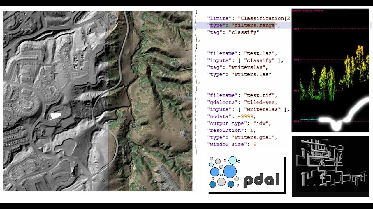
PDAL installation, pipelines and a bare-earth model
6.2K
PDAL (Point Data Abstraction Library) is a C++ BSD library for processing point cloud data that uses a pipeline-based architecture to read, filter, and write LiDAR data. To create a digital terrain model (DEM) from classified LiDAR data, users can install PDAL via conda, create a JSON pipeline file specifying readers (to import data), filters (to isolate ground points using classification value 2), and writers (to output GeoTIFF rasters), then execute the pipeline to generate a bare-earth model representing the ground surface without vegetation or structures.
Click to watch →

Triangle UFOs Hiding in LIDAR Data?
41K
LIDAR data processing involves classifying different types of returns based on what the laser hits. Foliage produces different signal signatures than bedrock or buildings. Software processes all points to separate out vegetation, structures, and bare earth, creating Digital Terrain Models (DTM) that show only the ground surface after removing non-ground features.
Click to watch →

DJI Terra에서는 LiDAR 데이터 프로세싱이 평생 무료! LiDAR와 사진측량 L2의 놀라운 산림 맵핑
10.1K
DJI Terra software enables lifetime free processing of LiDAR point cloud data from DJI L2 sensors, allowing users to convert raw LiDAR data into detailed 3D point clouds that penetrate vegetation through multi-bounce reflection, revealing ground surfaces and terrain features that are invisible in photogrammetry data; the software provides coordinate system configuration options (such as Korea East 1985 and Korea Geoid 2018) and ground point filtering capabilities to extract Digital Elevation Models (DEM) from dense forest environments.
Click to watch →

Create a bare-earth DEM with Whitebox Tools
613
This video demonstrates how to create a bare-earth Digital Elevation Model (DEM) using Whitebox Tools by first applying nearest-neighbor gridding to LIDAR point cloud data and selecting the last return points to capture ground surface elevations, then using the 'remove off-terrain objects' tool to filter out buildings and vegetation by identifying rapid elevation changes, resulting in a smoother DEM that better approximates the true ground surface.
Click to watch →
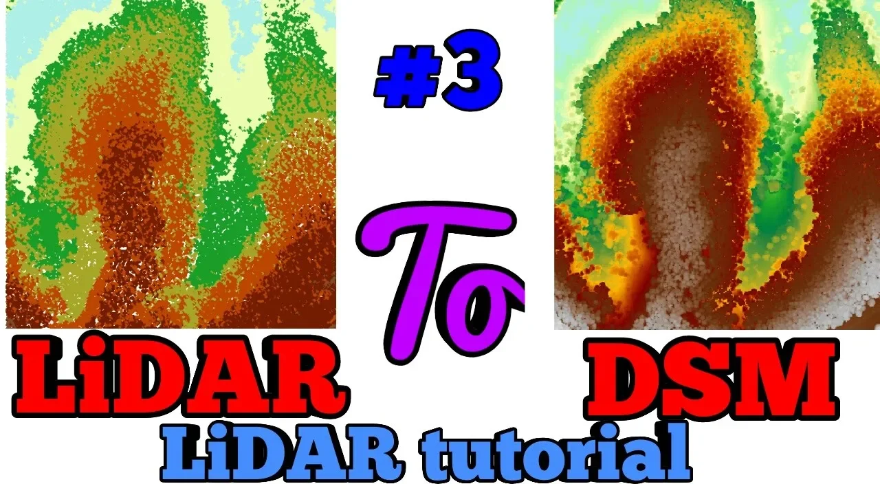
Let's Create DSM Digital Surface Model Using LiDAR Point Cloud Data ArcGIS
10.9K
A Digital Surface Model (DSM) represents the topography including vegetation and structures, created from LiDAR point cloud data by applying specific filters (first return, single return, return one) and excluding noise classification code 7, then converting the filtered LiDAR dataset to raster using ArcGIS conversion tools with parameters such as maximum elevation, void filling, and 1-meter cell size.
Click to watch →
Deep Dive
The concept of 'ground-truthing'—the crucial field methodology archaeologists use to physically verify and excavate anomalies detected by aerial scans.
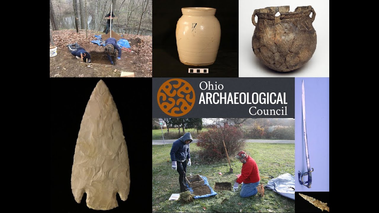
Geophysics as a Viable Tool in Phase 1 Archaeological Investigations
210
Geophysical surveys should always include ground truthing of anomalies because natural features can produce magnetic signatures similar to archaeological features. Soil coring is commonly used to sample anomalies and distinguish between archaeological and natural features. Multi-channel ground penetrating radar systems now allow surveying hectares daily at unprecedented data densities, enabling better evaluation during Phase One.
Click to watch →

| SUNDAY LIVE | Minerals: Kenya's Next Frontier
8.4K
Ground truthing is the process of visiting identified anomalies to confirm what minerals are present. This involves: (1) Visiting the anomaly location, (2) Collecting samples from the area, (3) In some cases, conducting drilling to obtain deeper samples, (4) Analyzing samples in laboratories to confirm mineral composition. The airborne survey cannot determine the depth of deposits, so ground truthing is essential for detailed exploration. Not all 970 anomalies can be investigated immediately, so prioritization is necessary based on the size and characteristics of each anomaly.
Click to watch →
Aerial Archaeology - STEM in 30 - Season 11 - Episode 3
4.6K
Ground truthing is the process of verifying remote sensing data by physically visiting sites to confirm what is actually present. While LiDAR and other technologies provide excellent data, archaeologists must be present to check what is physically on the ground. This ensures accuracy and helps interpret what the technology reveals.
Click to watch →
Workshop 1_Remote Sensing in Archaeology I, Dec 7th 2020
206
Ground truthing methodology combines multiple data sources (historical maps, remote sensing features, village-to-village discoveries, previous surveys) using hexagonal grid units for systematic sampling. Fieldwork involves GPS-capable tablets, systematic surface collections along transects at 50-100 meter intervals, and real-time database management using Open Data Kit. In one survey area, 264 of 1,000 visited locations were archaeological sites. Sites are classified into categories including intact mounds, terrace mounds, completely flat sites, irrigated sites, and destroyed sites. This systematic approach allows comparison across sites and provides quantitative data about site characteristics.
Click to watch →
Ground Truth
771
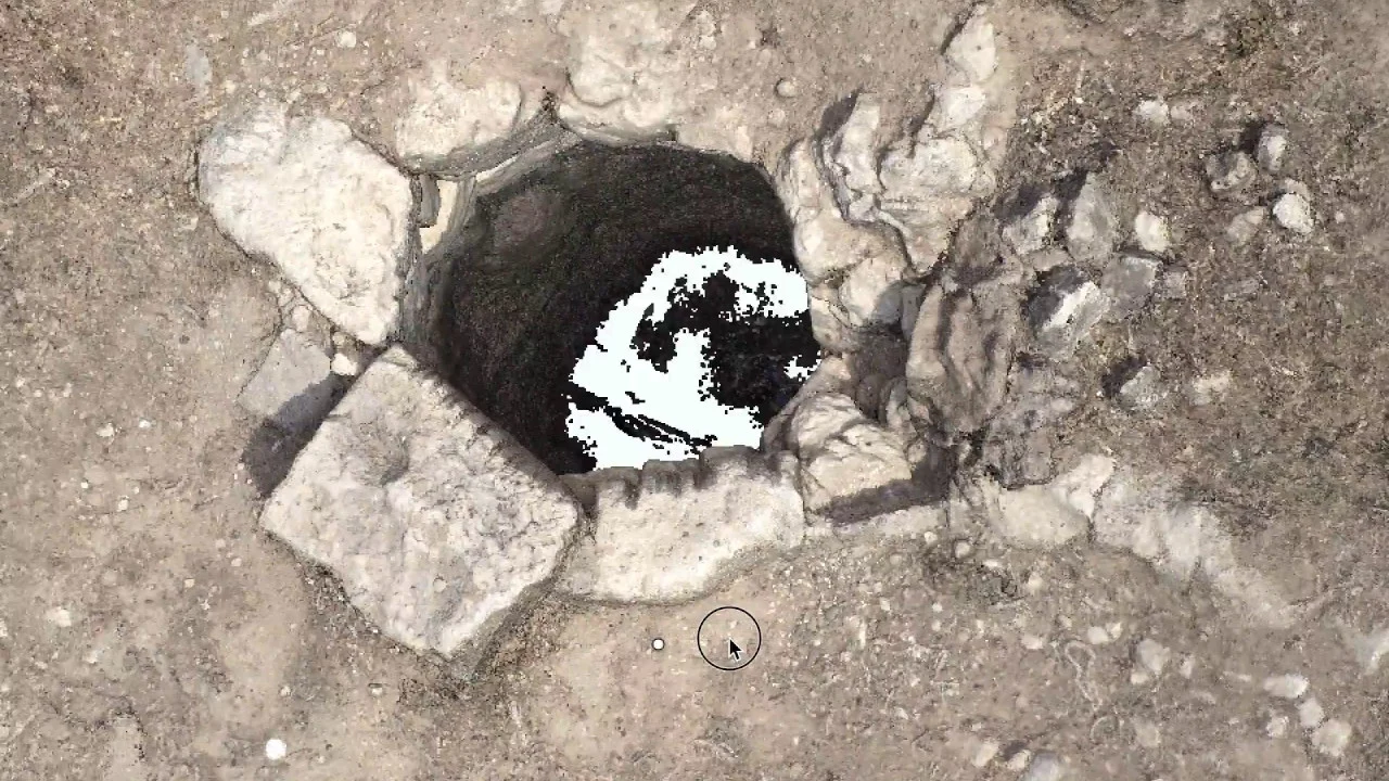
Ground truth is the calibration of one mode of representation (photographic grains of aerial images or pixels of satellite ones) with the material evidence of the survey on the ground. At each location, researchers record testimonial and material evidence, combining aerial imagery with physical documentation to create a comprehensive record of territorial transformation and destruction of physical relics.
Click to watch →
Deep Dive
How landscape-scale LiDAR data has revolutionized our understanding of Maya population density, agricultural intensification (such as terracing), and interconnected urban networks.

Algo Antiguo está Enterrado bajo la Selva de Guatemala — Es más Viejo que las Pirámides
180
Lidar analysis revealed Maya population distribution was surprisingly uniform across many areas, with settlement densities in some sectors exceeding those of medieval European cities at their peak. Based on Lidar data extrapolating structure density to family and population estimates, researchers have proposed that the Maya Lowlands during the Late Classic period may have supported a population of 10-15 million people—far exceeding previous estimates. The Maya did not rely primarily on slash-and-burn agriculture but developed sophisticated intensive systems including raised fields, canal networks, hillside terraces, and wetland management. They cultivated not only the basic triad of maize, beans, and squash but also an impressive diversity of other edible plants including fruit trees, tropical roots, and medicinal plants. This combination of systems enabled multiple harvests per year and total landscape productivity capable of supporting population densities that extensive agricultural systems could never achieve.
Click to watch →
ДРОН С Лидаром Обнаружил Под Джунглями Майя Мегаполис На 10 Миллионов Жителей!
4K
LIDAR data revealed that Maya civilization was far more populous than previously believed. Before 2018, archaeologists estimated 1-2 million people in Classic Guatemala; LIDAR showed 10-15 million could have lived there—comparable to the Roman Empire's population density. The technology revealed 60,000 structures, including urban complexes spanning 200+ square kilometers. Cities featured grid-like planning, houses built in close proximity, and ceremonial centers with 70-meter pyramids. This demonstrated Maya civilization was not a collection of isolated city-states but a vast, interconnected urban network spanning hundreds of square kilometers, fundamentally changing understanding of ancient Mesoamerican urbanism.
Click to watch →

The Weirdest Discoveries We’ve Ever Found on Earth | Part-2 | SCIENCE TO SLEEP BY
1.1K
LiDAR (Light Detection and Ranging) uses laser pulses fired from aircraft, millions per second, passing through gaps in the canopy, bouncing off the forest floor, and returning to sensors with millimeter precision. This technology has revolutionized Maya archaeology in tropical forests where traditional survey methods are slow, expensive, and physically dangerous. A single overflight can survey hundreds of square miles, revealing structures invisible from the ground. The 2018 Pátzún survey in Guatemala revealed 60,000 previously unknown structures—pyramids, platforms, houses, walls, roads, reservoirs, agricultural terraces—over 800 square miles of the Pátzún, the heartland of Classic Maya civilization. This forced a radical revision of Maya demographics: previous estimates suggested 1-2 million people, but the new data suggested 10 million or more. The LiDAR data revealed sophisticated infrastructure: raised causeways (sacbeob) connecting major centers, defensive fortifications with walls and ditches, sophisticated military architecture with killing zones, agricultural terraces climbing hillsides, drained fields in low-lying areas, and irrigation channels. The Maya had transformed their environment on an industrial scale. The jungle between Maya cities was not wilderness but suburbs, farmland, and managed forest. In 2020, researchers announced the discovery of a massive platform at Aguada Fénix in Mexico, nearly a mile long and over 30 feet tall, dating to around 1000 BCE—centuries before the Preclassic florescence at El Mirador. This suggests Maya monumentality began earlier than previously thought, with the civilization bursting onto the scene with large-scale construction, coordinated labor, and organized society.
Click to watch →

Os Maias Não Desapareceram O Que Realmente Aconteceu Com A Civilização Deles
27.9K
In 2018, Lidar technology (laser scanning from aircraft) revealed that the Maya world was far more populated and connected than previously imagined. This technology can mentally remove jungle canopy to reveal the ground beneath, revealing tens of thousands of structures including pyramids, houses, terraces, stone walls, and raised roads connecting cities across kilometers. While these surface roads were sometimes interpreted as underground tunnels for mass migration, scientific evidence shows that the Maya did reverence the underworld (called Xibalba) and had entrances to it in caves and cenotes, but no massive network of artificial tunnels capable of sheltering an entire population has ever been found.
Click to watch →

Они УБИЛИ себя сами: что на самом деле погубило цивилизацию майя
1.3K
LIDAR technology revolutionized understanding of Maya civilization. By flying aircraft over Maya jungles and using laser pulses that penetrate vegetation, researchers discovered that where maps showed only empty green forest, there were actually tens of thousands of buildings, including palaces, temple complexes, and ball courts. They also found extensive road networks (sacbeob), dams, canals, and agricultural terraces. This discovery revealed that the Maya population was 10-19 million people, with population density comparable to modern densely populated Asian regions. The Maya were not scattered cities in wild nature but a nearly continuous, densely populated country where villages, fields, roads, and cities covered the land like a mosaic.
Click to watch →
Deep Dive
Advanced applications of LiDAR in other disciplines, such as forestry management, flood risk modeling, and the navigation systems of autonomous vehicles.

(हिंदी में) Science and Technology - 2016 + 2017 Current Affairs - Part 4 - UPSC/IAS
57.6K
LIDAR (Light Detection and Ranging) is a remote sensing method that uses narrow beams of laser light (instead of radio waves like radar or sound waves like sonar) to build 3D images of surrounding landscapes. The technology works by sending laser pulses to objects and measuring the time it takes for the reflected light to return, thereby measuring and analyzing distance from the sensor. Different wavelengths are used for different purposes: near-infrared for terrestrial mapping, green light for underwater seabed mapping. Applications include urban planning, coastline management, archaeology, oil and gas exploration, cellular network planning, forestry management, flood modeling, pollution monitoring, transportation planning, agriculture (crop mapping and fertilizer optimization), topographic mapping, space flight and astronomy, and atmospheric studies.
Click to watch →

Технология LiDAR c DJI Zenmuse L1
3.7K
LiDAR technology serves diverse industrial applications: (1) Power infrastructure inspection enables 3D reconstruction of poles, towers, and wires for barrier analysis and maintenance planning; (2) Forestry management provides simultaneous topographic and tree data for growth tracking and harvest planning; (3) Disaster management creates accurate terrain models for flood assessment and water resource analysis; (4) Geological hazard analysis uses point cloud data to evaluate landslide recurrence probability and identify dangerous rock structures. The technology's ability to penetrate vegetation and capture ground surface information makes it invaluable for applications where traditional surveying methods are impractical or dangerous.
Click to watch →

Dr. Nicholas Coops: Introduction to LiDAR Technology
58.4K
Four main LIDAR types serve different purposes: (1) Profiling LIDAR—early systems for linear features like railways and power lines, emitting single pulses without spatial context; (2) Scanning LIDAR—modern systems emitting 88,000-160,000 pulses/second in sweeping patterns, providing comprehensive two-dimensional coverage; (3) Full waveform LIDAR—recording complete pulse responses, currently processed by counting peaks and treating as discrete returns; (4) Large footprint LIDAR—20-30m diameter pulses averaging returns across forest plots, useful for biomass estimation but complicating terrain extraction due to inability to assume flat terrain within the footprint. Ground-based LIDAR uses tripod-mounted instruments scanning hemispheres or vertical panels, providing ultra-detailed three-dimensional information about specific plots. Applications extend to archaeology (documenting historical structures) and mining (analyzing vertical surfaces). The technology provides precise distance measurements rather than reflectance, enabling automatic extraction of structural attributes including tree heights, widths, and tapers.
Click to watch →

What are the Top 7 uses of LIDAR ? Why is Lidar so important?
1.8K
LiDAR (Light Detecting and Ranging) is a sophisticated surveying technology that emits laser pulses to measure distances and create detailed 3D maps of physical environments. This technology has transformed multiple industries through its precision in data collection. Key applications include: (1) Archaeology - discovering hidden ancient structures like the 60,000+ Mayan sites in Guatemala without excavation; (2) Autonomous Vehicles - providing 3D environmental mapping for obstacle detection and safe navigation; (3) Forestry - measuring tree heights, canopy structure, and forest density for conservation; (4) Urban Planning - generating topographical maps for infrastructure development, traffic optimization, and flood risk assessment using digital elevation models.
Click to watch →

Lidar Nedir ve Nasıl Çalışır
12K
LIDAR (Light Detection and Ranging) is a remote sensing technology that uses laser pulses to measure distances and create detailed 3D topographic maps by calculating the time it takes for laser light to travel to a target and return, combined with GPS positioning and inertial measurement units to determine precise ground coordinates; this technology can penetrate vegetation to capture bare earth surfaces and is widely used in geology, archaeology, forestry, and cartography for applications ranging from terrain mapping to infrastructure analysis.
Click to watch →
Laser Map
Tikal Secrets
Tomb Clues
Laser Map
0:00- 1
LiDAR reveals massive hidden structures beneath jungle canopy.
- 2
Technology transforms understanding of ancient Maya civilization.
- 3
Pyramids and alignments uncovered across vast unexplored region.
The Limitations of Remote Sensing and the Critical Need for Ground-Truthing
While LiDAR technology has revolutionized Mesoamerican archaeology by revealing massive structures beneath the jungle canopy, critics and traditional archaeologists caution against over-reliance on remote sensing. They argue that aerial scans can lead to a form of technological determinism, where spectacular digital images overshadow the essential, meticulous work of physical excavation and 'ground-truthing.' LiDAR cannot identify artifact functions, stratigraphic timelines, or cultural nuances, and it often misses smaller, ephemeral dwellings crucial to understanding commoner life. Furthermore, publishing high-resolution coordinate data poses severe security risks, effectively creating a map for looters in remote areas. Finally, critics raise ethical concerns regarding 'digital colonialism,' where wealthy foreign institutions control high-tech datasets, sometimes sidelining local archaeologists and indigenous communities. Therefore, experts emphasize that LiDAR is merely a preliminary mapping tool, not a replacement for traditional, boots-on-the-ground archaeology.
The basic principles of LiDAR (Light Detection and Ranging) technology, specifically how laser pulses measure distances to map topography through dense vegetation.
An overview of the Maya civilization, including their geographical range in Mesoamerica, their timeline, and architectural characteristics like pyramids, causeways, and royal tombs.
The challenges of traditional jungle archaeology, such as dense canopy cover, physical accessibility issues, and the limitations of foot-survey mapping.
The difference between non-invasive remote sensing techniques and active ground excavation in archaeological methodologies.
How GIS (Geographic Information Systems) software is used to filter out vegetation and process raw LiDAR point clouds into bare-earth digital elevation models.
The concept of 'ground-truthing'—the crucial field methodology archaeologists use to physically verify and excavate anomalies detected by aerial scans.
How landscape-scale LiDAR data has revolutionized our understanding of Maya population density, agricultural intensification (such as terracing), and interconnected urban networks.
Advanced applications of LiDAR in other disciplines, such as forestry management, flood risk modeling, and the navigation systems of autonomous vehicles.
197.9K views1.2Klikes5:51@dagbladetOriginal Release: 2018-02-01
[Music] it's unbelievable as far as the eye can see jungle everywhere I'm Albert Lin engineer and National Geographic Explorer and I'm passionate about the way new technology can help to reveal secrets of the ancient world so we had this augmented reality platform built base off to the lidar data and it should be able to tell us what's beyond the trees you know it says there's a massive temple just around the corner [Music] is huge all right gives you like chills up your back we just followed a map created by lasers in the sky and then bushwhacked for hours to this point to find this this pyramid is just one of tens of thousands of new discoveries revealed by a new technology that seemed beneath this jungle Canada for the very first time allowing experts was created treasure map of a lost world it's like a magic trick this is amazing it's transforming our understanding of one of history's most mysterious civilizations the Maya we see buildings align to track the rising of the Sun or align to the movements of Venus cosmically aligned like all Maya cities every building in the heart of Tikal has been extensively met but hidden in the jungle it is never impossible to see it in all its glory until now this is the world-famous tea call yep that's the way it looks now let's see tea called naked but we see without the Queen's this is amazing for Francisco and I because this is an iconic myocyte we know this map we can close our eyes and and visualize this map as we've seen it on paper since the 1960s I feel like I'm there a thousand years ago and the people are still there and just walking around [Music] after more than a century of study archeologists thought they knew every inch of Tikal but they were wrong you see that yeah structure right there [Music] the lidar reveals a previously unknown pyramid hidden in plain sight close to the very center of the city that's gotta set the entire archeology community on a bus mistakenly overlooked as a natural feature the team thinks this could be an intact tune of one of the richest tikal kings it's the most important discovery and central tee call in decades this is a cut in the floor the Maya made this presumably to place a bear out here there is a slight chance this might be a royal burial it's definitely in a very prestigious location for the Maya burials within pyramids were reserved only for the most important people and finding a royal tomb is incredibly rare as Francisco's team searches for clues out of the dust something unexpectedly appears [Music] we've just came upon a plate that was face down at first it seems unremarkable then fen Cisco turns it over looks like it's fleshly painted and offering I am the first person yes to hold this my hand after 49 years it's a clue that there really might be an intact grave underneath but a heavy slab of stone blocks their progress we don't want anything underneath to break one wrong move now could be disastrous it's nerve-racking no one was up all the signs point towards this being a high-status grave but out here human remains rarely survive the acidic limestone soil there's more rocks
Up Next
10:22
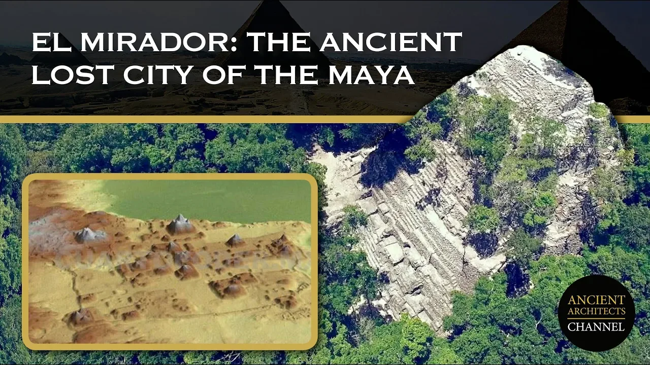
The Lost Maya City of El Mirador: A Forgotten Ancient Capital
@AncientArchitects
98.4K views•2019-08-12

12:54
Triumph of Orthodoxy Icon: Byzantine Art & History Explained
@BenCallan
2.1K views•2024-08-06

9:49
FastAPI vs Flask vs Django: Choosing the Right Python Web Framework
@TechWithTim
302.5K views•2024-05-26

1:42
Game of Thrones Opening Credits: A Cinematic Analysis
@gameofthrones
46.3M views•2011-04-18
Related Study Plans & Knowledge Roadmaps
Structured learning paths in General & Interdisciplinary Studies
general-studies
Elevator Engineering: History, Physics & Cities
01From Hoists to Safety Brakes: The Dawn of Vertical Lift
02Hydraulic vs. Traction: The Engineering Physics of Elevators
03Modern Speed, Safety, and Algorithms
+ 2 more learning modules
12h5 modules
Explore Roadmap
general-studies
Rubber: Material Science, History & Geopolitics
01Origins of Natural Rubber & Mesoamerican History
02The Chemistry of Natural Rubber & Vulcanization
03The Geopolitics of the Rubber Boom & Colonization
+ 2 more learning modules
12h5 modules
Explore Roadmap
general-studies
Containerization: Evolution, Logistics & Trade
01Ancient Trade & Bulk Cargo: Amphorae to Barrels
02The Industrial Revolution & Cardboard Packaging
03The Containerization Revolution: Malcom McLean
+ 2 more learning modules
12h5 modules
Explore Roadmap
general-studies
Textile Tech: Evolution, Labor & Global Impact
01Pre-Industrial Textiles: Handloom & Cottage Industry
02Mechanization: The Spinning Jenny to the Power Loom
03The Factory System & Global Labor Transformation
+ 2 more learning modules
10h5 modules
Explore Roadmap