
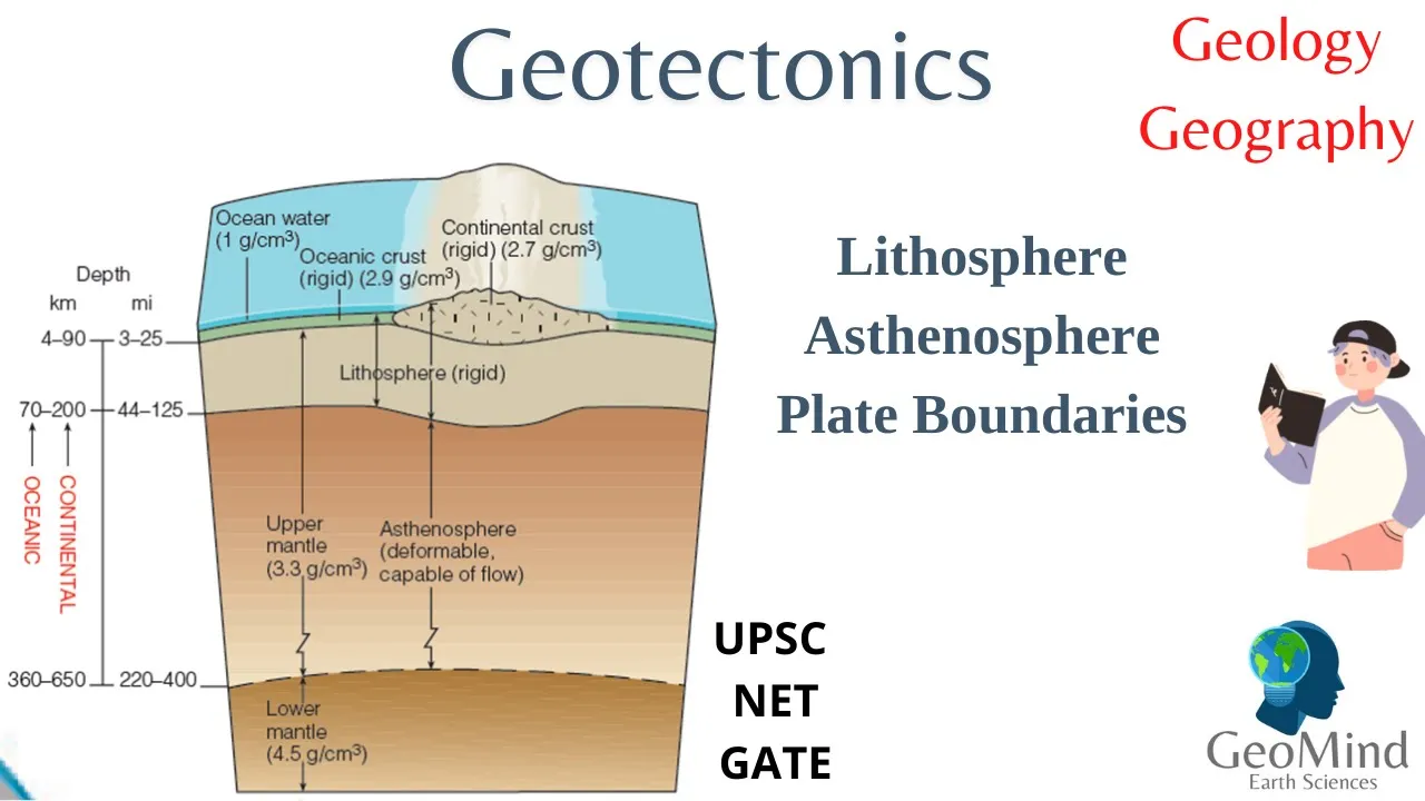

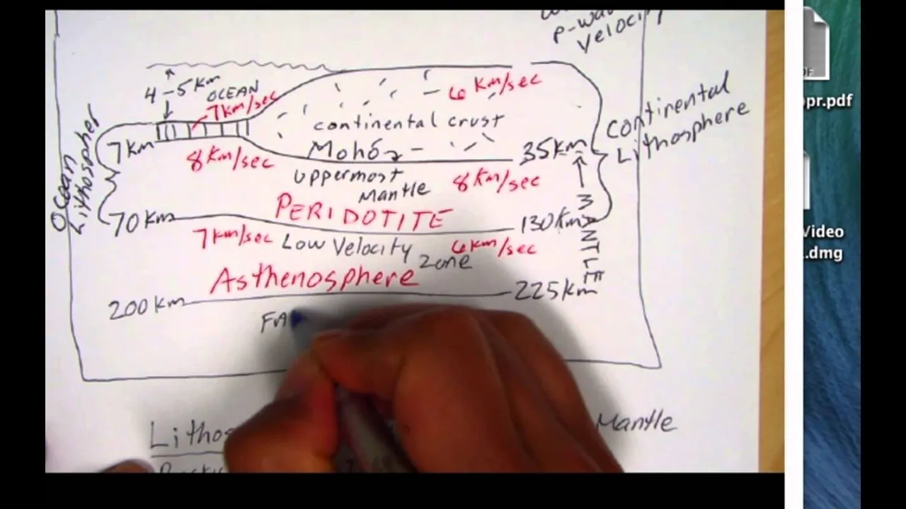

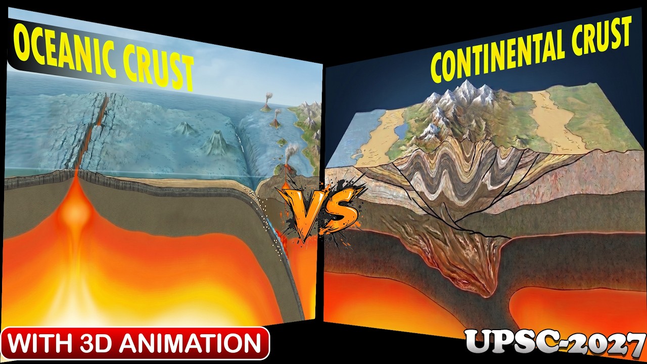

















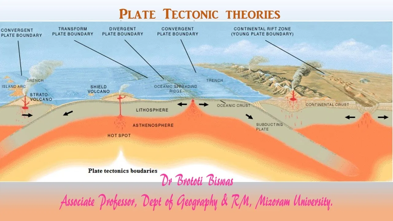


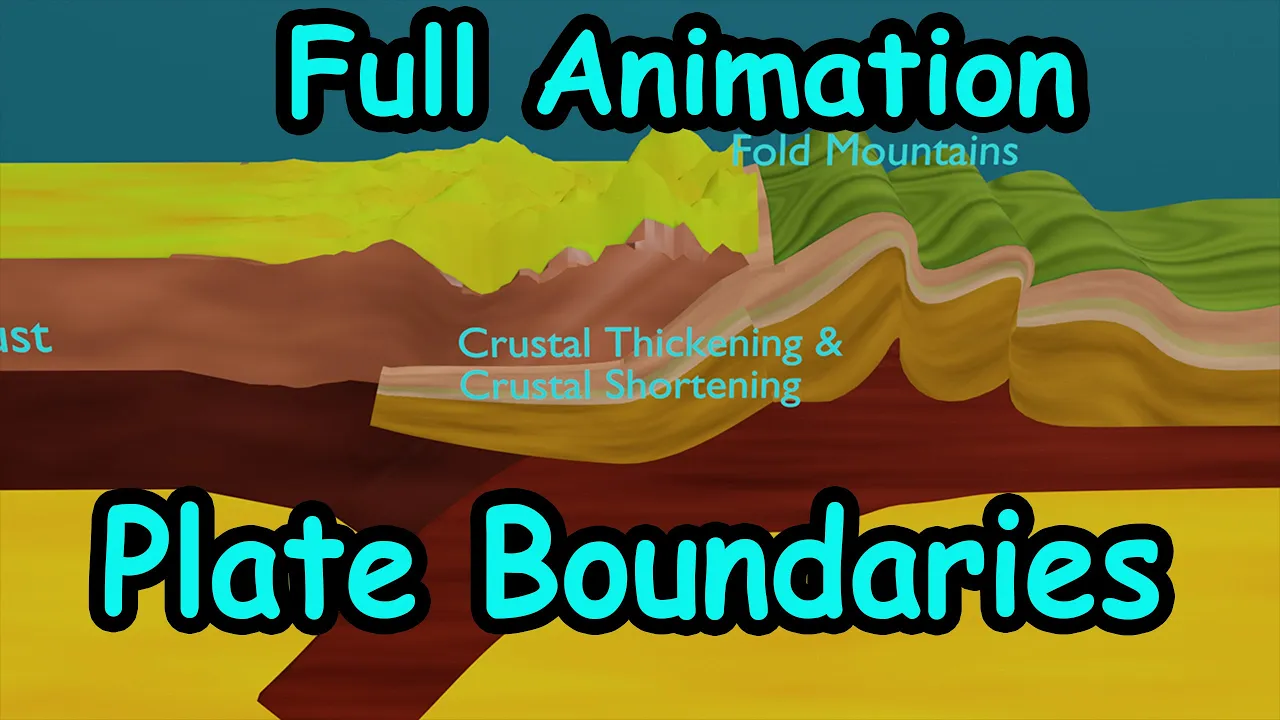
Convergent plate boundaries are destructive boundaries where tectonic plates collide, and the geological processes depend on the types of crust involved: when two oceanic plates collide, subduction occurs where the older, denser plate sinks beneath the younger one, generating magma that creates volcanic island arcs and deep ocean trenches; when an oceanic plate collides with a continental plate, the denser oceanic crust subducts beneath the buoyant continental crust, forming volcanic mountain chains; when two continental plates collide, neither subducts due to their buoyancy, resulting in crustal thickening and uplift that creates high mountain ranges like the Himalayas.
Convergent Plate Boundaries Explained: Geology 101 with Willsey #4
Added:The fundamental theory of Plate Tectonics, including the concept of lithospheric plates moving over the asthenosphere.
The physical and chemical differences between continental crust (thicker, less dense, granitic) and oceanic crust (thinner, denser, basaltic).
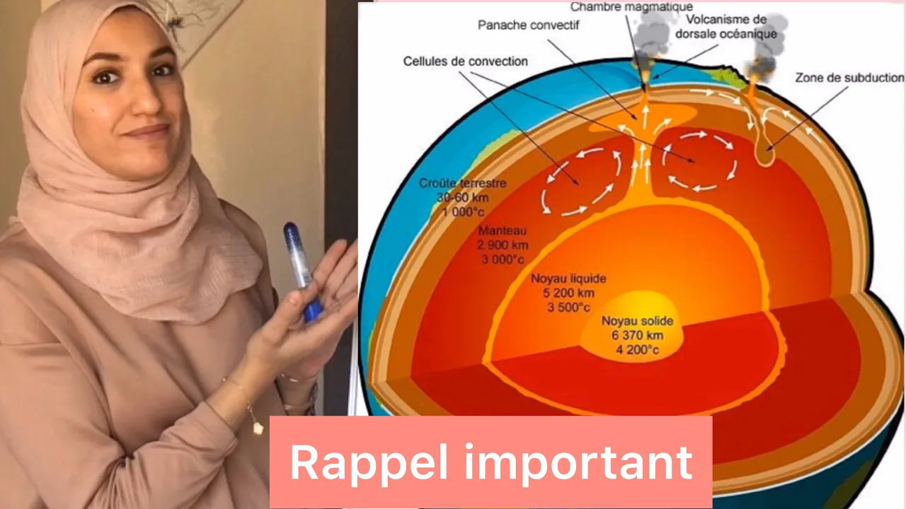
How heat transfer via convection currents within Earth's mantle drives the movement of tectonic plates.
An introductory understanding of force, stress, and basic geological structures like faults and folds.
The geochemical processes of flux melting, which explains how subducting plates introduce water into the mantle to generate magma.
Detailed case studies of orogeny (mountain building), such as the collision of the Indian and Eurasian plates forming the Himalayas.
The mechanics of deep-focus earthquakes and the mapping of subduction zones using the Wadati-Benioff zone.
The formation of metamorphic rocks under high-pressure, low-temperature conditions typical of subduction zones (e.g., blueschist facies).
The distinction between volcanic island arcs (ocean-ocean convergence) and continental volcanic arcs (ocean-continent convergence).
33.5K views1.9Klikes29:24Original Release: 2024-06-26
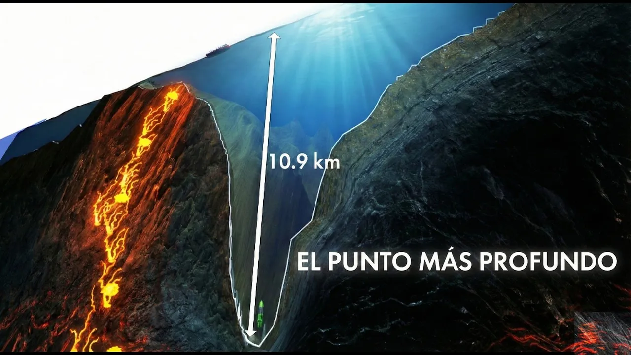
hi there and welcome to a new episode episode 4 in the geology 101 physical geology video series I'm geology Professor sha Willy thanks for joining me today today our topic is going to be on convergent PL boundaries this is the fourth episode in this video series and this video Series has been set up for those who might be interested in learning geology for the first time ever in a semiformal setting or for those who've maybe had classes in the past and looking for a refresher anyone who's interested geology all are welcome so thanks for being here uh this video series is modeled after my college courses it's the same lecture material the same content that I would present to my class the only thing missing of course is the field trips and Labs but you can somewhat supplement those here as well with some of the other videos in my catalog so I encourage you to please look through those and you might find some topics that are relevant to the particular um topic you're interested in so let's go ahead and get right to it so in our last episode we focused on our first plate boundary type which was divergent boundaries when plate boundaries um when plates move apart and magma is generated we called those constructive plate boundaries now we're going to look at what happens when two plates collide when two plates actually run into each other or what we call a convergent plate boundary so this is a collisional area between plates uh it's a destructive plate boundary where we are going to recycle and remove old older crust from off of the earth uh so it's in contrast to those divergent plate boundaries we learned about last time and it's a little bit more involved here than a divergent boundary in the sense that it really depends on what kind of crust we're dealing with as to what exactly takes place so we know that we have two types of crust on planet Earth we have oceanic crust which is heavy and dense and relatively thin and primarily made out of a rock type known as Basalt a dark volcanic rock and in contrast the continents are mainly composed of a different rock type granite and that's what continental crust is and granet tends to be uh low density quite buoyant and much thicker and so depending on the types of plates involved that's going to dictate to some degree what sort of scenario is set up and so we'll look at each one of these we'll look at the situation when two ocean plates collide when a continent in an ocean plate collide and then finally when a two continental plates collide so let's go ahead and start with our first situation where we have two oceanic plates colliding um the process here and we're going to use this term a lot not just in this video but probably in future videos as well because it's a very fundamental process on planet Earth helps us understand volcanoes and earthquakes much better this is a process known as subduction so when two ocean plates collide one of those plates is going to sink or slide beneath the other and the process of one plate descending beneath another is this process we call subduction uh you might ask well who's to say which plate is the subducting plate what did what determines or dictates which plate is actually the downgoing plate and we can answer that by comparing the two ocean plates that are involved and seeing what their ages are remember that ocean crust is generated as we learned in the last episode at a diver plate boundary so as these two plates come together here the ocean crust or ocean plate that has the oldest age and therefore is the most dense and heavy that is the plate that is most likely to sink and subduct beneath the other so whenever we look around planet Earth and we see these subduction zones and we get age data on either side of that subduction zone we see that universally that the ocean plate that is oldest is the one that subducts and sinks beneath the other even though they're made out of the same rock type there's enough of a difference in their densities due to their ages to cause one to sink beneath the other when one plate Dives beneath another another part of the process and another characteristic we see is that magma is generated we'll talk about this more when we get to ous rocks but for now um let's just leave it fairly simple and that is that as the ocean plate slides down uh water is driven out of that downgoing plate it reacts in the asthenosphere on the on the uh the the plate that's riding above the subduction zone that ocean water is reacting with the asthenosphere causing some of it to melt generating the magma the magma is buoyant and less dense than the rocks that it is residing in and so it tends to rise and of course when that magma W makes its way to the surface It ultimately creates volcanoes and in this case what we're going to see is a chain of volcanoes forming what we call a volcanic island arc on a map these tend to be curved uh in map view uh partly because of the Earth's shape as a sphere um and so this is some of the characteristics we see here so a subduction zone we sometimes call this region where one Plate's diving beneath the other a subduction zone so that's kind of the the the phrase we use for this overall tectonic setting the magma being generated here uh we see some of the Earth largest earthquakes happening in subduction zones upwards of magnitude 9ine in some instances so as I think back to um you know the last big earthquakes in my lifetime that I've been alive for I think of the Japan earthquake in 2011 which was around magnitude 9 the uh Sumatra earthquake in 2004 was a little bit over magnitude 9 so this is the type of plate boundary that produces our largest magnitude earthquakes which is something important and something we'll Circle back to when we talk more about earthquakes later in the course um the other thing we see as a characteristic feature of these ocean ocean convergent zones is right where this downgoing plate starts to bend and dive into the Earth as it's flexing and diving in contact with the other plate we get a narrow deep ocean trench right along the plate boundary so this is where we see the the deepest uh po portions of the ocean floor is right along these trenches that Mark these subduction zones and there's lots of examples of these types of plate boundaries I've listed a few here Japan the uan islands uh Indonesia but there's others as well and it might be a fun exercise for you to just you know pull out a map that shows or get on Google Earth even better and see if you can find where some of these uh sub subduction zones might reside just given some of this information and these characteristic features we've talked about here with the the magma the volcanic island darks uh you obviously won't see the earthquakes on that type of imagery but you can pick out those deep ocean trenches so this is ocean ocean convergence when we take out one ocean plate and swap it out for a continent we see actually a pretty similar process with just a few small differences so we still have that deep ocean trench uh in this case there's no question as to which plate is going to be subducted or or forced downwards it's going to be the ocean crust because it's so much more dense than this buoyant and thicker continent that it's running into and so the ocean crust subducts we still get the magma being generated so in this case instead of getting a volcanic chain of islands we'll have a volcanic mountain chain on the continent so notice that the volcanoes are preferentially on one side of the subduction zone on the over the plate with the overriding the overriding plate on that side of the plate boundary we still have our deep ocean trench we would still have very large earthquakes along this subduction zone uh and then just a few examples here as well the Andes Mountains the Cascade Mountains of the Pacific Northwest are good examples of these but there's others as well those are some of the the more uh classic examples of that type of plate boundary moving on to our final convergent plate boundary well what happens when we have two plates made out of continental crusts that Collide so in this case it's a little bit different actually it's a lot different um we have two plates made out of buoyant continental crust now we might get some initial subduction at this plate boundary if there's a Leading Edge of ocean crust so in this particular uh diagram here that they are showing subduction because there was some oceanic crust but once these two crustal masses come into contact UM that will end subduction the continental crust will not be forced downwards appreciably and we will no longer have subduction so we no longer have magma generation and um volcanoes for the for the most part now you can get some magma forming here as you thicken the crust um but the classic Model of magma Generation by subduction doesn't apply to this type of plate boundary this is sometimes called obduction which is kind of a a funky word and isn't used a whole lot um but is a little bit more succinct and kind of matches up with subduction so subduction and obduction so as these two continental plates come into contact and are continuing to move towards each other that of course uh results in very high lofty Mountains they're both made out of buoyant crust so instead of things being pushed down uh the low density of the crust causes the mountains to be push upwards these rocks are highly deformed uh at depth where they're somewhat more flexible and easily easy to bend we might see spectacular folding in the Rock we also might see rocks breaking and being pushed past each other which would be faulting and so we see a lot of earthquakes as well with that type of plate boundary so no volcanoes typically but big mountains uh rocks that are deformed and these areas can also produce large earthquakes not as large as a subduction zone not into the magnitude 9 range um but still devastating earthquakes well into the magnitude 7even range and then the two sort of uh classic examples of this in our modern period of Earth's history would be the Himalayas where India has plowed into Asia and the Alps where the Leading Edge of a Africa um is actually plowing northward into uh southern Europe um okay so those are our examples and oops let's not give away the question just yet let me show you a few Google Earth examples and let's go explore some of this on Google Earth and check out some of these plate boundaries so what I've done here is is chosen three different areas that I feel represents each one of these plate boundaries pretty well so let's start with an ocean ocean convergent plate boundary and for this one what we'll do is head out to the Western Pacific here's Indonesia Australia Japan's right here and this is the marana's trench so this is the deepest part of the ocean on planet Earth and on one side of this trench there is a series of islands the Marianas Islands some of most of these are volcanic in nature so I drew this line right through one of the islands and right across the trench and what we can do here is look at the elevation profile across this area so as we move from um I guess I've got this a little bit backwards here but that's okay but we'll move from east to west uh and you'll see that as we move from east to west the elevation of the ocean floor gets deeper uh it maxes out right about this point at the trench upwards of um 9 kilometers almost in depth I did switch to metric for this so apologize to my uh English unit folks but you can you can easily convert back and forth uh so down to 9 km here and then as we leave the trench of course we're on the overriding plate so the plate boundary is more or less marked by the location of the trench so this in this case on the east side is the Pacific Plate uh and then we have the philppine plate over here so as we move to the West we're on the Philippine plate and once we get some distance usually a couple hundred kilometers in this case away from the plate boundary we have uh the volcano you can see where the actual volcano and the island sticks up over here we can go ahead and zoom in a little bit and actually see that yeah that that looks a lot like a volcano crater at the top uh later we'll talk about volcanoes and what type of volcano this is and how explosive it is but there's a nice little cross-section through an ocean ocean plate boundary uh with these exceptionally deep uh ocean trenches marking the location of that plate boundary so there's the Mariana Trench if we go to the Andes mountain in South America uh I have a cross-section here um through the plate boundary the subduction zone that lies here again on Google Earth these trenches show up nicely it's got the we have the depth of the ocean shown in various shades of blue lighter blue is more shallow and deeper shades of blue is is deep so if we come down here to this um cross-section line and look at in this case this one's Orient it a little bit easier for you so this is from west to east so we'll start over here on the West side we're on the NASA plate so the NASA plate is an oceanic plate and this plate is in collision with the South American Plate so you can again see where that trench is designated here here with the trench is almost about 7 and 1 12 kilometers deep and so another deep ocean trench a little narrow Zone where the ocean floor is um quite deep and then as we move to the east beyond the trench we are moving on to the overriding plate which in this case is the uh West or excuse me South African South American Plate uh and then we get on to land here and then it finally Rises up to this High Point here which is a little less than 6 kilometers above sea level and if we zoom in there of course remember we should see volcanoes on one side of the plate boundary uh and sure enough there's another land form that looks a lot like a volcano another one here probably another one there and you can move up and down on in a north south Direction along uh the coastline here in a certain distance Inland and Trace out the location of these volcanoes so these volcanoes that exist in the Andes uh throughout Chile Bolivia Argentina Peru are there because of this subduction zone which pretty much runs the entire length of Western South America and then finally our last little profile view that we'll use Google Earth for is to head over to a place where there's continent continent Collision so in this case we'll go to uh the Himalayas so we're over here where India meets Asia and as many of you know this is the tallest mountain range on Earth Mount Everest is in there and the Indian uh subcontinent is still plowing into Asia even though this Collision began uh 30 or 40 million years ago this Collision is still going on and so these mountains are still being uplifted um Lots going on here but let's just check out our cross-section line uh let me see which way I've whoops oriented this and yeah so this is oriented from south to North so we could actually spin around this way that make me make it a little more easy to understand so we'll start out in the low elevation Plains of India just a few hundred about 100 meters or so you can see how flat it is on the topographic profile uh and then as we approach roach the plate boundary um which is more broad it's not as well designated by a trench it's a bit more diffuse but you can still see just over the course of a few tens or so of kilometers um that the elevation changes dramatically and that indicates of course where the plate boundary is looks like the highest point we get here is a peak that's somewhere between 7 and 8 kilometers in height so over 7,000 m in height pretty pretty pretty uh lofty there these big mountains that are right along um the plate boundary if we zoom in here of course none of these look like volcanoes like we saw with the subduction zones um they're tall enough even at this relatively low latitude to accumulate snow and many of these also have large glaciers on them and so glaciers have modified this landscape quite a bit as well and then as we move further to the north you can just see the just how high these elevations are this is you know part of the Tibetan plateau and this high elevation region uh that extends to the north so this type of plate boundary is a little bit more Broad and um more encompassing of larger areas than we see with the subduction zone but I thought the profiles would be a nice way to understand these three types of plate boundaries in a little bit more detail so hopefully that was helpful there and I'm just now remembering that I totally forgot to show you the animations that might help with these as well so let's start with the uh ocean ocean collision and so here is the older ocean crust diving down to the right beneath the younger Ocean Crest and so as we've learned here with the Powerpoints that generates earthquakes it also generates um melt which produces a chain of volcanic islands so there's our chain of volcanic islands here the trench here uh we'll talk more about this word in a future episode um this is just where stuff gets kind of plastered uh into or onto this overriding plate a little bit here um so that is one of our plate boundaries ocean ocean if we switch over to Ocean continent we see similar sort of thing so subduction zone earthquakes and magmas being generated that are feeding these volcanoes on one side so this this set of visuals might help some of you as well understand what's going on and then here's our continental crust animation so two continents moving towards each other little bit of ocean crust in between um which is initially subducted so we can see there's some subduction initially um so we've got a subduction zone here but eventually as these two continents start to collide uh this subduction zone gives way to this other type of convergent plate boundary and you can see how the whole area gets uplifted the crust gets thickened uh again all of this takes place over tens of millions of years with earthquakes fold um all sorts of other processes that are occurring there as well uh and then we get these big big mountains there so um okay so let's now move over to so we've done uh the Powerpoints we did the animation the Google Earth um section let me wrap up here and hopefully you'll remember this from the last episode remember the last episode we we finished it up with a little assessment question a quiz question this is one that I give in my classes this is actually the exact same question as the last episode except instead of looking for the right map pattern for um a divergent plate boundary here we're looking for which one of these five Maps A B C D or E best matches the earthquake distribution that we would expect to see from a convergent plate boundary between two ocean plates so if you didn't Watch the last episode let me quickly explain each one of these letters is a map the plate boundary is the dash line going down the middle the dots are earthquakes the locations of earthquakes on that map and the color of the dot corresponds to the depth of the earthquake black being shallow blues and greens being kind of intermediate depth earthquakes and reds being exceptionally deep so the earthquakes get progressively deeper so what you need to do here is figure out which one of these show the pattern we expect to see at a convergent plate boundary between two ocean plates um I guess the big hint I can give you here maybe to make your chances a little bit better of getting it right is that when we looked at this last time for the divergent plate boundary the answer was e so this this option here is the pattern of earthquakes for a divergent plate boundary so I would encourage you to take that one off the table so you got a you got a 25% chance if you just randomly guess this a B C or D the other thing to consider is remember what we learned about in episode one about the layers of the earth um not all layers will respond to the stress at a plate boundary the same some layers will behave brittly and they'll break and they'll generate earthquakes others might not so also remember that earthquakes are produced when stress is built up in rocks and the rocks break and shift and think about where that might actually take place so this is a good point now to pause the video if you need some time to sketch some stuff out or maybe look something up or think about it or have a conversation with a friend or a conversation with yourself um go ahead and pause the video and then when we come back I will reveal the answer all right so hopefully you had some time to think about it we're going to go ahead and figure out the answer so again in review a shows shallow Earth Quakes along the plate boundary and the earthquakes get deeper to either side B shows a mixture of shallow and deep earthquakes right along the plate boundary C shows shallow earthquakes along the plate boundary and the earthquakes getting deeper in One Direction and D shows deep earthquakes along the plate boundary with the earthquakes getting shallower in both Direction and remember that the the distance across these very small little little cute Maps is you know let's say a th000 km or more so they represent a substantial distance so the correct answer to our fun little quiz question here is c c is the correct um answer for the distribution of earthquakes for a convergent boundary between two ocean plates so what would it look like if we had two ocean plates colliding well remember that is a subduction zone so we would see one plate diving beneath the other um so in this case I've set that up with my little drawing here so here's the ocean here's my pirate ship we've got this plate here made out of the crust and the upper mantle these are the hard rigid layers that make up the lithospheric plates the plates that are moving around on planet Earth and they're sitting on a soft squishy layer um that is quite weak called the asthenosphere so in this case we have this plate moving to the right colliding this other ocean plate presumably of an older age which is moving to the left and what I've drawn here is the magma that's being generated with all this red there's our little volcanic island here's the trench Lots going on here and then the X's um are where we might expect the earthquakes to be so notice we have earthquakes in the shallow region here but we also have earthquakes to get progressively deeper as we move from the plate boundary which is at the trench um and we move in One Direction in this case over here and and it they actually go off the page here this subducted slab goes down literally hundreds and hundreds of kilometers down into the Earth um and so we still have earthquakes happening at depth here because remember this is a rigid tectonic plate it is still made out of rock and the the the the as it flexes and moves down and the other stresses that are on it causes rocks to break and shift and that's what's generating the earthquakes here so a lot of earthquakes are happening in the shallow region but there's still earthquakes happening uh at a variety of depths but it is there is a nice progression from shallow to intermed Med to deep as you move in this case from the plate boundary to the left and that matches pretty nicely with C what we have over here um so last thing here is to maybe convince you a little bit more and show you the real data behind what I've drawn there um if you need something to decorate your house or your garage or your office um you could do a lot worse than this and I'll put a link to this in the video description this is the USGS uh beautiful map this comes in a big I'm trying to look how big Mine mine's at least four feet wide as I look at my office wall here it's a very large map so don't let the online version fool you uh but this has a lot of great information and this is called this Dynamic map so if we zoom in for example um to let's say we go over here to the West Pacific we can see what this map shows nicely and why one reason why I love this map so much is it shows several things it shows the plates the white white arrows are the directions the plates are moving the little number is their rate of motion in millimeters per year the red triangles are the location of earthquakes and the dots are the Loca the dots are earthquake locations so what we can see from this map if we if you know a little bit about plate boundaries let me Zoom back in a little bit trying to find the right blend um is that the divergent plate boundaries such as we see here in the eastern part of the Pacific do have Earth Quakes but not that many the plate the plate boundaries that produce by far the most earthquakes are these convergent plate boundaries these subduction zones you can see them stretching from New Zealand up through uh the South Pacific over here along southeast Asia uh up along the border of Asia through Japan to Northeast Russia and then coming across the uion chain into Alaska uh similarly we can see uh more of these subduction zone earthquakes here in southern Mexico and Central America and then most of the western margin of South America so not only do these locations have the most earthquakes by far they also have the deepest earthquakes as well and so you don't see depth on this map so I have another map here that will show this a little bit better this is actually a map I use for an assignment that a colleague put together uh so on this map the red earthquakes are shallow the yellow earthquakes are a little bit deeper then it goes green then blue so notice over here like let's say in the divergent boundary that runs through the the Atlantic Ocean the earthquakes are only shallow and that's something we learned from our last episode but when we look at the subduction zones like here in Central America or along the west coast of South America notice you see a much more um much more diversity and a bit of a a organization to the earthquakes now it's not perfect but in general looks like there's a lot of red earthquakes right along the plate boundary right on that trench that's close to the coastline and then there's crudely aband of yellow earthquakes a little bit deeper the greens tend to be a little bit further Inland further away from the plate boundary and then we finally get to those Ultra deep earthquakes and so that's very similar to and then look at this pattern over here that kind of went off the map the other side of the ocean um maybe we can go over there and check that out over yeah towards New Zealand um and so you can see these patterns here that show up pretty nicely with these um subduction zones especially here in the West Pacific so the point here is that this distribution of volcanoes from shallow to intermediate to deep as one moves from the trench where the plate boundary is towards one side matches pretty nicely with the uh data that we see here here and also matches pretty nicely with our our uh our little quiz question here so hopefully that was helpful hopefully you enjoyed uh this little section and this episode on convergent plate boundaries we will continue in our next episode with our third and final plate boundary type and that's transform plate boundaries um I'll probably also in the future do a little bit more of a deeper dive on plate tectonic some of you who might know uh more about plate tectonic are wondering why hasn't he talked about accary wedges and oyes and all sorts of other things but remember this is a geology 101 course we're just starting with the basics and a good fundamental understanding and then in future episodes we'll we'll add to that so thanks again for joining appreciate your support of the channel uh whether that's Financial or just uh whatever support you give and we'll see you at the next episode take care and thank you
Up Next
15:31
How to Find Epicenter Distance from Seismic Station | Earth Science Tutorial
@kevinberler5082
176.8K views•2017-12-12

12:54
Triumph of Orthodoxy Icon: Byzantine Art & History Explained
@BenCallan
2.1K views•2024-08-06

9:49
FastAPI vs Flask vs Django: Choosing the Right Python Web Framework
@TechWithTim
302.5K views•2024-05-26

1:42
Game of Thrones Opening Credits: A Cinematic Analysis
@gameofthrones
46.3M views•2011-04-18
Related Study Plans & Knowledge Roadmaps
Structured learning paths in General & Interdisciplinary Studies
general-studies
Elevator Engineering: History, Physics & Cities
01From Hoists to Safety Brakes: The Dawn of Vertical Lift
02Hydraulic vs. Traction: The Engineering Physics of Elevators
03Modern Speed, Safety, and Algorithms
+ 2 more learning modules
12h5 modules
Explore Roadmap
general-studies
Rubber: Material Science, History & Geopolitics
01Origins of Natural Rubber & Mesoamerican History
02The Chemistry of Natural Rubber & Vulcanization
03The Geopolitics of the Rubber Boom & Colonization
+ 2 more learning modules
12h5 modules
Explore Roadmap
general-studies
Containerization: Evolution, Logistics & Trade
01Ancient Trade & Bulk Cargo: Amphorae to Barrels
02The Industrial Revolution & Cardboard Packaging
03The Containerization Revolution: Malcom McLean
+ 2 more learning modules
12h5 modules
Explore Roadmap
general-studies
Textile Tech: Evolution, Labor & Global Impact
01Pre-Industrial Textiles: Handloom & Cottage Industry
02Mechanization: The Spinning Jenny to the Power Loom
03The Factory System & Global Labor Transformation
+ 2 more learning modules
10h5 modules
Explore Roadmap