








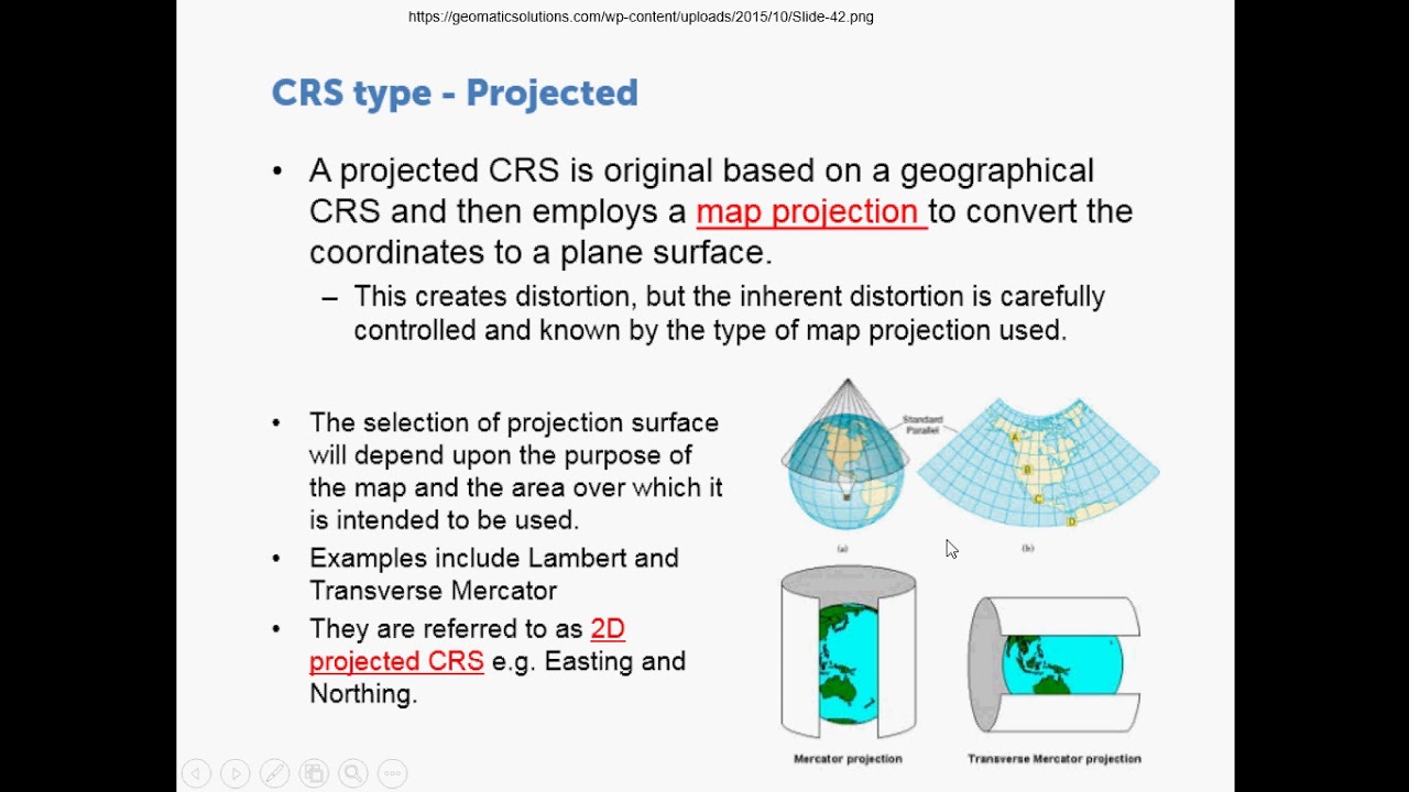


The Mercator projection, designed in the 16th century for navigation, systematically distorts Africa's size by stretching land masses near the poles, making Europe and North America appear disproportionately large while shrinking Africa to approximately one-fifth of its actual size; this cartographic distortion reinforced colonial ideologies that portrayed Africa as marginal and insignificant, despite being the second-largest continent at 30.5 million square kilometers—three times the area of China, three times Europe, and three times the United States—with abundant natural resources including 60% of the world's arable land and 90% of gold reserves; the Equal Earth projection offers a more accurate representation that restores Africa's true scale and central position, symbolizing a broader movement for African self-representation and recognition of the continent's rightful place in global consciousness.
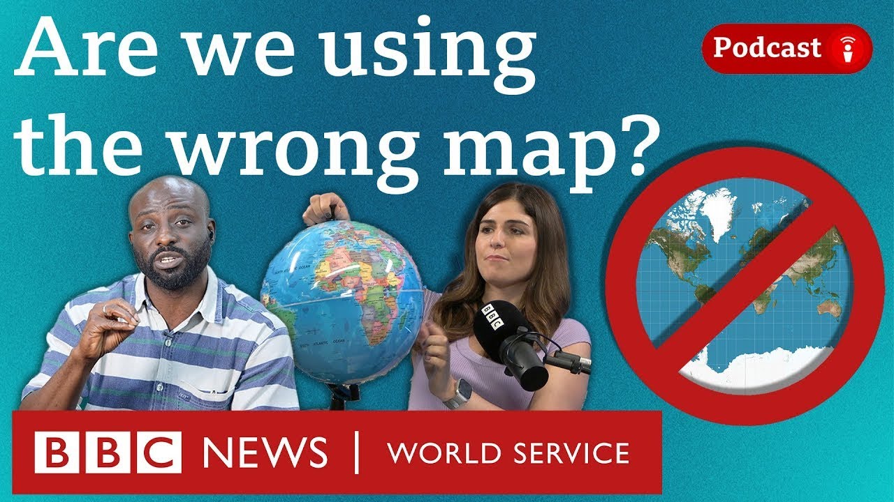
How Colonial Maps Distorted Africa | Righting the World Map
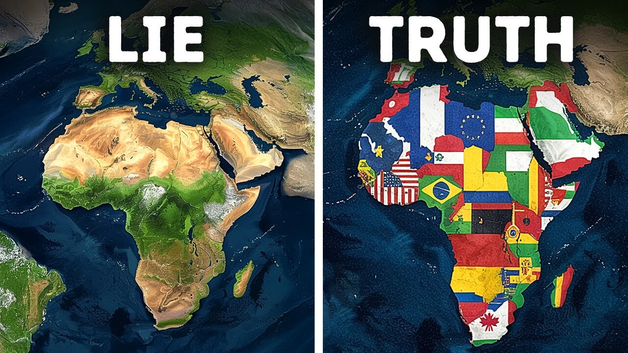
Added:For over 400 years, a lie has hung on classroom walls, in newsrooms, and in the very maps we use to see the world. A lie that told us Africa was small, distant, insignificant.
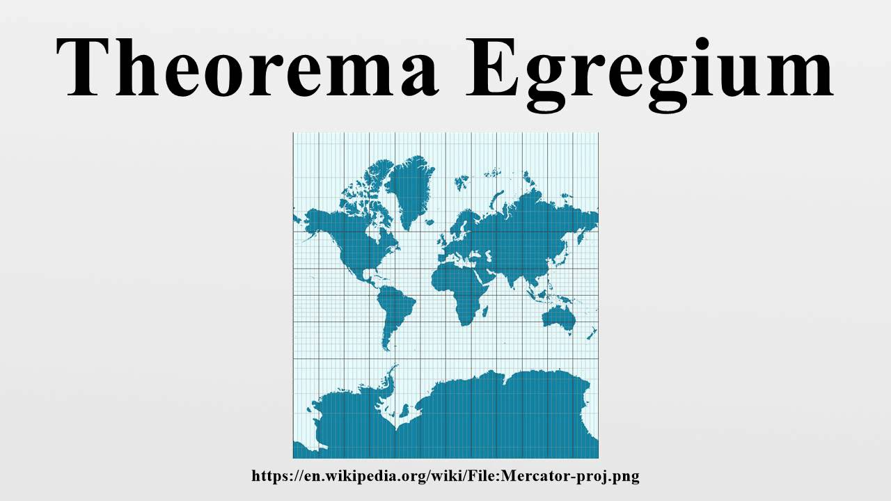
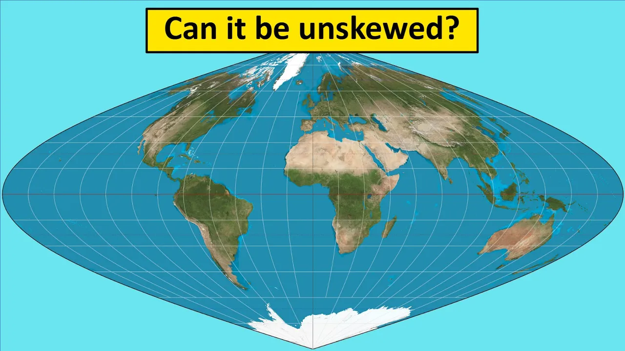
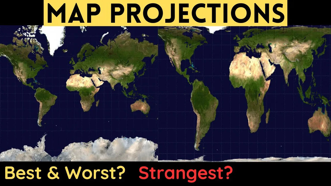
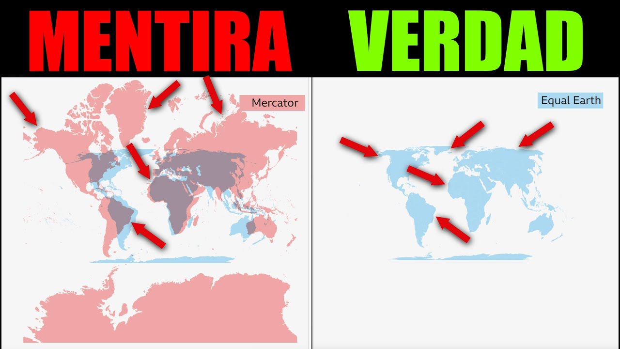
But the truth is, Africa is vast, central, and powerful. And the African Union is now demanding the world see it as it truly is. This is not just a debate about maps. This is a battle for perception, history, and Africa's rightful place in the global mind. The Merkar projection designed in the 16th century by Gyarados Merkar was never meant to tell the truth about size. It was made for navigation, helping sailors travel in straight lines over the oceans. But there was a problem. To keep straight lines accurate, it stretched land masses near the poles, making Europe and North America look huge while shrinking Africa and South America.
Look closely at a Mercar map. Greenland appears almost the size of Africa, yet Africa is 14 times bigger. Europe looks equal in size to Africa, but Africa could fit all of Europe, China, India, and the US with space left over.
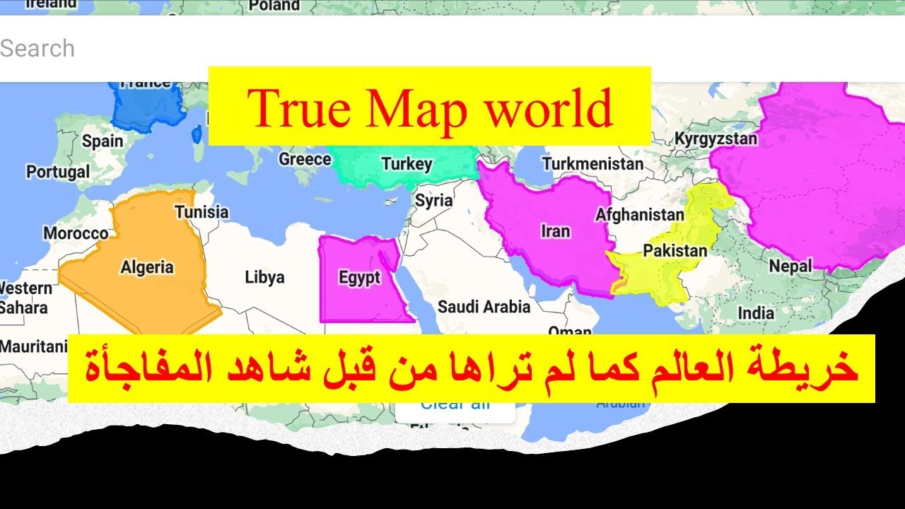
Countries like the UK, Norway, and Canada appear inflated while Congo, Algeria, and Sudan look tiny. This distortion did more than mislead. It reinforced colonial ideas that Europe was big and Africa small, feeding centuries of bias.
Maps shape how we think about power.
When children grow up seeing their homeland drawn small in every classroom, it plants a dangerous seed that their country is less important, less capable.
For Africans, the Merkar map was a silent propaganda tool during the colonial era. It supported the lie that Africa was too small to be independent, too poor to lead, and too weak to compete. But Africa is not small. Africa is not weak. Africa is the second largest continent on Earth. Home to the richest mineral reserves, the youngest population, and the largest future market on the planet. In 2018, ctographers unveiled the equal Earth projection, a map designed to show every continent in proportion to its actual land area. For the first time, Africa takes its rightful shape, stretching wide across the center of the world. No more being squeezed beneath Europe. No more looking far away from the action.
The equal Earth map is not just ctography. It's a visual revolution.
It restores Africa's vast land mass more than 30 million square kilm.
Its central position between the Americas, Europe, and Asia. Its importance in global trade, climate, and geopolitics.
This is why the African Union is calling for it to replace the Merkar projection in schools, offices, and newsrooms worldwide.
You might ask, it's just a map. Why does it matter? Because perception shapes policy. When Africa is drawn small, its value is underestimated in global negotiations, in investment decisions, in media coverage. Right now, Africa is rising. The African continental free trade area is creating the largest single market in the world. The Sahel Alliance is rewriting security and sovereignty.
African nations are leading in green energy, digital banking, and space technology.
The equal Earth projection aligns with Africa's new confidence, showing the continent's true scale to inspire its people and inform the world.
Colonial powers once used maps to divide Africa, drawing borders with rulers and pens, slicing through kingdoms and communities.
Now Africa is using maps to unite, not by redrawing borders, but by redrawing how we see ourselves.
Switching to the equal Earth map is a statement. We will no longer let the world shrink us. We are vast. We are central and our time is now. Imagine every African child in school seeing their continent fill the center of the map. Learning from day one that they come from a place of strength, abundance, and influence.
The African Union's call to replace the Merkar map is not a small change. It's a seismic shift in global imagery. It's about restoring truth, rewriting mental maps, and ensuring Africa is seen for what it truly is, the beating heart of our planet. So next time you see a world map, look for the truth, share it, teach it, demand it. Because until Africa is drawn right, the world's picture will always be wrong.
Africa has a total area space larger than all of Europe, China, and the United States of America combined. Yes, it is three times the area of China.
three times the area of Europe, three times the area of United States of America. Meaning you can transplant China, Europe and United States and several other countries on the Africa continent and they will fit neatly.
Africa is 30.5 million square kilmters and a youthful population of 1.3 billion inhabitants. China is 9.6 6 million square kilmters and 1.4 billion inhabitants. India has a total space of 3.3 million square kilmters and 1.4 billion inhabitants.
Now yet Africa is projected as overpopulated and pressure mounts on Africans and their leaders to depopulate. Why?
Why? Now please note Africa is home to 60% of the world's arable land, 90% of raw material reserve, 40% of gold reserve, 33% of diamond reserve, 95% of platinum reserve and holds the largest boxite reserves in the world. Of course, in addition to manganesees, woods, uranium, crude oil and others. Yet the continent is touted as the poverty capital of the world and ripe for depopulation. The question is why?
Well, President Jack Sherak of France provides an illuminating insight. He said, "We bled Africa for 4 and a half centuries. We looted their raw materials. Then we told lies that the Africans are good for nothing. In the name of religion, we destroyed their culture. And after being made rich at their expense, we now steal their brains through miseducation and propaganda to prevent them from enacting black retribution against us."
Well, put simply, for over four centuries, Africa is not in control of its resources.
Look, a 2016 study of Africa by the NGO called War on Want reveals that 101 companies, mostly British, control $35 billion worth of platinum, $276 billion worth of oil, and $216 billion worth of coal at 2016 market prices. Yes, they own mines or mineral licenses in 37 African countries and control vast sweat of Africa's land, four times the size of the United Kingdom.
Now look, Africa subsidizes the rest of the world by 32 billion annually. A 2017 report by Global Justice Now and other groups estimates that $161.6 billion enter into Africa while $22.9 billion leave Africa almost every year.
For example, in 2017, Africa received a total of $19.7 billion in aid but paid back $18 billion in debt repayments.
Depth burden is killing Africa. African governments have borrowed between 25 and 75% of their GDP, but with little or nothing to show for it.
Africans in the diasporas remit not less than $32 billion annually, but multinational companies siphon $ 32.4 billion in profits and illicit financial outflows. Look, an estimated $29 billion are stolen via illegal logging, fishing and poaching annually.
How can any continent, country or people accumulate and sustain wealth, growth and prosperity with such statistics?
That's a great question. Well, look, hopefully now you know your Africa better.
Edmmont once wrote, "Peace of mind always comes with knowing who you truly are, where you currently stand, where you positively need to be, and strongly believing in its possibility.
Africa needs to control its resources."
No doubt for productive, patriotic and effective leadership, we need our best and elless citizens with fortified character in local, state and federal governments.
This must be given utmost consideration in upcoming elections across Africa. Let me say it once more. Our problem is not the age of our leaders but unfortified character.
It is your responsibility to protect and defend your Africa. The starting point is to educate and transform the mindset of our leaders and peoples.
Look, the least you can do is to assist with ensuring that this message reaches every African.
Slavery destroyed us. Religion divided us. Ignorance controls us. And truth scares us. With these retrogressive forces, Africa will remain a dark continent. So, we must renew our minds.
Please share this video in support of my efforts at reconstructing Africa through mindset transformation. You see, together we will reconstruct Africa and take charge of our destiny. For who controls Africa controls the world. I thank you.
Wow. No one can stop revolution.
Revolution started in Mkina and right now has leed in the headquarters of African Union. The African Union has joined the call to replace the outdated world map that is showing Africa as a small continent compared to other continent. So uh this is evolution that we have been asking for a long time. But all in all, some Africans have been reacting after the African Union call to replace the map. Some have said African Union must concentrate on important issues that brings Africans together. So let us share the views of Africans on this matter. What the Africans want from the African Union. So if you have something to share with us, please do so through the comment section and also you may share this video to other Africans to get more views. Let us now dive deep into views of fellow Africans. Starting with G defa de Ga meda saying this collecting the map is more than the geograph it is restoring Africa's dignity uh visibility and lightful place at the center of our world that is the view of ghetto also for asen said rather than focusing on the structure of the map try your best to set the United States of Africa.
Those are vision and views of Mr. or I don't know it is women or female letters come for Asen. Uh also Alamin Damas say fulfilling duties before call to replace the outdated 16th centa map Africans citizens uh citizen demanding for a single Africans passport and Afrocurrence and borderless continent. You may see the vision of Africans and this is the call to African Union that when you talk about um changing the map, you have also a duty uh to unite the people of Africa, Africans or citizens demanding uh single African passport and afro and borderless continent opposit.
introducing one Africa continent monetary system make more sense than fighting for map. You may see that is Apostle Samuel arguing and calling African Union instead of focusing on or fighting for map let us introduce one Africa continent monetary system Africa demanding single curren says says that map just are not just tools for navigation their puff storytellers. For centuries, the Mika projection has subtra reinforced a world views that link Africa's importance both in size and perception which while inflating allegiance near the pole switching to the equal health projection is more than a technical collection. It is it's a statement of dignity, truth and selfdefinition. It tells future generation Africa is not small polif oh Africa is vast so rich and center or central to the story of humanity. Kudos to the African Union Africa no filter and speak up Africa for leading this shift. This is not just about changing a map. It's about changing the narratives.
# collect the map #quest # Africalizing # geopolitical truth. May said anyway let's unite our continent as one passport and money that is May calling African Union these are views of Africans after African Union called for changing of world map uh that's showing Africa a small continent um somebody wise said this is great please also consider social economic and political integration of this big continent that counts more than anything by this higher time. That is Moses Balle said Africa should focus more on how to achieve world diplomat world domination politically and economically. Instead of crying over a map, if we are so hung on a map, let us use our resources to produce a more correct map of the world.
We don't need to have any any anyone do it for us. We should be more concerned with how are going how are going to weed out corruption dictatorship and uses leaders we have today poverty economic hardship security issues and so on we cannot continue to allow ourselves to be controlled by anyone outside Africa when it it is clear we don't exactly need anyone as Africa we are fragmented So why not get together, bring our resources and share them amongst each other, trade with each other and we become one united and conquerable force. The more divided we are, the more we will continue to be manipulated and enslaved and controlled by the west and east. That is the view of Moses Ble. Um, Khed I think this man from Egypt said Egypt look at the African Union and very good. Yes. Um, know he know he said when it comes to real issues about peace, regional security, prosperity and economic independence, the African Union is silence. African Union is silent. an institution that depends on the US and European Union to provide over half of its budget is here concern about maps.
Uh that is the view of knowhammed what is map for you see those are just views and if you have different views please you may share with us through the comment section what is your view uh what is your perception on this matter and what do you think African Union should do or as Africans we need to focus we need to focus on the map or we need to focus on integration first because without integration without coming together even if we and have a big a biggest map than all other continent it is nothing will be controlled by small countries like UK will continue to be suffering you look the country small country such as Israel it is small but when it comes to international issues is so big every nation is listening what is Israel is saying why because Isa listen we need to come together to unite So no one will listen us as long as we continue to be in this division. So African Union first of all I think you have to listen the majority what majority Africans want from you. Uh just Dano Don say you your whole restoring the map size. How about the true knowledge like African American are also descendant descendant of Sahelian and Zansbar slaves which means to have native or indigenous Egyptian and North African borderline like Nubian from both Sahelian port and Zanzba port and may be Nigeria port also mumba means native diaspora and diaspora meaning people that have been have dispersed from the century from the country history historically also from slavery and um before also those are just idea um William kick said replace it with what of course of course other comments will not lead all comments I'm trying to take you through the ideas of Africans now you can understand what the people of Africa want from the African you know this This is just a small research. You can do your own research when you read these uh comments. I don't know if the African Union are leading uh these comments and I'm I'm leading this comment on behalf um George Clone said what is needed is the true identity of African people. The collapse of all British legacy of colonialism and restoring the really identity of the African people.
countries are not respecting the fundamental human rights on of their citizen uh citizens across Africa. The government is breaking the laws and extending uh their tenure. Civilians are helpless since African Union is s is quiet. Uh no free no true democrs.
Uh also Camil Bonab says that this distortion is not entirely innocent as it has historically contributed to reinforcing colonial perceptions that view Africa as marginal or less important geographically and economically. Anthony Tumbu Timbu said we will collecting the map solve Africa's problems. You see uh Anton is asking by collecting the map we'll solve our problems. What is our problems?
Peace, security, food, education, health care. That's what Africans want. So will collection of map solve these problem challenges? The only solution is to come together. So um tai mafo say satellite imaging we know the size of Africa we have satellite that we developed stop the nonsense talk of the size of brain that is t so it's it's okay it's okay those are just views ideas as as I said we are here to share the ideas and to find best solution I'm leading this on behalf of Africans who who want to make Africa great. So Ted Kim said good. We also need flag emojis for African Union and flags of African uh allies like East African community. We need uh our flag image flag Africa. We are moving. Yes. It's good. It's good views.
Also Joshua said the African Union's initi initiative to adapt the equal health projection map is significant step toward promoting a more accurate representation of Africa's size and importance global. Here are some key important about the development. The issue with Mika map the 16th century Mika map distorts continent size making area near the pole like North America and Greenland appear larger than the size um appear larger than they they are while shrinking Africa and South America. This has contributed to a false impression of African of Africa being marginal despite being the world's largest second largest uh continent with over billion people. Equal health projection this map um project him to reflect countries size um countries true size providing a more accurate representation of of the world. uh the African Union along with uh advocates group groups Africa no filter and speak up Africa is arguing governments, schools and international organization to adopt this map. Uh impact on perception. The mic's inaccuracies have influenced the media education and policing stereotypes about Africa's size and importance by adopting the equal uh uh project the African Union seeks to reclaim Africa's light place on the global side on the global stage and promote a more balanced view of the world of the world. So uh that is uh of course is too long. Let me continue a little bit to Mr. Joshua uh global support. The campaign has received support from other region including the Calcom Caribbean community repalations commission which seen the equal projection as a project as a rejection of the Mika map's ideology of power and dominance. Those are from Joshua. Ambassador Joshua of course those are his idea. John Joe Js said dear African men why are you fighting your own brother especially when we see the greet man uh greet brain instead of to be bridge for him. We bring guns to kill. Why? Why? Why? How come the Africa to develop? Please give all African men to power for our women. No war, no poverty. We will live in peace. Yes, those are power uh views, powerful idea.
Also Zo said in this blank space we can add those European countries with size 10 square kilometer and and and are used to block us to get to get there.
Those are just idea uh from uh Iblimo. uh Africans has written lot of ideas here as you can see as you can read um of course all of them are trying to contribute and it's my hope that African Union will lead these comments quark mayor rather than focusing on map why don't we focus on getting African country like Togo and Cameon liberated from weekly autocratic laws United Africa uh United States of Africa and and okay that is Mr. And sh Nixon tilop what I see here is only outsiders or foreigners. It is is it colonial master colonial masters or what? Okay. Thank you for your uh views. I think African Union will lead this. But is that the most important priority of African Union? not a safer and prosperous Africa that is blood David. Okay. Um if you go to coffee Chris together we walk for the light. Thanks um foro I would good to to know more. Thank you.
So but all in all family, friend, fellow Africans, those are views of fellow Africans who have reached the page of African Union and questioning African Union. Let me end with a shol.
This cannot bring any change to the continent. Now a day African Union is like puppet organization.
its aim its aim is not functioning try to do African Union things leather deleting the puppet union why African why Africa don't have a permanent seat in the UN security council those are questions why Africans can't feed themselves number three why Africans still fought each other number four why Africans solve their problems by their own means and people. Uh, number five, why Africa why many Africans can't why many Africans take illegal refugees? Number six, why Africans still fought for political power. Number seven, why always political instability in Africa? Number eight, why racism still exist in Africa.
So those are just uh views and question.
He has given a space. Maybe if you have something you can add, please may and many others. First of all, try to solve the above question at least one. Um, family, friend, fellow Africans, if you listen what Africans are saying, all of them, many of them are calling for solving challenges and uniting this continent. If you read the comments and you see the vision of Africans and you can understand what the Africans wants.
So Africans want a united Africa.
Africans want to see African Union solving challenges, political instability, food insecurity.
That's what Africans want. And of course, African Union has said this map must be adopted in schools. Do we have a task force that will make sure that these things that African has agreed will be adopted in some countries because we have seen right now we are not uh we don't have a common curriculum that's why we are saying we need a united Africa we can implement these ideas or we can call African schools and education system to adapt this map as long as we have a single curriculum what is taught in Zan IA must be taught in Kenya. What the student in Kgali are learning must be the same with what the people of Tanzania are learning. If we can do like that, if we have a common curriculum, we can enforce we can have a common understanding. Right now we have different understanding. We are talking about Mikita map other they have their own map. They have their own books. We have different publishers. Our books are being printed in Europe in America. So when will Africans having a common ground to solve their challenges and that's why Africans are calling for a united Africa. So after that dear lovely family friend fellow Africans thank you for watching thank you for being part of this movement. It's my hope that you have you got the ideas and the concept from fellow Africans. So u that let me say one thing stay in power. Thank you for being with me. Thank you for being part of this revolution. We are here to make Africa great. We are here to share our thoughts, to share our ideas and to find best solutions for our challenges.
Africa is our home and we have responsibilities to rescue and to protect our motherland our home. Thank you.
>> Thank you. Thank you Africa.
Mama Africa.
>> You make Africa.
>> Thank you freedom.
>> Thank you Africa.
Up Next

Textbook Propaganda: Palestine in Israeli Schools | Dr. Peled-Elhanan
@alternatefocus
92.8K views•2011-11-23

Triumph of Orthodoxy Icon: Byzantine Art & History Explained
@BenCallan
2.1K views•2024-08-06
FastAPI vs Flask vs Django: Choosing the Right Python Web Framework
@TechWithTim
302.5K views•2024-05-26

Game of Thrones Opening Credits: A Cinematic Analysis
@gameofthrones
46.3M views•2011-04-18
Related Study Plans & Knowledge Roadmaps
Structured learning paths in General & Interdisciplinary Studies