








![[RETA FINAL] CONCURSO ICMBIO: CONSERVAÇÃO E MANEJO DE POPULAÇÃO E META POPULAÇÃO](https://i.ytimg.com/vi/lhZNvySp_oQ/maxresdefault.jpg)










Roads significantly impact wildlife through direct mortality, barrier effects that fragment habitats and cause genetic isolation, altered hydrology, and increased fire risk; effective mitigation requires multi-pronged approaches combining scientific prioritization, early integration of conservation considerations in transportation planning, community engagement, and appropriate infrastructure such as wildlife overpasses and underpasses, which can be economically justified through reduced collision costs and long-term ecological benefits.
Road Ecology: Wildlife Impacts & Mitigation Strategies
Added:The concept of habitat fragmentation and how dividing natural landscapes impacts species survival and gene flow.
Basic ecological principles of wildlife corridors and the necessity of animal migration for resource gathering and mating.
An understanding of anthropogenic (human-caused) disturbances on ecosystems and biodiversity loss.
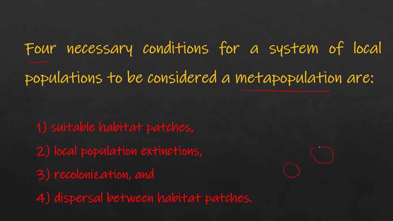
Fundamental conservation biology terminology, such as edge effects, carrying capacity, and metapopulations.
Landscape Genetics: Analyzing how physical barriers like highways alter the genetic structure and diversity of wildlife populations over time.
Geographic Information Systems (GIS) and spatial ecology tools used to map wildlife movement and optimal locations for crossings.
Environmental Policy and Infrastructure Legislation: How ecological mitigation strategies are integrated into civil engineering standards and environmental impact assessments (EIAs).
Cost-benefit analysis of green infrastructure, comparing the economic costs of wildlife-vehicle collisions against the construction of mitigation structures.
173 views5likes1:26:45Original Release: 2018-10-17
again things like hunting access or other impacts one of the mysterious things is that for some reason some animals avoid roads down in the Greater Yellowstone Ecosystem grizzly bear biologists found that where there are higher densities of roads there's a much lower likelihood of finding grizzly bears and these are not necessarily highly trafficked roads they're just roads they might be forced service or other roads so you can actually get animals that actually refused to cross roads likewise as once the road goes in we often treat them right it might be with with salt it might be with herbicides and pesticides along the roadside a number of different kinds of things and that can also have impacts that we didn't necessarily plan for across the ecosystem another aspect of roads of course is altered hydrological processes and I'm going to talk about that more later so I won't talk about it here and the last is that in particular kinds of roads part you know particularly those for example on Crown land that maybe you're meant to be temporary roads but then stay they ultimately can destabilize slopes so you can actually have landslides and things like that that actually can have a multitude of impacts across the ecosystem over time all right so let's pause here we now know a little bit more about road ecology and some of the impacts that we have to watch for and look at this global picture it's not the most uplifting I apologize for that but what strikes me about this picture is that here in North America we're almost seeing the creeping of roads moving further and further north you guys are blessed and don't have so many yet this is a map of just Canada and what you can really see here is so here they're highly highly developed areas these green lines you can actually see that they're really following roads are those what they call resource extract action areas right and so what you can see is that you know it's where you can almost predict where the next rows will go based on this pattern another thing that you can predict from this is is where species are likely to be imperiled right this if you click backwards you can see okay red area highly developed and whoops we have a lot of imperiled species right here as well so one of the things there's a paper being written right now about three states of the world and you can just sort of downscale that - why - why there's sort of the area we're in which is the really sort of still intact area there that's the area that at risk of being fragmented and then there's the area down in the US for example where those grizzly bears are disconnected which is fragmented it's a situation from a conservation perspective in order to achieve the why do I vision we have to work on restoration so what can we learn as we see more development and see roads go in in the far north that we already have experienced in the south what can we do better so let's talk a little bit about the unintended consequences of roads so this here is a map of South Eastern British Columbia and you can look at what the roads look like in 1952 and what they look like in 1986 and unfortunately I don't have the next map but one Road is an access point for more roads to be built you almost never in this world Siro get discs decommissioned it just doesn't happen that often at the scale at which roads are being built so as you con thinks about their roads and where they're gonna go it's really important to know that it's highly unlikely that these roads will get decommissioned a second consequence I mentioned that we were working with C paws and some other groups on finishing bath Nash park this missing area right here and you know by the way that used to be a large chunk of that used to be part of Banff National Park so parks do disappear and decrease but roads tend to increase and so we're looking to kind of refinish this piece so in order to tell this story and relate it to roads I want to talk about how roads have a multiplicative impact they're the entry points so here in red you can see the roads across the landscape and that I should have pointed out this area is the Bighorn area the area between Banff and Jasper that we're looking to protect and this will tell you the story about why so there are the roads the blue areas now are the cut blocks which they get to from the roads next are the utility corridors which are serviced by the roads and next are the well sites the drill sites across the landscape and last are the seismic lines this is an incredibly industrialised landscape that is serviced by what by the roads so you put in roads and more things come so be prepared is my message to you all in in Alberta and let's hope are in Alberta in Whitehorse and let's hope that Alberta gets it right and protects this last piece which is still relatively intact another unintended consequence of roads is that once continuous populations such as of grizzly bears become fragmented so remember that this used to be a continuous population you really couldn't genetically distinguish between the populations back then dr. Michael Proctor put this paper together and every single one of these little outlines with a number on the inside is the genetically unique population it's unique because of why mainly because of roads so let me point out right here is highway 3 going through here and highway 3 is a known barrier for grizzly bears they're no longer crossing it and it's not remember roads don't just come by themselves it's the development on either side of the highway and all of the human activity associated with that road that's causing that genetic barrier it also looks like Wolverines are genetically isolated in other words not crossing that road either and also mountain goats are in the same boat one of the other and unintended consequences is species decline so this is from the narrowest part of the Yellowstone two loops where I could just speed right through it the narrowest part of the Yellowstone - Yukon region in the Peace River these are all linear disturbances roads power lines etc I'm sure it comes to no surprise to you but the caribou population there is declining by 10 to 50 percent per year depending on the populations in that landscape so this is the kind of landscape where we have one last opportunity to get it right right now there's only four percent protected areas in that landscape who we can do better and overall Mountain caribou were only found in the greater in the Yellowstone - Yukon region we already we just this year lost caribou as a species from the United States sort of Immaculate Conception the three females that are left in that herd are on their way to extinction likewise the next herd up had twenty four and now has seven individuals thought to be all the same sex this is the story that happens with roads so be cautious one of the last things I want to talk to you about is that roads can you know are often built in valleys because it's easy to do right they often follow river systems this is in my backyard outside of Canmore this is the Bow Valley I live on top of a hundred and fifty feet of flowing water because although we see the water in the river actually the river is the whole entire Valley and that water in our case 150 feet of it flowing underneath the town of Canmore it turns out that researchers Rick our and others were able to show that that entire valley or the entire river system that you can't see because it's flowing under water are hugely and disproportionately important for just about all wildlife so one of the surprises when he started to ask carnivore biologists and others to engage are things like the majority of carnivore kills of grizzly bear and wolf kills actually happened on that River that gravel bed river system and it's because there's an amazing amount of nutrients that up well from that stream and really create this energy that all life depends on and that's why it's used disproportionately so when roads go in it's really important to think about how they go in it's things like this riprap either to support bridges going across or to keep roads from getting washed out that completely changed the hydrology hydrology of systems they could be avoided if they were well-planned you all as roads go forward in this system have an opportunity to get it right one of the other considerations around how you deal with with them this is a from again from Kenmore in 2013 during the floods I don't know if you can see this but this is the bridge and this was the road and with climate change happening it's more important than ever to plan for really big open span bridges and completely transform you know how we used to conservatively use sort of small culverts to much bigger ones given the different kinds of flooding that are happening today the final unintended consequence of roads is particularly R I wanted to mention is the introduction of fire so you get you know as you get an edge effect from roads you get drying along the region somebody throws out a cigarette and boom you've got all of a sudden that fragment of forest that's left often is at risk of increased fire so what can you do about this I'll just mention that you know one of the important things to do is to make sure you have the right information and that you bring scientists I see Hillary here from WCS who has been working on various project skates somewhere over yonder and other scientists in the audience scientists are really important for helping us to understand really complex problems the second thing is thinking about what species you care about when you're going into planning and you'll see some examples of this from our colleagues who are talking next on sort of somewhat small-scale and large-scale can look like and the third is really having a clear understanding of your long-term goals there might be a long term goal of having for example a mine but how does that road relate to human values maybe its values of having this moose or these these moose as dinner someday or maybe it's the value of tourism of people who come to see these kinds of things how do you make sure that you're also conserving those values as you move to develop that road to service a mine so I'm gonna stop there but I hope I was able to give you a little bit of an overview of why large landscape connectivity is so important what Road ecology is what some of the unintended consequences of roads can be and maybe how we begin to take some steps forward and I'm gonna hand it over to I think Mike and then to you thank you very much [Applause] hi everybody my name is Jen's chilka I'm a conservation biologist with Vermont Fish and Wildlife Department and you all are looking at me thinking what is this guy doing here well we were in that we're in that dark red area in some of the maps that showed he just showed but we we do have a long history and so I'm hoping to sort of put this discussion of roads and Wildlife in more of a community context so we're coming from Vermont and the good news about Vermont is that it's on a really small scale in terms of the as far as the US federal government is concerned we're the second most rural state in the in the Union next to Alaska but what that means for us is very very different than than what you all experience here so we're we're a rural a residential forest is maybe a better way of saying it there's something like 700,000 people in the state it's a really small area and we have a really long history in the 1850s we were about 20% forest cover and today we find ourselves at about 75% forest cover so we've had this dramatic impact on our landscape and now that landscape has been reforested and incredible changes have happened in some ways it's one of the most successful ecological restorations of all time but what has happened in Vermont what the the communities that have come back in these last hundred and fifty years are different and so I just wanted to give you a little sense of sort of our history and and maybe some of the take-home messages for you all from that history so this is a on a way to one of our ski towns it's called Stowe Vermont and it's an aerial photo from 1962 and what I've done is I've colored forest cover in this series of aerial photos and so here in 62 this is still a connected landscape from my point of view both east west north south I know this looks very different than the sort landscape that you all experience but this is what connectivity looks like in in in the dark red area so here we are 1974 we put our first roads into this block that was a contiguous forest 1980 check this one out 1996 and did you notice all those ponds popped up those are all every each one of the big homes has its own palm you know you might want to do a little swimming and then 2007 and here we are in 2011 and so in that sequence it might surprise you there's been no net change in in green so we still have a lot of trees but what's happened is because of the the road infrastructure being built in there we've dramatically changed the pattern of our forests and that is in turn causing habitat loss and so we're most concerned about forest pattern in Vermont right now looking at that larger pattern at that landscape scale the other thing that's been happening in Vermont is we've been getting some pretty big flooding in 2011 we had Hurricane Irene and and it really destroyed a huge portion of our municipal infrastructure the the federal infrastructure the interstate highway was largely unaffected in affected unaffected but the municipal infrastructure was hammered and so we're it was really that that flooding in that economic bottom line that first got us thinking about our the impact of roads and changing the way we do things so Vermont has the our my Fish and Wildlife Department and our agency of Transportation have joined the staying connected initiative and it's it's much like it's the eastern version I'll say of y2i and we're also huge proponents of this multi-pronged approach and realizing that no one partner can do it all as good intentioned as the Vermont Fish and Wildlife Department might be or our agency of transportation we simply can't do it all so I just want to go through these different prongs of our multi-pronged approach and give you a sense of we've embedded this into into our community work so I'll start with some of the conservation science what staying connected is done is its broader a real eco regional context to our understanding of what's happening in Vermont what you see here is this is the Vermont border this is a huge forested area the Adirondack State Park and the colored blobs that you see our linkage areas these are these are valleys in between our large forest blocks that were most concerned about from this landscape scale as being at risk our connections are at risk and so staying connected has brought this eco regional scale science and said look Vermont look how many of those are within your border look at the extent to which you have play a role in in connecting the entire northern Appalachian ecoregion it's the most intact temperate broadleaf forests in the world that whole blue area so while we're home to it that's about 80 million acres and home to about 8 million people but then so we start with that we start with this prioritization at that eco regional level looking at certain pinch points that connect the landscape but then we go down a scale in our science and we look within the state boundaries what are the places within Vermont that contribute to that eco regional scale connections and so we've the state has introduced Vermont conservation design and that's our blueprint for what conservation success looks like moving forward and I just want to give you a sense of this because I think working starting your prioritization for what you care about ecologically at the landscape scale is incredibly important this is work that I bring to local Vermont communities as well and so my job is to work with all 251 Vermont towns and bring this science to them and help them apply it I'll talk more about that in a second but let's just get into this for now so it shows the highest priority areas across the state the highest priority places for ecological function at this landscape scale the our unit the the first thing that we start with our forest blocks so again we're looking at that pattern where do we have forests where do we have development and these are shaded by by color darker is bigger forest blocks and that happens to be the the spine of the Green Mountains and this is a huge forested area and then we have lots of people here and this is a much more rural landscape here so we have this pattern of our largest forest blocks sort of running north-south consistent with with their mountains so these these forest blocks are the basic unit we've got four thousand fifty two of them in Vermont and we've taken we've taken those habitat blocks and we prioritized some for four different ecological values so we look at interior forests the deep dark woods what what blocks of habitat are functioning for this most important for those sorts of ecological processes we've done another set that looks prioritizes these forest blocks from the standpoint of physical landscape diversity I don't know where all of the biological diversity is in Vermont but I do know where calcium is calcium bedrock and for us that calcium is a better indicator of where we're going to have biological diversity into the future so if we can map the calcium we can figure out where even with climate change even with our species changing our species compositions changing where we're going to have that biological diversity into the future so this is how we're embedding climate resilience into our ecological planning yes I'm coming back to Rhodes I promise but I'm starting at this landscape scale because that's how we get to prioritizing our road sections by thinking big by thinking about that big pattern first and then getting into this specific the site-specific so another input here is surface waters in riparian areas and so we partly we've mapped all of them and and then help that helps inform and prioritize the forest blocks that are near it this is particularly true this is a more fragmented part of Vermont and so the the presence of those riparian networks is what ties our forest blocks together you can't just look at the terrestrial system and the aquatic system separately so then finally we've chosen these these highest priority connectivity blocks the places in Vermont that are participating in this eco regional network again it's another subset of forest blocks so we started with that landscape scale northern appellation scale eco regional vision then we got to this state statewide pattern of where their connectivity blocks and from that we can select individual road sections wildlife road crossings and so this is a model it's a computer model but it began with that landscape scale and now we're into the world of identifying specific road sections that connect these highest priority blocks now it's still just a model we're working on on checking it in places like this I'd say our model is pretty off but in places like this yeah I'm quite sure I'm quite sure it's good so we have to make sure we have to be a little careful with our science and make sure that the science where we're using is operating at the scale that we need it to so that was the sort of that conservation science that prioritization piece and so some of the partners in our in our habitat connectivity work in Vermont are actively contributing on this conservation science so there's a whole set of partners my agency in particular that's working on those landscape scale visions and providing that data to the people who need them not only the local communities but also the the highway departments and so that's the first piece I'll just show you this next piece this is a bridge that we built the agency transportation built in 2003 with a lot of input from my department we said you know this is a really active bear area please please please try and oversize it so it's appropriate for bear to move under in our very confined landscape we have narrow valleys those under passes are critically important for us and so we built that in 2003 and then we told our conservation partners about it and they started working on on conserving that land and so the green the dark green is permanently protected state-owned land and the yellow is permanently protected privately owned land but they're not able to develop it into the future so the the interplay between the science the transportation and the land protection becomes all-important here is using those multiple strategies at the same time to build something bigger just the bridge alone doesn't get you that Network that pattern of connectivity you're looking for it's those multiple strategies those multiple groups of partners working together to make sure that the the connectivity is embedded into the community I'm gonna talk more about that so another piece of our work is really actively engaging our agency of transportation and Vermont is very well known before the relationship of the the Fish and Wildlife Department and the agency of Transportation and the reason for that is because like you all they're not a lot of people in Vermont and so we can just call the people we know say hey we we got a road section what do you think should we can we oversize this bridge what can we do let's drive out there and so those interpersonal connections within the government set the stage for interpersonal connections between groups and therefore conservation success so it's a hugely important piece in our in our Road ecology work so anyway we do a lot of work with our agency asportation and one of the most important things we've done with our agency of transportation is moved where my department gets involved so typically they're the transportation agency is planning 10 20 30 50 years out on a very different time scale than most of us are planning so in our in in project review we've moved where the the transportation agency finds out about natural resources to the very beginning before they put pen to paper before they plan anything about a bridge they realize they learn where all of the resources are so we have an environmental section and our agency of Transportation and they work very closely with me and we have these we give them the data sets and there are certain triggers in the data set if it's a 3 out of 5 they give me a call and then we do a site visit so just that that act of switching it's a it's a policy it's a very boring policy statement but it makes all the difference in the world that timing of when we get involved allows us to brainstorm together without affecting the the cost of the project so that's a huge piece in our transportation work there's a lot more that we've been doing with our agency of transportation that I'd love to tell you about so the other part of my work is providing technical assistance to Vermont municipalities so we don't have a state land-use plan we don't have any sort of federal land use planning the way we decide where development happens is within the municipality so Vermont's a small state now take 250 one separate towns and if you want to affect the where development happens in Vermont you have to reach out to all 251 of those separate entities and that my friends is my job so 7:00 to 9:00 p.m.
weeknights we have Planning Commission meetings Conservation Commission meetings and there I am with the coffee and I get out my pom-poms and I say hey this is why your place is so awesome this is an amazing spot you've got these incredible wildlife species look at this eco regional vision of all of this connectivity across the region you've got a range of options let's talk about what we might be able to do with it so that technical assistance is really important because it's embedding it's explaining this eco regional vision this prioritization of all the science it's translating that and bringing it to the communities so that's a huge piece of this road ecology work is getting past the science jargon and getting it into a language into a format that people can understand and deal with we're planning for whole communities so I'm not up there just saying well you got to do this for the Bears no we're doing this for our own community values and so there's a there's a whole balancing act with all of these different values that we're trying that are trying to play out on the landscape at the same place so for us in a much more space confined place we're looking to meet multiple values at the same time we're looking to find where we can recreate and have wildlife habitat and have a working forest those multiple values are really important too and having anything survive another huge part of this community outreach effort is is helping people to understand their communities so this is the built in virus this is the built environment up top the infrastructure but that's only a fraction of what the whole community is about this is all of those social skills and in some of the poor communities they may have a lot of time they may have a lot of people but not a lot of money that's a tremendous resource for a community and it's really important that they know that and that they in in problem solving they can use that so we're embedding this discussion of roads and wildlife in this into the fabric of the community so that they can understand what their role is in it so a lot of the work we do is in is in training these groups and so we have a training we call it NR 2 and basically how to do this this translation how to build a team how to how to make sure that team has an a real representation of the community and then how to take a natural resource issue like Road ecology and bring it into the municipal planning process so training our local citizens is a hugely important part of how we're approaching connectivity work this is another community planning toolkit that I found for First Nations in Ontario and it Maps out you know this this system of well where have we been where are we where we where are we now where we want to go how do we get there and so this community planning framework and so we can embed these natural resources these natural resource discussions in this larger sense of community values for us in Vermont that comes down to the town plan the municipal plan is where we where we have the balancing act between private property rights and the rights of the Commons and we're making sure that that the discussion of a wildlife isn't just in the natural resources section but is also embedded in the transportation section and the energy section and the land-use section so so again so that this discussion of roads makes it is is planned for in all of these different contexts one of the tools I use a lot in working with communities is called community value mapping and we get as many people as we possibly can from a town into a room together and we break them up randomly into small groups and there's a base map in the middle of each small group and there's a facilitator for each small group and we say what do you love about this town and they draw sections of it and they'll say okay well I love the the fishing and the water quality here on Lewis Creek and you know when I Drive over this this Hill I get this sweeping Vista of farmlands and mountains in the back and I really love that and down here in the valley I hear the spring peepers and here in Hinesburg town forests I go I do my hunting and ATVing and cross-country skiing and so it's this very it's a really comprehensive look at what it means to live in this town but then we can overlap those with what I would consider ecological priorities and so it's a there it's a map of potential allies really in moving conservation forward and so you know this is a separate town but the same process community wildlife map my community value mapping and you can see the different values here and then some of the ecological resources here but again it's this it's this map of potential allies potential of real consensus across the landscape and so this can be an incredibly important starting point for moving conservation forward because again it's not just for the Bears but it's for the fabric of the community as we look towards conservation connectivity conservation into the future it's a huge message for us is that there are a lot of different ways of moving forward and it's the municipalities in our context it's the municipalities that make those decisions what is connectivity conservation going to look like in that place so we and staying connected and me and for the state bring this eco regional vision we bring the science we bring the interpretation of the science but it's the local communities that decide what it's going to look like are you going to use a regulatory tool or a non regulatory tool are you going to just try and get the word out with a lot of education and outreach or are you gonna write it in the town plan or are you going to do some zoning what's connectivity good connectivity conservation gonna look like so that range of options message is really empowering because it says you decide what connectivity conservation looks like at the end of the day we're making sure that our work in these communities is it involves this message of healthy economy healthy ecology healthy community and you don't get that healthy ecology without a healthy economy and vice versa and so we can connect the two and say no again we're not just doing this for the Bears though I think that's terribly important we're doing this because of the because the community wants it and it overlaps with those community values so a lot of our Road ecology work is embedded in our outreach in our land use planning and our outreach work and so we have a separate set of partners that do this municipal technical assistance and this outreach as a way of us advancing habitat connectivity well that was a whirlwind tour from the other side of the continent but thank you all so much [Applause] that's the right thank you I'm Rob Amon I'm the road ecology program manager at the Western Transportation Institute we're based at Montana State University but we actually have staff in Canada and staff on the US side we have been looking and studying the effects of roads on wildlife and aquatic species on native plant communities etc for about since the 90s and we've been looking especially we're well known for our wildlife research dr. Tony Clevenger who Jody mentioned has been studying the Banff crossings the largest and the very first mitigation for wildlife at the landscape level for 20 years and then the Confederated Salish Kootenai tribes forty-one crossings a colleague of ours dr. Marcel Hauser has studied that for about 14 years so these are the world's two biggest projects and so we had a lot to learn and I'm gonna share some of the results and some other findings about what you do if you do have a road and you do want to take care of your wildlife values as well and I don't mean this in any cosmic sense but what I really mean is the world is building roads like crazy like we have so many roads here that you could drive to the moon so many times and back that has the numbers show there but this is a problem that isn't just North America but it's really a global issue and this particular slide this was just published this year shows how many roads have been built since the turn of the century and then how many are projected and what a lot of it is is the undeveloped areas are where 90% of the projected 25 million new roads are going to be going into a lot of landscapes that don't have very many roads or no roads at all so what we're really seeing is that the road footprint rapidly expanding all across the world and so we have a lot to learn and a lot to share with one another as we learn more and more about what works and what doesn't work for mitigating roads and this just proves the point that as we have a huge human footprint the ability of wildlife to be able to move is severely impacted and roads are one of the greatest barriers to wildlife movement and the other thing is with the global warming issue one of the sorry about that one of the top strategies among conservation biologists to allow wildlife to adapt us to maintain that connectivity so a lot of these key pinch points to movement are caused by our transport systems and so we really do have to make sure that they're passable for wildlife and Jodi did cover up these issues about some of the implications of roads and I'll be covering a lot about the direct mortality and how you mitigate it and talk a lot about the barrier effect a wildlife from roads to that some of the findings we've gathered over the years and one of the things is sometimes we drive down roads and we say well we don't see any dead animals so we clearly don't have a problem and as you can see this is four years of collar data that as we learned about wildlife movement on Interstate 15 we could see the four years of pronghorn collar data they never crossed once in four years and the elk data the only one individual crossed in four years and when we discussed this road with both the Idaho and the Mont and the department's of Transportation they said we don't need to mitigate this road because there's no wildlife vehicle collisions so there's no problem so these are the kinds of things that were learning by putting GPS and other collars on animals this was just recently discovered in Wyoming when they started colouring a lot of their ungulates there too this is called the Wyoming great migrations initiative and again every single species stops at the interstate highway so it's become a total barrier for all wildlife movement or all heard movement and so this road hasn't been mitigated and so what we're starting to see this same Road going across Nevada Nevada just two years ago built the very first interstate crossing to get there mule mule deer herds across the road and this is now projected we built in the next year to in Utah so don't do what we did which was we built our road systems in the 50s 60s and 70s before we considered the needs of wildlife and now we're doing what's much more expensive which is to go back in and retrofit and try to make them passable again for wildlife and then the other thing talking about roads I know you don't have any four four-lane highways in in the Yukon so I wanted something more practical what we're learning on these more rural two-lane highways this was a study outside of Glacier National Park in Montana and and as you can see I keep hitting the wrong button here excuse me but they actually put the pneumatic air tubes to count traffic by the hour to try to get a sense of when bears across the road and when they don't and what the traffic volumes were and they had collared bears on both sides of the road and what they found was a hundred my hundred vehicles per hour never after the traffic hit that level that hourly rate did a collared bear ever cross the road so it actually is a barrier but it's not a complete barrier right now this is what you would call a partial barrier and so now the the Grizzlies can only cross at night for about 10:00 p.m.
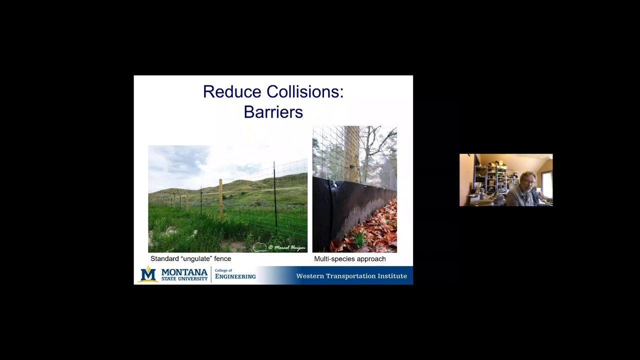
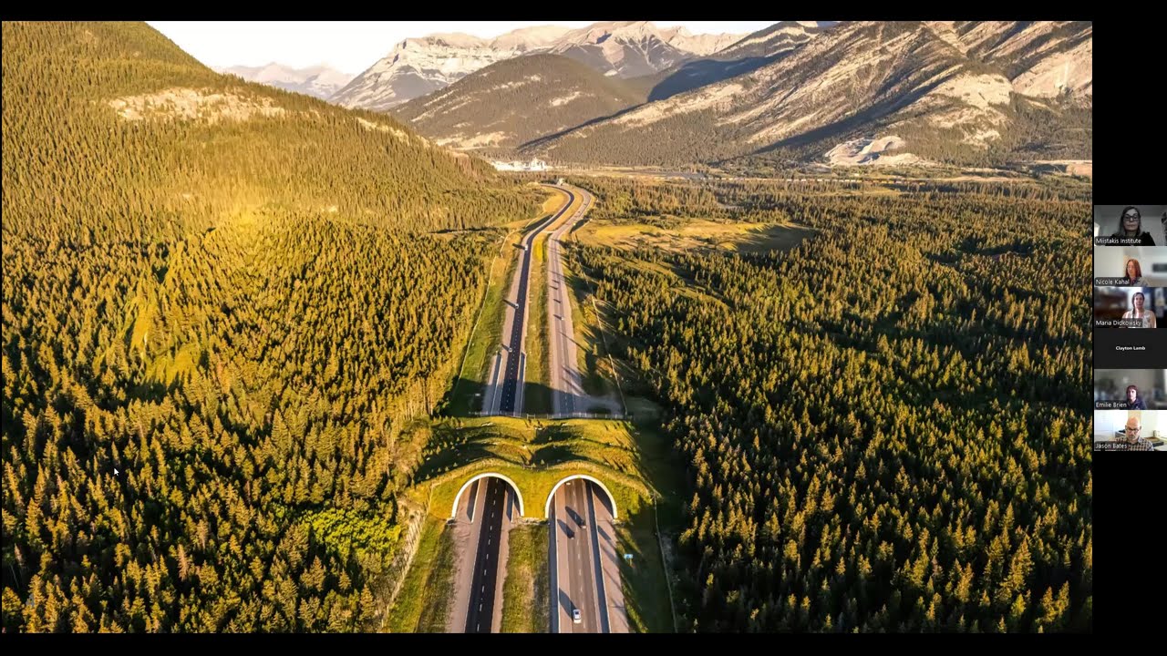
so you know 7:00 or 8:00 in the morning and this could be similar to like clue Ani where this is a highway that gets its heaviest use in the summer when the tourists are here and in that part of the area of that part of Montana and when the Grizzlies are out and so they're very concerned about this road and and and wildlife movement and this is a study that's in progress but they who I was coming up here and it's relevant because this is now ungulates and this is a very rural two-lane highway in Wyoming and the same issue occurs that they're finding on this to where it's not the annual the daily traffic on average but it's the hourly traffic it's the gaps between cars that are actually respond the animals are responding to and this is based on they had camera setup video cameras that would be tripped when the deer approached the road and then they would film them and infrared and they have 1,700 individual animals that they're picking through the tapes to see whether they cross the road or didn't cross the road or if they cross the road they got hit and so they either had successful crossings or unsuccessful crossings and they're getting the the same kind of information that it depends on how many how big of a gap there is between vehicles which can be related to the traffic rate or vehicles per hour so the same stories happening with ungulates and with Grizzlies and these are the very first two studies and they've just come out in the last couple years so we're just starting to learn not just about sort of gross animal we're learning about animal behavior around the roads and around traffic and this is all new information that will help us consider what we need to do these researchers are able to now take that across the state using traffic data across the state and actually select priority areas based on this new information so a lot of what dense was talking about in Vermont where do you set priorities statewide they're using this kind of information in Wyoming and so basically when you have wildlife issues you have basically three types of strategies one is to change animal behavior and that's like you've heard of deer whistles that they put on the bumpers of vehicles or roadside reflectors or even these boulder fields you'll notice that if an errant car would go into a boulder boulder field it'd be a safety issue so they put them behind guardrails but that's for ungulates and it clearly not in a snowy environment because that in the winter then that wouldn't work but there they've been testing those two as ways to keep on you-let's meaning deer elk and moose and and pronghorn off the road and then you try to change driver behavior and I'll give you a couple examples of that and then finally the separation what we've saw in Banff and and on the Salish Kootenai reservation which is separate the animals from the drivers with fences and then provide crossing structures so for changing animal behavior I'll just give you one example and this is a Wyoming study where they use I won't name the commercial provider of this but they make a claim that you can get ninety percent reductions just by putting up reflector lights down the highway and the principle is your headlight hits that reflector and it then goes into the deers eye that's an along along the side of the road and they freeze and when the lights hit him in the eye and then when the car passes the lights go off and and moves again and so they actually did a really rigorous study of that and they found out that actually it's only about 32% reductions and the amazing side story of all this is when they covered the reflectors up they actually doubled the effectiveness so they actually want to announce have a study about white bags on the side of the roads and what's going on there again trying to understand wildlife behavior is quite difficult so that would be trying to change animal behavior it's very difficult the other thing is trying to change iver behavior and of course we all know this is risky so no drivers ever pull out their cell phone when they're driving right so the other way we try to change the driver behavior is say be careful there's animals out there and we put warning signs up again not very effective measures at all and then they also said well what if we just slow drivers down and so this is that project that's in progress in Wyoming on a rural two-lane highway and what they found I keep hitting the wrong button I apologize that they reduced it about 15 miles per hour and put the signs up and then they put speed guns and they hit a hit in the sagebrush and basically recorded human behavior when they hit the zone and they found that basically it didn't do anything to just simply put up reduction in speeds and what traffic engineers will tell you is that people drive as fast as the highways design for not what the science tell you you're supposed to drive so if you feel safer driving faster you will drive faster than what's posted and so an improvement on just signage to get people to slow down and then be more alert is the notion of having animal detection systems that only turn flashing lights on when animals are approaching the road or crossing the road and so they've tried many different systems my colleague at WT eyes studied over 12 different commercial systems from around the world on these break the beam or radar radar or radio or microwave beams and what they found this was out of the Yellowstone a two-lane rural highways going through Yellowstone National Park it's basically the same story that before they are no lights are flashing they go about a little under 60 miles an hour and I'll be it should be noted the speed limits 55 and then when the lights are flashing you only get about a two or three mile both in the day and and at night so basically even when you try technology to try to change the driver behavior we're not seeing very much improvement and so this is now the next generation of how they're trying to improve driver behavior to slow down and and control the collisions with wildlife and what it is is they fence to just a very narrow section of highway so there's fence leading the animals and the animals can only cross right there and they painted the road thinking wildlife would think that's a cattle grate and they wouldn't come down into you know inside the fence part of the road and get hit and one is there's a study now on the striping of a highway and wildlife basically ignore it and then they only turn these lights on during the migrations so these lights would only be on not when they detected an animal but for a month in the fall and a month in the spring and as you can see that only got about a 40% reduction using that but in Arizona they used a animal detection system on a gap just like that and so this time the lights would only turn on when an animal went through that very narrow gap and it was amazing that that because of the the lights were very reliable they basically were only on for that for a three minute period when they detected an animal moving across there they got a 97% reduction and the way they kept the animals on the from coming down the road is they use this electrum at and so they bury the electro mat on both sides of the crosswalk and so they couldn't get down on the inside of the fence and so this is a very promising new new technology that other states are now picking up on and I don't I don't think they've tried one in any of the provinces yet and of course this is the the last one I'll give you as an example is we're hoping that the technologies on board vehicles are going to help drivers react to vehicle but to wildlife on the road and these are existing commercial systems I don't know if anyone has a Mercedes series s but you have it on your car I believe so maybe you could do a testimonial after during the question it varied but basically it just helps detect those animals in the dark of night and hopefully then you would be able to avoid them and then lastly now we're hearing about self autonomous vehicles so they have to be able to detect pedestrians bicyclists and they're going to be able to they're definitely developing the artificial intelligence or software's that will help pick up large animals the issue with all of these large animal focuses that doesn't protect any of this the small animals it's only going to pick up the the ones that are a safety issue to motorists and so the last strategy is separate the animals from the motorists and this was from our national study that we published and in a journal article as well but you could see that these are all the things that we're trying to change animal behavior or try to change driver behavior and what we found was it was always all the papers we could find on it or even gray lit grey literature was that it was fifty percent or less so they weren't very effective however when you got into using the fences and this animal detection systems promising and all of them have fence and then they that means the animals can't get onto the roadway and then to maintain the connectivity you have to basically provide crossings for them and that's infrastructure that's the underpasses or the overpasses or the animal detection systems are at great for the the two-lane highways and so that's why a lot of the focus in North America has been on these overpasses and underpasses they're basically being built by almost every state in and every province in the West Western North America and they're being implemented all over the world as well and the nice thing is you can also build crossings for the smaller animals and it's really relatively inexpensive to to do this and some of these are for badgers and salamanders and then for small mammals most highways have culverts that are passing water anyhow and so what you do is you put shelving in there and small mammals will use this shelving this was developed by a professor at the University of Montana and Roscoe Steele now provides these two transportation agencies everywhere to provide that dry dry spaces for for small animals and this is an example of a successful set of small crossings for large toad salamanders and to National Park what was happening was on the entrance road during the salamander migrations out of the pools into their breeding grounds they in mass would cross that entrance road and it was actually the visitors who were squishing him basically running them all over and you know taking nearly half of the population out in some years and complained and so then they developed these four or five three four of these crossings and now they're down to just you know very even though the populations fluctuate every year the percent of that population now that they have these little systems in smaller systems and has reduced the kill and then they have little little fences about that high that guide the animals to the crossings and the other thing they learned on on again we're just learning so much new things as when they did solid pipes they weren't getting much use but when now they have a great that allows light in there as well and as soon as that was put in the salamanders have been using it in mass so we have so many species we just don't quite know everything about yet but innovative innovations occurring all over with different people trying different things and so the other big the biggest thing that the whole world actually Road ecologists all over the world it's bamp that's sort of like go to Canada you gotta check that out that's the best system and it's so tony has published so many papers on it and so you can see that there were over 44 crossings built and they were of all different types so it was quite an investment if you're gonna twin a highway through your national park they had to maintain park integrity and no one knew back in the 80s when these that were built if they were going to work but they they did find that the animal the the what they had to his cameras on every crossing that when there was animal movement it would click so that's how they were counting wildlife crossings and then they had track beds in the early years and they found that the the numbers of crossings recorded across all of the different infrastructure was relative to the population of the animal in the park so of ungulates deer deer were the most numerous had the biggest population they also had the biggest recorded crossing so that was quite comforting to know that all the large mammals were basically using an in proportion to their relative population size but they did find and this is where they compared the overpass to the nearest underpass and so they only had that this study was done when there were only two overpasses and they looked at the two under passes next to him and they found that there was actually preferential use depending on the species where the moose and the Grizzlies loved the overpass and many of the miso carnem carnivores like Cougars and coyotes and Fox and black bear were quite comfortable using either on the overpasses or the under passes the other big thing that when they built them at first they said oh my gosh if we just fence to just the crossings all the carnivores are just gonna wait and camp out right and then here come all the deer and the elk and it's moose but they published a couple papers on this and to debunk what they call the prey prey trap hypotheses and I think in the first 17 years the only camera trap picked up one cougar killed the deer in an underpass and that was it for the whole time so they basically just this great concern and you hear this all around the world like tigers and Asia or you know whatever your biggest predator is that they're always going to wait at these crossings and so these papers have been quite useful coming out of band and then the whole notion of the animals feeling comfortable using these new structures was demonstrated by Tony as well and so these are a couple the moose and the grizzly bear and you look at the original years after after they built the structure and closed the fencing to the structure most PhDs are three years right so if they would have put a PhD candidate on that the story would have been these aren't very successful at all but Tony was able to stick it out for decades so we even have longer graphs than these now and what what basically has happened is they've come up here and now they bounce around but they've sort of flattened out so it is something that parents will teach their young when they go through with it and the noise we have camera footage of the noise a big truck and Rumble and they back out and things like that and then they get used to it and so these are all the different types of structures it wasn't just one type but these five different ones they could compare and this was the latest paper there that was published last year about the findings from genetic studies and what they found was not only did the the use increase over the 17 years but that the sows and the Cubs would only use just basically would only use the overpasses so they were not about to go into tight quarters underneath a highway and they liked the big open and I actually put a quote from Tony up here what he told me after 20 years in Banff he said this is the most important finding he ever had and that was if they wouldn't have put those overpasses in and would have went with what her relatively so it's about a million dollars for an underpass and the overpasses caused between four and six million and so if you would have wanted to save money and just went with under passes they would have had discontinuity because the families weren't wouldn't use the crossings at all the the under passes so by putting in the overpasses they basically made genetic continuity on to both sides of the road and then the other much cheaper thing to do of course when it comes to crossing is take your existing bridges take your existing culverts and and build fencing that guides the animals to them and this is a project at crosnes pass on highway 3 and in alberta and so five percent of the bighorn sheep were being killed every year on highway 3 at Crowsnest Pass and so what they did was they basically Alberta Transportation has now fenced to existing bridges that allow the bighorn sheep and the walk there's water but there's also terrestrial habitat as well so they can safely move on to the bridges to reduce this roadkill problem but the other good story about this was that this was a partnership that it wasn't just the Transportation Department doing it but the conservation groups got involved and Volker Stebbins the contractor that does the road maintenance contributed all the fence and so it was like a community effort to deal with a easily and it's a problem that had very sharp edges like this is 2 to 3 kilometers of the highway needed fencing and they had a couple under passes basically which were bridges in place so it didn't cost a lot of money but everyone threw together to make it happen and now yo-ho is going crazy this is like the biggest overpass ever built its clearing six six lanes of traffic but they are being creative this is actually very innovative very innovative way to build these they actually truck in each one of these ribs and then use scaffolding and then cast the Keystone so the keystone of an arch is actually cast in place once they get the ribs put and and then they remove the scaffolding afterwards and this is now complete and open to and open and and open for business for wildlife crossing on top of it but I guess my point here is that if you have issues in the Yukon with the roads and clue Ani that you won't ever have this kind of expense for for addressing issues and maybe you could work with Parks Canada could easily come up with some solutions for just two-lane highways that are much simpler less expensive but some of the parks in Western Canada because they have the trans Canadian Highway have to come up with expensive solutions to maintain the integrity of their parks when it comes to transportation and then lastly I just wanted to put in that there's an there's all the ecological arguments and then we published a paper that looked at the if you look at just the dollars and cents of it all and looked at the economic consequences and so basically we came up with and this was for in Canadian dollars we did it for both Canada and the US and the average crash for a deer is about 6600 back in oh seven 17,000 for a larger elk and of course the bigger the animal the more damage it causes to vehicle and more likely its to injure humans and so we only looked at four components of of that in the cost so it was just injury the value of the hunting value of the animal the cost to the vehicle to repair and then the occasional fatalities and there aren't many wildlife vehicle collisions that end up with fatalities just a few and then I brought it forward to today or 2017 a decade forward and you can see what the costs are so if you're having a lot of collisions and you're doing nothing you're really it really is costing motorists a lot of money to not do anything because this is what's accruing every time you get it accidents occur so actually spending what seems like expensive mitigation actually can save you money in the long run if your crash if your wildlife vehicle collision rates are high enough and I won't get into I we've run this on actual highway projects in Alberta and it all pencils out and and can pay for itself sometimes as the one we did on a three kilometer one underpass with three kilometres of fencing in Alberta outside the park system it paid for itself in ten years so basically it was saving a hundred thousand a year in the cost of quiet life vehicle collisions even though it costs you know three million dollars to build or something like I don't have all the numbers in front of me the point just being that sometimes we look at just the ecological arguments and once we came up with an economic thing a lot of the transportation engineers are starting to look at the economic values as well which helps justify if that's the right term mitigate what some people consider expensive mitigation and that it actually will pay for itself over time so so that's what I just wanted to wrap up with there so thank you very much thank you everyone what we're going to do now is open it up to for questions so I'll have our guests sit up here and Julia will be with the microphone to pass out so so if there is any of those burning questions that you have we'll be looking for people to to ask them I just wanted to acknowledge that these folks are up here for three days we met today with some Yukon government staff tomorrow we're meeting with some INGOs and we're going to have some time with a few ministers to talk to them about this and then on Thursday we're meeting with First Nations to talk about these so these folks are doing an incredible job helping us understand this very complicated circumstance so questions but an hour before the talk they said oh my goodness I don't know a lot about it in the Yukon so I asked doctor I asked dr. Google and we have three thousand seven hundred and fifty seven kilometres of named highways in Yukon and so I asked dr. Google how many tax payers that were in the Yukon over twenty thousand sorry twenty seven thousand people filed income taxes so each of us owns about 130 kilometers of road so just put some figures into the into the time thank you I am just I have a lot of questions most of which ii asked world moving backwards in the presentation that last slide you showed the costs and no he said you didn't have the numbers right in front of you but i'm curious whether that those costs were primarily to the motorists and maybe insurance companies or did that factor in conservation officer response time and other government services that pile up when collisions happen yeah what we did was where we could get national data and tried to keep it this was our first time out so we kept it very simple we worked with an economist on this as well it wasn't just a bunch of ecologists playing with numbers but a lot of the things we didn't do like for example if you got injured and couldn't work all those indirect costs are not included in this if when it comes to threatened and endangered species or where you have program set up to try to save the species and then they're getting killed on the road we didn't include this there were so many things that we didn't include that we felt this even with the most conservative costs just four things it was penciling out on many road segments around north america that it was a reasonable investment of public limited public dollars so i hope i answered your question and that conservation values were not put into this economic look in the original study and we are about to get a grant to now update this whole thing and we're gonna do a much more complicated cost-benefit analysis to include many of these other values that does answer my question thank you hi good evening I'm often on on the road and I'm driving often and I see lots of trucking so my what I notice on the big trucks they have huge fans you can gather maybe three moose in there but what I'm saying how do we know if a trucker decided to stop and report it's always a question I say well those guys have time do you have interests they care they don't care so it's all dudes kind I'm looking and see how often you see animals but you don't know well if it's a car well it's not there but it could be so many trucks I see you look in the back and have five plates and they they come from far far away so it can be we don't have many segments of road so it's part of the equation of how you calculate who is from where and anyway thank you yeah well I think a couple of points from from what you said one is that trucks have a lot harder time slowing down so we were just talking you know there are a number of examples of trucks taking out not one animal but six or seven or eight animals all in one time you know as to whether they report it or not unclear whether they do report it or whether they don't report it I think what's more important is that people who you know oftentimes most often actually when an animal gets hit it runs off the road and dies off the road and so we know that when we're counting the number of dead animals along the road that it's a serious undercount no matter what and I think you know that's that's just the reality of where we're at there are some studies and really focal areas where we'll have people walking transects off the road to find that roadkill but that's pretty rare and I'll respond on two components of it one is semi the big trucks it's not a safety issue with them they can just mow through and so there's not the incentive to slow down like there is for you and me in an automobile and so outside of Yellowstone semis plow through bison and don't slow down because it doesn't dent their vehicle or anything so but we've seen five bison get mowed down by a semi-truck another you know these are individual stories but one trucker killed 22 baked horn sheep one truck and they interviewed him I saw it in the paper and he said well I wasn't concerned for my safety and it's not illegal so you know that's just what it is it's not illegal so that's one concern the other is data and and this under reporting of data and there was a recent study that came out it's Virginia but nonetheless they looked at the law enforcement records so when your Highway Patrol I know RCMP I guess it would be records a collision they have to say what was the cause of the collision and that's when they'll record whether it's wildlife or not well some researchers went in and then actually collected data and compared it to their State Highway Patrol and the Highway Patrol were under the underreporting was six times less than what was really happening on the roads so so the the data is a big issue because if you don't have numbers to show that's a problem then like I say on that one highway where there were no collisions if it becomes a barrier it's not a problem either so there's two of two things one is the animals getting killed on the road and the second one is if they're not even trying to cross the road and we need to get good data on both of those to help support the mitigation of our roads okay well we suddenly have a lot of questions if you've already asked a question I'm gonna say I'm gonna go to someone else so let's take someone from this side of the room considering insurance companies they're big companies right and we all hear about the lobbying effects in the States I don't think candidates pay as much but with the with the losses that the insurance companies are seeing are they putting any any effort or any help into lobbying government to put or transportations to put animal Crossing's or some kind of medication in place in Canada some of the provinces do their self insurance is that correct like British Columbia has sort of a provincial insurance pool I don't know how to describe it perfectly in the US it's all just private and I think in some provinces I don't know what it is here in the territory is it just private providers right in British Columbia where it's sort of the government's in charge they actually have are using their information and trying to deal with problem areas in the US where it's all privatized they just change the rates so some of the states that have the worst problems have no mitigation at all I think what's happening and that tends to be in the East East where white white-tailed deer are have high higher populations right now so it's like Pennsylvania and Minnesota those are the states with the highest according to State Farm Insurance highest rates of collisions with wildlife out west because I think like here we have our conservation values so I think ours are our transportation agencies I want to frame this appropriately feel like they can do this because they get public backing and so some states are really moving forward Elbert is moving forward they're doing their first Southwest Elbert is doing a complete study of the whole area to figure out where their corridors are where their crashes with wildlife are and then coming up with a priority to to mitigate those hotspots and so it depends it's it's it depends almost on every province and every state is acting independent of each other but there are some real progressive provinces and states out there okay I think Mike do you think we have time for like one or two more okay hi there my question I guess is kind of in relation to mitigating road maintenance especially here in the Yukon in the wintertime seems to be a sort of higher road kill rate and I'm just wondering if there's been recommendations for mitigating that including even plowing I know in certain areas like along Highway 16 with maybe higher snow falls down BC you know it was often difficult for you know most say to get off the road because you know banks are too high so I'm wondering you know one in regards to salt and if there's other other things that are being used here on the roadways maybe it would keep you know wildlife from coming on the roads in the first place but also just recommendations to to maintenance companies you know I was in Jackson and I want to say it was last winter but I've sort of lost track of time and they had a huge amount of snow and they were actually seeing animals starved to get to death but also animals were getting trapped on the road because they literally couldn't climb the snow banks out and in those kind of situations the only thing that can happen is self policing of community and so the community sort of his self shaming other people in the community and putting out like handmade signs getting people to slow down because they they knew that those wildlife were trapped so that's a the only situation that I can think of an in that particular circumstance I understand here actually assault is a major component of what's used here because it's so cold it's mostly sand and so that's probably not a major attractant for a wildlife but they do often look for easy places to walk and so that's just a that's just a basic conflict issue and I think given that this is not a high tourist industry in the winters as much as it is in the summer I think you do you do have an opportunity if it's a community value to actually sort of change the way that people are driving from summer into winter and that's that's the only thing that I can come up with hi um Jodi in the beginning of your talk you said that not many roads are decommissioned once they've been built I'm just turned a lot onto that not many can you think of any or can anybody think of any jurisdictions that are really good at decommissioning like resource roads or anything like that there certainly are examples in fact why why with I think it's something like 60 partners in the the British Columbia Montana trans boundary area we worked on closing roads and what I would say about that in that particular experience is one we did we worked on a number of regrading experiences like actually trying to fix the road and recontour the road it is expensive it is really really hard to restore a road to normal also we put in barriers like plugged in huge rocks people came with their private tractors and we watched them remove the rocks on camera and they built roads and cut down trees to get around those barriers it's very very hard to decommission roads elsewhere in Alberta they've been doing some work restoring some of the the network of roads in sort of the cakwe area and again you know in some places they're having some success very expensive in other places you know that restoration work might take hundreds of years to do so it really you know I think I think it's it's it's not that you can't do it it's just it out there isn't often an impetus because often once a road gets build there are multiple users who want to use it forever and to to actually remove the road and get it ecologically functional again it's hard to do around 9:00 so we're a few minutes into there I just wanted to say again to these fine folks thank you very much for bringing your skills and knowledge so on behalf of the Yukon Conservation Society thank you for sharing your time if you aren't a member please buy a membership on your way out and we look forward to connecting with you in the future and this is a topic that we're certainly going to be interested in following along as an organization have a great evening and thanks for coming out everyone
Up Next

30:42
Australia's Fence Network: Ecological Impact on Wildlife
@WATOP_VIDEO
712.9K views•2023-12-29

12:54
Triumph of Orthodoxy Icon: Byzantine Art & History Explained
@BenCallan
2.1K views•2024-08-06

9:49
FastAPI vs Flask vs Django: Choosing the Right Python Web Framework
@TechWithTim
302.5K views•2024-05-26

1:42
Game of Thrones Opening Credits: A Cinematic Analysis
@gameofthrones
46.3M views•2011-04-18
Related Study Plans & Knowledge Roadmaps
Structured learning paths in General & Interdisciplinary Studies
general-studies
Elevator Engineering: History, Physics & Cities
01From Hoists to Safety Brakes: The Dawn of Vertical Lift
02Hydraulic vs. Traction: The Engineering Physics of Elevators
03Modern Speed, Safety, and Algorithms
+ 2 more learning modules
12h5 modules
Explore Roadmap
general-studies
Rubber: Material Science, History & Geopolitics
01Origins of Natural Rubber & Mesoamerican History
02The Chemistry of Natural Rubber & Vulcanization
03The Geopolitics of the Rubber Boom & Colonization
+ 2 more learning modules
12h5 modules
Explore Roadmap
general-studies
Containerization: Evolution, Logistics & Trade
01Ancient Trade & Bulk Cargo: Amphorae to Barrels
02The Industrial Revolution & Cardboard Packaging
03The Containerization Revolution: Malcom McLean
+ 2 more learning modules
12h5 modules
Explore Roadmap
general-studies
Textile Tech: Evolution, Labor & Global Impact
01Pre-Industrial Textiles: Handloom & Cottage Industry
02Mechanization: The Spinning Jenny to the Power Loom
03The Factory System & Global Labor Transformation
+ 2 more learning modules
10h5 modules
Explore Roadmap