



![Sistema Bentônico (Aula 1, parte 2) [Oceanografia]](https://i.ytimg.com/vi/EUIgf5kH6Zs/hqdefault.jpg)








![Climate Change & Coastal Erosion - The Great Ocean Road [Climate Science & Coastal Impacts]](https://i.ytimg.com/vi/VoiWv9gGlWY/hqdefault.jpg)

![[Nature's Returns] Valuing Nature: Models of Ecosystem Valuation in Environmental Policy](https://i.ytimg.com/vi/HHg-ybWCBiQ/maxresdefault.jpg)


Coastal ecosystems including salt marshes, kelp forests, and mangrove swamps provide essential services such as carbon sequestration (blue carbon), shoreline protection, and nursery habitats for marine species, but face significant threats from sea level rise, coastal development, pollution, and climate change; scientific research combining long-term ecological monitoring, remote sensing, and local restoration efforts is crucial for understanding these dynamic systems and developing effective conservation strategies.
Coastal Ecosystems Science: Vital Coasts Explained | WHOI
Added:Basic understanding of marine ecology, including how biotic and abiotic factors interact within aquatic food webs.
The concepts of photosynthesis and primary production in marine plants, salt marsh grasses, and macroalgae like kelp.
Fundamental knowledge of coastal geography, including tidal dynamics, salinity gradients, and the difference between estuarine and marine environments.
An introductory understanding of the global carbon cycle and how ecosystems absorb and release carbon dioxide.
The concept of 'Blue Carbon' and the advanced science behind carbon sequestration in coastal marine soils and biomass.
Practical methods in restoration ecology, including mangrove reforestation techniques and the cultivation of resilient kelp forests.
The specific impacts of ocean acidification, warming sea surface temperatures, and sea-level rise on coastal boundary zones.
Ecosystem services valuation and the environmental policy frameworks, such as Marine Protected Areas (MPAs), used to protect coastal zones.
536 views22likes1:14:55Original Release: 2026-03-05
[music] [music] [music] [music] [music] [music] [music] Heat. Hey, Heat.
[music] >> [music] [music] [music] >> Hello everyone. If you've tuned in for Woods Hole Oceanographic Institutions's Ocean Encounters [music] presentation, Vital Coasts, you're in the right place.
Joining us tonight [music] are three coastal scientists, Amanda Spiebec from the University of Georgia, Andre Ravi from the Smithsonian Environmental Research Center, [music] and Tom Bell from right here at Woods Hole Oceanographic Institution. Stay with us.
Everything.
>> [music] [music] >> Heat.
>> [music] [music] >> Hi everybody. If you've tuned in, uh, in just a few minutes, we'll get started with Woods Hole Oceanographic Institutions's Ocean Encounters presentation, Vital Coasts: Life at the Edge of Land and Sea. We've got a lot of people joining us tonight, so thank you for your patience.
Hello. You've joined Vital Coasts, a Woods Hole Oceanographic Institution Ocean Encounters presentation. We have a lot of people joining us tonight, so please bear with us. We'll get started very shortly.
And now, please take a moment to read Hooie's land acknowledgement.
At Woods Hole Oceanographic Institution, [music] science reaches beyond the waves, bringing us together for a common purpose.
From the skies to the deep sea and coast to coast, we find solutions that create jobs, keep us safe, and preserve precious resources.
Because ocean knowledge is human knowledge and working together to advance understanding of the ocean makes life better for everyone.
It takes all hands on deck to protect what matters most now and for future generations.
Together we can [music] sustain the ocean science that sustains us all.
Join us.
Welcome to Ocean Encounters, a virtual series from Woods Hole Oceanographic Institution, or HOIE as we like to call it for short. Tonight's event is Vital Coasts, Life at the Edge of Land and Sea. My name is Vinique Lapra. I'm the host of Ocean Encounters. HOIE's public event series is now in its eighth season and is once again an endorsed activity of the UN decade of ocean science for sustainable development. If you've tuned in before, thank you for watching. If you're new to Ocean Encounters, welcome.
I'd especially like to thank any HOIE members who are joining us tonight for your support of ocean science. You are the heroes at the heart of our efforts.
And for any viewers on the US East Coast who experienced last week's blizzard as we did here in Woods Hole, I hope you and your loved ones made it through the storm safely. And I'm so glad you could join us tonight. Before I introduce our speakers, I want to let our Zoom audience know that they can participate in tonight's live conversation. If you have a question for one of our panelists, please use the Q&A button at the bottom of your Zoom screen and type your question in the little window that appears. You might be more familiar with the chat function in Zoom, but tonight, please use the Q&A button instead. We often get hundreds of questions, so I apologize if we don't get to yours while we're live. You can ask questions anytime, starting now. I'd also like to remind our Zoom viewers that Ocean Encounters has live American Sign Language interpretation. To enable the ASL feature, please click on the interpretation button at the bottom of your Zoom screen.
And I want to let you know that we are recording this event. We often get questions about that. The recording will be made available after the show on the hoie.edu website. We had more than 1,600 people pre-register to join us tonight.
So, you are in very good company. We also have viewers joining us right now on Facebook and on YouTube. To everyone, thank you and welcome. Let's get started.
Coastal ecosystems are vibrant places, protecting coastlines, supporting diverse marine life, and helping regulate Earth's climate. They also face a number of threats. Examples include rising sea levels, marine heat waves, and coastal development. Tonight, we'll hear about salt marshes, kelp forests, mangrove swamps, and more, and the science that's helping us understand and protect these remarkable environments.
Right now, let me introduce tonight's speakers. Andre Rovi is a coastal wetlands ecologist. He works at the Smithsonian Environmental Research Center, or CIRC, where he also directs the Coastal Carbon Network. Circ is in Maryland, but Andre's research takes him all over the world. Next, we have Amanda Spivac. She's an ecosystem ecologist and biogeeochemist who works at the University of Georgia. Amanda also co-directs the Georgia Coastal Ecosystems long-term ecological research project, which is one of more than two dozen such long-term data collection efforts supported by the National Science Foundation.
And lastly, our own Tom Bell. He's a coastal ecologist right here at HOIE, although much of his research relates to the ocean off the west coast of the United States. Welcome to all of you.
Let's start by having each of you um introduce our audience to the kinds of coastal ecosystems you work on. Amanda, why don't you get us started and then Andre and then Tom.
>> Sure. So, thanks for having me. I work I've worked in seagrasses, mangroves, and salt marshes. I'm primarily working in salt marshes now. Um, my field sites range from the Gulf of Mexico to the Gulf of Maine. Uh, and a lot of my work right now is along the South Atlantic bite and this lovely marsh that you're looking at here. Um, this is one of our sites um for the Georgia Coastal Ecosystems long-term ecological research project which Verinique mentioned that I am co-director of.
>> All right, Andre.
>> Yeah. Hi everyone. Thanks. Uh, great to be here. Uh so I work mostly mangroves and and salt marshes. Um I do research related to carbon cycling in those uh coastal ecosystems. Um the shots that you're seeing in the background is some of the mangrove sites that we're going to be seeing today in Florida. Part of a partnership that we have some uh military installations. Uh we're try to help those installations to uh understand how those coastal wetlands pro provide protection in our ecosystem services. Um most of my work has been done in in some sites in Brazil, in the US and uh also some international sites like in Panama, Costa Rica and Vietnam.
So we're always trying to look for opportunities to work in in different parts and collaborate with uh folks and make new uh mangro friends around the world.
>> All right. And Tom, >> hi. Uh thanks everybody for coming again. My name is Tom and I study kelp forests. um like the ones you see here that floating kelp on top of the at the floating at the surface of the ocean.
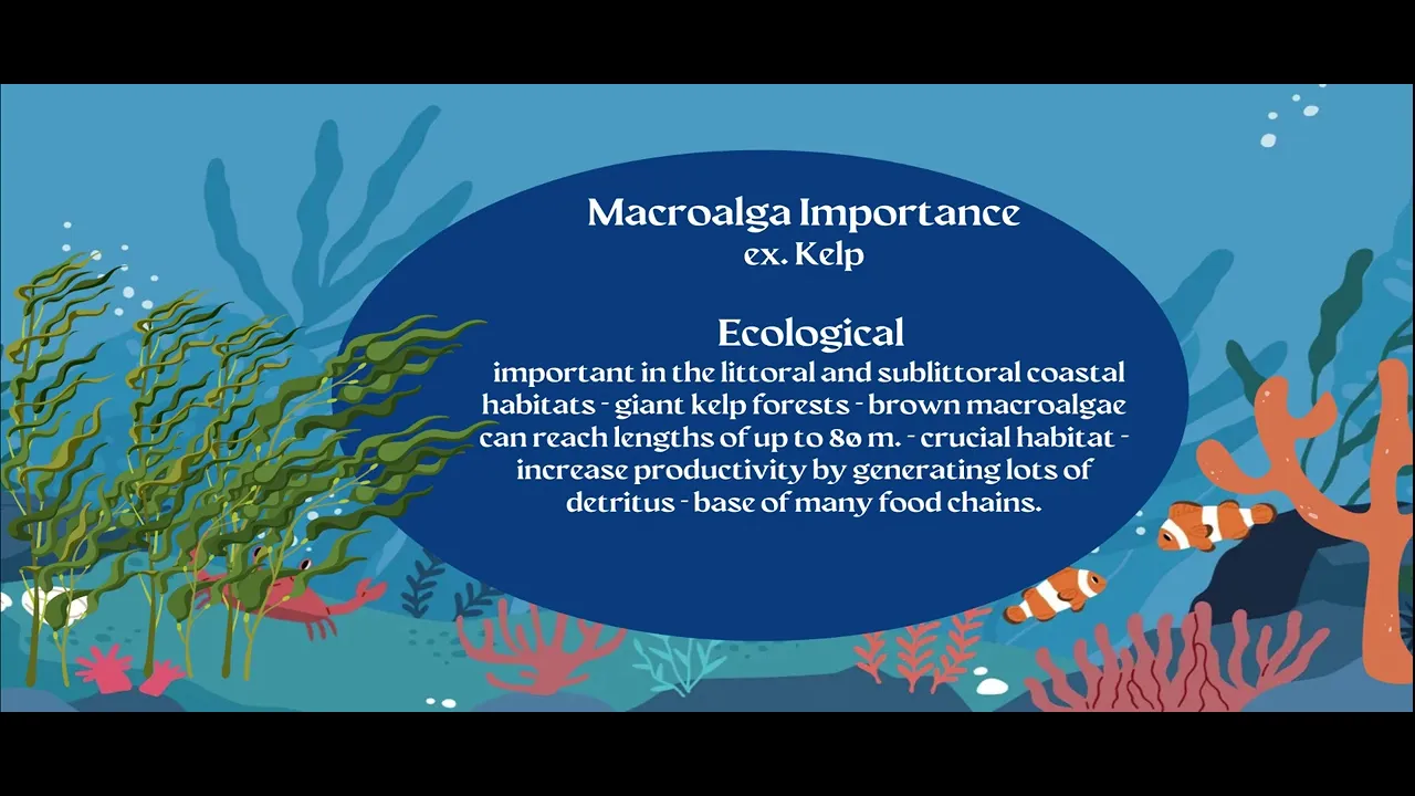
And so kelps are large brown seaweeds that form underwater forests on shallow rocky reefs. Um and some species like giant kelp, which you're seeing here, grow all the way to the surface forming this uh uh dense floating canopy. Um and today I'll be focusing on these canopy forming kelps tonight. And so kelp forest grow in these nutrient-rich cool coastal waters.
um off the coast of California, Alaska, Chile, Argentina, South Africa, and New Zealand.
>> All right. And why are kelp forests important? What do they do for the ocean and for us?
>> So, kelp forests really act as the housing and infrastructure for the nearshore ocean. Um, so a lot of the kelps that I study, like the ones you're seeing here, um, are attached to these shallow subtitle um, rocky reefs and then they buoy themselves up to the surface to create this floating canopy.
And this structure that it creates throughout the water column supports hundreds of species of fish, crab, sea stars, snails, and other invertebrates.
And they all really depend on that structure. Um, kelps like the giant kelp are some of the fastest growing organisms on Earth. They can grow tens of centimeters a day under good conditions. Um, and these high rates of growth and productivity really fuel coastal food webs. And so this productivity sustains commercially important fisheries like the red sea urchin, red abalone, spiny lobster. And so healthy kelp forest really support both ocean biodiversity and coastal economies. Um, and then increasingly kelp is farmed for food as well. So, we have a lot of sugar kelp aquaculture in the Gulf of Maine. And on the West Coast, like we're seeing here, wild canopy uh is harvested as feed for onore abalone farms.
>> And kelp can grow really fast. I can't remember if you said that.
>> Yeah. Yeah. It can grow up to, you know, over a foot a day. Um with nutrient conditions, uh if the water's cool and nutrient-rich.
>> That's amazing. Um Andre, what about mangroves? Uh why are they important?
>> Yeah. No, that that was amazing. It just blew my mind to see all this footage about the kelp. They're such an amazing ecosystems. I can't wait.
>> Yeah, I I got to dive in kelp in California a long time ago, and I was so surprised that it was as that the life there was as colorful as on a coral reef. It was really spectacular.
>> Now, now seeing those images, I just can't wait to maybe buddy up with Tom and and go dive [laughter] anytime.
>> Uh well, mangroves are pretty cool, too.
So mangroves are pretty important for a number of reasons like uh one hot topic at the moment is um for once you can see their global distribution. So are pretty much everywhere between the tropics um and and sometimes expanding a little bit into the subtropic and warm temperate uh zones.
Uh they're they're pretty important for um you know sequestering tomospheric carbon. So they take the CO2 from the atmosphere through photosynthesis and then they built those amazing networks that you see in this image. That's a mangro forest in Costa Rica in in in one of their uh national uh parks called Terabase. And that's a work that we've done that that was passed that was funded by the the forest service to understand like the role of those mangros in in the coastal in the global coastal um carbon cycling.
>> And for people who may not be familiar those are the roots that we >> those are the roots. That's right. Those are the roots of those trees. Those those trees are about like 40 meter aboutund and something uh feet tall. And it it's a very large tidal system. So you can see the darker part of the roots kind of like below our our foots, our our legs. It's kind of darker. That's the mark of the high tides. Uh and in the bottom uh right on the on this image, you can see a little bit of the mud. So that's how much the tide goes up into those systems uh twice a day. And uh so yeah they they convert the CO2 into into biomass. They build all that wooden structure above ground but they also build a lot of roots below ground and um once the organic matter is produced in those systems because they're water logged the decomposition is really slow. So that organic material that was produced is just stay in those anoxic or with very low oxygen level soil. So that material stays for a long time before it being being degraded.
They're also important u in in terms of coastline. You can see in that image right there u that was actually a snapshot of a video but you can see the water uh when those those forests are flooded uh in one of our collaborators trying to escape the the waves that roll inside the mangroves and you know avoiding getting all wet but they're amazing at protecting shorelines against this uh wave energy because of this network of entangled roots. They really uh dump down that energy. Some recent studies suggest that you only need about 100 ft of mangroves to reduce wave heights by about half. So they're really important to protect uh coastlines um infrastructure uh you know cities and harbors and and you know um military installations like I said for the projects that we uh work and and really really hold the tide back if you will. They're also like really important as nursery. They are nursery grounds for a myriad of of species like kelp like uh like Tom you know you know showed in in his images. If you go to a fish market somewhere around the world like between you know 70 to 90% of the species that we eat that are commercial that are commercially sewed. they have utilized mangrove ecosystems as well as salt marshes um in kelp forest but they have utilized mangroves for at least like one other um you know phase of their their life cycles. So you see a lot of juveniles in this video like that's a baby barracuda um and you know several species that just use those habitats and without them uh we would be in trouble. It's a matter of like you know national security, food security because of the protection that they provide and also nursery grounds, biodiversity maintenance, livelihoods, coastal communities and and so on especially you know uh thinking about the climate mitigation aspect as well.
>> Yeah, you talked about how mangroves uh store atmospheric carbon in their biomass. Sometimes that's referred to as blue carbon. We'll talk about that more in a bit. Amanda, I know uh salt marshes do that too. Uh tell us about them and what other services they provide.
>> Yeah, so salt marshes have a lot of the same important ecosystem functions that mangroves do. That looks like a grassland, but they're actually really complicated because of the way the tide moves in and out. And they have all these anoxic soils that and they're really good at storing carbon. Because the tide comes over the marsh and then back out, it provides habitat connectivity for a lot of commercially and recreationally important species.
And so animals will actually come up on top of the marsh during high tides and feed. And then on low tides, they'll move back out to coastal systems. And one thing that's really cool is that seaggrasses, marshes, and mangroves are actually a continuum. And so organisms will move between these different ecosystems as different phases of their lives in order to feed. Uh and so the connectivity between the systems is actually really important for our coastal food webs.
>> Interesting. All right. So I want to take a brief pause to hear from our audience and whether they have any questions about the benefits provided by coastal ecosystems. Uh my colleague Sam Harp is behind the scenes uh fielding the questions tonight. Um I know he's been having some technical difficulties.
So Sam, are you able to come on and talk to us?
>> I believe so. Can you hear me? All right.
>> Yep. You sound good.
>> Great. We've got a question from Kim who is currently circumnavigating the globe on a monohole sailboat. She's writing from New Zealand at the moment and she asks, "Are there things that we can do as we travel to support protection of these important ecosystems?
And are there citizen science projects that are helpful for us to participate in?
>> Anybody want to field that?"
>> That's a great question. Um, and there are different citizen science projects and there are different ways you can get connected with things. Uh, I don't have the website off the top of my head, but I know there are different ways you can get involved. Um, and in terms of citizen science, one thing that that we do is as part of the Georgia coastal ecosystems is get folks involved in sort of monitoring where the high tide line is. And so, is that changing in a community? um you know our local coastal communities.
>> All right. Well, let's >> Andre, I was just I was just going to add there that you know like sometimes just like during travels if you're just documenting like taking pictures, you may take that for granted, but you know like a lot of like species are rediscovered in different ranges. Uh for example, mangroves have been encroaching to higher latitudes. So encoder areas and uh a lot of those occurrences like come from pictures taking people taking pictures uh for example there's a there's an app called I naturalist that you can upload your pictures to and you know it goes with like the geographic location um and like Amanda said there is a a myriad of programs that you can contribute to um yeah so don't don't don't ever take for granted like those those records that you can especially photographic records those can be amazing for informing and helping moving science at local, regional, and even global levels.
>> All right. Now, I'd like to switch gears a bit and have you all talk about your science, what you do, and how you do it.
Amanda, take us back to the salt marsh with you. What kinds of questions are you trying to answer, and how do you go about doing that?
>> Sure. So, one of the main things that we're trying to understand is how coastal ecosystems and salt marshes work. And we do this by mapping how energy flows through the system almost how energy would or electricity would move through a circuit. [snorts] And the reason why we do that is because if we understand how a system functions, then we can diagnose when things go wrong.
And that can help with restoration and management plans.
>> [snorts] >> And right now a lot of our work is focused on these soil cores that you're looking at right here. We're thinking about how wetlands are building soils.
And the reason why this is important is because these salt marshes and mangroves will grow vertically in the title frame.
And that's one way they can keep up with sea level rise.
>> So they'll actually build their own soil to raise their >> Exactly.
>> Okay.
>> Yeah. So almost like a tree grows out, a salt marsh and a mangrove grow up.
>> Interesting.
All right. Um >> and >> yeah, go on.
>> Sure. So we do this work in a couple of ways. So we base what we do by observations in the system, right? So we can go out and we can characterize the plants and the animals and the soil and the water chemistry. And then this can lead us to some questions like why is this system doing better than that system? [snorts] And then we can take our samples and our questions back to the lab and we can develop more hypotheses. And then from that we will develop um some more specific lab experiments. And this will allow us to test specific mechanisms to better understand how an ecosystem works and how energy moves through the system. And so what you're seeing here is one of the folks in my lab working on uh an experiment that we did last year. And um then we take the data that we learn from these experiments and they give us information on a molecular scale about how ecosystems function, how carbon is moving through them. And so this is a really powerful way to basically understand how these systems tick.
[snorts] lab experiments. Oh, like this figure, this picture here. This is um from a soil. This is a scanning electron microscope image of a soil. So, this helps us understand how these soils build. And then we take this information that we uh learn in the lab and we know that there's some caveats because the lab environment can be pretty artificial. [snorts] So, we have another tool called a misocrained lab but more constrained in the field.
And then with this approach, we can combine our field observations, our lab experiments, and our misoc experiments like this one. Um, this is a marsh organ, and we're testing how these plants are >> a marsh organ, you said.
>> I did. Yes. So, a marsh organ. So if you think about a an organ like in a church like an instrument in organ and you have pipes at different heights we can basically do that with PVC and plants and then we'll put it into the title frame and then the the pipes or the PVC at the lowest levels that could represent a future sea level rise scenario whereas the highest level >> because they're getting flooded more.
>> Exactly. they're getting flooded more and for longer periods of time where those at the top are flooded you know kind of at today's rates or historical rates.
>> Um so then we combine the information from our field observations, our misoc experiments and then these field uh uh experiments uh and that helps us understand how carbon and energy are moving through these systems. and we're using that to better understand how soils are building and how our marshes might keep pace with sea level rise today and in the future.
So, that was all your own research, but you also, as we said, co-lead the Georgia Coastal Ecosystems long-term uh ecological research site or LTER as it's often abbreviated. Um, tell us about that and and why uh why are long-term studies important? What can they tell us that shorter term studies can't?
>> It's a great question. So, the LTER or long-term ecological research network started in 1980 and we have 26 sites, I believe. And as you can see in this map, they're distributed from Antarctica to the Arctic, from the uh Pacific Ocean all the way over to Puerto Rico. And so, they're in lots of different environments, but we study several core areas together. And so we're collecting similar bits of information from all these different environments. And what that does is it help us to better understand the rules of how ecosystems work. And so we can synthesize this information and that helps all of us in understanding ecosystem ecology. Um and that can inform, you know, things like management, stuff like that. [snorts] The reason why long-term data is so important is because we can think of these sites as sentinels. We have, at least in the Georgia coastal ecosystem site, 26 years of data. And so we can start to see the signals of warming temperatures, sea level rising. What you're seeing here, this is uh our field station at the UG Marine Institute uh on Sapalo Island. Um and this is sort of our home base, and we uh work out of here to collect this data over a long time. But the long-term records at GCE and all the other LTER sites really allow us context in order to detect signals um that we might not be able to see in shorter term studies. [snorts] >> And Tom, I know you're involved in a different LTER. Tell us a little about that.
>> Yes, if you look all the way down um to Southern California, I'm involved in the Santa Barbara Coastal LTER. Um, and what we mainly do there is track uh how kelp forest ecosystems respond to events like large wave events, marine heat waves, El Nino events, which could be both storms and high temperature water events. Um, and increased nutrients through coastal upwelling. And you know, with this long-term view of the system, we've been operating since uh about 2002. we're able we're able to like really establish baselines to separate long-term trends from normal seasonal changes. Um, and that's important especially in coastal systems which are affected by these kind of longerterm decadal climate cycles like El Nino or the North Pacific gy oscillation. And importantly, we are able to catch rare but important events like se the sea star wasting um event that happened in 2013 as well as the large marine heat wave events that happened between 2014 and 2016. All right, we'll talk more about those in a bit. Um, first Andre, let's go to you to hear about your work on mangroves. Uh, you said you have some projects with the military.
>> That is true. Yeah, we have a couple projects that are uh supported by by uh the department of defense or or department of war has a program called startup. Um it stands for a strategic environmental um development research and um under this program we partner with two military installations in Florida. One is in Tampa MD Force Base and then the other one is in in Q West Naval Air Station Qest and what we're looking a lot of the research that Amanda you know laid out like overlaps like we we actually work together under the Coastal Kim Network which I'll talk about that in a in a second but we're part of the same working group and um and so so a lot of that applies to the you know when you look at mangroves and marshes they swap each other based on you know the their global distribution.
So basically they're equivalent ecosystems in terms of occupying intertital flood planes. So what we do in those in those military installations and and you're seeing some of that you know um in this image you lay uh you're trying to account for like the sedimentation this sediment and carbon and organic matter trapping into the soil. um as sea level rise they provide the opportunity you know for for more material to deposit uh on top of the soil and and it also like um impacts on on plant productivity and decomposition rate. So you can measure that in in in different ways. So in those uh we call those mud popsicles right there. So if you um remember the image before you had that white powder that you lay on top of the surface of the marsh or the mangrove and then you come back after 6 12 18 24 months and so on and then you stick that copper you know hollow copper pipe into it and uh you pump liquid nitrogen so it freezes everything around it and make it makes a mud popsicle and then you can see the white stripe right in the middle right there um of those mud popsicles and uh there's material on top of it right uh So those are the m the material that accreted um you know ever since you laid out those marker horizons.
>> Okay >> that so that's how you can measure how fast a wetland is accreating soil building new soil relative to the flooding that it's getting whether it's like sea level rise or some hydraologic modification that was done to the coastline.
Uh so back to the military installations, we're trying to understand how sea level salinization um you know just changes in in in in environmental conditions in the the coastal boundary are influencing the vegetation, how the vegetation is responding to those changes. And we use carbon uh as a an element to trace uh that those changes. And why do we use carbon? Because if you get the organic matter in the soil and you dry uh that organic matter about half of that organic matter is carbon. If you get any pretty much any plant species and you dry you know that that that sample of that vegetation about half of it carbon as well of that dry mass. So carbon is really you know can be seen as this um indicator of structural complexity and healthy um you know it can tells you a lot about the the health of the ecosystems in terms of keeping up with environmental change. So we use carb carbon as a currency to track down uh for example is elevation being gained or lost right organic matter occupies an order of magnitude more volume into into soils relative to what mineral sediment uh would would be required. Right? So you would need an order of magnitude more mineral soil to occupy the same volume that organic matter does in the soil. So when you lose that organic matter then you you lose elevation and when you lose elevation then you make that system uh more exposed right to storm surge and hurricanes and winds and all that. So that's the the work that we're doing within the military installations to help them understand how their coastal wetlands are changing.
Like right there in the back u in the in this image you can see uh an eroded shoreline a little bit of a road that got you know already chipped away. And then to the left you can see a fenced area which is the end of the um the runaway for the um you know firefighters and all all that um sorry for the for the jets um in in you know from from in Naval Air Station QS that's where they take off from and land uh and they have the severe erosion program uh problem u well mangroves like counteract all that because they can assimilate that energy from storms and waves and surges and all that and and you know they can rebuild themselves. They they basically can regenerate themselves over time. Um so that's the work that we're trying to do with them is really try to assess the status of their wetlands and try to inform uh whether those wetlands are keeping up with change or if they're not and if they're not like then they can anticipate those threats to those military installations. There you can see a continuation of that road. It's a seaw wall, right? Mangroves uh like I said, they can regenerate, self-regenerate themselves, whereas a seaw wall has a lifetime and eventually will be gone. And you can see the erosion even under the seaw wall um um going on right there.
>> Yep.
Now, before tonight's event, you told me that your real passion though is mapping coastal ecosystems. First, how do you do that? And then how do those maps relate to tracking carbon and blue carbon and the amount of uh carbon these systems are actually taking up and storing over the long term?
>> Yeah. So um so mangroves not all coastlines are are equal, right? So there are different types of coastlines and the the the the marshes and the mangroves the way that the vegetation is going to grow um in different types of coastlines have to do which the environment in which they grow. So this image that you're seeing right there, this video shows like different colors along the coastlines. Like the purple color are delta or river dominated. Uh the the light green is uh coastal lagoons. So those are wave dominated environments and the bluish are um tide dominated environments. Uh so depending on those the relative contribution of those three forcings riverine tidal amplitude or wave energy you're going to have different types of coastlines and and that entails uh you know changing soil biochemistry the size and the sorting of the grain the amount of nutrients that get developed the amount of like fresh water um and in the you know the the the volume in the uh sediment budget as well. So plants will respond to all that and the way that they respond it's like either growing more above ground or growing more below ground right so an example that we we like to frame our hypothesis around is when you are in an environment that lacks nutrient for example coastal lagoons or carbonate right there are not that don't have like a lot of like riverine nutrient coming down to shore then plants have to get really smart and what they do instead of growing above ground they go below ground they grow up a lot roots and they produce this extra root tissue as a strategy to forage for nutrients because there's not a whole lot available. Uh but when you're in a river delta for example where you have a lot of like riverine contribution and nutrients and all that then those plants don't have to allocate much carbon to below ground tissues they can grow tall like hence that image from Costa Rica in one of their deltas. uh those trees are huge, right? They're like, you know, 40 meter, 10 and something uh plus uh feet tall. So, we travel around the world to try to capture that variability and we store this data in this uh rich database called the coastal climb network. Um where it's really a global hub for scientists around the world like Amanda and I and hundreds of other people that are part of the network. We have currently each one of those dots right there colorcoded the color the the warmer the color the more samples there are for soil organic carbon organic matter. Um so there's about 16,000 soil samples that went into this this this global um you know um um network database that allows us to understand the variation in carbon accumulation and and storage and partition between above and below ground. Um there's about 70 countries that we currently have data uh stored in there and it spans like about 40 years in data because we collect we compile studies um from different you know times so helps create baseline that information is really important for nations that are developing their nationally determined contributions uh relative to the you know IPCC and Paris agreement like what are the contributions in term of like mitigation of CO2 uh emissions from fossil fuel combustions does data can also be used to inform um you know coastal protection um um storm surge and and and and and so on. Um with the Smithsonian um I serve as the director for the coastal carbon network and then and I are part of the soil working group. We have a group that also looks at greenhouse gas emissions and it's just a great resource a great point of to meet people and collaborate uh and and you know promote like a really inclusive and and diverse research environment.
>> Great. Tom, take us over now to the west coast of the United States. How do you study underwater kelp forests and what are you finding out? Yeah. So, um on the west coast in the United States, I study cal forests really across various different spatial scales. And what I mean by that is I use um different methods depending on the scale that we want to observe. So, we use satellites to look at a whole coastline. Um we use drones to get kind of local context on the kind of think about acre scale. Um and that's what you're seeing there in the uh in the image is shot from a a drone. And then we use uh diver data for underwater processes, things that we c things that exist below the canopy that we can't see from a satellite or a drone. Um and the satellites I use most often are known as the LANCAT satellites um which have been in operation for decades. And this gives us weekly to monthly snapshots going back 40 plus years, which is enough to build a long time series of canopy change. And the key trick that we use is we don't rely just on natural color or true color imagery alone. So this >> I was say I can't really see the kelp in that.
>> Yeah. So this this this is a color image. Um it's a little brightened, but if you were flying on a plane and you took your iPhone and stuck it out the window, you know, this is kind of what you would see. Um the floating kelp kind of blends in with the dark water, so it's not always obvious. But kelp becomes much easier to to detect when you use nonvisible wavelengths. So these are wavelengths that we can't see with our eyes like the near infrared. And so we can color the near infrared as red in this imagery. Um and so water strongly absorbs near infrared light. So the open ocean still looks dark, but floating vegetation like kelp reflects near infrared uh much more strongly. So appears as these bright red blobs along the coast. And this contrast between the bright kelp canopy and the dark ocean background allows us to map where the surface canopy is and how it changes through time. And that's really the power of using these satellites. Um because they're always in orbit and taking images every few days, we can build these long time series showing where kelp is stable, where it's declined, how it rebounds from declines, and whether different regions are falling um you know, rising and falling together. Um, and there's an important caveat to all this is that satellites can really only see that floating canopy at the surface. And we can't see all the underwater forest structure um that we know is important for the biodiversity or the processes that occur below the canopy like the recruitment of juvenile kelp um or grazing by herbivores like sea urchins. And so that's where we use diver data. Um and so we use um drones to fill in these gaps of the shoreline.
So we have much higher resolution, centimeter scale resolution. So this is really useful for validation validation.
So we can fly drones at the same time that satellite overpasses um are occurring. So we can compare to make sure what we're seeing at satellites is what actually is there. And then divers measure what the satellites and drones can't. So they count species that live within the kelp forest, underwater structure, grazing by sea urchins, which are important uh kelp herbivore um and recovery after strong um disturbances.
Um and what we're finding is that kelp forests are really highly dynamic and that the physical and biological drivers vary by place and time. So what's controlling kelp forest in Northern California might be really different than what's controlling kelp forest in Southern California or any other part um of the world.
You talked about using the LANCSAT imagery to map the kelp and you're [clears throat] involved in an international project that involves mapping kelp forests all over the place.
Uh tell us a little about that.
>> Yeah, so this is uh called kelpwatch.org. Um and I encourage everybody um who's watching tonight to go take a look at it. And so it's an open public tool that we've built to make um kelp forest change visible and anyone can explore how the kelp canopy has changed through time at regional to global scales. And so using uh kelp watch you can really turn this decades of satellite imagery into maps and time series of floating kelp canopy. So you can zoom in on a coastline, click on a location um and see how kelp has fluctuated seasonally and yeartoear. Um, so here what we're looking at is you can see the kelp canopy changes year to year along the Channel Islands um, in California. And the kelp canopy is colored in these kind of yellow to blue um, colors depending on the density of the canopy. And then those gray areas you see are anywhere that we've seen kelp canopy in our 42-year time series.
>> And so this is a partnership between scientists at HOIE, uh, UCLA, UC Santa Barbara, and um, together with the Nature Conservancy and NASA. Um, and we're bringing in uh collaborators around the world as we expand our map.
So, right now, if you went on kelp watch, you'd see data from the United States, Mexico, Argentina, the Falcon Islands, Peru, South Africa. Um, and this year we're adding British Columbia, Chile, Tasmania, and New Zealand.
>> That's amazing.
>> Yeah, that's really neat. Um, and you can definitely see that the kelp is not extending as far as it has historically, at least on these islands off of California.
>> Yeah, there we've seen a lot of big dynamics um over the past 10 years or so, where some of these deeper areas offshore aren't don't have as much kelp as they did um in the earlier parts of the 2000s.
So, I've personally spent some time in the ecosystems that the three of you study, and they're not always very easy to access or to get around in. What are some of the physical challenges that you as a researcher working in these systems have to deal with? Uh, let's have Amanda go first and then Andre and Tom.
>> Sure. So, it might seem like it's really easy to get to these systems because we don't say need a big ship or ship time or anything like that. Um, and all of our sites are adjacent to land. But once you drive there, then you have to get out into the wetland. And this is a great idea. We have to shimmy down these boardwalks because you don't want to step on the marsh and disturb it. And so, you have to bring all of your gear, which can be, you know, very bulky. It can be really heavy and you have to backpack it all down and you have to do all of your work sort of in a way that is not going to disturb the ecosystem, right? Because we want to preserve it and we don't want we don't want to do damage to it. And once you're out there, it can be really muddy and so it looks like a big grass land, but remember it's flooded. And so it's very muddy. And these are folks who are in my lab and they were working out in the marsh and they clearly got really muddy, right?
It's sinky. [laughter] It smells bad. The bugs are terrible.
And once you've sunk in the mud, it's really hard to get back out. Um, and this is another group of folks here in my lab and they are collecting some sediment cores not too long ago in order to to think about wetlands that have been restored um and and how they're keeping up with sea level rise. So once you get out there, it's really hard physical labor.
There are lots of bugs uh and you know it's just hard to move around in.
>> They seem in good spirits though. Yes, this is one of those things it's really hard and then at the end of the day you're really happy because you accomplished uh something uh together and and you've got >> science you wanted to do.
>> Yeah, exactly.
>> Yeah, absolutely. Um Andre, how about mangroves? Those seem hard to get around.
>> Yeah, I mean I agree 100%. Like the the challenges are very similar. You definitely like sink a lot in the mud and to the point there's not a single, you know, like piece of your clothes that's actually Oh, there we go. Yeah.
Oh, wow.
>> That you're clean. I know you're tear waist right there. And this is like the beginning of the day, right? That was a um a field sampling campaign in Vietnam.
Um capacity building training. That's another thing that we go to places and interact with people and exchange, you know, um knowledge and all that. And that was like us getting there in the morning. So, it's fine when you get home, like Amanda shows, like after the end of the day, because you gradually got dirty, but when you get there 7 o'clock in the morning and you're already looking that way.
>> Yeah, that that's going to be a tough day, right? Uh, so it's it's Yeah. So, it's lots of people in this figure. Um, I'm the guy to at least hear on my screen. I'm holding the backpack up like trying to save some equipment that I had inside there. Uh, another thing that's really challenging in addition to to that, um, mosquitoes for sure, um, depending on the time of the year, but it can be brutal, like brutal to the point that I've worked in in the Florida coastal every um, and I remember like the only thing that I had sticking out of my clothes was my hand and I couldn't, it was all black. It was like I was wearing a >> and it was like just covered in in mosquitoes. Uh, that was a brutal day.
heat can be pretty tough to work in those environments. It can get really hot. Um, so got to do a good job keeping your fluids down and all that. And site access. Um, that was an example. For example, just for you to access your site, you have to go through situations like that. You know, sometimes there's a wildlife, you know, like, yeah, this is a 18 foot longer saltwater crocodile in Kri. We didn't have to go through him, though. We took this picture from the bridge, but um yeah, have had some encounters, really close encounters with alligators during my time in Louisiana in the marshes there. Yeah. So, there's all those challenges, but you know, it's I can't it's just amazing like being out there. One of my my friends says, "Mangroves are awesome." And and I have to agree. I couldn't agree more with that. [laughter] >> Tom, uh sorry, Tom, there are no mosquitoes in a kelp forest. Uh, heat probably isn't your biggest problem. No, no. Uh, no really dangerous animals, I don't think. So, uh, >> sharks. Okay. Sharks. Okay. Okay. Okay.
Um, anything else?
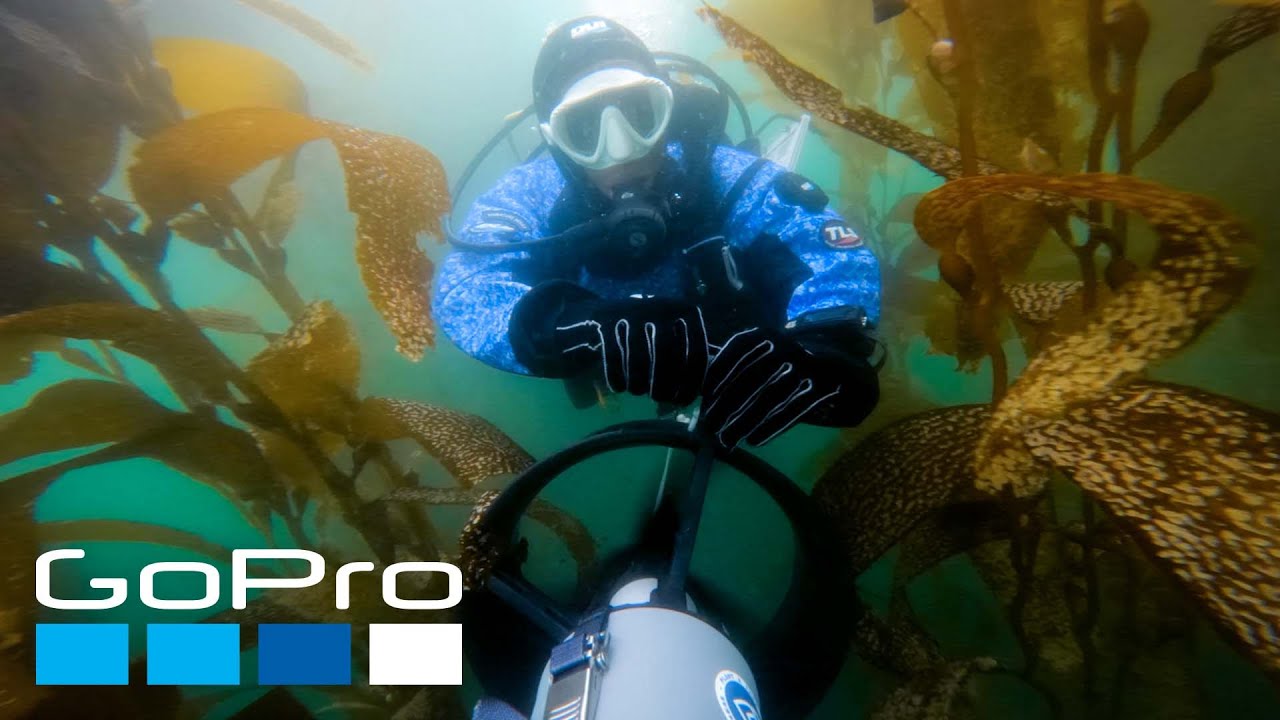
>> Yeah. So, this is this is an image of me diving in a kelp forest in South Africa near Cape Town. Um, so like I've mentioned probably a couple times before, kelp forests love to grow in cool, nutrient-rich coastal waters. And this means you have to wear thick wet suits or dry suits to really function underwater for any period of time. And really suiting up is can be kind of slow and physically demanding especially when you have to half suit up and then walk down a clip, you know, walk down a trail carrying scuba tanks to get in the water. Um, so it can really take it out of you. Um, that's before you even get in the water, which then takes you're swimming through carrying a bunch of equipment. Um, sometimes there's wavy environments. Oftent times there's a lot of surge, which makes precise work really difficult if you're trying to do a transect and you're being moved around side to side. Um, you know, when I saw that image of the of the crocodile there, it made me think I should have included the time that I was in South Africa and as we were suiting up, a troop of baboons came through and jumped on.
>> But, um, that's not a typical, um, issue we ti we typically have. That wasn't [laughter] one of them until I found.
>> All right. Um, we're running a little behind schedule, so I want to keep us moving here, but I'd like to spend the rest of our time this evening to talk about some of the threats facing these coastal ecosystems and how your research can help. Andre, what's the status of mangroves worldwide and what kind of pressures are these systems dealing with?
>> Yeah, so the good news is that there's reason for um optimism. um the the deforestation rates still continue but they have decreased uh significantly over the past two decades and that's because you know just legislation being put in place um in law enforcement and I like to believe that a change in mentality as well little but um people have grown on on on like knowing the value of those uh ecosystem services that those you know natural um systems provide for Uh there's still a lot of uh you know deforestation happening for several reasons. Uh shrimp farming is a big one.
Um Central America those are some pictures in Costa Rica. So those areas used to be mangroves. In fact in the background right there uh below the mountain line of course you can see uh the remainder of the mangrove forest.
And the way that they, you know, prepare those tanks, they first they um drain them out and then once it's dry, they, you know, usually cut down the vegetation or lit them on fire. That way everything burns. Um and so you're just pumping that carbon back into the atmosphere when you're doing that. And when you are uh carbon that took like you know hundreds to thousands of years to be stored and protected. And when you steer the soil around to build those tanks like you also like expose that organic matter that was protected from the oxygen um so it then becomes exposed and it's decomposed and sent back to the atmosphere. U pollution like just you know in general from chemical sources and also debris like plastic is a huge uh problem. You can imagine how much plastic getting like just stranded in the middle of the root system, right?
There's several pieces of research showing right now that that plastic actually breaks down and gets incorporated into the soil, which is a big deal because then it doesn't leave.
Um, sea level rise is a big problem.
Amanda like touched on that too. So those plants where sea level is like rising faster than it can adjust to that change, then the vegetation drown just like a plant in a vase. like if you put too much water, you're going to end up drowning it, right? And there's other threats to such as like cutting trees for like, you know, h building houses and and and also like for charcoal production. Uh that's an image from Vietnam right there where they have this rotation, you know, culture to basically use the wood for charcoal and also uh building houses. And the image from before, it's actually another threat.
It's like mangroves and marshes. That one right there, that's an empoundment cows by by you know a cutting hydraology. So when you cut off the connectivity the tidal connectivity uh or the rivering post like that promotes that daily um flooding right the tidal flooding once or twice a day. U you you just make that those environments is stagnant and and they just dry out. They just die off and and dry out and during the rainy season the water accumulates u and that's it. You disrupt the the the hydraology. That's all it takes to take those systems down. Marshes and mangroves, they work that way.
>> Yeah. So, Amanda, anything to add about salt marshes, just briefly.
>> Sure. I mean, they're facing a lot of the same threats that Andre just mentioned, like empowerment is a really important one. Not all of them dry out after empoundments. It depends on on how the hydraology changes. But, we've done some other things to marishes that that have really impacted them. We've drained them because of mosquitoes. We've filled them in in order for coastal development. We've turned them into pasture. Um, and marshes don't have a lot of places to go. So, they're really squeezed at this interface between the ocean and the land. So, on the ocean side with sea level rising, some marshes are actually drowning on their seawward edge. And normally, they would migrate uh yeah, like you're seeing here. This is actually off of Cape Cod. This is a relic marsh. Uh, and it was exposed during a winter storm. Probably not unlike what you just had. Um, and marshes can't migrate inland as they usually would. And some of that's just because of the slope of the landscape and they can't migrate up that. And some of it's just because we've developed the landscape and we physically prevented marshes from migrating uh inland.
>> Yeah. Tom, you mentioned earlier that some kelp forests in any case are in decline. What are some of the causes of that?
>> Yeah. So, um I guess there's uh some optimism as we've expanded our maps globally. We see that not all kepors are in decline. Some are actually expanding like those off Peru. Um but you know, a real cautionary tale I think is looking at Northern California. This is what it looks like on kelp watch where you our landsat record goes back to mid 80s and you could watch the kelp canopy area fluctuate naturally year to year and then around 2014 kind of collapses and doesn't really come back. And so what happened was this kind of perfect storm of multiple stressors almost hit the same time. So there was this oceanographic marine heatwave event called the blob which was this unprecedented marine heat wave higher than anything in the instrumented record. um that happened in the northeast Pacific in 2014. This is followed by a large um El Nino in 2015 to 2016. You can see >> also warm water.
>> Yeah, it's this big red blob out off of the coast of uh the west coast of the United States. Um and then almost simultaneously we had a large sea star wasting disease that um killed off most of the sunflower sea stars. They've actually kind of melted away and this is one of the main predators for sea urchins. And then we saw sea urchin populations explode. Um, and the result is that over about 90% of the bulcal forest in Northern California has disappeared and the system has been kind of locked in this urchin dominated state for over a decade now.
>> Okay. So, because those sea stars weren't there to eat the urchins, the urchins kind of took over.
>> Yeah. They can actually kind of change their behavior that typically when there's a lot a healthy kelp forest system, a lot of these urchins will be tucked under rocks and just kind of feed on drift um kelp. So kelp grows really fast. So it it loses a lot of its kelp biomass through time, which is a natural um turnover and the urchins will just eat that. But when they start getting really hungry, they kind of come out and start looking for food and it can without um predators to hold them back.
they can kind of turn into these uh urchin baron states.
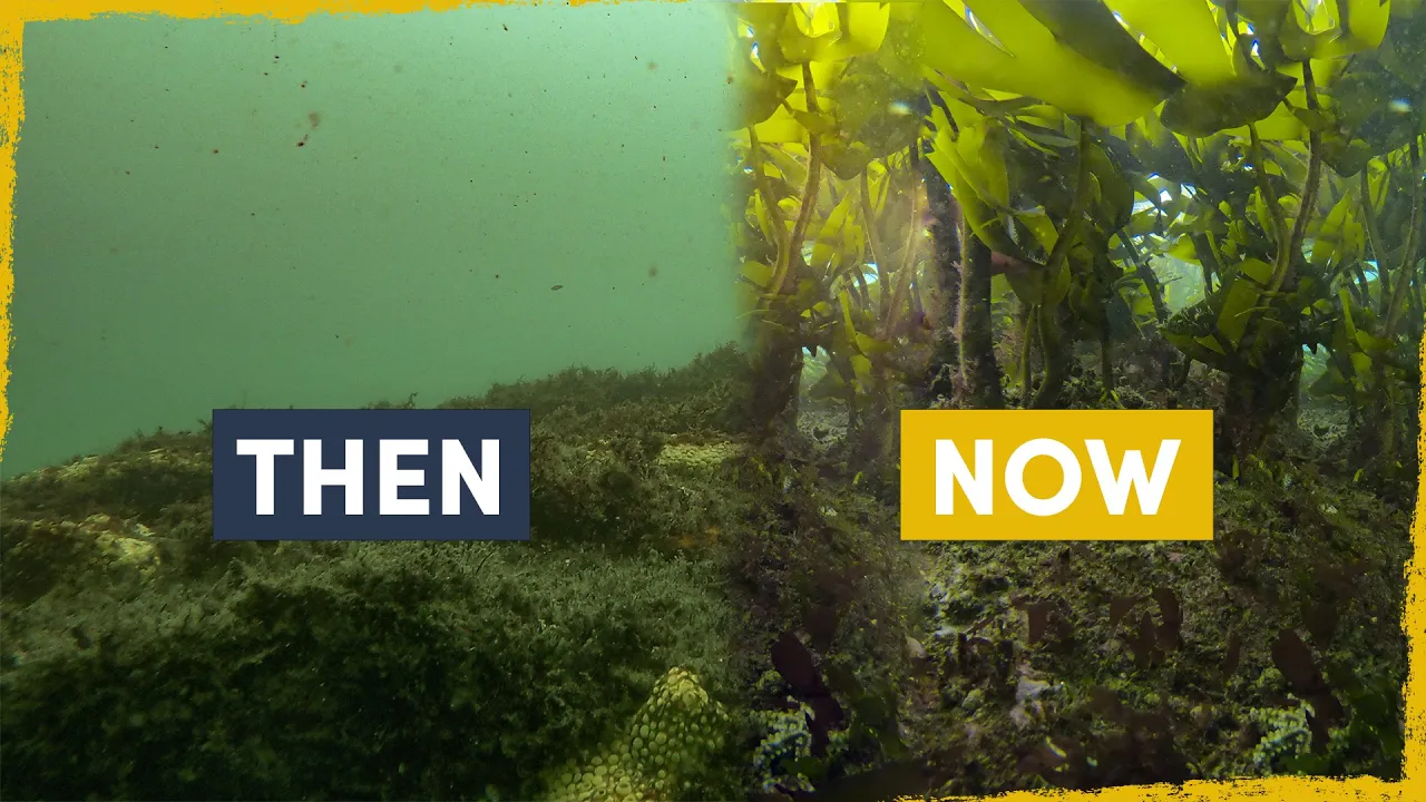
>> Wow. All right, let's talk a little about the management and restorations uh restoration of coastal ecosystems and the role that your science can play in these efforts. Um so Tom, how can your help your research help bringing some of these areas back in having the kelp regrow? Yeah. So, you know, because this is such has been such a large event, there's a lot of interest in kelp forest restoration, especially up in the Northern California coastline um and up into Oregon. And so, reversing an urchin baron isn't just about removing a few urchants. You actually have to bring the population down below a threshold. So, kelp can actually gain a foothold. So actually taking the population of virgins way down farther than you you um than would be naturally abundant naturally occurring in a kelp forest.
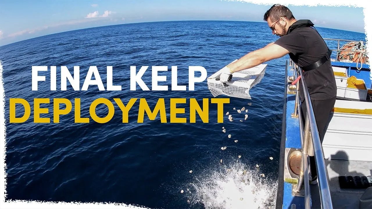
And so once the kelp starts to come back um it can maintain itself the recruitment of new kelp. And so what they're doing here is um they've hired urchin divers who are really good at pick at grabbing urchins to collect large amounts of urchins um in test areas to see how well urchin removal works compared to control areas. And then some other groups are using these things called ARVs which are called um arrays to recover kelp ecosystem vegetation. Um and so these are arrays seated with juvenile kelp that are suspended above the reef out of the reach of sea urchins. And so once the kelp grows to full size, it can release spores to aid in kelp development. And so groups like the Oregon kelp Alliance um and the Nature Conservancy are using these in Northern California and Oregon.
Um, but restoration is expensive and labor intensive as you can see here. And so we can't do it everywhere. So strategic site selection is critical.
And this is where our long-term satellite record allows us to ask three questions. Where did kelp historically thrive and remain stable? Where did it get hit the hardest? And where has it failed to recover on its own? And so this combination um shown here for Southern California identifies sites where restoration efforts are most likely to succeed long term rather than just fail again when the ne next stressor hits. And we've produced these maps for the entire state of California.
>> Okay. So picking the right sites for kelp restoration. Um Andre, I assume mangroves don't grow as fast as kelp.
They're trees. Um, can they adapt to any of the challenges they're facing and how hard is it to restore them once?
>> Yeah, they they can. They can. Like I like I said, hydraology is like a big deal for mangroves. That's a a mangrove restoration project that I visited in Costa Rica that's done by, you know, conservation international colleagues in partnership with the their their local um government. And you can see like a Doug channel that was done by hand by the by the local community there. And you can see a bunch of like mangrove bushes, right? Those are black mangroves, the same that we have in well, not exactly the same species, but um a mix of black mangroves like we have in in Louisiana.
And the reason why they are stunted like that, it's because the tidal connectivity has been restricted. So then you have a lot of evaporation. U so there's a lot of water leaving the system, but the salt stays in the sediment in the in the water in the middle of the sediment, the poor water, right? So that becomes like really stressful for the mangroves. If you look in the back, there's a grain curtain in the back and that's where the tidal channel is. And you can see how tall those mangrove forests are in there. But before like they opening those little tidal channels there or runns u that was just a baron flat, right? Because that was the bottom of like a a shrimp uh tank or or pond. Um so bringing the water back, the title back really allows the mangrove to uh restore. Bringing that hydraology back. That's another site that we visited in Costa Rica in um I think that was in Aana's beach. Uh and that was like a really interesting thing because the connectivity with the title right there. They had a they had a um an earthquake about a decade ago in there.
So I forgot exactly what the date is, but they had this this uplift that was caused that sort of like shifted the you know the the the earth like upwards and that cut off the some of the tidal connectivity. So, it was kind of like a natural event that happened and uh that mangro died off and you can see all the the standing you know dead trees in there but then you see a lot of like natural regeneration natural recruitment and it's because the community also you know dug up the channel like deepen the channel to allow the tide to like flood those mangrove uh uh backs somehat what we do is like I said we work with uh communities around the the world to like do those capacity building trainings where we apply this hydraology ology concepts and and that's an example partnership with WWF after their office in in Vietnam and also with the UK partners uh where they brought a team of scientists from around the world to go talk to NOS's, government, university um you know practitioners and and researchers u in Vietnam and come up with like you know blue carbon um assessment you know train do trainings on like collecting samples and um looking at the hydraology and and looking at impact acts and so on. That's yeah that that could have gone with the people at the end of the day like full of mud was the the beginning of the day.
So we do both we do field and and then we also do the work um um with with different teams and and people and organizations to make sure that we can you know um just have a a global network of people working towards the same go.
>> Great. Amanda, how are you getting involved in helping to restore salt marshes?
>> Sure. So most of our work here is in the states and we work with state and city and federal agencies. Um so we've had some projects up up near where you are on Cape Cod uh where ditching is a real problem. And so we've worked with resource managers to think about how these ditches, these were all man-made uh and they were dug um as part of um the works project and um they drain the marshes and they are supposed to reduce mosquito populations, but they also allow a lot of water back into the marsh. And so we have a real problem with um potential, you know, sea level rise kind of exacerbating flooding and potential drowning these marshes. So we've been working with resource managers to think about how to manage this um hydraology. As Andre mentioned, it's really important. Uh and we've developed models for that. And then uh we are working with managers down in Alabama actually where we uh they're really interested in tidal empowerment.
And so what you're looking at is an old image of a wetland that had natural hydrarology and [snorts] then over time a road got built and you can see it there and it cut the hydraology back even farther. And then in 2008, Hurricane Ivan dropped a 900 ton barge on it and it was drugg across the marsh and it really messed up the hydraology.
And so this is what that wetland looks like today. And so we've been studying this and working with um the city and state and federal agencies to think about what restoration would look like here and what those trajectories might be. And then in Georgia, we've been working with a bunch of different agencies to think about what restoration projects could be. And so thinking about using dredge materials similar to some of Andre's work uh and how that can enhance carbon storage. And I've been working with an environmental lawyer here to inventory the blue carbon stocks in Georgia and then think about the legal frameworks whereby the state might be able to monetize their blue carbon star stocks and then finance restoration and conservation efforts in the state.
>> All right. Uh we are a little bit past time. Uh but Sam, I want to give the audience who has stuck with us uh a chance to ask a question. Uh are you there? And can you relay a question for us?
>> I am here. Yeah, I've got a great question from Jennifer. Uh and that is how do you actually know if the ecosystems you study are healthy or unhealthy when it's not obvious? Do you have to wait until you can see the problem or do you have tests like a doctor that you can use to diagnose a problem early before it's too late?
>> That is a fantastic question. And so [clears throat] we collect samples of the soils, the plants, the water, and we can treat them almost like your doctor would as like blood tests and tissue tests and things like that to think about how that system is working. And then we work in a lot of different systems all over the world, all over the country. And so you can compare a system that you've just sampled to other systems. And that can help you know if your system is that you just sampled is functioning like other systems or if it's doing something different. And having long-term records is also a really important way to sort of put that system in context. So you can think about um what it might be, you know, how it might be functioning uh under different kinds of stressor conditions.
>> All right, Sam, let's go ahead and take one more quick audience question before we wrap up.
>> All right. All right. This is a big one.
It's for any and all. Um, if you could wave a wand and restore one missing or damaged piece of your ecosystem, whether it's a predator, a sediment supply, cooler water, tidal flow, something else, which single lever would make the biggest difference.
>> Guess for well, if I have to pick one, >> you have to pick one.
>> Yeah. So I would say tidal flow and tidal flow because you bring the water back, you flush you.
>> I think we're losing Andre a little bit.
It could be my connection, but I think we've we've lost Andre a bit. But Amanda, you were nodding there. You agree on tidal flow? Yeah, I can pick up there because tides structure mangroves and salt marshes, right? And without the tidal flow, we don't have basically the force that causes zonation for these plants, right? Where the water comes up, the high tides, high tide, and the lowest low tide really define where these ecosystems can be. And so, if that water is not coming in, then we don't have these ecosystems working like they should.
>> All right. And Tom, I'll give you the last word. What would be the one thing you'd pick for kelp?
Well, the one thing I'd probably pick for kelp in all systems would be to reverse the effects of climate change so we wouldn't have as many marine heat waves um or other warming. But specifically for kelp systems, what I think would be the most interesting would be if we can wave a magic wand and bring back um locally extropated or regionally extropated animals like sea otterters across the range um or even back to this uh stellar sea cow.
>> All right, unfortunately that's all we have time for tonight. I want to say a big thank you to Tom Bell, Andre Roi if he can still hear me, and Amanda Spivac for joining us to talk about the importance of coastal ecosystems. Thank you all. I also want to thank my HOIE colleagues who have been working very hard behind the scenes to make this event possible. And to everyone who joined us on Zoom, Facebook, and YouTube, thank you. Tonight's event was the second in our eighth season of HOIE's Ocean Encounters events. Our next event will be on April 8th. It'll be about the deep ocean. So, please watch our website hoie.edu for more details about that. If you'd like to see any of our past events, just follow the link in the chat that my colleague Matt Barton is putting in the chat window right now.
In the meantime, you might also want to take a look at the very cool merchandise at Hoie's online store. That links in the chat, too. you get a 10% event discount for joining us tonight. Just type in the discount code coasts.
Tonight's Ocean Encounters brought together scientists from three leading research institutions. Collaboration and community are hallmarks of ocean science where researchers from around the globe work together on expeditions, build on each other's discoveries, and leverage shared insights and technologies. We invite you to be part of this community, too. You can do your part to sustain the ocean that sustains us all by joining HOIE's campaign for our ocean planet right now. Just click on the link in the chat to learn how you can get involved.
If you're already a HOIE member, thank you. If not, you'll get some great benefits when you join the campaign and you'll be providing crucial support for our outreach and our science. Hoey memberships start at just $40 a year.
The average gift is $120, but any amount helps. If you do make a gift, let us know that you watch Ocean Encounters.
That will help us keep bringing you the science programming you enjoy. On behalf of Woods Hole Oceanographic Institution, thank you and good night.
Up Next
44:53
Blue Carbon: Its Definition, Location, and Importance | BrisScience
@uqscience
4.3K views•2020-08-13

15:54
Life in Biosphere 2: Sustainable Ecosystems & Human Survival
@TED
334.9K views•2009-06-16

14:30
Microplastics Everywhere: How Plastic Impacts Our Lives
@TEDx
100.9K views•2018-05-08

10:28
Ice Stupa Artificial Glaciers: Solving Ladakh's Water Crisis
@SonamWangchuk66
3.2M views•2015-05-03
Related Study Plans & Knowledge Roadmaps
Structured learning paths in Environmental Science
environmental-science
Ocean Noise: Cetacean Impacts & Mitigation
01Fundamentals of Underwater Acoustics
02Marine Mammal Bioacoustics
03Anthropogenic Noise: Shipping & Seismic Surveying
+ 2 more learning modules
16h5 modules
Explore Roadmap
environmental-science
Road Ecology: Corridors, Overpasses & Fencing
01Foundations of Habitat Fragmentation and Carnivore Ecology
02The Road Barrier: Ecological Impacts of Transport Infrastructure
03Principles of Ecological Corridors and Connectivity Mapping
+ 3 more learning modules
14h6 modules
Explore Roadmap
environmental-science
Ocean Acidification: Kelp Buffering & Shellfish
01Fundamentals of Ocean Chemistry & pH
02Chemical Pathways of Coastal Acidification
03Bivalve Physiology & Calcification Under Stress
+ 2 more learning modules
18h5 modules
Explore Roadmap
environmental-science
Ice Stupas: Glacial Retreat & Water Security
01Foundations of Glaciology & Mountain Hydrology
02Climate Change and Glacial Retreat Dynamics
03The Science of Ice Stupas & Artificial Glaciers
+ 2 more learning modules
14h5 modules
Explore Roadmap