






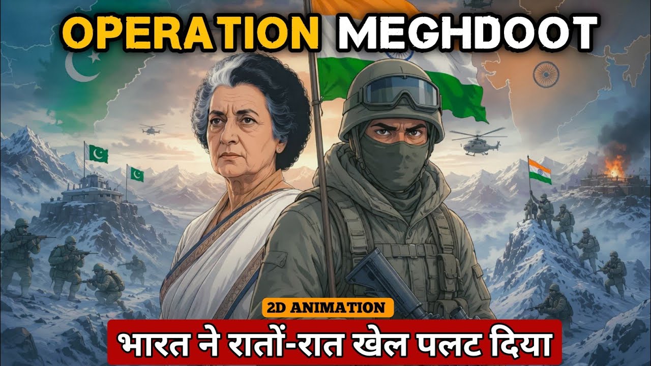







Political leadership plays a crucial role in authorizing military operations in contested terrains. In the case of Operation Meghdoot, Prime Minister Indira Gandhi provided the green signal for the operation after consultations. The political leadership's association with regional advisors (such as General J.H. Dhillon who had advisory experience in Sikkim) influenced decision-making processes. This demonstrates how civilian-military coordination is essential for operations in disputed border areas where strategic calculations involve both military feasibility and political considerations.
Operation Meghdoot: Securing Siachen with Lt. Gen. Kulkarni
Added:The history of the India-Pakistan border disputes, specifically the Shimla Agreement of 1972 and the undefined boundary line north of coordinate NJ9842.
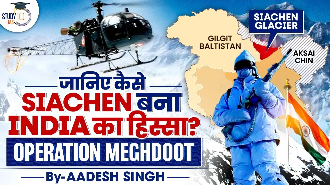
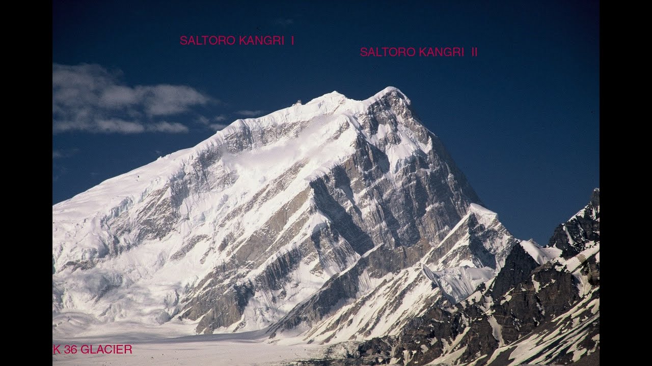
The geography of the Karakoram Range and the strategic location of the Siachen Glacier situated between Pakistan-administered Kashmir, Indian-administered Ladakh, and China.
The physiological and logistical challenges of high-altitude warfare, including extreme sub-zero temperatures, low oxygen levels, and specialized mountaineering requirements.
The concept of 'cartographic aggression' and how foreign mountaineering expeditions permitted by Pakistan in the late 1970s triggered India's strategic response.
The tactical and strategic escalations that led to the 1999 Kargil War, which was directly influenced by military positions held around the Siachen sector.
The immense economic, environmental, and human costs incurred by both India and Pakistan in maintaining a permanent military presence on the world's highest battlefield.
Bilateral diplomatic negotiations, treaties, and proposals regarding the potential demilitarization of the glacier or converting it into an international 'Peace Park'.
Technological and medical advancements in high-altitude military medicine, aviation engineering, and cold-weather survival gear developed as a result of long-term deployment.
1.8M views10.5Klikes0:44Original Release: 2023-04-12
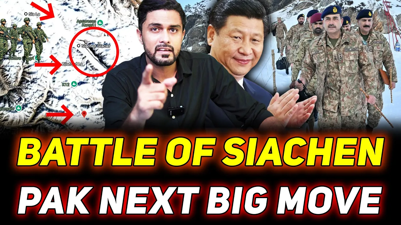
look better don't absolutely bad unbelievable what I saw the day previous to what else when I saw while I landed to what I was now seeing Sudden Change it turned blessed us how this particular thing came up was because bulkuma realized that the map that he was being shown had a straight line drawn from a point called nj9842 joining the karakoram pass it's not one man who does it it's a team that doesn't was quite uh forthright he said look the Chinese have occupied exciting because we were not attacked side chain then and since it's ah area we must occupy it pakistanis were sponsoring Expeditions through the saltoro Ridgeline because between the sultural Ridgeline and the karakora mountains is the siachen glacier jealous himself telling djsi so Pakistan is not a country which can be trusted at all you have to sustain 10 men on top of belafontla probably whatever tail which is a 40 to 50 men when we were hoisting the national flag over there just about reaching below I find a helicopter coming from the Pakistani Direction he saw that these intels are already on top of Bill of all so he took a U-turn and went back Namaste welcome to another edition of eni podcast with Smitha prakash joining me on this Edition is my colleague Ajit Dube editor National Security 13th April 2023 marks the 39th anniversary of operation make dude it was the Indian army operation to seize control of the siachen glacier which was considered the highest Battlefield in the world in 1984 the kumau regiment one of the oldest infantry regiments of the Indian army and units from the ladakh scouts nicknamed snow leopards were tasked with the responsibility of digging into and controlling the critical Peaks and passes of the glacier why was this significant what role did it play in the india-pakistan conflict did we learn lessons from the operation on the loc the line of control between India and Pakistan and has it come into play when our forces deal with the ground situation at the line of actual control with China to to speak on operation make dude I have with me Lieutenant General Sanjay Kulkarni recipient of the param vishisht Seva medal ATI vishisht Seva medal Sharia chakra Sena medal vishished Seva medal thank you for coming on the podcast General Kulkarni it's an absolute honor to have you here 39 years since operation make Duty you were a young officer then so tell us what happened then thank you very much to have invited me it couldn't have other I could not have asked for a better platform wonderful thanks once again now going back 1984 that you referred to when we launched operation make dude of course as a young Captain I was familiar with that area and that is where we had that advantage and more than anything else it is again like they say in the Army it's not one man who does it it's a team that does it so I owe whatever now that I am sitting in front of you I will wait entirely to my men my seniors and the Battalion that I was commissioned into Pokemon having said that let me tell you that in 1978 to begin with for the first time I got to know that something like siachen is there that's primarily because he was the commandant of the high altitude of warfare school and since the commandant high altitude Warfare school he was taking some officers onto syachan and as part of the course we had to climb a peak called Stoke mangrene Lake and we were also there and that's why we found out that seniors are going you know different direction and that they were going to a place called siachen Glacier and that's where we heard for the first time Glacier and not knowing that subsequently in 83 and in 84 I would also be a part of it now how this particular thing came up was because while interacting with one of his own foreign Mountaineer realized that the map that he was being shown had a straight line drawn from a point called nj9842 joining the kalakaram pass now that alerted him as to how come this friend of his is carrying a map and has the point joining straight and mountains you don't have straight lines because the the Karachi agreement stated Point NJ 9842 dense North onto the glaciers and it wasn't that the Karachi agreement between India and Pakistan 1949. U.N mandated agreement absolutely so that is what it was so he when he saw that it sort of you know put him on this thing he said he requested his friend if he could give that map to him for rupees 500. he was a civilian uh that Mountaineer was a civilian some German friend of his a mountaineer were done with him previous Expeditions and are also done river rafting uh with Colonel bulkuma and therefore again colonel bulkarma was still in the Indian army and that is where we are interacting and he said then when he saw this map he took the map and he got in touch with the Army headquarter uh since from the Kumar regiment the chief of the Army staff then was also from the Kumar regime in general Raina and then he got into who became chief of Army staff later Jal Rana was the chief of family oh he was already the chief of Army staff so he got in touch with him and he was put through together who was then the direct ability operations as Major General and so he asked him and bull was very well known in the Army for his exploits as a excellent Mountain yeah he will climb Mount Everest so he was a very excellent Mountaineer so he went and obviously what brought him and he said well I have a map and we're in the line shown is straight from point NJ 9842 joined the karakaram pass and thereby this is which year sir this is uh I'm talking 78 788 1978.
so he was obviously he said is it so and when he looked into it he said yes he said now what is it that you want us to do now he said before this cartographic aggression by the pakistanis thought Angel was quite uh foreign Glacier by not being there and since it's ah area we must occupy it how do you plan to do it so before we go on to the whole expedition of how you occupied it you use this term cartographic aggression if you could just explain to our viewers and listeners what that means you know cartographic aggression means on the map you start showing certain areas which have international recognition that it is yours so slowly and steadily people start believing that this area belongs to the country that it is and therefore uh like you find like I said the cartographic aggression Glacier is in the karakoram ranges the nj-9842 that is the the last demarcated delineated map on the ground and demarcated it wasn't beyond that no demarcation could be done because it's glaciated extremely difficult to go there and therefore it was said point ng9842 then not along the glacier so down the ridge along the glacier and obviously if you joined it to the karakoram pass the Chinese are supposedly accept as a one of the points on the their so-called Lac but accept it as a point between India and China as a boundary and that's a subsequent thing because they want the karakoram ranges we look at the cubland range and in between the cunnelin range and the karakoram range as the excitement so we lost the oxygiene or a pair of girls because we did not have people over there patrolling and doing things of those kind in a manner that we should have could have shown our occupation then in 50s so having said this said let's occupy so what would he do so he said we will go for a patrolling of this area so online Kumar decides to patrol with these officers from the High Altitude Warfare School were part of the advanced is called and while he's doing that he is buzzed by the you know flown the pakis flew they say budgets over them to say that over the Indian army people who were then mountaineering this particular in 1978 78 and even subsequently went okay He did it so obviously pakis saw that the Indians are showing interest in this area which they believed as I said cartographic aggression they believed that this area belonged to them so this saber jets flying over uh uh the Indian team was it some kind of an aggressive stance or messaging a messaging to the Indian that this area belongs to us and you are not supposed to be there because pakistanis were sponsoring Expeditions through the soltoro ridge line because between the salturo Ridgeline and the karakura mountains is the siachen glacier which is about 76 kilometers long about between two to eight kilometers wide about 300 meters deep and this Glacier is uh I don't know the boy called it the third polar region extremely cold temperatures go as low as minus 50 degrees Centigrade your wind speeds of going as high as 100 kilometers per hour and you have snowing almost about 15 to 18 meters of snow in a year so this kind of inhospitable completely absolutely totally inhospitable and most of us uh except for these Mountaineers and nobody would want to venture it out so this is what Karlin Kumar did in 78 these did it again subsequently to show this thing and the pakistanis sponsoring Expedition foreign Expeditions primarily from Japan and UK Austria all of these people who are being sponsored to that particular area so there were two passes on the saltwater Ridgeland one was called The Bella formula La Means a pass and the other one was ciala and so these two passes is where these foreign Expeditions would venture through siachen Glacier on to what would be terms a mountainous Paradise lovely Peaks Sia kangri kangri means a peak salty all these lovely Peaks that were there so obviously the pakistanis sponsoring Expeditions uh virtually came to a grinding hall because none of these Expeditions could come if the Indians are on the siachen glacier so on the siachen glacier you hear most of the time pakis talk of siachen they're nowhere near because saltaro onto the west and karakoram onto the East very distinctly you can make out because karakarama black in color range is absolutely black in color and you have sultural which is light brown in color and between these two ranges is this siacin Glacier and if you read Musharraf in the line of fire he says it very clearly the Indians preempted them now at that point of time in 1983-84 Musharraf was a colonel who was part of the mo the ability Operations Branch and your view to what is going on and there then uh 10 core Commander uh Lieutenant General Jahan Pete Khan he was the uh co-commander and they had the northern area commander who was a major general uh he was again I think peer Khan and they had the SSG it was a brigadier Mahmoud was in charge and uh jalakta was the isi chief of that and Jal Zia was the chief of the Army staff and the president of Pakistan so this kind of a thing and obviously when they saw that in 1983 when I had the chance of being part of uh polar bear one and subsequently polar bear II as part of the mountaineering we used to call it the long range patrolling lrp and that lrp involved staying over the glacier for a period of about 80 to 90 days and it would invariably be conducted from the month of June July like more convenient months to be on the glacier and terminated by September October so polar bear one and polar bear 2 were in 1982 83 8383 and then 84 that is 82 we had launched Ibex hunt so Ibex hunt was a long range Patrol which was launched in 82 and 83 was polar bear one and two and up make do in 1984 on the 13th one in polar bear 2 was your first impression of the siachen glacier yes and walking on this bear one and two both there was some difference now that's a very interesting question because there is a gap between polar bear one and polar bear 2 and why polar bear 2 had to be launched because uh when we launched the Ibex hunt in 1982 that was the time for the first time I got an aerial reconnaissance of the siachen glacier because we are just about gone there in a area called that is where my Battalion was and since we were there and this long range patrolling was going on I got a chance to fly with the helicopters to be seeing what theachen Glacier is all about and as luck would have it 83 I was told that I have to lead the long-range Patrol onto the glacier that's because the officer was leading in 1982 sprained his leg so he couldn't go in 83 so as I was there Patrol twice as I said no you have to choose so how we all took on this particular mission was in 83 like what you asked the question about uh why polar bear won and why polar bear too why we are in polar bear 1 and we were venturing and we warned the search English you know to be able to get to belafontla there were three camps which have to be set up camp one Camp two and camp three and even when uh Kal and Kumar when I went to uh on the xiachen glacier the porters you'll be surprised were paid the same sum of money per day as they would be paid climbing Mount Everest so the portal was there in Nepal assisting Mountaineers to climb Mount Everest were being paid then the same amount would be paid to the porters who were with us on the CIA in Glacier so that because who would venture because every Potter carried just about 15 kgs logistically we were only supported by the potters and of course by the helicopters uh over there so in 1983 as part of uh polar bear one when we went up to Belafonte I saw some rappers on the glacier I said it's a surprise who who could have come along this particular route and then there were rappers with markings which I didn't know then there were the Japanese or the Chinese because the script the characters are quite similar now of course I understand the script between difference between the Japanese script and the Chinese script there were Chinese rappers or Japanese Japanese so later on I was they were the Japanese rappers and some Japanese Mountaineers that wanted to come that way so when I saw those rappers obviously on the radio set informed that some rappers have been found on top of Belafonte and uh guess who came to see and interact with me none other than the later uh Jal bipin rava to became the CDs his father was then he came he was the chief of staff over there and he asked me I told him he was Northern command he was in I think part of 15 15 okay and he came there and he asked me and he took those rappers along in 1983 having taken the wrappers and the China the pakis got to know that we are on top of Indonesia so we inducted in the month of Summer a little mid-august caspas we deanducted the Pakistan let me interrupt you because this is not something that many people will understand what is the induction yeah now what happens is since I told you to a long range patrolling with a specific duration that we have to stay so we go and induct ourselves onto the glacier so since we have inducted on the glacier now is the time to de-induct because the it will now get very very cold extremely cold because the time that we are there June July August are months that are reasonably comfortable that we can stay on top of the glacier so now that we are de-inducted so both India and Pakistan used to de-induct in the winter months so Pakistan would never induct okay they would never be there they never had the Pakistani officers invariably accompanied the foreign Expeditions as a liaison officer to those Expeditions okay and they would the induct with the party which we had never seen if it had happened it would have happened in 78 79 and that period but noted induction mean at that stage you'd put tents or you would dig in induction meant staying on the glacier for the duration that we are supposed to be maybe 60 days 75 days 90 days whatever be the duration so you properly pitched tents over there and you stay on the glacier so you are inducted in and de-inducted from the glacier so for Pakistan viewers Pakistan was not inducting before the siachen conflict let's be clear on that he's putting it on record and now now what you just said is a very important thing when we de-inducted from the glacier the pakistanis inducted okay now they realize that this is the Indians have left the glacier they inducted to see that if they could occupy the glacier in 1983. now this was revealed even by Musharraf in his book in the line of fire I've read that twice over because I can't believe that somebody could write self-praise so much really bothered him two generals of the Pakistan Army General whom their own officers have written lacked officer-like qualities yeah and he became the chief of the Army staff and the president and a martial law dictator and they're themselves written on musharra highly indisciplined wouldn't take orders so easily he's written that in his own book that that's what happens yeah as a Commando now what had happened was they inducted and when they inducted they couldn't sustain themselves on the glacier and whether they could sustain themselves on the glacier they inducted in the month of October and they couldn't and that was the SSG and Brigade Mahmoud was supposedly there uh you know a tough man on SSG Commando Brigadier who subsequently was replaced by musharra so Mahmoud decided that his team is not able to sustain itself and they deemed that and generally how long could they stay there sir they hardly could stay there they came and they less than a month not even two days probably okay on themselves extremely difficult to sustain themselves but that left a note for us and that note that they left to say that look you have inducted you know on the glacier which is ours and they then for the first time admitted to say that in point nj9842 line joins the karakoram pass and not as what the Karachi agreement said dense not along the glacier so that was the first admission by the pakistanis that this line now this is very cartographic now this is very important who joined this line pass now this also has a history because it's to call the Hudson's line the Americans did it as Americans as part of uh you know for aviators to fly they must know whether they're stepping into which country and you know where are they like so they Hudson's the Americans were being told time and again in 60s that looked the whole of Jammu and Kashmir is part of India and you cannot have this kind of line drawn uh Pakistan occupied Kashmir Jammu and Kashmir and all that kind of thing if the whole of it is ours and uh so and therefore this cartographic straight line being drawn or drawn by a person called Hudson as part of the American survey team and that Advantage pakistanis took because they were part of sentosito organization where they were with Pakistan with the Americans and the Americans at that point of time uh want had were perturbed with the Soviet Union having come into Afghanistan the pakistanis were training the mujai to throw the Soviets out of Afghanistan so whole lot of this geopolitics playing and at the same time when this was going on Zia told his isi chief at that point of time that look keep the Indians occupied in Punjab and they only can be able to occupy the action Glacier otherwise once you know there's a confrontation then we may not be able to handle it yeah 1983 was at the peak Punjabi yeah the Soviets were in uh uh Afghanistan the Americans were wanting a foothold they were using Pakistan the Taliban and all these kind of things that were cropping up at that point of time so you found that at this point of time in the note was left by the Pakistani obviously uh yeah it was clear that pakistanis are now trying to show some interest in glacio Angel Chiba was will try to say that we have to occupy nothing we can't leave it uh default Theater Company we must occupy English and that area is approximately about 5000 odd square kilometers and uh in the originates from Indra called Coco is along here the nubra river and the shock river which then meets that culture and then this river goes and meets the Indus and uh now having said that and realized and they when they attempted to come in 1983 as part of uh we re-inducted that reinduction is so we went there and by then the pakis had deducted we reinducted we again deinducted and that was virtually the end coming of 1983.
now the int reports started coming in that uh pakistanis had picked up almost a thousand mountaineering equipment from Europe so the entire Europe was denuded of the mountaineering equipment now this mountaineering equipment is the same as that what the Mountaineers used for climbing Mount Everest so you get intelligence from raw probably on Military Intelligence that Europe May Sarah this thing has been picked up I think it was if I am not wrong it was Vikram sooth it was then as part of raw located in Srinagar who they have interacted with Jal Hoon was then the KO Commander to say that well the equipment so 2224 you had something on going on in Seattle Vikram suit chief of raw who was probably station officer okay he must have interacted with John Hoon we have to and general who at that time Commander okay and all of this area used to come under him now you have 14 questions but those days it is to be one that is 15 core and those jurisdiction the entire area came in so when this was uh going on then he also went because if we were to launch because the preparation had already started so this General shipper and general Hoon say that we've got to do this now in this kind of an operation do you need um an okay from the political leadership to would the raksha mantri have been informed or is it need to know basis and they are not informed see at this point of time firstly I'm just a captain at that point right that's very important because I would not be preview to all what was going on at that point I am only preview because I am part as a mountaineer being part of it Associated and training people you know taking them up ensuring that they survive under such harsh conditions but yes uh Delhi was taken on board and that is where uh when you see Delhi gave a green signal that was Mrs Gandhi at that point of time that yes it could be done raksha mantri was Mr venkata now since Mrs Gandhi was had very good association with Mrs Gandhi primarily because of Sikkim okay okay when Sikkim became part of India Jal Hoon was then the advisor over there in to the and that is how Mrs Gandhi and general were clothed now when the okay came at this point type time Pakistan was wanting to launch operations according to them and what Musharraf says the Pro Commander wanted it the 1st of May because they failed to sustain themselves in 1983 on top of the glacier so he said let's do it in on the first of May much that Musharraf says that he was as part of the military operations ban and they had suggested that it should have been March they wanted it much but unable to sustain their co-commander then General Khan said well it is better that we launched on the 1st of May and uh first of me being decided in January they had picked up this entire equipment from Europe so by Jan of 84 the equipment the mountain and Equipment has been picked up from Europe about a thousand sets by Pakistan obviously that alerted the Indian intelligence to buy so much of equipment had been picked up by Pakistan from there and that obviously then put us on this thing we didn't know what's going on in Pakistan because it's only the book which which Musharraf has written reviews because he was he himself said that I was in ammo and I was aware of what is going on at this point of time and then when Zion haq was being breathed so he said okay operation ababil to be launched on the 1st of May on the recommendations of the their Commander to say that which is very difficult so first May is what we will learn so much before uh operation make doth was put into play there was Operation by Pakistan to occupy siachen Glacier what we launched on first of May 1st 1584. that is the Pakistan part now for us we were told that we would launch on the 13th of April 1984 because uh then uh Brigadier Chandra was the sector Commander he said 13th is by Saki and it's a very good day of course you know eyebrows got everybody said uh sir 13th is supposed to be unlucky number 13. why do you want to launch it on the 13th is it is by Saki and it's one of the most holiest days and Pakistan also celebrates by saki we also celebrate the Saki and they couldn't have been a better New Year for us to launch our operation yeah because besaki is celebrated across both sides because on the India because it's a Harvest Festival absolutely and he realized that all of the equipment had been picked up and then uh I was ticked off in one of the presentations by Jal Hoon when John shebar asked me that can you launch the operations because you've been there in June July of 83 can you do so if we were to prepone it so I didn't know the date or anything like that so as a youngster and being asked by the Army obviously I couldn't have said no that was first and secondly assistance had gone there and had stayed there for so long I said by all means he said Remember the equipment is what you all wore in 1983 he said yes sir I told him positively same equipment we would be able to do so even during Summers it's it's a minus very it's you it's very cold it's minor did you and even today we see this lack of extreme winter clothing so what did you manage with in those days for your polar bear Ibex and all these totally Indian equipment totally the same code Parker the same trouser with two inners inside and the shoes that yeah absolutely it was perfectly another I thought if I lived with all that clothing on top of their glasses I didn't know then obviously June July and April we got foreign because when we were launched in April and I must tell you the equipment of course didn't turn up till the 12th of April no no that was a big thing who had gone to buy the equipment and this is also coming from Europe yeah all of it was to come and it was down down is an equipment which is of feather and the down feathers are from birds which are there in Europe and probably relaxer birds make one coat because the feathers are so warm and that's what keeps you warm and the because of the down feather the jackets and the trousers are so light that you don't even feel the weight of it so you know they had not reached and now Glacier and see for yourself what you had seen in 83 is there any change or you know do you see any marks of people walked over or something like that on the glacier so I was taken I was flown around the glacier I saw all of it absolutely Chopper by Chopper so absolutely no Footprints nothing whatsoever on the glacier it looked as uh pristine and pretty beautiful class as if nobody had touched it and everything flew over below flew over Seattle and all of it and got back so we were ready now clear weather absolutely perfect and I was also happy 13th April will launch and everything would happen 12th April at around five o'clock in the evening in me uh eight those days now where we call it me 17s those days the helicopter a different version of me it's they brought this equipment all right these are your intents yeah they're all it's still freezing cold everything is in 10 days only with my uh Team my company Commander was Major Sandhu uh VRC of 1971 war and we were another two youngsters to go to uh sort of establish Camp one two three and also be uh Reserve petrol based platoon to us with Captain paramvir yadav has one platoon Commander uh lifted in gusaini as another pluton commander and the third was myself under a company Commander R.S who unfortunately passed away some time back and he was the other uh company Commander for ciala and social he was the company Commander to occupy and we were to occupy I was happy and then I was brought back and to be ready to launch on the 13th so 12th in the evening at five o'clock I find this uh equipment has landed now this equipment was in cartons so many cartons trousers shoes and socks you know uh King that is those fire eater so many things it goggles you know the um So based on this thing and the command is also not very tall so if it's time for the common regiment the boys were same and some are here also had to be given the same equipment yeah so that so the equipment that came and segregated we always did jackets and trousers are not much of a problem the inner was not a problem socks the shoes was a big problem because the shoes looked almost identical with its left foot or the right foot it was a special alternating shoes oh they all look alike so anyway we found ourselves wear wearing those and you know ready and we found this next day morning early morning we got up at four o'clock and all set and then we found our five o'clock or 5 30 Calpers hello about seven eight helicopters you know coming to the base camp being flown by the Air Force pilots and they all came to the base camp to take us onto the glacier so we wore that equipment and ready with me was my operator mandal or radio operator so every helicopter could only take two people and because pilot co-pilot did two of us like that so and we were told radio silence nobody will open the radio sets less pakistanis get to know that there is some activity taking place so the total radius Island if you have a self-contained for five days of course you have to be self-contained for five days after five days by the time you would have established ourselves on the glacier then of course so keeping that in mind and we launched ourselves and the bundle with me and there were two more boys in the other helicopter Ramesh I remember very well and prakash not both these boys were with me in 1983 also so I knew you know we had that understanding with each other so Ramesh and prakash in the helicopter and I was in the lead helicopter and that helicopter was keeping a watch on us and we were to land and as soon as we had to land the pilots had already taken Muna Ricky before so perfectly fine I thought a land and I was sitting comfortably suddenly on that internal radio set he told me uh Sanjay we can't land here he said no no you have to jump and I'll jump from the helicopter but I'm not too sure uh how the snow condition why couldn't he land because not sure about it they were not so sure it was the hard surface or it was a helicopter if it has to land the uh there are lots of crevices crevices are deep no huge thing and this loose snow makes it look plain it's only when you land you suddenly realize that you have landed on top of a crevice and the whole helicopter will sink totally it'll go be go inside the crevice so the pilot he was aware of it because he had flown he said yeah I'm sorry I can't uh that I said I wish you had told me when we can't come for a cure if you can't land he said Lane how I feel that we can't land and we are about three kilometers short of Bella founder I suggest you jump I said okay I'll jump but I said look I bought one small with me I'll first throw that foreign to see whether the surface is hard if the surface is hot if that doesn't sink then even when I jump I will also won't you're not talking about para jumping now you're just talking about jumping straight jump you have to open the jump from 10 15 10 15 yeah they come down below but uh you know you have to just you could also fall in the crevice if it is I told him I said yeah let's first throw this to that uh that's your Russian which you're coming with you yeah and once you open it we'll throw it down and we'll see if it doesn't sink it stays on the surface that means it's quite hard and you hover out I'll jump you say perfectly fine but I saw it was on top it hadn't sunk perfectly fine I said ready ready jump jump and when I jump obviously the uh my radio operator mandal he couldn't jump because he had the radio set that was on his lap so I will reduce it like it so I jumped and I saw the whole thing I walked around a bit the helicopter after I jumped took off and I saw that is okay I gave a thumbs up I said no problems you can land okay so the other helicopter was also seeing this helicopter so it landed with Mandel and the other two who were with me they also landed and then the subsequent sorties started coming in from the base camp to reach Bella founder it would take us about 35 odd minutes for the helicopter to fly in you know the next 40 to come in because the same helicopters have to go back the refuel if required take another two passengers come back and land so all this would take out an hour or so so for that duration your load on top of the glacier the first fuel you're not pitching your tents you're not sorting nothing so far we are just there okay waiting for the entire platoon we were 30 of us the height and the temperature the height uh at that is almost about 18 000 plus you took off uh from 11 500 about 11 11 000 increased 18 and a half thousand the height that we were founded about 18 500 ciala is about nineteen or thousand and similarly is the Indra coal over there so and the temperature would be a temperature at that point would be at minus 20. so our temperature is a minus 20. it was clearly you know and it looked very clear lovely blue sky and absolutely white all over it was perfect I mean I could have asked for a better uh condition how many are you right now four four of us that's it that's it the first the first okay me and my radio operator and precaution so having done that and then the subsequent sorties were not the others so the subsequent salty and in about I found in about half an hour or so a bundle complaint of uh okay I'm having headache now this headache is very common in high altitude we call it the uh you know it could well be a part of Apple high altitude pulmonary sudden use you know you get disoriented you don't feel comfortable so it's a complete of headache and I said now you better sit down do nothing whatsoever and uh we'll mark the helipad and the helipad will be marked because we have seen the all other helicopters you know exactly where to come so that he he was not able to talk I said don't worry the next Chopper that comes will take you back no he's the only single radio operator with me and what to be evacuated even though he had trained so hard at house uh all had even down below and he was there during polar bear he was not part of polar bear one or two but he was part of the subsequent training and the training was very tough since we were all part of it we trained them very very hard okay but instead to sustain and you know training at kardumblr itself to get across this area from lay if you go is 18 380 feet that's the pass you have to cross by driving to be able to get onto partapur so all this training at high altitude there was nothing that was left to chance every viewer all but Monday yeah for sick at the last minute no subsequent people start Gathering major Sandhu was the company command he bought the entire team and we all settled out so we were 30 now left 29 because one the inducted within an hour of our Landing over there by about 11 30 the weather don't absolutely bad unbelievable what I saw the day previous to what else when I saw while I landed to what I was now seeing Sudden Change it turned blessed us you know wind speeds of over 100 kilometers nothing visible we couldn't see anybody I said oh God what's all this aren't you happy you have this equipment that you're wearing those what generally thank God hindsight I would say that you're absolutely right yeah terrible absolutely now the same Shoppers were to go back and take and troops land at ciala that mean major bahoganya's team was to land at ciala on the same day the 13th of April 1984. now this kind of weather conditions obviously no Chopper and nobody would come even we couldn't see each other and don't even two meters I could see anybody no was that bad oh God I said now some would were part of with me in 1983 were familiar to this kind of a weather so we could sort of understand but the rest of them were seeing it for the first time young boys all of us were 21 22 23 year old youngsters on top of the glacier you were probably called Sandhu was the oldest as a company Commander you must have been about 35 or something like that yeah we were all young 24 25 and 21 22 year old youngsters surprised if it me so I said yeah I told them I said no which up tense these imported tents had come Arctic 10 pop tents in which about two to three people could stand and say first let's get into it and then we'll see what is to be done let's uh hold ourselves on ground 13th of April extremely bad weather 14th of April extremely bad weather terrible weather only clearing the snow because you know the snow is also it's not so heavily about eight odd feet of snow in one night only so we should not so from inside the boys are just you know hitting that uh cover so that the snow doesn't rest on it and it sort of drifts off and one boy will come out clear the snow and again enter the food and water sir Paras that also must be turning into ice oh extremely difficult to eat extremely difficult to eat but we had those fire Kings you know those fire Kings were from Switzerland small little uh this thing which would keep the tent warm the two main Arctic ten would just have this area that you have for this table maximum three people can sustain themselves in these three just lie down nothing else you can do so you have your rucksack you are there and nobody else is there so that's all and then you're eating those shakar Paras and you're eating the chocolates that are there with you because there's no way you can cook because in this kind of weather will you cook and how will you cook is extremely difficult that little Fire King was enough to make it warm so every time you would attempt to go out to Bella founder people like we would sink up to waste deep snow well not able to walk even 100 yards and 200 times we will be back now 15th around 15th when uh we are attempting to go I heard come back come back shouting come back I said what happened but we found that Ramesh was no more died the in the night because of apple and froth in his mouth and uh poor thing you know I felt very bad because he was a very good buddy of mine and had been with me in 83 Etc so now the question aroused we call back halfway if we were to below we got back and now major Sanju said now what do we do here I said we have no option today is only the third day though we were told to have radio silence for five days and we are self-contained for five days in one tenth there are three of us only the two officers are there in one ten otherwise the men are almost three in one ten and I said now we can't leave him inside the tent and the two boys to sleep with him it may you know inconvenient at the same time we can't leave him outside just because he's no more you can't leave him outside also that's the respect for the fallen soldier if it's snowing I said it's snowing so heavily will not be able to find out because you will not know where it is it's extremely difficult to find out I said so let's open the radio set and let's inform Ed and one boy no more so sure enough you know because of this bad weather radio silence there's enough kind of uh you know culture happening at the sector headquarters at the Army Headquarters that this TiVo 30 seems to be basic they are not they told you five days yeah five days but but did tell us that look boy don't open the radio set for five days because and sure enough thank God these instructions were there because had those instructions not been there the pakistanis would have also because yeah they had planned for first of May so obviously anybody is wanting to come on top of the glacier on the first terminals although would already be sitting as kardu and kapalu maybe a fortnight before and 10 days before another they just can't launch and Musharraf himself said that it takes Indian seven days to occupy siachen Glacier it takes us one day because their road head was absolutely just the base of the sultural ridge line and they just had to walk up to occupy the glacier so that they were they could have got to the sultural region much faster than what it was for us so he said reduce it colonization sorry we have no option of character again it is better that we inform otherwise uh so we informed and uh you know by that cleared up and uh very nice of JAL Hoon he flew in in the helicopter and it dropped the national flag from the top onto us and a small little you know little bag there is a with the national flag in it and he said he told him by all you know indicating to him by a signal that this is what it is and he didn't lag but then he took off he knew that we could send a chopper to evacuate and take back remesh from there so Ramesh obviously by then the body had become extremely stiff how do you mentally deal with at that point of time you uh don't have anything you know you know that poor thing is no more and um but you don't let emotions come into play we have of course that you do feel bad that your body is no more Ramesh could have been the first casualty of mandal was the first one who didn't die but was evacuated because of HAPO and he was the first casualty of uh of operation on operation make tooth on top and his name is there in the war memorial this at India Gate then I went there I did see the name of last night Ramesh he was subsequently being uh you know given kirti chakra posthumas I'll tell you later how when I met him there and when this was he was evacuated and then we moved towards Bella found can you imagine I'm on top of beloved online just about to reach Bella founder which is about 18 500 feet so putting in context uh you're talking about uh we are talking about the first casualty of siachen Ramesh was that and uh now uh today when officers go or Javan school or even as journalists when we go we know how much acclimatization we have to do or for stage wise acclimatization 14 days seven days super high altitude and all those things now when you people went in there were no scientific studies on effect of high altitude on what it could affects it could have on a human body how you should behave what you should do or was there some kind of basic study see we have enough inputs because if you recollect 1962 and since 62 also was fought in Eastern ladakh and uh decorated with so we all the induction into to high altitude is very very scientific as you rightly said acclimatization is a must so you have your seven days acclimatization 10 days acclimatization 14 days acclimatization depending upon the heights that you have to go in all this training that we are supposed to be doing because you can't there is a saying no you can't be a gamma in the land of llama so that's everything another one which I've heard you say uh you know that is the uh I always call it as the mantra for mountaineering you know roti that means you must have a meal in your stomach you must have something to hold so that you are not swept up by the wind and this kind of a weather condition or don't step into a crevice by mistake because and child shorty because you should not get breathless because if your breathing is synchronized with your stepping then it's a great success but generally most casualties occur because you don't receive to realize it you know you're young and you feel all right it doesn't happen so they say don't be a gamma in the land of Allah so it's all these sayings and all have a lot of meaning behind it so we all undergo what we rightly said so if you all undergo proper acclimatization every entire study is there a whole lot of it there's no question even those days absolutely 100 and you but what happens you know seeing is believing it's only when you experience it first hand when you see that wind blowing at over 100 kilometers an hour on your face and when you only find yourself covered with snow all over and there's nothing but hitting you your hands aren't moving in nothing is you know then you realize all that studies are now coming to you being told because you own an experience when you are experiencing all of it you know you we told 10 times over that don't worry in an avalanche you can you know if an avalanche comes just see to yourself dig down and hold and seal and you know our way it is don't panic don't do the very easier said than done and you're in the crevice don't panic in the crevice you've gone 40 feet down Panic you don't know what's happening to you and everybody is trying to motivate you but you are losing your so it's easier said than done you know only a man who is experiencing you find so many of your friends have lost legs so many of them have lost limbs you know insomnia losing their health there's so many things that are happening so the man who experiences it he alone knows where the there are no leather shoe pinches sure no it's easier said so in this kind of what you said harming acclimatize and all of it we finished with 13th we finished with 14th and with 15. so before we reach 15 you talked about General Hoon giving you this bag yeah national flag I had to hoist it at Bellefonte I'll tell you very interesting story of this national flag also so that we hoisted and when we were on 15th you've hosted on on 16th 16th you've reached at the national flag okay so when we were hoisting the national flag over there just about reaching bilaf online I find a helicopter coming from the Pakistani Direction now that helicopter well like we have cheetahs they have llamas that aircraft is similar to what we had the Llama American problem yeah the small little chopper with a pilot and a co-pilot and two passengers is right right in front now obviously the helicopters have a limit to which you can fly you know you can fly maximum nineteen thousand twenty thousand feet after that it won't fly so I am as it is I'm standing at 18 500 so high hour really will be going he can't go to his extreme so he was right in front and so I saw the their Pilot's eye and my eye you know both are seeing each other now he saw that these integers are already on top of Bill of all they took a U-turn and went back so now we must have gone and told the look we were wanting to preempt India the Indians have already preempted us they're already sitting on top of Belafonte so this wasn't a satellite imagery or whatever there were no nothing like that he himself now how did he come that is also equally uh moment Ramesh passed away we had to open the radio set the moment we opened the radio set obviously they picked up the radio signals so when they picked up the radio signals these Indians are already somewhere here so he must have been sent to go and see the only way to induct enthusiasm from The Saltwater reliable of online so when he was wanting to cross Bell off only since you're already there now the next day the 17th of April when platoon which was to be inducted on top of siala because of the clear weather now they inducted and occupied ciala so the next day the same helicopters which had brought us to belafontla but could not take them to siala on the 13th and the 14th and the 15th and subsequently so they took now this platoon of major bhagana and landed at ciala and they occupied seala so operation make dude actually comes into fruition by between 13th and 16th 13th and say 17th of April of April everybody now is occupied 1984.
and at the same time simultaneously despite the bad weather we were establishing the camps along the glacier Camp one Camp two camp three Camp four Camp five Camp six so if you have to walk all these camps each campaign one day walk that's more than even Mount Everest Mount Everest required three Camp one Camp two and and the peak peek a scam 3 is assault straight assault on the uh Mount Everest one two three four five six and then again if you were to go on the Lola phone Glacier you have to go on the to go to Seattle there's a long you know stretch you know you have to walk establish one base camp and then walk up to Belafonte so all this that was happening now we had rightly so we had preempted the Pakistani the pakistani's initial of course they had wanted it to occupy in March but their core Commander is what Musharraf says suggested to be occupied and on the 1st of May we occupied the siachen glacier on the 13th of April 1984. so that is how we found that all of this got occupied now talking about what you just referred to the national flag of uh so since you know dropped the national flag for us for putting out on the Bella founder we had put that flag over there then subsequently Mrs Gandhi as a prime minister had to be told that ciachen had been occupied and she wanted to come and see for herself also okay what is it like so as luck would have it the day she was to fly it was total white out May or something like that you know and uh not even yeah something May June around that time and uh so when she was flying around no much later because 23rd of June we had passed an attack of the Pakistani on the glacier and his same time when what was going on in this thing simultaneously Punjab also had the problems now Operation Blue Star in 84.
yes and here Pakistan is launched an attack on the siachen on the 23rd of June 1984.
and before that on the 27th of April the first firing took place around because we had occupied the passes the pakistanis were attempting and how I realized that now it's become a battlefield now not till the 27th and the first day now I saw a crew you know a white group I said I remember having seen a white crow in 1983 also once and I see another Crow you know I said if there's a crow that means this Crow is following somebody food he's following somebody he couldn't have seen our food because he's coming from the park side and this Crow is following somebody and sure enough the pakis were right in front of us at a place called Ali branza on the Lola phone on the Bella found Glacier we are on the Lola Fawn Glacier terminates at Bella fondla and the Bill of on Glacier runs along Ali branza on their side and they were sitting there with a lot of crops and everybody all seated and that's the first firing took place on the 27th of April but you're at a height they are low oh much lower okay they must have been at about 16. we must have been so strategically or in a better position see mountains whoever is occupying Heights is dominating and anybody who occupies Heights dominance is extremely difficult to dislodge him he can only be dislodged if he is found sleeping or is complexion otherwise very difficult to dislodge now when this had happened this national flag and when Mrs Gandhi subsequently was uh flown in and shared a whiteout conditions she didn't see anything he saw a national flag being flown in because of the saffron color and the green that was visible to her from this she said she couldn't see anybody she said you were saying that there are troops over here I don't see anybody neither do I see anybody living over here and how could anybody be living in such condition but she saw some flag and she said I can spot a flag who's there so that's a post at belafontla and that is where we are he said excellent and whatever this he must have asked questions to the uh co-commander or the Army Commander was flying with her and everything ended the next day but she couldn't land no she could so that is why the first prime minister to land in siachen was Dr morning nobody came to see achen all those years even Mrs Gandhi's attempt was in June July again bad by the rule so no weather can turn bad I told you 13th April in the morning when we land perfectly clean Blue Sky fantastic and within us everything turned topsy-turvy so you can't and then she came it was obviously if the prime minister is being flown in the weather clearance did you know that she is flying nobody would nobody would nobody would have ruled it's only when you venture into the glacier that you realize no but did you know that the Prime Minister would like no he didn't know and sir when you talk about 27th first firing taking place by that time what was your uh how many of us were there on the see we were 13 any case and then subsequently we were built at all 50 50.
we became 50 because others came you know there were lots of people uh as key Troopers came in so you're a young man at that stage do you realize the significance or do you just think it's another believe me you know today when I look back I feel the people after you are asking me after 39 years at that point of time nothing we were enjoying every bit of it we were very lucky we thought that we were trained and that we are living and surviving and every day was fantastic day and eating chocolates if you could and uh you know it was good time badam Christmas we're all youngsters and everybody was but by then every day about three four people would be hit by chill billing or frostbite insomnia unable to a severe headache not able to eat not snow blindness can't see so it was terrible every now and then these people despite being trained they would become casualties because most of the casualties on the glacier are because of weather not more so because of firing so this was uh the 27th and Mrs I'll tell you then the battle so when Mrs Gandhi saw all this and uh was the overall Task Force Commander my force was called the zorawar fossil so we were one thing and the Pakistani is they used to call themselves the Brazil Force Brazil so not busy and uh the Brazil pass there they call this Aboriginal phosphere of course is I got a call from he he also supporting his normal pasta as a brigadier he was also Mount Everest climber and you know excellent climbers so he told me Sanjay come down no you're a very nice person am I supposed to come down it says have had to go back again so he said that I don't know it takes Camp you have to first come to petrol base then cam 3 Camp 2 campaign then I come to the base camp these four five days of walking I have to do and moment I reach base camp will again say Sanjay upper charger so again I have to walk back I said don't joke with me like this you know so and the conversation ended he thought probably since he was a colonel I was India captain and over there a little informal so next year again he said have you started walking back I said no I am still there is it you better come down fast I said sir how am I to come down you harness until you give me a helicopter left I don't mind coming down and you can again induct me uh so I said no no you come down uh you have to go to Europe I told your message sorry why because it would it was improbable for a young you know I said officer what uh I said you know try to keep me happy amused or something like that he said and I forgot about it again he called me in the afternoon have you started I said started I said sir you're joking me you made me laugh foreign I should be here only he said you come down and he said you have to go to Europe Mrs Gandhi has decided to send you to Europe to five countries you have to go as soon as I got down I was sent for my Visa and passport and everything I went to France I went to Germany I went to Switzerland I went to Italy and I went to Austria and uh Mrs Gandhi saw this national flag and she said who it is so they said this youngster is there crypto okay so I went to Europe as part of our team which was to buy equipment they said since he is now aware of the equipment that has come from Europe he can also suggest certain ways to see that what more modifications are required and I had my first trip abroad and courtesy did you go back south then to the mountains no I didn't go back because by then by 90 days because I was inducted in April and you know generally on top of uh we send people for nine so when you were there uh you could look in into the shakskum valley yeah now the shakscum valley is not towards Bella foundler for sucks come Valley I saw it later I was again posted there is Chief of Staff of 14 Corps and then that time I flew over Indira Cole so when you're flying on top of Indra you can see the shaks come Valley and I could see the green grass imagine I was flying on top and I saw the shakscum valley which had been seeded by Pakistan to China in 63 which is adjoining the siachen glacier and in the valley is the kunjara pass through which comes the karakoram highway which now has this China Pakistan economic Corridor which connects it to guada and comes from kashgar from kashgar comes down to kunjara pass goes along baltistan runs along goes as part of karakoram Highway then becomes China Pakistan economic Corridor and then joined the gwada that part of India where Indians can't go yeah that Valley yeah that the pakistanis had to seat to China because to settle the boundary dispute in a park China has a boundary land boundary with 14 countries and only two countries they have not settled the boundary dispute with India and Bhutan these are the only two countries with all other uh countries which they have a border with they have settled the boundary dispute and give or take mostly take never give so pakistanis lost shaks come Valley and settle the boundary dispute with China and karakoram passed with which we refer to from India 9842 had that succeeded it would have had Pakistan China and India at that rise up so one question I had for you that you know I was reading about in one of your interviews you said that you did your early schooling in Karachi and then you left Karachi and came to India and joined uh balbhati then Air Force Center school and then sriram College of Commerce so how come you were in Karachi see my dad was posted in the high commission over there and during the 62 War we were there in Karachi the India China was all of it but by 65 we are back in uh India and that was a time for the first time in the Indian uh High commission a certain number of people were told to leave Pakistan in 96 hours or was it a 72 or something like that and uh similar number of men who have ever told to leave Pakistan similar number of men from India also what I've been told because that's a very reciprocal thing but that was for the first time I had memories of the aircraft coming from uh India you know bringing us back to Delhi so by initial schooling uh was in Karachi we were staying in on Clifton Road what is now where you find it is something like what we call lithium Delhi so Clifton Road in Karachi is like that and we were I was studying in a school called Wendy's School the britos lived I think yeah everybody the top notch of Pakistan are on Clifton Road including are you watching he also stays on cliff guarded heavily by the park Army for him but uh that's the way and I studied in Wendy's school which was not very far and uh why did India Pakistan do this because the war was with China the India Pakistan okay thought that it is an opportune time because India has lost to China and that nothing better and he used to think that used to call Indian topiwalas and you'd be surprised pattern tanks your Sable Jets latest of artillery equipment all that started coming to Pakistan from United States and all of it was being assembled you would come in shipment to Karachi this is preparation for the first one the second one 1465.
it is just that you can have equipment but to use it in a manner like a professional it takes a lot of time but you were just a child at that time and your parents told you what that we're going back to India yeah going back to India and while going it was fantastic you know I have I think we went in a ship while going we went in a ship Karachi to Mumbai Mumbai to Karachi and took quite a I think may have taken over four or five days it was fantastic as children were enjoying on the ship Khana Pina Masti while coming also it was damn good whether in herosters who came with a tray with a lot of chocolates I still remember I I asked how many can I take this Air India probably right yeah take as many as you want so it was free for all thereafter yeah so Karachi was the consulate uh out there right no no we had an embassy I Commission in Karachi subsequently that Islamabad as a capital came up that now you have Karachi virtually as a counselor but those days it was uh and I think the Ambassador was not the present the old it's called G patasati it was also India foreign you know I have memories of his in the high commission Jana picture they would have a big screen and screening movies for us Bismillah coming and playing Chennai all these actors actresses coming there you know entertaining us because there was a lot of human contact which is going on in the 60s yeah nothing in fact what are you did in 65 was quite a stub in the back because Ayub Khan is not he was very good friends and uh well but he thought he always thought he you know even if you read kasuri's book on uh neither a hawk nor a DA that also he says that these two call Indians baniya he mentioned the word baniya so he chose to be a call for all Hindus Banias so that is the way uh he said but it was accepted nobody minded it it was well accepted and you know the Indians would call them musla it's just kosuri himself those were not considered pejorative terms in those days today you don't say that but actually if you listen in uh to some of the commentary that comes in from Pakistan they still say that Hindu you know in fact uh but together Jane dixit's book also says that that you know when he went visiting to a Pakistani home in Karachi uh they turn around and they the kid turns around you know because kind of uh this thing in Pakistan I think came a little later because I have distinct memories of the books that were there in Pakistan at that time it didn't have that kind of a hated then as much now that I think yeah yeah I think it is leading India with a thousand cars that radicalization that you know kind of Islamic Republic of Pakistan and all that kind of a thing and the hatred for the Indians develop now and now you find that the education system in Pakistan is to absolutely hate hate and hate so I've met many Foreign Service officers who you know served in Karachi served in Islamabad and they always have stories to tell about how the Aisa used to go you know follow them around and all that do you have any memories at that time you know in the 60s yeah I do have uh what my father told me then you know they would meet and interact not with the isi but with people in the cricket stadium in the football stadium you know go meet each other there and exchange information with not the isi about isi they would have somebody telling you basically 100 there's no question I still remember I have memories of that Chana churam you would bring it in the newspaper yeah or in that steel a steel level Iron Cow but you know of course they would be coming and feeding and very nice you can't mistake you know because I remember someone in Islam about me and you know I I a journalist and I we were we were there we would cover the events during the day so weird people is to go to Jenna super which is one of their markets to shop around and they would be this one man who would come so the second day when we were going we were we two more journalists were there and this man was still standing there so we just turned to him and said so he says the guy actually came with us because they didn't have their tail didn't thought so he came and sat in our car and he came with us this is unfortunate that Pakistan has turned the weight has done I have such lovely memories I remember as a child I would be talking in Marathi my mother tongue with my father and uh asked him for something yeah I want this or I want that you better buy this for me and that and uh you would say okay let's go that chap who's selling would speak in Marathi back sometimes telling my dad that your son is asking for it in marathi's talking why don't you give it to him my father said how do you know Marathi he says I've lived my life in Mumbai I've shifted to karachino so they could speak Marathi so fluently that it would shock us so there is nothing that you could do in good thinking if you are talking in code but I'm talking with my father in Marathi and my father is talking to me Marathi nobody understands no he is understanding everything because he's born and brought up in Mumbai interesting you know it is unfortunate I would even look back and say unfortunate that as a nation had Pakistan not turned radical the way they have turned radical and had they not been instigated and again that instigation comes from China is the Chinese instigated Pakistan when the Sharks come Valley was being handed over it is Pakistan was being advised by China that look you two people look alike you talk the same language why don't you do what we have done in 62 to them and that is what prompted Ayub Khan to do what he did in Kashmir so the all this instigation because uh somehow the Chinese wouldn't like India because of British imperialism and they thought that we were all talking English and you know we are not what we are supposed to be and this thing so much so that when Pandit nehru was visiting China for the first time he was being briefed that the word of command in the army or English standardize attention and it was turned to savdhan and vishram because the Chinese may not at a point of time thinking British foreign he's extremely upset he said what is King George 5 doing over there but when Queen Elizabeth came in 62 uh 61 or something like she was thrilled that her grandfather of others this thing is you know they're in the canopy and in 68 Mrs Gandhi had to remove King George under pressure and it has taken us how many years over there just see the indianization and the uh you know that love for our own culture love for our own history understanding it takes many years and many years for people to keep lying also not telling you the truth of what has happened as I told you 10 orange used to be staying there and how he was listening and Jenna was all set to celebrate Eid in Srinagar when The Invasion took place he was told very clearly yeah up Shallow you stage forward you will celebrate Eid in Srinagar 27th of October we have signed the instrument of accession that we will take that but third of November when the uh Srinagar Airfield yeah it is you had it not you know the defense uh how else could we have gone across to Srinagar there was no uh we have to cross over and it was snowing it was it's November you have to go back to think yeah November and you can't cross the only way you could go to Srinagar was by air and had we not got that Airfield we would have lost we'd have lost Sri Lanka if not for the way the troops were being inducted all my everybody was inducted by air imagine at that point of time all aircrafts in India wherever they were very Jam air Indian airlines that was all made available to just transporting troops to Chicago yeah that is how we could protect other things we have lost yeah and all planned orchestrated for Pakistan by the British in this aurangzebling and by the British and Orkin lake is the commander-in-chief and you have a British uh chief and you have India also but the divide and rule until recently we had this Auckland Lake Seneca ramgaret Delhi Delhi station and uh you'll you'll be surprised Orkin Lake was under so much of pressure walking Lake's wife ran away with the air marshal and the question she went with air marshall this is getting very interesting because he she went with the UK's Air Marshal Orkin Lake was deeply hurt his wife had left him and now married the air marshal offer you mount button knowing fully well this has happened he sent the Air Force Chief duck to UK and Orkin Lake unable to withstand finally left India in December of 47 and this is the history why the Air Force teams houses away from the rajaji Markley yeah there's trouble otherwise you know whose house is next to this thing the UK High commissioner's house is joined the chief of army stuff yeah I always wondered why that happened because at that time you know they wanted to retain obviously they wanted to see the South block and the team Murthy and everything by being there and also there is still there and everybody ignores it but now it's come the British High commissioner's house is again in the Limelight these days but well that's another story there's a lot that in history which we need maybe all uh nothing very uh this thing but it affects a human mind so is somebody who's commander-in-chief would he not know what the pakistanis are doing would you not know what the Indians are doing would he not alert the Indians look the pakistanis are doing like this the Raiders are going to come and are going to attack would they not know that muzaffarabad is going to fall so soon and that they have already got about five to ten thousand people uh who are afraidis and all these people from the uh the Raiders from baluchistan and all over to invade India answer in today's context would the britishers not know that the khalistanis are coming to create why do you think thank God why do you think the government of India removed that those barriers from their uh this thing residences over here just to tell them it's a messaging that if we are protecting you we expect a similar kind of reciprocal protection of our missions abroad if you don't protect our missions abroad then I'm sorry we will also have to remove this barrier we will protect you so General Brad I had on the podcast uh and he was attacked in London by khalistani absolutely he survived in his General vaidyas after General Valdez death it was he says I'm like I don't know when I'm going to die because I know for certain they will kill me when is the matter he said this on air when I interviewed him because he was and he till today so he opened the phone and showed me he still gets uh death uh threats from the khalistanis because he doesn't stay here he stays in Mumbai yes but he stays in protection still which is absolutely which is so hard and after we lost General vaidya I think it was like he was the chief in 1984. yeah blue star I remember when I went to for my investigator of Shara chakra he was the chief so so good memories but then it's just too bad you know these kind of things yeah let's get back to uh operation this did not sit well with the pakistanis they kept fighting and there was 1987 was this major assault when he was himself their uh SSG and uh as a brigadier by then he had been promoted to Brigadier and he had taken over he lost attacks one after the other and he failed in all the attacks and that's where bana earned his param vir chakra that's where you found a lot of mahavi chakras and V chakras being given subsequently uh for these battles over there and it was around the same time 23rd of June 84 the pakis lost attack again 23rd of June 1987 the party is launched the 23rd June by law is supposedly the longest day so you have uh you know clear day almost till about 8 30 40 to 9 at night you can see great distance so you have the longest day is the 23rd of June and that is the time twice the party is attempted and that is where at all times Park is lost and to create loss of this and that is where you found Benazir uh you know trying to tell Pakistani army Chief and the rest of them yes in 1989 I think it was when she stormed in supposedly into GHQ and she told uh and you can't dislodge any unnecessarily time to throw weight over us you can't even dislodge the Indians these kind of sharp things that she said to General Musharraf he didn't forget it she paid for it she paid with her life her father also humiliated and because he humiliated and uh foreign did not forget that humiliation and he lost his life and similarly Musharraf also did not suffer that humiliation by whatever Benazir had done and though of course it can't still be proved but the fingers are pointing towards musharra that she lost her life too yeah that when when he when she said to him that was a direct insult to the Pakistani armed forces and he's trying to instigate them that you people are unnecessarily being harsh on the pakistanis but when it comes to fighting with the Indians you are losing everywhere and look what's happening to unciation since 84 you're not able to do anything so this kind of a thing by the politicians in Pakistan have not been taken well by their armed forces and they have suffered and sir we were talking you were saying 27th of April the first attack first uh yes the first firing firing the Pakistan and uh 23rd June 1984 was the first attack by you know something you've taken me back uh those days on the uh 26th of June you know they fired with their mortars on top of Belafonte and obviously when they fired the top of Belafonte under 20 uh 22nd of June 22nd of June that fired on top of this thing and I said okay fine if they're fired I knew something is a mess so I told my boys I said please dig your trenches digging trenches was only clearing the snow everything is all snow there and one of my boy was called jalandria because uh even though kumoni he had spent a lot of time in Punjab in jalandha so we used to call him came and told me you know in the morning we would all be occupying our trenches at about 4 30 around first night Casper I'll clear the trench and you will see it clear but forget about today I'm not going to clear it but I'm tired so I said you have to do your job here he said sir you know he prevailed upon me by his talk and I said okay in the morning you do it so that was on the 22nd of June 23rd June there was a boy called chanchal and he was on the front edge of belafonda and suddenly a boy came to me and he told in the morning at about four o'clock uh sir dushman dushman I had uh passed orders to the boys who were patrolling on top of Belafonte that every wanna you must come and say giant to me or Ram to me or whatever are your greetings because now the boys will mix some boys greeted ram ram like in the Kumar regiment we greet each other Ram Ram Sam greeted Jehan you know some greeted because there were Sikh troops with me on there so I said whatever beer is comfortable to you and getting but you must greet me everyone and I must reply I must reply or I must say whatever I have to say I will reply if I don't please see that I am dead or alive because possibly I may be dead and you may not know so so every time they would come after Vana and this was going on for months on so they would come they say ram ram sahab Jain Saab you know Satya Kasa like that so when he came at four o'clock dushman absolutely white so movement on the glacier early hours of the morning could be spotted and he said I said who told you he said he had gone to clean he was a Sentry he was Sentry over there so he saw at night he could not spot it but probably at the cover of night they came as close as they could and now they had to climb the the to come on top of Belafonte now because on the 22nd of June they had fired with their mortars on top of her I fired my mortars now since I had fired my mortars in the 22nd the blade this plate of the malta had sunk and had you know formed and by morning the it was the snow becomes ice absolutely like you know it's very difficult so it had to suck now I find that Sherlock the first shot hit chanchal on his head and chanchal was normal no obviously there because there he saw that there is movement that has taken place on the post and that this post is alert now the attack is a short failure because either they could have only assaulted us attacked us if you were sleeping so there's no way these people are all alert they have already occupied position and the firing had started so now chanchal that is the only casualty I had on the glacier two more had been wounded one got shot on the leg and yet another was shot in the arm and all of us and then we repulsed that attack and a few about a dozen plus the pakistanis they had wounded and they attacked existing that was on the 23rd of June 1984 that the attack was repulsed and after that subsequently they kept attacking we had de-inducted and then subsequently the other they keep trying to come up the cliff they're wanting to come and occupy because occupation or Bella fondla was very important for them but they during this interim period they had occupied a height which was overlooking yeah so they used to call it the uh a little difficult that made our helicopters come for Logistics Supply difficult because no he was on a height of height and that they got this Lord by bana and his party of Jacqueline and it is that dislodging of the pakistanis from there and subsequently the post being named banatop and he having earned a param vir chakra is great because to be able to fight at that height to be able to beat that in a Pakistani attack I can't understand because I did that on the 23rd of June 84 and similar action in a more difficult terrain a much more higher height and being able to dis you know discreetly be able to sneak in so close to them and kill them I think it was wonderful so bana top is also part of operation make dude yeah I thought the operation people started getting to know because a lot of casualties started coming in and most casualties were very casualties not more of firing the first was the casualty was of course Ramesh and the first firing casualty was and before this and around May uh what you had a question to that there's Bill uponla and ciala and there's a place called we had lost 19 men in another lunch we had lost one officer and 18 other ranks of 19 Kuma in an avalanche at gyongla so it was terrible because we were losing men to weather and we were losing men to firing and each one of us at that point of time and you find the conditions are extremely extremely difficult difficult primarily because of the sub zero which goes very low minus 50 when the wind chill factor which is there plus no water because at night everything will freeze water will only be there so once stuff is virtually perpetually on in a tent at least water pineappani pina colada then even though you have chocolates you have the works you have all the dry fruits around in your tent you can't eat this is no appetite everything turns hard egg will turn Like a Stone in a rock you can hit each other and probably you'll get hurt the same age you made it so it is very very difficult but then by then what you are asking a lot of research went and and the drdo and the rest of them started making food which was which would be eaten immediately like chapatis chapatis would come uh in a nice pack thing and all that we need to do is just put in hot water and we put the chapati in hot water take it out cut that thing and you to eat chapatis you could eat pulao you could eat McDonald's yeah then everything was pre-cooked everything that came was pre-cooked all that yesterday we put was in hot water and in that boiling water it was that's with the Satchel all this came from their lab in Mysore and myself all of it you find that uh you know the uh children today we have all these varying diapers these diapers is nothing but when people were sent to moon and when you have to use this long time those men the astronauts have to wear something to sustain themselves so we find children today wearing diapers diapers nothing but from this Mission which is going to Moon you find that and and the food which is prepared for siachen soldiers is now going to go on the gaganyan yeah same same lab is saying that and the same food helps today so all these kind of foods which is available on the market so one question I have to ask you which we were mentioning that it seems a little odd that you know Indira Gandhi signs off on operation make duth in April she does blue stuff are in May and she's dead by November can you join the dots or wow again if you see what channel is that keep Punjab burning and they could link up with China the aim was not that they are not linked up because they had given uh hunza and they had given rally to uh China but they wanted that link up at which was accepted as a border between India and China now the pakis were also because of the Hudson's line the Hudson did not draw I don't think they would have drawn the line keeping all this in view but that have drawn it primarily for you know identification or aircraft more that ADI is that what they call it so the to ensure that the aircraft pilot knows that is now flying into another country because the courts change everything changes so they know so it is with that intention that the pakis were looking and now you suddenly find that as 76 kilometer wedge between uh China and Pakistan is India sitting on CIA Glacier the then now Chinese have ensured that the pakis can do no mischievancing because the yoga problems which is completely Muslims over there at this point of time they fear that the pakistanis might do a Mischief they don't trust Pakistan much that they may say the Friendship is deeper than the ocean sweeter than the honey all that is perfectly fine but they don't trust us and that is the reason why you find that because of the cpec and the karakora highway which Musharraf mentions it as the eighth wonder of the world with the Chinese were building and constructing which suffered there was a huge damage and a huge earthquake took place in that area and because of which the karakoram highway had completely been washed away and now you realize that the karakoram highway the Chinese are there now you find in the park occupied Kashmir the Chinese are sitting there sitting because in the gap of wanting to construct the cpec wanting to you know repair the karakaram highway it is not with that intention that is one the second is to ensure that this access the buffer that the parties don't send terrorists to think Young because that's the only way that is connected to them so Chinese are also very apprehensive because Chinese were themselves surprised when they found some from Yuga Province part of Isis so there's a whole lot of things happening around here you find that the kalistan movement being supported by isi from Pakistan it even now being supported Uhaul haq wanting to say that we will bleed India with a Thousand Cuts so that is still all you find in 84 all this happening you find that the Soviets are in Afghanistan the Americans wanting to throw the Soviets and Pakistan is helping America with mujahideen's 84.
everything so you find geopolitics absolutely and there's a cyclical thing to it you know sir I'm going to come to in 2000 and the lessons learned from operation make dude though it's still on as you were saying but still the the start of the operation and what we have learned from that you know in 2005 Dr Manmohan Singh said let's make siachen a peace mountain and I quote he says nobody fears any threat 2005 he says nobody fears any threat there is no scope for conflict and this place becomes an example of peaceful environment that's what he had said now how long will we allow these conditions to Prevail in siachen because of the number of men we were losing both sides were losing and he said now the time has come for us to make efforts to convert this battlefield into a peace mountain and he added talks for going on with Pakistan in this regard of course there was no there's no information about where the talks were leading who was conducting the talks it was just said like this in hindsight now I mean so many years have passed do you think it was it was right could it ever have been turned into a peace mountain in courts definitely no big no for a reason you can't trust Pakistan firstly and secondly you're occupying Heights why would you want to lose Heights in mountains it's all question of heights sham Saran has mentioned a part of it in his book The Foreign Secretary of India he has mentioned somewhere to say that the Army was also on the board and you know the prime ministers this thing and that thing I don't think the uh at any point of time he would know more because he was the foreign secretary but I would say that we wanted uh you know if at all uh such a thing we would want Pakistan to firstly accept and be able to confirm where they are because they were saying all along that they're on siachen once they identify by now that we have the means to identify where the troops are it would be clear that Pakistan is nowhere to see action and then we would turn ah people would turn around and say okay whoa that mitti is not no no not at all you know you see what happens is that Glacier looks the same everywhere so you can't possibly be doing you can make bahubalis you know things can be done anyway yes so that that doesn't make the pakeezah wanting to see that yes they are nowhere near Seattle and you don't trust Pakistan at all you know Pakistan is who do you trust in Pakistan who runs Pakistan the politicians can't be trusted because they don't know what is going on remote control or the real control is with the pakami you can't trust the park Army because pakami by a by and large is always using terrorism as an instrument of State policy I saw you control as it says himself but so Pakistan is not a country which can be trusted at all distrust and you wanted to lose the height imagine hindsight imagine the kind of ah you know the feeling of that it's an asset test for a soldier you ask a soldier today he takes pride in saying I served on why does he say yeah though he's serve in 90 days maybe some a little more but the fact that you have said no first woman officer on Glacier stays 90 days or will be staying 90 days why do does everybody say so because you take pride you're testing your human endurance as you can you survive can you do something good and all that and if you can survive that has helped us a great deal in fighting in eastern why are the Chinese on the line of actual control by China control because all the troops more or less since 84 by now would have experienced the action because if they are staying only for 90 days and you have to turn over the troops quite sizable number of them would have served on CIA and kamba if you have served on siachen and lived and you can teachers 10 minus 75 you could live in a rarified oxygen you could live in this kind of weather conditions where blizzard over there and positions where you can't eat you have snowballiness you can't sleep you can't see you can't breathe you find it difficult to talk you Define difficult to touch anything if you can survive there and still be vigilant and be a Sentry on the post and be able to say the dushman has come you think Chinese can face India because for them you find that these people are up and about confidence only comes when you have gone through all this this kind of weather terrain inhospitable Terrain terribly inhospitable terrain each one of us so he's thoroughly like what he said acclimatization so everybody in the Indian army is acclimatized to fight at those great Heights without you know we can say we have an army of Mountaineers who can totally deployed from Eastern the Lac or the loc is all alongside all along the mountains only most of it and therefore it is a great experience that the Indian army gets by being on top of Sea action at the same time Pakistan cannot be trusted and thirdly when you're occupying Heist why would you want to lose Heights those kind of troops again you have to learn you see what happened in kargil why was Cargill launched yes that's what I was going to come was Cargill a Revenge uh for what had happened in siachen did Musharraf think that we lost and I I have to say face absolutely it is because he said I must show the Indian armed forces in poor light because he as uh SSG Commander failed all his attacks failed one after the other as a brigadier field and now he was the chief of the Army staff so much so that will prime minister vajpai is being introduced by Nawaz Sharif he refuses to salute the Prime Minister look at it what's going on in his mind because he was already thinking of kargil he already knew what he was going to be doing in kargil and therefore you find that this man thought that occupying Cargill Heights would be a quit procure for what the Indians had done to them on siachen it wasn't to be the pakistanis could not fight the Indians on siachen and are nowhere near Seattle but we fought hard to regain our Heights on kargil but of course at what cost yeah at what cost so therefore in mountains whoever occupies Heights must not vacate those sides and therefore to say so that we can make it peace Mountain definitely not I don't think as long as the neighbors are what we have and we can't change our neighbors they did Pakistan or China we might always be alert 24 by 7 and I would say four wand is forearms I will quote you in which you had said capacity building takes time intentions can change overnight 100 capacity if you see how much time is taking even to occupy Bella foundler the helicopters can take maximum to now the helicopters don't even take two they sometimes take only 15 kgs of 50 kgs per flight only 50 kgs or if the me 70 is flying bigger then they're dropping they're not Landing so this small ones are taking only 50 kg a man weighs more than that so that means you can take only one man with nothing so just see the amount of logistics involvement the porters the helicopters cells not easy so once you occupy this great ice so capacity building takes time now if you are there eyeball to eyeball and Mirror Image deployment in ladakh opposite the Chinese you think the Chinese will venture anything wrong despite what they did at galwan they did attempt to do that at the Yankees what did that show that they are probing we have to be alert we have to ensure and what better training and what better is a kind of motivated troops that we have the kind of training ground that we have the kind of training that we impart the kind of equipment that we give the kind of modern equipment weapon you know the kind of food that we are giving the living that is available today the kind of hearts that we have constructed for them centrally heated things that are there communication facilities available where Fernandez would even tell the bureaucrat that before you sign a file on siachen please make sure that you have seen the action if you have not seen session don't say anything about raksha mantri George Fernandez who went to see urchin and who experienced that in not many people thought that George Fernandez equipment and go there is one defense minister who's got maximum number of time on siachen because he realized that if these troops are there it's very essential why does the Prime Minister go why doesn't we are with you and once you go there your eyes are enough to show you whether the morale is high or low so also the civilian leadership unless they see on ground what the troops need till then they can't sign off on stuff like you went uh General Hoon went and got all those uh all that equipment now had he not seen it had he not told uh venkatraman who was the raksha mantri and had he not told the prime minister they would because we for us in the way Indian army is the civilian leadership has to sign off on everything right so I think uh maybe that is probably the reason why uh you know the Army always wants the civilian leadership to go to the forward areas and another thing is you know after all we are we were not uh a very developed Nation at that point of time GDP wise we are not as strong as that we are today if we are amongst the top five is great because we spend about five crores per day uh to sustain our proposition so today it is Affordable but those days it probably was difficult to sustain and therefore the need is you know all these talks peace mountains but you know cutting down on costs even when you talk of T to tail ratio here to sustain 10 men on top of Bill of online probably whatever tail which is of 40 to 50 men then only can you sustain those 10 men so when you say cutting teeth to tell ratio and wanting to you know ah cut short the arm it's not easy because the terrain that we all operate in is extremely extremative you can't have your tanks and bmps and weapons starting in the morning but that's the even in uh on Lac we have these problems right keyboard diesel Valley uh yeah keep it warm we have to ensure that the equipment is functional the time when you start talk like either start over here you can't now be Insurance it has to be on for whatever the number of hours it's supposedly only then the equipment is functional so it's not easy to be able to fight or deter your adversaries on such eyes so you know you lost uh man you were talking about chanchal and you talked about Ramesh uh when they passed away I'm just bringing the human element into this that you know that there is one thing about tactical moves which have to be done but you know like when Cargill happened uh at that time our soldiers passed away we didn't have this all weather coffins to bring back our soldiers and those had to be imported and at that time I still remember that you know there was this whole talk that coffee that what is it how were these built-in-hour bodies of our soldiers uh the last how were they sent back and what happened after kargil see what happens is those these wooden coffees will be made then the wooden coffees are heavier to carry also plus obviously you have to cut ensures that so much of wood is available and then if it has to be transported the government had taken a decision that the body must reach the family if it has just reached the family earlier we would like in 84. most of the people who died in level unit pay cremation cremated them there only and you just sent a telegram to the family saying that Ramesh and chanchal got cremated their base camp yeah and you mentioned about Ramesh you know I remember when we went for the investiture ceremony and because he had got Kitty chakra possible so his wife was carrying a small baby about seven months just seven months baby and years later years later his brother called me up to say that that little baby has grown up and he wants to join Pokemon oh okay I said nothing like it what a fantastic that lady hadn't married at all and she was carrying this seven month old baby who must have been she herself must have been about maybe 19 or 20 small her father-in-law was from the Kumar regimen her father was the Kumar regiment is one of is one of the oldest regiments decorated the first person incidentally viewers our office is on somnath Marg and so when General mentions this this office is exactly where uh you know the road is Major somnath Mark and you'll be surprised both brothers were younger team are still alive yeah one of them retired as the chief of the Army staff so the other one retired as the engineering Chief the one who's engineering she will turn 100 this year will be a little lesser than that and both of them that's what may God give them good life and long life stand straight and recollect no loss of memory whatsoever yeah and their brother was the first of November 1947 and imagine his 2023 the brothers are alive and they know everything because they were also the one who is alive at 99th plus we'll turn 100 he was a captain when major somnath Sharma was a major in the Army he was a captain in the Army so imagine and their father a general his father was a general Army Medical Corps yeah so I'll come back to this this whole Cargill what experience from uh siachen uh did we learn and uh use in Cargill and what have we learned and used on the Lac you would think that all that's happening in galban and in arunachal first of course the troops themselves right it's very essential acclimatization behind the weapon is very important you could have the finest of weapons the finest of modern equipment and what have you but if the man behind it is not mentally tuned and his morale is high he must be physically fit and mentally robust to be physically fit and to be mentally robust it's very essential that he must be familiar under the circumstances he's supposed to be operating in so when he sees all of it he knows it he if it is he can sort of protect himself you know though we have buddy system each one of us if I'm trained into being able to identify that suddenly you find that he's not talking much or is showing symptoms of high altitude sickness immediately we tell the doctor or pick up the phone and tell he vomit to lose height you start improving yourself so all these kind of things which come there now you realize how much of weight can you carry how can you sustain yourself at that great height you understand how Logistics are important because it is not how much it is after all to bring even the 15 kgs of Atta at that great height you so many people are required and each one of them will be handing out to the other person and otherwise is flying in so numbers are important I remember self that we keep shooting them and cockroach in the sense that the reason they use the word cockroach was that you are not going to stop more and more men will come even if they get shot it's not easy you know it's very easier said than done when you see a man in front of you dead or wounded and you're still carrying on not easy you have to be trained you have to be very motivated to see to it irrespective what it is and that only comes when you know for sure that your family will be taken care of and that Soldier knows that his family will be taken care of even if he's a bachelor and he's died his family gets over a crore and if it is mother or father they get the last patron of that boy as if he's still in survey wife gets it children are taken care of money comes in so the man knows he is so foreign but financially the family is taken care of and that Assurance I think is a huge motivating factor in India in India the nli lost so many very sad they would not even identify their bodies they would not even take their bodies we wrapped them up in Pakistan if likes them told them that is where it is I remember in Cargill there was an officer by the name of Captain taimur you know General V K sings company officer retired as Lieutenant General a colleague of mine left and his Battalion 27 rajput that he was commanding they had killed Captain taimur and the party occupying a height of five seven seven zero I'm talking five seven seven zero meters when I'm saying in meters you have to multiply by 3.3 to know the height in feet feet so you can well imagine at what height they killed taimur was well born with a silver spoon it his grandfather was in London father was a brigadier and so they wanted his body and they wrote that please get his body and send it to us we would like to have they moved back I remember telling them why just his body we'll send all your bodies by not only him all your Pakistani bodies are lying with us please take them all yeah and we wrapped all of them in the Pakistani flag and send it and they accepted all of them I said not only taimur why taimur and the others Pakistani soldiers I said a soldier is a soldier you must Respect the Dead and please take they took all their bodies so just want to ask you you have been you uh you mushaira failed as a kernel as a brigadier then as a general in between as a major general Lieutenant General any failures with India um for him you know what what would have happened he would have been a co-commander okay and uh the other things he would have been in touch with Nawaz Sharif was the man who made him made the chief of the Army staff and uh well I don't know because he is a different kind of a person but I do remember reading in a book in which uh Nawaz Sharif was very known to give very expensive gifts to the co-commanders and especially the core Commander so that you know he they are keptical numbers don't have me hanging from commanders in Pakistan would themselves be saying because he would give them BMWs give them brand new BMWs that is the way Pakistan is run so you have the prime minister of Pakistan driving his gifting his own Commander so that they are kept in good humor and uh there it is so you have all these kind of stories I don't know much about it so we are General we kissing out here and uh we were talking to him because you know I quoted once he had said that as a military commander he kind of had a respect for General musharra because he came 11 kilometers inside India and he stayed a night because I mean foolhardi moves that he had done but he was like he was like so to motivate his men he came in and 11 kilometers inside and he stead stayed the night now you tell me at that time I said it wasn't it foolhardy for him to do that and general Wiki Singh said that sometimes you need to do these kind of things is that true see what happens firstly of course uh himself and you do need to motivate your people who he himself subsequently said they are not my men yeah he disowned his own men and nli the Northern Light infantry and we call them terrorists or you call them's word for all his terrorists no there's Heroes whom he called them he disowned them we had to virtually plead that please take back your bodies otherwise we will give them a good funeral that is not a problem we Respect the Dead and we will give them funeral but they are your men they accepted so definitely I would say Musharraf at that point of time to motivate his people you would have done that anybody would do that to motivate his men in whichever form that they wish to get motivated or I think they require that kind of motivation that's perfectly fine but as a general he let down his men totally without fail as a chief thing that he should have done he should have owned his you know even the kind of uh ill treatment that he gave to some of our own officers whose bodies came subsequently they kind of think that they're done I think it was not expected of a country who are our neighbors now what is Yusuf Musharraf himself his own death nobody knows what time his body is flown in from Dubai how quietly the funeral has been given nobody knows other than the family where so obviously a man who did not look after his men in the manner he should have finally found the same farewell to his own body so it is because he let down his country he let down his men and he attempted to do something which he thought that Indians will take it lying down how can Indians take it lying down and now after that if somebody wishes to make a low hanging fruit kisiacin is a low hanging fruit or is not possible Pakistan is not a nation that can be trusted because you never know what is going to happen in 1947 used to stay country has not been formed also Pakistan still then Pakistani officers were going to Jannah and wanting to plot what they did subsequently in Jammu and Kashmir Yaya Khan is a G2 to field Marshal maneksha maneksha is G1 as Lieutenant Colonel Yaya Khan is major as G2 and 71 was being played President of Pakistan in 71 Yaya Khan he was Major to foreign the motorcycle of maneksha and told him that I'll pay you later you give me your motorcycle because the same motorcycle field Marshall then as a colonel would pick him up from Princess park next to India Gate is Princess Park so they were all staying there as youngster it pick him up and bring him to office and he said while leaving uh going back to park Army he said the Manisha I want a motorcycle he said it cost so much yeah he said 10 year I'll pay you once I go back to Pakistan I said he never paid and believe you me field Marshall partner you never paid me for the bike now you have to pay East Pakistan you lost because you didn't pay me for my motorcycle you know I think I mean how many tables because we were in the uh 10 to 11 standard at that time drunk fully drunk I couldn't imagine Pakistan president what is talking I think he alone knew what he was talking I I still remember sir 71 I must have been a child or something at that time you know I was like in 71 I'd recall at that time in School uh seniorsan dash dash dash you know because at that time Yaya Khan was such a villain he used to claim all kinds of things to recollect I don't know whether you're correct we used to have a news item from all India radio which is used to cover all what these pakistanis were saying what they are doing and what is happening over there obviously you know when you're on the back foot you're always wanting to not to tell your nation that you have lost the war yeah again had a very funny thing you know his eyebrows would be like this you know yeah like and you wanted to show himself and he is one of those few pathans along with Ayub Khan Khan was also uh you know you've seen the park Amir eyeball to eyeball like you were talking about yeah you know so many times actually I met them at the place in Rajasthan where from you go to the train can go up to kokropa right across and we have water trains coming and you're delivering us water at manaba now of course the fencing has been done those days we used to meet them very often at the border pillar so fencing is on the dunes I have seen that fencing where no but I've also seen that that would you Niche Challenge and the fence is hanging in the air I've seen those now it goes along now it does yeah and it's beautiful in it it's virtually a tourist uh place now people go I met them at uh number of times so as people I remember so you've seen this infantry I don't know whether this happens when when you're there and they are on the other side and this eyeball to eyeball like I in films they show that you know when you lose a cricket match what happens is it true does it happen you know I must share with you two incidents one in 1970 it I was a tandar okay posted and there's a nastachun path which we used to call it sadhna pass in the Army most of these passes are named after film actresses names of these female actresses and some of these Peaks also so if you say Hema Peak universe so it was this is all in Jammu Kashmir uh for our viewers and listeners who live abroad uh in Jammu Kashmir we have a very strong presence and general Kulkarni was there you're talking about the 1970s 19788 and uh a place called tangdar and we were there I was at a place a post called there and right opposite overlooking is a huge thing I could oversee on the kitchen ganga River that's Pakistan occupied Kashmir just search they had a post which was just about 50 yards in front of me which is mind I'm there but generally very heavy snowfall uh it was New Year so I thought uh you know their company Commander would rarely come rarely come and as a youngster I was always there you know because that post was right in front and opposite for the to the company Commander okay so on top of my banker I had written Happy New Year 78. and so they also they must have set this up Happy New Year Happy New Year I said Happy New Year he said Happy New Year I could make out that is quite senior to me and you know elderly looking pathan dress me and he was standing in front of me so a conversation he said [Music] captain and we had lost the Series to Pakistan and so he was you know trying to poke foreign so these kind of conversations do take place I remember uh one of the chaps that cut wood you know it was a walnut wood piece lying over there a water point and okay hahaha nice because it's a water point where we would also go and get water and they would also go get water so the carpenter probably not able to bring it up lock it up so that Walnut coffees in Turkey because and these mountains is very difficult to have water and this water would be from Springs or through all these and so there was Point water point one two three what a point one they could come and collect the water whenever they wanted it water point two is there was a timing once the water time one had dried up water point two we had timings that morning they'll come after that they will not come so they will be given to us water point three no question it was very much you know and I put a big drum say over a whole day the drum would get filled up adequate for my men for water so water point one dried up water point two also dried up now water point three the chaps are wanting to come and take water I told him I said no way you have to handle it where is your company Commander I said I'm the company Commander here I'm not going to let you take water from me you have whatever strength you have I don't know what strength you are but you are coming from Top coming down and taking water Jerry can make I won't let you take water from my water point this is my exclusive one I've allowed you you are still coming down I have not said anything to you two I have still allowed you okay bye up three also you won't believe that chap was a baluchi I know it came down it said sabji foreign so this is Pakistan yeah and I've seen it with my own eyes in 1978 this was in 1982. this has been a real interesting conversation sir and uh though I'm not from the kuma regimen may I say ram ram in conclusion and Jai Hind and uh God bless you and thank you so much for the services for keeping us safe uh and all the best in your life thank you very much uh indeed honored and again as I said it's not me for God's sake has no role to play if not for the men if not for the seniors and if not for the colleagues we are nobody so all of us as a team and we deliver as a team and that is all the morale of the Indian army is sustained and that is how hats off to our men who can deliver anywhere anytime we need not worry at all and all the best thank you thank you thank you for watching or listening into this episode do like or subscribe on whichever Channel you have seen this or heard this namaste click here to watch the previous episodes foreign [Music]
Up Next
55:42
Misleading Data Visualization: Five Deceptive Tactics in Charts
@NDC
2.8K views•2022-03-01

12:54
Triumph of Orthodoxy Icon: Byzantine Art & History Explained
@BenCallan
2.1K views•2024-08-06

9:49
FastAPI vs Flask vs Django: Choosing the Right Python Web Framework
@TechWithTim
302.5K views•2024-05-26

1:42
Game of Thrones Opening Credits: A Cinematic Analysis
@gameofthrones
46.3M views•2011-04-18
Related Study Plans & Knowledge Roadmaps
Structured learning paths in General & Interdisciplinary Studies
general-studies
Elevator Engineering: History, Physics & Cities
01From Hoists to Safety Brakes: The Dawn of Vertical Lift
02Hydraulic vs. Traction: The Engineering Physics of Elevators
03Modern Speed, Safety, and Algorithms
+ 2 more learning modules
12h5 modules
Explore Roadmap
general-studies
Rubber: Material Science, History & Geopolitics
01Origins of Natural Rubber & Mesoamerican History
02The Chemistry of Natural Rubber & Vulcanization
03The Geopolitics of the Rubber Boom & Colonization
+ 2 more learning modules
12h5 modules
Explore Roadmap
general-studies
Containerization: Evolution, Logistics & Trade
01Ancient Trade & Bulk Cargo: Amphorae to Barrels
02The Industrial Revolution & Cardboard Packaging
03The Containerization Revolution: Malcom McLean
+ 2 more learning modules
12h5 modules
Explore Roadmap
general-studies
Textile Tech: Evolution, Labor & Global Impact
01Pre-Industrial Textiles: Handloom & Cottage Industry
02Mechanization: The Spinning Jenny to the Power Loom
03The Factory System & Global Labor Transformation
+ 2 more learning modules
10h5 modules
Explore Roadmap