
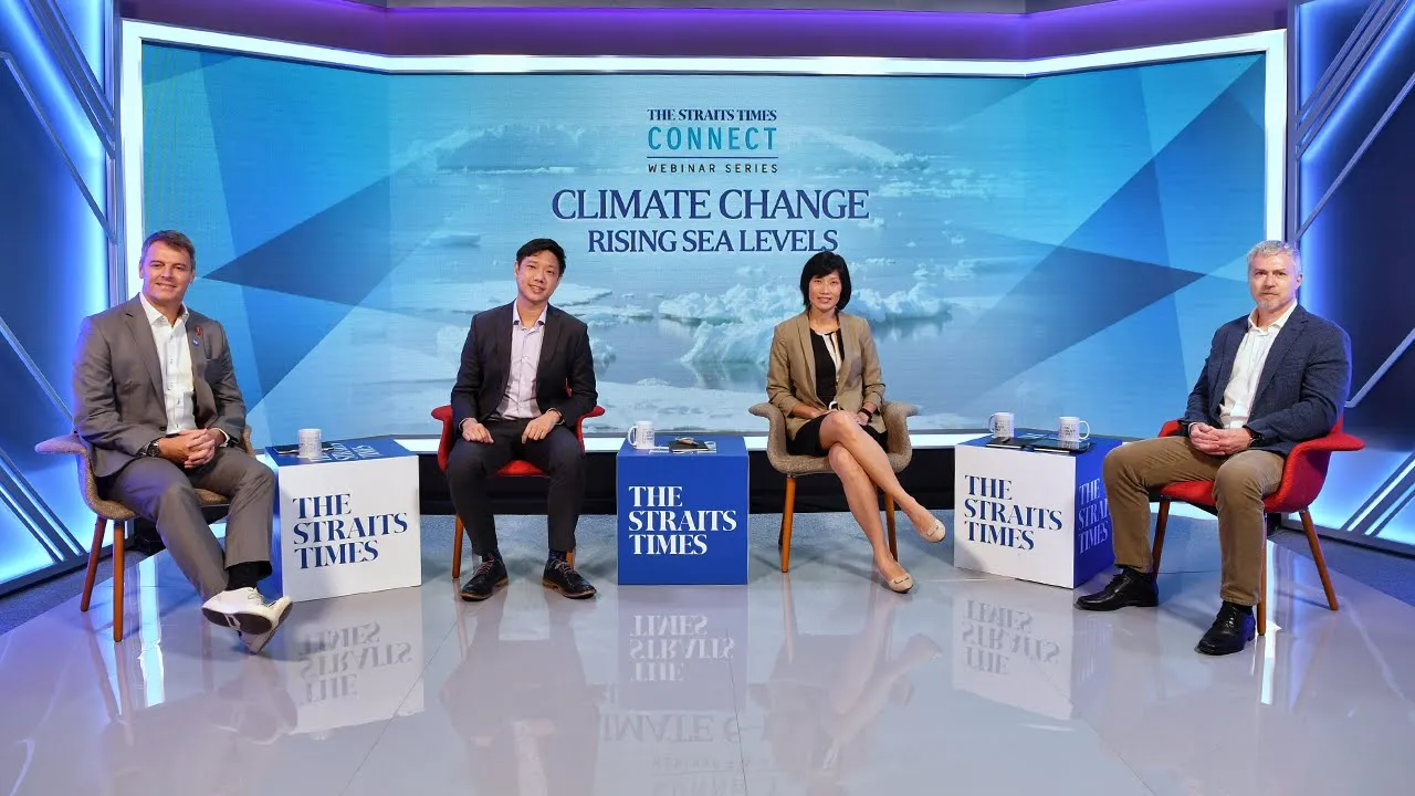

















Singapore is implementing a comprehensive coastal defense strategy that combines engineered solutions (seawalls, elevated infrastructure, mobile flood barriers) with nature-based approaches (mangroves, rock revetments, naturalized waterways) to protect against sea level rise, recognizing that climate change poses an existential threat requiring adaptive, multi-functional measures that balance flood protection with biodiversity conservation and community livability.
How Singapore Is Building Coastal Defenses Against Rising Seas
Added:Understanding the drivers of global sea level rise, including thermal expansion and glacial melt due to climate change.
Basic coastal geography and the vulnerability of low-lying island nations to inundation and severe storm surges.
The distinction between traditional 'hard' coastal engineering (e.g., seawalls, dykes, breakwaters) and 'soft' or nature-based solutions.
Fundamentals of tidal dynamics and how high tides and monsoon seasons compound the risks of rising sea levels.
Comparative analysis of global coastal defense strategies, comparing Singapore's model with the Netherlands (Delta Works) and Venice (MOSE).
The integration of coastal defenses with urban planning, specifically 'Sponge City' designs and sustainable inland drainage systems.
The economic and policy-making frameworks required to fund and manage multi-decade, multi-billion-dollar climate adaptation infrastructure projects.
Advanced research into hybrid engineering, such as combining artificial seawalls with living shorelines to enhance marine biodiversity while mitigating wave energy.
21.1K views47likes45:34Original Release: 2022-10-26
foreign [Music] what we see along our coastlines today will not be there in the event of continuing sea level rise at the current rates we are going to see extreme sea level rise a number of places we are used to will be underwater climate change and inevitable sea level rise if we let forward planning let me rephrase the question what will you see along the coastline will never be the same our flash flood today with some areas recording the heaviest rainfall in 1981.
you see sometimes the High Tides floods the path already so imagine if another meter of sea level rise would would do sea level rise and then compounding factors such as storms and heavy rainfall they will all combine together to make the problem a lot worse climate change and sea level rise is an existential threat to Singapore we need whole Community to understand what we are facing the impact that we can have and we will need careful planning as to what type of measures will suit the different coastlines of Singapore the actions are meant for us to protect what we have to enhance to maybe even improve if we don't do anything it will be gone this is an opportunity for us to co-create with the coastal communities to increase our climate resilience and protect the biodiversity and habitats I cannot be certain whether we have time on our side or not but I think this means we should look at the solutions right now to get things started there is no time to waste [Music] [Applause] [Music] [Applause] essentially global warming is a result of human activity in the last 75 years since the world war and as a result of that we're seeing the melting of the ice icebergs as well as also Perma Frost uh this aggravation is going to lead to significant sea level rise that will affect not only our countries all the world but close to half a billion people particularly in the Asia Pacific are likely to be affected by sea level rates nothing is done to mitigate the sea level rise it will cause inundation of our land leading to loss of property assets infrastructure and livelihood about most prediction actually based on satellite images of how they see in the surface is melted what we do not know is that 90 of the ice is actually below the water line and how it melts and how fast you melt is still uncertain the ipcc report has shown that sea level rise can be up to one meter by the year 2100 Singapore needs to contextualize the finding of the ipcc report Singapore is a very small place and often these Global Climate models don't even see Singapore the details of the coast for example are quite complicated and local here and and these sorts of details are not captured in the global climate models that are traditionally used now if you think of the weather in Singapore how heavy it will rain and also how often it will rain because that rainfall floods in land and of course as you can imagine if the storm's out at Sea if the tropical Cyclones further away are also increasing in intensity and frequency that combination is a perfect storm foreign [Music] is not going to happen every day so it's about understanding the extreme events I'll give an analogy of insurance when I insure my car or my health insurance I'm not insuring against what's most likely to happen and I won't crash my car tomorrow I hopefully won't get ill tomorrow but I'm taking that insurance for that extreme event for that one in a thousand time happening it's like that with Coastal protection and with other forms of climate defense I do I as well so I think that's the challenge what we need to do is plan iteratively and build defenses that build on the latest science so we might update the science every five years or so when we think about extreme sea levels apart from rising mean sea levels there is also transient effects like high tides as well as Coastal surges that may temporarily cause sea level rise to a very high level vulnerability depends on the land users for the area as well as some of the physical characteristics like the topography or simply put the ground levels so if we were to take an example like in the city east coast we find that the financial Hub is there there are residential areas and Changi Airport lies within the city east coast area and that makes it very vulnerable especially when it is a low-lying part of Singapore Singapore is a tropical island it receives a lot of rainfall under normal circumstances on the climate change we are going to see an increase in that if flooding happens if some areas become extremely fat prone in Singapore we don't have a higher Hinterland where we can move that makes it critical to safeguard the only areas that we actually can use the water can come from two main sources either rainfall or from the sea we would look at tracking and quantifying the water then over the land as it flows over the land through the drains and under the ground [Music] given that a lot of the vulnerable areas are also densely populated either residential or commercial so we should care about flooding you see our guys have really walked the entire stretch yeah we did an extensive survey not only on the technical things but also on the biodiversity and all the nature that we can see here it's nice I think we have checked out all the other drains actually we have about 12 other drains we in fact we can see the one right here because when the sea level rises of course it's also going to push into the drain and then that's how the flood actually propagates we are leading the study for pob Southeast coast side specific study the Adaptive planning area for the city southeast coast ranges all the way from Changi to the greater Southern Waterfront it stretches a coastline length of about 58 kilometers long on one hand we are looking at sea level rise on the other hand we are looking at trying to discharge water due to rainfall events we know what has happened over the last few years and how it's going to happen in the next few years but if you look at scenarios then at least you can say well we have a mid scenario that's not too bad you have an extreme scenario and you have maybe an optimistic scenario but to prepare ourselves it is good to adjust for the mid scenario and then in the future you start monitoring you see actually what's happened those measures can always be adjusted to a higher scenario a more extreme case or on the other hand a lower scenario [Music] foreign look at our coastlines today it houses Beach biodiversity natural habitats some of them are popular recreational spaces and some the heavier Sports and marine industries so when when we look at what are some of these Coastal protection measures that we want to put at these places we need to be mindful of what is currently there and the land users in the future and where do we find a space to actually accommodate Coastal protection measures climate change is thrill we have seen it from recent events all over the world hurricanes wildfires heat stress crops that are dying and these are all things that could have been prevented each of us can play a role in reducing climate change and hopefully that will slow down sea level rise and in the process may even allow our bio Marine system like corals to thrive under this situation I think this is a great opportunity for us to take a step back think about you know what exactly we want for our Coastal spaces we could re-imagine what we want to build for our generation and for the generations to come and so that we can all benefit from it [Music] was a rising the rain is more intense and the winds that are whipped up on the sea can also be ain't more intense whilst we talk about maybe a sea level rise of one meter by 2100 it won't stop there the purpose-built model will be developed based on Singapore's Urban and densely built up environment the model will also help us to evaluate the effectiveness of coastal protection measures that we plan as well as subsequently help us in our operations of some of these measures scenario planning can help us in multiple ways the coastal Inland model uses a cutting edge technique or subgrid for the flooding simulations foreign [Music] [Applause] [Music] the sea levels are rising the rain is more intense and the winds that are whipped up on the sea can also be ain't more intense and you put those together a perfect storm could be quiet quite a significant issue when you have a flood incident it is not necessarily a combination of all the events it can be actually part or in combination some of these events rain is due to water presentation from the Sea The Tide is actually due to the gravitational pull on the moon and we tend to get high tidal variation because of proximity in Equator the search is actually due to usually the North East Wind that actually blows through the created such event but these are typically not large in Singapore because we're protected but sea level rise is actually due to global warming 5.5 whilst we talk about maybe a sea level Riser one meter by 2100 it won't stop there oceans will be continuing to heat up and when an ocean heats up it expands and there's only one way to go which is up so sea levels rise and that could be several meters Beyond 2100 in the worst case scenarios could be as high as 10 or 15 meters that's a lot of Singapore's current land levels underwater so in terms of how we can prepare for the next 50 or 100 years the big project we have in ccrs right now is the third National Climate Change projections in the V3 project we're taking the global climber models look at the projections which have been produced by centers around the world at around 75 kilometer or more up to 200 kilometer grid spacing and we we're telescoping down into the Singapore region so we're running our own models to take that Global Information and provide regional and local Regional climate projections and to represent that uncertainty we don't just choose one Global Climate model we can take different Global climber models from different institutes in the world from the US from Europe from Australia the UK and each of those is producing their own data sets we can access those data sets it might be business as usual where we just carry on emitting fossil fuels as we're doing now so that will lead to a higher estimate of climate change but we also have hope that we will have maybe the Other Extreme maybe stick to the goals of the Paris agreement and that will provide much reduced levels of climate change and so between those two extremes we can run different scenarios of the way humans might respond to get a range of estimates of climate change in the Deep Tropics this really is first of its kind and we need that to provide those very detailed estimates of rainfall of humidity changes of sea level rise that will allow our local stakeholders such as Pub to plan effectively for the impacts of flooding sea level rise at a local level when it comes to Coastal production Pub takes a holistic risk approach to model the combined effects of both the Inland brain as well as sea level rise we instead of a fixed set of plants we are adopting an Adaptive approach so that we can devise and make plans along the way when climate science advances inform us on what are some of the trajectories moving forward we have actually segregated our coastlines into eight tanning areas and the reason why we do that is because each of the planning areas are actually hydraulically connected and this actually means that if a water passes through to one part of the coastline it can actually affect the entire area and therefore it helps us to look at such specific characteristics that is required the coastal processes there we will need to carry outside specific studies because of the different land use characteristics so for some areas there are more natural areas more rustic and there's a lot of Rich natural habitats and that is where we need to be very sensitive when we think about implementing Coastal protection measures along these coastlines for more built up areas like the southwestern Coast where it houses a lot of marine and offshore Industries it is very important for us to ensure that when we build some of these protection measures we will allow the operations of Waterfront Industries to continue and for other areas more urban areas settings like in the city area we will need to factor in considerations like livability to enhance the aesthetic features of the area so that we can allow people to still enjoy these Coastal spaces as we protect ourselves from sea level rise Inland impact is generally due to extreme rainfall incidents you know that overflow the current drainage system whereas coastal flooding is generally due to sea level rise title changes and such and this can actually happen with or without extreme rainfall [Music] h2i with Pub and nus we are co-developing a computer-based modeling system which is a suit of tools to understand and predict flooding patterns in Singapore in a holistic manner the computer model tries to track and quantify the flow of water over the surface under the surface as well as through the drains and channels and in case of flooding the propagation as water over tops the drains or comes in Inland through the seaside the coastal Inland flood model allows simulation of the complex flow patterns in the urban areas because of the densely populated Urban systems under the two main flood drivers in Singapore which is rainfall and sea levels build model will be developed based on Singapore's Urban and densely built up environment it comprises of two independent models the Inland model and the coastal model that can be run separately all together to assess the holistic risks in many parts of the world flat risks are assessed separately from the Inland rainfall and from the coastal areas the model will also help us to evaluate the effectiveness of coastal protection measures that we plan as well as subsequently help us in our operations on some of these measures the worst case sea level projections for Singapore are one meter rise in 2100 this gives us quite some time to analyze what the gaps are in our understanding about the flooding processes from the seaside as well as Inland starting early gives us more options with that scenario planning can help us in multiple ways the primary kind of scenarios are flood prevention scenarios which ensure that floods do not happen in the first place they are related to engineering works such as Seawall constructions or drainage and channel constructions and widening in operational context this can mean when to switch on pumps close Gates another reason for scenarios are flood mitigation where in case of flood does happen we want to minimize the impact of the flag in an early warning situation it is crucial to understand and know ahead of time the where and when precisely the flood is going to happen the coastal Inland model uses a cutting edge technique called subgrid for the flooding simulations the subgrid is a smart sampling method which automatically selects and scales important physical processes that allows us to run detailed simulation in fraction of time yeah so because we have some problems that we we are facing right now with the subgrid models putting the rain on top so what are the steps we can take to sort of clean the artificial floods from Model results when I come to the conclusion that it has been a thin layer yes so we are here at East Coast Park at the single up Canal the single up Canal outfall it's where the canal flows into the sea we're going to take some flood control actions here in the East Coast Park a main part of our work involves the hydrodynamic modeling both for poster as well as Inland with this modeling work we put identify the flat Rays we can produce flood maps and we can actually assess and quantify the damages from there we would then formulate adaptation measures when we think about coaster defense structures we require a continuous line of defense similar to our Singapore water story where we have actually changed a vulnerability into a strength our vision is to develop Singapore as the leader in urban Coastal production and flood management research Solutions and Engineering Services [Applause] [Music] [Applause] let me show you the Topography of Singapore when sea levels rise all these parts will increasingly be at risk not underwater yet but at risk like Chinatown used to be in the old days height rain trouble D efforts actually started way back in 2008 yeah when the building and construction Authority or the BCA from the new Department to study the impacts of mean sea level rise and started looking at what are some of these Coastal protection measures that we will need to put in place for the whole of Singapore so two of the significant studies that were carried out by BCA included a risk map study to assess the risks to Mainland Singapore as well as to come up with a high level plan on what are some of the measures and protection that we would need for for Singapore and that led on to the National Day rally in 2019 when the Prime Minister announced that Coastal protection is an important Endeavor for Singapore to safeguard ourselves against the existential threat of sea level rise and that is when pob was appointed to the National Coastal Protection Agency in 2020 team so since then we have actually started work on Coastal protection in terms of developing the strategies for Coastal protection formulating policies embarking on site-specific studies to study the areas and understand the risk not only from the threats of rising sea levels but also from the Inland rain to take Ang Mo Kio bishan Park as an example we have converted a concrete Canal into a naturalized Waterway and by doing that we have actually expanded the area of our Park during dry days when it is not needed for storm water management and on wet days the entire area will turn into a flood plain and convey the storm water and reduce flood risks [Music] foreign Coastline has different typologies for example Changi Airport and tuas airport they're on reclaimed land protected by a wall sea walls then you have the East part of Singapore where the beaches and you have also on the northwest part of Singapore where there are marshes and wetlands all these different typologies require site-specific inductive planning which Solutions are not necessarily one-size-fit or solution [Music] foreign about 70 percent of Singapore's coastlines are protected by heart engineered structures like sea walls and stone developments and of course for the rest of the areas they are lined by more natural features like features at Changi yeah what we have done is we have also over the years elevated our minimum platform Reclamation levels and therefore for critical infrastructure like Changi Airport at the Changi area it has been elevated to about five meters above the main sea level and along East Coast beach as East Coast Park we have the natural Beach if you were to look at VivoCity at the south for the Promenade that is fronting the water edge there are vertical sea walls over there sea walls are typically vertical reinforced concrete structures for places where it is very space constrained seawalls will provide a good measure where we can also complement with multi-functionality like boardwalks and bring people to the edge of the waters and at the same time be able to fulfill our objective for Coastal protection and moving on to the Northwestern Coast that's where our Coastal reservoirs are housed and we do have dikes and dams that is protecting the area revert burns are structures that are found basically on banks or Cliffs along the coastlines and they are made of materials like rocks gravels and it gives a bit of a more natural look to the environment so you normally find that maybe in the more natural areas like in the Northwestern Coast at crunchy and we also find some rock developments at the marina South area [Music] foreign [Music] [Applause] [Music] Canal outfall it's where the canal flows into the sea looking at your surroundings you can see that we're actually standing a little bit elevated Above the Rest of the East Coast Park and you can imagine that in the future something like this will need to happen to the east coast in order for us to reach a similar type of protection level and with that comes all sorts of different options we can walk to that a little bit further down the coast and you will see the coastal protection measure with an erosion protection measure which then is combined into your climate adaptation gland foreign so what you see behind us here it's an erosion control measure we call it a tombolo well we're going to take some flood control actions here in the East Coast Park we also always need to consider erosion therefore we will Design in such a way that we can still enjoy this park in a good way actually have we discussed how we will integrate the coastal modeling and the Inland modeling what we can see in the field is where the drains enter into the sea there's a direct interaction and as the sea level rises of course it's going to push into the drains so where the two models come together is exactly right there I think we have the preliminary data at a very good position to start shortlisting the toolkits that's great uh Gavin because then I mean it's also these kind of these kind of renders that are going to play an important role when we do with the stakeholder participation and it really gives you a visualization of what it could look like in the future right the coastal protection for Singapore started basically by the first area that's the the Southeast coast so starting from Changi all the way down east coast and then down to keppel and brania and Sentosa and this project was the first in a row of projects like the Singapore government has initiated to basically prepare itself for future climate changes specifically on the coastal side but also on the Inland drainage part and looking at flood risk and the avoidance of that a main part of our work involves the hydrodynamic modeling both for coaster as well as Inland with this modeling work we could identify the flat Ridge we can produce flood maps and we can actually assess and quantify the damages from there we will then formulate adaptation measures the final stage of the studies involve developing Master plans for the adaptation measures so that we can implement it progressively foreign [Music] when I run the model simulations like with inputs of the brain inside I can see that the water level is rising with the tidal influence as well we managed to match them we look at the proper data yeah so now we are almost matching the pick [Music] so when we think about coaster defense structures we require a continuous line of defense however when we look at some of our streets right how do we close them do we close them up with dikes and dams yeah permanently but that will actually affect the navigational traffic that we require to access so search barriers then offer an option for us to close the gates only when in the event of extreme events and during normal days we can open the barriers such that we can continue to let all these navigation traffic to continue similar to our Singapore water story where we have actually changed a vulnerability into a strength our vision is to develop Singapore as the leader in urban Coastal protection and flood management research Solutions and Engineering Services and through that I think we will be able to let our expertise and our solutions to other coastal cities who may have the same challenge of sea level rise so mangroves are a really key part of our coastal defense they have all of these really complex above ground routes and when a wave hits those it takes the energy out of the waves Mother Nature if given time if given its own way to create a solution it typically does today our coastlines are already very built up so when we think about Coastal protection we think about how we want to create Living Spaces a better environment where people can come and enjoy rather than just a facility that protects us from sea level rise sea level rise is not necessarily a negative situation it is a good opportunity on once in a lifetime generation for us to reinvent transform the coastline foreign [Music] [Applause] so in Singapore different parts of our Coastline will experience different effects of climate change but what they all have in common is sea level rise so mangroves are a really key part of our coastal defense they have all of these really complex above ground roots and when a wave hits those it takes the energy out of the wave so the wave at the the front of the mangrove as it goes through the mangrove the wave height decreases so that's kind of immediate form of coastal protection particularly around storms so this Coastal protection model of mangroves that we developed was for a couple of different sites somewhere below Wetland Reserve pull out to Kong passover's park and mandai Mangrove a mudflap this ability of mangroves to keep Pace with sea level rise by trapping any mud particles that are floating in the water and consolidate them on the surface also gives us a much longer term form of coastal protection so in 2011 we installed a number of instruments across a few mangroves in Northwest Singapore and these instruments are designed to measure how the mangrove is responding to long-term things such as sea level rise so basically we install these instruments into the ground and we have to drill them really deep until they hit some stable sediment maybe 15 meters deep or so and then we we come every six months with an instrument that we put on top and that instrument basically measures how much sediment is accumulating or how much the soil column is shrinking over time our set number six so once we have this field data of what the mangroves are doing we can put them into these bigger national scale models and to that we add our field data to data of the elevation of all of our different mangroves and seagrasses we add on sea level rise projections and we put it all together to try and project by 2050 or by 2100 what are mangroves and seagrasses might look like for some of the areas where we are already seeing natural habitats I think that is what we want to actively do to see how we can complement some of these nature elements together with our engineered structures so instead of just building a slope revertent where we only use rocks or gravels I think there's a potential for us to also incorporate mangroves into structures like this mangroves are very effective in attenuating wave energy because of the density of the roots as they grow yeah but we do need a lot of space for mangroves for the entire habitat foreign so where we are right now is actually the crunchy Coastal Nature Park right and in front of me you will be able to see the kranji dam right that cuts across the crunchy Reservoir and separates it from the sea water and the sea water is actually the streets of Johor and imagine just 10 years ago what you'll be able to see is not this bunch of rocks over here but actually a cliff a cliff of red clay being undercut by waves from the streets of Johor falling into the sea and if you see behind me you'll be able to see that there are these big mangrove trees and at that point of time they were being washed away by wave action by current drifts and all sorts of energy so what we did uh was about three years ago we put in a 400 meter long Rock Development that you see right here and that showed up the entire area we did a bit of gentle computer modeling to find out how the currents moved and we basically structured these areas to slow down or take away the energy of the wave action and if you look around you'll see some small trees these trees are no more than two and a half three years old and they represent various species of Mangrove plants so you'll be able to see to my right here a very very small example of a rhizophrah that's a mangrove tree over to my left you'll be able to see sonoration these are all mangrove trees that have grown in naturally they have established themselves after the wave action has been stopped after the revelman has been built what's really interesting about all this is that this is assisted natural Regeneration all we needed to do was to figure out the appropriate profiling of the area put in some rocks to basically stop wave action and because of that mother nature was able to bounce back Mother Nature is resilient and is a virtual cycle because once all these mangroves have come in through our little bit of help establish themselves what they will do naturally is then provide more mitigation of the impacts of wave action of current of tidal drift of essentially water action taking away sediments what we can see over here in this direction is the Western end of the crunchy Coastal Nature Park Singapore's coastline is protected quite a lot by Nature actually surprisingly for quite a developed Nation we have about 16 percent of our Mainland Coastline protected by mangroves about 12 11 to 12 percent protected by sandy beaches and about one percent which are rocky shores these natural habitats can be part of a solution to protect Singapore's Coastline so if they were part of a hybrid solution or natural based solution a nature-based solution to basically protect our coastlines from Storm surges sea level rise even floods so nature-based Solutions can take many forms it could be pure nature it could be a hybrid solution and for example the kranji coastal part what you see is actually a hybrid solution because we use engineering solutions to basically help the natural habitat restore itself and in so doing the natural habitat will be able to protect the cosine as well I think the main lesson we can learn from nature is resilience I think that mother nature if given time is given its own way to create a solution it typically does what it does need is time foreign s are already very built up and Singapore is so Compact and we are land constrained and so when we think about Coastal protection we think about how we want to create Living Spaces you know a better environment where people can come and enjoy rather than just a facility that protects us from sea level rise therefore we take into consideration the land users and how we actually complement you know the built environment as we go along with Coastal protection the marina barrage is a good example of multifunctional facility so it is basically a barrier that cuts off the tidal influence of the sea from the low-lying city areas but at the same time it is a lifestyle attraction a recreational space where people go to you know over the weekends to enjoy for picnics and most of the time they don't even realize that it is actually a functional facility that helps us and protect us from flooding and above that it creates a fresh water reservoir and it actually enhances you know our water supply for Singapore foreign there are many good examples from the Netherlands and one example is the card read underground parking system it is actually situated right beside a beach and the garage is actually built within the dike itself which forms the main Coastal protection measure to protect the town behind it another example will be from Germany Hamburg there is a popular Promenade yeah where the whole many festivals and parades and because of sea level rise the authorities there have to raise the Promenade by two meters so what they have done is they have retrofitted the historical buildings such that they maintain the historical look and feel of these buildings and yet at the same time be able to achieve the flood protection level that they desire another good example will be from Lower Manhattan that is a busy Promenade area where they have deployed integrated planning concept as well to build in multifunctionality into their business Waterfront [Music] the climate change is very top of mind for New Yorkers New York City has over 800 kilometers Coastline those coasts are really the engine of our economy and they're also really the center of our daily life in New York City but because we're a coastal city we do expect to see and we're already starting to see increasingly more severe events due to climate change which include higher high tide flooding so we've planned our master plan for Lower Manhattan in four phases and that allows us to really think strategically and we're working to advance that design over the next few years this includes raising the shoreline of lower Manhattan one meter higher than it is today it also means building a new flood wall system that would be about five meters or more higher than the elevation today we're also building new drainage infrastructure that would manage the flow of water during a coastal storm or during an extreme rainfall event along with all of that we have a lot of really important Ferry Terminals and other Maritime assets along this Waterfront that we need to protect long-term against climate change for Lower Manhattan the first people who were really thinking about culture resilience in this area were actually the community members the people who live in this area who work in this area because they were beginning to see the effects of climate change on their community so they reached out to their elected officials they asked the city to take action but in a way that actually improves the quality of life for their community and we're here today and we're working on these Solutions because of their advocacy foreign [Music] is actually a very long-term and significant Endeavor we have started to engage major groups in our Environmental Studies to better understand what are some of the concerns along various segments of the coastlines and then we also look forward to our community engagement sessions that will happen at the end of this year we want to hear from members of the public and Community you know what their aspirations are for different parts of the coastline [Music] Silo rice is not necessarily a negative situation in fact there's a positive narrative to it you'll be able to leverage this sea level rise for the benefit of an island nation it is a good opportunity on once in a lifetime generation for us to reinvent and transform the coastline that will not only improve our Coastal resilience but they also enhance the coastal communities living play and work and at the same time help us to protect the biodiversity and the habitats and Marine habitats [Music] [Applause] [Music] [Applause] [Music] [Music] foreign [Music]
Up Next

47:49
Singapore's Energy Challenge: Inside Our Power Consumption
@CNAInsider
139.6K views•2021-03-19

30:32
Ultrasonic Transducers: Resonant Frequency Measurement and Horn Design
@imajeenyus42
229.9K views•2017-02-22
54:16
Polymer Environmental Degradation: Mechanisms & Stabilization
@iit
1.8K views•2012-07-10
33:39
How a Student's Question Saved a NYC Skyscraper from Collapse
@veritasium
22.8M views•2025-04-26
Related Study Plans & Knowledge Roadmaps
Structured learning paths in Engineering
engineering
Building Acoustic Levitators: Physics & Arduino
01The Physics of Sound and Standing Waves
02Piezoelectric Transducers and H-Bridge Drivers
03Arduino Programming: Generating 40 kHz Signals
+ 2 more learning modules
14h5 modules
Explore Roadmap
engineering
Building Peltier Cloud Chambers: Particle Tracks
01Cosmic Rays & Cloud Chamber Physics
02Thermoelectric Cooling (TEC) Fundamentals
03Custom Liquid-Cooling Loop Design
+ 2 more learning modules
18h5 modules
Explore Roadmap
engineering
Yagi-Uda Antennas: Modeling, Build & VNA Test
01Introduction to RF and Antenna Fundamentals
02Yagi-Uda Antenna Design Principles
03Antenna Modeling and Simulation in 4NEC2
+ 2 more learning modules
18h5 modules
Explore Roadmap
engineering
ECG Monitor Design: Op-Amps, Filters & Noise
01Electronics & Breadboard Basics
02Op-Amps and Instrumentation Amplifiers
03Bioelectricity and ECG Fundamentals
+ 2 more learning modules
18h5 modules
Explore Roadmap