






![공인중개사무료인강_2017부동산공법[강승우] _21강. 복습(2)](https://i.ytimg.com/vi/GnnvaeJ1Y6Q/maxresdefault.jpg)
![나만의 도시를 만드는 건설경영시뮬 0티어 [시티즈: 스카이라인 2]](https://i.ytimg.com/vi_webp/RHIIGGcff7o/maxresdefault.webp)



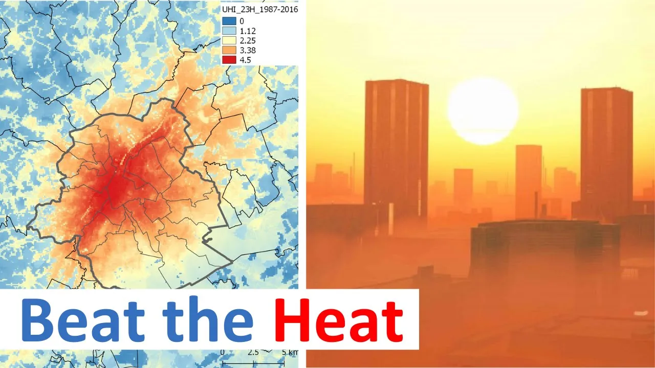

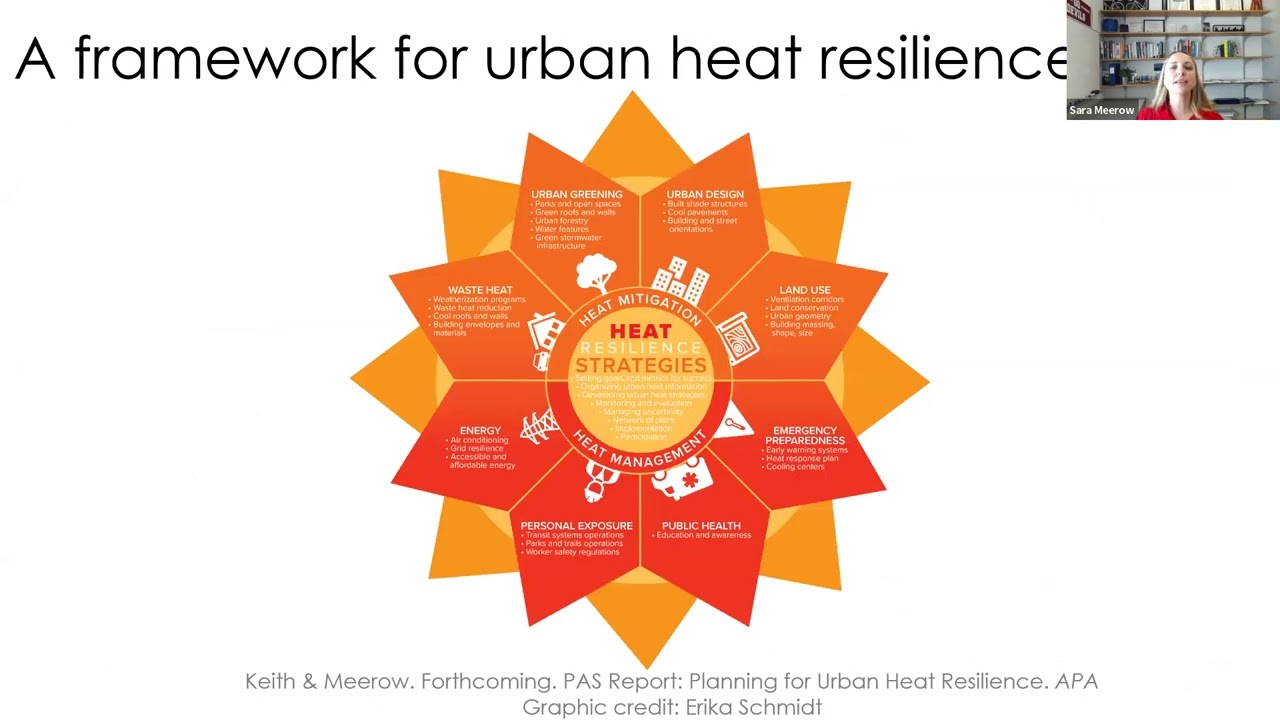

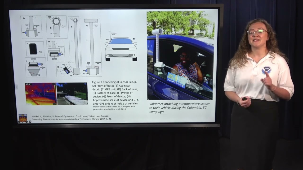






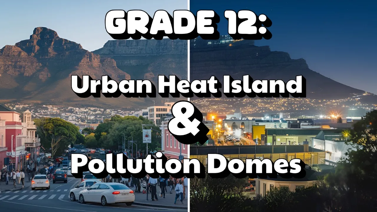
Urban heat islands, caused by concrete, exhaust, and infrastructure heat retention, create temperatures 2-5°C higher than surrounding countryside and pose significant health risks during heat waves; however, despite available urban heat maps and models, these tools remain underutilized in mainstream urban planning practice, with most cities treating them as isolated pilot projects rather than integrating them into everyday development decisions, due to lack of standardized formats, limited policy frameworks, and insufficient evidence connecting heat mitigation to tangible outcomes.
Evaluating Urban Heat Maps and Models for Planning
Added:The Urban Heat Island (UHI) effect, including its primary causes such as high concentrations of impervious surfaces and lack of vegetation.
Basic concepts of Geographic Information Systems (GIS) and spatial mapping, which are essential for visualizing environmental data.
Fundamental principles of urban planning, specifically land use, zoning, and municipal infrastructure development.
The distinction between climate change mitigation (reducing emissions) and climate resilience/adaptation (preparing for impacts).
Design and deployment of specific heat mitigation strategies, such as green roofs, cool pavements, and urban forestry networks.
The integration of social vulnerability indexes (SVI) with thermal mapping to address environmental justice and equitable heat resilience.
Policy implementation frameworks, including local zoning ordinances, building codes, and municipal Heat Action Plans.
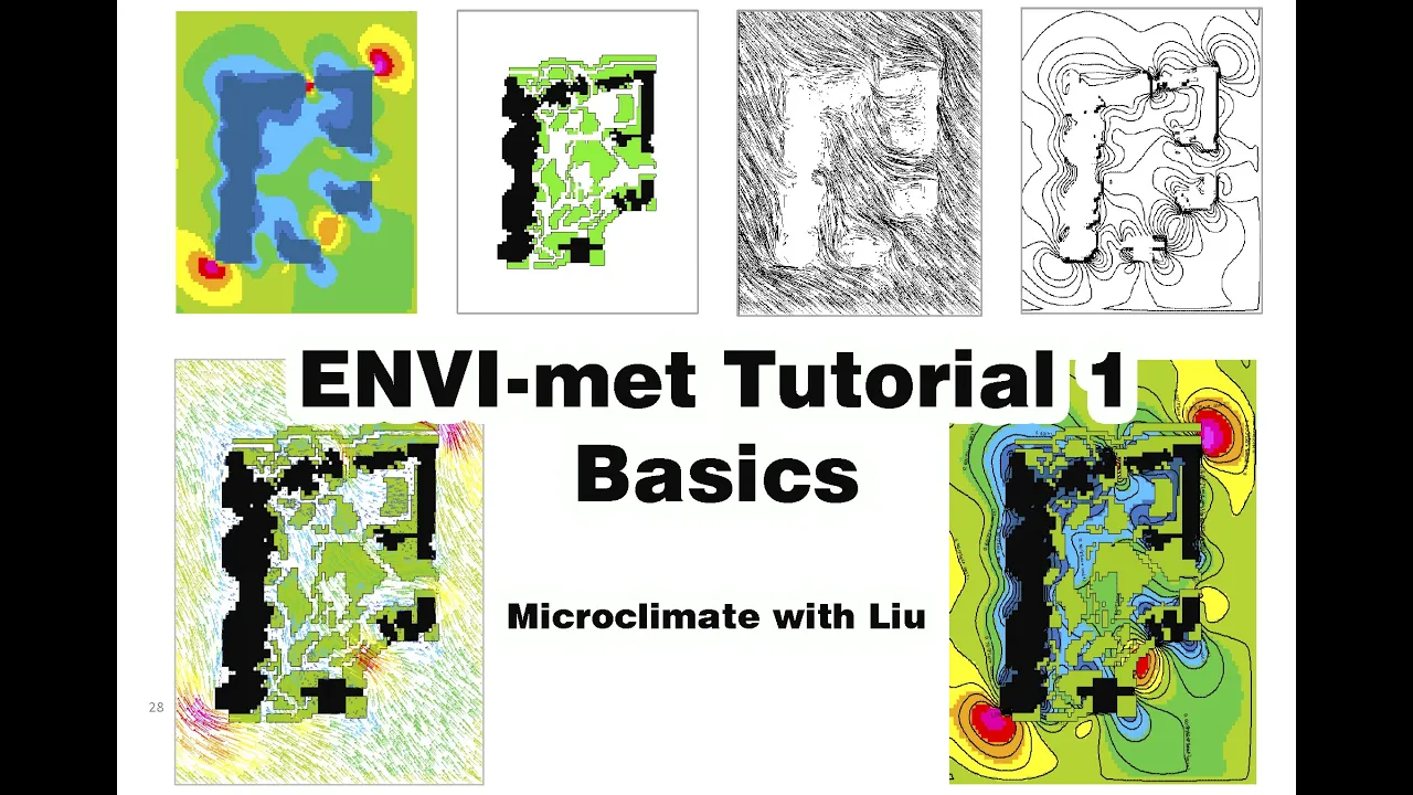
Advanced microclimate modeling software (such as ENVI-met) to simulate and predict the thermal performance of future urban designs.
175 views4likes17:14Original Release: 2017-10-06
hang out next that dislike me but I'm planning faculty in the College of Architecture planning Landscape Architecture and this is a project I'm working on with Ben so they built on some of his past research and expertise so I've been also some with his future cleanest projects and also I'm working with Michael story or GRA from Landscape Architecture who's with us here today so we actually got started before the Fleming was official so thank you for that and and we have some kind of interesting results already so I think it's kind of a we're looking at evaluating the use of urban heat maps and models and urban planning and obviously there's a topic of growing concern so one reason would be the urban heat island effect a lot of people know of this it's kind of become popularized from the last decade or so but it's the idea that when you build in cities the concrete's and exhaust and PCs running builds additional heat within the city that raises the temperature outside of what you would see in the surrounding countryside and actually it's been documented since 1818 a team in London that's meteorologists looking at it so so we've known about it for a long time but it's just kind of barely now working into planning I have an obviously another reason for concern is temperature increases due to climate change and things like potential extreme heat waves in the future so there's a lot of document that impacts on communities that specifically go into urban planning to let those relate to he related health concerns and so there's a lot of evidence that shows if you have nighttime temperatures below 80 degrees for a couple of days of increases honorable populations for a culprit health risk it's a huge stressor around urban ecology so kind of investments that we make into our plants in disease and then it also kind of goes against a lot of climate change mitigation measures the planners are trying to pursue because when temperatures get hotter if you have AC source well cool literacy tend to you some more and they'd be standard to you such as limiting or greenhouse as mission so there's a lot of reasons to be concerned about it for planning and then another reason is it actually goes in direct conflict with a lot of current urban planning bowls and practices so I'm kind of nationwide but then also specifically for a lot of cities in the southwest we're looking at increasing density in cities and things like infill development to make more compact cities again to greenhouse gas emissions and we're all making a lot of investments in walkability bicycling and transit you Sonne obviously it's hotter outside you're less likely to walk around you're less likely to use transit and bison also so it's kind of also an economic infrastructure investment concern too and so there's a lot of research going on in this area ASU particular is doing a lot of great work under and microclimate ecology there's a lot of work going on and improving the urban heat mapping and modeling and then specifically looking at impacts things like I mentioned the public health urban ecology and then st. Rican City can see on the right-hand side their own College of Architecture planning landscape architecture helps city high school down there I'm to kind of do some treatments with wind sails because it wasn't appropriate to have tree plantings which you hear about a lot for for combat and keep so so there's a lot of things that we know the word for it but what I'm specifically looking at is the lack of research on urban heat as a policy focus and they did that we know a lot of these good measures we have a lot of heat maps available but it's really not breaking its way into day-to-day planning practice so you don't hear about developments dealing with urban keeps unless it's developer driven and so governments are kind of grappling with how to incorporate this into their day to day practices so some of the theoretical stuff that I'm kind of interested in when I'm looking at this our policy innovations in urban planning so it was super quick you can have regional diffusion where potentially on policies have a geographic or spatial consideration where cities may imitate each other there might be kind of peer pressure to do things we might be competitive so you see a lot of that policy and then there's also internal determinants and a lot of you familiar with kind of adaptive capacity I did for climate change adaptation so things like will cities adopt urban heat policies because they have access to resources like the University of Arizona or do they offer special grant access they might have a strong local leadership or public support for those things have an important windows of opportunity so if you have an extreme heatwave I'm cities may be more likely to do something right after kind of after that window closes you may have a lack of interest from the public again so and then another thing that I'm looking at just generally is the two different approaches and so it's kind of a spectrum where on the left-hand side we have the dedicated approach where you would have planners looking at urban thief as the main objective and so when the policy emerges and urban planning this is convert historical over the last couple hundred years we've seen this intends to come out like with a specific policy specific pilot project and it's a very linear project process where you might have like a green infrastructure pilot project either about a lot to combat urban heat basically that's where you're just planning for herbin hitam it's not connected to anything else and what we're trying to move things like climate change resilience and Griffin keep planning towards is more of a mainstream approach where you integrate urban heat into every day-to-day consideration so when you do any kind of development approvals you always look at the site for transportation and economic developments and social equity and so you might have urban future climate resilience as one of those considerations so it's a kind of a spectrum that we're looking at and another reason that this project is interesting to me as I worked with Ben please my peer assessment my part was looking at how cities in the southwest or planning long-range for climate risk and so we kind of looked at past and current generations of general plans for cities those were six key study cities on the right-hand side so in Arizona New Mexico and then I did six interviews per city with layers of different types so to come and see how they perceived climate environmental risk and we've got a lot of really interesting results but what's relevant to this project in particular is everyone before hand was addressing urban flooding and now they're dressing urban flooding but realizing the climate connection to it so the climate change connection and where extreme flooding before again like the early 2000s no one was talking about urban Cuba supplanting consideration and now they're talking about it but they're not sure how to aggressive at all and so it's kind of an emerging topic that everyone's kind of becoming aware of but they're not sure how to incorporate into their policies so tucson albuquerque you men specifically are really looking at it and just just really quickly i'm on the left-hand side urban flooding on the right hand side urban heat and so you can kind of see urban flooding is currently mainstreamed urban heat is going to be dedicated and basically urban heat is emerging a lot of things best example is via email mapping that standardized i mean i'm municipal planning department look it's from mother ganges and urban heat there's no specialized staffing so so for this project we're really looking at how the documents communities and arizona-mexico i'm how they're using urban heat maps and models because some of them do happen we're looking at after we do that are iteratively working with several pilot communities to examine better practice those challenges and opportunities using those maps and then in the course expanding your network of community partners so in the timeline we already got started by documenting which communities in Arizona in New Mexico have urban keymaps models because that's never been done before so I'm already finding some interesting results I'm some cities that I would have expected having heat maps to do and collecting really detailed information on the existing maps included there's no standard format for them so how cities are requesting them and who's creating them Portland and doing more expensive policy analysis and interviews and those communities that do have them and then again from battle I think pilot communities inferring interest groups and then your to looking at an iterative work with a pilot communities to help determine challenges and future opportunities for using key maps and models to really see what's the standard current practice which out of all the planning literature does not be done we're EXO kind of scooping work that I think is really interesting and kind of due to the planning profession so some potential partners today to sign in Pima County and human cessation of governments have already expressed interest in working with us we've done a lot of work I think weekly mr. Garvin sir Leroy might have done work with Las Cruces El Paso and Ciudad Juarez and then American Planning Association in the Urban Land Institute of expressed interest as well as the Rockefellers 100 resilient cities because they're really interested in hurricanes but again though it's really looking at the policy and of innovation aspects of it so two quick examples and then one is specifically kind of just what we captured in the first the first couple weeks of our product is really looking at how this abuse on and it's keep matter working because again though it's kind of been a comprehensive overview of who's using the key map and whether its challenges some limitations so had had a key map created I had saved like six years ago and they're calling it their green infrastructure prioritization tool and you can go to it online so these is actually right now as part of a criteria for their conservative against Panchal words for green infrastructure and so kind of I don't think a lot of people were aware that it's already being used for granting processes and they use it for consideration and regional transportation planning projects which rotate reversal plant more trees around to encourage walkability so the City of Tucson also uses paddocks map and they actually used it to identify barriers for mayor Rothschilds ten thousand trees campaign you see a lot of kind of urban forestry is the common thing for combating urban keeps and they actually in 2014 they surpassed the ten thousand trees and their expedition like thirty thousand trees to think right now but but so they could have identified the hunter is something also had a social equity overlay map but they looked at to help identify where to plant the trees I think this is really groundbreaking because it's the first documented case but I've seen any work this looks at documents literature but the city to stop actually experimenting using urban heat map to evaluate rezoning requests and on those parcels being presumed which is what a developer does when they go to parcel and want to have more development on it than currently laws on those parcels that they're asking to be resumed I'm the city to sign is often referring that he Matt and requiring more trees or medication for heat so again that's not documented anywhere else in the literature so I think that's pretty interesting and in Pima County wants to use it to help for local action on the Pierce agreement there from that aspect and then also interestingly County Library System is really interested in using us help them prioritize which libraries stretch wrap so it's gonna Bernie has a lot of ways for useless hearing to sign what that said they're ready for their second generation of urban heat map they realized that this is kind of a flawed math it was it only uses the temperature at like 10 o'clock in the morning it was done specifically in 2007 so it's kind of a weird year for tree canopy cover and so there's a lot of things that they realize are not perfectly map that they're using and then another one is the city of Las Cruces let me read the presentation a couple NASA has a development program where they kind of worked with ASU and queenís and some other partners to develop the keymaster las cruces and so they're kind of just emerging into this might be a using key map for landing policy and so they're using the map to discuss multiple populations they're using it to help promote a stream infrastructure investments on a full quarter pilot project which again you see that alive and emerging kind of areas you do a pilot project and then you slowly move towards mainstreaming and they're using it potentially as I told the guy future development to and perhaps dependency on the website at Las Brisas it's very pulp is a bragger culture so they're looking at ways that perhaps that they can serve the agricultural lands to help all the rest of the studied stuff they're having that discussion now so so again these are just two examples a lot of cities up in the Phoenix metro area you're using on keep maps but they're not really talking to each other and so hopefully this project can help you to document the waste being used and really look at the challenges and opportunities if he maps some kind of the way forward for ludie studies so again be feelin I do to give images to speak for this kind of ties into a lot of his ongoing projects to longer banditti max are you see less connections between this climate profiles absolutely you see a lot of universities creating them NASA's creating them you see some cities trying to create them themselves but there's not a really consistent language of even the inputs being used to create key maps and so it's creating a lot of confusion and I'd say unlike FEMA flood maps which are very standardized and defines even though they're absolutely flat if you actually work with them I think people recognize the flaws on them and they just kind of go forward and so emails are tricky because in the flood maps let's create a like a visible physically visible threat to property that you can see is that if it floods like in Houston or the other things that we've seen you actually see the damage that it creates and you can kind of a plan around that later and forkie good surfer because he to them can come and go people are harmed Ecology's harms but the buildings look exactly the same after or so so you use a different type of mapping than planning is used to so that's a big question is how specific to you guess before it becomes overly complex to actually use the decision-making ability but not seen in examples of municipalities being sophisticated which kind of goes to a question are you collecting any data that you can see an impact as these policies are changing specifically I'm Picasso as there's more trees are you collecting usage or like of people getting out is being done at ASU for specific like micro climatology and tell Maurice enter property can reduce the Keats and I think we're just looking at the policy aspects of that and perhaps trying to bring in some of those other research to communities that are asking you a very specific questions at this point because they have a lot of those exact same questions since there's not a legal framework to use Eden planning when they try to do things like require more trees for rezoning they they feel like they need even more evidence that it actually works before they put themselves up at risk for a lawsuit I can get the last question sure you look at the playoffs last year a lot of things that you would do to reduce heating may also use more water and so it's the trade-offs of the trade-offs of which you can actually be with resources that we have you know communities are talking to her asking questions
Up Next

23:04
Exporting Harm: The High-Tech Trashing of Asia – E-Waste Crisis
@BaselAction
425.3K views•2013-05-16

15:54
Life in Biosphere 2: Sustainable Ecosystems & Human Survival
@TED
334.9K views•2009-06-16

14:30
Microplastics Everywhere: How Plastic Impacts Our Lives
@TEDx
100.9K views•2018-05-08

10:28
Ice Stupa Artificial Glaciers: Solving Ladakh's Water Crisis
@SonamWangchuk66
3.2M views•2015-05-03
Related Study Plans & Knowledge Roadmaps
Structured learning paths in Environmental Science
environmental-science
Ocean Noise: Cetacean Impacts & Mitigation
01Fundamentals of Underwater Acoustics
02Marine Mammal Bioacoustics
03Anthropogenic Noise: Shipping & Seismic Surveying
+ 2 more learning modules
16h5 modules
Explore Roadmap
environmental-science
Road Ecology: Corridors, Overpasses & Fencing
01Foundations of Habitat Fragmentation and Carnivore Ecology
02The Road Barrier: Ecological Impacts of Transport Infrastructure
03Principles of Ecological Corridors and Connectivity Mapping
+ 3 more learning modules
14h6 modules
Explore Roadmap
environmental-science
Ocean Acidification: Kelp Buffering & Shellfish
01Fundamentals of Ocean Chemistry & pH
02Chemical Pathways of Coastal Acidification
03Bivalve Physiology & Calcification Under Stress
+ 2 more learning modules
18h5 modules
Explore Roadmap
environmental-science
Ice Stupas: Glacial Retreat & Water Security
01Foundations of Glaciology & Mountain Hydrology
02Climate Change and Glacial Retreat Dynamics
03The Science of Ice Stupas & Artificial Glaciers
+ 2 more learning modules
14h5 modules
Explore Roadmap