






![Types of Map Projections [AP Human Geography]](https://i.ytimg.com/vi_webp/IBYzeT2O97g/maxresdefault.webp)
![Map Projections & Types of Maps [AP Human Geography Review: Unit 1 Topic 1]](https://i.ytimg.com/vi/coDnSg9xGlU/maxresdefault.jpg)

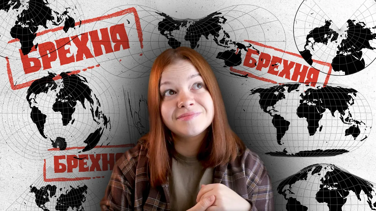



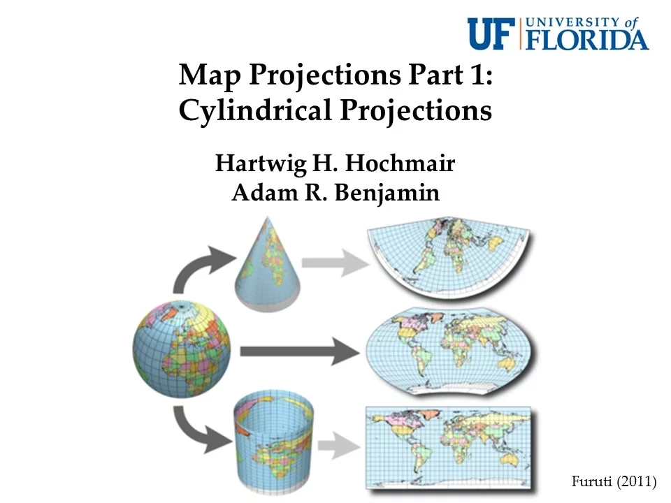



Map projections are methods to represent Earth's curved surface on a flat plane, inevitably causing distortions in shape, area, or distance; they are classified into three main types—conical (tangent or secant), cylindrical (normal, transverse, or oblique), and planar/azimuthal (polar, equatorial, or oblique)—with each type preserving different properties: conformal projections preserve shape and angles, equal-area projections preserve area, and equidistant projections preserve distances.
Map Projections Explained: Types, Distortions & Uses
Added:Understanding the Earth's true shape as an oblate spheroid (geoid) rather than a perfect sphere.
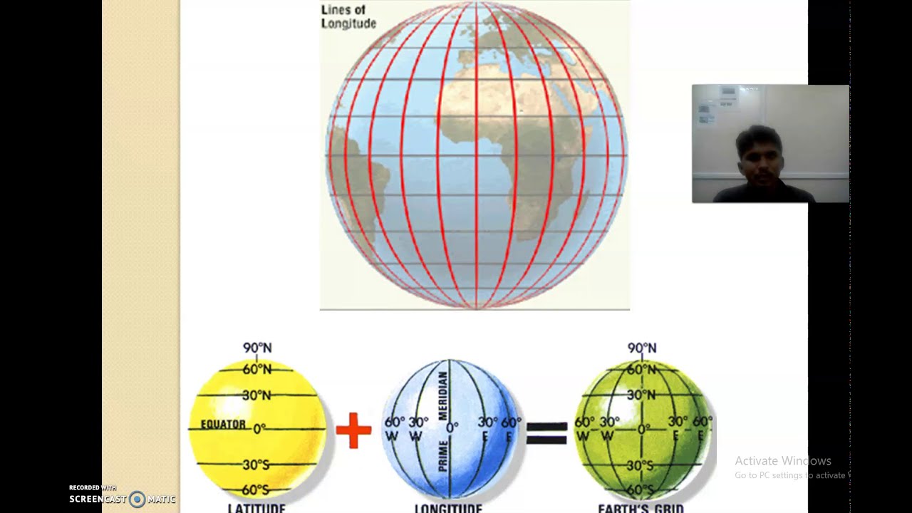
Familiarity with the geographic coordinate system, including latitude, longitude, the equator, and the prime meridian.
Basic geometric concepts of dimensions, specifically the mathematical challenge of translating a 3D curved surface onto a 2D flat plane.
The concept of map scale and how distance representation changes depending on zoom levels and spatial focus.
In-depth study of specific historical and modern projections (e.g., Mercator, Gall-Peters, Robinson, Winkel Tripel) and their societal and political implications.
Application of Coordinate Reference Systems (CRS) and EPSG codes within Geographic Information Systems (GIS) software.
Using Tissot's Indicatrix to mathematically measure and visually represent local distortion on various map projections.
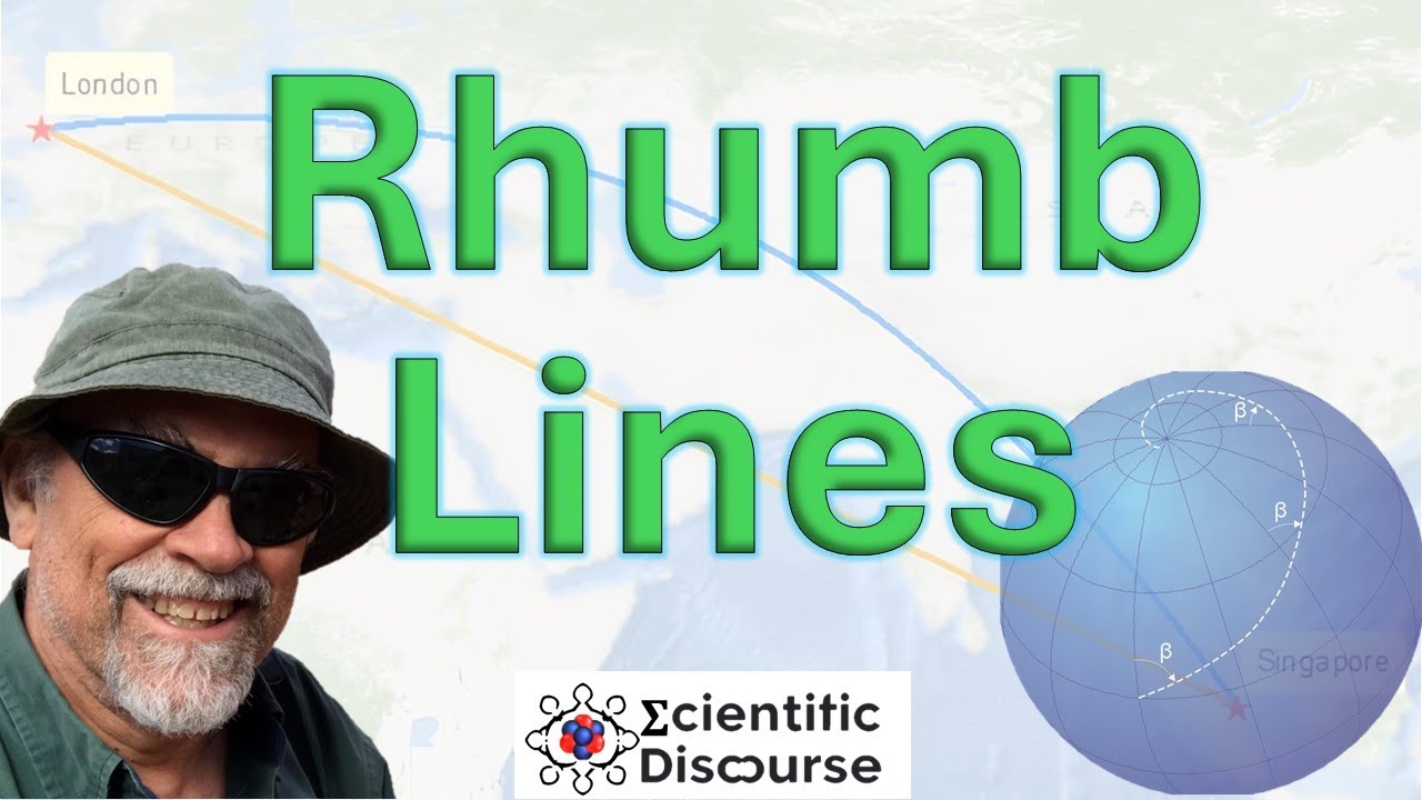
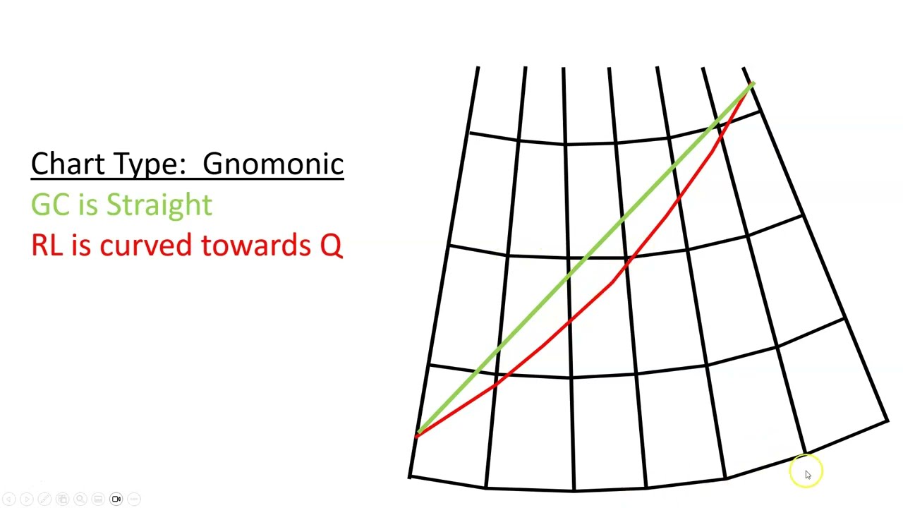
Real-world navigation applications, such as calculating great circle routes (shortest distance) versus rhumb lines (constant bearing).
47K views438likes15:51Original Release: 2014-08-12
hello welcome to this session on understanding the map projections in this session we will be talking about what is map projection and why do we require it so let's understand this in a very fundamental terms supposedly I have a globe and consider the globe to be transparent now if I have a light in the center of that globe and I draw the lines of latitude and longitude around that GL what would happen if I have a sheet of paper and I project the light from the center of it all the all the latitudes and longitudes that I have drawn on the globe would be projected onto the paper so that is what is basically projection when you try to represent a three-dimensional surface or the Earth surface onto a flat sheet of paper so there are two things into this first you are converting a three-dimensional picture into a two-dimensional picture then second while converting a three-dimensional picture into a two-dimensional picture there are certain kind of distortions which occur it is similar to you have an orange and you try to peel it out so if you are peeling it vertically you will have a different shape and if you are trying to peel it into a circular fashion there would be a different shape in either case there would be Distortion of the shape now the distortions can be in various forms one one is the Distortion of the shape if the shape shape changes the second is if the area changes and third if the scale or the direction change so let's start with understanding the concept of projection and why do we need to study it so here before we start any concept on projection what is important here to understand is the projection coordinate system so this is the coordinate system that we have for projection it's similar to coordinate system in any other field so you have the x-axis that's the horizontal axis you have the y axis that's the vertical axis now in the first block that is this block what happens is X and Y both are positive in this block what happens is X remains positive but y becomes negative so here is the second block then third is this block where both are negative and find finally this block where where I can say Y is positive but X becomes negative so these are the various phenomenas that we need to understand for analysis of coordinate system now as I explained considering Earth as a transparent system so consider this Earth as a transparent ball and within the center of that Earth if I cut it into two equal halves within the center there is a light source now I have drawn all the latitudes and longitudes on the surface of the sphere or the ball that I have when I'm projecting light from this Center and I have a sheet of paper behind what happens is something which appears to be this so this is what is basically the meaning and the technical concept of what is projection now when we talk about projection this is a curved surface of an earth and if I want to understand this section what will I do is I'll show it on a plain sheet of paper and this is the projection plane along which for example this is the section I'm trying to show on the sheet of paper so this curvature which is there would become flat and when this curvature is becoming flat there can be Distortion in various forms now let's understand what kind of distortions can be there so as I said the distor are of three types let's understand one by one the first is the conformal Distortion so you have the confirming Distortion uh confirming Maps what happens in confirming Maps as I said there are three aspects you have shape angle area and scale so these are the basic parameters that you try to preserve while changing any threedimensional picture into a two dimensional picture so all these projections which would finally come out are used in forming Atlas in Atlas every map you will find at the lower hand lower side corner of the map you will find the name of the projections on which this map is designed to okay so let's understand first the confirming map what happens in confirming map you are trying to preserve the shape or the angle so what happens here is all the meridians cross at 90° good examples of confirmable projections are maror and Miller cylindrical projections in both of these projections you are trying to preserve the shape and the angle it is good for a smaller region like for the mediteran region it's working fine but as you can see towards the pole there is lot of uh width and there is less of horizontal line so it basically preserves area only for smaller regions that's one of the basic limitation of conformal maps other examples of conformal maps are goods homeline and then you have sinal which is again considered as a confirmable projection now equal area projections in this you are trying to preserve the area so meridians and the parallels do not intersect at right angle but you are trying to preserve the area and when you are trying to preserve the area you are basically preserving it for uh I should say uh the various projections like gas stereotype and equal area cylindrical finally you have the equid distant in which you are trying to preserve the distance so some of the good examples of preserving distances equidistant conical and equidistant cylindrical projections these are mainly uh used uh basically Ally for designing a smaller area so you are trying to preserve the distances in these case now before we understand any of the projections in further detail there are some terminologies we must be familiar with so first is understanding the difference between elevation or altitude and the next is eoth so what is the difference between Azimuth and altitude so Asimo is any line which is relative to the geographical North uh point on the horizon that is directly Bel the point which is being observed so you have two points uh the point which is a straight overhead U is known as Zenit and opposite to that point is the n point so zenet is exactly overhead you and N is exactly opposite to it then you can see the compass bearings are clockwise in the direction from the north so asumo angle is starts from North so anything relative to North you have 90° here here the Asimo would be 180° and here it would be 270° here it is 0° so this is what is aim on the other hand we can say altitude is just the distance which is directly over at the person so elevation is elevation or altitude is the observed of an observed object is based on finding the compass bearings on the horizon which is relative to the true not so for example if I draw a picture here here is the center of the earth here is the Observer and here is the star so the distance between star and the Observer would be the altitude okay then there would be a center point which would be from here to The Observer and that would be the azimat so in this simple terms we can understand the concept of Asimo and uh altitude now uh what is rum line so rum lines are the lines that cut all the Meridian at the same angle and show True Direction so here are where we can find the rum lines so they are all cutting at the same Angle now let's understand a different concept which is known as the the types of projections we can say so I can have the conical projections cylindrical projections and the planer projections now when we talk about conical projections it can be two typ it can be of two types first is the tangent and the second is the secant now tangent is you have the circle and it just touches the sides so it's exactly touching the side it's like you are forming a cone which is exactly touching the side of the circle so when you will open it out on the piece of paper the kind of projection you will be getting is similar to this okay the best example of conical projection is polyconic projection now this is what is tangent what is secant is it is cutting through a section within the Earth so it's not just touching the outer surface of the Earth but it's going through the Section on the earth so that's what is the secant projection when you open out the secant projection this is what comes out to be so these are the type of conical projections when you have a sheet of paper and you are putting it into a conical format okay the next is the cylindrical projection in this what you try to do is you have a sphere or a globe with you and you cover the paper all around it so all around it if you are covering the paper this is the normal cilindrical if you uh cover it on the other side it becomes the transverse cylindrical and if you are covering it at an angle it becomes the oblique cylindrical the best best example of cylindrical which is changent to Equator that is the first case of the normal cylindrical is a Meridian Mercator Projection so Market projection is exactly what it is perpendicular to the Equator the second is the transverse projection which is perpendicular to any of the meridian the example here is transverse markor and finally if it is uh tangent to any of the great circles like this is one of the great circles that is getting tangent to so that is known as oblique gor so these are the three kinds of cylindrical projections that we come across and the finally uh the most important one is the planer or the Asimo we already understood what is Asimo so we have the ASL projection here if it is tangent to the pole it is known as Polar projection if it is tangent to Equator it is equatorial projection and then a planer projection can be oblique if it is oblique to either of it so if it is touching single point it would be tangent if it is cutting through a section and covering a small kind of circle it would become a secant projection similar to this if it is cutting here if I take a cross-section of this this would appear to be a small circle here so this becomes the secant projection now we already studied what is cylindrical projection there is a similar projection to cylindrical which is is known as pseudo cylindrical pseudo as the word we know pseudo means false so pseudo cylindrical projections are the projections where you have a straight lines and the parallels uh then they have equally spaced Meridian but all the other meridians besides the main Meridian would be curved the example of pseudocylindrical uh projection is mid projection and airit projection these are the two projections which are sud cylindrical inage now the most important section that we need to know while understanding any projection is the polar aspect so polar aspect is all about produtions from where we started so there can be three kinds of polar projections let's understand from the first diagram here so here is the light source so if the light source is at the center it is known as noronic projection if the light source is at the corner of one side of the earth it is known as a stereographic now what does it mean consider this ball to be transparent and if I cut it from the center and I have a light in between I keep the blue one is the paper here I keep a paper here this is what it projects out so so here is a nomic projection and it would give you the picture of half of the earth which is this stereographic I put light on one hand I have a transparent ball and I see this transparent ball has all the latitudes and longitudes drawn on it and I see what comes out onto the paper so this is what comes out to be on the paper and this is the stereographic projection finally is the orthographic projection in orthographic projection the source of light is at Infinity so you have the source of light very far you don't know from what place the light is coming out and all the lights run parallel so as you can see towards the end these are very close so when you have the orthographic projection on paper what comes out is towards the end you have very close lines that are drawn as you can see here these are two lines between which I'm moving my pencil and these two lines are so close as compared to nomon where the center lines are closed by okay so this is the major difference so nanic has the light source in Center stereographic at one end and in orthographic the light source is from Infinity so these are the very fundamental concepts on projections we would be talking projections in detail the you can have a various you have a list of various kinds of projections how to which preserves the area which preserves the shape and which is which kind of projection so that is something you need to learn but this what we have discussed today in today's class is the basic essential element of understanding the concept of projections and the various types of projections hope you enjoyed this session have a good day ahead
Up Next

5:46
Map Projections Explained: Mercator, Robinson & Winkel Tripel
@bstok0011
65K views•2015-09-20

12:54
Triumph of Orthodoxy Icon: Byzantine Art & History Explained
@BenCallan
2.1K views•2024-08-06

9:49
FastAPI vs Flask vs Django: Choosing the Right Python Web Framework
@TechWithTim
302.5K views•2024-05-26

1:42
Game of Thrones Opening Credits: A Cinematic Analysis
@gameofthrones
46.3M views•2011-04-18
Related Study Plans & Knowledge Roadmaps
Structured learning paths in General & Interdisciplinary Studies
general-studies
Elevator Engineering: History, Physics & Cities
01From Hoists to Safety Brakes: The Dawn of Vertical Lift
02Hydraulic vs. Traction: The Engineering Physics of Elevators
03Modern Speed, Safety, and Algorithms
+ 2 more learning modules
12h5 modules
Explore Roadmap
general-studies
Rubber: Material Science, History & Geopolitics
01Origins of Natural Rubber & Mesoamerican History
02The Chemistry of Natural Rubber & Vulcanization
03The Geopolitics of the Rubber Boom & Colonization
+ 2 more learning modules
12h5 modules
Explore Roadmap
general-studies
Containerization: Evolution, Logistics & Trade
01Ancient Trade & Bulk Cargo: Amphorae to Barrels
02The Industrial Revolution & Cardboard Packaging
03The Containerization Revolution: Malcom McLean
+ 2 more learning modules
12h5 modules
Explore Roadmap
general-studies
Textile Tech: Evolution, Labor & Global Impact
01Pre-Industrial Textiles: Handloom & Cottage Industry
02Mechanization: The Spinning Jenny to the Power Loom
03The Factory System & Global Labor Transformation
+ 2 more learning modules
10h5 modules
Explore Roadmap