































8 Mile Road in Detroit evolved from a surveyor's baseline established in 1815 to become a powerful symbol of racial and economic segregation, culminating in the construction of a six-foot concrete wall in 1941 to physically separate Black and white neighborhoods; this divisive boundary later gained global recognition through Eminem's 2002 film '8 Mile,' which transformed the wall into a canvas for community art and earned it designation on the National Register of Historic Places, demonstrating how local landmarks can carry layered histories of exclusion that eventually become sites of cultural reclamation.
8 Mile's Segregation Wall: The History of Detroit's Forbidden Road
Added:Understanding of 'Redlining' and the historical role of the Federal Housing Administration (FHA) in denying homeownership loans to minority communities.
The concept of 'de jure' versus 'de facto' segregation in American history and how public policy shaped racial division.
The historical context of the Great Migration and its impact on the demographic and industrial makeup of Northern cities like Detroit.
The use of racially restrictive covenants in property deeds to legally enforce residential segregation prior to the Fair Housing Act of 1968.
The long-term impact of historical housing discrimination on the modern racial wealth gap and intergenerational wealth transfer in the United States.
The role of infrastructure, such as interstate highways and physical barriers, as tools for racial and socioeconomic division in 20th-century urban planning.
The study of environmental racism and how historically redlined urban districts face disproportionate ecological, climatic, and health hazards today.
Comparative research on similar segregation barriers and post-war urban planning policies implemented in other major American cities, such as Chicago, Baltimore, and Atlanta.
114.5K views3.3Klikes17:40Original Release: 2025-09-13
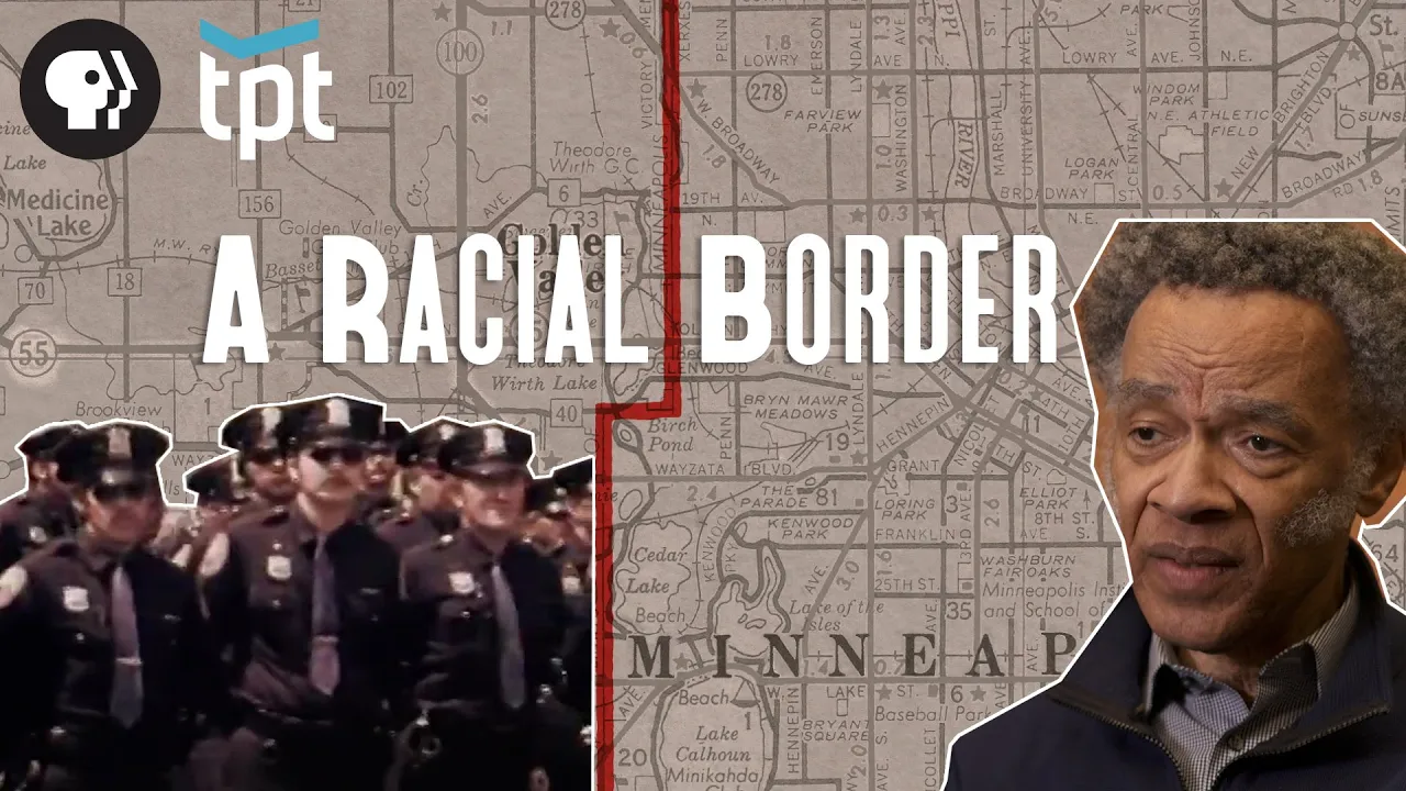
Running along Detroit's northern edge, 8 Mile has never really been just a road.
For generations, it has carried the weight of something much heavier. The boundary between those inside the city and those outside of it. A line that promised opportunity on one side, well, denying it on the other. At first glance, this appears to be like any other wide American thoroughfare. But beneath its lanes are layers of history that no one really wants to speak of.
surveys that carved this land into miles and then built neighborhoods from exclusion. At one point, there was a literal wall of concrete used to segregate American families. And that remained the case for decades until the area received an unexpected dose of world fame as its name was used to title a movie about a local rapper. So, how did one stretch of asphalt become Detroit's most forbidden line? Stay tuned to find out as we uncover the real story of Detroit's 8 Mile and the wall that made it infamous. I'm your host, Ryan Soash, and you're watching its history.
Long before the mile was a paved road, the land was little more than forest and marsh. Though importantly, natives to the region had been using the same pathway as a crossroads of their own, leaving routes that later shaped Detroit's entire street grid. Those early trails demonstrate that 8 Mile didn't appear out of nowhere. It was laid across land that had already been mapped out and lived on for centuries.
And when the United States pushed into Michigan, the first step was to take that land through the Treaty of Detroit in 1807. The treaty opened the door for surveyors to march west and mark the very line that would one day become 8 Mile Road. In 1807, the Treaty of Detroit forced the secession of enormous tres of land, pushing the native communities away and opening the ground to American surveyors. A few years later, in 1815, they stuck a line due west from Detroit. This became baseline road, a zero mark for the new grid. The measure was practical, a way to carve farms, plots, and townships into sellable squares. But in the act of drawing that line, they also created a border that would outlive its original purpose. The surveyor's line still sits beneath the pavement of 8 Mile, meaning what began as a mathematical calculation would grow into something much heavier.
By the mid-9th century, as Detroit transformed from a fur outpost into a booming town, the baseline road defined the city's edge. To the south rose a density of factories and new immigrants, whereas to the north, farmland stretched into orchards and scattered hamlets. The line marked where urban life ended, but also where people believed their futures might begin. Families traveling west from the city often used baseline road as their guide, cutting along it to reach farmland in Oakland and Macob counties. When automobiles finally arrived, the baseline was widened, paved, and folded into Michigan's numbered highway system. By then, it was simply known as 8 Mile Road, and it had already become one of the busiest eastwest arteries across Detroit's northern border. But beneath the new pavement, the story of its origins remained the same. A surveyor's line born from dispossession turned into a permanent marker of civil separation.
Detroit's transformation from a frontier town to the motor city happened fast enough to be measured within a single lifetime. Remember in 1701 French officer Antoine de Lamoth Cadillac founded the settlement as a furred trading post and indeed for more than a century it remained a small outpost on the river. But by the mid 1800s, with Michigan's admission to the Union and the arrival of railroads, Detroit began pulling in new residents. Germans, Poles, Italians, and many others arrived to fill in workshops and breweries that sprouted up along Jefferson and Gartland avenues. Then came Henry Ford. In 1908, Ford's Model T rolled off the assembly line. Four years later, in 1912, his Highland Park plant on Woodward Avenue was turnurning out cars in a way that the world had never seen. Detroit's population doubled between 1910 and 1920 from under half a million to nearly a million. Families came from places like Ohio and Pennsylvania. Not to mention that tens of thousands moved up from the southern states. By the 1920 census, Detroit was the fourth largest city in the US. And I need to point out that this explosion in population brought new pressures to the northern edge of town.
Land near 8 Mile was still open and relatively cheap. A fact that the city authorities used to their advantage. You see, in 1917, the Detroit Urban League began helping households purchase small lots there when banks and realators refused them entry into other districts.
Meaning the 8 Mile/Wyoming neighborhood grew from otherwise undesirable transactions. Homes often started out as tar paper shacks or wood farm cottages.
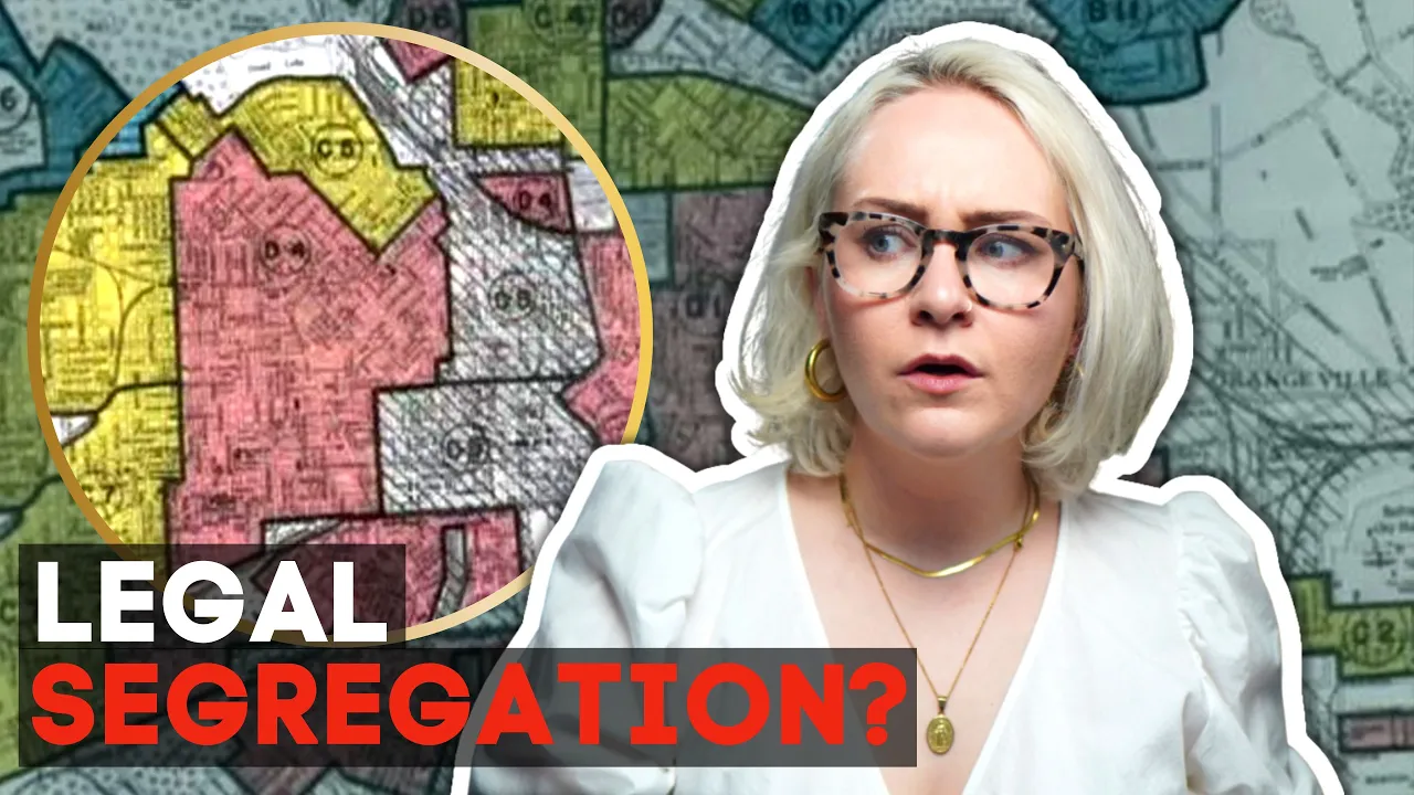
But here's the thing. Ownership gave families stability when rental housing closer to the factories was overcrowded and speculative. The setting may have been humble, but the intent was clear to build a place of permanence. Developers and lenders, however, did not view it that way. In 1934, the Homeowners Loan Corporation drew its infamous residential security maps, a survey that basically graded neighborhoods from A to D. The 8m/Wyoming area with its patchwork homes and self-built blocks was coded red, hazardous. That single designation meant mortgages would not be insured.
Basically, that any outside investment would not come. Meanwhile, the opposite side of 8 Mile, subdivisions such as Greenfield Heights and Oak Grove were planned with restrictive deeds promising protection for buyers. Realators openly market these enclaves as guaranteed to hold their value precisely because they excluded the communities to the south, meaning by the late 1930s, the stage was set for collision. In the summer of 1941, workmen arrived on Burwood Avenue with lumber, rebar, and cement. Their task was simple, to build a wall 6 ft high and half a mile long. The barrier was poured between Burwood and Menota Street, cutting through what had once been open backyards. Now, the order itself came from developer James T.
McMillan, who wanted federal approval to finance a new subdivision north of Detroit's 8 mile boundary. Federal Housing Administration officials told him bluntly that the only way to guarantee approval was to erect a barrier separating the new development from the older self-built homes to the south. McMillan later admitted that the wall was not his choice but a concession to the federal requirement. His words were telling. Quote, "We had to do it, otherwise we wouldn't get the money."
The wall served no purpose for traffic, drainage, or sound. Its only function was symbolic, and everybody knew it. For families who lived south of 8 Mi, the wall was a bitter landmark. Some saw it go up right to the edge of their property lines, a daily reminder that their neighborhood had been written off.
Meanwhile, on the north side, brand new brick houses sold quickly to buyers who believed in the concept as realators promised that the barrier would protect their investments. The timing here was explosive. Detroit factories were surging with wartime contracts and the city was packed. Hence, in 1942, the opening of the Sojourer Truth Housing Project for defense workers sparked protest and violence when Caucasian crowds attempted to keep African-American families from moving in. A year later, in June of 1943, Detroit was rocked by 3 days of unrest that left 34 people dead and required federal troops to restore order. So, you might be asking, how does this all fit into the 8 mile? Well, the Burwood Wall had become a symbol, a physical element that drew a line and divided the city.
By the 1950s, Detroit reached its peak population with nearly 2 million. But the groundwork for its decline had already been laid. Federal highway funds cleared entire neighborhoods for expressways like I75, and thousands of middle-class families moved outward to the suburbs such as Oak Park, Ferndale, and later Southfield. These communities were advertised as safe, modern, and insulated from the chaos of the city.
Crossing 8 Mile into them was like stepping into another world. Manicured lawns, tidy schools, and shopping strips that glowed with neon. The contrast was sharpened in the 1960s. Even as Detroit's cultural voice reached the world, in 1959, Barry Gordy founded Mottown Records in a modest house on West Grand Boulevard. Within a decade, that house known as Hitzville USA was producing the soundtracks that redefined American music. The Supremes, the Temptations, Marvin Gay, Stevie Wonder, and so on. Their songs radiated from Detroit to every corner of the country, projecting confidence, style, and possibility. Well, newspapers carried grim headlines about housing disputes or racial conflict, Mottown carried an image of Detroit as a creative capital alive with energy. But just as Mottown Sound was climbing the charts, Detroit itself was unraveling. The 1967 rebellion, sparked by a police raid, left entire blocks in ruins. In the following decade, factories that had once provided steady work began shutting down or moving out. And from there, the dominoes began to fall. By the 1980s, just as unemployment climbed to its record highs, some of the last and most important factories closed. Now, white flight had began accelerating back in the 1970s, leaving Detroit's population in a steady decline. But by the 80s, the city had lost nearly half a million residents from its post-war peak. Crime rates surged and 8 miles reputation hardened. It was no longer just the surveyor's baseline or the edge of a federal map. It was shortorthhand for a boundary that you didn't cross lightly.
On one side, suburbs still touted good schools and safe investment. And on the other, neighborhoods fought to hold together as disinvestment deepened. The Burwood wall stood firm, faded, and cracked. A relic of a monument when officials believed that concrete could fix the quote problems of proximity. But the deeper problems, unemployment, declining tax bases, and racial divide only grew. By the early 1980s, the wall was no longer just a dividing line for property values. It had become a haunting monument. Promises broken and opportunities denied. By the early 1980s, Detroit was a different city from the one that had built cars for the world. Factories were closing, jobs were disappearing, and whole blocks of the inner city stood hollow. The population, which had once numbered nearly 2 million, had fallen below 1.2 million, and what remained was often concentrated along the northern edge, where 8 Mile Road cut a stark line between Detroit and its suburbs. Crossing 8 Mile could feel like passing into another reality.
To the north, communities like Ferndale, Oak Park, and Warren, property values held as promised. Schools were better funded and storefronts stayed open. To the south, neighborhoods frayed, businesses shuttered, and along the 8 mile strip itself, liquor stores, topless bars, and party shops multiplied in places of grocerers and clothing stores. Residents spoke bluntly about what it was like. For example, in the 1990s, one local told a Detroit news crew that quote, "Nobody comes here after 8:00." Describing prostitution and related crimes that flourished along the corridor. Another recalled picking up used on the street, furious that his three-year-old had seen things that no child should ever witness. Patrol cars were scarce and residents felt abandoned. What had been built as a border of opportunity was now described as a no-go zone. Detroit became known nationally for its violent crime rates.
That year alone, the homicide rate was more than 10 times that of New York. For many outside observers, 8 Mile Road became shorthand for danger and decline.
The place where the city ended and the suburbs began, but where life was brutal. As according to some sources, for those who grew up in the area, 8 Mile was simply home. In interviews decades later, some residents described neighborhoods where families looked out for one another. And here's the interesting thing. As that environment grew harsher, teenagers in modest houses just south of 8 Mile began rapping in basement parties and swapping mixtapz. I think you see where I'm going with this.
One of them was Marshall Mathers, better known as Eminem. Eminem spent his childhood moving constantly. At times living near Dresden Street, south of 8 Mile and others staying in workingclass suburbs like Warren. His family never had stability, and the transient life across Detroit's northern edge became central to his music. He didn't invent 8 miles reputation, but when he wpped about it in the 313, the line dividing rich and poor, insiders knew exactly what he meant. Then in 2002, this local situation went global. That year, Eminem released 8 Mile, a semi-autobiographical film set along the road. Though the movie fictionalized much of his life, it captured a certain truth about the essence of Detroit. A truth which resonated far beyond the city as well as the state of Michigan. A story which beyond the surface is actually pretty inspirational. A tale where talent could rise, but only after fighting through the weight of poverty, stigma, and separation. The movie success and its Oscar-winning song, Lose Yourself, with that famous line about mom's spaghetti, cemented 8 Mile in the cultural imagination. For longtime Detroititers, the irony was sharp. A road that had once been ignored or whispered about was suddenly on movie posters and news broadcast worldwide. What locals had known for decades, that 8 Mile was more than pavement, it was a boundary, was now understood on a global stage.
After 2002, 8 Mile was no longer just a local shortorthhand. It was global. The movie had turned what Detroititers lived with for generations into a story that the entire world now recognized.
Tourists began driving north of downtown, not to see a skyscraper or a factory, but to take pictures beside the road itself. Yet, the reality remained more complex than Hollywood suggested.
Remember, Eminem's childhood was scattered across Detroit and its suburbs. from a house on Dresden Street, now demolished, to apartments in Warren and just over the border. He grew up near 8 Mile, often just south of it, but not always on the road itself, only to later move into Rochester Hills, a far wealthier suburb, which underscored the distance between the hardship that he wrapped about and the life he eventually achieved. For the community along 8 Mile, the film's fame didn't erase the past, but it did change the way that outsiders looked at the neighborhood.
The most striking transformation was the wall itself. What had been poured in 1941 to separate families was by the 2000s covered in murals. Artists painted images of children, symbols of peace, and tributes to Detroit's history.
Meaning, where neighbors once looked at bare concrete, they now saw color and memory. In 2006, community groups began formally reclaiming the wall as public art. By 2021, it was listed on the National Register of Historic Places, recognized not as an embarrassment to hide, but as a reminder of what had happened and how far the city had come.
Local voices helped keep that memory alive. Activist Terresa Moon, who grew up in the neighborhood, described it as quote, "sacred ground, a place where, despite exclusion, families built community and children still played."
Her work and that of others reframed the wall not as a scar but as a landmark of resilience. And even beyond the artwork, 8 Mile today is not the bleak corridor that its reputation suggests. Yes, parts of the strip are still lined with pawn shops, liquor stores, and empty lots.
But there are also thriving businesses, community centers, and unexpected signs of ordinary life. One recent visitor noted gyms, bakeries, and even an MMA training school operating along 8 Mile.
Another described stretches of the road where families were barbecuing, kids were playing baseball, and neighborhoods looked more stable than the headlines would suggest. That duality, reputation verse reality, defines 8 Mile now. It's still invoked as the border of Detroit, still remembered as a line of division.
But for those who live there, it's also a backdrop of daily life, marked by the same mix of struggle and pride found in any community. And with that, our story comes full circle. What began as a surveyor's line became a barrier in concrete, a symbol on the silver screen, and finally a canvas for the people who refused to be defined by it. I thank you all for watching. Until next time, I'm Ryan Soash signing
Up Next
10:41
The Mesoamerican Ball Game: Aztec History & Ritual Sacrifice
@InvictaHistory
494.1K views•2018-11-17

33:02
The Great Schism of 1054: Causes and Consequences
@SacredCathedrals
113.5K views•2026-02-19

91:57
The Geopolitics of the Ukraine War and the Rise of Global Autocracy
@JordanHarbingerShow
468K views•2025-04-19

17:05
Understanding the Cold War: Superpower Conflicts and the Road to Détente
@OverSimplified
46.1M views•2019-01-24
Related Study Plans & Knowledge Roadmaps
Structured learning paths in History
history
Byzantine Iconoclasm: Theology, Art & Politics
01Foundations of Byzantium and Early Christian Images
02The First Iconoclasm: Leo III and the Crisis of Images
03Empress Irene, Nicaea II, and the Second Iconoclasm
+ 2 more learning modules
9h5 modules
Explore Roadmap
history
Iranian Revolution (Causes, Events & Legacy)
01The Pahlavi Dynasty and the Roots of Discontent
02The Spark of Rebellion and the Rise of Khomeini
031979: The Fall of the Shah and the Climax of the Revolution
+ 2 more learning modules
8h5 modules
Explore Roadmap
history
Mali Empire: Mansa Musa, Trade & Timbuktu
01Foundations of the Mali Empire
02The Trans-Saharan Gold and Salt Trade
03The Reign and Pilgrimage of Mansa Musa
+ 1 more learning modules
6h4 modules
Explore Roadmap
history
1947 Partition: Politics, Borders & Legacies
01Foundations of British India and the Divide
02The Political Negotiations and the Mountbatten Plan
03Drawing the Boundary: The Radcliffe Line
+ 2 more learning modules
8h5 modules
Explore Roadmap