Sultanhani, built in the 13th century in Turkey, is the largest caravanserai in the country and served as a crucial rest stop and safe haven for Silk Road caravans that transported precious goods between the Mediterranean and China, significantly enriching both the caravan owners and the cities along the trade route.
Sultanhani Caravanserai: A Seljuk Landmark on the Silk Road
Added:Deep Dive
Understanding the historical and geographical scope of the Silk Road network as a facilitator of Eurasian trade and cultural exchange.

The Silk Road- A Fantasy ? Valerie Hansen in conversation with William Dalrymple
9.4K
Traditional Silk Road maps incorrectly emphasize east-west routes while marginalizing north-south connections. Archaeological discoveries in Northern Siberia reveal Chinese silks dating to the 5th century BC, two centuries earlier than traditionally accepted. India-China trade operated on separate axes from India-Rome connections, with minimal Indian presence in China compared to Iranian traders. The India-China route was treacherous, plagued by sandstorms, mountain passes, and bandits. These findings challenge historians to reconsider the geographic and temporal scope of Eurasian exchange networks.
Click to watch →

The Numismatic History of the Silk Road(s) | NumismaTalks
162
The Silk Road was not a single road but a complex web of interconnected trade routes connecting diverse civilizations from east to west across Eurasia for over 1,500 years. These routes facilitated exchange of people, goods, and ideas, with diplomats and travelers exchanging far more than silk—spices, textiles, plants, animals, religions, technologies, and even diseases traveled with merchants, permanently altering encountered cultures. The network straddled three cradles of civilization: China, India, and Mesopotamia. Key empires included Alexander the Great's Hellenistic civilization, which spread Greek culture, coinage, and language; the Roman Empire; the Parthian and Kushan empires in Central Asia; the Islamic Caliphate; and finally the Mongolian Empire. Coins provided a portable standardized medium of exchange that relieved barter burdens, bridging trade gaps between East and West. The basic requirements for the Silk Road network were contiguous empires large enough to span routes and provide protection, along with stable currency. Alexander the Great created the first great world coinage produced at multiple mints throughout his vast empire, accessing the enormous hoarded wealth of the Persian Empire to create an extensive and uniform coinage consisting of gold double staters, silver tetradrachms, and bronze coins—the most extensive of the ancient world before Rome.
Click to watch →

The Silk Road (up to 1700) (AP World History)
143
The Silk Road was a vast network of trade routes connecting Asia to Europe and the Middle East, facilitating the exchange of luxury goods like silk, porcelain, and spices, as well as technologies, religions (Buddhism, Christianity, Islam), and ideas across Eurasia from its origins in the Han Dynasty through the 1700s; this trade network was shaped by geography, political empires (including the Mongol Empire), and commercial innovations such as paper money, banking systems, and caravanserais, which together intensified trade and cultural diffusion across the continent.
Click to watch →

Казахстан был центром мира: правда о Шёлковом пути. КТО РЕАЛЬНО ПРАВИЛ ШЁЛКОВЫМ ПУТЕМ?
474
The Silk Road was a comprehensive cultural exchange network connecting civilizations separated by thousands of kilometers, functioning as a 'blood system' for religions, technologies, arts, and ideas. Long before Chinese silk gave it its name, ancient routes existed: the Neolithic Jade Road transported jade from Eastern Turkestan to China, while the Lapis Lazuli Road (4,000 BCE) carried blue stone from Afghanistan to Egypt. The Bronze Age Steppe Road facilitated movement of metals and animal-style art. The Saka peoples controlled these early routes. Zhang Qian's diplomatic mission unified scattered routes into a single system. The Turkic Khaganate provided security, while the Sogdians served as merchants and diplomats. The most valuable cargo was invisible—ideas, religions, and knowledge. Buddhism reached China, Nestorian Christianity and Manichaeism penetrated Central Asia, and later Islam spread. The 751 Battle of Talas transferred paper-making technology to Arabs, eventually leading to European printing. The golden age ended through a 'perfect storm': the Mongol invasion, the Black Death, and the Age of Discovery's maritime routes. Yet the legacy persists in UNESCO-protected ruins, Kazakh hospitality traditions, linguistic influences, and modern projects like the Belt and Road Initiative. The fundamental truth demonstrated is that connections and networks, not isolation, shape human civilization.
Click to watch →

The Silk Road
439
The Silk Road was a network of trade routes spanning approximately 6,400 kilometers across Eurasia, active from the 2nd century BCE to the mid-15th century, facilitating economic, cultural, political, and religious exchanges between East and West; it was named after the lucrative silk trade from China, began with the Han Dynasty's expansion into Central Asia around 114 BCE, and ultimately ended with the Ottoman Empire's rise in 1453, which prompted European exploration and launched the Age of Discovery.
Click to watch →
Deep Dive
A basic overview of the Seljuk Sultanate of Rum, its rise in Anatolia, and its timeline during the 11th to 13th centuries.
Ertugrul Ghazi Urdu | Episode 82 | Season 4
18.9M
The Seljuk Sultanate of Rum was a Turkish state that ruled Anatolia from the 11th to the 14th centuries. It was established by the Seljuk Turks after their victory at the Battle of Manzikert in 1071. The sultanate faced constant threats from Mongol invasions and eventually fell to the rising Ottoman power in the late 13th century.
Click to watch →

CRONOLOGIA DEL IMPERIO SELYÚCIDA | PARTE 1 | EDAD MEDIA
58.2K
The Seljuk Empire, founded by Seljuk (d. 1037), expanded under Alp Arslan (r. 1063-1072) who won the Battle of Manzikert in 1071, and reached its golden age under Malik Shah I (r. 1072-1092). After fragmentation, the Sultanate of Rum emerged in Anatolia, with Suleiman I declaring independence in 1077. The most illustrious sultan was Kayqubad I (r. 1192-1211), whose reign marked the empire's peak before the Mongol invasions. The sultanate fragmented among descendants, with multiple sultans ruling simultaneously, until it was absorbed by the Ottoman Empire and Mongols by 1307.
Click to watch →

دولة سلاجقة الروم ✅ من ألب أرسلان ⚔️ الي عثمان بن ارطغرل
1.5M
The Sultanate of Rum was a Seljuk Turkish state established in Anatolia during the reign of Sultan Alp Arslan (1063-1072) and lasted for 231 years until the emergence of Osman I, founder of the Ottoman Empire. It was one of the branches of the Great Seljuk Empire and derived its name from the Latin 'Rum' (Romans), referring to the Byzantine Empire it replaced. The state successfully resisted Crusader campaigns and faced Mongol invasions, playing a crucial role in Islamic history by bridging the gap between the Great Seljuks and the Ottoman Empire.
Click to watch →

9) AYT Tarih -Yerleşme ve Devletleşme Sürecinde Selçuklu Türkiyesi (1075 - 1308)-Ramazan YETGİN-2025
222.3K
The Seljuk Sultanate of Rum (Anatolian Seljuk State) was established by Kutalmışoğlu Süleyman Shah in 1075 after the Battle of Malazgirt opened Anatolia to Turkish settlement, and it was a contemporary state that coexisted with the Great Seljuk State and various Turkish beyliks rather than being founded after their destruction. The state's capital moved from İznik to Konya following the First Crusade, and its most significant achievements included the conquest of coastal cities (Antalya, Alanya, Sinop, Samsun) to develop international trade, the establishment of the Ahilik trade organization, and the patronage of prominent scholars like Mevlana (Rumi). The state's decline began with the 1243 Köse Dağ defeat against the Mongols, which led to the fragmentation of Anatolia into multiple independent beyliks, marking the end of unified Turkish political power in the region.
Click to watch →

اعظم عشر امبراطوريات اسلامية في التاريخ.. قهرو كل الدول!
187.5K
The Seljuk Sultanate of Rum was established after the defeat of the Byzantines at the Battle of Manzikert. Sultan Suleiman I conquered most of Byzantine territories in Anatolia, making Nicaea his capital. The state reached its peak under Sultan Alaeddin Keykavus I, who launched campaigns against the Georgians and Armenians with an army of approximately 150,000 soldiers. The state declined due to attacks from Crusaders in the west and Mongols in the east, ultimately falling to the Mongols after the Battle of Köse Dağ in 1243. The state completely collapsed under Sultan Ghiyath al-Din Mas'ud in 1308.
Click to watch →
Deep Dive
The fundamental concept and purpose of a caravanserai as a state-sponsored roadside inn supporting merchants and travelers.
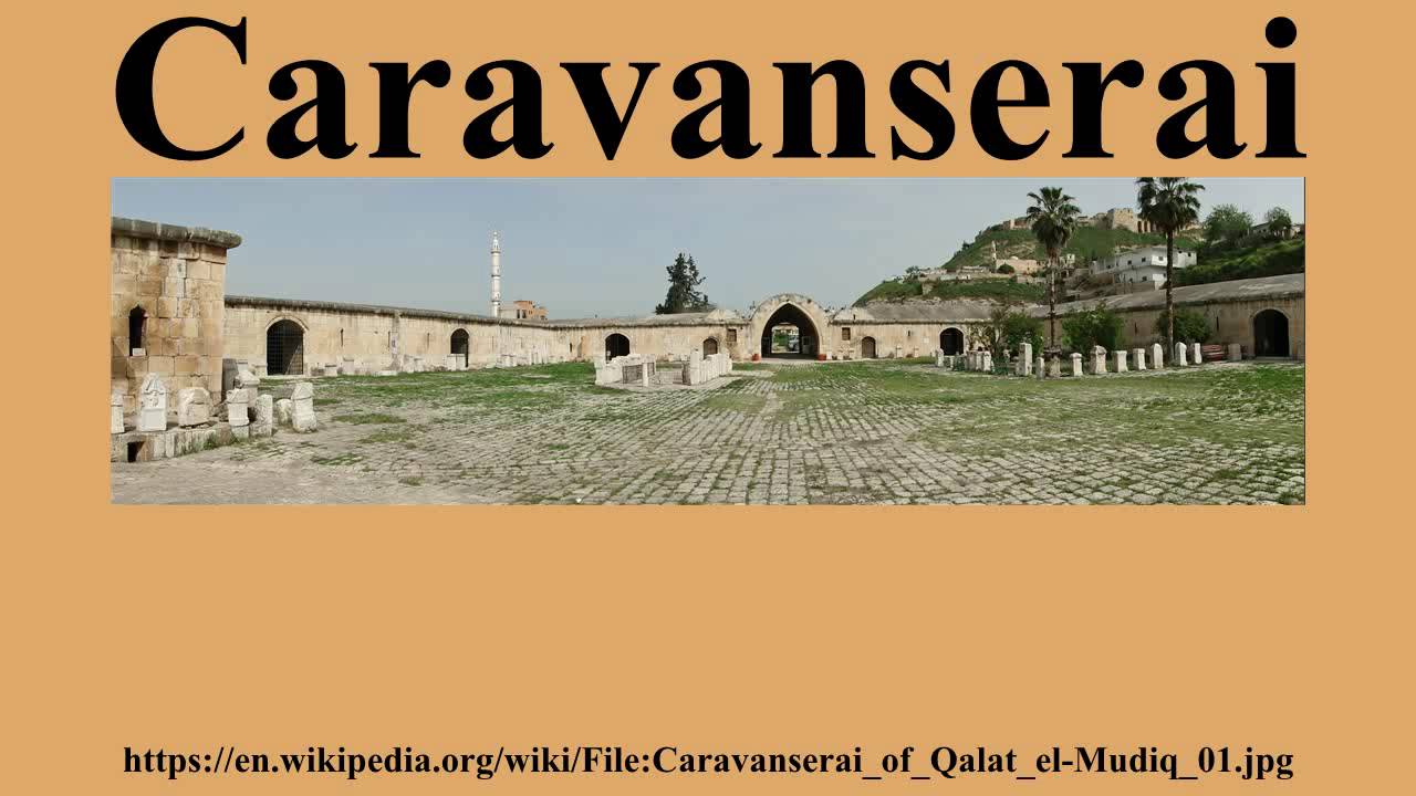
Caravanserai
1K
A caravanserai (or khan/katra) was a roadside inn that supported the flow of commerce, information, and people across Asia, North Africa, and southeastern Europe, especially along the Silk Road; it featured a square or rectangular walled exterior with an open courtyard containing stalls for merchants, servants, animals, and merchandise, providing water, fodder, and shops for travelers to rest and resupply during their journeys.
Click to watch →

Історія на ніч | Чому ви не протрималися б і дня в вікторіанському Лондоні
69.4K
Qasr al-Hayr al-Gharbi, built around the beginning of the 8th century, appears to be a fortress with thick walls and narrow slits but has no real defensive features, no water source, and no signs of a permanent garrison. It is believed to have served as a caravanserai, a roadside inn for merchants, travelers, and diplomats crossing the desert. With about 60 rooms on two floors around a central courtyard, it could accommodate guests, slaves, and animals. It may have also functioned as a meeting place for tribal leaders where Omayyad administration could influence Bedouin tribes controlling desert routes.
Click to watch →

Fondouk_caravansérail de Tlemcen
953
A caravanserai (caravansérail) is a roadside inn for travelers, derived from the Arabic word 'qaravanserai' meaning 'caravan' and 'serai' meaning 'inn' or 'lodging'. These establishments served as stopping points for merchants and travelers along trade routes, providing shelter, security, and basic amenities. Caravanserais functioned as important commercial and social hubs, strategically positioned to monitor and tax commercial transactions. They typically featured square or rectangular architectural designs with multiple levels, including commercial spaces, accommodation areas, and amenities like fountains and chapels. The inclusion of religious facilities demonstrated religious tolerance for diverse travelers. Caravanserais and their associated records serve as valuable historical documentation sources, providing information about trade patterns, economic relationships, and social structures. Many historical caravanserais have been lost or significantly altered over time due to urban development and natural decay. Some caravanserais became significant economic power centers with high commercial volumes, sometimes having the authority to produce their own currency, representing a significant level of economic autonomy and political power.
Click to watch →

9. SINIF TARİH 3. ÜNİTE FULL TEKRAR - Orta Çağda Dünya - TYT AYT
127.3K
Caravanserai (kervansaray) refers to roadside inns where caravans and travelers could rest and find shelter. These establishments were strategically located along trade routes and provided essential services for merchants and travelers moving between distant locations.
Click to watch →

Vocab Roots | For SSC/BANK/NDA/CDS/CAPF & All Competitive Exams | By Neetu Singh Ma'am
97.3K
The root 'caravanserai' comes from Persian words meaning 'caravan' and 'serai' (inn). A caravanserai was a roadside inn where travelers could rest and store their goods, particularly along trade routes. These establishments provided shelter, food, and security for merchants and their caravans traveling long distances. The root helps identify words related to roadside inns and traveler accommodations.
Click to watch →
Deep Dive
Familiarity with basic Islamic architectural elements, such as monumental portals (pishtaqs), muqarnas (honeycomb vaulting), and courtyard layouts.
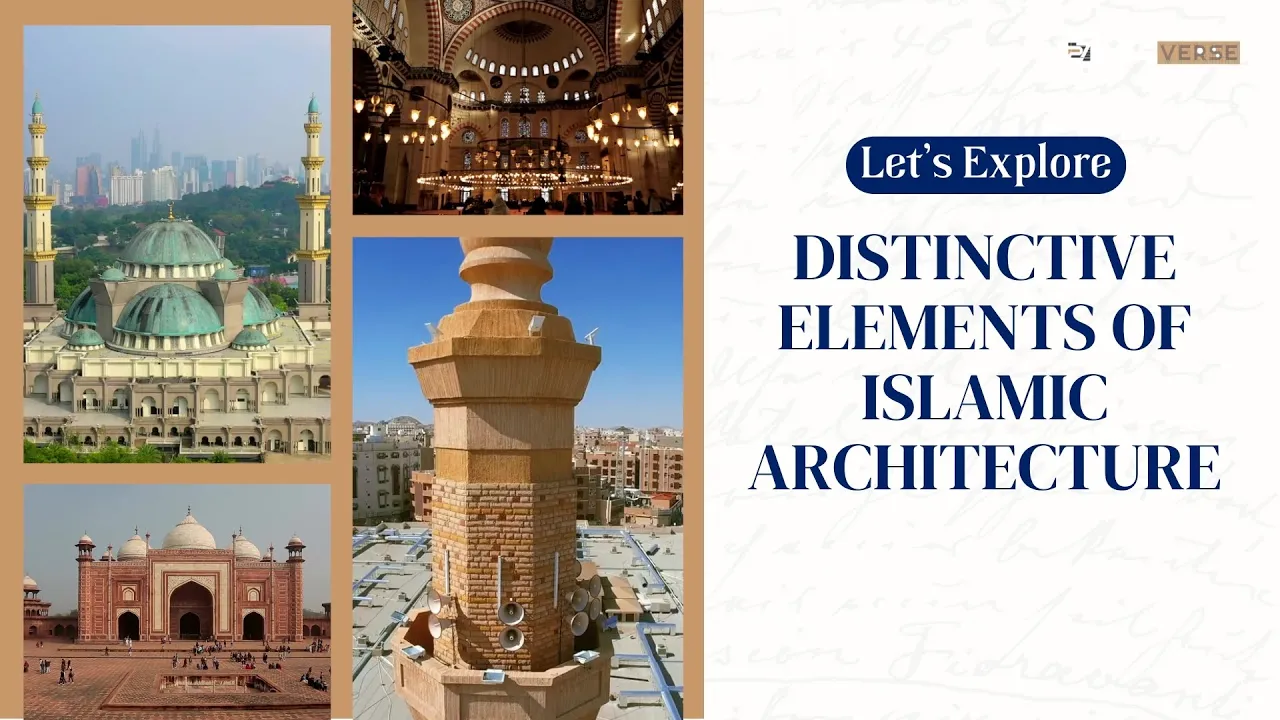
Characteristics of Islamic Architecture / World Architecture History
2.1K
Islamic architecture is characterized by ten distinctive elements: domes (hemispherical roof structures with oculus openings), arches (including pointed, ogee, horseshoe, and multifoil varieties), muqarnas (honeycomb-like 3D sculptural ornamentations), minarets (towers with balconies for prayer calls), mihrabs (semicircular niches indicating Qibla direction), arabesque art (geometrical patterns, floral motifs, and calligraphy), hypostyle halls (rectangular/square rooms with grid-patterned columns), courtyards (surrounded by arcades with ablution fountains), gardens (quadrilateral layouts symbolizing paradise), and iwans (rectangular halls with three walls and a vaulted open side).
Click to watch →
الحياة العلمية وفنون العمارة | الدرس الرابع تاريخ تانية ثانوي الترم التاني | شرح شامل + أهم الأفكار
151
Islamic architecture is characterized by four basic elements: domes, arches, muqarnas (stalactite vaulting), and arches. Each element played both aesthetic and structural roles. Domes required precise engineering calculations to be built correctly. These elements combined to create the distinctive visual and functional identity of Islamic architecture.
Click to watch →

HISTORY OF ISLAMIC ARCHITECTURE
18.7K
Islamic architecture emerged in 622 CE when Prophet Muhammad established the first Islamic State in Medina, constructing his house and mosque that birthed this distinctive architectural style. Key terminologies include E1 (rectangular hall with vaulted ceiling), Ka'ba (sacred black cube in Mecca), Qibla (direction toward Ka'ba), Makarnas (stalactite vault ornament), and Hamam (public bathhouse). The mosque comprises essential parts: Minaret (prayer signal tower), Pishtak (gateway), Sane (atrium), Wudu (ablution), Dome (half-spherical prayer hall cover), Mirab (Qibla-niche), Min bar (sermon platform), Dica (Quran reading desk), Maksura (imam protection screen). Islamic ornaments encompass Calligraphy (word art), Islami (flower patterns), and Geometric (symmetrical designs creating optical illusions).
Click to watch →

المقرنصات | عناصر العمارة الاسلامية
589
Muqarnas is a distinctive Islamic architectural element characterized by its geometric, honeycomb-like design that creates a three-dimensional effect through the interplay of light and shadow. Originating in 711 AD in Al-Andalus (modern-day Spain), this architectural feature was initially used to decorate religious structures like mosques and domes before evolving for use in gates, iwans, and even private residences. Constructed from materials such as stone, brick, clay, wood, or stucco (with stucco being most common), muqarnas serves both decorative and functional purposes by facilitating smooth transitions between different architectural spaces, including connections between domed and square rooms, interior and exterior areas, and lower to upper levels. Regional variations emerged across the Islamic world, with Iraq and Iran using brick covered with stucco and colored tiles, while Syria, Turkey, and Egypt developed their own distinctive styles. The first muqarnas is attributed to Caliph Al-Hakam II for the Great Mosque of Cordoba, though some scholars suggest it may have appeared earlier in the Cairo Citadel's minaret in the 11th century.
Click to watch →

Arquitectura Islamica Características y Elementos Principales Tipologias de Mezquitas
210
Mosques contain several essential elements: the prayer hall where faithful gather, oriented toward Mecca; the mihrab (niche indicating qibla direction, decorated with mosaics or Koranic inscriptions); the courtyard (sahn) for prayer and socializing, especially important in hot climates; the fountain of ablutions for ritual purification before prayer; and the mimbar (elevated pulpit) from which sermons are delivered. The mugharabe (honeycomb vault) covers domes and intradomal spaces, representing creation. These components demonstrate how Islamic architecture integrates religious requirements with functional design.
Click to watch →
Prerequisite Knowledge
- Concept 01Understanding the historical and geographical scope of the Silk Road network as a facilitator of Eurasian trade and cultural exchange.
- Concept 02A basic overview of the Seljuk Sultanate of Rum, its rise in Anatolia, and its timeline during the 11th to 13th centuries.
- Concept 03The fundamental concept and purpose of a caravanserai as a state-sponsored roadside inn supporting merchants and travelers.
- Concept 04Familiarity with basic Islamic architectural elements, such as monumental portals (pishtaqs), muqarnas (honeycomb vaulting), and courtyard layouts.
Subsequent Learning
- Step 01Analyzing the economic policies and security/insurance systems implemented by the Seljuks to protect and encourage international merchants.
- Step 02Conducting a comparative study of Seljuk caravanserai architecture with contemporary Mongol, Ilkhanid, or Persian road stations.
- Step 03Exploring other major Seljuk architectural achievements in Anatolia, such as the double-minaret madrasas in Erzurum and Sivas.
- Step 04Investigating modern cultural heritage preservation and the restoration challenges of 13th-century stone monuments in Turkey.
Sultanani Caravanserai
Sultanani Caravanserai
0:16Playing Section
- 1
Largest caravanserai in Turkey, built in 13th century.
- 2
Provided rest and safety for Silk Road caravans.
- 3
Caravans enriched owners and cities along route.
Imperial Projection and Military Control Over Trade Altruism
While traditional narratives celebrate the Sultanhani Caravanserai as an altruistic haven for Silk Road merchants, revisionist historians offer a more critical perspective. They argue that these monumental structures served primarily as heavily fortified outposts designed for Seljuk military control, tax extraction, and imperial propaganda. The imposing, fortress-like architecture and grand portals inscribed with the Sultan's titles were intended to project state power over newly conquered, diverse, and often rebellious Anatolian territories. Rather than acting as purely economic facilitators, caravanserais functioned as instruments of state surveillance and military logistics, ensuring the ruling elite's hegemony over regional trade routes and local populations.
Deep Dive
Analyzing the economic policies and security/insurance systems implemented by the Seljuks to protect and encourage international merchants.

12) KPSS Tarih Türkiye (Anadolu) Tarihi Kültür ve Medeniyeti Sinan Doğan #kpsstarih #2024kpss
12.8K
The Seljuk state actively developed trade by capturing port cities like Sinop and Antalya, building connecting roads, and implementing customs duty reductions for foreign merchants. The construction of caravanserais along trade routes provided safe accommodation for merchants traveling long distances. The state implemented an insurance system for merchants, guaranteeing compensation for losses of goods during trade—the first such system in the world. The Ahi Organization functioned as an esnaf (craftsmen) organization providing credit, regulating state-craftsman relations, protecting consumer rights, and conducting quality control. The organization provided education in religious, trade, and moral subjects, regulated production levels and prices, and was a Sufi order that excluded non-Muslims from membership.
Click to watch →

Anadolu Selçuklu Devleti #tarihkpss #tarihyks #tyt #kesfet #türk #yks2024 #kpss2024 #ayt#kpss
114
The Anatolian Seljuk State implemented comprehensive economic policies to develop trade: (1) Conquest of port cities including Sinop, Samsun, Antalya, Sugdak, and Alanya; (2) Construction of shipyards (tersaneler); (3) Trade agreements with foreign merchants; (4) Reduction of customs duties from 12% to 3%; (5) Construction of caravanserais along trade routes; (6) State guarantee for merchant goods (first insurance activities); (7) Security guarantees for trade routes; (8) Encouragement of Muslim traders to use the Silk Road; (9) Establishment of Turkish markets in Sivas; (10) Creation of the international Yabanlı Market in Kayseri. The state also established the first Turkish navy under Çakabey, marking the beginning of Turkish maritime power.
Click to watch →

Tarihçilerin Anlatmadığı Gerçek | 1071 Malazgirt Zaferi'nin Ekonomik Faturası
202
The Seljuk Sultanate implemented a sophisticated three-pillar economic strategy to control the Silk Road. First, they built approximately 30-40 caravanserais across Anatolia at 30-40 kilometer intervals, providing merchants with stables, baths, markets, and medical facilities free of charge. Second, they established a revolutionary commercial insurance system where the state compensated merchants for stolen or damaged goods. Third, they transformed cities like Konya, Sivas, and Kayseri into commercial centers. This infrastructure made Seljuk routes more attractive than Byzantine ones, increasing trade volume and revenue while further weakening Byzantium.
Click to watch →

Yerleşme ve Devletleşme Sürecinde Selçuklu Konu Anlatımı| 39 GÜNDE AYRINTILI TYT TARİH KAMPI 2026-10
68.8K
The Turkish Seljuk State adopted Fars cultural influences, evidenced by titles like Keyhüsrev, Keykavus, and Keykubat. The state maintained traditional Turkish succession, which led to conflicts, prompting Kılıç Arslan II to divide his kingdom among his 11 sons. Children were called Meliks and sent to sancaks with Atabey tutors. The administrative system included the Haciplik position, Divan-ı Saltanat as the highest council, and Niyabet-i Saltanat when the ruler was absent. Provincial administration featured Şıhne (military governors), Muhtesipler (municipal affairs), and Kadıs (judges). The state developed significant naval power controlling the Black Sea, Aegean, and Mediterranean, with commanders holding titles like Melikü Sevahil and Reisül Bahr. The state continued the Ikt system, allocating land to governors in exchange for military service. The Pervane was responsible for land distribution through the Divan-ı Pervane. The state implemented trade policies including reducing customs duties to encourage foreign merchants, establishing agreements with Venice, and initiating insurance systems to protect merchants. Caravanserais were built to facilitate safe trade routes. The Ahilik organization, founded by Ahi Evran, regulated trade through mutual support among merchants, quality control, and credit systems.
Click to watch →

4) Anadolu Selçuklu Devleti
13.1K
The Anatolian Seljuk State implemented comprehensive economic policies to develop trade. It conquered coastal cities including Antalya, Sinop, Samsun, Alanya, and Suğdağ to facilitate commerce. The state offered incentives to non-Muslim merchants, particularly Christians from Cyprus, including low customs duties. It constructed kervansaray (caravanserais) along trade routes, with some routes having up to 30 facilities. The state implemented the world's first insurance system, compensating merchants for damaged goods during transit.
Click to watch →
Deep Dive
Conducting a comparative study of Seljuk caravanserai architecture with contemporary Mongol, Ilkhanid, or Persian road stations.
SUSUZHAN MUHTEŞEM KERVANSARAY - SUSUZKÖY
21K
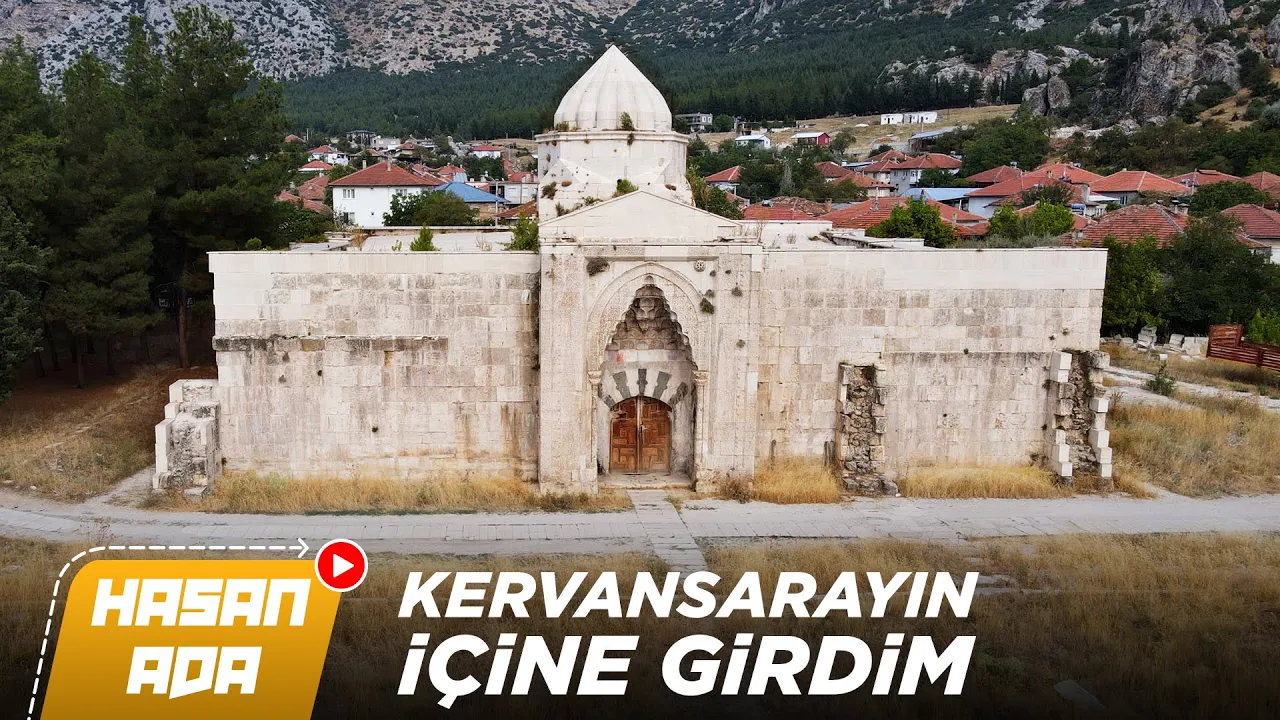
Susuz Han, built by Anadolu Selçuklu Sultan II. Gıyaseddin Keyhusrev between 1237-1246, is one of the finest examples of 13th-century Anatolian Selçuklu architecture, featuring a geometrically decorated entrance portal and belonging to the Karmaplı Hanlar group of caravanserais that provided shelter for merchants along the East-West Trade Route; despite losing its large courtyard to time, the remaining structure demonstrates sophisticated Selçuklu engineering with vaulted ceilings and stone columns, and archaeological excavations in 2008 revealed artifacts spanning from the Byzantine period through the Ottoman era, confirming its continued use beyond its original construction period.
Click to watch →
Why You Wouldn't Last a Day in TUDOR Britain and more
100.9K
The Silk Road was a sprawling network of trade arteries connecting continents, but traveling it was dangerous—endless deserts, mountain passes, and bandit raids. Caravanserais (roadside fortresses) transformed the Silk Road into a reliable commercial lifeline. In medieval Turkey under the Seljuk sultans (11th-13th centuries), these structures were built roughly every 20-30 miles (the distance a caravan could travel in a day). They were strategically positioned at crossroads, mountain passes, or near rivers where the journey was most treacherous. From afar, travelers saw massive stone walls rising from the barren landscape—a sign that warmth, food, and protection awaited. Guards welcomed traders, pilgrims, and wandering dervishes regardless of origin or faith. Inside, a great courtyard accommodated camels, horses, and mules, while chambers around the edges provided rest for human companions. These were more than shelters—they were lifelines of trust where merchants could rest assured their cargo would be safe behind thick walls patrolled by guards. Caravanserais looked like fortresses—deliberately imposing to intimidate bandits and reassure travelers. Built of massive stone blocks (limestone or basalt), they were engineered to endure centuries of harsh weather and human conflict. The exterior walls rose high above the landscape, forming nearly impenetrable barriers. The only entrance was a monumental gateway, often arched and intricately decorated with Seljuk geometric patterns and calligraphy. Heavy wooden doors could be barred shut, turning the caravanserai into a fortress at night. Inside, travelers entered a vast rectangular courtyard designed to accommodate entire caravans of camels, horses, and mules. Around the courtyard stretched rows of vaulted chambers with thick stone walls providing insulation from summer heat and winter cold. At the center stood a small mosque or prayer niche, reminding guests that faith was as important to survival as food and shelter. Fountains and wells provided clean water for humans and beasts. Some grander caravanserais (like those commissioned by Seljuk Sultan Alp Arslan and Kavad) added stables, storerooms, bathhouses, and kitchens.
Click to watch →

Aksaray Tanıtımı
17.5K
The Seljuk caravanserai tradition in Aksaray demonstrates the evolution of roadside hospitality architecture serving the Silk Road. Ağzı Karahan (1231-1237) represents a fortress-caravanserai hybrid with two portals, a kiosk mosque, hammam, and watchtowers, designed to protect against Mongol attacks. Alay Sultan Han (1156-1192) predates both, featuring mukarnas-decorated portals and light-domed vaults, representing early Seljuk caravanserai architecture. These structures combined commercial facilities with defensive capabilities, featuring geometric stone carvings, geometric patterns, and functional spaces for travelers, horses, and goods. The architectural evolution reflects the changing needs of merchants and the strategic importance of these routes.
Click to watch →

ORTA ÇAĞIN 5 YILDIZLI OTELİ | Sultanhanı Kervansarayı'nda Her Şey ÜCRETSİZDİ!
116
Sultanhanı Kervansarayı, built in 1229 under Sultan Alaaddin Keykubat, represents the pinnacle of Seljuk architectural achievement as Turkey's largest and best-preserved caravanserai. The structure demonstrates sophisticated integration of artistic, functional, and social systems. Architectural features include niches with eye-pattern decorations, calligraphic inscriptions, and intentional imperfections reflecting Islamic artistic philosophy. The caravanserai provided comprehensive services through the waqf system: food, bathing, veterinary care, medical treatment, and accommodation. The water supply system transported water 2 kilometers via lead pipes. The elevated mescit (prayer hall) sits above a shadırvan for ritual ablution, with a staircase allowing muezzins to call prayer. The enclosed winter section (develik) sheltered caravans with their animals. The system created mutual security incentives: settlements protecting trade routes received tax exemptions. The caravanserai reveals sophisticated construction practices including stone markings that served as signatures and payment records for craftsmen. The distinctive dome design reflects Seljuk nomadic heritage, with conical shapes inspired by their tent-dwelling lifestyle. Four strategically placed light openings function as a solar clock, indicating prayer times through sunlight positions.
Click to watch →
ليلة تاجر في دروب الحرير القديمة
827
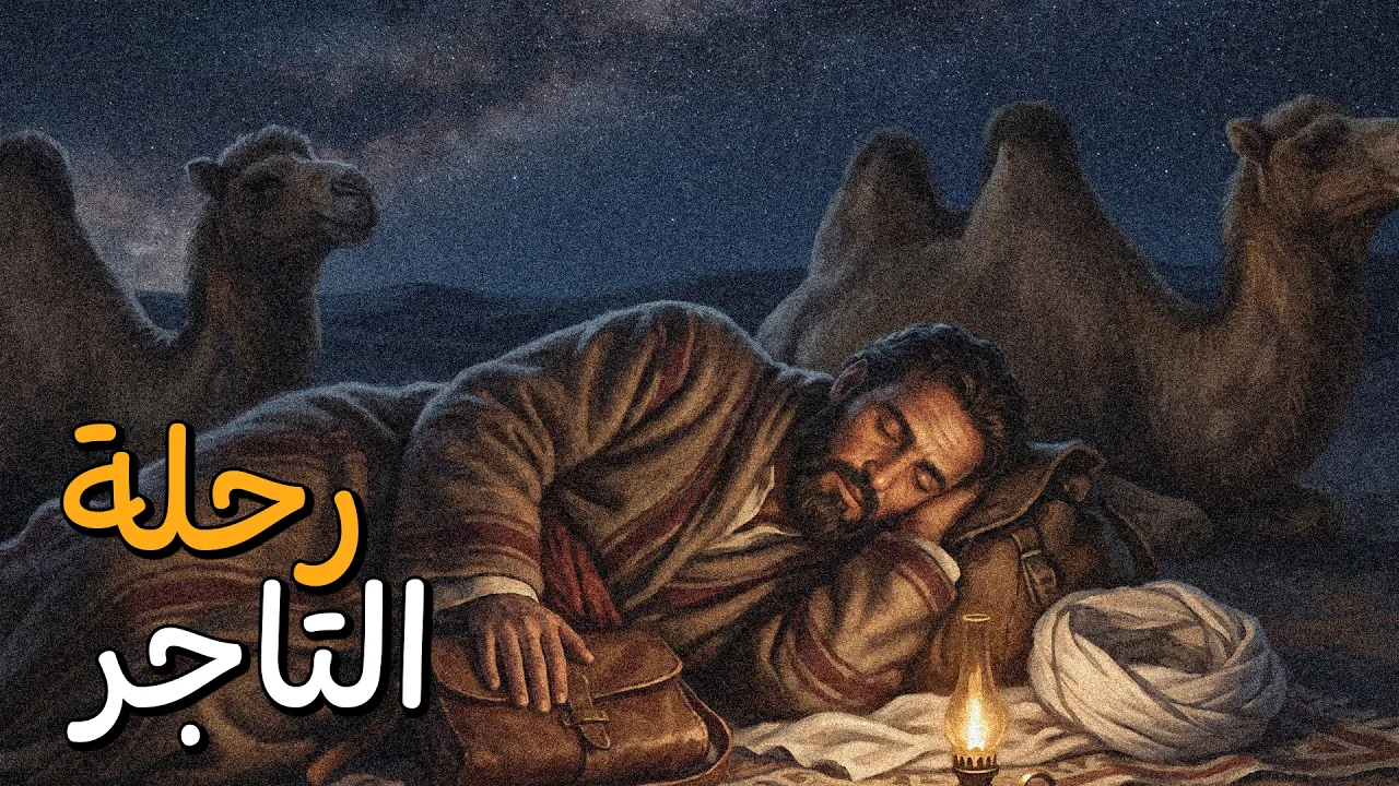
Caravanserais (karavanserai) were built along the Silk Road with specific architectural designs: thick outer walls like fortifications that closed at night with heavy iron doors, open courtyards facing the sky surrounded by rooms on three sides, and central wells with camel troughs. They were spaced one day's journey apart (30-40 farsakhs) in populated areas. These were not merely hotels but complete civilizations on the road, providing water, food, safety, and shelter. They included prayer rooms for Muslim travelers, as the princes who built them understood merchants needed places to pray before sleeping.
Click to watch →
Deep Dive
Exploring other major Seljuk architectural achievements in Anatolia, such as the double-minaret madrasas in Erzurum and Sivas.

6 - 2026 AGS - Tarih - Türkiye Tarihi Kültür ve Uygarlık - II - Aydın YÜCE
45.4K
The Çifte Minareli Medrese (Double Minaret Madrasa) in Erzurum was built during the Anadolu Selçuklu period and is a distinctive example of Seljuk architecture. The Çifte Minareli Medrese in Sivas was built during the Ilkhanid period when they conquered Anadolu. These double minaret madrasas represent important architectural achievements of the period.
Click to watch →

7 - 2026 KPSS - Tarih - Türkiye Tarihi Kültür ve Uygarlık - II - Aydın YÜCE
117.7K
Double minaret medreses were architectural innovations in Anadolu Selçuklu architecture. The Erzurum double minaret medrese was built during the Anadolu Selçuklu period, while the Sivas double minaret medrese was built during the Ilkhanid period when they conquered Anatolia. This architectural feature represents the distinctive style of the Seljuk period.
Click to watch →
4) Anadolu Selçuklu Devleti
13.1K
The architectural works of the Anatolian Seljuk State are concentrated in specific cities: Konya, Kırşehir, Kayseri, Ankara, Sivas, Erzurum, and Antalya. Istanbul, Bursa, and Edirne were conquered by the Ottoman Empire, so their architectural works belong to the Ottoman period. Notable works include Diyarbakır Ulu Cami (the only significant work of the Great Seljuk State in Anatolia), Karatay Medresesi, and the Çifte Minareli Medrese in Sivas. The period saw the development of double minaret structures, which would later evolve into four and six minaret designs in the Ottoman period.
Click to watch →

10 Günde KPSS Tarih - Genel Tekrar - Özet 2. Gün I İlk Türk İslam devletleri
4.3K
Turkish Islamic architecture included religious (mosques, madrasas, türbes, kümbets), civil (palaces, caravanserais, hammams, markets), and military (castles, barracks) structures. The first Anatolian madrasa was established by the Danishmend in Niksar. The most important Anatolian Seljuk madrasas were the Nizamiye Madrasas (established by Nizam al-Mulk). The Gök Madrasa in Sivas and Gevher Nesibe Darüşifası in Kayseri are significant. The Erzurum Çifte Minareli Madrasa is identified by the term 'Çifte' (double).
Click to watch →

Erzurum Çifte Minareli Medrese🇹🇷
130
The Erzurum Çifte Minareli Medrese (Double Minaret Madrasa) is a 13th-century Seljuk-era educational institution built around 1271 AD by Hatun Khatun, daughter of Sultan Suleiman I, featuring two distinctive turquoise-tiled minarets and intricate stone carvings; it served as a religious school during the Seljuk period, later functioning as a gunpowder storage facility and military barracks under the Ottoman Empire, and is now recognized as part of UNESCO's World Heritage Site 'Seljuk Madrasas of Anatolia'.
Click to watch →
Deep Dive
Investigating modern cultural heritage preservation and the restoration challenges of 13th-century stone monuments in Turkey.
Türkiye's rich southeast heritage sites severely damaged after quakes
323
The 7.7 magnitude earthquake that struck southern Türkiye has severely damaged or destroyed multiple historic sites in the Hatay region, including the 13th-century Habibi Net John Mosque which was almost entirely demolished, the Saint Nicola Orthodox Church in Iskandaroon which was partially damaged, and the Gaziantep Castle, while archaeological sites like the Caracalla Arco Park remained relatively intact; restoration efforts require international cooperation and preservation of building materials for reconstruction.
Click to watch →
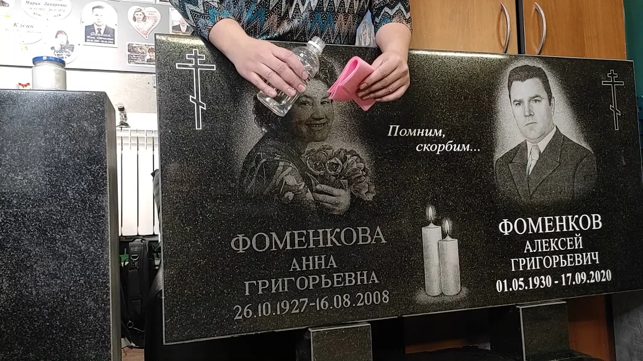
Как обновить текст и портрет на старом памятнике
616.3K
To restore faded or worn gravings on stone monuments, first clean the surface with acetone, then apply white acrylic facade paint to the grooves, let it dry until matte, and carefully scrape off the excess paint using a knife; this technique preserves the original carving while making it visible again, protecting it from weather damage.
Click to watch →
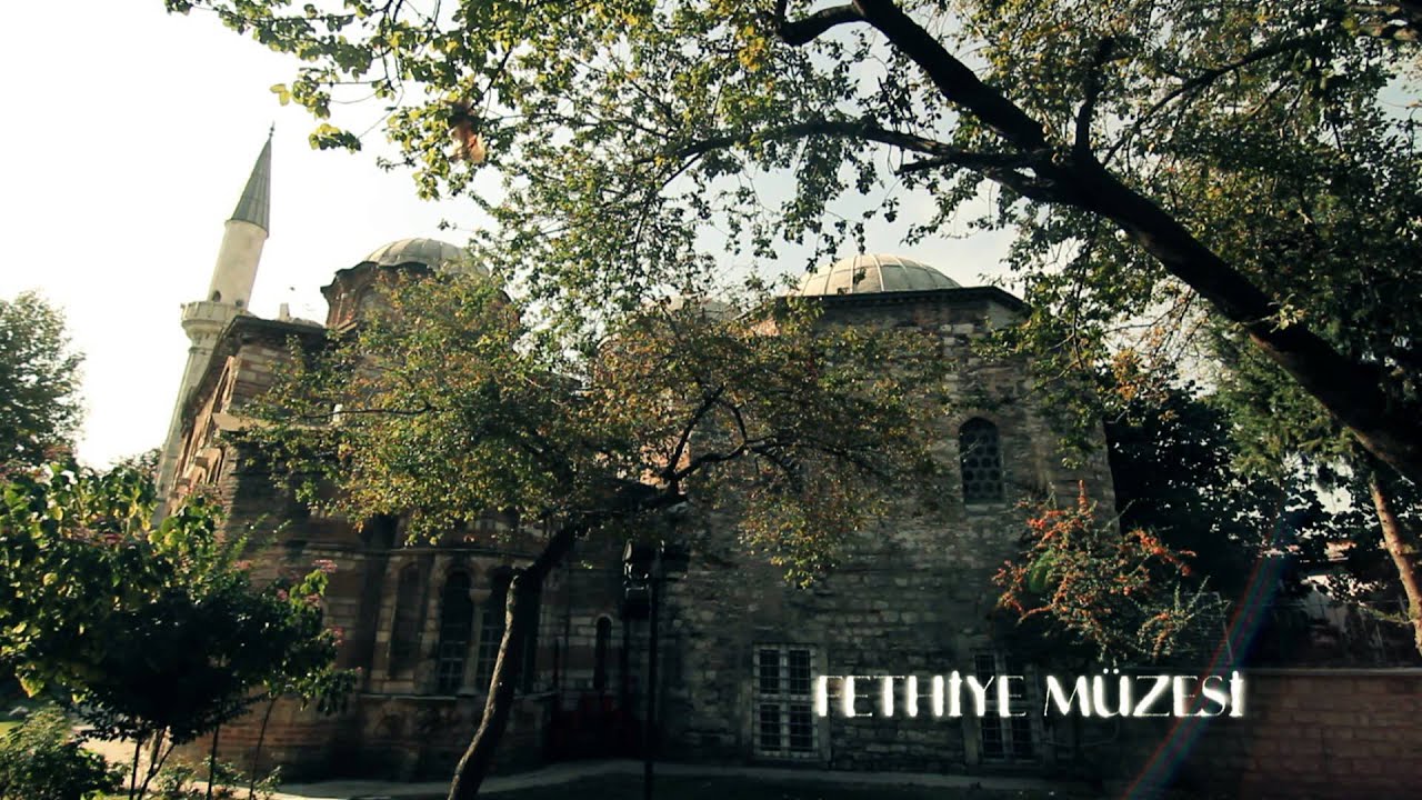
KÜLTÜR BAKANLIĞI 2013
319
Cultural heritage preservation represents a systematic national commitment to protecting historical monuments. Turkey has approximately 17,192 registered cultural monuments and 12,170 civil architecture examples. The 2020/2023 restoration project aims to restore 300 additional monuments through government support. Between 2005-2012, the government provided support for 3,155 privately owned cultural monuments and 2,091 registered cultural monuments, with 1,064 restoration projects receiving 49.645 million Turkish Lira. This systematic approach demonstrates how nations invest in preserving their cultural legacy through dedicated funding, legal frameworks, and institutional support.
Click to watch →

RESTORASYONU TAMAMLANAN YILDIZ SARAYI AÇILDI!
624
Turkey has demonstrated a comprehensive approach to cultural heritage preservation, exemplified by the restoration of the Savarona yacht after it was used for scandalous purposes. This approach extends to all historical periods, including the Ottoman era, without discrimination. The Turkish government has undertaken numerous restoration projects, including the Beykoz Mosque and Glass Museum, Ankara Palace Museum, Topkapı Palace's treasury collection, hat collection, and Mecidiye Pavilion. Since 2002, the General Directorate of Foundations has conducted approximately 6,000 restoration projects across the country, involving over 120 restoration works. Cultural heritage sites are viewed as living memories of civilization, representing milestones in the nation's journey from eternity to eternity.
Click to watch →

Southeast Turkey Part 5 Mt Nemrut, Deyrulzafaran Monastery, Dara Ruins, Virgin Mary Monastery
54.6K
Southeast Turkey contains remarkable historical sites including Nemrut Mountain's ancient stone heads (erected 2,000 years ago as monuments to a king whose tomb remains undiscovered), the 16th-century Deyrulzafaran Monastery with its 6th-century cave structures, and the Dara Ruins, representing one of the earliest established Christian religions that was built like a fortress due to centuries of persecution.
Click to watch →
Sultanani Caravanserai
Sultanani Caravanserai
0:16- 1
Largest caravanserai in Turkey, built in 13th century.
- 2
Provided rest and safety for Silk Road caravans.
- 3
Caravans enriched owners and cities along route.
Imperial Projection and Military Control Over Trade Altruism
While traditional narratives celebrate the Sultanhani Caravanserai as an altruistic haven for Silk Road merchants, revisionist historians offer a more critical perspective. They argue that these monumental structures served primarily as heavily fortified outposts designed for Seljuk military control, tax extraction, and imperial propaganda. The imposing, fortress-like architecture and grand portals inscribed with the Sultan's titles were intended to project state power over newly conquered, diverse, and often rebellious Anatolian territories. Rather than acting as purely economic facilitators, caravanserais functioned as instruments of state surveillance and military logistics, ensuring the ruling elite's hegemony over regional trade routes and local populations.
Understanding the historical and geographical scope of the Silk Road network as a facilitator of Eurasian trade and cultural exchange.
A basic overview of the Seljuk Sultanate of Rum, its rise in Anatolia, and its timeline during the 11th to 13th centuries.
The fundamental concept and purpose of a caravanserai as a state-sponsored roadside inn supporting merchants and travelers.
Familiarity with basic Islamic architectural elements, such as monumental portals (pishtaqs), muqarnas (honeycomb vaulting), and courtyard layouts.
Analyzing the economic policies and security/insurance systems implemented by the Seljuks to protect and encourage international merchants.
Conducting a comparative study of Seljuk caravanserai architecture with contemporary Mongol, Ilkhanid, or Persian road stations.
Exploring other major Seljuk architectural achievements in Anatolia, such as the double-minaret madrasas in Erzurum and Sivas.
Investigating modern cultural heritage preservation and the restoration challenges of 13th-century stone monuments in Turkey.
1.7K views14likes6:09@JeanMariePutzOriginal Release: 2022-03-22
[Music] built in the 13th century sultanani is the largest caravanserai in turkey caravan series were places of rest and safety for the silk road caravans that transported their precious cargos from the mediterranean to china and vice versa these caravans have considerably enriched their owners as well as the cities on their way [Music] [Applause] [Music] [Applause] [Music] [Music] [Music] [Music] [Music] [Music] you
Up Next

1:25
Genghis Khan: Rise, Conquest, and Legacy of the Mongol Empire
@TheQuietConquest
205K views•2025-03-17

33:02
The Great Schism of 1054: Causes and Consequences
@SacredCathedrals
113.5K views•2026-02-19

91:57
The Geopolitics of the Ukraine War and the Rise of Global Autocracy
@JordanHarbingerShow
468K views•2025-04-19

17:05
Understanding the Cold War: Superpower Conflicts and the Road to Détente
@OverSimplified
46.1M views•2019-01-24
Related Study Plans & Knowledge Roadmaps
Structured learning paths in History
history
Byzantine Iconoclasm: Theology, Art & Politics
01Foundations of Byzantium and Early Christian Images
02The First Iconoclasm: Leo III and the Crisis of Images
03Empress Irene, Nicaea II, and the Second Iconoclasm
+ 2 more learning modules
9h5 modules
Explore Roadmap
history
Iranian Revolution (Causes, Events & Legacy)
01The Pahlavi Dynasty and the Roots of Discontent
02The Spark of Rebellion and the Rise of Khomeini
031979: The Fall of the Shah and the Climax of the Revolution
+ 2 more learning modules
8h5 modules
Explore Roadmap
history
Mali Empire: Mansa Musa, Trade & Timbuktu
01Foundations of the Mali Empire
02The Trans-Saharan Gold and Salt Trade
03The Reign and Pilgrimage of Mansa Musa
+ 1 more learning modules
6h4 modules
Explore Roadmap
history
1947 Partition: Politics, Borders & Legacies
01Foundations of British India and the Divide
02The Political Negotiations and the Mountbatten Plan
03Drawing the Boundary: The Radcliffe Line
+ 2 more learning modules
8h5 modules
Explore Roadmap