









![Colapso - 0.4 Un marco de cinco elementos [27 a 32]](https://i.ytimg.com/vi/oPvufh8IBZs/sddefault.jpg)






![Ancient Amazonian Cities [3 examples...kind of]](https://i.ytimg.com/vi_webp/exk_5Vph3ao/maxresdefault.webp)


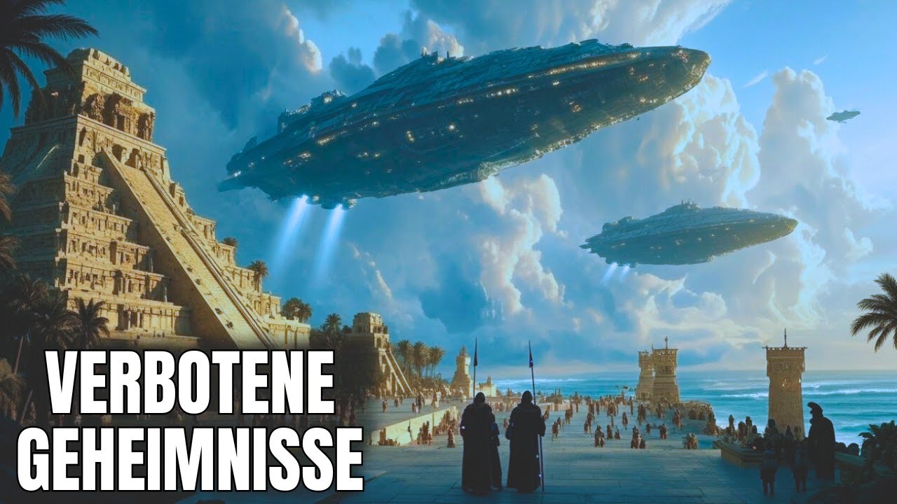



Ancient Angkor (Cambodia) and the Ancient Maya (Mesoamerica) represent two parallel civilizations that developed independently across oceans but share remarkable similarities in their rise, peak, and eventual collapse around 800-900 years after their emergence. Both civilizations emerged in tropical monsoon forest environments with seasonal rainfall patterns, developed complex urban centers with divine kingship systems, and ultimately collapsed due to ideological transformations rather than purely economic or environmental factors. The Maya declined around 900 AD with abandonment of cities and mass migration, while Angkor fell around 1431 AD when Thai forces invaded and Theravada Buddhism replaced the Hindu god-king ideology. Both civilizations lasted approximately 600-800 years before experiencing this ideological collapse, demonstrating universal patterns in human societal development that transcend specific geographic and cultural contexts.
Parallel Civilizations: Ancient Angkor and the Maya | Yale Lecture
Added:ANNOUNCER: program is a presentation of UCTV for educational and non-commercial use only.
Check out our YouTube original channel UCTV Prime at youtube.com/uctvprime.
Subscribe today to get new programs every week.
SPEAKER: Pleasure to welcome you today to the third of three Hitchcock lectures to be given by professor Michael Coe.
The Hitchcock endowment fund was established in 1865 to recognize the highest levels of scholarly thought and achievement.
This fund has grown over the years and has brought many notable individuals to the Berkeley campus, including Niels Bohr, Robert Oppenheimer, and Stephen Hawking.
The bequest has become one of the most cherished endowments of the University of California.
We are pleased to present to you today, under the aegis of the Hitchcock professorship fund, the highly distinguished professor Michael Coe.
Professor Coe is the Charles J. McCurdy professor of anthropology emeritus at Yale University.
As one of the foremost authority in historical archaeology, his studies of ancient Mayan culture and writing systems have been heralded as major developments in the understanding and evolution of this fascinating civilization.
Thanks to Professor Coe's work, we now much more about the Maya, a people that achieved remarkable advancements in art, literature, mathematics, and astronomy.
Professor Coe has written numerous books on the Maya, including breaking the Maya code and the art of the Maya scribe.
He has also written about a broad array of Mesoamerican subjects, ranging from pre-Columbian art, pottery, and ceramics to the history of chocolate in the Western hemisphere, which I trust some of you heard about yesterday.
Professor Coe's work is sensitive to developments in all areas of Maya research and to the growing knowledge about interactions between the Maya and other ancient peoples of the region.
His studies have also extended to other Mesoamerican civilizations, including both the Aztecs of Central Mexico and the Olmec in Southern Mexico and Central America.
As a result of these efforts, his work has significantly contributed to the awareness of Mesoamerican history and has influenced our understanding of the evolution of ancient civilizations in general.
In this lecture today entitled "Parallel Civilizations: Ancient Angkor and the Ancient Maya" professor Coe discusses the evolution of yet another mysterious civilization from the other side of the world, the Angkor of ancient Cambodia.
The Angkor, still an enigma and a matter of dispute among academics, was a remarkable civilization that housed a vast urban complex.
Professor Coe believes that there are potential analogies to be drawn between the ancient Angkor and Mayan settlement patterns.
And so holding, he hopes to illuminate the mysteries that enshroud this ancient and fascinating civilization.
Without further delay, I am pleased to present to you professor Michael Coe.
[APPLAUSE] MICHAEL COE: I'd really like to express warm thanks to Dean Mason and the members of the Hitchcock committee for inviting me here.
I've enjoyed this tremendously.
Nothing like an audience to a retired old professor.
I haven't had an audience for a long time.
And you've been a good one.
I got interested in this subject of ancient Cambodia a very long time ago, almost as long ago as I've been involved with the peoples of Mesoamerica.
In 1954, on my way back from a two year assignment in the Far East, I decided I wanted to go to Angkor, and one could then.
And this was no less than 46 years ago.
And I was flabbergasted.
I had been in the Maya area quite a lot ever since I was a sophomore at Harvard and changed my major from English to anthropology so I could study the Maya.
And I'd seen the great Maya sites, not all of them by a long shot.
But I had seen them in their tropical forest setting.
And when I walked through Angkor, I was just flabbergasted at how similar Angkor was to a classic Maya site.
The jungle looked the same.
The animals sounded the same.
A lot of the sculpture looked similar.
And certainly, the architecture really resounded.
Now, this afternoon, I'm not going to draw any conclusions, or even suggest that there were any connections between these two.
Frankly, not for publication, I think there were, but that's another story.
In my dotage, that's what I'm going to devote myself to.
But nobody else would believe me on this.
But there are some amazing parallels between these two cultures.
Now, the great strength of being an anthropologist, rather than any other kind of an ologist is that anthropology, from its very founding, from its founders back in the mid-19th century, has been a comparative study.
It began as, really, the comparative study of civilizations, and in particular, of ancient religions.
And some of the great theorists back in those days, men like Lewis Henry Morgan and Edward Tylor and people of this sort, who were the founding fathers of anthropology, were comparative scholars.
They believed that by comparing civilizations in the past through time and space, you could illuminate the whole story of how human cultures came about to be.
Now, this afternoon, I'm not going to draw any great conclusions by a long shot.
There's some big questions that can be raised, perhaps, without any good answers and some little ones.
I'm not a person who believes that all cultures can be reduced to one particular grand unified field theory.
I don't think that works.
And I don't think it has worked in the past.
And it's led us down many false paths that ended up in a blank and turned out to be wrong.
I'm a believer in multiple causations.
But you'll see some interesting parallels when we get to them between these two cultures.
Now, I've been back-- since the piece has returned to that really troubled land of Cambodia, I've been back five times.
And I'll be there again next month.
And each time I go, I learned something new.
It's a place one can go to now.
And I'm glad I came very close to wanting, when I got back to Harvard, to dropping all these stuff about the Maya.
I came back into graduate school as a graduate student to study.
And I thought, well, the heck with them.
I think I'll do the ancient Khmer of Cambodia.
This is really going to be the future.
I'm so glad I did not because of really the tragic history of that place-- war torn, massacres, genocide.
Every horrible thing that can ever happen to a people in a land has happened to these people.
And I would have had no success whatsoever.
So I stuck with the Maya and the other Mesoamerican.
But now, in my old age, I'm coming back to an original love of mine.
And I'm not sorry about it.
So I think we'll start with the first slide.
Now, for those of you who didn't hear me about the Maya, I just wanted to recapitulate some of what we know about the Maya civilization without spending any great time on it.
So we can move across the ocean to Cambodia and to Angkor and the classic Khmer civilization.
Essentially, the Maya occupied the lowland Maya that I'm talking about during the classic period.
From around 250 AD till about 900 AD, occupied this region of the Southeastern Mesoamerican lowlands, the Yucatan Peninsula, and particularly the Southern lowlands here, which is where most of the great ancient cities like Tikal and Copan and Quirigua, Piedras Negras, and so forth are located.
Some time, beginning about 800 AD, something went drastically wrong with these people and with this civilization.
And center after center, city after city failed to put up dated stone monuments.
Evidence of widespread destruction and mass migration out from there to other parts of Mesoamerican, particularly to Northern Yucatan, and apparently to the Guatemalan and Chiapas highlands down in here.
This area was abandoned, really, pretty much for hundreds and hundreds, almost 800 years, reverted to the jungle.
Something terrible happened there.
And I'll come back to that at the end of this lecture when we talk about what happened to Angkor.
So this is the environment in which this all took place.
This is in Northern Guatemala, actually taken from the top of one of the higher pyramids at Tikal.
And it's a tropical monsoon forest here.
That's the original vegetation of the Maya lowlands.
However, we do know from pollen studies that have been made by the palynologists, that, in fact, this forest is a regrowth.
That the Maya had most of it cut down, as a matter of fact, towards the end of the classic period due to their agricultural practices.
But essentially, before humans came into this is what this area looked like.
It's a tropical forest civilization that arose there.
Now, in that kind of environment, to make a living, of course, these people are maize, corn, agriculturalists, maize, beans, squash, chili peppers, and a host of other domesticates but essentially maize farmers.
A form of cultivation called swidden or shifting cultivation is the rule and has been in for hundreds and hundreds of years, and probably was largely so in the past during the classic period.
Shifting cultivation, where the farmer burns down a section of a forest at the end of the dry season.
He cuts it down, excuse me, allows it to dry out at the end of the dry season, and then fires it.
And in the ashes, plants the maize so that all the nutrients that were in the trees are now in the soil.
It's not at all a bad form of cultivation, except it's highly destructive to the forest.
And this is one of the reasons why we believe most of it was cut down.
Now, that's not the only form of cultivation that the classic Maya practiced.
Within the last 20 years or so, we have come to know from aerial surveys and on the ground checking of this and even through a certain amount of radar survey, using side-looking airborne radar, that there is another form of cultivation which was highly intensive.
In the swampy, low-lying areas, which are very extensive in the Maya region, they cut, what are basically, ditches and canals.
Sort of the way the land of Holland was rescued, or the fens of Eastern England through drainage, leaving rectangular plots, which are continuously wet and using the mud from the ditches to basically fertilize these plots.
And this is a highly intensive form of agriculture that was practiced, not really over the whole Maya area but in certain important places.
So they could probably support a lot more people than we gave them credit for, let's say, 50 years ago when we thought slash and burn cultivation was the only kind.
There were very, very high populations.
I won't go into this here now, but there's excellent evidence from archeological survey that the populations in the Maya area were tremendous.
Millions of people living in that area that by, let's say, 1,000 AD, probably had only a few thousand.
Of course, one of the more famous classic Maya sites seen from the air, these great conglomerations of temple pyramids and palace structures here, which are range type buildings with corbel vaulting, in which the kings and queens and royal courts of the Maya lived and carried out their life.
These are royal cities in every respect.
At the bidding of the ruler, basically, all life went on.
He was a holy person.
He was a divine king.
And we will come to these divine kings when we come to Cambodia and Southeast Asia again.
Many of these great Maya cities have been extremely well mapped on the ground surveys with testing of structures.
And really, we know an awful lot about the settlement pattern of places like Tikal and Ellsworth.
In large part, that grew out of the work of my old professor, Gordon Willey at Harvard, now retired, who was the founder of studies of this, basically, in archeology and was a world leader in this.
And he turned his attention to the Maya area.
And he stimulated all of this kind of ground survey so that we can actually plot out-- this is Tikal, most of Tikal that you see.
These are the central acropolis, which was the palace of Tikal.
And these are the great temple pyramids here, which were dedicated to the royal cult, to the cult of dead kings, of ancestral kings.
But huge causeways, reservoirs, because drinking water is a great problem in the Maya area even today.
But essentially, that's it, an amorphous settlement pattern.
It doesn't look like a city of Near Eastern city.
It doesn't look like a Chinese city laid out on a grid pattern at all but a very, very amorphous kind of a settlement pattern.
But a city nevertheless because it had the function of a city.
Most Maya architecture, most Maya buildings are really like wedding cakes.
That is, there's layer after layer after layer after layer of buildings built up through the centuries by kings who had rebuilding programs and so forth, where they tore down the vaults, bolted structure, superstructures, on older buildings, and then raised other buildings above them.
So here, for instance, at the site of Uaxactun, which I talked about last time, is an original temple complex with three temples around it, perhaps dedicated to three gods and then successive rebuildings.
Until finally, this thing has turned into a palace with interior temples at the end of the late classic.
This is the kind of archaeology that's been done in the Maya area.
And it's been of the absolutely highest quality.
And it's the kind of archaeology that's barely begun in Southeast Asia.
Maya architecture was extraordinarily beautiful.
This is the site of Palenque, where some of the most beautiful architecture is.
You're looking at a late classic building, 8th century AD called the Temple of the Sun at Palenque.
And it was built. We know who the person who built this was.
It's part of a complex of actually four different major structures in that area, built by a king named K'inich Kan Bahlam the son of the man who was buried in the great temple of the inscriptions there.
Very, very beautiful, all covered with stucco at one point.
And it was like a billboard up here.
This is the roof comb, which had stucco figures of it of the gods and of the ancestors.
This is from-- somebody asked me previously about this book by John Lloyd Stephens.
John Lloyd Stephens went in the 1830s to this region with Frederick Catherwood, an English topographical artist.
And later on, Catherwood, in 1850, published a wonderful lithograph album of his lithographs of various Maya sites, including Copan.
Stephens bought Copan for $50 so they could do whatever they wanted there.
And they got a wonderful account of it.
The Maya had put up a stele, dated monuments of their kings, and put it the other way around.
The kings put up monuments for themselves.
This particular king was a guy named Waxaklahun Ubah K'awil.
And this particular character put up a number of very important stelae, or monuments at Copan to celebrate his reign and his association with the gods, particularly with the maize god.
And in front of it are altars.
This is a deathbed altar.
We don't a lot about that.
But these stelae are usually associated with these altars.
And of course, all of this has hieroglyphic writing on it.
Now, these Maya kings were divine kings.
They had the title of K'uhul Ajaw, or K'uhul Ajaw, the holy king of such and such, a city.
And many of these cities had very, very long dynastic successions, very long lineages.
Tikal had dozens of-- wells, almost two dozen rulers, one after another in an unbroken succession, really, which lasted almost 700 years.
The other cities had more recent founding and therefore had to invent past genealogies.
But these kings sat on thrones in their palaces.
They had, probably, numbers of wives and a principal wife.
And they had heirs apparent.
And all sorts of rites were celebrated by them to mark victories and to mark important time periods.
The writing, as you know, from my first lecture can be read.
Even if we can't pronounce all of it, we can do most of it in what we call Ch'olan Maya, the ancestor of Ch'orti Maya, which was the literary language of these people.
And we can read this.
This is a huge-- this is a great slab from Palenque, very, very late in the history of Palenque by a master calligrapher.
And it's the dynastic history of the kings of Palenque, particularly mentioning a very important king named Pakal, who was the guy buried in the Temple of the Inscriptions in the great sarcophagus, in tomb in there.
And ending up with the ruler down here, who commissioned this whole thing, a man named K'uk Bahlam, or Quetzal Jaguar, who was also, like all of his predecessors, a K'uhul Ajaw, a holy king.
The Maya were tremendously warlike, except the people of Copan, who were relatively peaceful.
Hardly any war monuments there at all.
But this is a wonderful mural, a watercolor copy of it in a small building with three rooms at the site of Bonampak in the Southern Maya lowlands.
And here, you have the king, a guy named Chan Muwaan, as war leader in his jaguar costume, with all of his underlings and officers and his principal wife over here.
And they are-- this is called the arrangement of the prisoners.
Most of these Maya political kingdoms were at war at one time, or another with other ones.
And warfare was a tremendously important thing.
Highly, highly warlike people, as you will see that the Khmer of Cambodia were and are.
The political geography of the Maya area during the classic is pretty darn well known now.
Instead of an old empire as earlier people had thought existed there, say, with Tikal as its great capital, there never was an empire.
There never was a unitary political system at any time in the Maya lowlands.
This is the political geography of the Southern Maya lowlands, as we know it from their inscriptions, and particularly, from the emblem glyphs that I talked about the first time.
And you will see that the actual territory, these, of course, are idealistic polygons that the anthropologists have drawn.
But the territory that they control is never very big, that they actually controlled that were-- say, this is the territory of the Tikal polity.
In fact, the boundary between it and the next kingdom was never more than a day or two's walk or march from the capital city.
So these are not very big.
It's sort of a Balkan type situation.
And this came as a great surprise to Maya, is how to account for this.
And it marks them off from the civilization that we're going to be looking at shortly.
So that's what it all looked like at the time of-- just before the whole thing collapsed in the 9th century AD.
However, having said that, it's also true that they might have looked all equal there, but some of them were more equal than others.
And in particular, these two cities, Calakmul here, that's its main sign of its emblem glyph, the snake city, and Tikal, this is the anciently named Khan or snake.
And this is anciently-- actually not Tikal, but Yax Mutal, we now know as the real name of Tikal.
That these two cities hated each other.
And they had a rivalry that went on for centuries, in which each one of them would try, through diplomatic means and intermarriages and diplomatic visits and whatnot, to somehow, or another co-opt other cities and get them allied against their enemy.
And this is a whole scheme that's come out recently of the political alliances and misalliances that took place during the classic period.
We never could have done this 30 years ago, I mean, 25 years ago.
Now, we can start talking about this kind of thing now that we can read these inscriptions.
The whole idea of warfare was not necessarily to get territory here, but rather-- they never had that idea-- but rather to get political hegemony over other people to command tribute from states that were left alone, basically, politically, but always had the threat of an army coming in.
And secondly, and probably even more importantly, to take great captives, important captives, from that other city and bring them in for torture and sacrifice.
This is on a bone-- from a small, beautifully incised bone from the tomb of Jasaw Chan K'awiil, the great king of Tikal, who won a great battle over Calakmul.
And this is a prisoner from Calakmul on this.
And he is actually given his name and titles here.
And it says that he comes from Calakmul here, which is way to the North, their bitter enemy.
So Tikal eventually won.
But that's the main point of Maya warfare.
OK, that's the Maya.
I'll come back to them later.
Now, let's move to the other side of the world.
And I mean, it is the other side.
At least, it is from New Haven.
This is, of course, a map of Southeast Asia.
And I'm not going to go into any great detail about the geography here.
But this is Southeast Asia here with the great Mekong River coming down through here, one of the largest river systems in the world.
And it comes down through these lowlands here.
And that is the center of the Khmer empire right there.
The Khmer held that, including the delta region, which is now in South Vietnam.
And then all of this land North of the Dangrek mountains up here and the Khorat plateau in Northeastern Thailand, plus a whole lot more, that's the area that we're going to be looking at.
The prehistory of this place, or at least of Cambodia, is not well known.
Although the archaeology of Thailand and Northeastern Thailand, in particular, has been much better worked out than in this area here than in Cambodia proper.
But about the beginning of the Christian era and in the first centuries of it, there were very important trade contacts between India and Southeast Asia.
And contacts that also included Chinese goods coming in here, goods from India, and even goods coming from the Mediterranean, crossing the Malay Peninsula into entrepots, trading posts in the Coast of Southeast Asia, or near the Coast.
The net result of this was that in this region of Southeast Asia, Southern Vietnam, the delta region, Cambodia, today Thailand, the Malay Peninsula, there were a series of chiefdoms of local chiefs, who were probably clan leaders, or leaders of, perhaps, patrilineal clans, people who spoke an ancestral form of Khmer, or an ancestral form of Cham, which is a Malayo-Polynesian language and who had been taken as their model for how to put a polity together, India.
This area became Indianized at this point.
And there was a long time when because of all of the obvious presence of Indian ideas here, that Indian patriots claimed that this was actually greater India.
But it was no such thing.
These people were emulating a great civilization, the great civilization of India, and taking the whole idea of the god king and of the exemplary center of the hero king, like Rama in the Ramayana, as the model to put together something more complex than a mere chiefdom.
And you have, during the centuries leading up to about 800 AD, you have the crystallization of some of these chiefdoms into real states built on Indian lines.
This is not to say that Indians came enmasse by a long shot.
Perhaps, gurus came at this point, wandering monks and priests and holy men.
But many of these people who were gurus were probably Khmer, who had gone to India to learn these things and come back.
So it's no simple takeover.
And why India rather than China?
Because the Chinese model of contact is takeover.
The Chinese imposed upon Northern Vietnam, for instance, their way, their bureaucracy, their people, and their tribute system so that you were beholden to the Chinese emperor wherever he happened to be.
This did not take place in the rest of Southeast Asia.
And they kept the Chinese at arm's length, except to trade.
So you had these crystallizing kingdoms of the Chinese.
There are Chinese reports about these kingdoms.
They talk about, first, a kingdom called Funan down here in the Delta region and along this part of Cambodia.
And then later, they talk about a really important region called Zhenla up here in what's Northeastern Cambodia and neighboring Vietnam.
And these are crystallizing kingdoms.
There's actually architecture to go with this.
These are becoming urban centers with heavy trading going on and all sorts of rare materials between India, China, and Southeast Asia.
Incidentally, from down here in a site called Oc Eo in the delta region that the French dug before the war, before the Vietnam War.
They actually found Roman coinage coming all the way from Italy there.
So these were really trading entrepots.
Now, I'd like to say something about the geography here because I've described to you the geography of the tropical lowlands of Southeast Asia-- excuse me, of Southeastern Mesoamerica.
Southeast Asia is very similar, except you've got to talk here about the great river system.
It's a monsoon climate, a heavy tropical forest, originally over much of it.
But the Mekong River is what really makes this whole area.
There are two strongly marked seasons-- a rainy season, the so-called monsoon season, and a dry season.
And they're exactly the same as the rainy and dry seasons in the Maya area, come at the same time.
Rainy in our summer, and especially in the fall.
And dry from winter time on until the end of May when the rains come again.
During the rainy season, in the summertime, the Mekong is nourished by the melting snows of Tibet, where it begins.
And what happens is that this river coming down here, this great river, comes through all the mouths of the delta.
And like a bad sewer system, it backs up.
It cannot handle all of that water.
And it backs up-- the rivers back up and back up into this lake, the great lake or the Tonle Sap in Cambodia, which is the largest lake in Southeast Asia.
And this lake expands to four times its dry season size.
At that point, fish come in to breed in this region.
And the Tonle Sap has the greatest density of fish in the world.
It's an incredible source of protein to the people of Cambodia.
So if you look at that environment, this is Angkor, it looks like the Maya area.
It's a monsoon forest, a high tropical forest.
However, this was and is today largely cut down.
Some of it's left because it's an important source of various raw materials and things that people need.
But mostly, it's gone because these people are rice agriculturalists.
It's been left here in the Great National Park that the government has at Angkor.
You can actually see a ruin there, peeking through the trees.
It does look like the Maya.
It looks like Tikal.
This is a map of the Tonle Sap itself.
And you can see how Angkor is placed here.
This is where you fly into Angkor.
Here, you stay at SIEM REAP.
And this is where Angkor is itself.
It says, Angkor Wat here.
Let's say Angkor.
Angkor means city.
It's the Cambodian version of Nagari, the Sanskrit word for city.
And it includes Angkor Wat as you will see later on.
But it's strategically located here because during the dry season, when the waters recede in the Tonle Sap-- it's flooded a very large area here-- they plant in the mud that's left by the receding waters.
They plant their rice.
And it's a breadbasket.
It's like the Nile.
It's an incredibly rich area because most of the land in Cambodia is not that good away from the Tonle Sap, or away from the river systems.
But here it's incredibly good.
And because of the protein here in the Tonle Sap off the Great Lake and because of the receding agriculture, rice agriculture-- receding water as rice agriculture, rather, Angkor is where it had to be.
And the whole growth of Angkor, I think, depends, if you want to take economic models, upon the possibilities, the agricultural potential of this region.
Now, as I said, there is a rainy season and a dry season.
This is November, which is towards the tail end of the rainy season.
It's raining like mad now in Cambodia.
And it will taper off finally at the end of November and beginning of December.
And that's a fact.
Almost all cultivation away from the Great Lake depends upon this rainfall.
Most of the rice in Cambodia is actually rainfall produced on fields that are merely watered by rain and not cultivated at all in the height of the dry season.
Here, you are looking out at the edge of the Tonle Sap.
These are all flooded rice fields here.
And as the water goes down, they will plant them in the mud, come in and plant in the mud.
And this will all turn into green rice.
It's quite a sight.
But it's just loaded with fish.
And there's a huge fishing industry here.
Fish mainly turned into the most unattractive stuff to the Western ears, eyes, and nose, fish paste, fermented fish paste.
Which is a wonderful source of protein for everybody.
And it's part of the Cambodian diet.
You get to like it after a while.
This is now a rice field in an area that has been left by the receding waters of the Tonle Sap.
I shot this one in November.
And you can see a little Cambodian hamlet there.
All the houses in Cambodia are on stilts raised up above the deck there.
And people live in the upper story.
And the pigs and other animals, water buffaloes, live down below.
Which would make it very, very difficult to find these things archaeologically.
And as I say, there are many kinds of rice grown in Cambodia by the Khmer, all with different growing seasons, length of growing time, and different characteristics.
Now, today, of course, hybrid rice produced by the big rice institute up in the Philippines, that's spreading everywhere.
Not, in some cases, such a great idea.
Now, this place is big.
Angkor is huge.
Angkor covers at least 75 square miles, 200 square kilometers, I think, one of, perhaps, the biggest ancient archaeological site in the entire world.
And I'll prove it to you in a moment.
It's so big, it can be seen from space.
It's one of the things that you can see from space, like the Great Wall of China.
And this is an image taken in space from the shuttle, Endeavor shuttle, when they passed over Angkor in a project that was backed by NASA and the Jet Propulsion Lab, to shoot to make radar pictures on different bands of Angkor itself.
Here's the Tonle Sap down here.
This is Angkor itself.
These are the Kulen Hills from which all the water comes that runs down through Angkor to supply these huge artificial basins here, really tremendous ones.
There's Angkor Wat.
This is Angkor Thom, with the royal palace there and the Banyan in the center, and all sorts of other complexes around it.
But this thing is really enormous.
Flying into SIEM REAP from the West from Bangkok, if you look out the plane, you'll see this.
That's the Western Baray, the Western reservoir here, completely artificial.
Stone lined on the edges.
It's 8 kilometers long, which is 5 miles long.
The center of it is actually right here.
This has all been silted up over here.
And there's another one on the other side of Angkor that's almost as big and others elsewhere.
So what were these?
These are all rice fields here with hamlets.
This is an ancient site right here.
What were these?
And the idea came up early on.
The French have been here for over 100 years, excavating and restoring it.
And the idea came up from their investigations that these reservoirs were there because it was an irrigation civilization.
That the kings of Angkor had these things constructed by hundreds of thousands of slaves to keep the water in so that these rice fields could all be irrigated.
That this was a prime example used by various, mainly Marxist, historians and anthropologists to show that in Eastern Asia, there was another kind of civilization that was very rigidly organized kind of civilization that depended upon irrigation.
It turns out not to be the case.
There is a map of what you were looking at in the radar picture.
Angkor Wat is here.
That's Angkor Thom with the royal palace and whatnot, the center of the huge city here.
The two Baray, big Barays, other ones are elsewhere.
There's another one down here that should be in blue also.
And I have put on that map of central Tikal at the same scale.
You can barely see it.
It's postage stamp sized.
You could put how many Tikal's-- which Mayanists love to think is the biggest thing ever made in the history of the world-- how many could you put within Angkor?
Just to give you an idea of the size of this place.
Now, there's a difference.
That Angkor was the center of a great empire, a unitary empire, where Tikal never was.
So one has to be fair about this.
But it does put things in perspective.
To the North, in the Kulen Hills, is where the people of Angkor got the stone from which they constructed, or at least finished all of their buildings and architecture, and from which they made their sculpture.
And it's also the source of all the water that comes down to fill those Barays.
And that runs through the site and through all the canals that are around there.
This is the headwaters of the SIEM REAP river during the rainy season, going over a waterfall here.
These Kulen Hills are extremely important just to the North of Angkor because in the year 802 AD, one particular king named Yashovarman declared himself-- he was a local ruler-- he declared himself a universal king.
And he founded the city of Angkor, which was called Yasodharapura.
That's the ancient name for Angkor.
So he is the founder of it.
And he is the founder of the Khmer empire.
And it becomes then you enter, really, something equivalent to the classic Maya period at this point but in 802.
I said that the models on which they drew were India, 100% from India and the Indian model for building architecture for building a royal center and a royal temple.
And these were royal temples.
Everything you see at Angkor, all the great structures, are royal temples.
What they are doing is reproducing the Himalaya mountains, the home of the gods, where they make these-- these are temple mountains.
And ideally, there's a central mountain with five other ones around it.
This is a mandala.
These are definitely mandalas of Indian origin.
And you are reproducing here, Mount Meru, the great mountain of the gods, where all the gods and spirits live in the Himalayas according to Hindu mythology.
And around it, you construct a moat.
And the moat represents the sea that surrounds Mount Meru.
Even though it's a square moat and all the rest of it, that's what it is conceptually, it's that.
So in making this into each one of these temples, each king, successive king made his royal temple here, or in temples to his ancestors.
He is aligning himself with the gods in Mount Meru.
And the gods are the Hindu gods.
Shiva, the most important of all, the god of destruction but also a great creator god and the God of the royal family and the royal house and of the king himself, as seen in the form of a lingam, which is a stone phallus which represents the godhead and the king at the same time.
Vishnu, another very important god, the preserver and Brahma, the creator.
These are the three gods of the Hindu trinity.
There, in one of the temples, is a lingam sitting in the female yoni here.
It's been busted off.
But it actually goes way underground.
And it represents the three.
Shiva on the top and then the other two gods further down in parts that you cannot see.
And these are the gods themselves.
This is the divine part.
This is the holiest part of each temple is the lingam here.
Which, each successive king dedicated.
These are royal foundations.
Now, where is that?
It looks like Tikal.
It's Angkor.
I practically fell over when I saw this for the first time in 1954.
The earliest architecture in Angkor-- this is a temple mountain actually-- looks terrifically Maya.
And I really don't think there's any connection because the dates are wrong.
Remember, this can't be any earlier and isn't any earlier.
It actually dates to early in the 10th century AD.
The Maya era is over by that time.
The Maya were making this kind of thing long before the Cambodians were.
So if there was any influence, it went the other way.
Mayas paddled their canoes across the Pacific and brought it to the other side.
But it's remarkably similar.
Each one of these temples has inscriptions in it.
The inscriptions are generally on the sides, on the jams of the buildings of the doorways when you get to the temple on the top where the lingam is kept.
And what do they say?
Some of them are in Sanskrit.
And some of them are in Khmer.
The Sanskrit ones are of interest to the history of religion because they're entirely religious.
They described the dedication of the temple to a particular god and described the holy ancestry of that particular king and so forth.
And they are poetry.
They are actual Sanskrit poems, very beautiful ones, in writing that's eventually derived from India.
But it's typically Khmer writing but writing in Sanskrit.
The Khmer ones are much more interesting to archaeologists because they give you some economic data.
They tell you that each one of these temples had so many villages attached to it that had to produce, through corvée labor and tribute and temple work, had to produce so much each year at certain times.
And some of these temples and temple complexes had thousands of villages attached to it, with thousands and thousands and thousands of people, who are called Khnum.
Which some people translate as slaves, but nobody is quite sure what.
Probably, the majority of the people in the landscape of the villagers in Cambodia were attached to one, or another of these temples in Angkor and all the other provincial sites.
We know from the inscriptions, which don't tell us, really, a great deal, that there were as much as 90 provincial capitals in the Angkor empire.
And each one of them filled with temples that had its own villages.
I suspect the Maya were organized the same way.
And yet, unfortunately, Maya inscriptions don't tell us this kind of a thing.
They tell us other things.
In fact, there's much more history actually in Maya inscriptions than there are in Khmer ones.
Now, everybody thinks it's Angkor Wat.
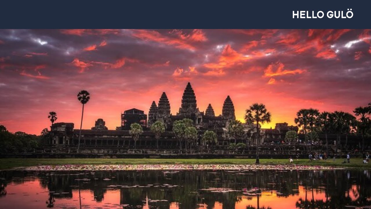
Well, this is Angkor Wat, but it's only part of Angkor but really incredibly beautiful.
And it's the largest religious structure in the entire world and was built in the first part of the 12th century by a great and important king, as some people think, his funerary temple.
His ashes were eventually going to be deposited in a deposit underneath, or around, or by the lingam that would be here.
But it's not dedicated to Shiva, which most temples are but rather to Vishnu because the main entrance actually faces West here.
You come in from the West here.
It's, again, a temple mount, a quincunx with four towers around a central one.
And some of the most beautiful sculpture in the world occurs there.
Here is a map of it with an enlargement of some of the galleries.
The great moat around it, huge, huge moat.
I mean, really, everything's big.
This is coming in from the West.
And then galleries that are absolutely covered with bas reliefs.
These are the largest and longest continuous bas reliefs in the entire world.
All over Angkor Wat are these wonderful images of apsaras, who are divine beings, lovely women, who were created during the churning of the Milky sea at the first moment of creation.
And they live in the Cambodian heaven.
But they represent, obviously, the thousands of, probably, palace attendants and dancers that were at the beckoning of the king and his court.
This is one of the corridors in Angkor Wat, the galleries.
And these are all covered here, this surface, completely with bas reliefs, extraordinarily and complex and beautiful bas reliefs.
One of them shows the king, Suryavarman II, seated on his palanquin here, surrounded by his court officers with umbrellas and fans and fly whisks and so forth.
And here is what he looked like.
There are military processions with his war elephants and all of his officers and army.
And then there's a whole lot of Hindu mythology told in other reliefs.
But this man was a divine king.
He was, some people think, a god-king.
He represented the god on Earth, in this case, Vishnu.
Usually, the king was the avatar, the earthly representative of Shiva, the main god of the royal pantheon.
Well, to get back to the map, you have been looking at Angkor Wat here.
But the largest complex here is not Angkor Wat but rather Angkor Thom.
It's so big, I mean, you stand at one of these entrances and look across up this road to the center of it.
And it's all the way to the horizon.
And then you realize, there's another part that keeps on going all the way over there.
A map like this can't even give you an idea of the scale of this.
This is just part of the moat around Angkor Thom.
In Angkor Thom, the king who was responsible for a lot of the architecture that you see was a man named Jayavarman VII.
Unlike his ancestors, he was a devout Buddhist but a Buddhist of the Mahayana sect, which was much more complex and much less austere than Hinayana Buddhism, which comes in much, much later, and therefore incorporated the Hindu gods into their mythologies and everything else.
All around Angkor Thom, and especially at the gates and in the center of it, the bayon, is the face of what people think is Lokesvara, the Buddha of the future.
However, it's the portrait most people think of Jayavarman VII himself.
And they're all over the place.
Every one of these towers has these faces looking out.
Four faces around it here.
Each one has four faces looking out.
So everywhere you go-- this is the very center, the central complex, at Angkor Thom-- you find this face looking out at you with his enigmatic Khmer smile.
There are wonderful bas reliefs in the bayon and the center of Angkor Thom, showing all kinds of scenes of daily life and like the Maya, scenes of warfare.
In this case, the Khmer fighting a jungle battle with their traditional hereditary enemies, the Cham.
The Cham have a long history also.
They are Malayo-Polynesian speakers, who occupied large hunks of Southern Vietnam and part of Northeastern Cambodia and were, as I say, the hereditary enemies of Angkor, and actually conquered Angkor before Jayavarman VII took the throne.
And he beat them in a series of battles shown here very, very graphically.
All sorts of scenes of daily life here.
We know from-- well, let's say right now, an awful lot of what we about ancient Angkor is not from excavations that the archeologists have done because they've been mainly concerned with reconstruction and making the place into a tourist site and with art history, not with big, anthropologically interesting questions.
Most, therefore, of what we know about their life comes from two sources.
One, these bas reliefs on the bayon.
And secondly, a Chinese traveler named Zhou Daguan, who was a diplomatic envoy from the Yuan court, the court of the Mongol kings in China at that point.
And who came back after a year or two in Angkor and wrote a wonderful account of late 13th century Angkor.
It's delightful.
It's wonderful to read.
And most of what people talk about is actually based upon this, particularly upon Zhou Daguan because the Khmer sources don't tell you these things.
We know that the king had thousands of servants in the royal palace.
That he had hundreds and hundreds and hundreds of concubines.
And it's a wonderful description of the royal life of the splendid riches of this man who could command these elephant armies and tons of gold pouring in at all times, and the tremendous luxury in which he and his court lived.
This is a scene in the bayon, showing, probably, part of the palace.
But I'll come to the palace in a moment, the royal palace.
But that's all we know.
That is the royal palace in Angkor Thom.
It's huge.
It's a tremendous structure.
I mean, really big with ceremonial pools there.
This is the royal temple in which the royal family worshipped.
The elephant terrace is here, where he went out and watched these great processions, and according to Zhou Daguan, even fireworks shows and all sorts of things over here.
It's barely been touched archaeologically.
The excavations are going on now but just beginning.
There isn't even an archaeological sequence that's based upon dirt archaeology.
For Angkor, I discovered, on talking to all the various expeditions that are in there today, there's about six different groups at Angkor now from all over the world.
There's two to three Japanese ones.
There's everything but an American one, unfortunately.
But they're just beginning the kind of study that went on 50 years ago in the Maya area, where you build up sequences through study of pottery and things like this.
It's just in its infancy today.
So there's not much we know about the royal palace, except what.
Zhou Daguan tells us.
That's the elephant terrace that I told you about with the king's war elephants shown here in bas relief here, going along here.
And we know from Zhou Daguan that he and his court and his wives and everybody came out and watched these incredible spectacles that took place during the year at Angkor.
Well now, everything comes to a halt here eventually.
But before it does, under Jayavarman VII and the later kings, Angkor basically conquered the most of Southeast Asia, large parts of Thailand.
They held all of this area of Vietnam down here, all the way into Burma and then down into the Malay Peninsula in what is Malaysia today.
It was a huge empire at its height, reaching its height, probably, in the 11th, 12th, and 13th centuries.
But then things eventually starts to fall apart.
At their height, there are numerous provincial capitals.
This is one of the most amazing of them, a place called Preah Vihear, which, until the Khmer Rouge, decided to make peace with the government, about a year or so ago, you could not go to.
I've been there.
It's an incredible site on the edge of the Dangrek mountains, overlooking the Cambodian lowlands here.
And it's scary to go there because you know the people who are taking you around these ruins were Khmer Rouge only about two years ago.
Now they're selling Coca-Cola to the tourists, but sic transit Gloria.
But it's a wonderful ceremonial site.
And there are sites like this all over Cambodia and Northeastern Thailand.
And at this point, I've been to an awful lot of them.
This is a very important site in Phimai in Thailand today that's been beautifully restored by the Thai government, which has done a lot of very good archaeology, sort of a miniature Angkor here.
And even in Laos, there's major Angkor sites.
This is the most important of them, Vat Phou, which is above the Western bank of the Mekong River in Laos, one of the palace structures here.
It hasn't been reconstructed at all.
But it's a very beautiful site and a very ancient one.
The problem in studying Angkor is-- and all the theories about Angkor is that there's no-- until recently, there's been no really good map of Angkor.
That's the equivalent to the maps that I've shown you of classic Maya sites.
They've never done on the ground survey that should be done.
Except recently, the Japanese International Cooperation Association, or JICA, has made some really good maps that are almost impossible to get.
I'm still trying.
I photographed these things surreptitiously the last time I was in Angkor.
So you're looking at the photographic part of it.
Wonderful maps, topographic maps using aerial survey, photogrammetry of Angkor.
And it's really important to do this.
This is Angkor Thom, the royal palace is up here.
This is where the bayon was.
This is Angkor Wat.
This is the Western Baray, the Eastern Baray up here, and so forth.
But this covers a big hunk of Angkor, just this map here in three or four colors and very, very detailed.
It's got elevations here.
And what's come out of this are two things.
First of all, it turns out that it's impossible that these Bayars guys, these great reservoirs, ever could have irrigated the fields that past investigators like Bernard Philippe Groslier claimed it did.
He claimed that this was a great irrigation civilization city.
It's impossible that these things could have done this.
It just doesn't work out from the elevations.
And there's no sign that the dikes that go around this were ever breached to flood these fields.
In fact, we know that from very good studies that geographers have carried out here recently-- well, not a thorough as they might be but they started it-- that, basically, these fields are not irrigated, but rather, they've got some flood retention devices to hold the water back so that it doesn't all run out as the dry season goes on.
There's a lot of water coming down from the Kulen Hills to the North into here to fill these reservoirs.
So what are the reservoirs there for?
The reservoirs are there for ideological reasons.
Because the Hindu religion that they followed demands reflecting pools, demands the sacred oceans around and near their holy sites.
This thing was built for totally uneconomic reasons.
Has nothing to do with the famous economic substructure that's supposed to be underneath everything, but has to do with the ideology of kingship and the idea that's behind Hindu religious iconography.
So you have to have these moats and these huge reflecting pools here.
They have no practical use whatsoever.
And in fact, this Western Baray, before the Cambodian wars began and recent ones, the US government and the French government tried to reconstruct this thing and put in a system that was supposed to irrigate all the fields down in this area here.
And it doesn't work.
No Cambodian in his right mind, no farmer ever, could grow rice from this thing.
And it doesn't work.
So the idea that this was an irrigation civilization is now pretty much kaput.
The other thing is, what kind of a city is this, or was this?
Now we know what the Maya cities were from the surveys that have been done.
Lots of excavation done in hamlets, outlying sites, little village groups.
Every kind of place has been surveyed in the Maya.
Here, nothing's been done, absolutely zero.
But on the basis of this map, and if you look at the aerial photographs, whole areas of this are in ancient rice fields.
You can see the bunds, or the dikes around these old rice fields that are all laid out on a grid pattern here.
If this were a city, in our sense, why is it that you have huge areas in this that were growing rice?
It's as though Central Park was turned into a Kansas farm.
It doesn't honestly make any sense to me.
Was this, really, an urban city on the Chinese model, or the Western European model, or the Near Eastern model?
I don't know.
And I think that's all up in the air now.
Was it even an urban civilization?
Or are these holy cities with the bureaucrats and the royal family and all the traders and everybody around them but not really a city in the sense that we know it?
We don't know at this point.
Well, now, I said this before, and I'll say it again, all this comes to an end.
There is a mighty collapse of the classic Khmer civilization and Angkor itself that takes place at the end of the 14th and beginning of the 15th century.
As the Thai come into Thailand and start moving down, originating in China and come down here, they begin attacking Angkor and the outlying parts of the Angkor state, and start defeating the Angkor kings.
At the same time, the other peoples are moving down in here, particularly the Vietnamese and so forth, taking over every other areas from these people.
In 1431, Angkor is abandoned largely, not entirely but largely, most stay on.
And the capital is moved down to this region here, eventually to Phnom Penh, where it is today.
The court moves down, but it's in total disarray.
It's nothing the way it had been before.
The kings are still divine, but they have extremely little power compared to their ancestors Jayavarman VII and Suryavarman II and Yashovarman I. It's a pale reflection of what went on.
They've gone into a post-classic phase of all sorts of disruptions taking place.
At the same time, the Thai victors introduce Theravada Buddhism, which is totally different than what the Khmer rulers had been used to and totally different from the ideology of the Khmer god-king.
Theravada Buddhism is the kind of Buddhism practiced in Sri Lanka.
And it's practiced in Thailand and a number of other countries, including Laos.
And it is in Cambodia today.
And it is built around the meeting hall where monks, who do not belong to high-ranking nobility, or anything-- it's a highly democratic religion-- all made to decide the affairs of the community.
And this is the basis of Theravada Buddhism.
It's a communal religion and a religion of-- it's a gentle religion.
No more warrior gods like Shiva going out and raising all kinds of pain with the enemy.
It's a totally different ideology.
It does not celebrate the building of royal monuments for the royal ashes, but rather puts up stupas that look like the old royal monuments but for ashes and relics of important Buddhist saints.
A totally different religion comes in at this point.
And Angkor does not entirely disappear because the Theravada Buddhist monks continue to use Angkor Wat.
That means a Buddhist monastery, Angkor Wat as a great temple, a communal temple for these people.
And they're still there today.
When you walk through Angkor Wat, you will come across Theravada Buddhist monks conducting ceremonies.
And they're living there today all around Angkor Wat and have always been there.
The French claimed that around the end of the 1850s, that a man named Henri Mouhot discovered Angkor.
He didn't discover Angkor.
It's never been forgotten.
There have always been people living there.
All the Cambodians knew where it was.
And the Cambodian monks kept it clean and kept it cleared.
You could always go and visit Angkor.
And many, many visitors did, even before Monsieur Henri Mouhot came there.
So it's a total takeover.
There is Phnom Penh as it is today.
That's the royal palace there.
And the king still-- there still is a King and a royal house there but greatly, greatly diminished.
He's still divine in many respects but nothing like his ancestors.
So what has happened here?
And this collapse is a total sociopolitical collapse of an ancient system that had an ideological basis to it.
We see no reason to believe that it was anything economic that resulted in this.
But rather, the whole raison d'etre of the whole thing, the god-king no longer could rule.
I have a quote on this from-- I had a quote from a wonderful student of this subject, who was an American diplomat, Lawrence P. Briggs, who wrote a great book called The Khmer Empire, which really got me going on this.
And he says here, it's a long, long sentence, "No amount of blows from without could account for the unfinished condition of temples and sculptures begun decades and even centuries before the fall of Angkor, or for the systematic mutilation of the images of the hated gods seen everywhere at Angkor."
And you do see that.
In short, to use a crude expression, the wonderful period of ancient Khmer civilization ended, not so much because the Khmers got licked but because they got religion.
And this is absolutely true.
Now, let's just finish it off and look at the Maya again.
Oh, there, by the way, is what happened to Angkor, most of Angkor.
It went back to the forest there.
And these great jungle trees took it over.
This is Ta Phrom, a wonderfully romantic part of Angkor that the French archaeologists have left in its original condition.
The same thing happened to the Maya area.
This is Tikal, an artist's reconstruction of it around 1,000 AD, 100 and something years after the fall of the classic.
And all these structures are now going back to the forest with various small little groups camping out in the ruins here but mutilating the monuments the same way the Cambodians had done at Angkor.
And no longer, all of these cities now abandoned.
And they move somewhere else.
They moved, according to very bad records we have, to the North into Northern Yucatan and possibly into Guatemala at this point.
And at the same time, just as in the Cambodian case, a new religion comes in into the Maya region.
This is taken at Chichén Itza.
A religion based upon a god who had not existed before among the classic Maya.
And that's the feathered serpent or Quetzalcoatl, known to the Maya as Kukulkan.
It became a single cult, in which the old Maya gods had really pretty much been put to one side.
They built a four-sided pyramid in honor of Kukulkan here.
And this is very, very late.
I mean, this is now-- we're talking about after 900 AD to about 1,200 AD when all of this-- here is a feathered serpent on one of their temples, grim kind of architecture, highly militaristic, and definite evidence of outside people coming in from Mexico at that point, just as the Thai had come into the old Khmer area.
So an ideology has now-- the old religion is totally overturned.
There are no more god-kings left in the Maya area, just as in Cambodia.
There are no more scribes.
They no longer make that beautiful pottery with those wonderful scenes.
The scribes have all gone.
As far as we know, very few of them left.
Total destruction of an old way of life.
So what did it?
Well, a number of archaeologists on both sides of the water think that these two ancient civilizations, where, really, the destruction of them was because after 600 or 800 years-- and that's how long most ancient civilizations last-- that the people had, had enough.
After all, when you consider that all of Cambodia, most of the people there were basically slaves of these great temple cities, you can understand they get pattern exhaustion.
They get tired of doing the same thing over and over again.
In the Maya area, because of the good studies we have, we know that this went along with other factors.
It went along with environmental destruction.
And it went along with a collapse of the agricultural system.
There's no evidence for this in Cambodia, but that's because they haven't looked.
As I say, Cambodian archaeology is 50 years behind that of the Maya.
And someday, we'll know this kind of thing.
So that's the story that's told by these two civilizations.
They run in parallel, except slightly askew, as far as time goes.
But there's so many things that can be learned and thought about, and new ideas come up by comparing these two civilizations.
Whether they were connected or not, we don't know ever.
I don't think they actually were.
But they have lessons to give to each other that I think we'll all want to learn from someday.
Thank you.
[APPLAUSE] John!
JOHN: Time for a few questions, if you have some.
MICHAEL COE: Yes, please.
AUDIENCE: Yeah, when I was in high school, we read about the Maya is mostly about war and bloodletting and torture.
And I was wondering, where are the depictions of dancers, or musicians, or people making love, or doing the things that people do in real life?
MICHAEL COE: In real life.
Now, that's a good question, that whole business about all the bloodletting and whatnot.
There was a period in my studies about 15 years ago or so, where everything was blood.
And the picture came up of a bunch of people, who were doing nothing but mutilating themselves and each other to draw blood, et cetera, et cetera, et cetera.
And that's a little bit exaggerated.
We now know where-- but on the other hand, this did occur to a certain extent, just as human sacrifice did.
But the ordinary day-to-day life of the Maya is depicted.
You get views of this on the classic Maya pictorial pottery.
We have palace scenes.
You don't show the slobs.
The proletariat doesn't show on that.
Just like in most civilizations, that kind of life is really downplayed.
The elite were concerned with their own life, with themselves, and with courtly things.
So a lot of that has to do with the courts.
And we get a lot of views of what went on in the courts, marriage negotiations.
Feasting is a big no on classic Maya pottery.
You see this on Justin Kerr's wonderful rollouts of classic Maya pottery, this kind of thing going on.
Gift giving, tribute, this kind of thing, that's what you get depicted there.
The Bonampak murals, which are the most-- or were, now, they're largely destroyed-- the best picture into what it looked like in a classic Maya site.
They show you warfare in one room going on, and off in the jungle, really very accurate description of this thing, arraignment of prisoners.
Then it shows preparations for a great celebration going on.
And all the palace servants and so forth are there doing whatever they have to do, including people who are putting all the equipment on the participants.
And then finally, the last room shows a great dance going on, with probably the feathers from several thousand quetzal birds involved in their costume.
But the point is that the dance is a sacrificial dance.
There's somebody getting sacrificed and beheaded eventually there.
That's what you get for the classic Maya.
There are no scenes that I know of that give you the kind of life that you find at Angkor in the bayon reliefs, where you have people showing them cockfighting and gambling and stuff going on in markets and whatnot.
We don't have that.
They were operating on a different level.
But we know an awful lot about courtly life from this.
Yes, please.
AUDIENCE: Yes, professor, I have a couple.
About what is the ratio of size between Tikal and Angkor?
About how much larger?
MICHAEL COE: How much larger is Angkor than Tikal?
AUDIENCE: Yes, about [INAUDIBLE].
MICHAEL COE: It's at least 15 times larger, maybe 20.
If you look at that map where I put Tikal in Photoshop, I put it on at the same scale.
And it's only this big.
And Angkor is like that.
AUDIENCE: OK, it's about 15 times?
MICHAEL COE: I'd say, at least.
AUDIENCE: The other question is, you mentioned the Chinese scholar.
MICHAEL COE: Yeah, Zhou Daguan.
AUDIENCE: Yes, could you spell that out?
And are there any-- MICHAEL COE: Zhuo Daguan?
Well, I'm going to use the old Wade-Giles system of transliteration.
Z, H, O, U, then T, A, - K, U, A, N, Zhou Daguan.
I don't what the pinyin is for, but that's Zhou Daguan.
And he was a diplomat, Chinese diplomat.
And it was published first in French in a French translation by Paul Pelliot.
But you can find it in bookstores in Bangkok in English, a little paperback.
It's wonderful.
It's really very entertaining.
He had a wonderful sense of humor.
And he loved those Khmer ladies.
And he really did.
AUDIENCE: What do they call [INAUDIBLE]?
Is there an English title to that book?
MICHAEL COE: It's the Customs of Cambodia.
It's a geograph-- the Chinese, when they went on these expeditions for trading expeditions and diplomatic ones, they would get back and they'd write up an account of what they'd seen.
And these are very early ethnographies.
They're often very entertaining.
There's another Chinese named Ma Duanlin who also was much, much earlier, who describes several pre-Angkor life.
Somebody could search through Chinese archives and they'd find more of these things.
But there are a lot of descriptions.
The Chinese were always interested in the barbarians, the outer barbarians.
I mean, they were really fascinated.
They were early anthropologists.
And they really liked that kind of stuff.
And they wrote it up.
And Zhou Daguan, we know, is very, very accurate.
Everything he says is true.
Please!
AUDIENCE: Knowing what we know about Polynesian navigation between Southeast Asia and the rest of Polynesia all the way to the Easter Island and Hawaii, is it possible that there was any pulling back to the Miami region?
Because I know that there's some [INAUDIBLE].
MICHAEL COE: There definitely is.
AUDIENCE: [INAUDIBLE] MICHAEL COE: That's right.
Well, you want me to let my hair down about this?
[LAUGHTER] I am convinced from a lot of time spent in Asia and Southeast Asia-- I've spent as much time there as I, frankly, have in Mexico and Central America and extended stays in Bali-- I'm convinced that there is a connection.
And I think that this connection is on an intellectual level, and that it took place sometime in the early centuries of our era.
And it would have involved such things as the transmission of bark paper books, the technology behind bark paper books that are folding screen books.
It would have involved calendrical things, such as permutation calendars.
The Balinese permutation calendar is practically identical to what I've described of the Maya calendar.
It's incredible how close it is.
Because when I talk to a Balinese calendar priest, I can predict the next thing he's going to say from what I know about the Maya.
It's really strange.
There are color directions, the idea that the universe is associated with the four directions but which have colors and plants and specific birds and animals associated with them, that spread all over East Asia, Southeast Asia, and Mesoamerica, a little bit up into the Southwest of the United States.
Just thing after thing after thing, always on an intellectual level.
Of course, there's no horses.
There's no water buffaloes.
There's no rice.
There's no wheat, et cetera, et cetera, et cetera.
But I think that the navigational skills of the peoples of East and Southeast Asia were tremendous.
The people of Borneo in the first centuries of our era got all the way to Madagascar.
The people in Madagascar speak a language that is from Borneo.
That's a long, long, long, long way.
These were master navigators, these people.
And we know that.
The Chinese were master navigators.
The Southeast Asians were.
If you go to Borobudur and look at the great boats that are in Borobudur and in Java-- they're these huge outrigger boats that are as big as European boats of the day-- I think they could make it easily across and back.
So I think there was contact, I really do.
But nobody's ever found the smoking gun.
That is, if you could find, let's say, a wonderful Buddha statue, or a Shiva in an early tomb in the Maya area, that would be it.
[LAUGHTER] You want to watch out, though.
There's a lot of jokers around, who like to salt excavations and drop something in surreptitiously.
I used to carry pieces of Roman glass around with me to the excavations, hoping to be able to drop them in.
[LAUGHTER] But I really do think someday.
I think there really is-- I mean, the eclipse calendar of the Han Chinese, which I talked about last time, or two times ago, of Han dynasty China, is identical to the eclipse calendar that's in the Maya Dresden Codex that the Maya had.
There are many ways-- there are a number of ways to skin that cat.
And it happened to be that the Maya and the Chinese did it alike, as Sir Joseph Needham, who once was up here lecturing in the same series, pointed out.
Yes, please.
AUDIENCE: [INAUDIBLE] MICHAEL COE: A Maitreya in Palenque?
No, I've never seen a Maitreya in Palenque.
I'll tell you what has shown up, though, a Roman figurine, a head.
I didn't drop it.
[LAUGHTER] Showed up at a site called Calixtlahuaca, which is near Toluca in the highlands of Mexico, way Southwest of Mexico City.
And it's in a pre-Columbian context.
I know the guy who found it was a very fine archeologist.
It's underneath a sealed floor in this site, which is a very late site.
I mean, it's in an Aztec, period, but it's pre-Spanish.
And they've recently analyzed that and it's Roman.
They carried out chemical analyzes on it.
There's no doubt about it, it's terra sigillata.
It's a Roman figurine.
How did that get there?
Yes, please.
AUDIENCE: Yeah, is there any relation, do you think, with the bay of jars, I guess, in Brazil?
MICHAEL COE: Are you talking about the so-called Phoenician stuff there?
I'm not going to get into that one.
That gets a little-- that's a guy called Barry Phelan.
I don't believe anything he says, to tell you the truth.
But a Roman figurine isn't going to worry me because there are Roman figurines that show up at Oc Eo, that site in that site in the delta region of Vietnam, which was very early in the first centuries of our era.
So who knows?
I keep my mind open about this, I really do.
But when it comes to the big question, is all of Maya civilization, or all of New World civilization transplanted from the Old World?
The answer is no.
Most of it is basically native.
Yes, please.
AUDIENCE: The question of the use of the term "warfare" I'd like to discuss that for a moment.
The warfare that's depicted on the bottom part of the mural could very easily being a raiding party of 20 individuals.
MICHAEL COE: Well, that's exactly what Eric Thompson said in the initial comments that he made on that mural.
AUDIENCE: [INAUDIBLE] captured the third king of [INAUDIBLE] in the same kind of raid by 20 or 30 individuals.
I question the use of warfare to represent that [INAUDIBLE].
MICHAEL COE: Well, that's how you define-- can I answer your question?
That's how you define war-- I mean, depends on how you define warfare.
I think raids are part of warfare.
I mean, guerrilla warfare is largely raids carried out and very highly successfully, too, very often.
That's the way the Maya fought.
They fought the Spaniards with raids, actually.
The Maya were great resisters of the Spaniards.
They fought at night.
They fought in the jungle.
They used all kinds of modern guerrilla tactics on them.
And it took hundreds of years for the Spaniards to really conquer the Maya.
And in fact, in the East Coast of Yucatan, I knew independent Maya in the late 1940s, who always had never been conquered.
Why can't that be warfare?
I mean, guerrilla warfare is warfare, as far as I'm concerned.
Versus a pitched battle is what you're thinking about, that's another story.
But the Aztecs, for instance, made a big, big mistake in fighting a pitched battle against the-- Otumba-- against the Spaniards, which they lost.
And that's when the Spaniards moved on the Great Lake and finally were able to take Tenochtitlan.
But they never should have fought a pitched battle.
If they'd done the way the Maya did it, everybody in Mexico would still be speaking Nahuatl, the Aztec language.
AUDIENCE: Would you please join me in thanking professor Coe.
MICHAEL COE: Thank you.
[APPLAUSE] Thank you.
[APPLAUSE]
Up Next
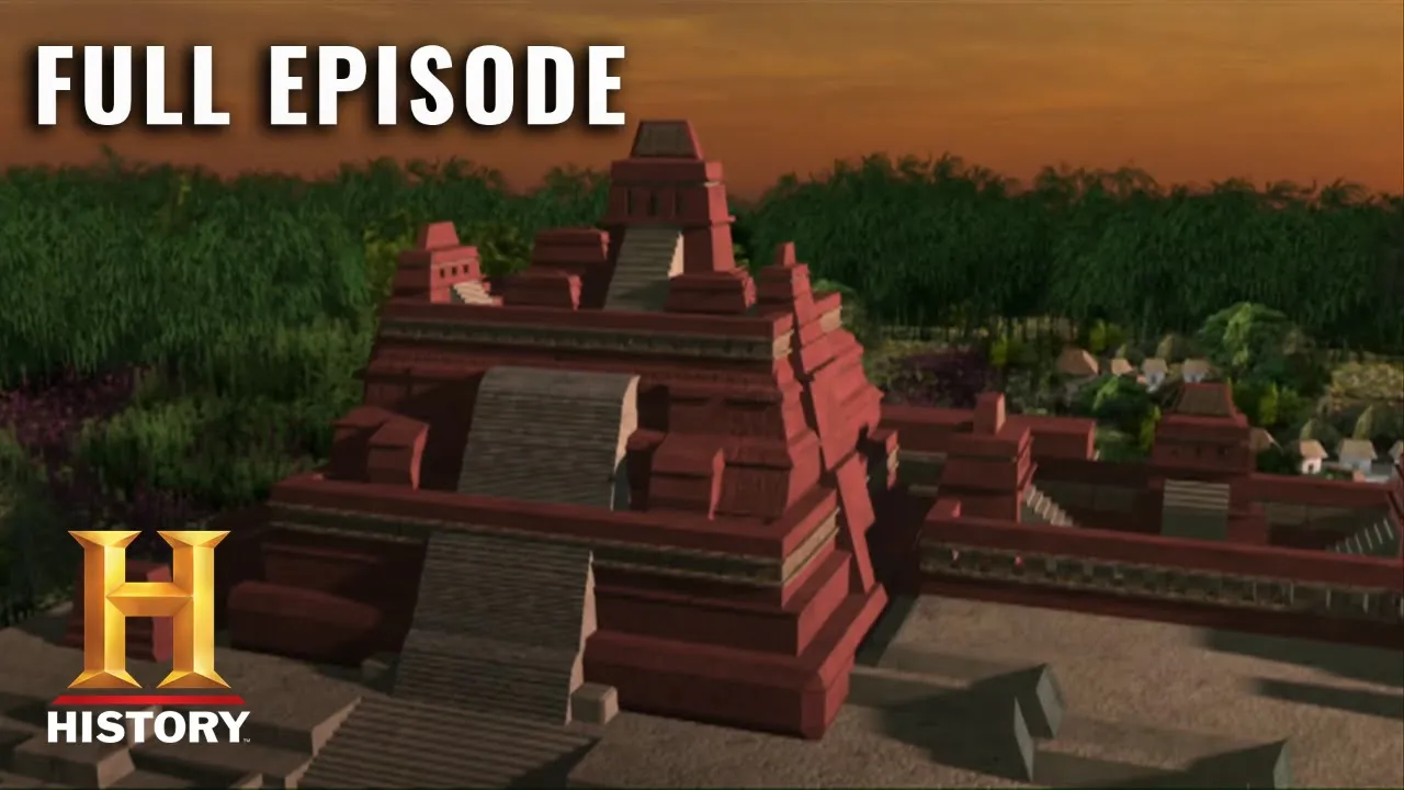
Maya Underground: Blood Rituals & Collapse | History Documentary (S2 E6)
@HISTORY
321.6K views•2021-01-21

The Great Schism of 1054: Causes and Consequences
@SacredCathedrals
113.5K views•2026-02-19
The Geopolitics of the Ukraine War and the Rise of Global Autocracy
@JordanHarbingerShow
468K views•2025-04-19
Understanding the Cold War: Superpower Conflicts and the Road to Détente
@OverSimplified
46.1M views•2019-01-24
Related Study Plans & Knowledge Roadmaps
Structured learning paths in History