








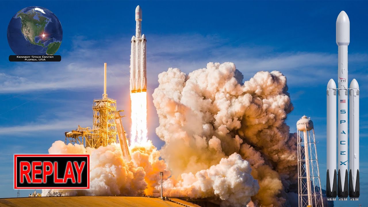


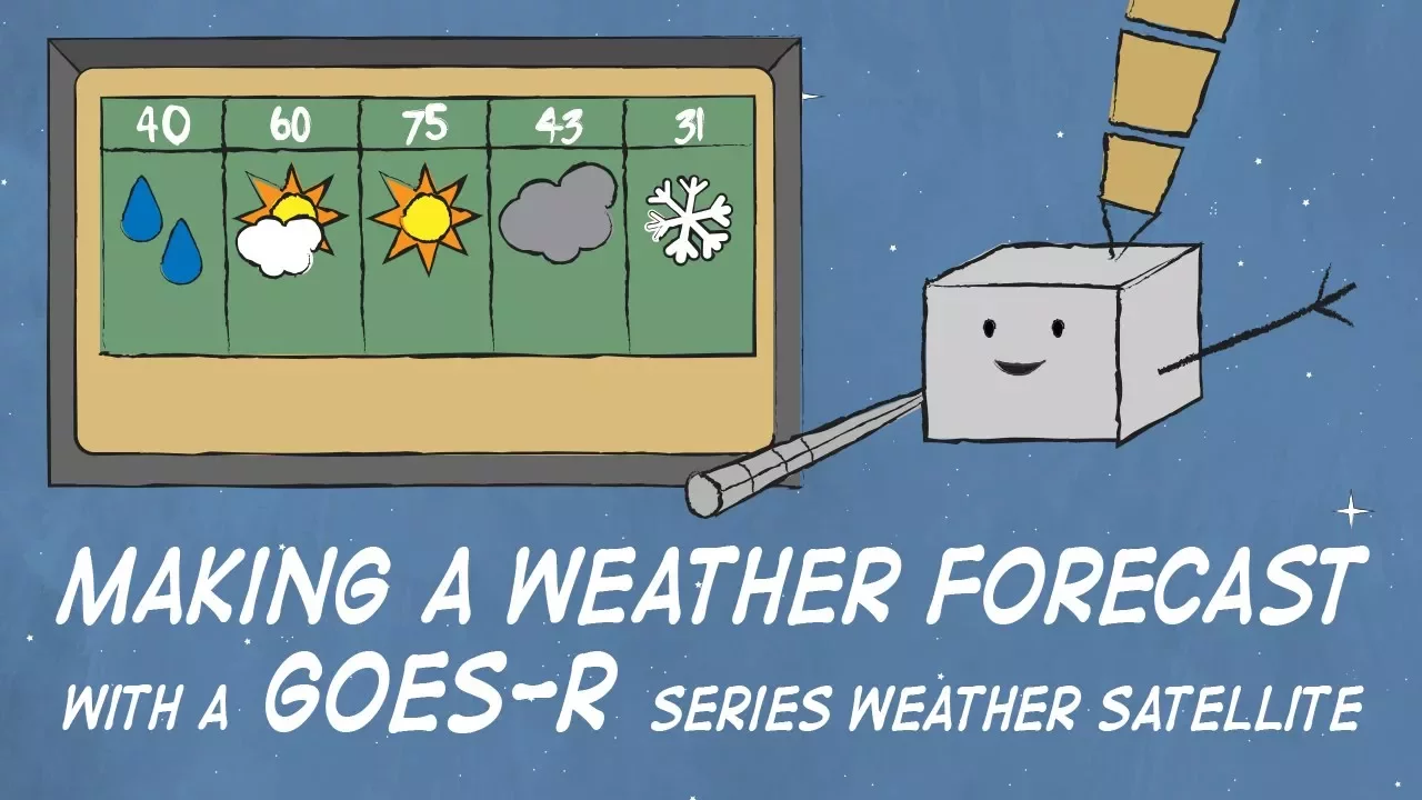







GOES-T is a NOAA weather satellite launched by NASA aboard an Atlas V rocket, designed to monitor weather and environmental conditions from geostationary orbit at 22,236 miles above Earth's equator; it carries six advanced instruments including the revolutionary Geostationary Lightning Mapper that captures 500 images per second to detect lightning activity and storm intensification, providing critical data for severe weather prediction, wildfire detection, atmospheric river monitoring, and space weather observation to protect lives and property across the Western Hemisphere.
GOES-T Weather Satellite Launch Coverage | NOAA & NASA Live Broadcast
Added:The concept of orbital mechanics, particularly the characteristics and scientific advantages of a geostationary orbit compared to low Earth orbit (LEO).
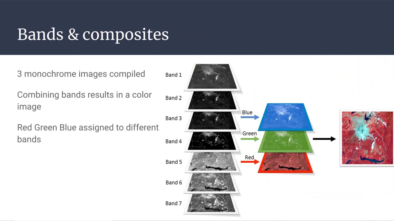
Basic principles of remote sensing, including how satellites use different bands of the electromagnetic spectrum (visible, infrared, and water vapor) to image Earth.
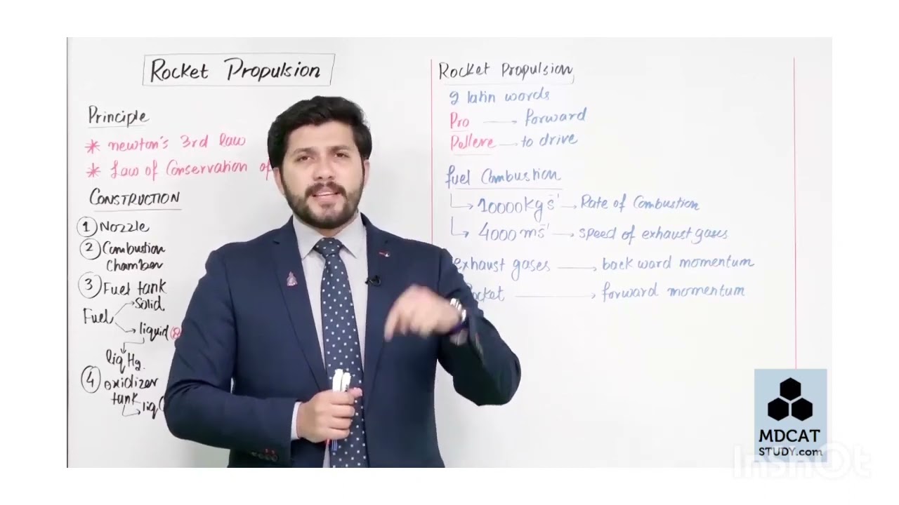
The fundamental physics of rocket propulsion and the primary stages involved in launching a spacecraft payload.
The respective organizational roles of NOAA (operational environmental monitoring) and NASA (space technology development and launch services).
How meteorologists assimilate real-time data from the GOES-R satellite series into numerical weather prediction models to improve forecast accuracy.
Advanced environmental monitoring applications of GOES-T, such as tracking wildfire propagation, volcanic ash detection, and sea surface temperature analysis.
The study of space weather and solar monitoring, utilizing GOES-T's specialized instruments like the Solar Ultraviolet Imager (SUVI) to predict geomagnetic storms.
The operational mechanics of the Geostationary Lightning Mapper (GLM) and its role in improving severe thunderstorm and tornado warning lead times.
279.7K views7.1Klikes1:11:50Original Release: 2022-03-01
live from the space coast of florida this is nasa's launch coverage of noaa's goes-t mission [Music] in just about 40 minutes this united launch alliance atlas v rocket will launch goes-t into space the satellite will continue nearly 50 years of protecting people and property from severe and potentially deadly storms welcome and thank you for joining us here at kennedy space center in florida i'm nasa's megan cruz the rocket's right there on the pad behind me and this is kevin fryer he's with noah the national oceanic and atmospheric administration great to have you here kevin great to be here thank you for having me it's kind of cold though a little windy a little windy absolutely i think that's going to be the biggest concern for the launch today but so far we are 80 percent go so i hope that we can see this thing launched yeah that's great news kevin is here because ghost t is a noaa mission nasa and noaa have been launching goes satellites since 1975 right yeah it's an amazing relationship that we've been able to have with nasa um over the past 50 years the one thing we can say is that we've actually saved lives as a result of that we've also obviously moved the science forward with with advanced satellites but for the most part what we'd like to hang our hat on is that we save lives yeah ghosty is the third in a series called goes-r you know you're the chief of staff of that program can you tell us a little bit about that series sure within the program we like to say that not only can we provide you with a big picture but we can also read the fine print again being one of the most sophisticated satellites in the geostationary orbit our capabilities are basically to provide you with a constant view of the earth in our case we're able to look at half of the globe and in doing so we're also able to inform you on the environmental changes over time so we're so ghosty is going to be looking at what happens here on earth in terms of terrestrial weather but also space weather right that's another reason why we're incredibly excited about this package that we'll be able to launch today not only are we improving what we can see on earth but also what affects us from space and space weather does really affect us i learned that while i was researching this mission so i'm interested to hear more about that and we will learn more about it later in this broadcast plus how you benefit from goes data every single day also if you have a flight to catch goes satellites play a crucial role in deciding if it's safe to fly and we also have a fun game for you to play while you watch the broadcast and the launch this here is a bingo card that you can print out by just scanning this qr code you see on the bottom right hand corner of your screen we also have the website there if that's easier that's cyjinx.gov goes hyphen t hyphen launch noaa has a list of words that we've incorporated into this show so be sure to listen for those words and see which family member or friend wins but first let's meet the talented team of people helping to cover today's launch we have meteorologist arlena moses monitoring the launch weather nasa's leah martin will introduce us to key players in the goes team mission and we also have our nasa launch commentators daryl nail and mick waltman inside with the launch team there you know mick is an engineer with nasa's launch services program which is managing today's launch so guys the two-hour launch window opens at 4 38 p.m eastern time how are we looking we're looking great so far megan and thank you uh welcome into the atlas space flight operations center here at the cape canaveral space force station mick will woltman as you mentioned lsp engineer extraordinaire and rocket guru appreciate that daryl so far it's good to have you back into the broadcast booth for another launch and so far so good so far so good we just entered the t minus four and holding this is a 30 minute built-in hold where the team is going to you know look at the vehicle and finalize last-minute preparations as we head down to t-zero this morning so the team's done a great job been on console for several hours and uh has gotten this rocket ready to go so looking forward to this that shot from the ground there looking up at the rocket you can see the skies are blue we've got some clearing throughout the day started off windy and a little overcast but there you see the the clouds moving across the pad very light very scattered now we want to tell you where we are we are in the nerve center of where launch is happening we're going to turn around in our seats and wave at the camera we're up here on this second level but down below on the first level is the launch team and you can see the three levels there the three rows this is where all the action is happening yeah this is the united launch alliance team this is their launch control center and daryl as you said this back row that's closest to us this is where the launch conductor dylan rice is sitting along with his uh assistant launch manager the anomaly chief dave mcfarlane and our red line monitors who are monitoring all the telemetry and everything on the vehicle and on the ground in the middle row you have the team that is working both the first stage booster and the second stage centaur propulsion teams there and in the front row you have flight control and electrical systems that are monitoring the guidance nav avionics and all the electrical systems on the rocket so as you can see a lot of team members from united launch alliance to to work this atlas 5. and they've been quite busy for the past few hours making sure that the fueling operation has gone smoothly and they were also on console yesterday mick when we rolled this rocket from the vertical integration facility to the pad we got a little video there and you can see there it is the atlas 5 coming out all 200 feet tall rocket coming out of the vertical integration facility and rolling about a third of a mile out to the launch pad nick you were out there pretty smooth operation yeah it was team did a great job traveling that making that uh trip about 1800 feet to the pad traveled about a half mile an hour with on the mobile launch platform and everything there and team did great getting that out there and ready for rp1 tanking and then launched today you look at the rocket there and it carries a special dedication today mick it holds the name of a former ula employee by the name of mark tim mark started his long aerospace career with the boeing team in 1987 but after a decade in denver colorado he transferred to ula's facility in decatur alabama that's where mark timm supported the ula's fleet of rockets including the delta ii delta iv atlas v and vulcan there you see him in the middle surrounded by nasa astronauts mark 10 passed away in 2020 and he is missed by all those who had the pleasure of working with him during his 30-year career in aerospace and mick you knew him yeah i got to know mark when he was in the decatur facility and i'll tell you he was an extraordinary person the team will miss him and our heart goes out to the family and everyone that worked with mark he was a great guy and just wrapping up we are on time and on schedule for a 4 38 p.m eastern time launch of this atlas v rocket a beautiful shot from a drone there we are ready to roll we'll have uh the lsp nasa launch manager poll here in just a few minutes but for now back to megan thank you both and now for a check on the weather here's lunch weather officer arlena moses from cape canaveral space for station's 45th weather squadron arlena this launch weather you're about to report out forecasted with data from satellites right yes that's correct megan in fact right behind me is a great example of the type of imagery that we get from the ghost satellites in this case because we're here in florida this is from the goes east satellite giving us a great view of what's going on across the cape and east east central florida this afternoon now as mentioned earlier we did have quite a bit of overcast clouds and some low clouds out there earlier today but as our satellite imagery is showing we've scattered out pretty nicely with only a few clouds as a concern as we go through the remainder of the launch countdown the trade-off however for those clearer skies and some in partly sunny conditions is that we do have pretty breezy conditions out there sure anybody who's outside across the cape this afternoon is experiencing and those are going to be our primary concerns as we go forth into the count for the remainder into the launch now if we take a look at the forecast here we're going to be looking at those pretty gusty northerly winds from about 26 to in a 26 to 32 mile per hour range temperatures about on point for this time of year here in central florida where highs are temperatures are going to be in the upper 60s to around 70 which will feel a little bit cool if you're outside with that but for launch concerns not a big deal as i mentioned earlier liftoff winds are going to be our primary concern with a smaller concern for some of those passing cumulus clouds but overall we have an 80 go for weather and things are looking good and so hopefully good luck to keep our fingers closed back to you guys megan and kevin all right you said fingers crossed we're doing it hey where are your fingers okay arlena thank you again quick check of the clock we are now at l minus about 28 minutes to go before we launch goes t now goes stands for geostationary operational environmental satellites geostationary refers to where and how the satellite will orbit the earth so this might be a little difficult to understand unless you see it right so this is why we brought some props here today kevin let's start off by just talking about how you determine a satellite orbit so it's really determined by its overall role right what is the job of that particular satellite so in the case of polar orbiters they typically will rotate along the poles and their job is basically to image the entire planet as it planet rotates underneath it so there is a there is a time frame for which they can provide you a global image and so again in a low earth orbit that is why you'll see those particular satellites used but the geostationary orbit it has to be in a fixed place so in the sky at all times right correct and actually to achieve that you have to be 22 000 miles above the planet and as a result so it can actually spin with the earth as it continues to rotate so relative to your position on earth you will always see this particular satellite in its place so that's why we say it will keep continuous watch over the western hemisphere with a second go satellite right absolutely so between the two of them they'll be able to cover this portion of the hemisphere we're talking about from western africa all the way to new zealand all right and ghost tea will reach that geostationary orbit on march 12th and now let's take a closer look at the satellite goes tea is the size of a small school bus and weighs over 6 000 pounds it has a five panel solar array which you see there it's the one that's kind of swinging out they'll produce more than 5 000 watts of energy which is the same amount needed to power your home's central ac system goes t has six advanced instruments that can analyze weather hazards and environmental conditions the plan is for goes-t to replace one of two goes satellites already in orbit that together protect more than one billion people in the western hemisphere three two one noah is about to launch a new satellite into orbit above the earth this satellite will be the third in a fleet of noaa's latest generation of geostationary operational environmental satellites called goes the most advanced weather observing and environmental monitoring system in the western hemisphere goes satellites orbit 22 236 miles above the earth's equator at speeds equal to earth's rotation this allows for continuous coverage of weather systems as they move throughout the atmosphere the ghost satellite system keeps watch over more than half the globe from the west coast of africa to new zealand and from the arctic circle to the antarctic circle each satellite in the series provides high resolution imagery and near real time to provide critical information for weather forecasts severe weather prediction lightning detection and solar activity the latest satellite is goes-t which will be renamed to goes-18 when it reaches orbit ghost t will be the third satellite in the series and is expected to replace the current go 17 satellite in the goes west orbit in this position the satellite will continue goes west's legacy of keeping watch over the pacific ocean the western u.s and the u.s territories it will provide complete satellite coverage for the weather systems that impact hawaii and alaska it will provide critical data over the northeastern pacific where many of the weather systems affecting the continental us originate it will monitor and track tropical storms and hurricanes in the pacific ocean it will help identify and track wildfires across the western u.s it will assist in search and rescue efforts around the us and its surrounding waters as part of noaa's sarsat system and it will help monitor and track weather phenomena that impact the western u.s like dust storms monsoons marine fog atmospheric rivers and more the go series of satellites supports noaa's mission to provide secure and timely access to global environmental data and information from satellites and other sources to promote and protect the nation's security environment economy and quality of life [Music] goes tease instruments will gather data that can help in so many different ways as you just saw for more on that let's hear from nasa's leo martin thanks megan i'm here with pam sullivan noah goes our program manager pam thanks for joining us today to give some insight onto this mission oh it's great to be here thanks for having me so we've heard that there are six advanced instruments on board goes t can you tell us a little bit about them sure let me tell you about our most revolutionary instrument the geostationary lightning mapper is actually the first time we've had this capability on orbit and this instrument is watching the earth taking pictures 500 times a second to look at lightning and because it is a new instrument we're actually learning new and interesting things about lightning as a phenomena for instance we've seen that large wildfires can generate their own lightning and the glm has also shown us that lightning strikes can be really really long for instance glm recently measured a lightning strike that was more than 470 miles long stretched from texas over to mississippi wow and so having that type of information you know 500 images per second that's almost like having maybe like a stop-motion film what can we do with that information once we have it yeah well the important thing of course is what the forecasters can do with it and they use the glm data in conjunction with our advanced baseline imager data and some other data but they look um when they're wanting to see if a storm is intensifying they're looking at that lightning signature and they're looking for what they call a lightning jump when the amount of lightning strikes increased or mass dramatically because that indicates that the storm is likely to be becoming more severe and may spawn dangerous tornadoes oh wow so we talked a little bit about the location that this will become a satellite that observes the western hemisphere what part why is that location significant well specifically ghost t is going to go into service as our goes west spacecraft so it'll be stationed over the equator a little bit off of the west coast of the u.s and as you know most of the weather in the u.s moves from west to east so that western satellite is really important as giving us an upstream view of what's coming so that's a big part of it but the other thing those two will also see dangerous conditions uh they're particularly in the west like wildfires and smoke dangerous dust storms and also that the phenomena of atmospheric rivers that's incredible and so some of these instruments that are on board that are advanced they're actually an advancement from current satellites that are in orbit now is that correct so um the goes-r series compared to the previous generation yeah is much more advanced the advanced baseline imager generates 60 times more imagery and then the lightning mapper as i said is a brand new capability thank you so much man for giving us some insight into this mission we're excited to see the launch and megan we're going to go back to you perfect thank you so much guys you know one agency actually uses goes satellite data more than anyone else and that's the national weather service so joining us now is chrissy hurley who's a meteorologist there for the nashville area hey hello good to have you thank you for having me so excited yeah and i know that your job is a warning coordination meteorologist that means that you need to coordinate with people public safety officials if there's severe uh weather headed that way right yes that's my main job is outreach with the public tv meteorologists and emergency managers and safety personnel we just heard pam say that go satellite data you know or go satellites look for things like atmospheric rivers can you talk to me about what that is yeah atmospheric river is very similar to a river on land it's taking moisture from a tropical region and transporting it in the sky to cooler drier regions over land and so this can be a sign for heavier precipitation or snowfall or rain which could lead to flash flooding so it's a it's a flooding event there are many different kinds of flooding event right right yes and so last year i remember you and i were talking there was a major flooding event it was actually a deadly flooding event in august in that middle tennessee area right waverly tennessee experienced a catastrophic flooding where we had over 20 inches of rain that occurred in mcewen tennessee that less than 12 hours and so we were able to use go satellite imagery to monitor the intensity of these storms and watch how they just trained over the same locations over and over and over and able to you know alert emergency officials that that rain wasn't going anywhere wow and the last time that tennessee had an extreme flooding event like that was 2010 so that was a whole series ago yes you know big differences would go satellite imagery between 2010 and 2021 is a meteorologist forecaster in national weather service office you know data coming in much quicker better resolution and this is really going to help us you know predict forecasts better and save lives when we say much quicker what does it mean you know how often were we getting images in 2010 versus now you know in 2010 we were getting images every 15 30 minutes if you think your internet's slow now it's like hitting the refresh button right now we're getting them as quick as 30 to 60 seconds wow and so that is really making a huge difference for any operational forecaster chrissy thank you so much for joining us and giving us that insight because that is really something to think about minutes versus seconds and seconds really matter in severe weather absolutely thank you chrissy now goes he also has the latest technology in detecting and tracking wildfires a few years ago one wildfire tore through california at an estimated rate of 100 football fields a minute the 2020 western u.s wildfire season was historic both for the record 59 000 wildfires that formed and the 10.1 million acres they scorched but right on its heels was 2021 in which nearly 52 300 fires were recorded with more than 7.8 million acres burned through december 24th of that year since launching in 2016 noaa's most advanced geostationary satellites are improving fire weather forecasts wildfire detection and fire hazard tracking in near real time with lives and property at stake timely high quality data is critical for firefighting efforts on the ground noaa's go 17 operating in the goes-west orbit has shown its metal detecting and monitoring wildfires and the hazardous smoke they emit there's two instruments on the go series of satellites which are helpful for wildfire detection and monitoring the first is the advanced baseline imager or the avi we're able to detect hot spots from the thermal signatures from the fires and we're also able to detect the smoke and track the smoke with time in order to issue notifications and warnings to the public the second instrument is called the geostationary lightning mapper or the glm glm is important because oftentimes lightning is the cause of the start of wildfires and so forecasters can monitor the glm to see where lightning has occurred to decide whether or not they think some lightning may have started a fire but a new satellite called goes-t is poised to replace goes-17 in the goes west position once it reaches orbit ghosty will be renamed goes 18 and it will provide the same sophisticated technology to track wildfires in the western us as well as detect lightning that can ignite a wildfire and parched vegetation this current capability of goes is the fact that we can do rapid scans higher resolution with higher sensitivity and include things for the first time like lightning mapper and the abi instruments i don't think we could imagine not having goes capability we absolutely need it the national interagency fire center is the nation's support center for wildland firefighting goes is an eye in the sky it's giving us a hemispheric perspective with those 16 and 17 without having those two satellites up there constantly staring constantly monitoring constantly providing us with information we really have just a big gap we would lose a lot of our capability to understand the environment to see the interaction of the fires with the atmosphere and see how the atmosphere is impacting the behavior of the fires with those being able to look at the united states every five to ten minutes we're getting a much more real-time appreciation for how fires are behaving because of the ability of the ghost satellites to detect the heat from the fires kevin we were talking earlier and you told me that oftentimes goes satellites even at 22 000 miles above the earth's surface they can sometimes detect fires before people on the ground even know that they're there absolutely that's so impressive it's an amazing capability absolutely and we heard from our national weather service rep i mean right there that's a great example of how it happens national weather service meteorologists are able to view an area that's not populated but they could see a heat signature and actually detect that fire and we found out to the tune of eighty percent of the time they're the one the first ones actually call and let fire responders know that there's a fire that has just started or is is ongoing so we know goes satellites can help national weather service fire officials as we've said but i didn't know this that we use ghost satellite data every day every single day anytime you open up your phone and you want to see the forecast and you're opening up an app a weather app that's exactly what you're doing you're actually using goes information that goes data is going directly into the models that inform you on what the conditions are going to be fascinating i can't i i had no idea here i am just look at it you never think about where it came from so thank you so much for telling us about that we're now l minus about 14 minutes away from launching goes t daryl and mick it's about time for that launch manager paul you talked about it sure is and uh before we get to that poll which is happening at l minus 13 so just about 50 seconds from now we got an update from the launch weather officer you can see on the bottom of your screen the weather briefing there right there they talked about the winds they're still pretty up but the clouds have dissipated so we are now at 90 percent go for launch improving from that 80 earlier that you heard reported but mick still down at 10 because we are watching those wins yeah as you can see in the uh forecast uh there uh where where megan and kevin are the winds are still here on the ground blowing pretty good the team is continuing to monitor those but yeah i'm glad to hear that 90 percent go winds for upper level and they will remain green through 22-18 zulu so significantly into the window and then we could get a later update should we need it listening to it looks like we have very improved ground winds additionally so we look great for weather we've had a really good uh ground propellant load today and uh very very little activity on the range instrumentation so with that i would like to now conduct the goes-t launch poll nasa ce nasa ce is go copy nasa ce sma sma is go copy sma smd smg is go copy smd nasa mim now submit let's go copy nasa mem and lsp lsbs go copy lsp nlm copies the nasa launch team is ready for the launch of goes-t spacecraft and that was nasa launch manager tim dunn that you saw at the bottom of the screen uh there towards the weather briefing milestone and so now we're good to go yeah chuck that was a very important uh sorry daryl i'm thinking of that because i did hear chuck nasa lsp what i was going to say there is tim paused at the end there because chuck duvall nasa lsb uh this will be his last mission as he just announced his retirement from nasa after 40 years so this mission shock goes t thanks for everything you've done and uh thanks for that go been here a long time did he start as an intern he did he did that's a long career well congratulations to him and uh here we are with the rocket on the pad ready to go we're gonna pick up this countdown we're also going to have a special message from somebody you may know a very popular and somewhat famous meteorologist we're going to get to that in a second but we'll send it back to megan for now and goes-t is one of many nasa science missions underway right now let's head back to leah to learn more about that hi megan i'm here with dr thomas zurbukin nasa's associate administrator for the science missions directorate and this is a huge year for you and your team absolutely it's a year of science every year is a year of science we say you know like we have an amazing number of launches ahead of us in fact tropics which is three launches we have maya we have uh emit we have jpss and you see the theme it's all earth science related launches uh some of them partnership we also have psyche and then first light of uh the james webb space telescope as many as well as many other you know highlights this year alone yes and so many of the missions that you just mentioned are actually tied in to both weather and the environment why is that important for nasa and the work that we're doing from the beginning nasa was about exploring the universe but also exploring and understanding our own earth and providing service for that and and launch today as well as many of the launches in the future are precisely about that understanding our changing planet the system of systems everybody we love is right here our entire history is right here on that planet so we want to understand and help protect it as we go forward and so the information that we get from these launches how how will we use that so the information we get from these launches we used to get a better understanding in many areas of course understanding for example emmett about the aerosols that are in the air where do they come from we know they relate to precipitation in many areas like how do they get transported globally maya you know my daughter has asthma it's about pollutants learning from space how to predict those and provide information for my daughter and the many others that suffer from asthma and so forth that's precisely each of them has an application like that a set of understandings that we want to bring to the table complex science has a very simple application here on life on earth for life on earth so we also heard that the information that we're going to be capturing from these satellites is going to be available to the public as well absolutely everything we do here in earth signs and all over the science portfolio is information that is made public we want scientists of all training levels learners of all ages to be able to look at this but we also believe it's really important to trust the science you should be able to look it up yourself and understand it we think that's a really important part and be flat that we're actually moving from open data to open signs so we actually even make in the future the quotes available that provide the actual predictions and the information that is there it's incredible using this information in conjunction with other information to give us the best picture possible dr zurbukin thank you so much for joining us today we're looking forward to this launch i'm sure that you are as well and we really appreciate you being here thanks so much absolutely megan we'll send it back to you thank you both and now taking us the rest of the way of the launch countdown is darrell admit guys take it away all right thank you megan l minus 7 minutes and 50 seconds until liftoff welcome back inside the atlas space flight operations center the launch team right behind us working this launch and so far things have looked really good and sounded good over the nets yeah everything sounded great the team is uh continuing to finalize their work as we get ready to pick up the count at t minus four and sync up the l clock and the t clock uh we're coming up on that launch conductor poll at uh l minus seven minutes with dylan rice so i'm looking forward to hearing all goes from the the team to get goes-t on its way you can look at the bottom of our screen you can see the milestones as we count down to liftoff we are coming up on polling which is at l minus seven minutes in just a few seconds we're going to pull up the poll on the right side of the screen and count it down status check to proceed with terminal count atlas systems propulsion go hydraulics go pneumatics go lo2 go water go centaur systems propulsion go pneumatics go lo2 go lh2 go as gap go electrical systems airborne go ground go facility go rffts go flight control go gcq go operation support go on go umbilical go ecs go redline monitor go quality go up safety manager go ula safety officer go vehicle system engineer go anomaly chief go range coordinator clear the proceed launch director you have permission to launch proceeding with account alc verify t-zero is set for 2138 tulu verified ula launch conductor dylan rice getting uh green across the board yeah that was great to see dylan choreograph that to pole the culmination of several hours of work by this launch team and then hearing uh launch director tom heater from united launch alliance giving that ready to proceed for launch today so very excited and happy here to hear that as we get ready to pick up the count as we look outside at the rocket we can see those blue skies the clouds are moving a little bit very very slight amount of clouds you don't see it here but we're looking at blue skies you can see some of them there they're moving that's representative of those winds but as we know here in florida such a beautiful time of year in march but mick three months from now it'll be the start of hurricane season which is a concern for florida and everyone along the atlantic seaboard and in the gulf states yeah and i'll be very happy to have ghost tea up there uh in the west as kevin was saying you know all weather moving west to east so getting goes-t into proper position to follow those weather activities will be a great asset for everybody from a personnel safety standpoint and the public really relies on the public broadcasters who come out and give us that information about what's going on and we have one of the more popular meteorologists that you may have heard of sent us a pre-launch message take a look at it now hello everyone i'm meteorologist jim cantori from the weather channel television network and i am so excited for the ghost tee launch meteorologists and weather anchors like me across the country depend on go's data to bring you your daily weather forecast but also to keep you and first responders safe during severe weather events accurate and timely forecasts are crucial and that's not possible without satellites like this one godspeed ghost t three two one mark and there you have the sinking up of the l clock to the left top and the t clock on the right hand side they are in sync mic and that means we are starting up and really close ready to go yes this is a very thrilling time for us daryl as we get ready to perform a lot of activities here the team's going to finish tanking and topping the vehicles securing everything getting things to flight pressure getting the ordinance control unit armed the flight termination system armed getting the vehicle on internal power which we heard a little while ago that the spacecraft goes t is configured and on internal power ready for today's launch so we'll be finalizing all these steps the united launch alliance team that we talked about earlier and they will get ghost tee ready for a lift off at 4 38 p.m and there you can see from that shot of the pad out over the atlantic ocean you see down towards the bottom of the rocket those two solid rocket motors there's two on this side two on the other this is an atlas 541 configuration which we know is going to provide a lot of performance with those new gem 63s yeah daryl the 541 as tory bruno ceo of uoa likes to refer to it as the dominator those uh four solids will provide a lot of thrust as we get ghost tee off this morning using those new gem 63s from northrop grumman will provide a little extra performance and get ghost tea on her way they can hear the team really picking up the chatter here as we get down to the final minutes for the launch of goes-t on board an atlas v rocket from right here at the cape canaveral space force station yeah daryl we heard the team they secured the atlas tanks to flight pressures secured that topping so we see that the liquid oxygen on board that first stage is uh secure and ready to go we should be hearing them at about a minute 50 securing the centaur uh tanks and getting that tank up to flight pressures getting ready for launch spacecraft is on internal getting ready lh2 securing centaur lo2 so there we hear darryl vehicles on internal the auto sequencer is taken over and started count and centaur lh2 and locks 30 sequences are done launch has been enabled by the launch conductor fcs armed the flight termination system has been armed the team is continuing to finalize all preps as the vehicle is getting ready for liftoff 120.
fcs count started 115 reduce ecs for launch roger 110 bent valve's lock and there we hear the vent valves lock securing everything to secure that boil off we should now be coming up on the last call for the range one minute rock report range status range green and there we have a green range daryl so everything looks good this morning last but not least we will bring everything to flight pressures and then hear that last status check from dylan rice and that'll be an exciting moment indeed as we look across the river there to a shot of the rocket just four seconds left stable at step three and there we verified that all uh pressures are are good and we are stable at step three ready for liftoff this morning 28 verify ecs reduced for launch verified 25 status check go atlas go centaur go goes t and here we go the final seconds now 10 9 8 7 6 5 4 3 two one and liftoff liftoff of noah's go's teeth our newest weather symbol in the sky to help keep us safe here on the ground let's listen in as we listen to the united launch of my instagram that's okay if you have gone to close with control the rd180 is now throttling down as expected engine response looks good we are now 33 seconds into flight atlas is three miles in altitude point nine miles downrange distance [Music] we have bathroom rock one vehicle is now passing through max q maximum dynamic pressure now 55 seconds right atlas is seven miles in altitude four miles downrange distance traveling at 1900 miles per hour rd180 is now throttling back up it backed off the throttle to redoubt it to flight atlas is 13 miles in altitude 10 miles downrange distance traveling at 2 700 miles per hour now at 90 seconds into flight ula's atlas 5 rocket weighs now just one half of what it did at launch burning propellant at a rate of more than 2 600 pounds per second in 10 seconds those solid rocket motors on the side will cut off beautiful shot from space srbs have burned out as expected and we see a good sop jettison clear shot of those vehicles now executing steering here in a few seconds they're going to throttle back up vehicle performance looks good at this time now 135 seconds into flight the rd-180 has throttled down slightly vehicle performance continues to look good at this time tank pressures are stable and atlas booster battery voltages and rain in their expected ranges now the upper stage is preparing for its use centaur reaction control system is now pressurizing flight levels another jettison the payload fairing which protects goes-t at three minutes and 30 seconds we have just over one minute until biko we're now seeing the rd180 throttle limiting to maintain a 2.5 g acceleration limit standing by for payload foreign we've seen a successful pay with fern jettison good shot of those fairings are you 180 straddle back up now the vehicle has reached a 4.3 4.6 d acceleration limit and will maintain this level through biko and you're looking at animation now we've seen that the centaur has begun its blue state still down sequence loose we're about to cut off and eco booster engine cut off standing by for state separation and a successful state separation event we've seen pre-start on the ro10 and mass 1 we have ignition for the first burn this first burn of ula's since our upper stage will place the goes-t spacecraft into a parking orbit around the earth this burn will last just over seven minutes what a shot there huh mick yeah that was great daryl to see all that and listen to rob kesselman call that flight to the first stage performed very well this morning this afternoon and everything's looking good those gyms control system as it begins its periodic firings to maintain thermal control conditioning yeah those jim 63s performed well solid rocket boosters and rd 180 performance well what i really liked was when we saw the payload fairing come off that was a great shot from the camera saw the payload fairing come off and then most people probably noticed that little half cylindrical come off after payload fairings that was what we call the centaur ford load reaction deck because the fairing the five meter fairing encompasses both centaur and the goes-t satellite there's a load ring that's inside the fairing around centaur to help keep that five meter fairing from flexing so that's what you saw when you came off there i was wondering and the engine response remains nominal from the trajectory and performance group that boosted performance was as expected for the booster phase of flight all right we're going to keep an eye on this burn and listen in but in the meantime we'll send it back to megan out the host desk if you're just joining us welcome live to kennedy space center in florida where we just saw ghost tea launch from just behind us at cape canaveral space force station and guess what everyone i just found out that this was kevin's first launch it was how was it it was super exciting uh almost a proud moment as an american you know 20-year air force vet and to be able to see this was was awesome absolutely awesome yeah i'm so glad to be here it was very fun to watch you react like you were like i i you were like a kid like this oh wow that was great absolutely it was great so what's next for this mission well the wonderful thing about this now that we've had a successful launch we have about 12 days before it actually reached geostationary orbit so at that point that's when we'll start our checkout phase we'll be looking for the data to come down from the from the spacecraft to make sure everything checks out that the imagers that the images are correct all that kind of stuff has to work work its way through and you know goes is noaa's latest weather satellite as we've said you know we've been launching goes satellites together for nearly 50 years i mean there's been so many advancements made in between those times there have and you know i like to remind people that you know this particular satellite in the series is really an evolutionary step much like cell phones or when we talk about hey do you remember when we used to use land lines and rotary phones well think about the leap we've taken from then to the cell phones and the capabilities that we have much like that with our satellites yeah i know i know i know i feel safer knowing that goes satellites are up there and now i'd like to bring in nasa's leah martin who got to watch the launch with our agency's deputy administrator leah hi megan like you said i am here with pam milroy nasa's deputy administrator and what did you think of that launch so exciting it was exciting and it it was i don't know i always just feel this electricity when a launch goes up you're like wow people can do this this is just the power and the majesty of it as you see it lifting into the heavens it's always exciting and you know hours and hours and months and months of work that go into it absolutely so you know nasa's vision is to expand uh knowledge for the benefit of people here on earth that's the heart behind everything that we do how does this mission fit into that this mission is a great example of our mission in a lot of different ways i think one of the most uh powerful things that we do at nasa is we partner with others to maximize the benefit of the things that we do so this mission uh to launch the goes-t satellite will enable us to have cutting-edge capabilities that are looking down on the western hemisphere the western part of the united states to ensure that the data that goes into the noaa models around weather are optimized they're up-to-date they will affect people's lives whether it's farmers or protecting from wildfires but what's interesting is we're also going to take that data because we have earth scientists who are modeling our earth as a system and climate far out into the future this isn't an operational weather which is what noah's mission is they do it very well but we take this data and we also use it for the benefit of science so it's a really synergistic partnership and you just mentioned climate change and monitoring the changes because that is a priority for nasa it is it's one of our top priorities we are already doing a significant amount in this area earth science and looking at our own earth has always been an important part of our science mission interestingly we also study other planets in the solar system such as mars which we believe was once wet and had more of an atmosphere and so the question is how did it get the way that it did and how do we make sure that does not happen to our planet so it's a critical part of our our mission well we're hoping that the information that we get today can feed into the future missions of tomorrow if nothing else we'll certainly know the weather pam thank you so much for joining us today we really appreciate it and we thank you exciting day megan back to you thank you liam pam and kevin go see doesn't just forecast the weather we've talked about this a little bit you know we've talked about how it monitors the atmosphere uh for fog dust storms and smoke and and uh you know especially for wildfires but what about like smoke and ash for volcanic eruptions yeah absolutely this past year's been kind of a revelation in our capabilities uh to view volcanic eruptions in particular probably the most spectacular example would be the tongan what but what we also have is another example in the caribbean where you can see not only the amount of ash that goes up but the the area that it covers and and as a result of that that that particular hazard becomes an aviation hazard in particular yeah you can see all the smoke there you know i weirdly enough two years ago i was traveling in the philippines and there was a volcanic eruption there and we had to ground hundreds of flights because of it so so really goes helps decide whether or not it's safe to fly they do again noaa's partner with the faa and they provide them with those volcanic ash both forecasts and projections for where that ash could go all right we're now approaching another milestone in the ascent daryl and mick back to you thank you very much megan and we continue to burn continue to get good numbers as we monitor the flight of the centaur and those teams yeah things are looking really great uh on this flight and uh coming up on uh mikko one of that centaur engine as centaur continues to perform normally we've heard pressures and everything with the pressure system has gone open loop here in about 10 seconds we'll have the standby for the end of the burn and we have miko main engine has cut off there you go that completes that first burn and so now we go into about an 11 minute coast phase at this time the goes t spacecraft and ula centaur upper stage are in an unpowered coast phase that will last approximately 11 minutes the coast allows the vehicle to move to optimal orbital position in orbit prior to beginning the second main engine burn and what you're looking at is animation that is tied directly to the telemetry we are receiving from the rocket yeah the team is using all the all the vehicle telemetry to uh look at and uh power this system is operating at the hundred percent settling mode at this time power this animation that we're seeing which is is really good and as we heard rob kesselman say a minute ago this approximate 10-minute coast uh we're in this park orbit around earth right now as we coast around to get into the proper uh trajectory we want to be for that second burn which will then send us on our way towards that geostationary spot we want to be it'll be a longer burn and and then we've got daryl that long long three-hour coast that we're going to wait around for three hours folks between the points on the bottom of your milestone list between miko 2 and mess three that's three hours it's short there on your screen but it's a long one as you're looking at the animation we are in uh orbital darkness the sun is blocked out and so the animation is reflecting that at this time so we can't see the earth behind it they give it that kind of accuracy in terms of its look so the spacecraft is in uh total darkness but when it comes out and those uh solar rays unfurl it'll have some power all right we're going to send it back to megan for now and while we coast but we'll be back for that second burn thank you both now goes to will warn us about weather here on earth but also space weather but what is that and how does it impact us here on the ground take a look so the sun looking here from the ground seems very constant and quiet but actually when we look at it from space we can see it's quite turbulent and active space weather is activity on the sun and in a near-earth space that can affect our technological infrastructure in [Music] the society is constantly spewing out a stream of particles called the solar wind that goes out into the solar system and it affects us here near earth to where we're protected by a magnetic field the interaction between the solar wind and the magnetic field can cause space weather [Music] the carrington event is the largest storm we've seen in recorded history when we're looking at space weather but every solar cycle which repeats about every every 11 years one estimate estimates that there's a 10 chance of getting a large storm like the carrington event that could impact us here on earth but we see solar storms almost all the time and these storm of storms have an effect on our technological infrastructure solar storms can cause activity in earth's atmosphere magnetosphere that can damage electrical power grids that power our communities interrupt radio and satellite communications and can cause our gps navigation to fail noaa is working with its international partners to ensure that we have different vantage points where we can observe space weather our space weather observing infrastructure from space includes the the noaa discover satellite and the nasa a satellite that are stationed upstream of earth to give us a first buoy measurement of the solar wind it also includes the esa nasa soho satellite and this nasa stereo satellite that image the sun and also make chronograph measurements of the outer atmosphere of the sun the corona that can tell us when a large explosions happen off the sun we also observe the sun and the earth's magnetic field from the geostationary location with noah's goes [Music] so the way we use the space weather information from satellites and from the ground is to be able to make forecasts and predictions just like we do with with hurricanes and terrestrial weather we observe the sun and look for activity and see how it develops [Music] and see if it's going to culminate into a large explosion that can affect us here on earth noah is working with his international partners to expand our observing capability we're committed to observing along the sun earth line so we're going to do the imaging of the sun and the upstream buoy measurements of the solar wind along the sun earth axis more we understand about the sun the more we can prepare for it and become just like we are a weather ready nation become a space weather ready nation and as we look forward to humans exploring out into the solar system and advancing our space commerce activities space weather becomes more and more important [Music] go see is one of many satellite programs operating right now leah is standing by with someone you know very well kevin dr spinrad our administrator yeah noah's administrator all right take it away guys hi dr spinbrad thank you so much for joining us today for the ghost tea launch we really appreciate it so this launch is actually not the only nasa noaa watch that we have a collaborative effort with this year we have another one coming up as well yeah that's right thanks for having me and in fact this next launch will be a polar orbiter which is fundamentally different from what we launched here today so this we call it a geostationary satellite as the name implies it's earth synchronous it actually follows around and looks at one uh one spot on the earth if you will and then the jpss launch is a we call it a sun synchronous so it actually stays at a certain sun illumination and does orbits around the pole many times to give us a different look at the earth as it's spinning on its axis and you take the jpss satellite data and the geostationary data together and it's like taking pictures at multiple angles to get a much better idea of what's happening on the planet so that's information that we can use independently but we can also use them together just to get a better picture of what's happening absolutely think of it in terms of being able to forecast whether say two days ahead versus a week ahead and if you've got multiple views of the planet you can start getting a much better handle on when hurricanes are forming where they're forming how intense they are or things like atmospheric rivers forming way out in the middle of the pacific when will it arrive in the pacific northwest so having these multiple ways of looking at the earth gives us a lot more and a lot better information for these critical forecasts to save lives protect property and basically uh protect our american public from these natural phenomena now and the system that is currently on orbit is that i believe to go through the 2030s what comes after this so we've called this series the goes-r the geostationary operational environmental satellite r series there are four of them we've launched the three here today and after this series we're looking at what we call geo exo extended observation so what is the next generation of geostationary satellites look like what's the newest technology we can put on there are there different phenomena that we can look at in the earth system but also out at the sun for example to understand what's happening with solar storms that impact us here on earth as well so really science for today while we're facing forward to sites for tomorrow it absolutely is you think about how many years it takes to build a satellite like the goes series and you want to make sure that you're putting the state-of-the-art science and technology in the satellite that may not launch for five ten years so what do we think the scientific capabilities will be in five or ten years and let's start working in the laboratory now to build those new sensors and those new operating systems it's incredible to think that you know in just another decade or more that we could be here talking about a completely different system thank you so much for joining us today we really appreciate it megan really interesting to hear about everything that's happening that we can really all learn from it's been about 21 minutes since launch dale remick we're coming up on that second burn now yeah we sure are and uh thank you megan back inside the atlas space flight operations center mick woltman here with us lsp engineer um we're heading towards orbital sunrise we've been in a coast phase right now heading over africa west africa across the southern coast there and we've got a burn coming up in just about a minute yeah this second burn is very important is it'll get us out of this park orbit around earth and get us on our way towards that geostationary orbit we want to head for goes-t to allow them to do their science and and protect us with all those instruments they've got for weather realization you're looking at animation now tied to real-time telemetry uh the centaur on the left part and goes-t on the right part as it uh chases the sun nick chasing orbital sunrise here in just a few seconds and uh ula kind of uh basically simulating that with a more lighted landscape and there we hear a pre-start on the rl-10 coming up from rob kesselman data's showing that rl10 is getting ready to ignite for the second burn locks pre-start on the r10 we have ignition s2 all right main engine start number two we have advanced across the bottom of your screen where we have all the milestones listed we're going to burn for about six minutes as you mentioned mick this is really hitting the gas you have gone into space yeah absolutely this is going to be the burn where we uh get goes t headed out where it needs to be and then we'll coast for that three hour period to get where we need to uh go and then get ready for separation so uh still a lot to go from here but this is a very important burn for the mission going deeper into space approximately 22 000 miles away from the surface of the earth make i want to take you back of course we know that this satellite here can have uh ability to map lightning it's got high technology on there that's very valuable um but also when it was on the ground flush chamber it could have been suspect uh it could have been suspect rather i should say susceptible sorry susceptible susceptible to lightning when it was on the ground but launch services program developed some technology to help protect it and i was fortunate to go out to the pad this is something that you do a lot go out there to the launch pad but i was invited to go out with one of uh lsp's young engineers to share and install this equipment that helps protect against delays let's check it out [Music] hey alex hey daryl good to see you good to see you too hey thanks for having me out so this is it this is it this is the pli the nasa portable lightning instrumentation i see it right here you're gonna take it up there all the way where the top of the rocket is yeah right right around where the payload fairing is level five all right that's where we're going well you need a hand yeah come help us now that we're inside the vif and we're about 13 stories up tell me a little bit about this box you've got some looks like some sensors here that's right so we got the current probe which is over near the rocket and we have three more sensors over here this one is an electric field sensor this one up here is a magnetic field sensor and this little one over here that's a gps antenna that's how we we get it make sure our data stays uh synchronized in time so that we can correlate that data to all the other lightning detection networks in the area so what happens if there's a lightning strike somewhere nearby what does this do so if it's close enough to cause any uh interference in this area these field sensors will pick it up first and they'll cause the entire system to take a snapshot of that data and record it and how is that helpful we'll know what the peak of it was we'll know how long the transient lasted we'll be able to calculate how much energy traveled through there we'll have a lot more information to work on small box big rocket but it's got a big role in the whole scheme of things it's got a big job that's for sure [Music] so we can see those lightning towers out there and ula tells me that that protects the rocket when the lightning strikes so why do we need the pli yeah so this system over here we call that the lightning protection system that's designed to protect it from a direct lightning strike that means the the lightning is attaching directly to the rocket and we're concerned about you know a lightning strike out there in the ocean maybe just a mile away and the energy in a lightning strike is so intense it creates these very powerful magnetic and electric fields and those are the things we're concerned about because that magnetic field can come through and couple into the umbilical cable it's a huge loop it makes a big old loop and that's the current we're looking for with the pli has the pli ever prevented a long launch delay for a previous mission march 2020 was where the data from the pli gave the spacecraft team the confidence to go ahead and launch so there was a lightning strike around the mars perseverance rocket that's right and you saw it and we gathered that data yep and it lost on time it did and it's up there now that's right on mars that's right [Music] well that was a lot of fun to go out there and alex of course was great to have me out there at the pad but this technology i mean really helpful when you have a lightning strike it was connected up inside the vif when goes was inside yeah alex and the team have done a great job with that they they've been studying this for years and they came up with this pli work and working with our commercial partners they've been able to install it like you said on the vip for the atlas v mission and as alex mentioned we actually used it during march 2020 to help us verify some information so we didn't have to go back and retest anything and it actually saved the launch from delaying so uh you know the the the uh hardware is is great for what uh what we have involved in it especially important for a planetary window like mars where you only had so much time to launch to make it uh to the planet but we are in the midst of a six-minute burn we're about to wrap that burn up and just you have open loop control you're looking at animation of the centaur upper stage and also looking at goes-t spacecraft as represented by animation just a few seconds left in this burn and we have miko 2 second stage main engine cutoff and there you go we have completed the second burn really is now operating at 100 settling level really got away from the earth and now we're cruising uh pretty good speed now way towards that stationary point where they want to get that geostationary orbit yeah this is the moment we've been talking about a little bit right is this is that three hour coach that uh we're to have centaur and ghost tea do their thing head out towards that geostationary where they want to where they want to get to so we can have that third burn of the centaur and what we'll see on that third burn darrell is is that after that three-hour coast centaur will go through its process again of pre-chilling the engine uh doing some things to get ready for that centaur is now entering an extended duration coast phase this coast phase will last approximately 180 minutes where we'll have a final yeah so we've now flipped the bottom of our progress bar to a countdown clock to show you and represent that three hours uh when we return we should be out of africa and near the coast of australia so we're going to do some cruising yes we are this uh like i said longest part of the mission but uh very much needed to get ghosty where she needs to be all right for now that's going to wrap up our coverage for this initial part of the mission we will be here throughout listening to the loops monitoring the launch team uh mick's not going anywhere either he's going to lock it down and of course we'll give you all the updates as we go along and then rejoin you finally after three hours but for now we'll send it back to megan and kevin yeah as i just mentioned goes tea will now coast for about three hours before spacecraft separation we will stay on air for this coast face to bring you those live animations you've been watching as well as commentary from daryl and mick you can expect those hits at the top of every hour at six and seven pm eastern time in the meantime we have some fantastic art to show you from kids around the world as part of nasa's space place art challenge where every month we invite kids to draw something space related and in honor of ghost tea's launch today we asked kids to draw ghost tea observing the weather where they live and then at 8 p.m eastern kevin and i will be back to cover the rest of the mission so set your alarms and we'll see you back here soon see you then he forgot i did [Music] you
Up Next
48:18
AS5600 Magnetic Position Encoder for Stepper Motors: Review & Code
@CuriousScientist
159.3K views•2021-03-05

30:32
Ultrasonic Transducers: Resonant Frequency Measurement and Horn Design
@imajeenyus42
229.9K views•2017-02-22

125:55
NASA Habitat Engineers: Designing for the Moon and Mars
@NASASpaceflight
44K views•2022-05-22

33:39
How a Student's Question Saved a NYC Skyscraper from Collapse
@veritasium
22.8M views•2025-04-26
Related Study Plans & Knowledge Roadmaps
Structured learning paths in Engineering
engineering
Building Acoustic Levitators: Physics & Arduino
01The Physics of Sound and Standing Waves
02Piezoelectric Transducers and H-Bridge Drivers
03Arduino Programming: Generating 40 kHz Signals
+ 2 more learning modules
14h5 modules
Explore Roadmap
engineering
Building Peltier Cloud Chambers: Particle Tracks
01Cosmic Rays & Cloud Chamber Physics
02Thermoelectric Cooling (TEC) Fundamentals
03Custom Liquid-Cooling Loop Design
+ 2 more learning modules
18h5 modules
Explore Roadmap
engineering
Yagi-Uda Antennas: Modeling, Build & VNA Test
01Introduction to RF and Antenna Fundamentals
02Yagi-Uda Antenna Design Principles
03Antenna Modeling and Simulation in 4NEC2
+ 2 more learning modules
18h5 modules
Explore Roadmap
engineering
ECG Monitor Design: Op-Amps, Filters & Noise
01Electronics & Breadboard Basics
02Op-Amps and Instrumentation Amplifiers
03Bioelectricity and ECG Fundamentals
+ 2 more learning modules
18h5 modules
Explore Roadmap