
![Grandi Sfide | La sesta estinzione - Telmo Pievani [#3]](https://i.ytimg.com/vi_webp/pWXG78NOMy4/maxresdefault.webp)















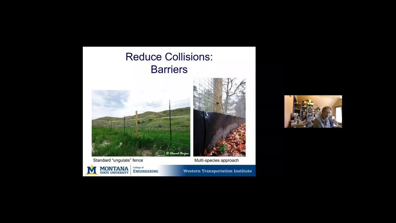





Road ecology research demonstrates that wildlife mitigation strategies like fencing and crossing structures can significantly reduce wildlife-vehicle collisions and maintain ecological connectivity, but their effectiveness depends on species-specific factors, proper placement, and long-term monitoring; the Banff National Park case study shows that an 84% reduction in collisions was achieved through wildlife fencing combined with strategically placed underpasses and overpasses, while also revealing that different species and age/sex classes have varying preferences for crossing structure types, and that long-term data collection spanning multiple generations is essential for understanding mitigation effectiveness.
Road Ecology in the Anthropocene: Lessons from Banff
Added:The concept of the 'Anthropocene' and how human infrastructure and development globally alter natural ecosystems.
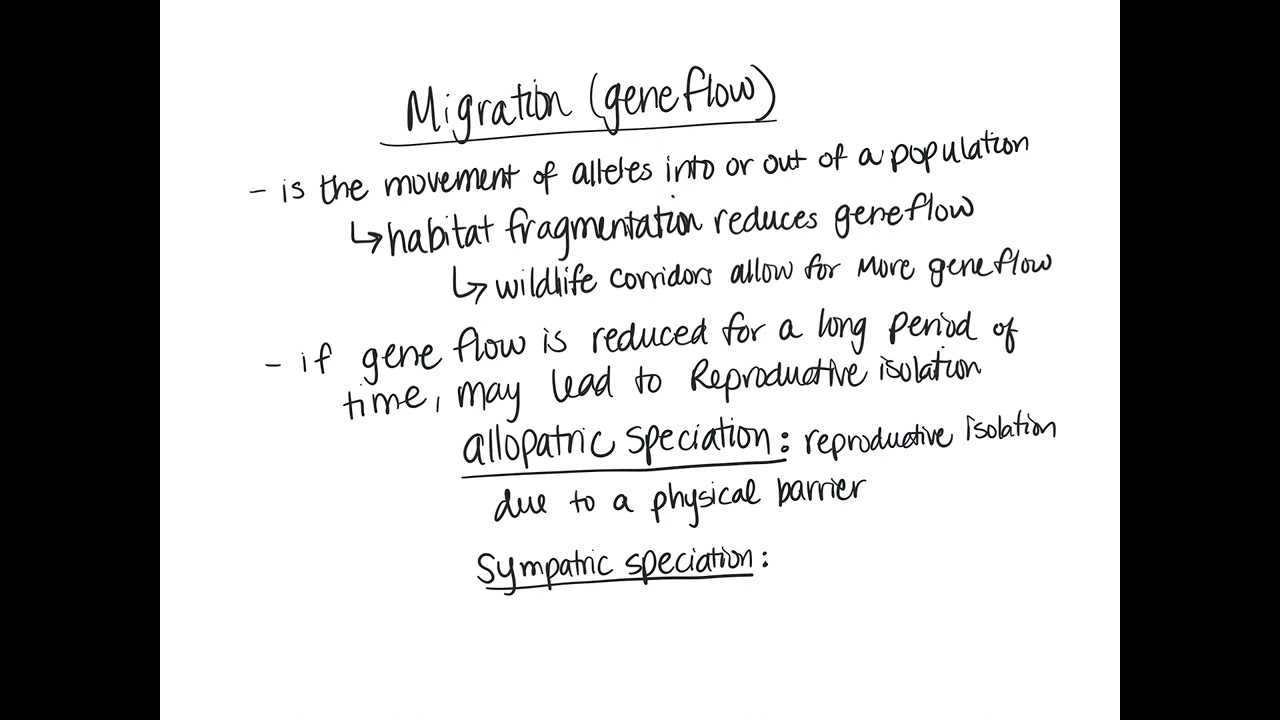
The ecological consequences of habitat fragmentation, including the barrier effect on wildlife gene flow, dispersal, and population dynamics.
Basic principles of conservation biology, specifically the role of ecological corridors and habitat connectivity.
Familiarity with the geography of Banff National Park and the historical conflicts between major transportation corridors (like the Trans-Canada Highway) and wildlife preservation.
Advanced engineering and behavioral design specifications for wildlife crossing structures, including species-specific overpasses, underpasses, and exclusion fencing.
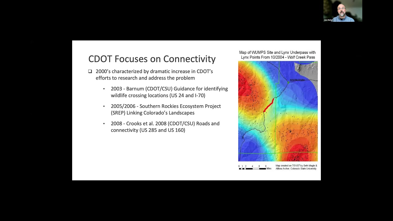
Landscape-scale connectivity modeling using GIS (Geographic Information Systems) to predict and prioritize wildlife movement corridors.
The integration of road ecology into environmental policy, transport legislation, and Environmental Impact Assessments (EIAs) for future infrastructure.
Economic valuation and cost-benefit analysis of wildlife mitigation infrastructure, balancing construction costs against the prevention of wildlife-vehicle collisions.
Global case studies adapting Banff's mitigation models to different biomes, such as tropical rainforests, deserts, or densely populated urban-fringe environments.
694 views7likes1:32:51Original Release: 2021-06-30
all right thanks everyone for attending it's uh seven o'clock uh really appreciate your time and hope everyone's managing to avoid the heat as best as they can this meeting will be recorded uh this webinar will be recorded so that it can be viewed in the future uh recognizing a lot of people are busy today uh and it's getting into the summer doldrums so people are probably on vacation and finishing up the school year the objective of these webinars is to give you information to inform your advocacy work uh you know if we just pass this information on to you and you don't tell anybody or talk to anyone about it doesn't really do any of us any good but if you're meeting with your mlas and your mps and you're using this information to help educate them and move things in a positive direction for fish wildlife and habitat uh then this this the goal of this uh webinar is uh will be successful i'd like everybody to keep in mind that dr ford is a researcher he's not a policy maker so if you feel your blood pressure rise and you're getting really mad presentation keep in mind that his job in all this is to present the science our job is to do the advocacy piece so if you have a question try to frame it around the science um as opposed to the policy end of things and uh we'll be keeping kind of the line of questioning around the world of science and uh data as opposed to the world of policy um in terms of the way things will go there's a q a function if you're on facebook live you can put your questions right in the comments if you're on zoom you can put your questions in the q a we'll keep track of them and at the end we'll ask dr ford if there's similar questions we'll kind of collate them and put them together so that we're not asking the same question multiple times so with that i'd like to introduce dr ford for all of you who haven't met him yet uh in two days uh dr ford will graduate from an assistant to an associate professor at ubc that's a big thing uh in the world of uh academia he's currently the canadian research chair in wildlife restoration ecology prior to his work at ubc he completed a libreo post-doctoral fellowship with john frixel in guelph working on the design of wildlife corridors in the banff area ford's phd work was on rangeland ecosystems in kenya where he studied how leopards wild dogs their alternate antelope their antelope prey and plants interact those are dick dicks right dick dicks and impala okay his phd research received several awards including the governor general's gold award gold medal and an american association for the advancement of science prize for early scientists his earlier education included carlton university uvic and lethbridge college prior to becoming a professor ford was a researcher on the banff wildlife crossing project an analyst for the canadian wildlife service working on endangered prairie raptors and conducted third party reviews of environmental assessments for the energy sector in alberta ford has co-authored over 75 peer-reviewed papers and several million dollars in grant funding ford's advice is actively sought by managers and decision makers he sits on a number of provincial committees including the bc hunting and trapping advisory team the bc flynn road ministers wildlife advisory council ford's research group of graduate students and post docs in the wildlife restoration ecology lab works to restore important relationships in nature's food web including those between people and wildlife some of his group's research includes studies involving mule deer caribou roosevelt elk mountain goats wolf bighorn sheep bison cougar boreal caribou and wolves as well as studies on bear and human interaction disease modeling and policy analysis ford works closely with several first nations environmental groups governments and private sector companies to use evidence and cooperation in the restoration of natural systems and the people that depend on wild animals plants and spaces uh just to mention as well dr ford is also one of the primary investigators for the southern interior mulder project along with dr sophie gilbert from the university of idaho so he makes up um half of our uh primary our pi uh on the project so uh he has the credentials the experience he's done the on-the-ground research and tonight he's going to talk to us about road ecology so dr ford thanks for coming and it's all yours uh thanks that introduction jesse and welcome to the talk tonight everybody um yeah i'm excited to uh to to come to you from kelowna from my nice cool basement and i hope you're keeping cool as well um here speaking on silk okanagan territory and as jesse said i'm from ubc so what i want to talk to you today about is road ecology in the big picture and some of the lessons we learned from one of the world's sort of most famous and longest-running road mitigation projects and one of the reasons why this project uh has the fame it does is because of the investment in monitoring and that's one of the key sort of take-home messages that i want you to think about as we keep talking today is it's one thing to have great ideas and it's one one thing to have uh interventions that are brave and bold and it's another thing to make sure that we're keeping track of what's going on on the ground to know that the investments we're making in wildlife and habitat are worthwhile so here we go so yeah just to visualize where we're working as a group in the wire lab the wildlife restoration ecology lab it's mostly in southern bc um these are the the critters we work on i think jesse did a great job of covering it so i won't get into too much detail but just know that in all these studies some of which you're going to hear about are have heard about some of which you won't quite yet but roads are probably part of all of these projects in some way and in fact you know jesse was mentioning oh i'm going to be an associate professor which i don't think most people know what that means but um it's just a marker of where we are in in the building of this research program in bc and when i started this program literally like three weeks into into my job as a professor at ubco it was a bad weekend for badgers two percent the badger population was killed that weekend and one of those animals was killed right in front of of ubco campus so this is highway 97 in kelowna right by the airport i took this photo it was just uh very odd to see such a rare and endangered species um dead right in front of campus and i think this was a reminder that even though i had kind of you know expanded my research portfolio here into british columbia that of course these issues are really important everywhere we go yeah and roads are a part of humanity it's hard to imagine roads and people separate right so roads have been part of the roman empire the they're part of indigenous cultures in north america and around the world the footprint or use of those roads is still occurring today there's you can walk on roman roads in in europe uh you can go to the anasazi roads in the chaco canyon and still see them as you can in this photo so roads are something that are part of us um we use them almost every day uh unless you're a basement dweller like me but you're on a road almost every day um they're connecting us to our community to each other to our work to our food and our water uh roads are part of life and there's different kinds of roads of course so we have you know your typical urban road which is what probably most people interact with on a daily basis the urban roads are you know clustered in a small area they have high traffic typically slower speed and they don't really have a big impact on the habitat around them because the habitat's already not there because it's an urban area so they're dense but kind of confined and then we have highways which have high traffic volume so they're moving a lot of cars through uh through a small space they're very wide these can occur in good habitat as in this photo but they're typically fairly sparse so there's a low density of these and then we have resource roads which are have low traffic volume they're narrow they're usually unpaved and in a place like british columbia as i'll show you later they are ubiquitous they're almost everywhere and indeed roads are everywhere in the world there's an estimate of 21 million kilometers worth of roads right now and an estimated three to almost five million kilometers of new roads added to the earth uh by the year 2050. so whatever we understand and know about roads we need to know more about them because they're going to be more a bigger a bigger part of the earth as a in the near future and it's not just that there's more roads somewhere but it's where these roads are being built so this is from a study we published earlier last year looking at how road expansion in tiger landscapes could affect tiger viability so each one of these colored blobs on this map is an area that the host country has sort of dedicated to prioritize tiger conservation and you can see that some of those areas vary quite a bit in road density the darker areas or rhetoric areas have higher road density but there's a there's a lot of effort there's a policy initiative from china called the belt and road initiative and other road expansion projects around the world that want to expand roads and we're seeing upwards of a 50 increase in the roads within those tiger conservation landscapes so this suggests that even in areas that people are setting aside for one of the most charismatic and important you know wildlife species that we can think of in the world roads are still part of the footprint and the difference or the the the similarities to what's going on in british columbia are very clear um 2017 auditor general's report suggested that there are 10 000 kilometers worth of new roads being built each year in this province we don't have a good handle on where all those roads are it's another question for for maybe another day we're trying to figure that out but roads are part of the bc story too of course so this is from a study on highway 3 in the crowsnest path so just on the other side of the bc alberta border and you can see that roadkill is increasing with time so we're we know that the roads themselves are increasing but we also know that in some places the impact of roads on wildlife and human safety could be increasing as well it's a little ambiguous because if you get more roadkill it could mean that the wildlife population is increasing as well if if it's sort of a fixed rate or could mean that the wildlife population is decreasing as more and more mortalities are being caused by by roads and traffic so this doesn't tell us much about the impact of roads on the population per se but it is definitely a problem to have a growing number of roadkills so in the big picture there are a number of problems that roads bring to habitat and for wildlife they can contaminate the land they can spread weeds they can impede hydrology there's a lot of these sort of abiotic drivers and plant-based drivers but today i'm going to talk to you about these bottom four uh about how roads affect movement of wildlife how animals are killed by wildlife and how we understand patterns of mortality from from roads these specific kind of contexts or conditions that make some species or some areas more susceptible to road effects and others and this idea of the road effect zone and that is basically the impact of the road on the landscape is bigger than the footprint of the road but it extends out into the surrounding landscape so the impact of these different road effects on nature really depend on things that i sort of mentioned earlier like the width of the road it's surface type you know is it impervious or pervious to water the amount of cars on the road the speed at which those cars are traveling the density of roads in the landscape what condition is the adjacent habitat in near the road and what's going on with the local wildlife population so these are sort of the sort of jump around here but these are sort of the main ones for the talk today and we're going to begin with one of the most important charismatic species in north america the eastern chipmunk i say that tongue-in-cheek but obviously chipmunks are a great model organism to understand how small creatures can interact with the road because they're easy to manipulate and you can keep track of them pretty easily so this is actually from my master's work but basically what we did is translocated a bunch of chipmunks dropped them off near the road that's where that little star is and then tracked these little chipmunks near the road with that we fit them with little backpacks that had string in them so we come back the next day after dropping them off and follow the string and trace out their pathway and it was something like 68 chipmunks six kilometers worth of tracking string and only two animals crossed the road and what we're trying to do is figure out if traffic volume affected the probability that a chimney could cross the road and uh and yeah it doesn't but animals these animals are reluctant to cross the road irrespective of the amount of traffic on the road so traffic is a part of it but the road itself can be a barrier to a lot of animals we also summarized some data from a lot of different studies eight studies starting with publications that came out in 1935 up to 2000 up to the year 2000 where people would just drive around and count roadkill so like those 1935 studies were actually pretty rigorous you can imagine somebody driving around in a model t right and they just counted all the roadkill they found on the roads in the us someplace and um it counts as data and it was rigorous enough so we pooled all those data and looked at the body sizes of the animals that they were finding in those surveys and found that there's sort of a sweet spot of an animal that is abundant enough to show up in a road kill survey which tend to be the smaller animals but also large enough to get hit by cars and be detected by a driver and that's where this sort of sweet spot is around one kilo so that's things like hairs and rabbits so different animals have different vulnerabilities to roadkill and roadkill has a different sort of selective pressure too on wildlife so here's a study from banff that's in the works right now with our group and what we're looking at here is the sort of body condition at that at the time of death when these animals were found and the green bars show animals that were killed by predators typically wolves and cougars and the dark blue bars show animals that were killed on the highway and you can see that across most seasons animals that were killed on the highway were in better body condition than the ones that were killed by predators so what this kind of means is we know that individual body condition can affect the trajectory of a population so healthier animals are going to survive and reproduce better than unhealthy animals and this means that an animal killed by a car could have a bigger impact on the population than an animal killed by a wolf or another natural predator so keep that keep that in mind as we're thinking about what are the drivers of populations as a whole yeah and roads are some they're a novel thing for animals in terms of their evolutionary history so some animals don't really respond in an optimal way uh two roads so we those participated in a study where again we translocated animals uh drop them off at the edge of roads and then watch them cross the road just with just by watching them so these are leopard frogs and um the control areas on the far left this bar on the far left here were areas off the road and then we had low traffic sites and high traffic sites and if you were faced with crossing a road that had high traffic on it you would want to get off that road as soon as possible but that's not what frogs do they freeze up you know if there's something coming like their response is to hide or or to to pause to you know be more cryptic but on a road that's probably not the best approach so animals that that don't have that optimal response again perhaps more vulnerable to raw mortality and other road effects than animals that are quicker or have a different type of response so and then i just want to touch on this idea of a road effect zone so this is an old paper uh 42 years old by roasting bailey in general wildlife management and they counted deer pellets near and away from the road and they found that as you get further away from the road you tend to see or encounter more sign of mule deer and this kind of captures the idea of the road effect zone that maybe these mule deer are avoiding the sight of cars or the sound or some other disturbance that's associated with the road but the idea is that they're not just avoiding the pavement but they're avoiding this swath of land around the road and then we look at the combined effects of roads you can you can imagine an effective road density at the landscape skill or population level and clayton lamb who some of you may be familiar with published a study in 2017 with some colleagues looking at the effects of road density on grizzly bear density and below sort of a management recommendation of 0.6 kilometers per kilometer squared of road there was a substantial difference in the number of grizzly bears in the landscape so the bar on the left is is that low road density uh location and the bar on the right is the uh higher road density locations so what is the mechanism there you know is it a human wildlife conflict is it harvest pressure is it disturbance from the road itself habitat degradation that is that is associated with higher road density sites all these things can combine together to affect roads and so thinking of roads as a as an index or a proxy or some other way of measuring sort of like a number of uh the human disturbance processes is a way of sort of bundling up our understanding of the impact of people on wildlife so that's sort of the bad news of rhodes um what can we sort of learn about how to manage roads as a as a problem for wildlife and habitat and an opportunity to restore the movement and ecological processes associated with wildlife and that's where banff comes in so i'll run through the background of how we got to learn all this information about roads from banff and then get into some of the specific findings and i want to begin with uh the champion of this project uh dr tony clevenger who's based at the western transportation institute uh in montana he lives in harvey heights uh just uh around the corner at the end of this picture here um your camera and tony i think is just it's worth mentioning that uh these sorts of projects need a champion right and they need people that can navigate complex bureaucracies and can pool funding from different sources and can believe in the final vision and i think uh yeah we need to sort of find these people for the specific wildlife projects that we're passionate about and make sure that they get the support they need to do their jobs and what tony was able to do is bring management from parks canada and funding from other agencies from around the world and private donors and support a long-term wildlife monitoring program on the highway and when the typical phd project lasts five years maybe through those years or actual data collection getting to something that's an 18-year monitoring project is quite remarkable so the study area that i'm referring to kind of extends from camera out to the bc alberta border along the trans-canada highway so it includes areas within and outside banff national park um this is a key connectivity area for the wadaway region um and yeah all the species of all the large mammal species sort of in western canada tend to be found in this area or at least southern parts of western canada so the the trans-canada highway and banff started out as a you know like a lot of roads do right like gravel uh like a resource road um it expanded to a two-lane road and still pretty low uh low traffic volume and then uh there was a lot of pressure as as traffic increased on the trans canada through the 70s to twin it and with that there was this risk of of collisions without so the elk population in banff at that point was booming there were no wolves around um and they called this section of road between cameron banff uh the meat grinder because there is a lot of elk vehicle collisions so that was like a big motivation to sort of understand hey if we're going to expand this road if we're going to make bring more people into the park and increase the traffic volume and we're going to increase the risk to people's people and wildlife within the park so we better figure out a way of reducing wildlife vehicle collisions so the easy solution there and at this time you have to appreciate how visionary this was was to fence the highway so they did that and then oddly enough they were concerned by fencing the hobby between cameron and banff that it would displace animals outside of the national park and onto the private provincial land and create a problem for the town of kamwar and surrounding areas so trying to be good neighbors parks hannah just said hey if we can relieve that sort of pressure on the fence and make the fence work better we should build some underpasses so that's what they did they didn't know which kind of design would work best so they tried a few different designs they tried to stagger some they tried to make some really long ones they had box culverts some near creeks some are these yeah elliptical culverts and at this point in the early stages there were no overpasses so it was a bit experimental and part of that experimental design is really adaptive management which is something that people often talk about but rarely do so here's that first phase of the bamptown site in camera so this was built in the 80s 1200 passes and then the focus again there was really on elk and angular movement phase 3a was completed in the 90s this is a 25 kilometer stretch it had 10 underpasses and these are where we get these first overpasses showing up uh in banff these two big 50 meter wide overpasses and the focus there was much more on carnivores and in parks language maintaining maintaining ecological integrity and then while we were doing this phase 3a monitoring phase 3b was being planned and built and so the lessons from both phase 1 2 and 3a were informing the design and placement and monitoring plan for the structures along 3b and this is all pretty much completed now as far as i know right out to the bc border so starting yeah in the late 90s research began monitoring began on these sites are they doing their job and during the time that i worked on there and and since and before uh several papers and proceedings and conference presentations have followed to share this work and that's part of why i'm coming to you today so i'm just going to cover some basic questions about what we learned from vamp there's many more lessons that we did learn but i just want to touch on some of the highlights so the first is how do we even monitor mitigation and its effectiveness for doing its job which is reducing wildlife vehicle collisions and increasing animal connectivity across the highway is is our mitigation working so does the fencing work to reduce roadkill do wildlife crossing structures work and then how does mitigation fencing and crossing structures affect species interactions so one of the first questions we tackled was how do you track wildlife at crossing structures and when i showed up at the project they were using these dirt track pads i'm going to pull up my pen here hopefully um spotlight there we go so we had these dirt uh track pads in the underpasses which worked great because there was a lid on the underpass which was the road so they were kind of climate controlled right and then in the early days of the project they had cameras set up at the overpasses because of course it's really hard to maintain a track pad in the weather conditions uh on an overpass in the old days they were you know slide based remote cameras so uh every week someone would have to drive all the slide film from banff into calgary to get processed and then they would have to wait for the film to get processed and then go back and count the pictures so such a far cry from where we are now with camera trapping technology but even back when i started we got first generation reconyx cameras so these are housed in an old pelican case and there's a couple of those on the crossing structures so while we're tracking animals at the underpasses we would note if there were too many tracks to count and this can happen when a herd of elk comes through and just obliterates the tracks it makes it hard to count how many elk there were but it basically obliterates any other track that was on there at that time so that's not a great monitoring tool but again the idea with track pads is all you need is dirt and a rake and we did break a lot of rakes right hopping over the fence to go check the crossings but uh you know a 12 rake every few months is was pretty cheap compared to the cost of these crop cameras at the time so ultimately we found that when you factor in the cost of visiting uh dirt track pad every couple days so there weren't too many tracks right we flagged them as too many to count if there are too many uh tracks to count um uh and compared that to the cost of servicing cameras every few weeks and then classifying the pictures it was far cheaper to use camera traps when they were really expensive than it was to pay someone to visit a track pad and do the dirt raking thing every two to four days so that was a good lesson in helping improve the efficiency of doing this work and of course now i think most people would just intuitively gravitate towards uh camera trapping but at that point camera traps are so new we had to demonstrate that we also need to keep track of roadkill right if we want to know where things are dying from roads or not dying because of mitigation we need to keep track of where they're dying and how often so we did a study where we looked at monitoring um with a road contractor with the support of road contractors who were there to pick up the roadkill right they would keep track of where things were killed and sometimes it would say oh it's you know two kilometers from such and such a bridge or it's between this mile marker post and that mile marker post and we found unsurprisingly that using a gps again this is relatively novel at the time but using a gps to keep track of where the roadkill was happening is a very important improvement to providing accurate descriptions of where roadkill was occurring and i say that because there's a lot of legacy data out there and a lot of a systematic or haphazardly collected roadkill data and it matters right it matters if we're talking about an accuracy that varies by kilometer whether um yeah so if you're if you're here to promote some better monitoring uh and data collection for roadkill in british columbia um let's try to find a way of integrating uh spatially accurate gps based locations when we're asking contractors to pick up roadkill there's also citizen science approaches so collaborators at the mistakas institute at not royal are participating in app design that is being used by people to keep track of road kill and that's something else that perhaps even the wildlife federation could look into there's people that are regularly driving certain stretches of road and this would be a great way of keeping track of where the roadkill is okay now does mitigation work we'll start with fencing so uh here we have a record of uh along the trans-canada highway of annual uh wildlife vehicle collisions so upwards of 80. so this is uh not a long stretch 30 kilometer three kilometers and then after fencing there was an 84 percent decline in collisions and most of these are uh gonna be carnivores so coyotes and black bears are either get under over the fence respectively but by and large the ungulates were kept out so it's very effective now why why doesn't this happen everywhere well one of the reasons is it costs money to build these fences right and uh estimates around this time for banff or when i was there was about 75 dollars a meter for one side so it gets really expensive and that's the end us funding back in the day so um marcel hoyzer and colleagues in 2009 published a great paper that quantified the societal value or the societal impact of a vehicle collision for different species of wildlife this includes things like injury to people damage to property to vehicles and lost wildlife viewing and hunting opportunities that these animals provide deer the impact of deer is about six thousand six hundred usd but it goes up to almost thirty thousand dollars uh for a moose so these collisions are expensive i'm going to come back to how we can think about the economic benefits of fencing in a few slides oh yeah that's this one sorry so we looked at so if you think about wildlife vehicle collisions happening in different parts of a highway where do you want to put a fence and how big should that fence be that was sort of the question we're looking at because at this time there's a sort of other road if you're familiar with eastern bc there's a road past radium that connects to bound through kootenai national park and at that point it wasn't fenced at all so we're thinking about how can we also learn lessons from banff national park and apply them to other parks in the system and so we simulated different sections of highway and move them around like a moving window on highway 93 in kootenai national park and calculated the cost-benefit ratio of those locations using existing roadkill data and so this is uh this is me trying to do economics so apologies to all the uh natural resource economists out there but i was young and so uh yeah anyways forgive me but we're looking at a benefit ratio so as you go above that line um it pays to build the fence because you're reducing that suicidal cost of that fence segment below that line it's more expensive to build the fence and so it's i know the figure isn't a great quality but the the general pattern here is that short fence segments two kilometers to ten kilometers are very efficient at capturing a societal benefit of building a fence up to two times right the impact of that in savings from reducing collisions the trade-off here of course is you need to have a very good estimate of where those collision hotspots are occurring and you have to know that those hot spots are relatively stable so in a park setting with really good data that kind of makes sense in areas where you have more dynamic landscapes that may affect animal movement you may want to mitigate the risk of having an inaccurate fence placement by having a longer fence but within that longer fence know that there's going to be some sort of quieter spots that may not be as if where wildlife may not be willing to cross anyways yep okay so one day we're out with some wildlife um engi or sorry some road engineers and looking at some of those new fence sections that some of the new fence sections in bath national park and i asked if um actually some of you may know this but if you look at this these pagewire fences especially in the okanagan and places in the cuny's you'll find that the mesh size is smaller closer to the ground than at the top of the fence and i'm not sure what that's about but i wondered if it was to keep small animals from crossing the the fence i don't know if there's some other structural benefit but i asked the engineer hey does this keep the little animals out and he's like that's your job so i said okay that's our job uh so we went in the winter and counted tiny animal tracks like little shrews and weasels and whatnot to see if they were crossing the fence and if this variable mesh size had any effect at all on animal movement and it was pretty cool to learn different sizes of tracks and different types of tracks anyways most animals of course if they could fit through the fence they did like these animals are used to going in tight spaces to begin with so no big surprise that most animals across the fence which tells us that you know maybe the variable mesh size design if it's more expensive than a fixed mesh size is pretty maybe a place where we could get some cost savings um and yeah if animals can fit through the fence they probably will which is another sort of not terribly surprising conclusion the other kind of cool thing though was if there was a little under like a little culvert under the road which is what this dark spot is in the photo so the pictures taken with the road at my back the animals would cross through the fence and then sort of gravitate towards the culvert and that helped them cross the road so if they use the culvert they had a greater chance of crossing the road the key is in the winter at least you have to keep this culvert open so if it's if the culvert opening is close to where the snow plow pushes the snow off the road it's not going to get used by animals as much and that's going to affect permeability and probably risk of collisions for those small animals so the engineering the optimal engineering design would be to push this culvert entrance a little bit closer to the fence to get it away from the snow plow okay so let's talk about crossing structures so what makes it the wildlife crossing structure well the answer to almost everything in ecology is it depends um things like where does the crossing structure go you want to put it in a place where animals are going to find it and use it the type of crossing structure the design like we talked about under passes and overpasses that matters uh we need to keep people out of them so i'm going to cover that in a bit but some like some of these crossing structures are accessible to people and hikers and in some places like in the okanagan to motorists and cows and then there's also species specific and even within a species different sex and age classes that have preferences for different crossing structures so there's a number of ways you could break down the question what makes a good wildlife crossing structure so coming at you here with a lot of data uh from 1996 to 2014 so almost 18 years of data you know thousands and thousands of records of crossing crossing events by track pads and by cameras and there's just yeah a number of papers and research you know ideas and questions from this and that's still believe it or not being published and coming out one of the ones that we're working on currently is a very sort of tight examination of overpasses versus underpasses now why i mention that is because it's hard to do experimental research on wildlife crossing structures once you build them you can't really move them around it's not like let's yeah let's take this underpass plunk it two kilometers down the highway and see if it works better like once they're built they're kind of there so really only opportunity we get to add some experimental control to these questions is to look for these opportunities like here where we've got an overpass right next to an underpass and so these are within 200 meters of each other so they're basically for these large animals they have the same chance that an animal encounter either one and so we're controlling for the effect of the sort of surrounding habitat for the road design so like as many things as possible that are the same for these two crossing structures are in place it's just they're a different design so now we can get into a sort of tighter understanding of what is the effect of the design per se on the probability of use by these animals so looking at grizzly bears here i'm just going to walk you through this figure so we have years since construction on the x-axis and we have the predicted probability that an animal we will prefer to use the underpass relative to the overpass so if the uh dots in the line the lines here are the confidence intervals and the dots are the predicted response of the grizzly bears so if we're below the pink line it means that the grizzly bears prefer to use the overpass relative to the underpass so what does that mean okay so over time look at here years since construction over time you know with the first really decade of research in this area or more we would say to get grizzly bears across the road you have to build overpasses right it's for a long time but getting into more recent years after a decade or so so a couple generations of griz we're getting into more equal use of overpasses and underpasses so i think this is a really important finding because it tells us one you know that these animals can adapt to different structure designs maybe they're passed down from month to cub or something maybe there's just a greater chance of encountering these uh different structure types over time but either way the effectiveness of the underpasses seems to increase over time which is great um the other thing is we have this finding because of long-term monitoring again this is like 16 years here and it's still going in some parts of that so this is an important lesson to invest in long-term monitoring and again we found that cheaper method to do this so the the economic and scientific benefits were there okay the other yeah another sort of question is what about people so we have some crossing structures and banff that are close to town and they're used regularly by hikers and others that aren't and we found that their species specific responses to the presence of people in these underpasses so grizzly bears and cougars unfortunately do not seem to avoid people so they use crossing structures at the same time that people do now this is kind of good if you if you want to get these animals across the highway and and you also want to get people across the highway but it's bad if you're worried about facilitating a human wildlife conflict so it would be better if everybody used them at a different time unfortunately wolves and black bears tend to avoid using crossing structures that are used frequently by people this is also bad because it basically makes the crossing structure less effective if people are using it so you can't be you can't have both and so here we want to yeah the the upshot here is to really keep people out of the crossing structure it's called the wildlife crossing structure uh leave it for leave it for the wildlife i mentioned earlier that different groups within a population may prefer different crossing structure types too so here we looked at individual grizzly bears and compared them to so probably adult males and compared them to family groups so mom with cubs this is a messy figure but the the idea here is that the adult females and cubs tended to use overpasses this is like publishing before we're allowed to use color or something i don't know why it's so hard but anyways these are this is the use of overpasses by family groups and then here is box culverts oh sorry this is uh common groups yeah there's a tendency for them to use overpasses and then for the single tends to use overpasses but a greater diversity of structures too so basically the single bears are generalists they don't have a strong preference for crossing structure design whereas the mom and cubs tend to prefer the overpasses but animals used all these different structures at some point and these structures vary quite a bit in their cost right so an overpass is a few million bucks a box culvert is like tens of thousands of dollars and so this brings up this idea of what is what's the best use of our money to get animals to cross the road or at least to make the road as permeable as we can and so if we assumed in the studies we did a fixed budget of let's say 5 million bucks what are you going to do spend it all on overpasses and bill 2 or build 28 box culverts and the model predicted that we could get more animals across the road by building more of these smaller cheaper crossing structures that are maybe on an individual basis less effective but as a system are a better way of getting animals across the road or a cheaper way of getting animals across the road and within that we know that adult male bears so these single bears make you know kill cubs so if we can spread out where these different animals are using structures to get across the road it could reduce uh mortality rates and increase recruitment within the population speaking of do how do species interact at crossing structures this question came up all the time on this research do the wolves just hide out in the underpass and wait for deer to come by and then they jump out and kill him and it was always said with this idea that like carnivores are cheating like they're cheating the system or something as if there isn't like a four-lane highway through a national park but anyways it it was just something that we had to address because everybody had the question whether whichever way you came out on it i mean some of these things were built to support carnival our movement i don't know why we would feel that carnivores are cheating nonetheless we had to look at this question so the prediction of the prey trap hypothesis is basically you would have a distribution of kill sites made by carnivores across the landscape you know there's a road in this landscape but before any fencing or crossing structures were built right so anyways these animals are running around interacting and killing each other but after the crossing structure and fencing was built then you've got this funneling effect of prey through the underpass maybe the carnivores are ambushing them or maybe it's just sort of corralling animals together into a tighter space either way you're going to get animal these prey kill sites would be closer to the fence or closer to the highway following mitigation so we had a nice uh design for it for that because people were tracking the location of kill sites before the highway was built just in unrelated projects and we could look at the distance from the highway to these kill sites before and after mitigation and we found yeah in two different phases a 1980s phase on a 1990s phase if anything uh kill sites tended to get slightly farther away from the highway after mitigation than before so this tells us basically that prey that the crossing structures and fencing are not pre-traps but you can see from the pictures that they're still dead animals near the highway and we looked at the probability of finding one of these carcasses as a function of distance to the highway and other areas across the landscape and basically predators still kill prey near the crossing structures but that probability is about the same in other areas of landscape so this tells us the this is a very satisfying uh non-significant uh statistical finding um for a scientist to encounter right because usually we want to find them like oh we found a difference or we found effective x on y or whatever it is but in this case there was no effect and that's really cool because it says hey these structures are not really interrupting or disrupting predator prey interactions they're still happening in the in a way that we'd expect them to happen or places that we'd expect them to happen if the highway wasn't there and i think that's kind of interesting yeah lots of cool interactions picked up by camera and you know this could change you can imagine some specialist individuals especially cougars might pick up on a sheet population or something in an underpass but what we're talking about here is the big picture focusing especially on the main predator in the bow valley which was uh wolves okay so here are the big sort of take home lessons from bam before i get into what we want to see in bc so we need that long-term data to understand the effectiveness of our management this is especially true for large mammals that have long generation times slow reproductive rates and have large home ranges so we want methods to monitor that are robust right that are that give us good answers but they're also relatively cheap to implement and camera traps are a great technology for doing that in the bath case we kind of went across a number of different governments during that time and different interests and priorities within a particular electoral cycle and so we needed partnerships to buffer the uncertainty around funding and agency priorities and i think that's a really important lesson it wasn't just government driving this it was a whole sort of bulk collaboration again there was a champion with 20 but there was other people that were brought on board at different phases to keep this thing going and that's a really important lesson too and we had to communicate broadly about what we were finding so when i was at the office it was me who was checking the crossings and you know taking my rake out and changing batteries in the crossing structures and there was a another funded position in this project which was pretty small and that person's job was to do outreach and education but i think that was another victory so it wasn't like a side idea it was like you know 50 50 we're going to have research and we're going to have communication about that research they're both seen equally and that included school visits we put up a display at the calgary zoo yeah it was i think a big part of why that project was successful we learned that fencing you know reduces collisions of course it also saves wildlife people and money so there's an economic argument from this we learned that crossing structures work but their effectiveness depends on species or groups within a species different ages and sexes within a species and of course these different design location and human use factors that need to be accounted for as well and then the future i think is this idea of species interactions how does the crossing structure influence predator prey interactions how does it influence disease spread i'm going to touch on that on a bit in a bit what's the link between crossing structures and the growth of a population how do we design crossing structures and mitigation for species that don't often encounter roads most of the stuff i'm showing you here are from low elevation species that already occur near roads but other species crossroads just not very often and we need to design highways in a way that facilitates their movements so here i'm thinking about uh things like sheep goats uh wolverines you know things that you know marmots pika there's a lot of different species in different areas i don't think some of you are thinking why i saw it going on the road the other day like consult well yeah but in a lot of places they're not near roads and so thinking big picture here how do we get animals across roads when we don't have a lot of data on current interactions with roads is a challenge and always finding cheaper methods to understand road wildlife interactions okay so where do we go from here well one is one idea is how do we prioritize where we want to build uh mitigation in the future outside of banff like banff had this very clear mandate which was great like parks canada said okay if you're gonna we're gonna build or expand a huge highway through canada's flagship national park then that's gonna be the best highway in canada for wildlife not every highway has that mandate or a transportation agency has that mandated in fact very few do so to prioritize for the big picture regional scale where do we invest our five million bucks to make a greener road or a safer road that's sort of the next level here so uh recently in 2020 we published this paper looking at this question for southern alberta so this is the south saskatchewan regional planning area so calgary is up here and we built a number of connectivity models that sort of emulated where we're simulated where animals are likely to move through this region and we combine that with data from the rcmp on animal vehicle collisions and it came up with an index of places that you're likely to hit an animal and we put these two streams of data together to prioritize alignment so where is an area where you have a high risk of wildlife vehicle collisions and an area that's important for wildlife movement and they're not always the same right because you could have an area that's good for wildlife movement but there's not a lot of traffic on it so you don't get roadkill showing up in the in the record so it's seeing the different combinations the win-win here of human safety and wildlife conservation value uh in an analysis like this so the hope here is uh with these sort of red areas these prioritized areas uh this is where um wildlife and transportation agency agencies should take a closer look at funding and supporting wildlife mitigation on highways so how do we yeah why can't we do that in bc to my knowledge that hasn't been done in bc and you know there is a lot of highways through some of the best wildlife habitat in the country in british columbia we don't have a province-wide plan for where to put our next overpass we have regional plans there's great work happening on highway 3 there's local localized efforts but where do we situate that the next overpass in this great province and then think about resource roads okay we've got a million kilometers worth of roads in this province that's a lot where do we start dealing with this problem just to look at this from a road effects zone perspective so here we are in region 8 south of kelowna i'm over here someplace so lots of roads here and when you include a 500 meter road effect zone there isn't much left for wildlife only and you can see where the protected areas really pop out in a map like this so i would like people to consider a vision for road ecology in british columbia that we are smart and capable enough to make a plan of where we want to see where we want to make uh highways safer and then we're going to fund it we're going to work on a systematic road closure plan or access management plan in sensitive landscapes and we're going to make sure that we're promoting the right type of connectivity across highways and not the bad kind i'm going to tell you what i mean by that in a second so thinking of big picture like where do we put the next overpass we've got data on collisions it varies in quality it's hard to access these data but we have a rough idea of where some of the collisions are occurring we have a poorer idea of where the important areas for connectivity are in the province so that's one opportunity we also have provincial road mitigation efforts that are celebrated so there's been some good work in bc on this there's a lot of fencing especially down here in the south and i think most of the fences in bath national park were built by kelowna-based fencing companies because they're really good at building fences over here for the orchards and all the highway fencing that's already here so canada's first overpass was built just outside of peachland in the okanagan there are 29 large wildlife overpasses in bc so there i don't want to diminish the work that's been done already but to put this in perspective in banff national park you've got one wildlife crossing structure for every 1.86 kilometers of fencing so if you had a stretch of 30 kilometers of highway there would be 17 crossings on that stretch of highway in damp or i'm sorry in bc for every uh you have one crossing for every 4.85 kilometers of fencing so over that same 30 kilometer stretch you would have seven crossings now we do need to know how many crossing structures is enough but i just want to put that into context about um what the priorities of the province look like when it comes to building infrastructure to support wildlife connectivity what about road closures and access management so this has been happening again so here's a photo uh on the bottom there shared from uh clayton lamb who's doing some work with the province and the tamaha to look at road deactivation in the kootenais this is a photo of a access management structure in the young main forest area in the granby and we know that yeah access management is predicted predicted to have increased grizzly bear abundance by upwards of 20 27 in that kettle granby area where they did a lot of access management so that's inspiring right and where else should the next kettle granby area be can we figure out a systematic way of rolling that out and access management comes out a fair bit in different wildlife recovery plans such as caribou there was a very small stretch 2.3 kilometers on the fisher creek forest service road designed to reduce predator access and human access to sensitive caribou range as part of the recovery of the cleansies that caribou heard fortunately somebody went and undid that deactivation so they brought in heavy equipment and undeactivated the road so i mean there's a bigger problems here with uh social support for some of this work i get it but we also need to find a way of navigating that uh different perspe these different perspectives on what access means and who's going to benefit people or wildlife or both bringing this back to southern bc again where we're doing work on mule deer so this is one of the the deer from the cinder project the southern interior mildew project that jesse mentioned earlier and you can see this map of designated angular winter range units in region eight so here's uh kelowna over here oh right there there's the bridge so each one of these green polygons has a special management a general area regulation that dictates the type of uh forestry forest harvesting that can take place there with the idea that they need to prioritize ungulate winter range that includes food and snow interception cover and thermal cover to get undulates through tough winters well here's the proportion of those uwrs those special areas for for mule deer that are within 500 meters of a road so most of them are you know within that road effect zone so they're not as good as they could be and within that we need to think more clearly about access management and there are some access management areas within this of course but again at a more systematic level how can we think about access management at a region like at this sort of scale when upwards of eighty percent um or more more of these crossing or sorry more of these uwrs are uh have more than eighty percent sort of influenced or covered by that road effect zone so lots of room for growth on this file and i'm just going to wrap up the idea of a vision for for connectivity in vc with another example from banff so town ungulates just like in southern bc county deer tony elker problem with mount and one of the solutions to this is to block elk from coming into the town but that would you know if we blocked all animals from coming into town or near town it would impede or or disrupt parks canada's other mandate to support carnivore movement and natural predator prey interactions so to get around that uh banff national park looked at a few crossing structures that were near town so we have a herd of elk an underpass and the elk are trying to get under the underpass into town and what they did is a very simple technology just a rail fence here right and when the elk are in town they'll eventually go under the underpass to the area outside of town and then the wildlife the wardens will come out the biologists will come out and put up these uh rail posts and that it's like a you know a permeable semi-permeable permeable membrane that keeps the elk out of town but still allows the carnivores the cougars and wolves to use this crossing structure unimpeded so simple but i think pretty innovative technology to think about how we can use infrastructure like crossing structures and highways to be selective and smart about the kind of connectivity that we want to see in the landscape and here's the reason why this matters a lot in british columbia right now chronic wasting disease is 50 kilometers away from our borders okay that's within the migratory range of some of the deer that we've tracked in southern bc they've gone from the kootenays down into libby montana down to this red dot okay so the animals that are crossing the bc border into montana or alberta are getting close to or are in counties with chronic wasting disease which means it could be coming back through a natural vector of a migratory animal we need to know where animals are crossing the border and we need to find a way of getting animals across the border that we want to have and blocking the ones that we don't want to have and that's one of the questions that my student jay cubner is looking at is looking at uh four different species of ungulate and how uh you know they're likely movement routes across the us and alberta border into bc and then we're going to look at ways that we can use existing highways to sort of funnel or be more selective in connectivity so not all connectivity is good when we're talking about things like a terrible disease transmission like chronic wasting disease yeah and then just the last point there um if we're gonna do road mitigation we need to yeah restore what we need to monitor and then make the data available that's the priority so i'll just end with and all of this will work nice picture of a grizz using an underpass and bamf this is early days of remote camera work and a few minutes later something interesting happens so pretty cool that people and grizz can co-exist in banff that everybody's using the underpass um but what you didn't but i didn't want to reveal is what these people are talking about they knew what this crossing structure was about and why it was important and i think that's an important piece of the puzzle is making sure that the public people like you are aware of why roads matter and what we can do about them to make the world better thank you awesome thanks dr ford uh appreciate it i think uh a bunch of people's minds are still spinning uh we had a couple of questions which you preemptively covered in your talk so we'll open it up now for probably about 10 or 15 minutes for people that have questions for dr ford please feel free go ahead here we go in your opinion is road deactivation sufficient in reducing the road effect on wildlife specifically ungulates or is road recommend reclamation required to reduce the efficiency of predator travel and sight lines or is it a case of take what you can get well i don't think we know but i think it depends on your ungulate so i think for caribou for sure we would want to keep the keep their predators from using the roads as efficiently as they as they can we know that from other work on seismic lines and roads would be no different it's the scale that that work has to be done at is kind of the big question for other species where you're worried about hunting pressure perhaps or disturbance from off highway vehicles and i would look at the access piece and you can imagine why certain certain bits of habitat animals are going to get bumped out of if there's yeah loud vehicles around and people making a rocket so i think we just want to be choosy about where those motorized access places are and try to keep them out of areas that we know are important especially for things like you know fawning and and that summer fattening time that ungulates need thanks any other questions i think you've got everybody their minds are still turning uh adam or dr ford region eight bcwf is partnering with others to investigate re-establishing ambulance migration corridors across highway 97 c are you aware of the initiative and are you available for consultation totally yeah we've worked with the okanagan nation to put in some proposals to fund some of that work the cinder project is informing some of that i think there could be better efforts made to and simple stuff to monitor those crossing structures some of them are not you're not allowed to access them so i think they could open that up to scientists and then i think there's some spots where there's fencing because it's a pretty handy way of managing cattle to fence an underpass and i and i don't know if that's still the case but some of those things are easy wins if you can get the people involved to support the the work that we're doing so yeah i'm absolutely uh standing by and thinking deeply about 97c on an almost daily basis thanks for the question okay thanks dr ford so we have one from dave how is the project on the connector underpasses that are not being used progressing to move wildlife yeah i think kind of related we need to see the data and we all and my understanding is we're not monitoring as much of those structures as we should be so i think that's that's a project my understanding is that's a project being led by the okanagan nation and maybe we could all get in touch together with them and see where they're at with their monitoring and i know obviously mystery transportation and infrastructure has cameras up at that overpass i don't know what their interests or efforts are at the underpasses thanks a question from colton has a mapping exercise like the one used in alberta to identify hot spots for government agencies to focus on being completed in bc and how are the alberta results communicated to government agencies okay so first part of that question no um the follow-up is we've applied three times to fund that work with some of the same people and so it's a work in progress i guess i'm optimistic it will be funded it seems like it's a it's a it's an easy the workflow is fairly straightforward um and it seems like an obvious priority to me it's just finding a match between the people who can support the research and bring the experts together to get it done the second part of your question was you remind me jesse it was um and how were the alberta results communicating to government agents right yeah so the great thing there was government was part of that team so we brought together i mean one of the big challenges with uh with road ecology i guess where the opportunity is you have transportation people and wildlife people and if if you work with government sometimes within the same ministry you don't have people really talking to each other as much as you would expect let alone across ministries so one of the benefits of that project is we sat around the table with transportation people and wildlife people and ngos and researchers and we hashed out this plan we're like what kind of data do we have we brought in snakes mule deer grizzly bears and we reached out to our our network and kind of cobbled together the different data sources that we could find that were the priority for that group and then we went through sort of a process by which those experts the people in the room the policy makers and decision makers were setting priorities and guiding us in that research so i think it was a very clear pipeline from the research to the decision making and the reason why that project was initiated is uh the partner that that i was working with mr the mastakis institute and tony was doing a lot of work on highway 3 in the crow's nest pass on the alberta side trying to get an underpass built finding funding to build the underpass did a lot of work okay here's the spot here's where the underpass is going to go everybody's happy with it and then the transportation people said hey we've got like thousands of kilometers of roads in our management area why is this the priority like how do we know yes that sure that's a good spot for that underpass but why not somewhere out in near medicine hat or lethbridge or calgary so that's what's burned our interest in saying like actually that's a really good question how do we compare or how do we prioritize at the scale that matters to you the people with the budget and and i think that's where we need to look at the bc model is you know uh modi the transportation people have a different planning region than than flynn road than the wildlife people and we need to get those overlaid and get all those people in the room together to chat just because there's a wildlife person in modi doesn't mean that they're you know talking this they're speaking the same language as the wildlife people uh in the wildlife shop of government we got a couple of spatially uh spatially distinct areas here are you aware of any mitigation work being done near spar wood yep yeah there's some good stuff happening there there's a fence fencing going in and underpass being installed or a bridge a bridge crossing that's being expanded to accommodate wildlife better that's pretty exciting stuff you know first nations government researchers all coming together on that one um uh industry too tech i think is involved in that one so that's the kind of multi-group partnership that i'm talking about that made banff work and i think that's the model of the future everybody uses roads and i think these are easy wins because everybody wants to see a safer road for people in wildlife i think we just have to kind of get the get the people informed that this is an option for them to do good um yeah sorry for the tangent there but yeah i am aware and also i would say that highway 3 in the spiralwood fernie that whole area at crownbrook that's where i think we need to be very choosy about where we put underpasses and the right kind of crossing structures because that's where you know we suspect chronic wasting disease is going to be coming through into the province okay another one any work done on the island there have been some great fencing mid island but the lake couch and highway is a hot spot for elk accidents are you tied into any of that no i'm not too familiar with that yet but we have an elk project on the go further up island and campbell river um starting up this summer and so i guess we'll get a look at some of that but a little bit further away from the highway um yeah not too familiar okay uh maybe you've explained this already but what do you think the reasons are for insignificant predator funnel i guess near the um near the overpasses underpass yeah why wasn't there a significant effect um i think the way that especially wolves hunt it didn't lend themselves to sitting near an underpass waiting for something to come by so if if you're a hunter think of them as it's more of a mule deer program than a whitetail program and so they should be out looking and spending their energy chasing and looking for animals rather than ambushing and i think that that's probably one reason why um early days in when that fence went in there was reports of coyotes uh chasing sheep into the fence and so banff put up parks canada put up some green mesh along the fence so that sheep would see it and not kind of avoid it until it was too late um they would kind of keep away from it but um yeah i think it's it's just not it's not a it makes sense to people but it doesn't only make sense to the wildlife okay thanks the questions are flowing now uh what process did you use for engaging industry industry and cooperating yeah um well here's here's one so i think i mentioned something a little cheaper cheaper i what i was actually referring to was a cheaper crossing structure and one of the things we did just at the end of my time in banff you can read about this it's called is sponsored by a group called arc and what they did is put out an uh they got funding for an engineering competition so they put out a prize i like a prize that's worth worth it for engineers to come up with a design for a cheap but effective overpass and they built it um where they designed it so i think they got i don't know a couple hundred k together and then a bunch of different firms bid or put forth their design and then engineers chose the best or engineers and wildlife people together who chose the best design from that the design all the designs were available to people to look at and build their own crossing structure and then there was the winner who got the prize now the rub there is just because you invent a crossing structure and it's experimental doesn't mean anybody wants to build it even if it's cheaper because he wants to build an experimental anything over a huge highway and you know the risk there is not great so somehow someone has to take the risk to build it and test it the designs that people are or have used for crossing structures have been tested on on other things like bridges so they know that they work and they're safe and the liability is there for them to do that these experimental and cheaper designs for wildlife specifically are something that has to be worked out okay thanks um do you know if wildlife corridors are as effective with their current spacing with small animals with smaller rangers are as they are with the large ones yeah so oddly um in connectivity science we don't have a clear answer on how much connectivity is enough it sounds strange so you could have connectivity that promotes gene flow in which case you don't need that many animals to cross the road so i say that because the more crossing trackers you have the more animals are going to cross the road so uh so do you need a crossing structure for every squirrel home range to do the job of of making that road better for squirrels like i don't i don't know um again the the culverts work pretty well and and in the summer they work well we did an understudy but yeah um the spacing that i referred to was for the for the larger animals and and then we have within a home range you know these different designs for different groups within a population so it would be a good idea to have more than one crossing structure to minimize encounters with animals that you don't want to encounter each other in a tight space like you know a boar grizzly and some cubs okay thanks uh have you made this presentation to or has it been shared with the bc ministry of transportation no is that a good idea we can make that connection let's do it we'll follow up on that one uh can you make available more info ie specific studies about your animal movement data matching with a wildlife vehicle collision risk and also adam for your information i posted your google google scholar website so i imagine a lot of that's open source yeah so where do animals move versus where are the collisions i think we have some control over the animal movement data being people that are funding the collection and distribution of colors and tracking we have less control over the wildlife collision data and it's yeah i'm working on on collecting it and i've heard mixed reports on its quality i think a lot of stuff is missed um you know we've got contractors out there collecting roadkill and it's not clear what priority um you know that kind of systematic collection is for them so it yeah if there was ever an interest in sort of a citizen science approach to road kill data collection that would be good a recent study published late last year or maybe earlier this year by mistak the mistakes institute again found that there's an under reporting of collisions by upwards of 2.8 times so for every carcass you find there's almost three that you don't find um because they get bonked and they're in the bushes and you don't see it from the roadside survey so there's lots of lots of missing data out there um so i just say yeah i wish i had better access to the collision data and then yeah we'll have some from the sender project where our our monitor gear are hit and that will help a little bit to you uh here's that this would be an interesting question interested in todsy or boreal caribou use of these crossing structures bearing ground caribou equo seem to be less stressed over highways that look like eskers curious about toddsy as we have a new highway being built here in the nwt in key today habitat and if a wildlife crossing structure may mitigate any potential future concerns identified through the required monitoring programs of todd's behavior is that from angus uh that is from stuart i believe okay stuart why don't you follow up on an email but uh i have a student in coming to the lab who's working on that question stress effects and caribou maybe you know him um he's wrapping that up for his master's with chris johnson at umbc and we'll be coming to our group to work on roosevelt elk on the island so they'll catch him out of time before we shift all of his attention to elk um so we can put you in touch to figure out what's going on there great uh you have talked about a comparative analysis between under and overpasses in one area i've requested modi to compare two s-curves along a heavily used mine road have sent them gps coordinates also how would you suggest this comparison should proceed you've sent them so you're concerned about a stretch of road and you're wondering if there should be an overpass or an underpass built on it is that how you interpret that question justin i think so yeah i think there's two stretches of of heavily used road essentially right and i think they will want to know um underpass overpass right and and you know kind of where you focus it yeah i would say um i would think about overpasses as something probably for the highways for big roads for you know four lane roads um and then within yeah outside of that i think there's an engineering question to it so if even if it's a hot spot for crossing sometimes engineers can't build the kind of structure that wildlife people might want and it can go either way we've been in projects where we proposed underpasses and engineers say we can't dig into the water table right there so they built an overpass there might be a natural cutter embankment that would make one of those designs better than the other but i think the big picture is if you fence it and put even a box culvert you'll get animals using it um there might be a better structure but just those box culverts that they use for cows like that that can be enough especially if you keep people out of it and it's fenced okay a question from the granby this is with throughout closed roads and access is it effective from a wildlife ecology perspective yeah there was a predicted bump in 27 27 for that grizzly bear population with access management um parts of that design could be more rigorous so if we were to do that again we would have a good sense of what the population was like before access management went in um so this is something that yeah we're talking about with the deer project is how do we roll out restoration in a like access management like prescribed fires at a scale where we actually expect to see a bump in the wildlife population not a postage stamp so not like a couple kilometers worth of roads but like a watershed that's the kind of thing that's the kind of skill that i think we need to think about and i know in some areas they're you know deactivating roads and and doing access management but um i don't think we're really at the scale um to look at the population response we can we can predict it with some some models like i showed you but we really want to get here's what the population is like before the access management and here's what happened after and that's the only way we're going to get it and we we need to get everybody on board in industry you know the federation and the ango sector and government all say like let's do this and do it right and we'll do it in 10 different watersheds across bc we'll measure things before and we'll compare it to things in nearby watersheds where we didn't do this access management that will give us the answers and it'll give us the cost that's the key too is a lot of these things will eventually grow more animals how many more animals and at what at what cost is i think what will carry the conversation and we don't have the data to have that grown-up conversation yet okay uh this is a really this is extremely pertinent um can you comment on mechanisms other than fencing and under overpass preventing wildlife collisions thinking of the alaska highway where we have expansive you know highways that last hundreds of kilometers and lots of collisions especially in the fall and winter can we think of other ways of keeping animals off the road yeah yeah where where fencing and overpass underpasses are going to be cost prohibitive right yeah the big one the big one one of the big ones is speed so you'll see in national park the speed limit is 90 and that's typically that's for wildlife you go up to 110 and the risk increases a fair bit um i would guess the time of day you know speed limits buy time a day maybe is another way to think about it but also i mean this is kind of a bit sci-fi but not too much is people are talking about wildlife mitigation being outdated already because of the ai technology that's coming on board for vehicles so they're teaching cars how not to run over people they're going to teach them how to not run over deer and elk and moose and and with that you'll basically have your highway wildlife mitigation built into your car um and so i think that's an exciting prospect and i'd love to say that it's yeah like or not i wouldn't have to say you can imagine why that's something that would happen in 20 years but it might be closer than that so um yeah we'll we'll see there's other technologies that i again are you know cheaper than overpasses and fencing like wildlife detection system so it's like a string of infrared you break the infrared beam lights go on or there's a variable message so it tells it's not just a fixed sign that says deer crossing and you never see a deer it says there's a deer here when there's a deer there so you know how to adjust your behavior as a driver and so those technologies are out there too and there's one in the koonies that has been trialled but you don't see it very often and probably for a reason okay and i just i'll line this other question up there there's a question that ties into what you just mentioned do you have any doubt on the effectivity of the wildlife detection and warning systems installed recently on some of bc's highways yeah i i've heard a mix mixed bag so i guess we'd have to go to the report authors for that one um and then the other one on that last comment around the alaska highway i know we've had some site specific issues i'm thinking of roy ray's work on lex for moose yep and also goats and sheep that's down on the highway and lick salt off where you know you can either move the licks bury the licks or put salt off of the highway to keep the animals off yeah that's a good point too that intercept feeding i know that group wti there on the slide has tried um sort of wildlife friendly de-icing agents that don't attract animals to the road as well great uh what's the spatial variability and resolution of the map with the red dots red dots i'm guessing the alberta map of the priorities uh the priority stretches red dots i use red a fair bit there's some red dots this one no squares this one i was thinking yeah probably yeah yeah you can see the scale on the bottom left what's the so this study was 79 000 kilometers of roads sorry 7 900 kilometers worth of roads and 84 000 square kilometers of study area so imagine yeah a couple wmus in bc to get that started but the idea here is we could template this in south saskatchewan and roll it across the province turns out there's differences in opinion among different regional managers and people yeah just because you do it for government in one region doesn't mean everybody wants to see that in there and they're fighting consistently inconsistent got it has any of the data from the alberta wildlife watch app been used in any of uh any research yet yeah it's being used on the on the down here in the crow's nest past to put that structure in and also that um that study i was mentioning about the detection the detection rate of carcasses okay yeah awesome uh we'll get just a couple more questions in we'll cut it off around 8 30 have any uh have types of fences been looking at looked at in terms of risk of entanglement um yeah i mean i i we we hear about wildlife friendly fencing but with respect to road mitigation i haven't heard too much it's most of the stuff i've seen pretty standard is that eight foot high page wire fencing so there's different designs to make it more durable but not from an entanglement perspective it seems pretty solid in that respect but maybe other people have seen otherwise i think the way it's maintained is a big part of it so parks canada is on it like if there's a tree that falls on that fence they're on it because animals get out so and i yeah i see a lot of dilapidated orchard fences around here and so that could that could lead to an entanglement issue that we may not see in damp awesome uh what about data on number wildlife killed in kootenay bought region by rail have you spent any time with that uh not much on the rail piece um but i've i heard a bit about it um so i think that's another one of those interesting yeah jurisdictional breakdowns like who's who's watching that one you don't have the human safety issue with the rail kills so you almost have to look at animals that are monitored for another study and see what the rates of railkill are yeah and there's a government database where it's all tracked i think it's susceptible the same issues that the uh icbc databases yeah fair bit under reporting when you when you explode an animal on the end of a locomotive uh is there any difference between no one road roadkills occurring on highways versus resource roads yeah we don't hear much about roadkill on resource roads to be honest um yeah i don't know i don't know the state of that uh that question really yeah i i you know because you need a little reporting as well then too yeah there's a reporting issue and then i mean we've all probably all seen people going down resource roads fast enough that they will hit something um but uh but with the traffic volume being typically so much lower yeah i don't i don't know okay uh it's 8 31. so dr ford thank you very much for your time this is awesome lots of questions people from all over the province and and all over canada too asking questions about road ecology so that's great really appreciate your insight and i think there's some people that are looking to do some kind of boots on the ground work related to road ecology so i'd really like to thank you for your time i'd like to thank brian and josie for arranging this with the bcwf our office um and then i uh just want to give a quick plug we weren't going to have any webinars in july but we have won a last minute webinar because we couldn't do it in 2022 or any more of 2021 uh this one's going to be really interesting uh it's the title is environmental induced epigenetic transgenerational inheritance hatchery impacts on steelhead trout populations very salient for what we're going to be dealing with here in bc is we have our endangered interior fraser steelhead to be presented by dr michael skinner from the university of washington so that one will be july 15th uh same time same place i would highly recommend everyone tunes in to that one it's going to be super valuable and uh hopefully you know the weather isn't quite as warm then either so again thanks everyone for tuning in it's 8 32 that's enough of everyone's night i hope you're all staying cool and please keep in mind with these webinars the objective here is to give you information so that you can advocate on behalf of fish wildlife and habitat if you learn all this cool stuff and you walk away and you don't share it to anybody with anybody it doesn't do fish wildlife and habitat any good so thanks for tuning in hopefully see on july 15th and have a good night
Up Next
15:15
Planning Conservation Corridors with Linkage Mapper in GIS
@tomwrede214
3.4K views•2017-05-01

15:54
Life in Biosphere 2: Sustainable Ecosystems & Human Survival
@TED
334.9K views•2009-06-16

14:30
Microplastics Everywhere: How Plastic Impacts Our Lives
@TEDx
100.9K views•2018-05-08

10:28
Ice Stupa Artificial Glaciers: Solving Ladakh's Water Crisis
@SonamWangchuk66
3.2M views•2015-05-03
Related Study Plans & Knowledge Roadmaps
Structured learning paths in Environmental Science
environmental-science
Ocean Noise: Cetacean Impacts & Mitigation
01Fundamentals of Underwater Acoustics
02Marine Mammal Bioacoustics
03Anthropogenic Noise: Shipping & Seismic Surveying
+ 2 more learning modules
16h5 modules
Explore Roadmap
environmental-science
Road Ecology: Corridors, Overpasses & Fencing
01Foundations of Habitat Fragmentation and Carnivore Ecology
02The Road Barrier: Ecological Impacts of Transport Infrastructure
03Principles of Ecological Corridors and Connectivity Mapping
+ 3 more learning modules
14h6 modules
Explore Roadmap
environmental-science
Ocean Acidification: Kelp Buffering & Shellfish
01Fundamentals of Ocean Chemistry & pH
02Chemical Pathways of Coastal Acidification
03Bivalve Physiology & Calcification Under Stress
+ 2 more learning modules
18h5 modules
Explore Roadmap
environmental-science
Ice Stupas: Glacial Retreat & Water Security
01Foundations of Glaciology & Mountain Hydrology
02Climate Change and Glacial Retreat Dynamics
03The Science of Ice Stupas & Artificial Glaciers
+ 2 more learning modules
14h5 modules
Explore Roadmap