


















Wildlife crossing structures (overpasses and underpasses) are the most effective solution for reducing wildlife-vehicle collisions and maintaining habitat connectivity, as they physically separate wildlife from traffic rather than relying on driver behavior; successful implementation requires identifying priority locations through connectivity modeling, GPS tracking, and camera monitoring, then advocating for funding and implementation through public engagement and policy initiatives like the National Wildlife Corridors Act.
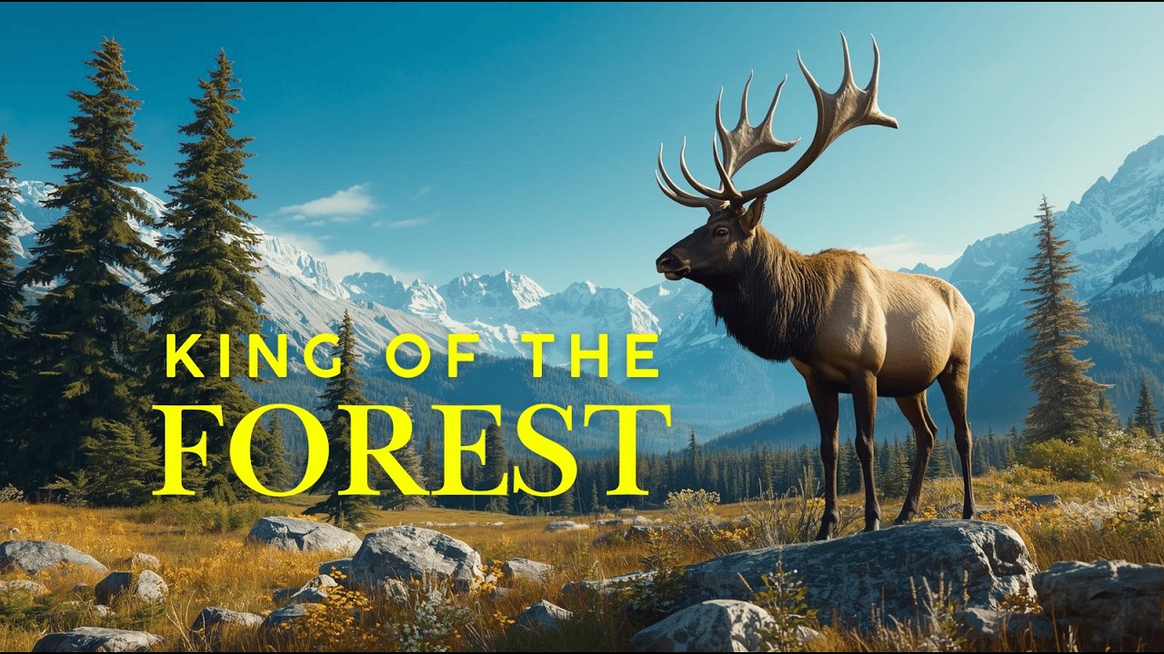
Elk and Road Ecology: Wildlife Crossings and Connectivity Conservation
Added:The concept of habitat fragmentation and its ecological impacts on biodiversity and wildlife populations.
Basic principles of wildlife telemetry and tracking technologies, specifically how GPS collars collect and transmit spatial data.
Fundamentals of road ecology, including the 'barrier effect' and 'roadkill effect' of linear infrastructure on animal movement.
The life history, migratory behavior, and habitat requirements of large ungulates, particularly elk (Cervus canadensis).
Civil engineering and design principles of wildlife crossings, including the structural differences between overpasses and underpasses tailored to specific species.
Advanced landscape genetics to evaluate how physical wildlife corridors affect gene flow and prevent inbreeding depression in isolated populations.
Environmental policy, transportation legislation, and funding mechanisms (such as federal infrastructure grants) that support public-private conservation projects.
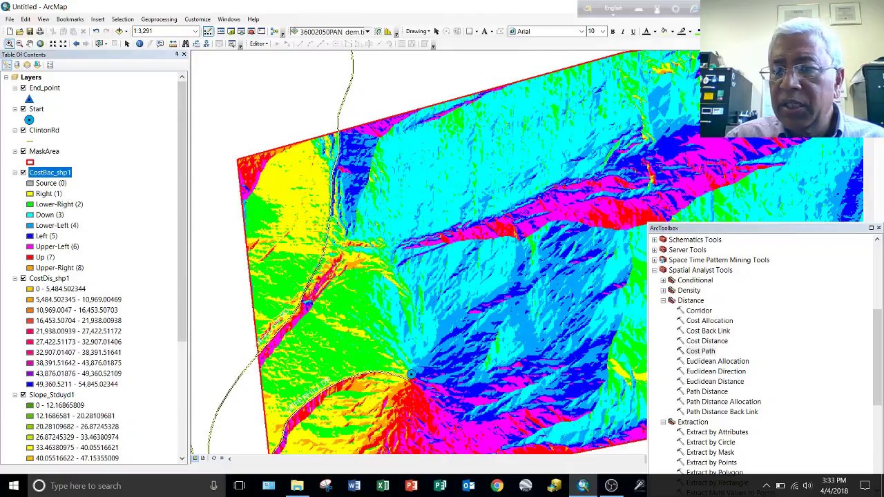
Applying GIS and spatial modeling techniques, such as Circuitscape or Least-Cost Path analysis, to map and predict regional wildlife corridor networks.
902 views1likes45:54Original Release: 2018-08-01
hi everybody i'm tracey butcher the director of outreach for wetlands network and i'd like to thank you for taking the time from your very busy schedules to join us today we are very excited to tell you about our road ecology working with carolina conservation winds are a bit rare lately so we're very excited to report on our inspiring work and good news I'd like to begin by introducing dr. Ron Sutherland our conservation scientist and eastern program director Werner is responsible for a swath of project starting with designing habitat connectivity models for the entire southeast coordinating a collaborative effort to map the entire eastern wild way and passionately driving our red wolf recovery efforts including an extensive camera-trap project in the red wolf recovery area in North Carolina between 2013 and 2015 Ron ran a successful campaign for wild lands Network to save the 79 thousand acre Hoffman forest in eastern North Carolina and it was stopped from being sold and destroyed by private buyers largely to his efforts ron has earned his bachelor's degree in biology from North Carolina State University and has a master's in conservation biology and sustainable development from the University of Wisconsin at Madison his master's research research focused on the conflicting goals of population and wildlife conservation within villages near the I'm going to try to pronounce this properly brought cayenne a tional park the largest national park in bolivia he then went on to receive his PhD in environmental science and policy from the nickle school of the environment at Duke University where he studied the response of wildlife to urbanization and vehicle traffic in the Sandhills region of North Carolina Ron lives in Durham North Carolina with his wife his three children and a dog named Henry and few people know this about Ron but fancies himself an excellent ping-pong player I'm also going to introduce to you Emily Blanchard she is a conservationist working for a wild lands Network she's been under the weather and was going to help present today but I'm had voiced a little bit so she's present but won't be presenting but because so much of her work is involved in this we I wanted to make sure you got to her emily manages a rather large and important portfolio of field research projects for wild lands network in the southeast she coordinates our camera trapping in the red wolf recovery area and really have more than a hundred cameras cataloging the occurrence of game species red wolf activity and other species of interest she's evaluating our wildlife bridge monitoring data in Durham and monitors the GPS collar delft movements at Western North Carolina you'll hear more about these projects today Emily also is this wrong and our partners with GIS mapping and she coordinates a North Carolina Wildlife strobe working group she also leads the student Red Wolf working group in the Triangle region of North Carolina she graduated from Barnard College Columbia University where she majored in Environmental Policy and she worked in the environmental health and justice field before being selected for a year-long fellowship for an environmental photojournalism project called faces of environmental change she obtained her master's of environmental management in 2015 from Duke University and her master's research on forests elements and the effects of hunting on wildlife communities in Gabon if ever Emily takes a break from this full plate and meaningful conservation work he likes lighting her step by studying foreign languages astronomy and quantum physics so move on from these two very talented people before I hand it over I would just like to mention that if you have any questions throughout the presentation please type them in the question box and this is typically located on the right side of your screen in the dashboard after the presentation we will address questions and if there's time we will open the floor for discussions to all participants so thanks once again for joining us and without further ado I'm going to hand out great thanks Tracy for the introduction and thanks everybody for tuning in this is exciting happy to have the chance to talk to you about some of our road ecology projects that were doing here in the Southeast United States and I thought I would start a quick story but about this the bear you're seeing on the screen that's a real bear and we were driving on a road we're on the way to check some of our wildlife cameras down the red wolf recovery area and we came across this young bear wandering aimlessly down the middle of the road we ended up having to go around him to get down to where we were going and on the way back he was still there walking across the road just had no idea what he was doing and we later we talked to a waitress at a local restaurant in Columbia she said the locals all knew about the bear that he was a an orphan had been orphaned a little too young didn't really have a chance to learn from his mother much of anything much less how to get across roads safely so we don't know that bear survived or not but just a good good individual case study of the dangers that that roads pays pose to wildlife and our landscapes so hopefully made it but let's let's begin I should say a little bit about wireless network for those of you who might not know that much about us we are a nonprofit conservation group whose mission is to reconnect restore and rewire North America so that life in all of its diversity can thrive we work in the United States in Mexico and Canada and we're trying to just stitch together the landscapes back together again so that we have a holistic network for keeping biodiversity on this continent what makes us different from other conservation groups well we've always had this realistic ambitious optimistic continental scale vision of what it would take to protect nature in North America and because of that we've also had this emphasis on habitat connectivity long before it was a trendy subject like it is now but we were some of the early folks to work on habitat connectivity and we're still going strong we also have a focus on top carnivores and other keystone species now because they're they're cute and cuddly or charismatic megafauna but because they are so important for you consistent because that's what the science says hints are work on red wolves and other species like that and then most relevant to today we've we've always had a leadership role in working on Road ecology efforts trying to help wildlife get across roads so why focus on roads and wildlife but it seems obvious I guess you know roads have had lethal effects but you know really it's not an understatement to say that roads are the most lethal barrier to wildlife movement across the landscape particularly here in the East eastern United States where we have so many roads they just really get away and you know to hit that home a little bit this is not a red-eyed tree frogs is a barking tree frog unfortunately had to run in with a car on a road dairy because I found it on my PhD work and you know it's just it's just sad you think of the way while life gets hurt on the highways yeah I can show you a lot of pictures from my PhD and from just the animals we've seen driving around doing the various field projects here's a bobcat that got run over the roads they kill and maim individual animals they endanger population sometimes even endanger entire species they block seasonal migrations you've probably heard of the like the path of the pronghorn or the mule deer migrations up by Yellowstone they hamper climate adaptation a lot of species need to move for climate change and the roads get the way of act they interrupt gene flow that's very important to maintaining healthy populations and just overall roads from ruin habitat connectivity so what are we doing about it and why does it work well you know that what the science shows is the best solution besides not building the road salt or besides ripping the road mouth which is another thing we can talk about but the best solution according to the data we have so far is actual structural improvements why live road crossing like this one that health animals either go over roads or under roads without actually interacting with cars at all and things that rely on drivers to avoid hitting animals don't seem to be nearly as effective as actual physical separation and you know a lot of folks have seen pictures of fringes like this one in Vance national parks they're kind of internationally famous thanks to Facebook there's some great memes going around of all the wildlife crossings in Europe right now the United States we're still playing catch-up in this arena there's more of them in the western United States and the in Florida does have a healthy number of wildlife crossings right now but we'd like to use to catch up and the sort of big question becomes where can we put these wildlife crossings to have the most positive impact for wildlife in this part of the continent and unfortunately while the network happens to be sort of experts in habitat connectivity and we've done various maps and models of connectivity priorities across different scales here I'm showing you the our entire eastern wall a network this is a draft design that we've come up with for base to the entire eastern portion of the continent showing green project green core areas and yellow potential corridors so if we've looked at connectivity at FF scale we've done connectivity models at the regional scale here this is a timber rattlesnake model we did for the South Atlantic landscape conservation cooperative stretching from from the panhandle of Florida up there at southern Virginia and the green areas are sort of higher predicted flow of rattlesnake on the landscape and then here at the sort of sub regional level if you're looking at Western North Carolina we mapped out some priority wildlife corridors for the Blue Ridge forever coalition of land Trust's and the quarters are shown in red and yellow groups existing protected areas are shining green there and when you think about the basic science of where to put wildlife crossings it's not too hard if you know where the priority areas are for wildlife movement on the landscape and you know where the major roads are there's shown on black on this map then you can fairly easily identify the intersections of those those two components so that those are trying to blue hopefully you can see some of these areas in blue on this map so you know the question is how do we do that at a scale that we can identify you know the priorities of where to put these these crossing structures we've done that for North Carolina at a statewide scale back and we finished a report in 2017 where we use our own wildlife connectivity data we use a wildlife vehicle collision data like beer collision data from the North Carolina d-o-t and some other variables and we actually priority made a prioritization for wildlife crossings across the entire road network for North Carolina in 2017 and I consider that if you would like me to but you know the the the modeling and the the connectivity modeling is only one approach you know we've used Clemson supercomputer and other things but we enjoy fieldwork just as much and so that the bulk of my presentation today is actually gonna focus on two ongoing field projects that we have underway right now and one of those is here in Durham in North Carolina where I'm based and in terms part of those rapidly urbanizing suburban izing Triangle region of North Carolina there's not that many opportunities for wildlife movement left but the the new hope Creek corridors shown here there's some green protected areas it's sort of a remnant wildlife corridor that stretches from the Jordan leg game lands south up to Duke forest and then to the Eno River State Park and bog lake has some game land as well so this this urban wildlife corridor actually is a crucial component to connecting about a hundred thousand acres of wildlife habitat in this otherwise very urban environment and we are monitoring two bridges two very different bridges in along this corridor so far we might like to expand that in the future the big one is this bridge over in 1515 501 and it's a it's a huge bridge is 300 feet long now and it's got an interesting story this bridge they were going to widen the highway back in the early 2000s and some local environmental advocates sort of caught wind of that and they actually banded together and pushed really hard to make sure the d-o-t so a new thing they recognized the value of this this new Hope Creek corridor and they pushed really hard and made the d-o-t make the bridge wider and taller than it otherwise would have needed to be just for the the traffic alone so we ended up with is this magnificent 350 NC State University did a pre study of the old bridge looking at wildlife going on the old bridge and they admit that they would do a follow-up study but nobody ever did a follow-up study so the situation was right for a while the network to step in and we wanted to evaluate how well does this big investment in wildlife movement was actually working so we've gone in and we've installed cameras using some some custom wooden mounts we weren't allowed to to drill them into the bridge where we did get permissions been a deity to put these cameras out there under the 15501 braids I think we have 10 cameras now such a huge grade - takes a lot of cameras to monitor what's going on underneath there the the other bridge nc54 it's a lot smaller in fact I don't have any good pictures of the whole bridge because it's small and obscured by vegetation but we're able to use just four cameras under that bridge and we wedges them in there with these fancy box structures you can see here between the concrete girders there that's what we had to work with I should say that these these camera mounts were we had help designing and building them from a couple of folks John Kent there on the left he actually was one of the people that advocated for that 15501 bridge to prove it the first place and then John Sutherland on the right that's my dad he helped build these things too plus he helped me learn how to do woodworking so he's got lots of credit there and so we've been checking these cameras at the Durham site now for just over a year we're building up a nice data set and we're seeing a ton of deer going under the 5501 bridge which is deer not an endangered species but from the human safety perspective that's very important and we think there's also smaller species going under as well but here's like we're getting herds of up to 12 deer go under that bridge at once different sides of the creek as well so here's some of those we're also getting coyotes it's probably the second most common species under there right now and then some other species raccoons possums even a groundhog or two going under there and then the nc54 bridge more or less sort of the same types of species but we're getting we're seeing less deer less big groups of deer going over there harm continue groups so it's a smaller bridge doesn't seem to have the room for the entire herds of deer - under at once that's interesting and what we're or hoping to do now is take all this data and present or take it integrated together do the analysis you know it's one thing Emily's can be working on is running through this analysis figuring out how many how many do your extras onto the bridge and we want to make a nice video out of this thing and take it to the public as a success story of how this Durham 5501 bridge is actually working to promote wildlife movement under this or process it's really important wildlife corridor and we think we can do that we can make this you know it's an important wildlife corridor for its own right it does connect to different river basins the new system to keep your River Basins but we also think that it can serve as a really good case study and because it's here in the Triangle we have a lot of good environmental environmental support here in the Triangle area of North Carolina we think we can use it to leverage investments in other wildlife crossings around North Carolina and possibly even other salvation states so it's going to be a good a good sort of successful case study now 15 geographies a bit the other field project we have is going on right now in Western North Carolina where we're looking at and trying to get elk across interstate 40 next to Great Smoky Mountains National Park and this this area is famous for being a biodiversity hotspot not just for plants and trees but also for things like salamanders this is a global sort of richness map for salamanders and you can see that the red area here in in Western North Carolina Tennessee and so forth it's actually the sort of the global hotspot for salamander richness in the entire world so this area's is very diverse you know Great Smoky Mountains National Park which some sort of roughly here by the blue it's been the subject of some all taxa biodiversity surveys now for a number of years we just know that it's tremendously diverse it's about a half a million acres tons of mature hardwood forests and just all kinds of different environments and there's so much diversity there and that that diversity with climate change some of those species are going to want to move north you know along the spine of the Appalachian Mountains going all the way all the way up into it you know the feast and into into Canada and and other species you know they they just need they need more than half a million acres as we've seen in even Denali National Park is turns out not to be big enough for for holding all of its wolves inside Great Smoky Mountains National Park five thousand acres is huge but if we need the connections between the National Park and those national forests around that's the park to stay sound for the biodiversity things like bear and Bobcats say they need more than half of my neighbor's unfortunately there's a big interstate that runs right on the northeast side of the park interstate 40 which goes from the coastal North Carolina all the way up to California and i40 it basically blocks that wildlife movement opportunities particularly to the north so that climate change adaptation direction is stymied by this big interstate highway and in that area the interstate runs through what's called the Pigeon River Gorge and it's a beautiful gorge it's really shame that there's interstate in it because if it was a hiking trail if this would be one of the finer hiking opportunities I think in the East Coast but instead you know it ends up having a four-lane busy highway and with rocks steep rock walls on both sides it's kind of the last place that you would want to run into an elk or any other large species I'm sure the elk would agree you know we want to prevent this thing an elk elk were reintroduced into Great Smoky Mountains National Park in the early 2000s and they've been doing pretty well ever since the population has grown up - there's different estimates I think counting the outs that are outside the park I think they're up to somewhere over 200 250 oak now in that area and there the population continues to grow and we expect there the habitats outside of the National Park is actually better for elk they're kind of an early successional species and so that mature hardwood forest in the park is not as good for them as the grassland private private areas outside the park so they are expanding and moving and the question is how can we keep scenes like this from becoming more and more common in North Carolina nobody wants to hit us a thousand pound elk the good news is that studies out of the West have shown that elk will use these wildlife crossing structures both underpasses and overpasses and so the the question becomes where can we put these droppings to help help to get across i-40 helped other species get across i-40 and other Road nearby that are also hitting up the elk population at the National Park to address that question you know Emily spirit and effort last year we started this GPS coloring project to help with health the National Park Service and we're also working with National Parks Conservation Association and the North Carolina Federation and the North town Wildlife Resources Commission some other partners as well to work on this and what we so far we have five out of eleven elk colors deployed on some elk and we're going to put the rest of them out this fall when the weather turns cool and the current crop of calves is grown-up enough with mothers can take a break from the calves long enough to get a Colorado so these different colors show you the five different health to do just some of the recent locations all the locations we've had since the collars were deployed but if we look this up here's i-40 running along the side of the park you know Cherokee National Forest and this is the National Park here my cursor and zoom in on the elk up there at i-40 we were fortunate to have one else that we already knew of that we knew had showed up along i-40 on the other side of i-40 from the place where they'll hang out during the winter in Cataloochee and so we were able to call her color her and she has not disappointed us she's I already showed us several places where she crosses this interstate and so we're excited about that and we think that she can be a great ambassador for her species in terms of teaching us where she would like to cross the interstate and here she is we were able to track her down using her latest collar data and she's doing well she had a calf after we had a collar earlier the spring and so it you know she's doing good other elk that we've colored have gone in the other direction they've gone south it's harder you know it is hard to know we got lucky with the one but it's hard to know which direction they are going to go but some of the other outs are going out towards Maggie Valley right here and there's a highway that comes through this area it's called u.s.
19 in that area actually possibly gets even more elk vehicle collisions and i-40 does probably because there's a lot of private land private you know farmland and grassland along this road and as you can see with this animal it's spending a lot of time along that highway and so it's not surprising that we're getting more vehicle mortality it is going to be interesting to try to figure out how to mitigate that when you see this animal uses several miles of this highway and crosses back and forth on a regular basis so that's going to be pretty interesting to try to sort out while it's working we're going to keep going with those the GPS collars will put more on this fall and keep going with the collars next year as well in the meantime we're also going to deploy some other data collection methods to sort of round out the up data because you know we can only do somebody else with the colors but we can also use cameras so we're going to be deploying a set of I think at least 80 motion sensitive wildlife cameras along this portion of i-40 next to the National Park and we're not going to put them sort of randomly out there on the landscape we'd like to put them in places along the road you can see these these a couple pictures here so from the Virginia G ot they did a similar project on an interstate in Virginia where they put cameras along the road and strategic points so for i-40 we are going to identify places hopefully with the help of an engineer identify places where it would actually be feasible to put wildlife crossings along that stretch of highway because given the rocks and cliffs and things not every part of that that highway is actually feasible and then if we put cameras up along those the feasible points then and collect wildlife data for for a period of a year or two then we'll be able to compare them and say which which areas that are feasible are also the most important for for wildlife moving along that road and might be the most important and this sort of thing is important yeah when I was out in Utah a year or two ago for a road ecology meeting we got to visit a road crossing site that the Utah G ot put in and they put in quickly without really thinking about a little movement and without any data and what they found is it didn't work at all even though most most studies have shown really high success rates for these things but if you put in the wildlife crossing where no wildlife actually wants to go then you're going to end up with with poor results and that bad well these things are expensive so the camera is going to be helpful we also want to put some of the cameras out on some of the existing crossing point that that might be suitable for wildlife already and the most obvious of those is this there's a double tunnel where the interstate goes through a mountain and the land bridge over the highway there is sort of obvious route for wildlife so we'll put cameras up there and there are a few other bridges underneath the highway for her small roads like the one shown here and creeks and of course the Pigeon River itself there's a few bridges where the Pigeon River cross kept under the interstate so we'd like to put cameras under those as well to see how well they're already working for wildlife and it could turn out that things like this I mean this looks like a while that process to me already it's a quiet gravel road and what's missing perhaps is pinching one of the components of successful Wilder crossings is having fencing to steer animals to these crossings so it may be that with with some enhancements like better fencing that we can we can make these existing holes under the interstate work to work a lot better and then focus our attention on the gaps between these existing structures to nowhere else we would like to advocate for putting wildlife crossing structures so and lastly we also want to combine in some roadkill surveys and someone that can be done by car you can see a dead deer else or a bear by car but walking surveys in places where it's safe to walk on these sort of the other side of the guardrail from the highway are have been proven to be the sort of the most effective way of really surveying the small animals like you know that the snakes here the dead timber rattlesnake which is important species up there at the mountains the salamanders that we talked about the high salamander diversity you're not the salamanders driving along the interstate at Interstate speeds so but if we can get out there and walk them on the interstate we actually might be able to target some of these smaller species with roadkill it will also be will be asking the State Highway Patrol in both North Carolina and Tennessee and also the road cleanup crews when they respond to a deer you know to your vehicle accident to record a more accurate location the VOT and highway safety folks they keep that sort of data but they don't always keep it very accurate and which from our standpoint we want to have this precise of data as we can so we're going to work on getting some standardized data collection methods going National Parks Conservation associates and helping us with that but trying to get the agencies to sort of cooperate together have a standardized data collection method across that that stretch of interstate so that's you know I guess going back to this you know we're going to get all these different data sets together the the roadkill data the the camera of data and the elk GPS data we're going to integrate those different datasets together into what we hope will be a complete picture of what's going on with wildlife with respect to this the stretch of interstate between the National Park and the National Forest to the north and then we hope we will be able to advocate successfully to the North Carolina and Tennessee Department's of Transportation to start thinking about you know to implement our recommendations so we hope it will identify at least a few key locations where these wildlife crossings would make sense and would have the most impact for protecting my life and enhancing the flow of biodiversity out of this tremendous National Park and you know what we've learned in some other states is that a small group of sort of concerned citizens and environmental advocates conservation groups can work together and and push for these things fairly successfully particularly you know if we're able to bring the public along convince the folks in Nashville and Knoxville that this is a big priority and also generate some seed funding if we can if we can put together some seed funding that gets these presses like if we identify a key place for why like crossing a high 40 if we can put together a small pot of money to get that project started we can leverage that money this has been done in states like Colorado in other places leverage that money with State dollars and then use the state dollars to leverage federal dollars and actually find a way to pay for these structures and get them implemented more quickly than you would assume that's the basic plan for the smokies project future research directions I should mention a few things that we we think are important to keep looking at we've done worked where we've identified sort of lots of different wildlife crossing opportunities around like North Carolina around the southeast and that can be overwhelming when you're trying to talk to the d-o-t talk to the media and talk to the public so what we'd like to do is try to narrow down our lists of important places to sort of top-ten lists or even top three lists so we'd like to be able to someone ask us we'd like to be able to say what are the top ten most important wildlife processing opportunities few places to put these crossing structures in North Carolina so then if something comes up and funding and becomes available then we could we can push them same thing for those and be entire southeast what are the most important areas for the southeast and then for the entire eastern blob way from Florida up to Quebec say what are the top 20 wildlife crossings for that entire wild way and how can we make that into a campaign to focus attention on those those keys places that would really you know if we can mitigate the roads and their impacts on wildlife and those key places you know we actually be making progress that's when one area will be working on the next year or two and then what another thing that near and dear to my heart since I did my PhD in a longleaf pine forest environment we don't know very much about how to get wildlife across roads in lonely find ecosystems and these are sort of the biodiversity hotspot of this healthy stream coastal plain from Virginia down to Florida and around over to East Texas and these ecosystems are sort of they're also a biodiversity hotspot there they're full of reptile amphibian species and those reptile effeminate species are sort of universally bad at crossing roads they say hop on the road and they stop and watch the car smush them or in case of like timber rattlesnakes or other species like they crawl across the road like 1 mile an hour and they just have done basically no chance of getting across so we need there needs to be more work done to identify not only how to build a crossing either over under the highway but also like the types of fencing that would work to keep small animals you know go for frogs or tiger salamanders and things chain link fences don't work very well for herbs so if we got to figure out how to how to do that to facilitate this this particular location here is sort of stylist to the showing that the two halves of the same field gameland north carolina which add up to about 60,000 60,000 acres a nice long leaf pine habitat and tragically there's this four-lane highway us one that goes right between the middle of them it is an opportunity though we think to where we could we could work on convincing to do tea and other another groups to mitigate that by putting some great wildlife possibly on the policy front there's some good things to talk about you know right now thanks to the leadership of our DC staff or student homes there's some headway being made with a national wildlife corridors act and if this act would be sort of to wildlife corridor is what the Wilderness Act is to Wilderness it would help designate official national wildlife corridors around the country and then we'd sort of sphere funds and and policy attention and protections towards those corridors including we think an emphasis on mitigating roads within those corridors so that national on the quarter is access it's doing surprisingly well given the political situation can be see right now and I thought I should mention it's easy to assume that everybody in Congress is not the very environmental friendly right now with the there are some true champions for wildlife left in Congress like representative Don Byers shown here up on the Appalachian Trail with one of our staffers on a hike and Don Beyer is championing the National Wallet quarters Act he's also doing all kinds of other great things for wallet so you know represented by us here keep up the great work we need more folks like them of course and then I should say is at the state level we're also working hard to implement state wildlife corridor legislation that would do sort of the same thing but at the state level push for these push for designating and recognizing the importance of wildlife connectivity in different states and that would also lead towards improvements we think in getting wildlife across these roads in addition to sort of to designating official corridors and identifying the key places to put wildlife crossings across roads another the other key limiting factor is funding and these crossing structures have been shown to be very effective but they're also there they are expensive there they've been shown to be cost effective in terms of the you know if you look at the property damage and the cost of sort of human life and injuries versus the cost of the structures that they pay for themselves but you have to come up the money the way unfortunately you can't sort of pay in advance the saved amount of of collision damage and that kind of thing so we need to find a way to pay for these things upfront so we can recognize savings down the road one strategy I've come up with would be to push for something like a two cent tax on gasoline and it would pay for not just wildlife road crossings but also for strategically week think about combining that with a pedestrian crossings for humans to get across roads as well so put those two coalition's together the people that care about wildlife people care about to end up not seeing animals down the road and then all the folks that care about greenways and human safety so forth up that's two huge coalitions that could come together to support something like this and then you can add in all the people that would be involved in actually building these things with a two cent tax on gasoline would pay something like a billion dollars or more per year and that would be thousands of these structures getting implemented every year that would put a lot of people to work and so we think we could we could build a coalition around this and again you know if it's not going to happen at the federal level just yet we can push with it but state level and try to get some states to adopt something like this so we actually have a funding stream to pay for mitigating but life getting them across roads so we're housed at the end here and I do want to thank our many partner organizations for their health and in this exciting work we're doing it's great to have good partners and all the work I've been talking about has been funded by private donors to violence Network so I really wanted to give a shout out to them just you know none of this would happen without the score we get so thank you and those four exam and if we're extra kind of anybody knows these two species of snakes that are intertwined up here you can email me afterwards fittingly for the discussion today of course they're they're both roadkill unfortunately but they're beautiful animal so how can you help you know you're out there listening to this presentation and you want to do something that can thicken health you know save save that turtle you see crossing the road we saw a couple bucks turtle this this weekend because of getting a lot of rain this time of year do it carefully don't they don't become roadkill yourself can be easy to get hurt doing that kind of thing but scaling up you know you could be the person that starts that local initiative to reduce roadkill in your local area like you know like John Kent and others that have pushed for the better Ridge here in Durham maybe there's a bridge project in your area or road projects where you could actually be the person that stands up and tells the d-o-t you know yes you actually have to take wildlife into account when you're doing this project showing that local enthusiasm for protecting wildlife is is really important one thing that's less intuitive is to go talk to your local Land Trust there's land conservation groups and encourage them to be open to buying land at key places for wildlife road crossings and it's counterintuitive because you're we're asking land trusts to buy land you know next to an interstate highway which traditionally has been it's approved in the last place you want to buy land for wildlife in particular if you're trying to conserve animals you don't want it next to the highway but in some cases these these key key corridors where we want to connect the landscape we need to have land on both sides the highway the d-o-t state deities are reluctant to spend the million dollars to build a wildlife road crossing at a given site if the land is not protected on the on either side of the road because it developed in fact we saw that happen in North Carolina down it's down at the coast the deity did though the wildlife crossing I think on the way out to Oak Island and then the land and one side of the crossing is they were building a bridge and they made it better for wildlife and the land on one side of that bridge ended up getting turned into a development so it's sort of ruined their investment so we need land trusts to to buy into this effort to protect wildlife crossings and if we can protect them then that sets the stage up for them advocating for implementing that the actual structures and then you know that the federal level you know folks in the US if you can ask your congressional representatives your your you know US reps and your Senators to support the National while that quarters act or even co-sponsor it with the representative buyer and I think represented graves is the Republicans that we're working on right now as well ask them to support this national walnut quarters Act there's there's a lot of websites you can go to and to find your members of Congress we don't know where they are how to get their contact information but there's there's one of them and if you're going to take the time I suggest calling right now emails we think are slightly less effective so if you have the time to call your aggression representative ask them to support this National Wildlife quarterback then also now will be a great time to ask them to support the Red Wolf stand up for red wolf conservation there's only 35 red wolves left in the wild and we can send you out the link there's also a public comment period going on where you can communicate directly with official multi-surface but the fish line service in many ways is written right now is responding to Congress and so we need Congress to sports rebel as well and then you know even bigger picture that you know you probably notice that that there's an attack being made right now on the entire Endangered Species Act so again if you if you get your congressional representative or their staff on the phone ask them to also stand up from the endangered species act public we know the public supports it but they need to hear from you over the next few weeks about that the red wolf comment comment period I think in July 30th so it's a little bit more more original effort and lastly you know if you if you aren't already donated while as network or even if you are please for donating supporting us this kind of road ecology work that we're doing is not cheap buying those cameras there's they're fairly expensive checking the cameras doing all the fieldwork doing those a roadkill surveys my kind of thing it's expensive we'd like to hire that engineer to help us identify the sort of the feasibility of where to put these structures on i-40 of the mountains here in Durham we want to hire a videographer to help us make that video to really to compellingly tell the story of how wildlife are getting under this busy highway so all these different things we have we need times for so please consider donating the Wilders Network today that would be really awesome so with that I think that sort of wraps up the presentation if you have questions there's my my contact information but I will now take a look at the questions and just read it you have questions feel free to keep typing them while we look at these and I'll go through as many as we have time for so let's see here fine down means that you know I'm Joel readings one question here that show answered person yeah let's see the window is so small let me what do studies of post installation of crossings tell us without effectiveness in use by their studies that tell us how often and whether animals create alternate routes around them to avoid or otherwise north yeah well start with that one the the best data for evaluating wildlife problems from Banff National Park actually the folks at the twenty Clevenger and others at the Western Transportation Institute study those those crossings for I think decades really and what they found out there was that for the first few years they looked like they weren't working at all or it's not very well and then things like like the grizzly bears and the Bears it took them a few years to find them the crossing structures but once they found them then they started using them and then they the really cool thing is they started showing their their the other the bear cubs how to use them and so it became an intergenerational thing so that is that data shows that those structures actually were very successful I think that's been that sort of thing has been found for most wildlife crossing structures of them I'm familiar with around the country they've generally has been trying to be pretty effective so our Landscape Architect guys mess the same all right cool any other any other questions I think now okay Tracy do you see any other questions that we we should address right now or no I think that's it wrong um I think you're good okay well the folks have my contact information there if you think of more questions and I think we'll we'll be emailing some stuff out right yeah and I'll go ahead and wrap up for the day I would like to thank everyone one more time for joining us today and I'd like to take this opportunity to reiterate what Ron said about very grateful for all of you bringing your passion and your resources to wildlands network we could not do this work without your support and participation in advocacy and friendship you'll soon receive a follow-up email from us with a link to the webinars recording and we invite you to share this with your friends family and colleagues anyone who might want to learn more about this road ecology work in the southeast and for those of you who may want more detailed information or have more questions that you think of later please do contact Ron at wild lands Network org and he could also he and Emily can help you get more involved if you'd like to do that as well and if you'd like to make a donation or you'd like to discuss your giving plans for the year you can contact me I see at wild lands Network org have a great week have a great weekend remember we're sharing the roads with millions of critters so drive safely thanks so much everybody thanks folks I Ron thanks yep
Up Next
48:33
Wildlife Connectivity Projects in Vermont's Green Mountains
@vermontfishwildlifedepartm6195
236 views•2024-11-19

15:54
Life in Biosphere 2: Sustainable Ecosystems & Human Survival
@TED
334.9K views•2009-06-16

14:30
Microplastics Everywhere: How Plastic Impacts Our Lives
@TEDx
100.9K views•2018-05-08

10:28
Ice Stupa Artificial Glaciers: Solving Ladakh's Water Crisis
@SonamWangchuk66
3.2M views•2015-05-03
Related Study Plans & Knowledge Roadmaps
Structured learning paths in Environmental Science
environmental-science
Ocean Noise: Cetacean Impacts & Mitigation
01Fundamentals of Underwater Acoustics
02Marine Mammal Bioacoustics
03Anthropogenic Noise: Shipping & Seismic Surveying
+ 2 more learning modules
16h5 modules
Explore Roadmap
environmental-science
Road Ecology: Corridors, Overpasses & Fencing
01Foundations of Habitat Fragmentation and Carnivore Ecology
02The Road Barrier: Ecological Impacts of Transport Infrastructure
03Principles of Ecological Corridors and Connectivity Mapping
+ 3 more learning modules
14h6 modules
Explore Roadmap
environmental-science
Ocean Acidification: Kelp Buffering & Shellfish
01Fundamentals of Ocean Chemistry & pH
02Chemical Pathways of Coastal Acidification
03Bivalve Physiology & Calcification Under Stress
+ 2 more learning modules
18h5 modules
Explore Roadmap
environmental-science
Ice Stupas: Glacial Retreat & Water Security
01Foundations of Glaciology & Mountain Hydrology
02Climate Change and Glacial Retreat Dynamics
03The Science of Ice Stupas & Artificial Glaciers
+ 2 more learning modules
14h5 modules
Explore Roadmap