











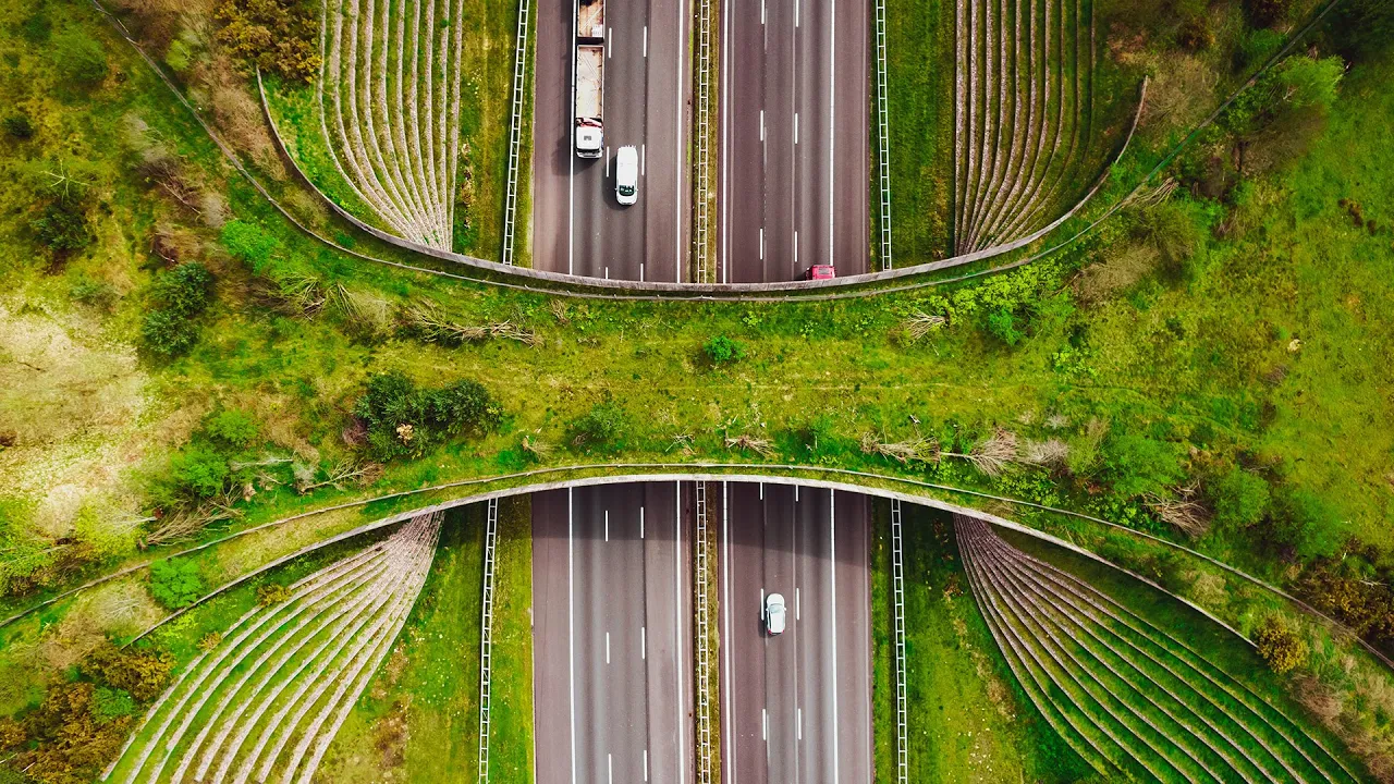





Wildlife connectivity projects in Vermont's Green Mountains aim to maintain healthy wildlife populations and enable species adaptation to climate change by reconnecting forest blocks separated by major highways like I-89 and Route 2; these projects include oversized culverts, wildlife shelves, and highway underpasses designed to allow safe animal passage while addressing both wildlife movement needs and transportation infrastructure requirements.
Wildlife Connectivity Projects in Vermont's Green Mountains
Added:The concept of habitat fragmentation and its ecological consequences, such as genetic isolation, edge effects, and reduced biodiversity.
Basic principles of landscape ecology, specifically how patches, corridors, and matrices influence wildlife movement.
How climate change drives range shifts, forcing wildlife species to migrate latitudinally or elevationally to find suitable habitats.
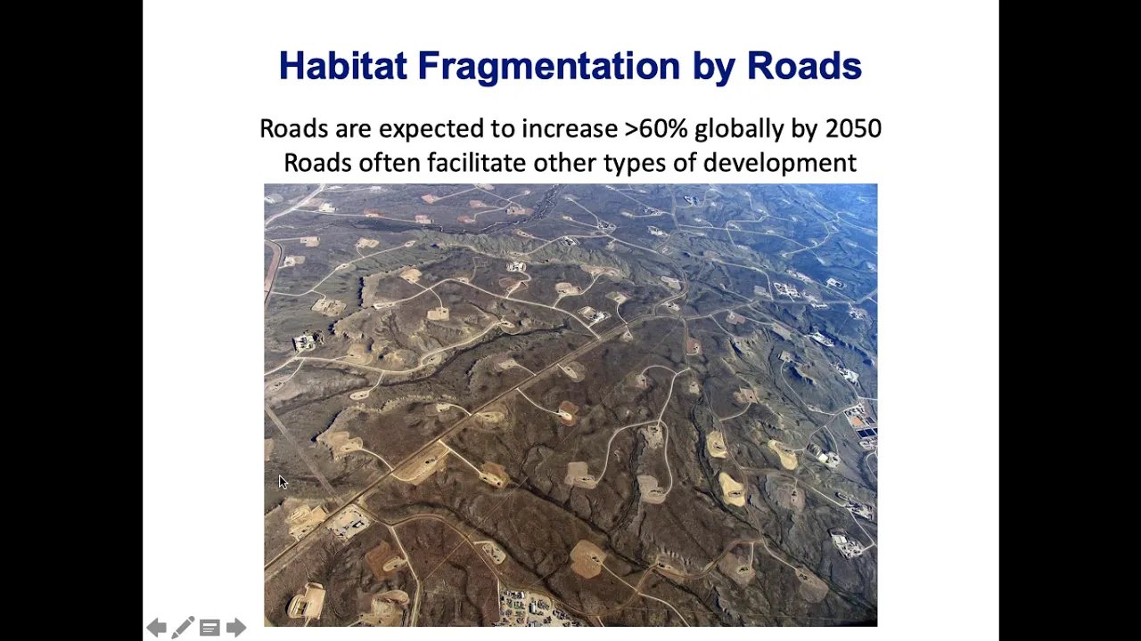
The direct impacts of anthropogenic infrastructure, like major highways, on wildlife mortality and behavioral avoidance.
The engineering and design principles of wildlife crossings, including ecoducts, underpasses, and specialized culverts.
Using Geographic Information Systems (GIS) and spatial ecology to map and model potential wildlife corridors.
The role of environmental policy, community-led initiatives, and private land conservation easements in securing contiguous habitats.
Methods for monitoring and evaluating the success of connectivity projects, such as camera trapping, track plates, and genetic sampling.
236 views4likes48:33Original Release: 2024-11-19
all right well here we go um well again welcome everybody it is great to have you with us uh my name is yance hilka I'm a conservation planner with Vermont fish and wildlife uh also with us today is Jesse Johnson a biologist with the Ron agency of Transportation she's going to take the second half of today's presentation on reconnecting the Green Mountains so again great to have you all with us um so uh we are using Microsoft teams thank you for your patience with this uh clunky program um please uh know that we are recording this webinar so you might want to turn your video off uh during the presentation uh please do keep your mics muted during the presentation um and know that we're going to use chat to communicate with you all so we'll be dropping a few links in the chat as we go um uh to offer some background information and uh and you know go ahead and click on those and and have them up in your browser and then come back to the the webinar or or you'll you'll lose them but we're also happy to send those out to you afterwards but for now if you go ahead and and practice using the chat and just type in your name and what town you're from or what organization you're with uh that would give us a sense of of who's in the virtual room and introduce your yourself to each other um all right and then I'm going to go ahead and and jump in so uh also in the back end uh forgive me Dave I didn't introduce you uh managing the back end of today's webinar is Dave and Dave and I are both from Vermont fish and wildlife department and at the department we believe in the conservation of Fish Wildlife plants and their habitats for the people of remont that's a huge Mission it takes us in a lot of different directions Dave and I staff the community Wildlife program and so we offer technical assistance to Vermont municipalities uh we are currently working with a couple of the towns on the webinar today and it's great to have you all with us but we do uh technical assistance so we do presentations and workshops we help with mapping us how we can be helpful in in your Town's work so for today's uh uh presentation we're going to divide things up into four different uh sections and first we're going to think about the larger ecological context of this area of the Green Mountains the really the junction of the northern Green Mountains and the central Green Mountains so we want to dive into that ecological context and then we want to discuss the barriers to Wildlife movement I 89 Route 2 uh the railroad and then we want to talk a little bit about land use planning in that region and see what towns are doing uh in terms of their land use and and how the the municipal piece ties into this larger area uh and lastly Jesse's going to take over and uh and really dive into the transportation infrastructure that's present in this area and also the opportunities with infrastructure to allow for wildlife movement many of you have been on our webinars before you know that we'll take breaks about every 10 or 15 slides uh and that's the time to ask questions so feel free to write questions while we're going um and uh and um and uh Dave will read those questions from the chat uh when uh when the time comes all right so I'd like to start by going on a hike and so here we are in Bolton and we're going to walk up to one of the overlooks near Bolton Dome to get a good view of this area and so across the way you can see the the Camels Hump block uh and we're standing on the edge of the Mount Mansfield Forest block and in between you can see I 89 and Route two here's that same area just on the map and so we're really focused on these towns of Bolton Waterbury and ducksbury and uh you know this area is so interesting because the chain of the Green Mountains really offers a a ridge for wildlife movement with very few Wildlife Crossings the Mount Mansfield block alone is is 71,000 Acres the uh camel's hump block is 56,000 acres and so you can see uh the acreages with the in in blue we're seeing the habit blocks the forest blocks and those are colored by size with darker being bigger and so you can see again 71,000 acres for that Mount Mansfield block 56,000 acres for that camel's hump block the Worcester range that with the putam state forest is 46,000 Acres uh so really there's just a huge concent or there's a concentration of huge Forest blocks in this re in this region that uh is really unparalleled uh and so there's this in in here in central Vermont it's it's really the Lynch pin of a much larger network of connected habitat now over the course of the presentation this morning we're going to drill in and and think about two three different structures that Jesse is going to introduce Pineo Brook shyville underpass and the Little River Wildlife shelf and so I want to talk about this larger context but know that we're headed to talking about very specific structures within this much larger context now Vermont has a conservation design and you can see this on the biofinder website it is a Statewide prioritization and the places in dark green on this map are the most important lands and Waters to maintain for ecological function there three words that we really rely on to to help distill this and those are intact connected and diverse we need our ecological systems to be intact whether we're talking about large Forest blocks or the riparian network excuse me these places also need to be connected to one another uh and there needs to be a larger pattern across the landscape a pattern of connected forests and Waters is important to maintain biological diversity and to adapt to climate change and then lastly we need a diverse array of habitats and Landscape settings when we look at this region in the in on biofinder and and you can see the Vermont conservation design data you begin to understand that this whole region of Central Vermont is really considered highest priority at that Statewide scale and their highest priority because of their size as interior Forest blocks and also their location thatl that context and here I really want to talk about habitat cont con activity so we can take this overall design this dark green and light green prioritization and explode it into its component parts and that's going to help us figure out why a particular spot is called highest priority and so the the maniel block and the camel's hump block are both considered highest priority as interior forest and also as connectivity blocks so connectivity um here in biofinder you you can see that uh that there's a selection of forest blocks that that form this unbroken chain north to south east to west and so this this highest priority area in Orange is really the backbone of connectivity this is what allows for wildlife movement from the birk shears to the Sutton in Quebec from the Adera to the White Mountains these are the plac in Vermont that add up to that much larger system of connected habitat north south east west we can also think of this as we can think of this as something as a wildlife highway that's part of a larger network of wildlife movement now our network of wildlife movement is is huge really there are hundreds of local Crossings across the state and so these purple arrows don't begin to express the complexity of our Network and just how many local Crossings local Road Crossings are super important to add up to this larger network but I'm just trying to give you a sense of the the the backbone of the network Vermont is really at the crossroads of wildlife connectivity throughout the entire Eco region and so here you're seeing the staying connected initiatives eco eco regionally significant linkage areas so staying connected is a public private partnership it's bational it's uh multi-state multi-province at the at the northern Appalachian scale it's more than 60 partners and then there's a chapter that operates just within Vermont and then there are groups that operate within each of the linkages look at those colored blobs right those those uh those linkages uh see how many of them are in Vermont Vermont is really this Crossroads of connectivity across the entire Northern Appalachian across this entire region and so the forest the connected pattern in Vermont is adding up to something even bigger at this Continental scale speaking of the Continental scale um this is a work from the nature conservancy and it uh here's a model of some 2000 mammals birds and amphibians and how they are projected to move in response to to climate change now this is work done uh by a Lawler at all in 2015 and it the na servy estimates that entire populations are moving North and South away from the equator on average about a mile per year and about 36 feet up up slope in elevation and please notice how the Northeast is really this pinch point for this Continental scale Wildlife movement so I'm talking about I'm talking about a network an ecological context right where this this area of the the the junction of the central greens and North greens is a Lynch pin for central Vermont and it's part of this larger backbone that that extends across the entire State and that in turn is incredibly important Crossroads for wildlife movement at the entire Northern Appalachian scale so I just wanted to put this place in a in a very much bigger context uh and and help you understand just how important this location is Dave are there any early questions for me about that sort of ecological context no questions at the moment yens um hi folks Dave here with the community Wildlife program I just want to remind you that you can type questions as they come up into the chat I'll be keeping track of them I can read them out um so yens and um Jesse can answer them live for you in today's presentation I noticed we have a hand from uh from one of the uh participants so we have a moment here so uh if you'd like to unmute yourself and go ahead and ask your question uh we have space for it since we have a nice small group today that would be Wheezy go ahead Weezy well uh we have another question that came in yans um so uh from Norma in the chat um is there a higher priority assigned to south to North Crossing versus west to east no no there isn't um I mean both are important uh but the you know the wildlife that are moving in response to climate change aren't just going north actually if you go due north along the spine of the greens it's sort of dead ends in um in agricultural lands in in southern Quebec so the actual path to continuous forested movement is a little bit more uh North Northeast um and so that East West movement is every bit as important as that north south movement even more than that we have very high biological diversity in the Champlain Valley and uh and less so where we have the larger Forest blocks along the spine of the greens so that East West movement from the low elevation Champlain Valley to the higher elevation of the ridge of the greens is also incredibly important great thank you yens um let's move on for the time being we're going to have another opportunity for break in questions so uh feel free to put those questions in the chat and and Weezy we we' be happy to come back to uh your question when when you're ready awesome thanks Dave so next up I want to talk about the barrier um and so here we are on the side of i89 uh right in Waterbury just on the Bolton waterburry Town Line and at the right you see route two and that uh route two in this section uh carries about 5,000 cars every day and then here we are on 89 and and 89 carries 13,500 cars each day and then pleas notice in the middle of i89 is a jersey barrier that concrete barrier uh and that is 4 feet tall and that's really a significant barrier for small to medium and even large mammals we have anecdotal reports a bear Crossing two lanes of 89 seeing the jersey barrier and turning around only to get hit on the return trip now uh further to the left of this image uh there's also a railroad there's some development down in the valley there's the wusi river there's River Road so while the Forest blocks as I showed you earlier the forest blocks are so close here uh you know there's this the opportunity is ripe and yet the the barriers in the middle are pretty significant um I just wanted to give I know I don't think you're hearing this I forgot to enable sound for you all but uh I just wanted to give you a sense of just how busy this section of Road really is uh it it's really quite dramatic uh in terms of the sheer volume of cars and so if you think about trying to find a gap between cars during the day uh it's it's really quite uh quite a challenge uh obviously there's a lot less traffic uh during the evening uh and at night in particular and so there are opportunities to cross 89 but uh it it's it's it's a tough business now the barrier effect here actually goes back quite a ways to when Vermont was only 20% forested in the early 1900s and at that time Vermont's black bear populations retreated to high elevation refugia in the in the the northern Green Mountains and in the Northeast Kingdom and so Vermont's black bear population really exhibits surprising genetic structure around the subpopulations considering how small Vermont is and so the results indic are indic indicative of restrictions in in gene flow so what we're seeing here is is what our our our bear biologist refers to as a linear sorting that occurred when the bear population was restricted uh and yet today the high way continues that uh continues to limit genetic exchange so to be clear the highway did not cause this these subpopulations uh to form but the highway is reinforcing that pattern of maintaining um separate genetic populations so it's really interesting to me to understand you know that the the role that landscape history has played and also the road the role that roads are playing today so we have uh done work for years in this region to understand the barrier effect of i89 and Route 2 to get a better handle on the amount of uh species diversity that are in the habitat blocks on both sides of 89 to understand more about the crossing that happens under or over 89 or or not so in 2014 the agency of transportation and and the Vermont fish and wildlife department got together and worked with McFarland Johnson to do a study of this area and here's the the study area um and so in green is uh is is permanently conserved public land uh the green dots are locations where we had game cameras trail cameras set up in red are transex and so they the Consultants did winter tracking where they they walked uh basically between the two camera locations and looked for any tracks that crossed their transect their path of travel uh and were able to record a surprising amount of species diversity in these Forest blocks on both sides now the Consultants also walked along the median of i89 and walked along River Road to get a sense of that over the road movement and there were cameras at several of the structures to try and capture any under the road movement so here's some uh here's some uh data uh and I have highlighted those three structures that I introduced earlier Pineo Brook shyville and Little River now Jesse's going to tell you a lot more about these but for right now I'll just say that there's really very limited movement uh using these three structures now after this study Little River uh became the site uh has become the site of a wildlife shelf under I 89 that has actually been terrifically successful and Jesse will tell you more about that but PR construction uh there was uh some Fox usage uh you know some uh some dog usage uh but but not that much but then we were able to uh to put in a wildlife shelf uh and and that that that side of the um of this uh area of interest uh has a lot more passage than it used to look at that shyville the the structure in the middle there was one Mink that crossed through that structure once uh and Pineo Brook will will introduce as well and and you know that that has had a little bit of movement but but not much but the Consultants did find that this structure between Pineo Brook and the shyville uh shyville Road shyville Brook was uh the highest priority Road segment in in the area that they studied uh and so they really they basically they said if you ever have heaps of cash and can appropriately size some of these structures it would be a great investment in Wildlife now the Consultants also found that there's a tremendous amount of wildlife movement parallel to the highway and so at right we can see you know there's there's there's this path of uh of of uh what game trail of deer moving beside the RightWay fence ostensibly looking for places to cross under over the highway um this is a moose at above the shyville Culvert didn't even pause to look at the Culver because it's so small but uh you know so there's a lot of movement parallel to the highway that we're seeing at this location now we are seeing a tremendous amount of wildlife diversity in the forest blocks left you can see a all of our trail camera photos from uh what we call the Richardson Road remote um and so at right is the map um so it's in the Big Forest block to the south of shyville and Little River and really just about any mammal species you can imagine uh uses this Vernal pool we even have uh we'll have a bat flying through here in a few minutes but uh you know just incredible the diversity of species that we see up in these Forest block so we're really confident that we've got good species diversity on both sides of the highway let me show you a little bit more um this one is from north of the highway and so we have bear and deer this is just Upstream at the Little River uh here a little closer to the highway uh excuse me I'm still I'm still up with that Higher One uh we more some more photos of bear coyote Fisher moose Bobcat just a tremendous diversity and then here a little closer to the highway again we're we're still getting uh bear and moose and this is just about uh 1,000 meters up from from Little River so we there's a tremendous barrier here we know we've got great species diversity on both sides of of the highway we know that Wildlife are are moving parallel to the highway we uh the Consultants estimated that about 1% of the total amount of movement they saw up in the habitat blocks actually is moving across uh I 89 and Route two so the amount of of crossing under over the highway is is pales in comparison to the amount of Crossing that we're seeing up in the forest blocks on either side so that was just a little bit more information about the barrier and and we're beginning to get a little bit more local in terms of looking at this location what kind of questions have come up for folks so far feel free to type your questions in the chat if you have them for yens um we also based on our time could probably take a question or two live if if folks have one we've got one question coming in if you'd like to use the raiseed hand icon you're welcome too we have one comment just uh just to let you know yens it's just amazing to see and hear all of this thank you Penny just wait Penny the the Jesse's got the big surprise for us okay y we have a question from Norma um Can a corridor meaning a wildlife Corridor be redesignated or reappointed uh Norma I I'm not exactly understanding what you mean by that yeah yeah sorry Dave so we're talking about reappointed or redesignated yeah redesignated or reappointed Norma's typing a little more in the chat to clarify um but you know I might interpret that perhaps part of that question is is understanding you do people decide whether something is a wildlife Corridor or is it uh does it exist based on you know its ecological uh you know foundation so is it something that we can just say you know here's a wildlife Corridor um Norma has written yeah if something keeps um uh yeah not quite understanding that Norma um but yeah that's kind of my interpretation right on um so yes uh so first of all Wildlife are determining where to cross and uh you know mothers will teach their young uh the best the the spot where they've always crossed and so there is a lot of fidelity to certain Wildlife Crossing locations um and uh that have worked for Animals over time and that have been passed down um from generation to generation that that that's the spot to cross so on one level animals are are making that determination and then humans are responding to that so we put up Wildlife road crossing signs based on locations where there are uh where there's High roadkill uh or or High Crossing rates and so we're responding to that um uh to that the the presence of of animals crossing at certain locations but it it's also true that as the landscape gets more and more developed if we set something aside as a wildlife Crossing and make it more suitable for wildlife movement as the rest of the landscape gets more developed that will see more usage and so uh out west when they put in um new overpass or underpass they estimate that it often takes some of the bigger animals three to five years to begin to use that new Crossing so it's a little bit of both right if we build it they will come uh is partially true and it's also true that they've been Crossing in certain locations for generations and that's where they're going to cross so it's a little bit of both great thank you uh we have one hand raised icon if you'd like to take yourself off mute and ask your question go ahead um I think that might be for me yes yes okay great I wasn't sure if it worked um thank you Yan I had just a clarifying question about the consultants and how those animal tracks were determined so were they actually just tracking um the tracks or were there cameras that they used to also verify the identity of the species they saw um so both we had 40 cameras deployed and those were those green circles that I showed you and so those were static locations for the camera traps and those camera traps were uh used continuously for two years um and then actually a few of those locations we continue to monitor with those camera traps ever since the transect data they were hiking in the snow and they field identified tracks in the snow that they encountered uh and so uh you know they're they're really excellent trackers and so they were able to get to species on many of those tracks okay thank you so much I missed the transect part thanks yeah all good okay um how we doing Dave we're good let's move on to the next section thanks your questions yeah please please keep them coming we we do have we do have time here but um okay so I just wanted to talk in this next section the the last last of my piece uh a little bit more about land use planning and as I said at the outset you know Dave and I work with Community Wildlife program we're really focused on this Municipal level and so I just wanted to explore that a bit if you look at this is a map of permanently conserved lands in in tan uh the use value appraisal program in in green the locations of those three uh structures in purple um and so I just wanted to give you a sense uh that in this area land managers both state land managers and private land managers have really maintained this area in a forested condition for quite a long time uh and have been doing a great job of managing for Forest Products but also for for wildlife habitat and so this whole area is really is is is really seen great stewardship and and in the private lands you know 83% of ront is in private land uh and and so the these private land managers have have really done a great job of maintaining this area to allow for wildlife connectivity that may not have been their goal but it's certainly what's happening in practice uh and so you can see opportunity where where these these managed forests really line up north and south across uh across from the highway now um at left is the town of Bolton at right is the town of Waterberry and I just wanted to tell you a little bit more about what Bolton has done over the years uh in this regard so Bolton had a natural resource inventory done in 2012 as part of the science to Action project so they got it's a field-based inventory so they learned a lot more about their landscape and then um in the years after that uh I worked with the Conservation Commission a couple times and they were really excited about aspects of connectivity they did some hotspot mapping of Road segments in Bolton that were important for wildlife movement and then in 2019 uh a pretty awesome volunteer Deb Shelby uh took over as chair of the Planning Commission and uh their first the first town plan that she worked on um she uh there she did some really tremendous Outreach to get people involved in that effort and uh and so first they had a pizza party as part of their Town plan Outreach and they got I think 40 or 50 people to attend this uh and and they broke them up into four different groups by neighborhood and really checked in um then the town put on an art contest the spirit of Bolton out art contest and here are two of the winners of of that uh Julie longstreth painted Boulders and bears at left and then you can see one of the youth winners at right Bolton streams are awesome um Bolton its motto by the way is the land of Boulders and bears uh and so that's uh the inspiration for for Julie's painting um and so you know this this public process as part of the Town plan really showed how important this Ral character was to the town how important Wildlife was to the town uh and meanwhile the Conservation Commission was getting really interested in this concept of north south connectivity now the old zoning that was in effect at that time in Bolton uh really allowed for sprawling development East West uh parallel to the highway you can see here in this map I'll just turn on my pointer uh uh um here is their Conservation District here is their Forestry District and this is a rural residential district and we know that the vast majority of growth in Vermont happens in these rural residential districts and regrettably it happens as uh as sprawl exurban sprawl and so zoning like this really encourages sprawling development uh in those agal residential districts we really don't get development in our village centers uh the way we we want to uh often that's because of septic capacity so uh so at the time Bolton had a pretty big rural residential district so then after the town plan work Deb and the Planning Commission began to work on their zoning and they updated their zoning now Bolton H is the home of the Bolton Valley Resort and um and has seen a number of act to 50 proceedings over the years that have limited development uh in in put deed restrictions in place to limit development so a lot of the expansion of the Conservation District that you see here is actually just the the Planning Commission admitting this area will never be developed anyway uh because they deed restrictions so let's just call it part of our Conservation District because that's really what it is um so this isn't as dramatic of a change as it looked but they did redraw The District boundary to go uh to extend farther south and to to cut across what was that rural uh agal residential district and meet up with their fluvial Hazard Hazard overlay uh down by the river and the highway so they expanded their District boundaries they just redrew their District boundaries they didn't put in an overlay they expanded their District boundaries they expanded the Conservation District and the forestry districts uh and had the brought those down to the highway now note this one that I was just highlighting um it's happens to line up with Transportation infrastructure and so they designed their zoning to limit development in a North South Way a north south pattern that lines up with existing Transportation infrastructure this Culvert isn't the best in the world in terms of moving Wildlife uh it has its problems it's it's repelling some animals but there is opportunity there because the land use is in place to limit development and when this structure fails in 20 30 years there's incredible opportunity to appropriately size it and to line up with that existing zoning uh to the North and then to the South is permanently conserved land on the ducksbury side of the river so uh really Bolton zoning was just a tremendous step forward in terms of of of allowing for for Habitat connectivity I believe Dave has put a story map uh in the chat for you that really tells the story of how Bolton was able to accomplish this now on the uh just to the east is the town of Waterbury and I just wanted to show you that here uh on the north side of the river um this area is uh a Conservation District for the town of Waterbury and then we have a significant amount of of permanently conserved land up here uh and so there on the on the Waterbury side there's a great deal of protection both in land use and in terms of permanent protection um north of the highway in in Waterbury what that means their Conservation District actually has single family homes as a Perman use rather than a conditional use and uh and that's a 10 acre minimum lot so there's room for improvement here for sure uh in terms of zoning protections but I I did really want to underscore just how much work has happened in this land use planning sphere okay that's it for my section um questions comments thoughts for me as uh as Jesse is changing over to her screen it's a fresh slate so we can take any questions you have for yans from any of the components of the presentation thus far no pressure but we'll take a minute here just to open up that space for you to ask the questions that you have all right uh Jesse we are seeing your screen and you're good to go all right hi everybody um I'm going to be presenting on the Transportation uh infrastructure part of this presentation here so we're going to look a little bit more into those structures and how they relate to transportation and Wildlife so here's just a map of where our structures are so the first one that we're going to focus on is pimo Brook um and then the next structure we're going to look at is the Little River Wildlife shelf um and then we are going to look at the shyville underpass so let's look at pimo Brook first um this structure uh currently has 47% Bank full width um right now at uh vrand we want all of our structures to be one times Bank full width um so this is not uh sufficient for us as well um and if we think back to that McFarland Johnson study um there was a lot of active avoidance uh of this structure by Wildlife here um during the going out and looking at tracks portion of that study um only nine sets of tracks were recorded going through this structure and um there was a lot of active avoidance by uh hooved mammals such as deer um that were believed to have crossed at the Little River location and not here um additionally um this area is the um farthest to the west of this um this Corridor for wildlife here um this area wasn't chosen for a potential Wildlife Crossing um because of its proximity to the railroad um so if we were to go and make this structure a lot better for wildlife um we wouldn't just have to deal with you know um adjoining land owners in transportation we'd also have to deal with the railroad which makes this a lot trickier of a spot um however you know at reiterating what yans had said um when the structure is in time to be replaced we are going to hopefully replace it with something that's a lot better for wildlife here okay um the next location is the Little River Wildlife shelf so um this is the UND side of um Three Bridges uh I 89 Northbound southbound and US Route 2 um which all travel uh over this little river here um and as you can see there's a lot of rip wrap in this area um before it was made better for wildlife here um and this rip wrap I don't I know if you guys have ever tried to walk on RI WP but it's not super fun um it's a little bit difficult to Traverse and if you think um you know it's difficult to move through in shoes just think about how difficult it is to move on this with Hooves um so it's very difficult for wildlife to be able to move on this structure so there's a lot of avoidance here so we actually had a project on US Route 2 that left us with a lot of Sur plus material that needed to be disposed of um so the material was actually disposed of on top of the rip wrap here um and created a wildlife shelf in this area so we were able to kill two birds with one stone um and you can see that this area is now naturally vegetated um and you know provides habitat for pollinators and other things um while also uh is very welcoming to a lot of uh Wildlife um so this has allowed a lot more movement underneath the structure so um here we have a deer um moving um right underneath our structure here right after construction happened in 2014 um and you can see that there's still um you know that netting down um so this was like directly after construction which is really really cool that we're getting movement so quickly um and then these photos are also from the cameras all at this location here so you can see more deer in these photos there's a bobcat a fox and a moose that all can use this structure to be able to move um along this Corridor here um it's also important to note that this is on the farthest east side of our um Wildlife Corridor that we have so it would be really great to have a structure in between our Little River location and the pimo brook location for wildlife to be able to move in that should be able to catch um a lot of the wildlife moving through this area so that brings us to the shyville Culvert um I have three photos here the upstream and downstream Inlet um if you see the Upstream Inlet it's very very small um and you can see that it's very constricted as well um currently it's only 222% bankful width and there is no Wildlife passage available in here um had mentioned earlier um we have had just one mink traveling through this nothing else has ever gone through this structure um it's really really long and very dark I don't particularly want to crawl through it and I don't think anything else does either um and if you look at the picture of the downstream Outlet you can see that this area is um perched and there's huge scour hole in this area so during flooding events um water just comes shooting out of this hole so um not only does the structure need to be replaced in terms of hydraulics but this is actually the perfect location to be able to put in a wildlife crossing here um the per the third picture here is a picture of a moose that walked past the cul um there are is a lot of wildlife movement uh through this area and on the Upstream inlet side there's actually a path moving right past the uh Inlet of the Culvert um for Wildlife moving alongside the highway being able to look for a spot to cross that's safe um and so we know that this area is a barrier um for wildlife movement so being able to put in a structurally sufficient structure would be F fantastic here um so we actually um applied for the iig um Grant here and we were able to to uh secure 2.1 million um for the development of plans for this project and that was developed um by McFarland Johnson and they were able to write up a nice little Grant proposal for us um and uh now we're able to you know get those designs in that are being uh constructed by Hoy Tanner um in addition to that um we also have uh active monitoring going on at the site active monitoring is not new to this location um cameras have been here since the first McFarland Johnson study but now we are adding um thermal image cameras um these have been put in here by Hoy Tanner um to monitor uh this location so you can see this Little Fawn here um taking a drink of water from the stream and then here comes the mother coming in here um in addition to thermal imaging we are also putting um and conducting roadkill surveys which I'm actually going to do this afternoon um to be able to find where Wildlife are getting hit along this Corridor um which I think is very important for this as well so um here is a plan view of the shyville Culvert um in its current state um so if you see these contour lines you can tell that this there's an up slope and a Down down slope um on the other side the either side of US Route 2 and I 89 and the Culvert goes underneath all of it so it's actually 385 ft long um so it's very dark very small um and nothing's getting through it and it has around 40 to 60 feet of fill on top of it um and then this is the current Culvert and this is what we are likely going to put in um these plans that I'm showing you were designed in house by vetrans and are just conceptual um the actual plans for this project are being um designed by Hoy Tanner actively so we don't really know exactly what it's going to look like but you can tell that the new structure that we're putting in is a lot wider and a lot bigger um and it's going to have um a lot much larger opening uh which is going to allow Wildlife to feel more comfortable to move through the structure it's also going to be a lot more hydraulically sufficient as well um and it's only going to be around 200 feet long because we're cutting out a lot of that fill that's holding together that Calvert location so this is the um mockup of what this um structure is going to look like and if you look at the um at at the front here I don't know if you can see my Mouse um but but there is a two-scale um Mose uh in this mockup so that you can um really gauge how large this structure is going to be um so we have also applied for another proposal for construction cost um so hopefully we can you know get that approved and be able to um and get this built um and that is uh what I have here today so I can stop sharing
Up Next
53:25
Dr. Joe Gaydos Explores the Salish Sea Ecosystem
@liheritagetrust
152 views•2022-06-08

15:54
Life in Biosphere 2: Sustainable Ecosystems & Human Survival
@TED
334.9K views•2009-06-16

14:30
Microplastics Everywhere: How Plastic Impacts Our Lives
@TEDx
100.9K views•2018-05-08

10:28
Ice Stupa Artificial Glaciers: Solving Ladakh's Water Crisis
@SonamWangchuk66
3.2M views•2015-05-03
Related Study Plans & Knowledge Roadmaps
Structured learning paths in Environmental Science
environmental-science
Ocean Noise: Cetacean Impacts & Mitigation
01Fundamentals of Underwater Acoustics
02Marine Mammal Bioacoustics
03Anthropogenic Noise: Shipping & Seismic Surveying
+ 2 more learning modules
16h5 modules
Explore Roadmap
environmental-science
Road Ecology: Corridors, Overpasses & Fencing
01Foundations of Habitat Fragmentation and Carnivore Ecology
02The Road Barrier: Ecological Impacts of Transport Infrastructure
03Principles of Ecological Corridors and Connectivity Mapping
+ 3 more learning modules
14h6 modules
Explore Roadmap
environmental-science
Ocean Acidification: Kelp Buffering & Shellfish
01Fundamentals of Ocean Chemistry & pH
02Chemical Pathways of Coastal Acidification
03Bivalve Physiology & Calcification Under Stress
+ 2 more learning modules
18h5 modules
Explore Roadmap
environmental-science
Ice Stupas: Glacial Retreat & Water Security
01Foundations of Glaciology & Mountain Hydrology
02Climate Change and Glacial Retreat Dynamics
03The Science of Ice Stupas & Artificial Glaciers
+ 2 more learning modules
14h5 modules
Explore Roadmap