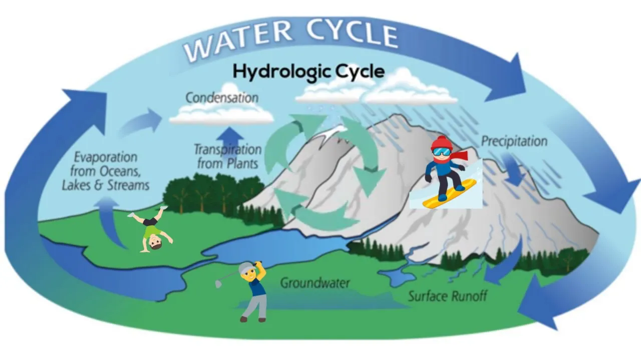














Mountain glaciers act as natural water towers that regulate water supply by storing snow and ice during cold seasons and releasing meltwater during warmer months, providing critical water resources for hundreds of millions of people globally; however, rapid glacier retreat driven by climate change is causing peak water conditions in over half of glacierized basins worldwide, threatening water security, energy production, agriculture, and ecosystem health, necessitating integrated research approaches that examine the entire hydrological cycle beyond just glacier dynamics to develop effective adaptation strategies.
Climate Change, Glacier Retreat & Water Security Explained
Added:The Hydrologic Cycle: Understanding how water moves through reservoirs, including precipitation, runoff, and storage in ice sheets and glaciers.
The Greenhouse Effect and Global Warming: The basic mechanism of how anthropogenic greenhouse gas emissions trap heat and increase global average temperatures.
Glacier Dynamics: The fundamental understanding of how glaciers form through snow accumulation and how they naturally advance or retreat based on mass balance.
The Concept of Water Security: Basic definitions of water scarcity, security, and the reliance of human populations and ecosystems on freshwater sources.
Transboundary Water Governance: The geopolitical implications and international treaties governing shared river basins fed by melting glaciers (e.g., the Indus or Mekong rivers).
Climate Change Adaptation Strategies: Engineering and ecological solutions to manage water variability, such as artificial glaciers (ice stupas), managed aquifer recharge, and reservoirs.
Hydrological Modeling: The scientific methods and computational models used to project future river flows and seasonal water availability under different climate scenarios.
Socio-Economic Impacts on Agriculture and Hydropower: Analyzing how changing runoff patterns affect food security, crop selection, and renewable energy production in downstream regions.
414 views15likes34:23Original Release: 2020-03-20
hello everyone thank you for joining me today for this online version of the World Water Day event at Birmingham my name is John Mackay I work at the British Geological Survey and the title of my talk is climate change glacial retreat and and water security so so my I'm really interested in in sort of three disciplines and a lot of my work crosses those disciplines such a Glaciology hydrology and and hydrogeology as well so so my work kind of spans or is really focuses on water cycling in cold region environments it's the kind of environments where you get lots of snow and ice in the form of glaciers and the head of my talk is warming water towers so so water towers is a term that we often used to describe mountain environments so mountains receive a disproportionate disproportionately large amount of water through precipitation processes either through either through rainfall or snowfall and they distribute that to downstream systems through run often and subsurface processes but the kinds of water towers that I'm interested in are what's ours that have glaciers in them so glaciers have have a really profound influence on the runoff regime of these mountain water towers so they accumulate mass accumulate ice as snowfall during the cooler and often wetter times a year and then they release it as meltwater in the warmer and from drier times a year so are we when Worcester month is highest and because of that they have a really profound influence on runoff characteristics of these systems so this here is a sort of hypothetical set of hydrographs for three alpine river basins but with differing levels of glacier ization so so the black line here is is a heavily glacierized River Basin it has this very smooth very seasonal hydrograph if we were to take that glacier away you end up something more like this red hydrograph which is much more much more stochastic much more flashy much more dependent on day-to-day runoff rainfall runoff inputs so the glacier has a really profound influence and the reason for this seasonal cycle of course is because of the melt cycles so you're getting you're getting melts during the warmer warmer time of the year and you get this really nice smooth sort of hydrograph and these glaciers these these water towers with glaciers on them are can be found all over the world so we've got the Himalaya the Andes I've got Alaska Central Europe Scandinavia so there are really important control on on water availability in lots of parts of the world in terms of the number of people that are reliant on these water sources it depends on really on what what which literature you actually look at so some sources will say that you're talking abili ins of people that rely on the water some will say it's more like millions but if you have to take a sort of stab down the middle you're talking about hundreds of millions of people that live in areas where where glacial meltwater contributes a significant component of their water supply so it really is a they really are an important component of water availability so how do we use meltwater will will melt water provide energy security so an example this is the table ella dam in Pakistan this is the world's largest earth filled dam it generates about 5,000 megawatts of electricity through the hydroelectric power station they've constructed in in this dam so it's a really major player in the overall energy availability of Pakistan and it's fed by the Indus River and the Indus River of course is fed by net water from the from the Himalaya and the Karakoram and mountain ranges so here we can see how meltwater from glaciers helps to provide energy security for Pakistan meltwater can also be important for providing food and food security and an economic security as well so as an example of that this is the Java magic irrigation project in Peru so this was a project that was initiated in the 1980s and it aimed to transform about 70 thousand hectares of what were what was essentially desert it's extremely dry arid area on the coast of Peru and they wanted to transform that into a land that could be cultivated so it could be used for farming and they did that by excavating this huge canal from from the rear santé northwards along the coast and this canal could then be used for irrigation but the rear center of course is fed by by meltwater it's fed by meltwater from the Cordillera Blanca so here we can see how meltwater can provide food security and an economic security for a country melt waters also can also be really important for for the ecology of river basins and particularly in river systems so we're looking at hydro ecology meltwater is it's been shown as she forms a really important is a really important player in the sort of hydro ecology of rivers so this these these plots here are taken from a study led by a group at University of Birmingham so they were looking at some some meltwater Federer's in the French Pyrenees and the first thing they did is they looked at physical and chemical properties of those rivers and related that to the overall meltwater contribution to those rivers and that's what all these plots show here on these these graphs so on the x-axis you've got meltwater contribution from 0 to 100 percent and then on the y-axis you've got various physical chemical properties so you've got things like pH suspended-sediment concentration conductivity things like that and you can see how the meltwater contribution has a clear control over some of these key properties and of course those properties also have a bearing on on the hydro ecology so things that are living inside that River so they went on then to look at map different macro invertebrate metrics metrics of biodiversity and and richness and you can see here with the equivalent grass where we've got world's contribution again on the x-axis you get these really interesting you know modal distributions for a lot of these different indices of biodiversity and richness so this shows that it's kind of like a sort of happy medium where if you have a considerable amount of meltwater contributions somewhere in the region about 40% that tends to result in a more diverse and rich macro invertebrate ecosystem so so meltwater can it can also be really important ecologically so the problem that we face now is that is that glaciers are retreating and they're retreating rapidly and this is a global well a truly global issue so if we look at one of the latest analyses of glacier mass balance data this was published in Nature last year just to take a quote from that it says present mass loss rates indicate the glaciers could almost disappear in some mountain ranges in this century so this is one of the key figures from from that study and it shows you that the cumulative specific mass change of glaciers around the world each of these lines refers to a different region from 1961 to 2021 and you can see almost all of them except in fact all of them apart from one of entering into this negative zone so it's indicating that they are they are retreating they're losing mats just to pick a few metrics from there as well that the report the global glacier mass loss on average is probably around 335 gigatons per year so that's between 2006 to 2016 so in one of the you know a recent decade and that equates depending on which region you look at you're talking about 0.5 to about 3% of the total ice volume so it's not insignificant it's actually a really big big chunk of of water and ice as being it's being lost every year and of course is directly linked and to rising global mean surface temperatures and the implication for this of course is that we're seeing changes with that now we're seeing changes and in the future we're likely to see even more changes in in global runoff so runoff from these glacierized River Basins this is a figure that I've taken from again another recent study a couple years ago published in Nature climate change they did a global analysis of glacier retreat and its implications for bulk meltwater inputs to to river basins and they actually took a glacier a hydrological model and forced it into the future up to the end of the 21st century so all the way to 2100 and then they focused their their analysis on a concept called peak water so peak water is is essentially the time in the hopefully in the future where you might expect water outputs from from glacierized river basins to be maximum so essentially what happens is as as the climate warms more of the glacier begins to melt so more of the glacier surface area provides meltwater into the system and you'd expect as it continues to warm and more of the glacier melts that flows will gradually go up so the amount of discharge it releases goes up but then it gets to a point where as the glacier shrinks and continues to melt the size of the glacier then becomes the limiting factor on the amount of flow it can supply downstream so then we expect see the flow reduce but the alarming thing about this analysis is that it showed that for over half the tested Basin so they did basically they test the basins all around the world but over half of these this peak water has actually already been reached so this is a this is a problem that we're going to face in the future but it's also a problem that we're facing now we're already seeing lasting effects and that's that's really what my sort of I guess a lot of my motivation for what I do for the for the work I do I'm interested in this cascade of impacts from from climates to to glacier shrinking and then to impacts on on water security to to society and to to the environment and I guess you could add on another another bit there which perhaps I should have done which is adaptations so then how do we adapt to these changes and really that's kind of kind of my motivation and and I'll be yeah continue to talk about that a bit more so the way we do this is we use models we use models of the climate to help us project how how climates going to change in the future we use models of glaciers and hydrological models to then understand how glaciers responds and how how water resources are going to change in the future but it's tricky and there are we're doing that at the moment but there are lots of challenges that we face in doing that so I want to spend the sort of second half of this talk talking about some of these challenges and talking a bit more about the research and and some of the research challenges that we're facing now in terms of trying to complete this they sort of puzzle and trying to understand how we go from climate change to water security and then probably adaptation as well on the end which are which I'll talk a little bit about so the first challenge I think is is that actually we need to look beyond the glacier so what I mean by that is if you look at a lot of studies have been done in the past there's a lot of focus on trying to understand how global glacier mass changes are going to going to play out in the future so how glaciers are likely to shrink over the future and then the impact of that will have on on bulk melt water runoff inputs to the environment to downstream systems and all of that research is super useful and it's and it's provided us with with some amazing insights into potentially how things could change in the future but I think when you start getting down to local impacts and starting to think maybe more about adaptation strategies we actually need to think about the wider hydrological cycle how does how does meltwater propagate through the hydrological system does it what stores does it end up in does it end up on the ground does it end up over ground and and if we we understand that that's how we can start to build a picture of water security and potentially how we can adapt to those changes so really we need to start thinking about developing models that really span across different hydrological boundaries so I just want to spend a bit of time talking about that now so obviously working at the British Geological Survey I'm quite interested in things on the ground and and groundwater in particular it's one of the the key components of the hydrological cycle that I'm I'm particularly interested in and there's there's definitely increasing interest in research in in groundwater systems in glacierized river basins and this is a really nice example of a recent piece of research that was done this is published in geophysical research letters it's a grouper hydrogeology group at McGill University and they focus their study on the showcase will shed in Peru so this river system is fed by the Pieta palana mountain range which you can you can see here a glacierized mountain range but they really wanted to look a bit more at the groundwater system downstream of this of this glacierized basin so they constructed a model that consisted of a glacier model that could simulate Glacia mass balance and dynamics a surface hydrology model and importantly a groundwater model system that could simulate water underground and by doing that they were able to really sort of poke into how the system works and and look at which of the key constituents of the water balance and water cycling in this system the first thing they showed us that groundwater is a really really important component the water balance particularly in the dry season so if we look at this graph of river discharge and the Shockers River this blue section underneath indicates how much groundwater is contributing to that you can see during dry season flows it is it's almost the only contributor to River discharge so groundwater is is really important for maintaining dry season flows and they went on a little bit further to - and actually force their model into the future so they forced it all the way to the end of the 21st century 2100 and then they started looking at dry seas and fluxes in the model so they showed that meltwater inputs relatively stable from 1960 but then once we go into 92 2020 and Beyond we can see meltwater inputs a drastically reducing him pretty much reducing to zero as the glacier recedes but for groundwater indicated by this this orange line to groundwater fluxes to the surface we can see they're actually relatively stable they do reduce slightly and and they attributed that to some other components of the water balance such as evaporation but generally speaking the groundwater component is is relatively stable it's actually helping to buffer some of these changes in in meltwater fluxes that we're seeing so starting to look beyond the glass here and looking at other components of the system it could it could really help us in terms of developing some of these adaptation strategies there might be other components of the hydrosphere that we that we need to think about and and I myself have done quite a bit of work on this so up until very recently I was working in Iceland this is the vergis yokel glacier in southern Iceland this is a glacier Observatory that was set up by the British Geological Survey and you can see this huge expansive almost like desert space in front of the in front of this glacierized mounting water tower system and this is this is a sander this is a floodplain and it's it's made up of hundreds of meters of unconsolidated sediment and gravel and things that have all been kicked off this mountain system over the over the decades and actually it's significant groundwater store it's full of water it's a huge permeable very very high storage system and this ground water system readily interacts with melt water runoff emanating from this glacierized mounting system so as part of my research I developed along with my colleagues a an integrated model of not only glacier hydrology so thinking about the mountain water tower system but also this ProGlide shore ground water system so I linked a distributed groundwater model to it and this allowed us to really really look at some of the some of the water cycle components in in really high detail so we could look at things like how the water table fluctuates in in that prob'ly Jewell aquifer and we can look at other fluxes like recharge fluxes going into the aquifer and how those change over time and we can also look at how fluxes how fluxes emanates from the river into the groundwater system so we were really interested in looking at the importance of the river as a source of recharge to the groundwater so could the glacier melt water that emanates into the river then actually be an important contributor to recharge to the groundwater system and when she found that it is quite significant at certain times a year it is a significant input to the groundwater system so some indication that the that this probe lay chakra is actually dependent on on the glacier and then what we went on to do is test a series of different scenarios so we put future climate scenarios through the model and tested to see how those recharge fluxes from the river into the groundwater changed and we actually found that there was quite a high degree of variability between those between those scenarios and it was all controlled by the variability was was a result of how much the glacier was retreating and it wasn't that we were that as the glacier retreated you got less water going into the river actually the amount of water in the river is about the same it's just that it switched from from glacier meltwater to rainfall runoff instead but the reason that we saw differences across the scenarios was actually because if you if you look at a hydrograph a river flow hydrograph emanating from a glacier ice river basin if you zoom right into that time series and get all the way down to a day you'll find it has this diurnal cycle so it has this donal melt cycle river flows go up as as the day warms and the melt increases and Melton's ends up in the system and then it goes back down again towards towards the end of there in the cooler of the day as melt graduate decreases and we found that that periodic rising and falling of river flows every day almost act like a pumping system it would push water into the into this probe layer of groundwater system so if you lose that glacier you lose that kind of pumping system and therefore the amount of a recharge that would get into the river actually reduced over time so so this is the kind of these are the kind of things that we need to start thinking about I think about how the whole system behaves and not just looking at one particular component so this is a photo I took in November last year this is in Peru this is the study area of a new project that I'm now working on this is a quite a common site you find if you're in the Peruvian Andes you're in the highlands you'll see mountains you'll see glaciers on top of those mountains and then you see these quite lush green Plains within the valleys of these mountains often without package because they're they're they're farmed in these areas these are actually wetlands that they're they're huge water stores locally known as Beaufort dollars they store huge amounts of water and they also store huge amounts of carbon so they provide a number of ecosystem services but in this project we were really interested in in again looking we're really interesting looking beyond the glacier and looking at the king of the whole hydrological cycle and the Beaufort dollars one of the things that we're going to focus on so in this project when we're working in the vilcanota Otto Bamber basin which is in southern Peru it's in the Cusco region of Peru projects called Rahu it's being led by Imperial College and and we're working with the University of Birmingham and then various institutes and universities including New Tech and in sac in in Peru and the aim of this project is really to fulfill that that that flow diagram that I showed you where we go from climates to glacier shrinkage to water security and then also that little add-on as well we really want to be able to come up with a model that can help us look at adapt ations dress cheese as well for this region so we're interested in glacier shrinkage and and then and then going on to adaptation strategies so at the moment we're developing that model framework but actually what our focus has been on primarily because we're still quite early on in this project where we're looking mainly at increasing the observation data that we have because there's if you go to most mountain systems there's almost no observation data so you very rarely do you find data on river flows or meteorological stations or anything like that so so we're really trying to build in some of that infrastructure to this region so these are a couple of photos so we got so we hiked up to one of the glaciers err this is CR Purina and we were on the glaciers he's a couple of our colleagues who are helping us and we drilled in ablation steaks on these glaciers so these steaks allow us to measure how much the glaciers melting so we can understand how much water is might be emanating from these from these glaciers we then came down onto the Beaufort Dollaz and on these Beaufort dollars we we installed a series of bore holes these orange tubes here you can see they're borehole seaweed weed joys into the ground and then this allows us to measure the water table water water storage within the bay for Dallas and to do that we use these low-cost sensors these are these are Arduinos arduino water level sensors they were developed Imperial College and we've actually been putting them into bore holes into the Bofur dollars so we can continuously monitor how storage changes our house storage is varying in these wetlands in these in these buffer dollars over time and then as we start to get a handle on how much glaciers are melting how much meltwater flux is coming out how these Beaufort dollars at storages are changing we can start to build up a picture of how water fluxes are propagating through the system and start looking beyond the glacier and of course all this observation date is it's it's super important if we're going to build models we need observation data to to back them up with and this is a this is a really important component and a challenge in itself if you like is building up that observation network so I think the second big challenge we have in terms of thinking about Glacia shrinkage and water security is dealing with uncertainty so any model that we use as a climate model or a hydrology model or whatever it is their course they're not perfect they've got lots of issues with them and they're validated with observation data which itself isn't perfect and has it is prone to errors so whenever we make projections whenever we want to talk about water security in the future we have to accept that there's a certain degree of uncertainty associated with those projections and some of the work that I've been doing has really been trying to trying to deal with that uncertainty trying to trying to face it head-on and start to try and understand and pick apart that uncertainty and where it comes from so if we were going to ask the question well how will the runoff regime change in a glacierized River Basin over the 21st century well the first thing first question will be will presumably the climate skins change but it'll change dependent on how we behave as humans how many greenhouse gases we emit or as we often talk about how the representative concentration pathway or RCP will play out and then when you think about which climate model do we use is not just one climate model but there's multiple climate models out there they're all parameterised and and constructed in different ways so they all give slightly different simulations so there's there's an uncertainty about about what each of those climate models is telling us we might want to employ a sort of downscaling approach where we take climate projections and and downscale them to a finer resolution so that they're compatible with our hydrology models and then our glacier and hydrology model there's lots again there's lots different models out there we have to parameterize them and often we don't have the observation data to do that so there's some uncertainty associated with those so you can see we have this whole cascade of uncertainty going through any given model framework and really we need to think about this and try and quantify it as best we can so so I've done a bit of work on this myself and this is we're going back now to the verka show called glacier Observatory in Iceland and we undertook a bunch of experiments looking at these different sources of uncertainty in this in this cascade so we use two different representative concentration pathways we use 14 different climate models use 10 different downscaling procedures and we used over 300 different configurations of a glacier a hydrological model and we combined all of those to generate thousands of thousands of different future scenarios and the useful thing about that is that we can actually start to put uncertainty bounds or confidence bounds around our predictions and our projections so this these are a series of projections we made for our for our catchments in in Iceland and these are all different metrics of River flow and how they'll change over time so we've got things like mean monthly flows or we've got metrics that look at really high flows so ever interested and say flood frequency in the future we've got metrics looking at very low flows so we might be interested in looking at drought and we've got metrics that look at the timing of the system so so the sort of residence time how how how quickly does it store and release water over time and how is that going to change in the future but the really nice thing I think about starting to do some some analyses around the uncertainty in trying to deal with the uncertainty is to is to really sort of deconstruct them and start to trying to understand where they stem from in that model chain and that's what we did we we use a statistical approach so you actually decompose these uncertainties use a statistical approach known as it analysis of variance or ANOVA which you might have heard of and then for each of those metrics of future river flow we we actually quantified the contribution of each of those those different model components and that's what all these colored bars indicate but the really interesting thing we found is that they're by no means uniform across those there's different metrics for example if we were interested in in low flows perhaps we were interested in looking at drought severity in the future this gold bar here is is the one that dominates and that one is associated with the way in which we we represents Glacia hydrology so the way in which we represent water storage and release within a glacier so that was well it was a key source of uncertainty for that metric then if we look at different metrics we see that other sources perhaps the emission scenario or the climate model other key key contributors to uncertainty and this is really interesting and it shows us that if we want to again thinking back to that flow diagram going from climate to water security if we wanted to undertake studies like that we might want to tailor our modeling design so it really hones in on those on the key sources of uncertainty if we want to look at drought maybe we need to think more about the glacier hydrology than maybe we do about the different climate models that can really help us sort of focus in and try and generate more robust projections so the final challenge is maybe a little bit more blue skies but it's certainly the direction that the research is going in now increasingly we're seeing studies that are not just focusing on one catchment perhaps not even focusing on one region but they're they're looking at the entire globes they're looking at all the glaciers all of the river basins around the world and this is a big challenge so so can we make model predictions for everywhere and I guess the answer to that is well yes we can there are increasingly there are lots of large scale often open source models now for example for glacier evolution if we're interested in in simulating glacier dynamics in glacier mass balance there's models like OGG M which is the open global gracia model there's PI gem which is another so pipe Glacia glaze revolution model and glow gem as well it's been used in some studies recently so the technology is there to start making these start doing these studies and to start looking at global variations and the the really nice thing about these is that they really do show some fascinating results in terms of different responses across regions and across the globe when you really get a nice picture of how different systems behave and and and and really the variability between those and and that's really quite insightful but one of the things they they're still lacking they're still suffering from that from that challenge one going beyond the glacier so they so a lot of these studies that have used these kind of models for example have tended to be quite Glacia centric they focused on on getting the glacier right and then and and then maybe not accounting for the wider hydrology which is not a criticism by the way because they're because they're it's it's totally fit for purpose but I think if we want to be able to make global projections that are the really relevance to water security issues then we might want to think about going beyond the glacier game so this is my last slide and it's more of a plug than anything else on a new project that I'm that I'm working on this is called it's project called Hydra joules so joules is a land surface model it's the joint UK land environment simulator and and Hydra joules is a is a sort of cooperative project to develop the next generation of joules it's a really trying to improve the code and this is where we're working with the UK Center ecology and hydrology and n Cass the National Center for Atmospheric Science and one of the aims of the project there are lots of lots of different aims of this project but one of them is to is to develop a code that is more generally applicable to large-scale global scale studies so one of the things that I'm doing on particular project is is trying to improve the representation of glazes in it so actually this model already has a very sophisticated representational hydrology although we are trying to improve that as well but it doesn't have much in the way of representation of glazes at the moment and that can certainly be improved so that's that's currently what I'm working on so in terms of large-scale global projections that are applicable to water resource issues I think this I'm hoping this project can be really pivotal and kind of pushing that forward so so this is kind of a watch this space slide and then ya see what happens so so please please do go and take a look at this have you got a chance ok thank you for listening to this online presentation if you have any questions then please feel free to contact me you can I'm sure there'll be some kind of contact info down below but if you can't find me just type in my name and bgs and you'll find my profile online thank you very much
Up Next
7:57
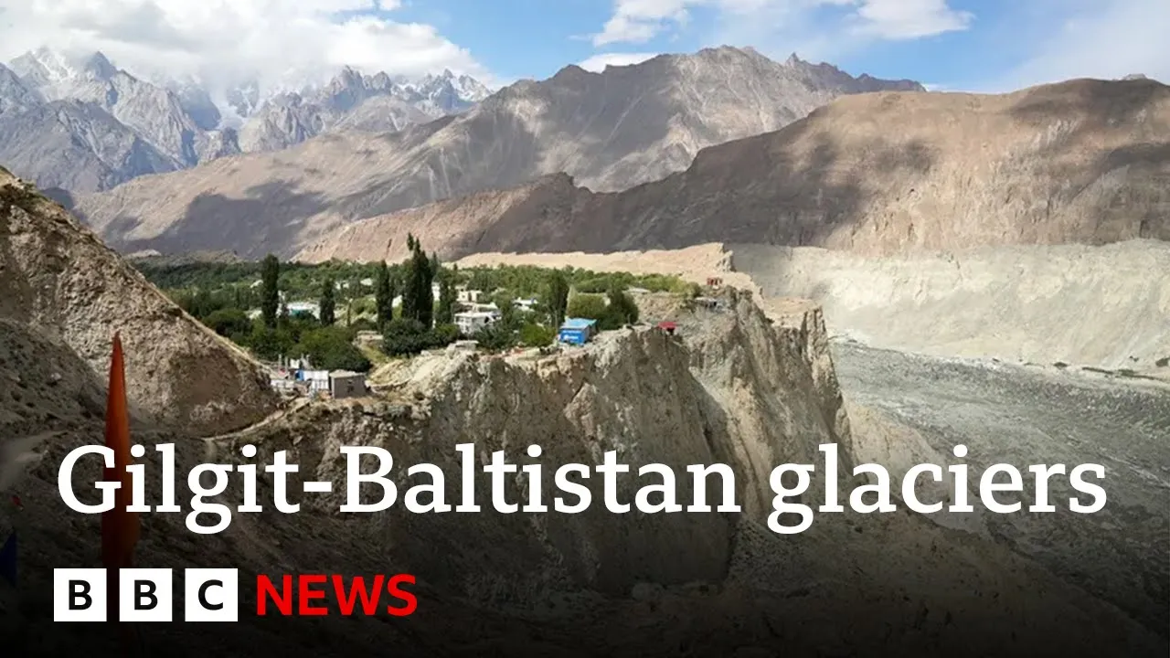
Climate Change Threats to Third Pole Glaciers | BBC News
@BBCNews
190.9K views•2024-11-18

15:54
Life in Biosphere 2: Sustainable Ecosystems & Human Survival
@TED
334.9K views•2009-06-16

14:30
Microplastics Everywhere: How Plastic Impacts Our Lives
@TEDx
100.9K views•2018-05-08

10:28
Ice Stupa Artificial Glaciers: Solving Ladakh's Water Crisis
@SonamWangchuk66
3.2M views•2015-05-03
Related Study Plans & Knowledge Roadmaps
Structured learning paths in Environmental Science
environmental-science
Ocean Noise: Cetacean Impacts & Mitigation
01Fundamentals of Underwater Acoustics
02Marine Mammal Bioacoustics
03Anthropogenic Noise: Shipping & Seismic Surveying
+ 2 more learning modules
16h5 modules
Explore Roadmap
environmental-science
Road Ecology: Corridors, Overpasses & Fencing
01Foundations of Habitat Fragmentation and Carnivore Ecology
02The Road Barrier: Ecological Impacts of Transport Infrastructure
03Principles of Ecological Corridors and Connectivity Mapping
+ 3 more learning modules
14h6 modules
Explore Roadmap
environmental-science
Ocean Acidification: Kelp Buffering & Shellfish
01Fundamentals of Ocean Chemistry & pH
02Chemical Pathways of Coastal Acidification
03Bivalve Physiology & Calcification Under Stress
+ 2 more learning modules
18h5 modules
Explore Roadmap
environmental-science
Ice Stupas: Glacial Retreat & Water Security
01Foundations of Glaciology & Mountain Hydrology
02Climate Change and Glacial Retreat Dynamics
03The Science of Ice Stupas & Artificial Glaciers
+ 2 more learning modules
14h5 modules
Explore Roadmap