This tutorial guides users through installing the Point Cloud Library (PCL), an open-source library for 2D/3D image and point cloud processing, which provides tools for filtering, segmentation, and registration; the installation process involves setting up dependencies, cloning the GitHub repository, configuring with CMake, building and installing PCL, then installing Python bindings to enable point cloud processing in Python scripts.
How to Install Point Cloud Library (PCL) in Python: Step-by-Step Guide
Added:Deep Dive
Basic familiarity with the Ubuntu terminal, package management (apt), and shell commands.

Ubuntu/Debian APT Commands - Tutorial
393
APT (Advanced Package Tool) is the primary package management system for Debian and Ubuntu Linux distributions, where 'sudo apt update' fetches repository information about available packages without installing them, while 'sudo apt upgrade' downloads and installs the actual package updates; other essential commands include 'apt search' for finding packages, 'sudo apt install' for installing packages with their dependencies, 'sudo apt remove' for uninstalling packages while keeping configuration files, 'sudo apt purge' for completely removing packages including configurations, 'sudo apt autoremove' for cleaning up unused dependencies, and 'apt list' for viewing installed or upgradeable packages.
Click to watch →
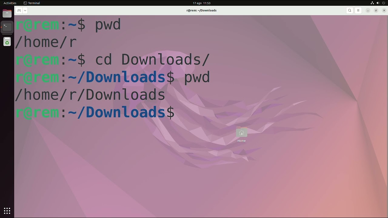
Domina la Terminal en Ubuntu 22.04: Personalización, Comandos Esenciales e Instalación de Programas
269
This tutorial covers three essential aspects of Ubuntu terminal usage: (1) Personalization options including theme selection (dark/default), font customization, cursor settings, color schemes, and transparent backgrounds for better tutorial following; (2) Essential commands including pwd (display current directory), cd (change directory), clear (clean screen), echo (print text), cat (view file contents), grep (search text patterns), chmod (change file permissions), ps (list running processes), and kill (terminate processes); (3) Program management using apt (sudo apt install for installation, sudo apt remove for removal, sudo apt purge for complete removal with configurations) and snap (sudo snap install for installation, sudo snap remove for removal). The terminal is accessed via Ctrl+Alt+T or through the menu, and programs can be installed using either apt or snap package managers.
Click to watch →

【概要把握】Part2 : Ubuntuを初めて触る人が抑えておくべきターミナルや便利なコマンドを広くカバー(学生、エンジニア/技術者、研究者用)【初学者向け】
23.5K
This tutorial covers essential Ubuntu terminal commands for beginners, including file operations (mkdir, rm, mv, cp, ls, cd), file content viewing (cat, head, tail), file searching (find, grep), command chaining and output redirection, shell scripting basics, process management (ps, top, kill), network tools (ping, curl, wget), and package management (apt), enabling users to efficiently navigate and manage their Linux system through the command line.
Click to watch →

Terminal Ubuntu - Iniciantes
25.2K
This tutorial introduces essential Ubuntu terminal commands for beginners: access the terminal using Ctrl+Alt+T, use 'ls' to list files (directories appear in blue, files in white), navigate directories with 'cd' and use Tab for auto-completion, return to the previous directory with 'cd ..', create directories with 'mkdir', remove directories with 'rm', clear the screen with 'clear', and use 'sudo' to gain administrator privileges for system-level operations like 'shutdown' with parameters '-r' for restart or '-h' for shutdown.
Click to watch →

Conociendo el Terminal #4: Gestión de paquetes (en Ubuntu)
1.6K
Linux package management uses package managers like apt (in Ubuntu) to install, remove, and update software packages and their dependencies through the terminal. Key commands include apt-cache search for finding packages, apt-get install for installation, apt-get remove for removal, and apt-get purge for complete removal including dependencies. Ubuntu also supports PPA (Personal Package Archives) for accessing additional software repositories, which require adding via add-apt-repository, updating with apt-get update, and purging with ppa-purge to maintain system stability.
Click to watch →
Deep Dive
Fundamental understanding of 3D spatial data, Cartesian coordinates (X, Y, Z), and what constitutes a Point Cloud.
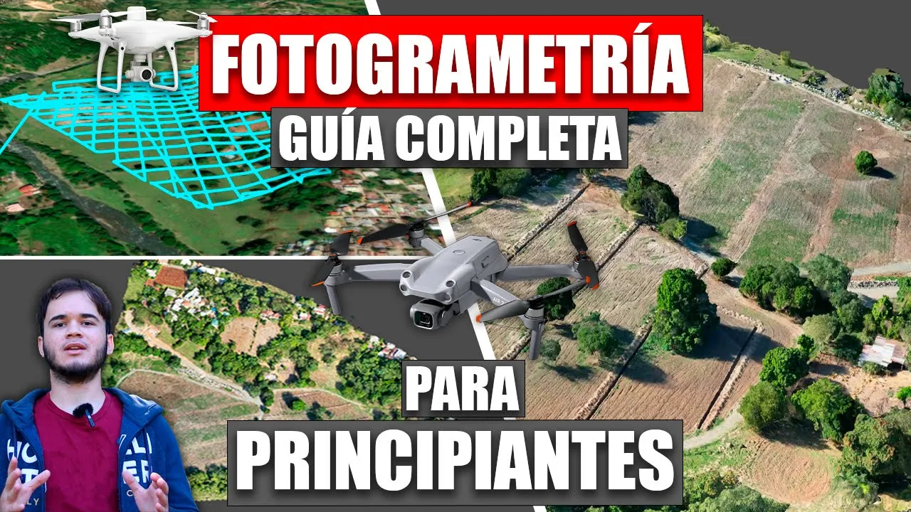
Fotogrametría con Drones GUÍA COMPLETA para PRINCIPIANTES - Mapas 3D desde CERO en ESPAÑOL
191.2K
A point cloud is a set of vertices in the three-dimensional X, Y, Z coordinate system that serves to represent the external surface of an object, typically terrain. It should not be confused with a scattered point cloud, which is a completely different type of cloud. A dense point cloud contains many more points and provides higher detail representation of the terrain surface.
Click to watch →

Introduction au Nuage de Points 3D ( QGIS 1/10)
2.4K
A point cloud is an ensemble of points in 3D space representing object surfaces visible to a sensor. Unlike images with pixels in a grid, point clouds use points as basic units with no inherent dimension. Point clouds contain geometric coordinates (X,Y,Z), radiometric data (intensity, RGB colors), and optionally spectral or semantic information. Acquisition involves measuring horizontal/vertical angles and distances to calculate Cartesian coordinates relative to the scanner's local frame. Platforms include terrestrial (tripods, handheld, vehicle-mounted) and aerial (drones, helicopters, satellites). Key characteristics include irregularity with variable density (closer objects appear denser), unstructured nature (no predictable neighbor relationships like images), and unordered data (point order doesn't matter). Voxelization can convert point clouds to structured 3D cubes for efficient processing.
Click to watch →

What is point cloud data? (C14, v1)
554
Point cloud data is a 3D spatial data format consisting of millions or billions of points, each with XYZ coordinates and optional descriptors, used to represent irregularly spaced data from sources like photogrammetry and lidar, unlike raster data which uses regularly spaced pixels; it can be displayed in 3D perspective with points colored by elevation or surface type, and stored in either ASCII text-based formats (larger, human-readable) or binary formats like LAS (more compact, requiring specialized software).
Click to watch →

Cartesian Coordinate System (Part 1) Hindi
962
The rectangular (Cartesian) coordinate system uses three mutually perpendicular axes (x, y, z) intersecting at the origin to represent points in space. To locate any point, we measure its distances from each axis: first project onto the XY plane to find distance from Z-axis, then measure from origin to this projection. The coordinates (x, y, z) represent distances from the point to each axis respectively. Each coordinate ranges from negative infinity to positive infinity, allowing representation of any point in 3D space.
Click to watch →

Grupo Revit MEP 2024/12/18 Nuvem de Pontos
361
Point clouds are aggregations of points in 3D Euclidean space with three defining characteristics: irregularity (uneven point spacing), unstructured nature (variable point density), and permutation invariance (no inherent point ordering). Each point has X, Y, Z coordinates and may include radiometric properties like color or intensity. Point clouds can be categorized by acquisition distance (aerial/satellite for long distances, terrestrial for short distances) and by sensor type (active sensors like LIDAR that emit pulses, passive sensors like cameras that capture existing radiation).
Click to watch →
Deep Dive
Experience with Python programming and managing virtual environments (such as venv or Conda).
What are Virtual Environments in Python? - Python Tutorial
13.8K
Python virtual environments (venv) are isolated Python environments that allow developers to manage project-specific dependencies separately from the global Python installation, solving conflicts when multiple projects require different versions of the same package; they are created using the python -m venv command, activated with scripts/activate (Windows) or source bin/activate (Linux/Mac), and can be managed using requirements.txt files to specify exact package versions for reproducibility.
Click to watch →
Clean New Projects with venv - Virtual Environments
16.8K
Virtual environments using Python's built-in venv module allow developers to isolate package dependencies for different projects, preventing version conflicts when working on multiple projects simultaneously. To create a virtual environment, run 'python3 -m venv .venv' in your project folder, then activate it with 'source .venv/bin/activate' (Linux/Mac) or '.venv\Scripts\activate' (Windows). Packages installed in the activated environment are isolated from the system-wide Python installation, enabling different projects to use different versions of the same packages. To share your environment setup, use 'pip3 freeze > requirements.txt' to export all installed packages and their versions.
Click to watch →
How to Create and Use Virtual Environments in Python With Poetry
178.8K
This video provides a complete tutorial on Python virtual environments and Poetry. It begins by explaining dependency hell—the conflicts arising from different package versions—and introduces virtual environments as isolated solutions. The instructor covers multiple tools (venv, virtualenv, pyenv, pipenv, conda) before demonstrating Poetry as the preferred choice for its simplicity and automation. The tutorial walks through installing Poetry, creating pyproject.toml configurations, setting up virtual environments, managing dependencies with add/remove commands, running code within isolated shells, and publishing packages to PyPI. Best practices include storing environments in project folders and understanding limitations with system-dependent packages. The video emphasizes that virtual environments enable reproducible, shareable Python projects.
Click to watch →

Saiba como criar Ambientes Virtuais com Python de uma vez por todas!
20.6K
Virtual environments in Python are isolated development environments that prevent dependency conflicts between projects by keeping each project's libraries separate from the global Python installation. There are three main methods to create virtual environments: (1) using Python's built-in venv module with the command 'python -m venv <environment_name>', (2) using Conda with 'conda create -n <environment_name> python=<version>', and (3) using the virtualenv library with 'pip install virtualenv' followed by 'virtualenv <environment_name>'. Each method creates an isolated environment with its own Python interpreter and package dependencies, allowing developers to manage project-specific requirements without affecting their global Python installation.
Click to watch →
Python Tutorial: How I Manage Multiple Projects, Virtual Environments, and Environment Variables
159.1K
This comprehensive section covers the entire workflow for setting up isolated Python environments using Anaconda and Conda for managing multiple projects. Key topics include: (1) Understanding why environment isolation is essential for preventing package conflicts and managing dependencies across projects, (2) Installing Anaconda and using Conda alongside pip for package management, (3) Creating virtual environments with 'conda create' specifying Python versions and dependencies, (4) Activating environments via 'source activate' which modifies the terminal prompt, (5) Exporting environment configurations to 'environment.yml' files for reproducibility, (6) Managing sensitive data like database credentials using environment variables, (7) Creating 'activate.d' and 'deactivate.d' directories within environment roots to automatically set and unset variables when environments are activated or deactivated.
Click to watch →
Deep Dive
Conceptual understanding of software compilation from source, including build systems like CMake and compilers.
CMake - the essential package
18.1K
CMake is a powerful build generation system that creates platform-independent build scripts (like Makefiles) from CMakeLists.txt configuration files, enabling consistent cross-platform compilation by abstracting the complexity of different build systems; it operates through a two-phase process where the configuration phase reads the CMakeLists.txt file and creates a cache file storing variable values, followed by the generation phase that produces actual build files for the underlying build system (such as make or ninja), with key concepts including target creation (libraries and executables), target properties (with public, private, and interface visibilities), and proper variable handling using the cache system.
Click to watch →
Create app with CMake and AI | Praktikum Algoritma dan Pemrograman
510
CMake is a build system generator, not a compiler. It reads configuration scripts (CMakeLists.txt) and generates platform-specific build files like Makefiles or Visual Studio projects. A toolchain consists of interconnected tools: Make manages the build process, GCC (including CPP preprocessor, compiler, assembler, and linker) transforms source code through preprocessing, compilation, assembly, and linking stages to produce executables. CMake sits at the top of this chain, abstracting platform differences so developers can use one configuration across Windows, Linux, and macOS.
Click to watch →
![[Environment Setup 8] Compile programs from source code using GCC, GNU Make, and CMake](https://i.ytimg.com/vi/qON2D3vDIt8/maxresdefault.jpg)
[Environment Setup 8] Compile programs from source code using GCC, GNU Make, and CMake
5.3K
In Linux, compiling software from source involves using GCC/G++ compilers to translate source code into executable programs, with build systems like GNU Make and CMake automating the compilation process by managing dependencies between source files and handling incremental rebuilds only when necessary, making it the preferred method for installing programs on Linux systems especially for scientific and data science applications.
Click to watch →
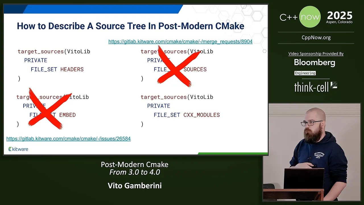
Post-Modern Cmake - From 3.0 to 4.0 - Vito Gamberini - C++Now 2025
12.6K
CMake operates on three conceptual trees: the source tree (code in version control), the build tree (artifacts generated during compilation), and the install tree (organized artifacts ready for deployment). The source tree contains your version-controlled code. The build tree is populated by CMake during the build process with various artifacts. The install tree organizes these artifacts into a structured layout suitable for consumption by other projects or deployment. CMake's primary role is describing how artifacts move through these three trees from source to final installation.
Click to watch →
CMake Explained for Beginners
2.3K
CMake is a meta build system that generates platform-specific build files (makefile, ninja file, or Visual Studio project file) from a single configuration, enabling cross-platform C++ project compilation without rewriting build scripts for each platform. The CMakeLists.txt file uses a scripting language with variables (set), lists (semicolon-separated), conditionals (if/else), loops (foreach/range), and functions/macros to define build targets, include directories, and library linking. Key concepts include PUBLIC/PRIVATE/INTERFACE scopes for include paths, add_subdirectory() for organizing large projects, and add_library() for creating static or shared libraries.
Click to watch →
Prerequisite Knowledge
- Concept 01Basic familiarity with the Ubuntu terminal, package management (apt), and shell commands.
- Concept 02Fundamental understanding of 3D spatial data, Cartesian coordinates (X, Y, Z), and what constitutes a Point Cloud.
- Concept 03Experience with Python programming and managing virtual environments (such as venv or Conda).
- Concept 04Conceptual understanding of software compilation from source, including build systems like CMake and compilers.
Subsequent Learning
- Step 01Advanced Point Cloud processing techniques, including segmentation (e.g., RANSAC), clustering, and registration algorithms (e.g., Iterative Closest Point - ICP).
- Step 02Integrating PCL Python wrappers with ROS (Robot Operating System) for real-time robotic perception and mapping.
- Step 03Exploring alternative 3D processing libraries such as Open3D and comparing their performance and ease of use.
- Step 04Applying Deep Learning models (like PointNet) on processed point clouds for 3D object detection and classification.
PCL Setup
PCL Setup
0:00Playing Section
- 1
Install PCL library and dependencies on Linux.
- 2
Build PCL from source using CMake.
- 3
Verify Python binding with a sample script.
The Case for Modern Python-Native 3D Libraries Over PCL
While the Point Cloud Library (PCL) is a powerful standard in C++, attempting to install and use it in Python is increasingly discouraged in the robotics and 3D data science communities. Python bindings for PCL (such as python-pcl) are notoriously difficult to compile, frequently break during dependency updates, and are largely unmaintained. Instead, the industry has shifted toward modern, native-Python alternatives like Open3D, PyVista, or Trimesh. These libraries offer seamless installation via standard package managers (pip/conda), native NumPy and PyTorch integration, better visualization tools, and active developer support, making the arduous process of building PCL from source unnecessary for most Python-centric workflows.
Deep Dive
Advanced Point Cloud processing techniques, including segmentation (e.g., RANSAC), clustering, and registration algorithms (e.g., Iterative Closest Point - ICP).

20_Robotik-I-Übung-07-Bildverarbeitung
1.3K
This section covers advanced point cloud processing techniques and the PCL (Point Cloud Library) framework. The Iterative Closest Point (ICP) algorithm registers two point clouds by iteratively matching source points to closest target points, computing best-fit transformations (rotation and translation), and applying them until convergence. Convergence criteria include error thresholds and maximum iterations. The error function measures alignment quality, typically as sum of squared distances between matched points, minimized using gradient descent. RANSAC (Random Sample Consensus) is a probabilistic algorithm for fitting geometric primitives (planes, cylinders, spheres) to point clouds by randomly selecting minimal point subsets, fitting primitives, and selecting the best fit based on inlier count. RANSAC is robust to outliers but requires multiple iterations. PCL provides efficient implementations of these algorithms, including point cloud loading, transformation application, registration, and visualization. The library supports various point cloud formats and provides tools for debugging and understanding registration results.
Click to watch →
![[3D Point Cloud Data Processing] Chapter 9. Point Cloud Analysis: Segmentation, Registration](https://i.ytimg.com/vi/WKZfeep92-U/maxresdefault.jpg)
[3D Point Cloud Data Processing] Chapter 9. Point Cloud Analysis: Segmentation, Registration
533
This lecture covers five segmentation methods for 3D point clouds: edge-based (detecting boundaries via gradient discontinuities), region-based (clustering similar points), attribute-based (using color, density, curvature), model-based (fitting predefined shapes), and graph-based (using normalized cuts); and explains point cloud registration, including the closed-form SVD solution for known correspondences and the Iterative Closest Point (ICP) algorithm for unknown correspondences with various data association strategies like closest point, normal shooting, projection, and point-to-plane approaches.
Click to watch →
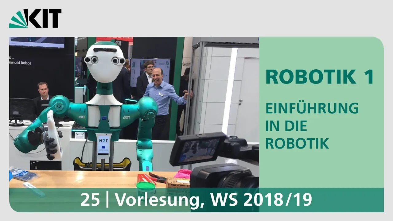
25: Canny-Kantendetektor, Visual Servoing, Punktwolken
1.2K
Point clouds are collections of 3D points representing scenes, containing spatial coordinates (x, y, z) and optionally color or normal information. Surface normals are estimated by computing covariance matrices from local neighborhoods and extracting eigenvectors corresponding to smallest eigenvalues. Point cloud registration merges multiple scans from different viewpoints using the Iterative Closest Point (ICP) algorithm, which iteratively finds correspondences, computes transformations, and applies them until convergence. RANSAC (Random Sample Consensus) provides robust model fitting by randomly sampling minimal point sets, fitting models, and counting inliers within thresholds. This enables detection of geometric primitives like lines and planes from noisy data containing outliers.
Click to watch →

Iterative Closest Point (ICP) - Computerphile
151.6K
The Iterative Closest Point (ICP) algorithm is a popular method for aligning point clouds by iteratively finding correspondences between points in two sets and optimizing the translation and rotation to minimize distances between matched points, though it may converge to local minima if initial estimates are poor.
Click to watch →

3D Point Cloud Processing Course: From Noise Removal to Segmentation
2.9K
Point cloud registration and segmentation form the core of geometric analysis, transforming raw point distributions into meaningful spatial representations. Registration employs a two-stage methodology: global alignment using RANSAC to find corresponding planar surfaces and bounding box matching, followed by local refinement via Iterative Closest Point (ICP) to achieve sub-centimeter precision. Segmentation leverages advanced techniques including difference of normals for edge detection through multi-scale analysis, super-voxel creation for intermediate-level grouping, and region growing for expansion based on feature similarity. Quality assessment requires monitoring over-segmentation (excessive fragmentation) and under-segmentation (segments spanning multiple objects). These techniques enable systematic extraction of planar surfaces, building facades, and other geometric primitives, forming the foundation for architectural analysis, infrastructure monitoring, and automated feature extraction from complex 3D environments.
Click to watch →
Deep Dive
Integrating PCL Python wrappers with ROS (Robot Operating System) for real-time robotic perception and mapping.

Getting Started with ROS2 and PCL: An Introduction to Point Clouds for Beginners
21.4K
This tutorial provides a comprehensive introduction to point cloud processing in robotics using ROS2 and the Point Cloud Library (PCL). The complete workflow covers: (1) Understanding point clouds as 3D data representations from lidars and depth cameras; (2) Setting up TurtleBot 3 simulation with RTAB-Map for 3D depth mapping; (3) Generating point clouds through robot navigation and teleoperation; (4) Exporting point clouds as PLY files for reuse; (5) Integrating PCL with ROS2 by creating C++ nodes, configuring CMakeLists.txt with find_package(PCL REQUIRED), and handling compilation challenges including include directories and target link libraries; (6) Verifying successful compilation and execution. This end-to-end pipeline enables beginners to develop custom point cloud processing applications for robotics applications.
Click to watch →
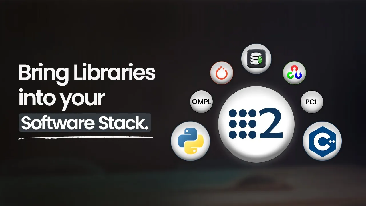
Top Libraries You Need for Robotics Software (Python & C++ with ROS2)
730
This extensive section demonstrates practical integration of robotics libraries within the ROS 2 framework. It covers both Python and C++ node development, showing how to create nodes that inherit from appropriate base classes, implement subscribers for sensor data (camera feeds, depth point clouds), and publishers for processed outputs. The Python section demonstrates OpenCV image processing (grayscale conversion) and PyTorch AI inference (model loading, preprocessing, forward pass, probability calculation) within ROS 2 callbacks. The C++ section covers PCL point cloud processing with voxel grid filtering (reducing 37,000 points to 2,200 points) and OMPL path planning (state space creation, bounds definition, start/goal point setting, path solving). The section concludes with practical demonstration of the complete system, showing real-time object classification (loudspeaker, ping-pong ball) and path planning results, emphasizing how these libraries work together to create functional robotic perception and control systems.
Click to watch →
Use a Camera with ROS and OpenCV in Python - Robotics and Computer Vision in Python and ROS
20.3K
This tutorial demonstrates how to integrate a camera with ROS (Robot Operating System) and OpenCV in Python by creating a publisher node that captures images using OpenCV, converts them to ROS image messages using cv_bridge, and publishes them through a topic, while a subscriber node receives these messages, converts them back to OpenCV format, and displays the video feed. The process involves installing camera drivers, creating a catkin workspace and package, writing Python code for both nodes, configuring CMakeLists.txt, and running the system with roscore, roslaunch, and rosrun commands.
Click to watch →

How to get your robot to see in 3D! (Depth Cameras in ROS)
100.2K
Depth cameras enable robots to perceive their environment in three dimensions by returning distance measurements for each pixel, which can be integrated with ROS through drivers that publish depth images (as 32-bit floats or 16-bit integers) and camera info topics; these depth images can be visualized, normalized for better interpretation, and converted to point clouds using tools like depth_image_proc, with stereo-based cameras like the OAK-D Lite providing an accessible entry point for adding 3D sensing capabilities to mobile robots.
Click to watch →
Webinar: ¿Cómo programar un robot industrial en ROS?
5.1K
This section covers ROS (Robot Operating System) as an open-source framework under BSD license enabling parallel task development. It explains the master-server architecture where nodes publish/subscribe to topics, use services for request-response, and execute actions with goal-result-feedback workflows. The section details ROS 1 (Ubuntu-optimized) vs ROS 2 (Windows-optimized with DDS), and the ecosystem including perception libraries (PCL, OpenCV), navigation tools (Gazebo), and manipulation libraries (ROS Industrial, MoveIt). It also covers multi-language support (C++, Python, Java, MATLAB) and ROS Bag recording for offline analysis.
Click to watch →
Deep Dive
Exploring alternative 3D processing libraries such as Open3D and comparing their performance and ease of use.
![Deep Learning approaches meet 3D data [eng] / Ivan Sahumbaiev](https://i.ytimg.com/vi_webp/zVup0zHjdSQ/maxresdefault.webp)
Deep Learning approaches meet 3D data [eng] / Ivan Sahumbaiev
348
For Python: Open3D provides easy installation via pip, contains analyzers for computing descriptors and algorithms, and integrates with PyTorch Geometric for defining models and training utilities. For C++: PCL (Point Cloud Library) has a good community, Leap-IGL offers tutorials and is easy to implement for descriptor computation and normal estimation, and Open3D C++ provides additional functionality. The choice between Python and C++ depends on project requirements - Python offers easier installation and integration with deep learning frameworks, while C++ provides better performance and more specialized libraries.
Click to watch →
Open3D: A Modern Open-Source Library for 3D Data Processing
71.3K
Open3D is a modern, efficient, and easy-to-use open-source library for 3D data processing that implements fundamental data structures (point cloud, triangle mesh, voxel grid, octree) and algorithms (odometry, registration, TSDF volume integration) for applications in visualization, machine learning, and robotics; the library supports Python and C++ APIs, is cross-platform, and enables applications such as LIDAR semantic segmentation with PointNet++, 3D scene reconstruction with Intel RealSense cameras, and color map optimization, with future developments focusing on deep learning integration and GPU acceleration for real-time performance improvements.
Click to watch →
![[2022 라이다센서] 6차 라이다센서 데이터 정제(실습)](https://i.ytimg.com/vi/pXRLV69DZCs/maxresdefault.jpg)
[2022 라이다센서] 6차 라이다센서 데이터 정제(실습)
1.5K
This section covers two major point cloud processing libraries. PCL (Point Cloud Library) is a comprehensive C++ library providing extensive functionality including data I/O, feature filtering, segmentation, and visualization. Due to extensive dependencies, it recommends pre-built all-in-one installations. Open3D offers similar capabilities with enhanced Python integration, enabling simple pip installation and rapid prototyping. Both libraries support noise removal, clustering, and geometric processing, making them essential tools for implementing the five-stage preprocessing pipeline efficiently.
Click to watch →

Creating a Voxel Structure for 3D Point Cloud processing with Python: Florent Poux
2.3K
Six main Python libraries are commonly used for 3D point cloud processing: Open3D, Pyntcloud, PDAL (for point cloud data), NumPy (for numerical operations), and others. Open3D and Pyntcloud are particularly recommended as primary libraries due to their comprehensive functionality. NumPy serves as the foundation for numerical operations. The choice depends on specific project requirements, with the recommendation to stay as low-level as possible when performance is critical, using specialized libraries only when necessary.
Click to watch →
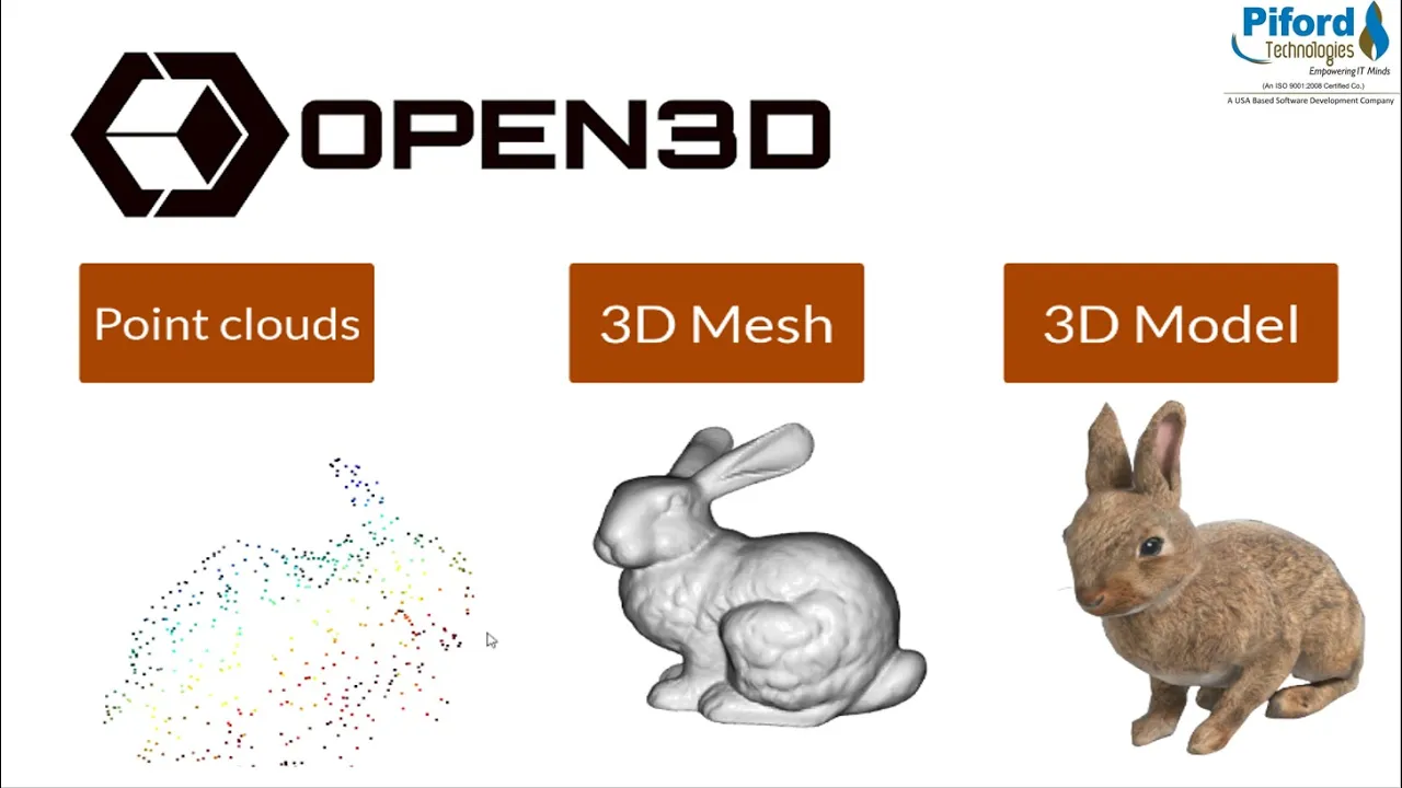
Open3D Tutorial | 3D Data Processing | Visualize 3D Data
47.8K
Open3D is an open-source library for processing 3D data that enables tasks such as scene reconstruction, surface alignment, and 3D visualization; it works with three fundamental data types: point clouds (collections of points representing objects), 3D meshes (structural bases made of vertices, edges, and faces), and 3D models (complete representations including texture and color); the library provides methods for reading/writing these data formats (.pcd, .xyz, .ply), performing voxel downsampling to reduce data complexity, cropping specific regions using selection volumes, and visualizing 3D objects with color and bounding boxes.
Click to watch →
Deep Dive
Applying Deep Learning models (like PointNet) on processed point clouds for 3D object detection and classification.

3D Computer Vision | 3D Point Cloud Processing
7.1K
This lecture introduces 3D point cloud processing, covering explicit representations (point clouds, meshes) versus implicit representations (occupancy grids, signed distance fields, neural radiance fields), followed by deep learning approaches including PointNet (which solves permutation invariance by processing each point independently through MLPs then applying max pooling) and PointNet++ (which adds hierarchical clustering via farthest point sampling and k-nearest neighbor grouping). The lecture covers six key tasks: place recognition (using PointNetVLAD with triplet loss for localization), key point detection/descriptor learning (using weakly-supervised approaches), 3D object detection (VoteNet with voting and clustering), semantic segmentation (weakly-supervised methods with smoothness constraints), point cloud registration (RPM-Net with Sinkhorn layers), and image-to-point cloud registration (combining deep learning classification with optimization).
Click to watch →
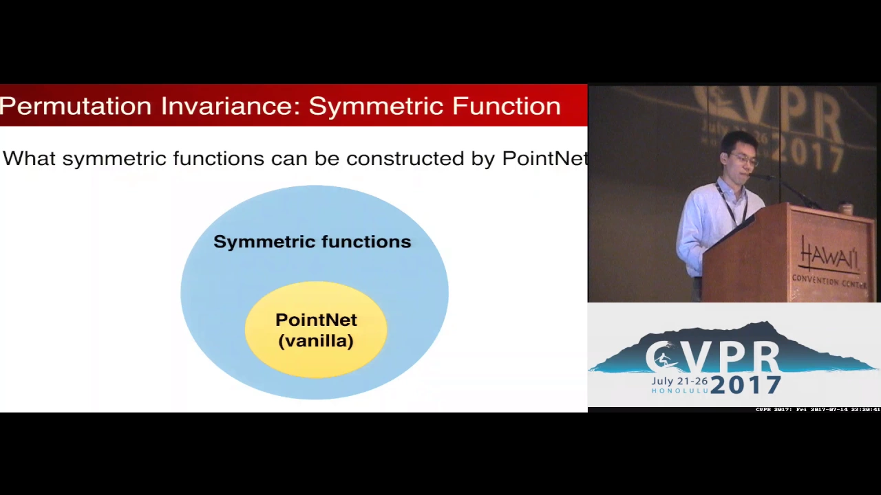
PointNet: Deep Learning on Point Sets for 3D Classification and Segmentation
69.2K
PointNet is a novel neural network architecture designed to directly process point cloud data by leveraging permutation invariance through symmetric functions, enabling unified solutions for 3D object classification, part segmentation, and scene semantic parsing while demonstrating robustness to data corruption and missing points.
Click to watch →
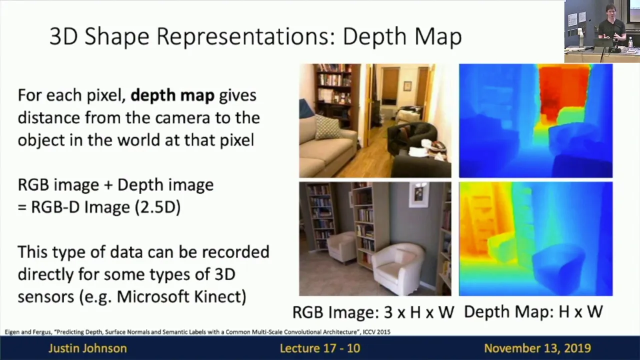
Lecture 17: 3D Vision
41.8K
PointNet processes point cloud inputs by applying a Multi-Layer Perceptron (MLP) independently to each point's coordinates, producing feature vectors. Since point cloud order shouldn't matter, max pooling is applied across all points to produce a single global feature vector. This vector is then fed into additional MLPs for classification or regression tasks. More complex variants iterate this process of per-point MLPs followed by global pooling to capture hierarchical features.
Click to watch →
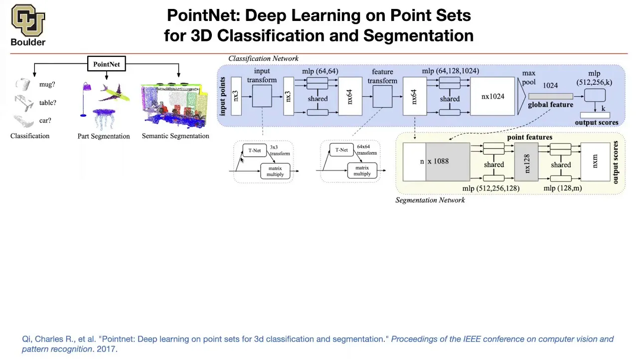
PointNet | Lecture 43 (Part 1) | Applied Deep Learning
21.8K
PointNet is a deep learning architecture designed to process unordered point cloud data (3D XYZ coordinates with optional color and normal features) for classification and segmentation tasks. The architecture achieves permutation invariance through a shared multi-layer perceptron applied to each point, followed by global maximum pooling to extract global features. For classification, these global features are passed through another MLP to produce class scores. For segmentation, the global features are broadcast to all points and combined with local features from the point-wise MLP layers to generate per-point segmentation labels. The method is computationally efficient and achieves competitive results on datasets like ShapeNet, though it may miss fine-grained details compared to methods that exploit local neighborhood information.
Click to watch →
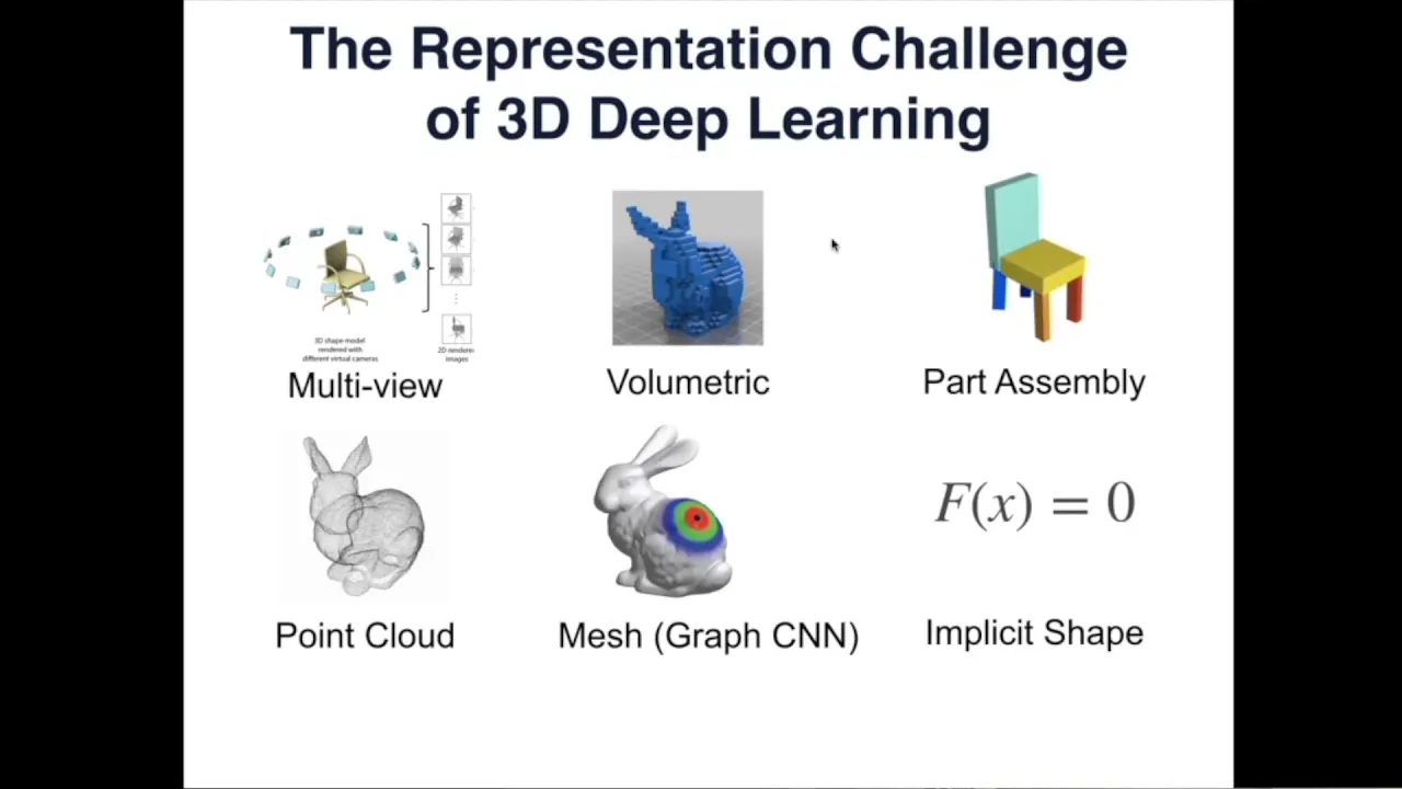
3D Deep Learning Tutorial
44.5K
3D deep learning addresses the challenge of processing irregular 3D data structures (point clouds, meshes, voxels) by developing specialized neural network architectures that respect permutation invariance and capture local geometric patterns, with key approaches including PointNet/PointNet++ for point cloud processing, volumetric networks using octrees for sparse representations, and spectral/spherical CNNs for achieving rotation and isometric invariance, applied to tasks such as classification, segmentation, and synthesis of 3D shapes.
Click to watch →
PCL Setup
PCL Setup
0:00- 1
Install PCL library and dependencies on Linux.
- 2
Build PCL from source using CMake.
- 3
Verify Python binding with a sample script.
The Case for Modern Python-Native 3D Libraries Over PCL
While the Point Cloud Library (PCL) is a powerful standard in C++, attempting to install and use it in Python is increasingly discouraged in the robotics and 3D data science communities. Python bindings for PCL (such as python-pcl) are notoriously difficult to compile, frequently break during dependency updates, and are largely unmaintained. Instead, the industry has shifted toward modern, native-Python alternatives like Open3D, PyVista, or Trimesh. These libraries offer seamless installation via standard package managers (pip/conda), native NumPy and PyTorch integration, better visualization tools, and active developer support, making the arduous process of building PCL from source unnecessary for most Python-centric workflows.
Basic familiarity with the Ubuntu terminal, package management (apt), and shell commands.
Fundamental understanding of 3D spatial data, Cartesian coordinates (X, Y, Z), and what constitutes a Point Cloud.
Experience with Python programming and managing virtual environments (such as venv or Conda).
Conceptual understanding of software compilation from source, including build systems like CMake and compilers.
Advanced Point Cloud processing techniques, including segmentation (e.g., RANSAC), clustering, and registration algorithms (e.g., Iterative Closest Point - ICP).
Integrating PCL Python wrappers with ROS (Robot Operating System) for real-time robotic perception and mapping.
Exploring alternative 3D processing libraries such as Open3D and comparing their performance and ease of use.
Applying Deep Learning models (like PointNet) on processed point clouds for 3D object detection and classification.
479 views0likes4:13@CodeMakesOriginal Release: 2023-11-26
Please Subscribe and you can download this code from description below do the point Cloud Library PCL is an open source library for 2d/3d image and point Cloud processing it provides a set of tools for filtering segmentation registration and more in this tutorial we will guide you through the process of installing PCL in Python and demonstrate some basic code examples before installing PCL you need to make sure that you have the required dependencies installed the following commands can be used to install these dependencies on iunu now clone the PCL repository from GitHub navigate to the PCL directory and create a build directory configure the build with cmake build and install PCL now that PCL is installed let's install the python binding ensure you have Python and pip installed create a python script example PCL example.py to verify the installation run the script if the script runs successfully and generates the filtered unor cloud. PCD file your PCL installation is complete congratulations you've successfully installed the point Cloud Library PCL in Python and executed some basic code examples feel free to explore more features and functionalities provided by PCL for Point Cloud processing chat GPT
Up Next

27:04
Autonomous Robot Navigation with ROS Setup on Jetson Xavier NX
@jamesbruton
119.6K views•2020-11-10

12:54
Triumph of Orthodoxy Icon: Byzantine Art & History Explained
@BenCallan
2.1K views•2024-08-06

9:49
FastAPI vs Flask vs Django: Choosing the Right Python Web Framework
@TechWithTim
302.5K views•2024-05-26

1:42
Game of Thrones Opening Credits: A Cinematic Analysis
@gameofthrones
46.3M views•2011-04-18
Related Study Plans & Knowledge Roadmaps
Structured learning paths in General & Interdisciplinary Studies
general-studies
Elevator Engineering: History, Physics & Cities
01From Hoists to Safety Brakes: The Dawn of Vertical Lift
02Hydraulic vs. Traction: The Engineering Physics of Elevators
03Modern Speed, Safety, and Algorithms
+ 2 more learning modules
12h5 modules
Explore Roadmap
general-studies
Rubber: Material Science, History & Geopolitics
01Origins of Natural Rubber & Mesoamerican History
02The Chemistry of Natural Rubber & Vulcanization
03The Geopolitics of the Rubber Boom & Colonization
+ 2 more learning modules
12h5 modules
Explore Roadmap
general-studies
Containerization: Evolution, Logistics & Trade
01Ancient Trade & Bulk Cargo: Amphorae to Barrels
02The Industrial Revolution & Cardboard Packaging
03The Containerization Revolution: Malcom McLean
+ 2 more learning modules
12h5 modules
Explore Roadmap
general-studies
Textile Tech: Evolution, Labor & Global Impact
01Pre-Industrial Textiles: Handloom & Cottage Industry
02Mechanization: The Spinning Jenny to the Power Loom
03The Factory System & Global Labor Transformation
+ 2 more learning modules
10h5 modules
Explore Roadmap