











![[Tidal Wetland Restoration & Ecosystem Services in the Bay of Fundy Dykelands (PartI)]](https://i.ytimg.com/vi/kIc2RkcZFeo/maxresdefault.jpg)







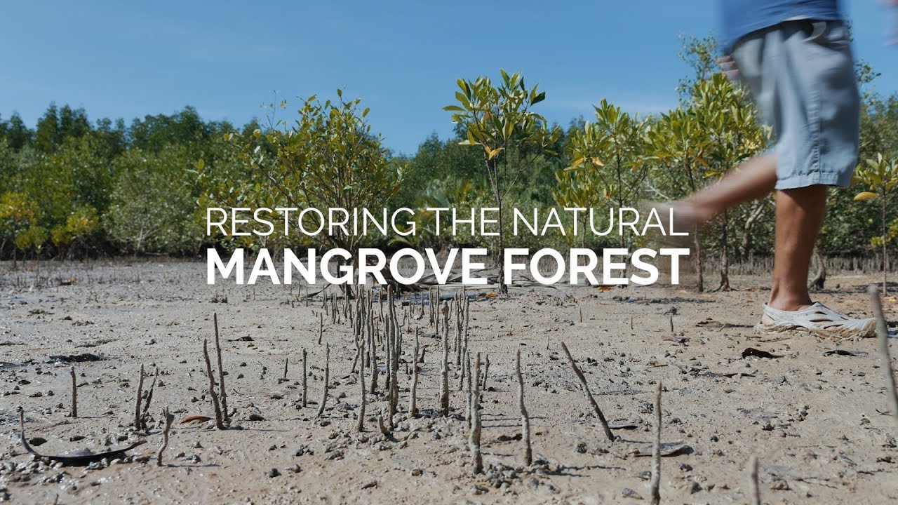
Ecological Mangrove Restoration (EMR) is a community-based approach that restores degraded mangrove ecosystems by addressing hydrological connectivity, substrate conditions, and community needs, as demonstrated in Ban Talae Nok, Thailand, where villagers participated in surveying, regrading, and channel excavation to convert aquaculture ponds back to natural mangrove habitats while securing their livelihood resources like nipa palm.
Ecological Mangrove Restoration in Thailand: CBEMR Case Study
Added:Basic mangrove ecology and the critical role of tidal hydrology in maintaining coastal wetland ecosystems.
The environmental impacts of commercial aquaculture (shrimp farming) on coastal land, including soil salinization and habitat fragmentation.
The conceptual distinction between active tree planting (reforestation) and facilitating natural ecological regeneration.
The core principles of Community-Based Natural Resource Management (CBNRM) and its importance in conservation.
The specific 6-step methodology of Community-Based Ecological Mangrove Restoration (CBEMR) as pioneered by the Mangrove Action Project (MAP).
Techniques for conducting hydrological assessments and implementing physical alterations (like breaching dykes) to restore natural tidal flow.
Methods for monitoring biodiversity recovery, soil rehabilitation, and carbon sequestration capacity (Blue Carbon) in restored mangroves.
Socio-economic analysis of how restored mangrove ecosystems bolster local livelihoods, sustainable fisheries, and ecotourism.
811 views2likes9:54Original Release: 2012-02-23
this is a short film Which documents Mangrove action Project's work in a village called bantel in ranong Province their project has implemented a technique called ecological Mangrove Rehabilitation to return an aquaculture Pond back to Mangrove anelo is the uppermost of uh the pins that you can see on the map here just south of Rong town it's a small Muslim Coastal Community the livelihoods are based on fishing was greatly affected by the Asian tsunami one of the things that was completely destroyed was the school that was uh very close to the beach this has been rebuilt uh in land and up the hill but the tsunami managed to kill uh tens of children in this school similarly an awful lot of houses were completely wiped away these are just steps in front of what used to be a house it's a small village with one road running through it the road runs down to the beach otherwise a typically Thai Village nippa Palm is an important natural source which they use extensively they collect the leaves from the Nipper Palms themselves like this and using other natural materials turn the Nipper Palm leaves into roof sections this work is often done by women's groups it's particularly useful for them because it's flexible from a Time point of view the community is concerned about future access to Nipper Resource as an area Nipper they currently Harvest material from has been sold to a private uh private owner so uh they would like never to be grown in the ponds that we are rehabilitate similarly the nippa P leaves can also be turned into cigarette papers each roll selling for two bar a piece so onto the work a lot of the greenery that you can see there is actually Dryland Forest rather than Mangrove these are agriculture ponds uh that have been carved out of what used to be a communal land uh of Mangrove uh just after the tsunami and there's a continuing land rights issue because of it from previous surveying work we've numbered these ponds the one that we're looking for with the red arrow is Pond four and you can see it's in a u shape and North is essentially straight up our collection of ponds are linked by the channel you can see there to the Open Sea much further down the channel uh a lot of mangrove trees so we hope that we should be prop or Limited in proper EMR fashion the first thing that's been done is a lot of consultation of the community the issues that strike them are the land rights and land grab and something they made clear to us is that what they would like is more Nipper in order to help them produce uh Roofing sections and cigarette papers so back to Pond 4 and how we found did originally this is the southwest corner looking north of the left hand arm or the West arm from the southwest corner and spinning through to the right so as to look along the bottom of the U it's about 70 M to then the far Corner the southeast corner and up the East arm or the right arm it's about 55 M just before we started this project the community had managed to cut through one of the BMS to reconnect this pond with the outside channel the first task at the site was to survey the pond floor this allowed us to understand the relative spot Heights of the pond floor compared to the vegetation gray naturally around the pond and also the level of the pond compared to the outside stream we also found that the salinity was extremely low the surveying allowed us to produce this Scale map including the spot Heights this allowed us to plan what we we're going to do next so it was clear that we had to deepen and widen the channel That linked the pond to the outside world we also had to regrade the substrate inside the pond uh to improve the hydrology and the topography so the next visit was to implement the regrading of this substrate inside the pond this started with a village meeting to explain exactly what we wanted to do it was very encouraging to see that between 20 and 30 villagers came out to help us dressed in all forms of clothing and over the course of the next two or three days we managed to take a lot of material from the top of the burm and shift it down towards the water to produce a slope that was much more appropriate for Mangrove growth The Villages worked incredibly hard through all sorts of weather including pouring rain and scorching Sun the team took great care in explaining to the local people exactly what we were doing and what would need to happen after we had gone and making sure that the slopes that we were producing were the appropriate height for Nipper palm and other mangroves and the finished result of all the grading work after 2 or 3 days looked like this we're fortunate that in the middle of our pond there's an area of natural Mangrove that's still survives so we also took the opportunity to increase the hydrology in the flow through this system system and removed all the dead Bri and dead wood in the ponds including old fish cages and netting we also widened and deepened the connecting channel to make sure we had as good a flow in and out of the pond as possible the next visit to bantar started with a village me meeting as always we went to Great Lengths to explain exactly what we wanted to do to try and improve the hydrology of the Pond from our survey we knew that the pond was flushing poorly and some of the fine Material off the newly regraded slope had been washed uh down onto the pond floor it appears slightly readyy Brown on the right hand side there so we use split bamboo poles to Mark out where we wanted to excavate a deeper wider Channel across the Palm floor to encourage better hydrology and better flow of water we brought the villagers some extra tools because we knew that this process would damage a lot of their existing tools as you can see in the pictures here the mud on the palm floor was extremely soft so rather than walking through it and chaining it up villagers broke up into teams to hand bungies of mud along from the Digger to where it was going to be piled up for 3 days they worked incredibly hard and never lost their sense of fun however dirty they became the mud was almost semi- liquid so we put the mud into Corrals rather than just piling it up these Corrals were made by using debris found in the pond and building temporary walls to hold the mud back to allow it to dry out we also widened the channel further and deepened it as much as we could in within the time having completed the excavation on the east side of the pond the villagers then wanted to plant some Nipper pal the villagers had grown these seedlings themselves and planted them out on the newly produced slopes as well as on the pond floor so at the end of the digging the site looked like this with a much deeper better channel for the water to flow around in after the site work we then installed some monitoring plots we put these together using 2 meter metal rods and explained very carefully to the local people why we were putting these in place these were put at various Heights to be able to monitor natural regeneration including some areas that covered uh part of the newly excavated canal and right at the far end of the arms of the pond the monitoring plots can be seen here as square boxes on the map the final project with the village was to consolidate all this work and learning into an EMR train session which was held at the newly built School the participants included local villagers who had taken part in the work that we had done conservation group members from other local Villages all facilitated by a professional facilitator we then went back to the site to help bring theory and practice together during the course of this EMR training we were joined by a film crew from the University University of British Columbia who are producing a documentary about the relationship between shrimp aquaculture and mangroves we then moved South to Krabby town in Krabby Province and ran a further EMR session with most of the participants talking about a different case history in bangar Village this Village is based in a crabby estery ramar site where we met the local people and had lunch with them and then heard from the local people how they ran a successful crab bank before looking at the EMR site in bangar which follows very much the same principles as bantalan thank you very much for your attention this concludes the film map would like to thank the Villages of bellino for their unfailing support and financial assistance from bmz
Up Next

57:10
Conservation Leaders on Biodiversity, Half-Earth, and Geospatial GIS Mapping
@EsriEvents
10.6K views•2019-07-09

12:54
Triumph of Orthodoxy Icon: Byzantine Art & History Explained
@BenCallan
2.1K views•2024-08-06

9:49
FastAPI vs Flask vs Django: Choosing the Right Python Web Framework
@TechWithTim
302.5K views•2024-05-26

1:42
Game of Thrones Opening Credits: A Cinematic Analysis
@gameofthrones
46.3M views•2011-04-18
Related Study Plans & Knowledge Roadmaps
Structured learning paths in General & Interdisciplinary Studies
general-studies
Elevator Engineering: History, Physics & Cities
01From Hoists to Safety Brakes: The Dawn of Vertical Lift
02Hydraulic vs. Traction: The Engineering Physics of Elevators
03Modern Speed, Safety, and Algorithms
+ 2 more learning modules
12h5 modules
Explore Roadmap
general-studies
Rubber: Material Science, History & Geopolitics
01Origins of Natural Rubber & Mesoamerican History
02The Chemistry of Natural Rubber & Vulcanization
03The Geopolitics of the Rubber Boom & Colonization
+ 2 more learning modules
12h5 modules
Explore Roadmap
general-studies
Containerization: Evolution, Logistics & Trade
01Ancient Trade & Bulk Cargo: Amphorae to Barrels
02The Industrial Revolution & Cardboard Packaging
03The Containerization Revolution: Malcom McLean
+ 2 more learning modules
12h5 modules
Explore Roadmap
general-studies
Textile Tech: Evolution, Labor & Global Impact
01Pre-Industrial Textiles: Handloom & Cottage Industry
02Mechanization: The Spinning Jenny to the Power Loom
03The Factory System & Global Labor Transformation
+ 2 more learning modules
10h5 modules
Explore Roadmap